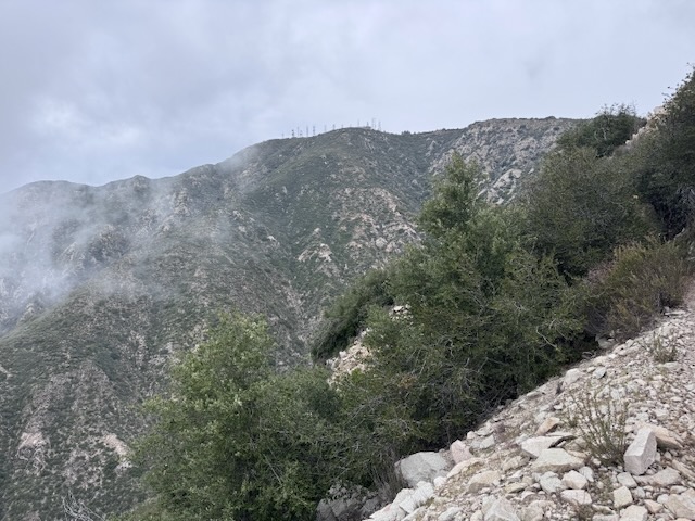
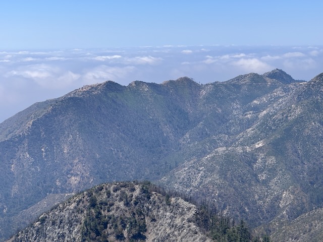
The poppy fields near Lancaster, California, our place that I've wanted to visit for sometime. They are open from Dan until desk and there are several hundred acres to explore. Some parts of the reserve are accessible by OHV, along unpaved sandy roads. The best parts of the park are supposed to be down these roads. It was a 3 hour drive to get here, and I left just before sunrise. It was a Monday morning, and not the peak time for visitors. Poppies are not a morning flower and need full sun to open up. That is one reason I did not come earlier, at sunrise. Late morning was decidedly the best time to see wildflowers, when the sun was up. Around 10:30 am I began my hike. I was greeted by a small Painted Lady Butterfly. After making my way halfway up the hill, there were yellow blooms all around, mostly of poppies, tiny yellow daisy’s, and sky blue lupines.
Tag: travel blog
A forgotten desert peak
Indianhead Peak is a desert peak in every sense of the word. It is a place you go to get away from it all, going off the beaten path, and hopefully not get lost in the process. Lost and forgotten, are themes that re-occur throughout this adventure. What is lost is found. All is not lost. Most importantly, all make it back to the trailhead. There is a reason few people hike to Indianhead Peak. There is not actually even a trail. That is the first part of the story...of 8.4 miles with 3700 feet of gain, with 2700 feet of the gain, over the course of a mile. This one is steep in every sense imaginable.
Coyote Peak in Anza Borrego
I drove into Borrego Springs and I made a right through the center of town. I drove around the traffic circle and noticed a farmers market. From here, I drove straight out into what feels like the middle of nowhere. Rego Springs that's one of those places where you feel like you're getting away from it all every sense of the word. Very few stores, homes, or anything here, yet it still hangs on somehow I personally like this little town a lot. I continued onto Sultan seaway. I could see the coyote peak off in the distance illuminated by the morning sun. I wasn't expecting to see an actual coyote, driving up the road to Coyote Canyon. I headed up Rockhouse Canyon Rd. and parked in what looked like a small turnaround, next to a bush. It would be a 6.2 mile hike to Coyote Peak, and there was no trail.
Hiking in the clouds to Mount Lukens
Mount Lukens is a popular hike, located within the LA Mountains, near Glendale. The trailhead has free parking, clean restrooms, and some historic stone buildings. I decided to hike up to Mount Lukens the same day in which a significant rain was to take place, that evening.. I planned to hike early to avoid the rain, and potential for flooding, mud or rock slides with it. I always plan to attempt foothill hikes such as this, climbing mountains 5000 feet or lower in elevation, from December to March, when temperatures are cool, prior to spring vegetation overgrowing the trails.
Standing on Sitton Peak for the Second Time
This was my third time hiking this trail, and would be my second time to Sitton Peak, elevation 3270 ft in the San Mateo Canyon Wilderness. I arrived at the Bear Canyon Trailhead at 7am, located to the right of the candy store on Ortega Highway. Many of the trails in this area from Bear Canyon parking area have remained closed since the Airport Fire, including Hot Springs Canyon, Chiquito Falls, and the San Juan Loop. There is parking is alongside the road and I displayed my forest service pass. My hike began along the Bear Canyon Trail at 7:15 am. I was hiking along a singletrack. The trail was well maintained, and free of brush, since it was early spring.


