I decided to hike up to Mount Lukens the same day in which a significant rain was to take place, that evening.. I planned to hike early to avoid the rain, and potential for flooding, mud or rock slides with it. I always plan to attempt foothill hikes such as this, climbing mountains 5000 feet or lower in elevation, from December to March, when temperatures are cool, prior to spring vegetation overgrowing the trails.
Mount Lukens is a popular hike, located within the LA Mountains, near Glendale. The trailhead has free parking, clean restrooms, and some historic stone buildings.
I was hiking with a friend today, who is intent on challenging herself, with difficult climbs, building up to a big hike in the Grand Canyon, two months from now. She would be taking the Bright Angel trail down, and camping overnight at Phantom Ranch.
Most of my hikes have not been around Los Angeles, and this would be the closest peak to the metropolis that I would climb. Of all the mountains in my local area in Socal, this peak is one of the most popular, so I was grateful to be here, to see what it was all about. They say location plays in to the popularity of trails. This trailhead sits within a highly popular area.
We began our hike to Mount Lukens around 7:30 am down a narrow trail, surrounded by low growing shrubs, with overcast skies and swirling clouds above. We headed up the trail staying to the right, since first 1/4 mile of this trail has many branches. There were several side trails leading off to the left, which was confusing without a map to refer to. I always have a downloaded map with me, and study that map before I leave. There was a small network of trails to explore here close to the trailhead, if you’re looking to do a shorter hike, but we were taking the main trail all the way to the peak today.
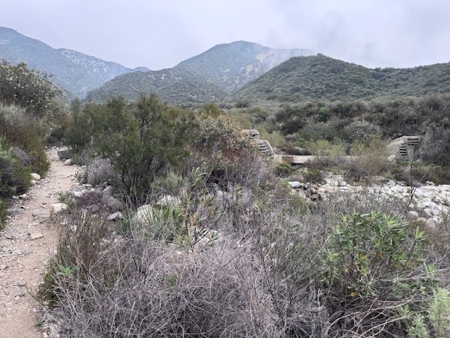
After about 10 minutes, we came to a water crossing and spotted a spillway off in the distance to the left, used for flood control, common in canyons throughout the area, to prevent flash floods from wiping out the adjoining neighborhoods as they have in the past. Whenever you have steep mountains, and communities below, flash floods and potentially mudslides are inevitable, if measures are not taken to prevent them.
Aware of the risks of hiking a mountain such as this during rain, I trod on, feeling confident the weather report would be accurate, with rain forecast after 4pm. We planned to finish well before this, around 1pm. I had packed my rain shell just in case. Bring a rainshell, or a lightweight disposable poncho is a must for hiking in the mountains, since they tend to make their own weather, due to multiple microclimates, which can differ greatly from the forecast.
The trail climbs steadily and is steep, and narrow. This trail attracts many trail runners, who enjoy a predictable vertical climb, and a great workout. There was nothing too challenging about the terrain initially. The greatest challenge would prove to be staying back from the edge. That is one reason I would not run on a trail like this, the potential to trip and fall over the edge. To think runners jog along on this, makes me think they are either very brave, or overly confident.
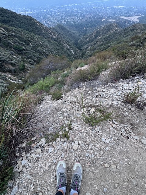
The drop offs on this hike were kinda insane, and something I was not prepared for. Of all the hikes I have been on in the LA mountains, I would rate Mount Lukens to be the one to take the utmost care on. I have heard Mount Wilson is also quite steep, and am eager to complete that one someday.
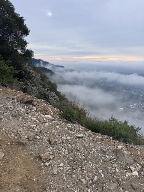
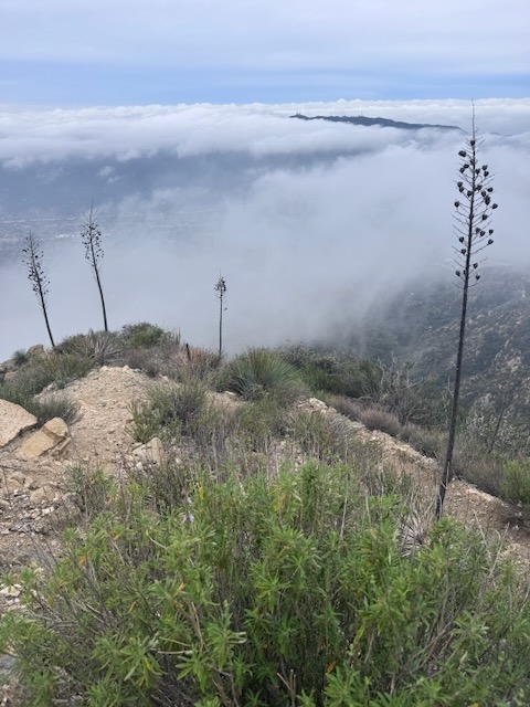
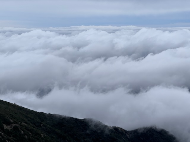
I could see what was likely a recharge basin, flood control channel down below and was hiking above the clouds.
To the south of us was another peak.
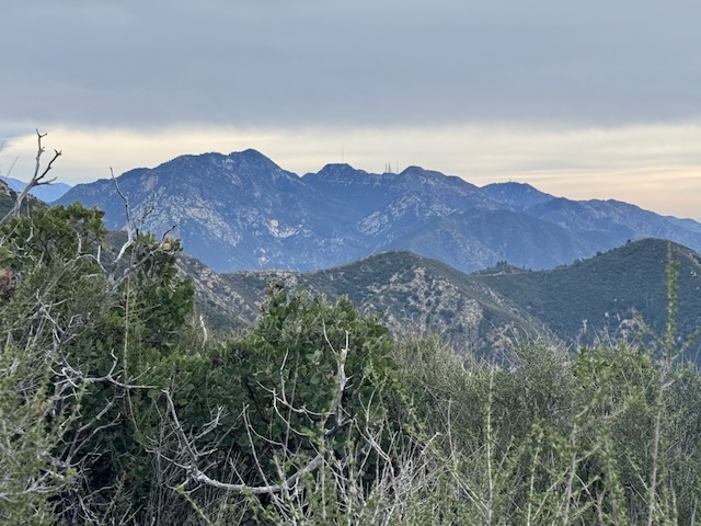
To the east was Mount Wilson.
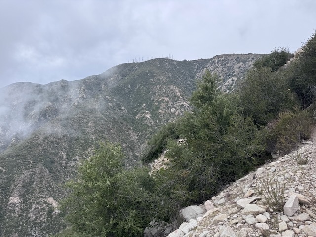
I could see the towers of Mount Lukens in the distance. We continued alone, marveling at the scenery in the deep chasm to my left.
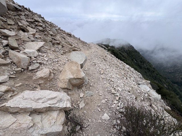
The terrain became more alpine, as we hiked over smooth granite rock, the trail punctuated by sharp granite outcroppings and formations. Was I above 8000 feet, it sure felt like it. I love these types of landscapes.
I was now closing in on the ridge.
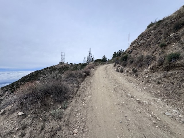
I connected with the fire road, which we made a right on up toward Mount Lukens and its towers.
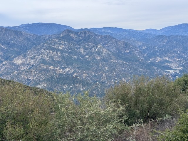
All around us were beautiful landscapes, other distant peaks I had yet to climb such as Condor Peak and Fox Mountain, Vedder Fire Lookout and Mount Mooney, along with peaks I had already climbed such as Strawberry Peak and Josephine Peak off to the Northeast of the fire road.
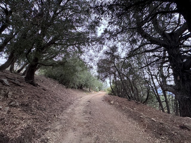
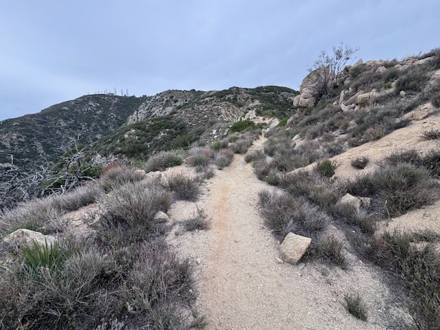
Soon I was walking within shady pines, nearing the summit. The road and trail level off on this plateau. I continued on to the very last tower, and it was here that the peak marker was located.

By about 10:20 am, I had made it to Mount Lukens! I did not notice signage of any kind here, or peak signs. No, the peak sign was gone.
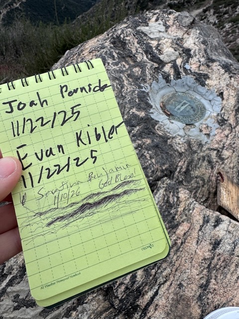
After a few minutes to enjoy the moment, we signed the register, located in a canister hidden under the rock, and continued back. I did not feel this was a great spot to hang out, and as far as summits go, it is not the most scenic.
We hiked amongst the clouds on back. Though Mount Lukens has awesome views, the peak left much to be desired. But I truly enjoyed this one since it is always better hiking with friends. I would place Mount Lukens in the training hikes category. It is great for a workout, but there are so many other peaks, much more worthy of a summit party, and lingering around. Until next time Mount Lukens!
Sign Bandits
I recently learned that some young leave no trace advocates have gone rogue, stealing peak signs in the name of saving the planet. It is frankly hilarious how dumb this really is. To take a concept such as leave no trace, and create a life promoting it, by stealing the peak sign, saves nothing, and only upsets people. Your hiking shoes do more damage on the dirt. Peak signs are part of our cultural heritage. Leave what you find they say. Also please stay home for the good of all, so we can enjoy our peaks in peace.
I hope you enjoyed reading this, and it is helpful in knowing what to expect, should you decide to visit here.
The Essentials
Just be sure to come prepared, bring the 10 essentials, and Pack Out Your Trash to keep the wilderness pristine for future hikers.
About me
I’m Serafina! I’m a writer and California girl who loves to go exploring. Hope you will get outside today, breathe some fresh air, and be happy!
Like and Subscribe to my Channel!
Follow my Journey @serafinabenjamin
Follow along on My Youtube Channel where I post videos!
Disclaimer:
The work on this blog is my opinion and my opinion alone and I am not responsible for the outcome if someone were to apply these thoughts to their own life. All text and photography copyright 2026 by Serafina, all rights reserved. Information and opinions provided are kept current to the best of the author’s ability. All readers’ usage of the ideas and opinions presented in the blog, are at their own risk. Be aware of the possible dangers of hiking, surfing, walking, cooking, and other activities, which may take place indoors or outdoors. By reading this, you agree not to hold the author or publisher of the content on this web site responsible for any injuries or inconveniences that may result from reading the blog, or partaking in any activity mentioned in the blog. Read the blog, and use its ideas, if you so desire, at your own risk.
