Mill Peak Elev 6657
There are a few peaks in the area around Lake Arrowhead, and one of these, Mill Peak, sits at 6657 feet, towering over San Bernardino below. It is located between the small mountain enclaves of Arrowbear Lake and Running Springs.
After driving up SR-330, past fire charred hillsides, I eventually made a turn onto Hilltop Blvd. I would park at the trailhead for both Mill Peak and Exploration Trail, located just past the Deer Lick Fire Station, along Keller Peak Rd. I found several parking spots at the trailhead, and several more up the road on the right. There is another access point further down the road for Mill Peak Trail as well.
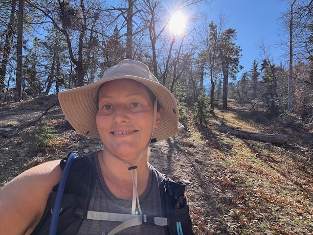
I started hiking rather late, around 11 am. I decided on this hike around 9am that morning. I knew it was going to be shorter, so I figured I had time for it with my late start. Being December, there is very little daylight, and I usually start earlier at sunrise, if I am hiking longer or further.
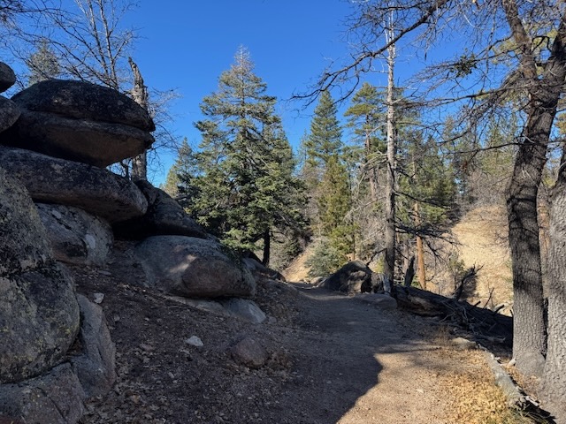
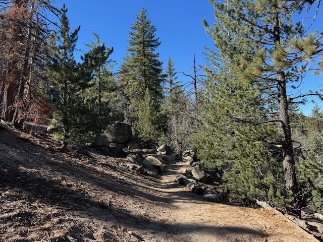
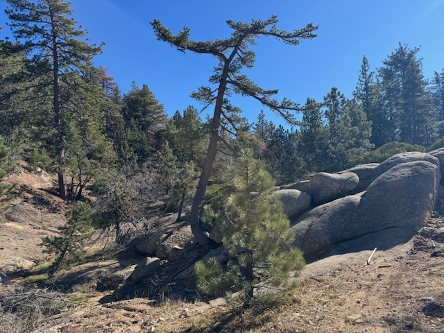
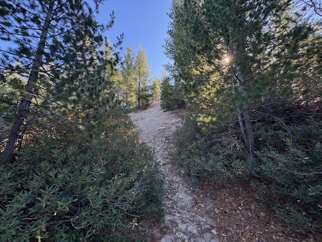
Upon beginning my hike up the trail through a dense forest of pines.
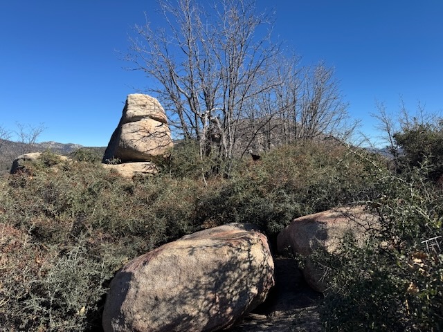
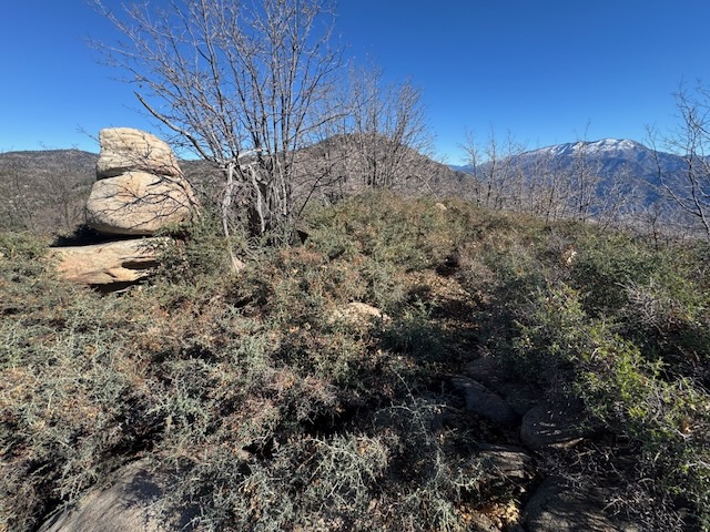
I began to notice a series of large granite boulders all around, characteristic of the Lake Arrowhead landscape.
The forest felt quite peaceful, as I ventured through it. I knew there would be very few people hiking along the trail, since there were only two other cars parked there at the trailhead.
For the first half hour of my hike I did not see a soul. I would run into a woman hiking with three loose dogs, one of which growled at me for a moment.
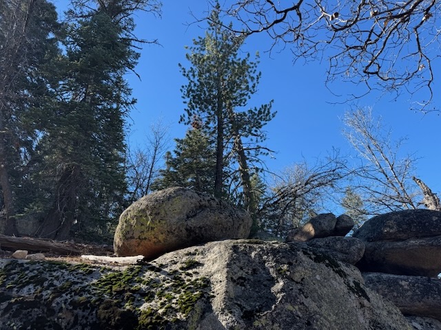
Carrying on, I noticed the boulders grew more and more immense.
Some boulders were strewn about in such a way, it was a true wonder how they managed to end up as they did, resembling Stonehenge, stacked one atop another.
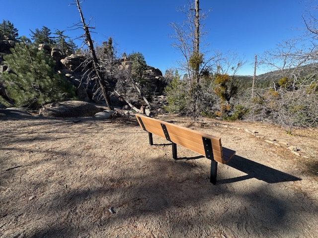
After a short while, I came to a bench, overlooking the surrounding scenery.
Some of the trees seemed like something out of Dr. Suess.
The forest was still very dry this time of year. There had not yet been significant rain here in the San Bernardino National Forest.
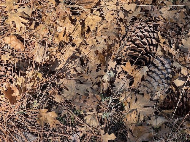
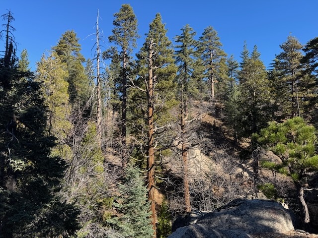
About 45 minutes into my hike, the forest began to grow ever more dense, the forest floor covered in leaves, pine needles, and pine cones.
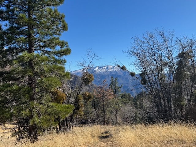
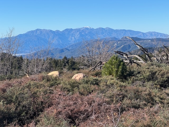
The surrounding peaks, such as nearby Keller Peak, were still dusted in snow by a recent early winter storm.
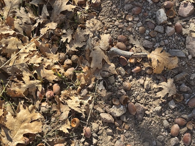
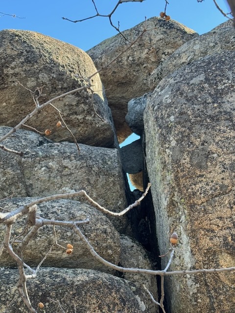
The many oaks had littered the ground in acorns, an interesting food source, filled with vitamins and minerals along with a good balance of carbs, fat and protein. It is no wonder the native tribes relied so much on them for their survival. They are definitely an acquired taste. I have tasted acorns, and enjoy the nutty, earthy flavor of them.
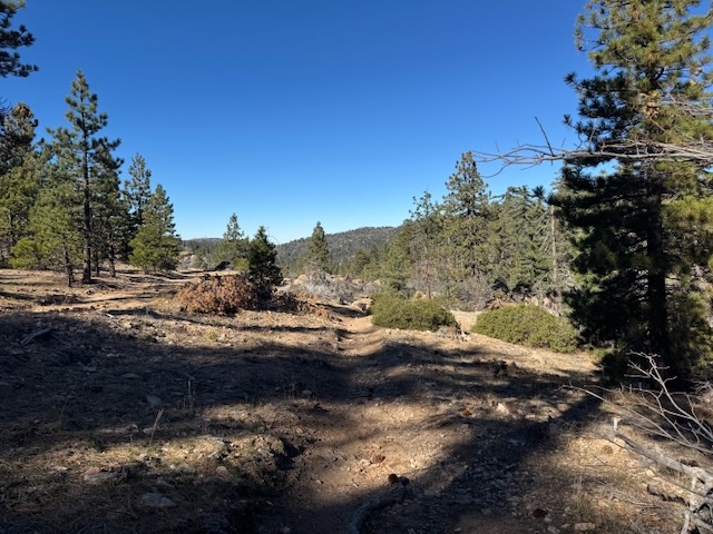
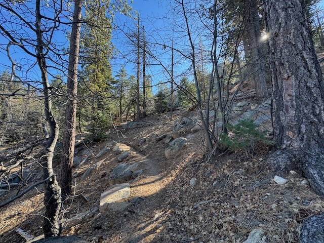
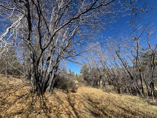
As I made it to the first ridge plateau, where the trail flattened out a bit, where there were dry grasses all around. The trail became narrow in sections, and I could see how this area can be overgrown much of the year. Winter was an ideal time to visit here, where it is most passable.
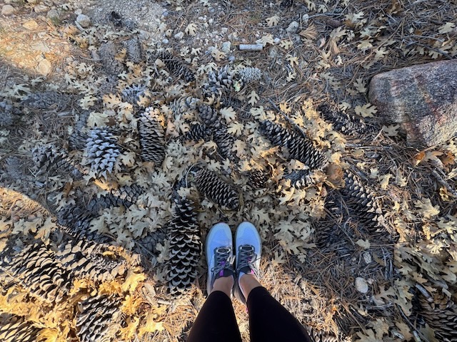
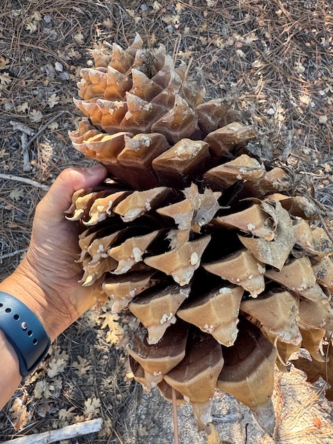
There were a variety of absolutely gigantic pine cones, some shaped like pineapples.
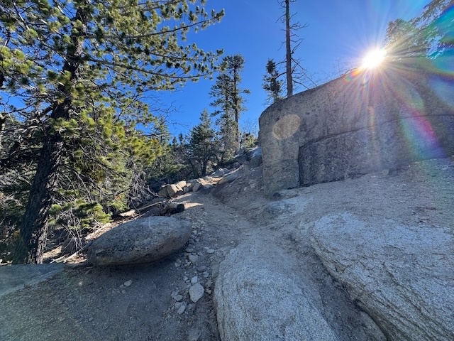
There was one particularly steep climb I would undertake.
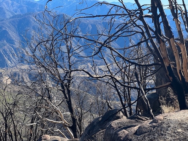
There was a certain stark beauty here, the silhouette of the mountains, as seen through the charred branches.
A rocky, rugged, and completely charred landscape revealed itself as I climbed higher. It was a wonder the remaining forest had survived, no doubt the result of the efforts of firefighters to preserve it, along with the town.
There were clear views throughout the foothills, south face of the ridge.
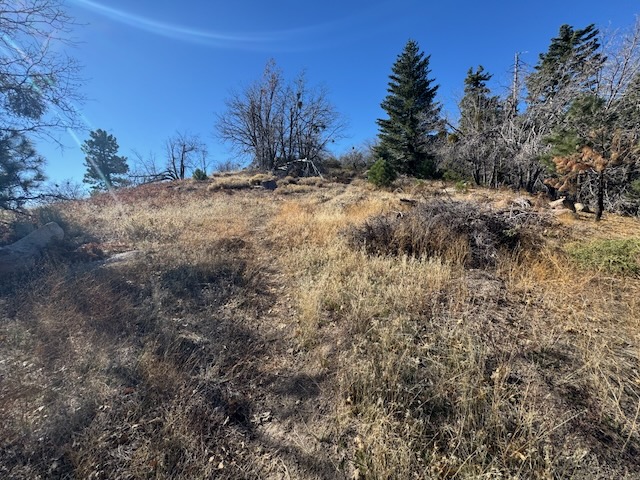
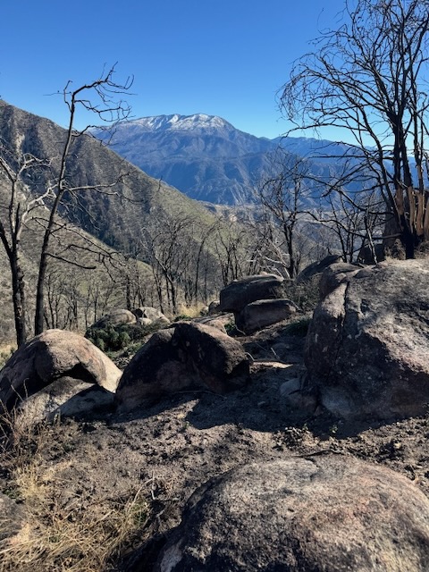
Just after noon, I was nearing the ridge, which was bone dry, covered in the golden hue of dry grass and brush.
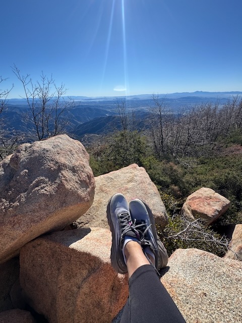
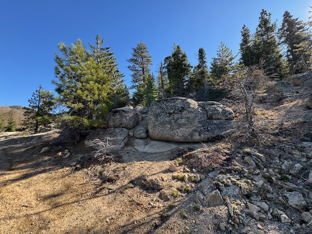
By 12:15 I had made it to the peak, with its characteristic large boulders and iron marker.
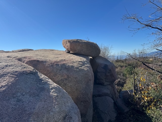
I located the summit register, which was ingeniously, artistically wedged beneath a small boulder, sitting atop a larger flat boulder at the top.
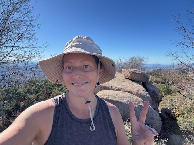
Mill Peak complete! This would be my 18th peak this year.
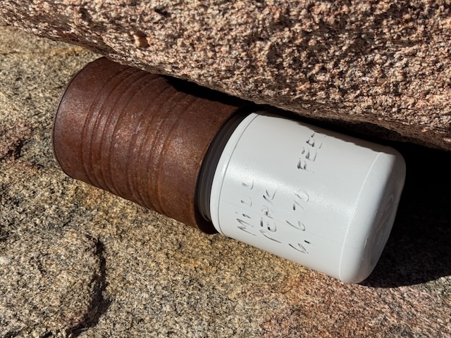
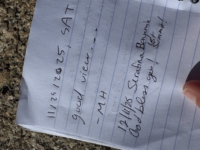
I climbed atop the large boulder, and signed the register, before taking a break atop the rock, perfectly placed. It
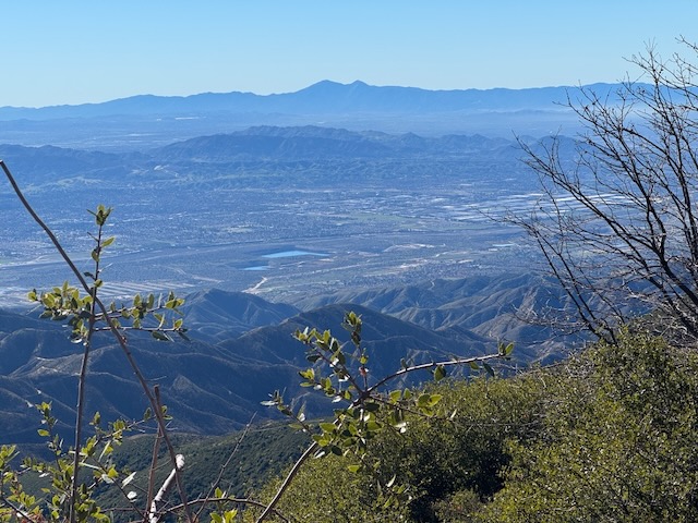
The views from the peak were rather dynamic, to the west, towards Mount Baldy.
I heard rustling in the bushes while up here. I know there are creatures that inhabit this landscape.
I was grateful to get in another scenic wilderness hike, before the year’s end, as I headed back to the car, hiking in a loop along the west side of the mountain, the opposite of the way I came.
The Yellow Post Sites
I had hiked along part of the beginning of the Exploration Trail, which ends at the base of Keller Peak. I decided I would drive down to the end of the trail, to see the area. I explored Keller Peak Road, checking out the Keller Peak Yellow Post camping sites along the way. The sites all looked beautiful, and scenic, along with being located just off the road. They are first-come first, first-served, and free, though a campfire permit is required to park at any of the nine sites here. I want to note there is a peak listed here on alltrails, that is not accessible, according to signs, called Slide Peak. I planned on adding it, but after walking a .25 mile on a poorly maintained fire road and trail, filled with lion tracks, I came to the sign. Also there is another hike in this area, I would not recommend in any way. It sort of felt like the twilight zone here, and I was ready to leave as soon as I arrived, which rarely happens when I visit a new trail. There was really nothing to see here in my opinion. Keller Peak itself is nothing more than a paved road, and you can drive up there to see it, if you feel like driving to a peak. Nothing to see there. Exploration Trail travels between Mill Peak and the base of Keller Peak. If you’re hiking this trail, you may want to add Keller.
I hope you enjoyed reading this, and it is helpful in knowing what to expect, should you decide to visit here.
Leave No Trace
Just be sure to come prepared and follow Leave No Trace principles to keep the wilderness pristine for future hikers.
About me
I’m Serafina! I’m a writer and California girl who loves to go exploring. Hope you will get outside today, breathe some fresh air, and be happy!
Like and Subscribe to my Channel!
Follow my Journey @serafinabenjamin
Follow along on My Youtube Channel where I post videos!
Disclaimer:
The work on this blog is my opinion and my opinion alone and I am not responsible for the outcome if someone were to apply these thoughts to their own life. All text and photography copyright 2025 by Serafina, all rights reserved. Information and opinions provided are kept current to the best of the author’s ability. All readers’ usage of the ideas and opinions presented in the blog, are at their own risk. Be aware of the possible dangers of hiking, surfing, walking, cooking, and other activities, which may take place indoors or outdoors. By reading this, you agree not to hold the author or publisher of the content on this web site responsible for any injuries or inconveniences that may result from reading the blog, or partaking in any activity mentioned in the blog. Read the blog, and use its ideas, if you so desire, at your own risk.
