This one was a doozy.
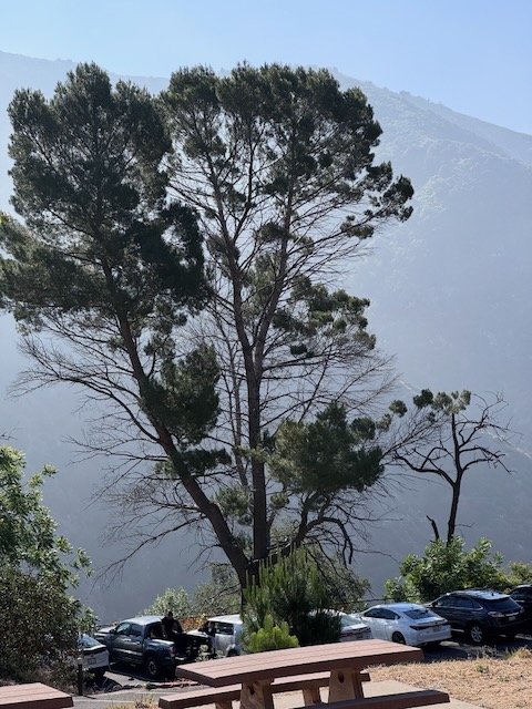
I arrived at the trailhead, finding the large parking area fairly empty on a weekday, and the fog slowly dispersing from the canyon, making was for a sunny day.
It is mid-May, and there has not been much rain, so the terrain is fairly dry. There is a waterfall nearby, but I am unsure if today will be the day, I return to it.
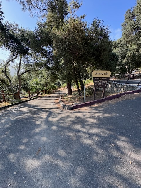
I have hiked from Chantry Flat, once before. It is a beautiful area for hiking, in Santa Anita Canyon, which Santa Anita Creek runs through, toward the Santa Anita Dam, a major water source for Los Angeles. It is a popular hiking destination, accessed by a winding road, with a 15 mph speed limit, from Sierra Madre, below. The area has been affected by wildfires, and recently re-opened after the Eaton Fire tore through, the same day Pacific Palisades burned.
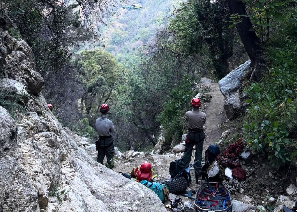
I heard of a hiker falling to his death on the Mount Wilson Trail, less than a month ago…which had me concerned. But I had planned this hike for the last few months. I was waiting for the right opportunity.
With hike had been on my mind for some time, being one of those iconic socal hikes everyone has done, at least once, I was not going to let fear or unfortunate past events get in the way of enjoying this trail. I still knew the trail can be dangerous, not just from the recent accident, but multiple rescues that occur along this trail every year. Not just falling, but dehydration, and being lost were reasons for the helicopter rescues. I was not sure why this trail had proved challenging for so many. But I was about to find out.
I began my hike from Chantry Flat to Mount Wilson along Upper Winter Creek Trail around 8:30 am. It was not clear at first where the actual trail even began. After venturing through a large meandering picnic area, walking up a handicap ramp, passing Adams Pack Station with its small cafe serving burgers, finding no actual sign saying Upper Winter Creek Trail and a few wrong turns, I eventually just used my map, cut through the woods, and was on trail. It should have not been that hard.
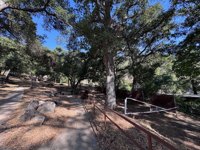
Initially the trail was just a wide paved fire road steadily climbing higher passing through the peaceful oak forest, with an expansive picnic area down below along the hillside.
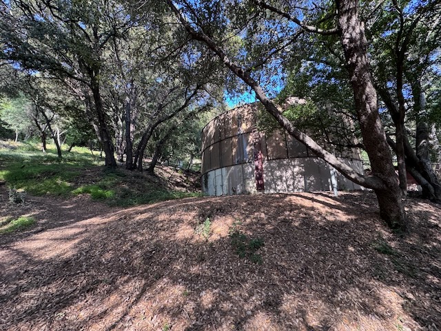
Large ancient looking water tanks were tucked away within the forest canopy.
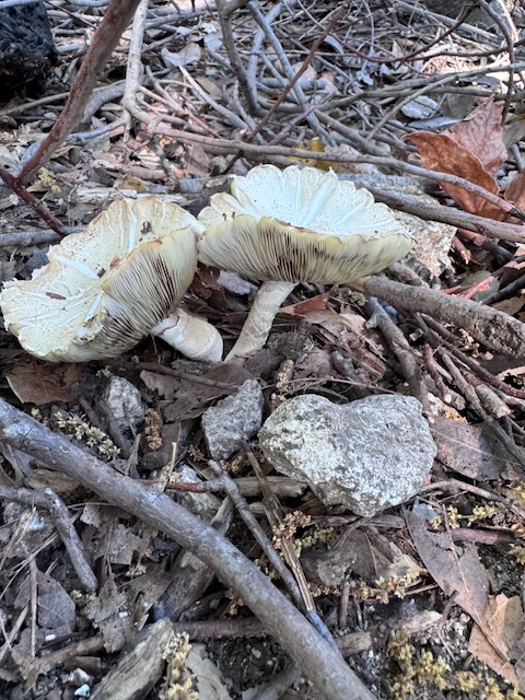
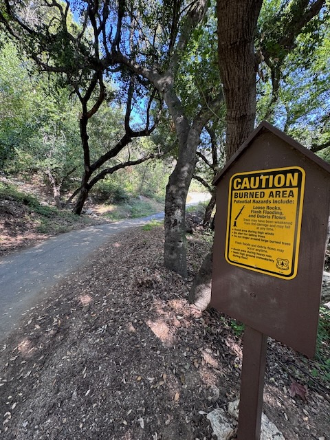
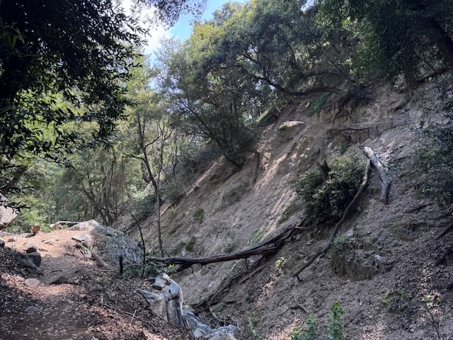
Oak forests are the best place to find mushrooms, if you are a mycologist, or into foraging. Some highly poisonous parasol mushrooms emerged trailside, waiting for an unversed mushroom hunter to pick. Signs clearly marked that I was entering a burn area, and to use caution due to unstable terrain.
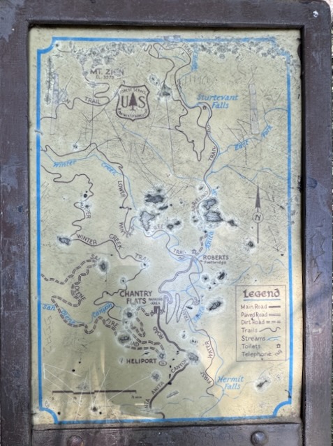
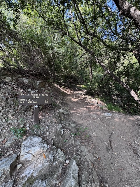
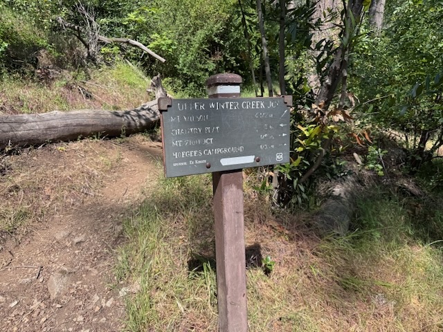
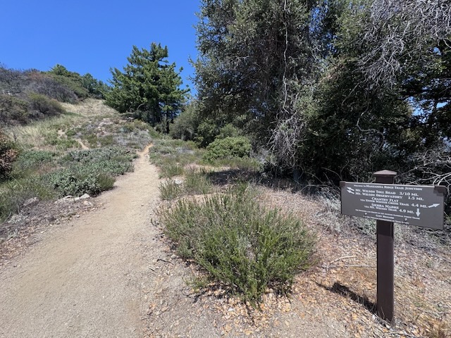
After about 10 minutes, the fire road bisected a woodland trail, marked with a small aging map, and signage marking the mileages. It would be 2.5 miles to Hoegee’s Camp and 6.5 miles to Mount Wilson according to this.
I headed up the trail along Upper Winter Creek Trail, I was venturing into the unknown. I was well aware these signs slightly underestimated the actual mileage. I knew bears inhabited the area. I was on the lookout for them. But really, I had no idea what was in store along this trail.

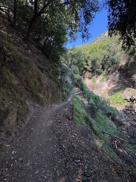
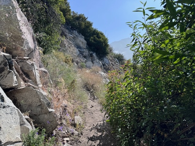
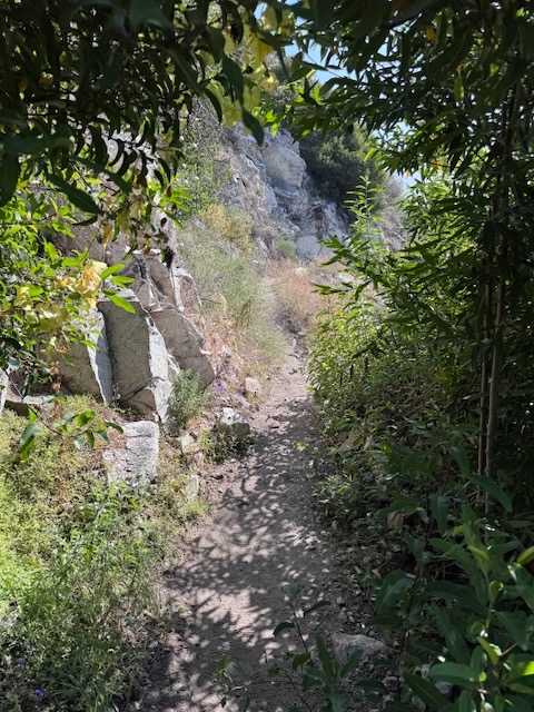
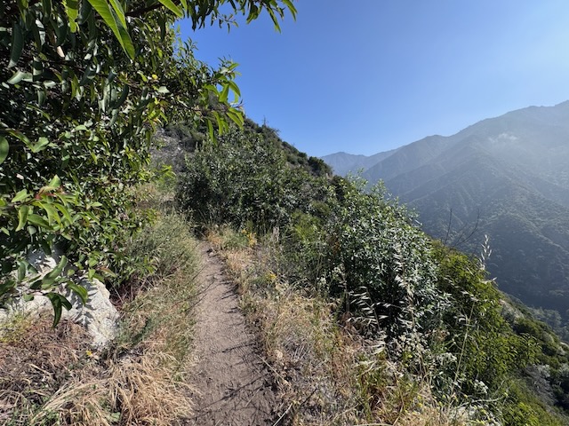
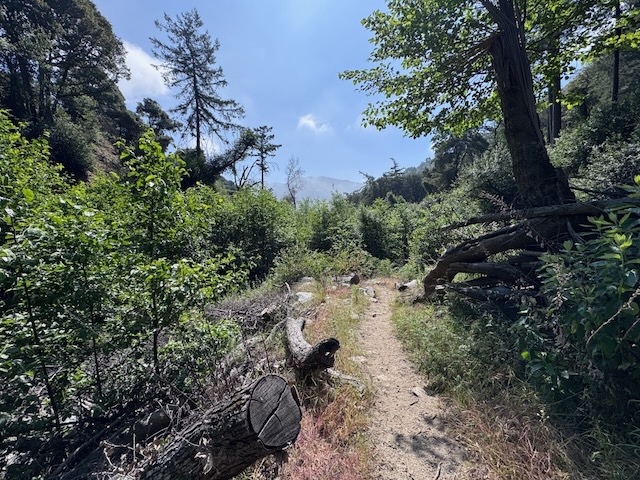
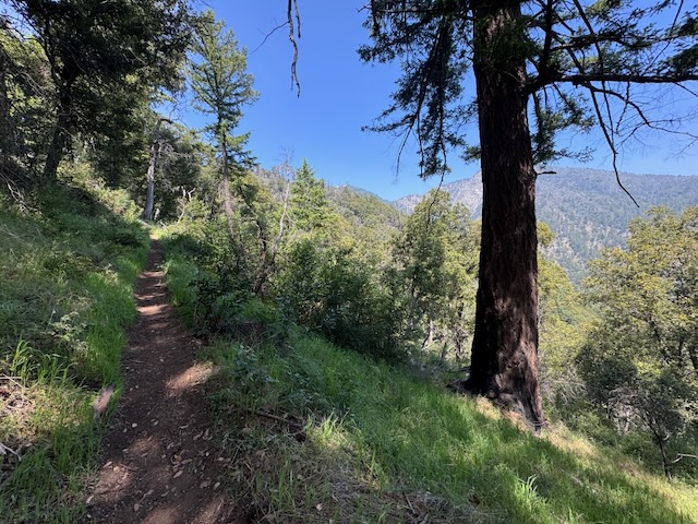
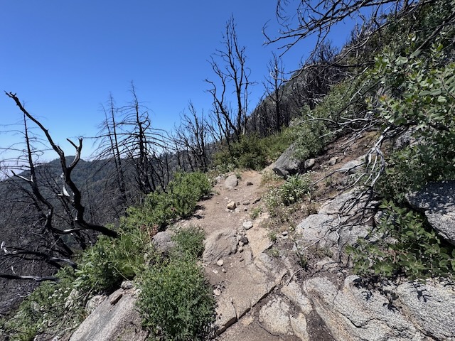
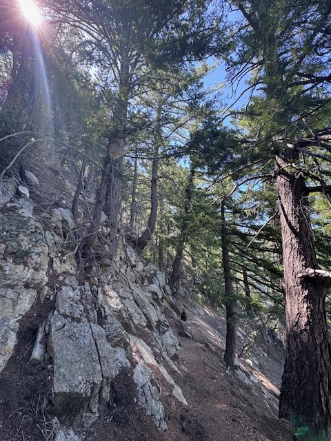
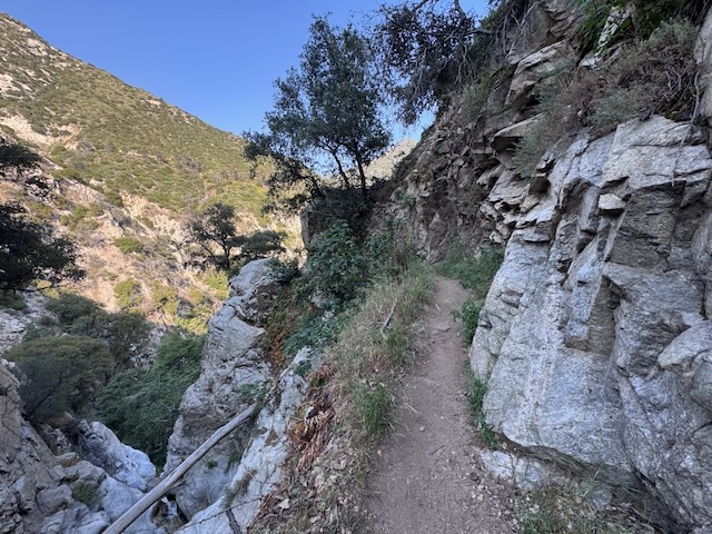
There was plenty of erosion, with skinny dirt trails just dropping off towards hillsides of new growth. Some inclines I would encounter initially, seemed reasonable, but the majority later on, would prove to not be. There was nothing to catch me if I fall.
Steep drops offs would abound along Upper Winter Creek Trail.
As the trail wound its way around the cliff sides, I hoped my late start would not be in vain, as the sun shone down, I worried I might be too warm. I did not want to get heat exhaustion or run out of water. I had 4 liters with me just in case. That was another thing, the stories of running out of water hiking to Mount Wilson. What is it about this trail? I was about to find out.
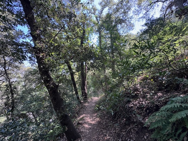
The trail proved to be mostly shady depending on the way the hillside faced initially, so I was banking on it staying shaded.
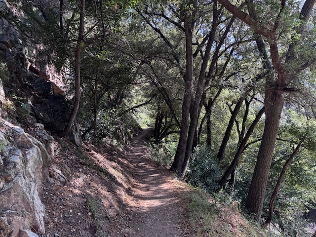
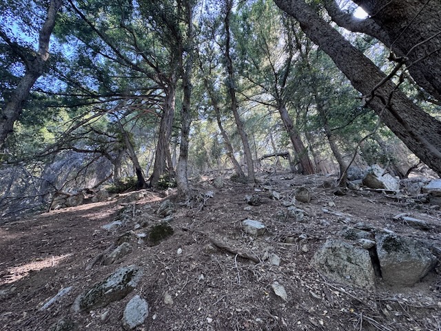
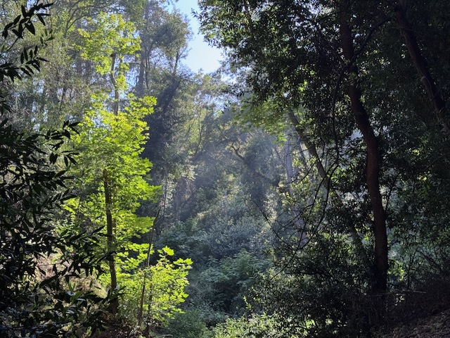
There was a beautiful forest canopy all around. Already, just 30 minutes in to the hike, I was enjoying the scenery. There was also, no one on the trail, and all I could hear were the sounds of nature.
But there were sunny, very exposed sections.
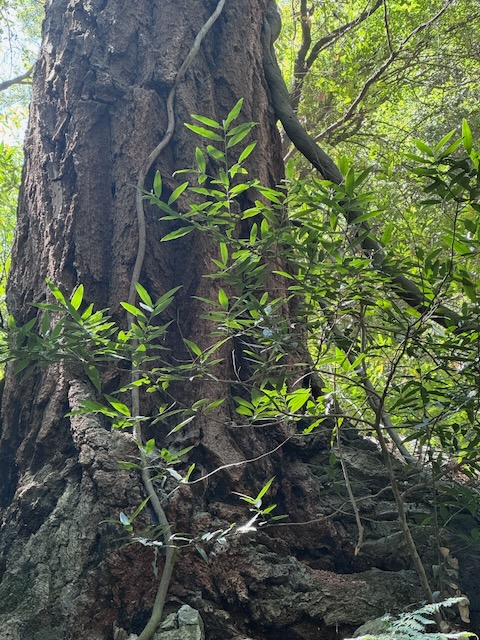
There would be huge trees ignoring gravity, such as this hefty 100-year-old oak clinging to the hillside.
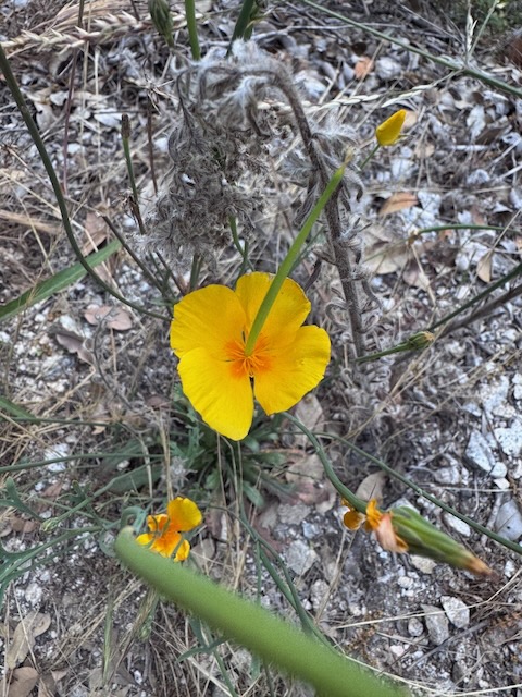
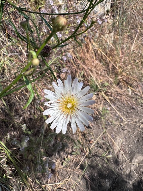
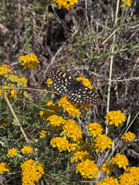
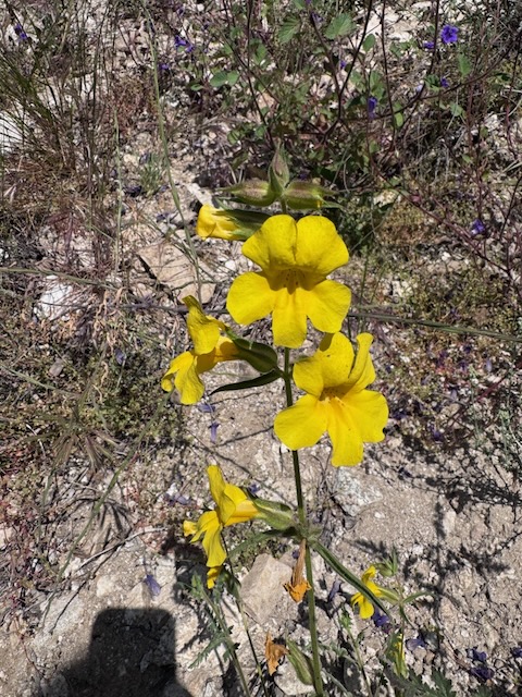
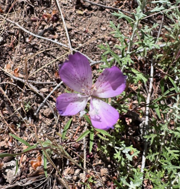
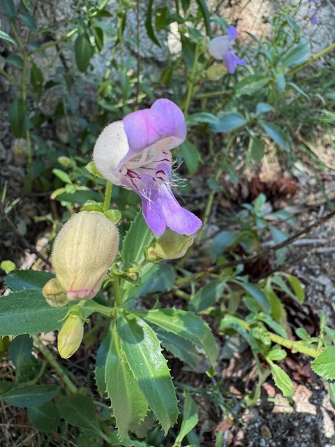
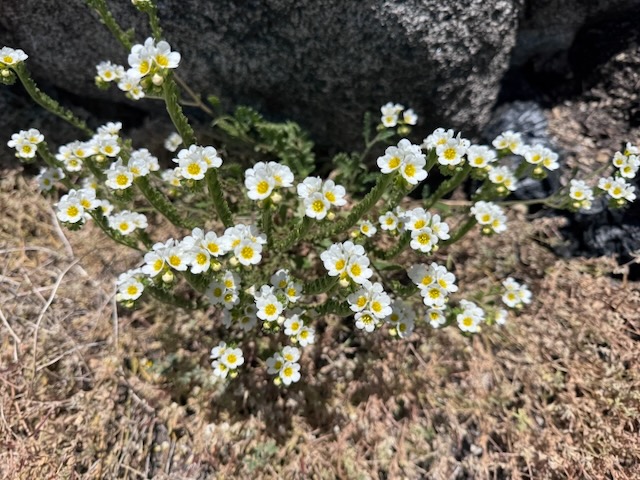
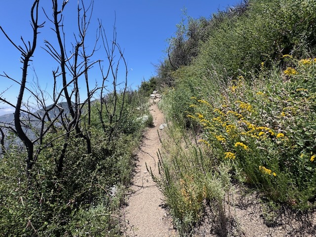
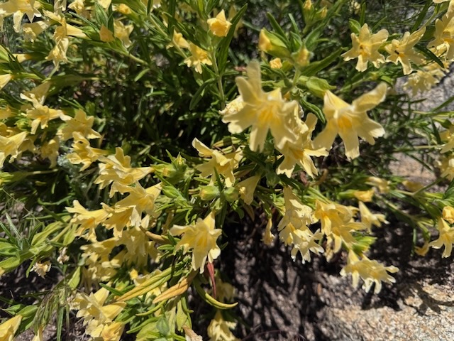
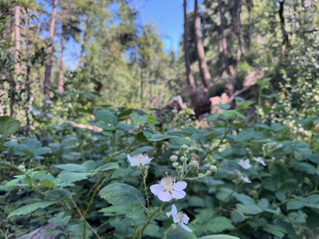
A small patch of poppies was an indicator that wildflower season had not expired yet. Butterflies, such as the Painted Lady, were enjoying all the beauty and feasting on flowers. As I hiked on, there would be many more wildflowers along the sun filled slope. It would be overgrown along much of the entire trail, but the wildflowers made up for that being a complete objection.
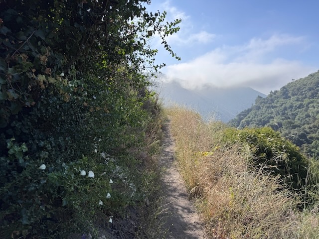
But as the trail climbed, with it were thoughts about safety, these steep hillsides, had nothing to stop you. You had one choice, to steadfastly walk forward, not a wobbly sort of walk, but a deliberate, stable one, with careful attention to everything on my path.
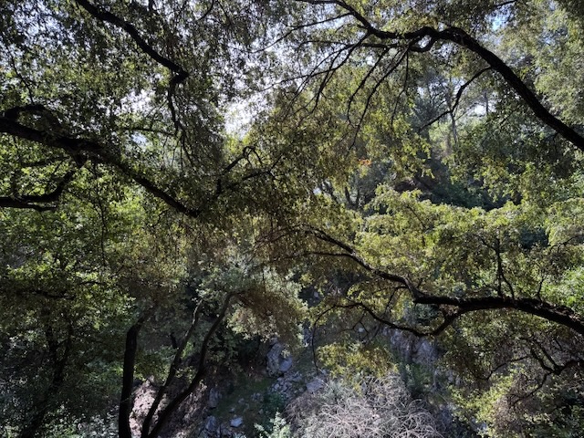
Tunnels of trees, golden light, illuminated portals, made it feel like an enchanted place.
The incline was steep, but not too steep. The problem was not the climb, but the incessant and endless array of drop offs, cliffs that dropped straight down, some flecked in trees, which might sooner impale rather than catch you if you fell. Hard to even tell in the photos.

The pitch was such that nothing could stop you if you slid on some dirt, or tripped on rock or a root jutting from the ground, tumbling down all this to who knows where.
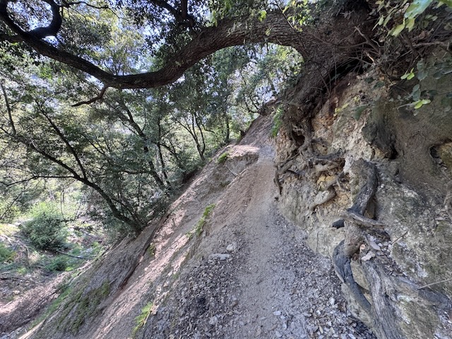
The narrowness of the trail and the potential to fall for most of the entire hike, made me feel on edge.
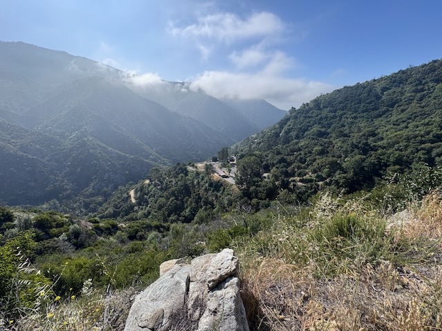
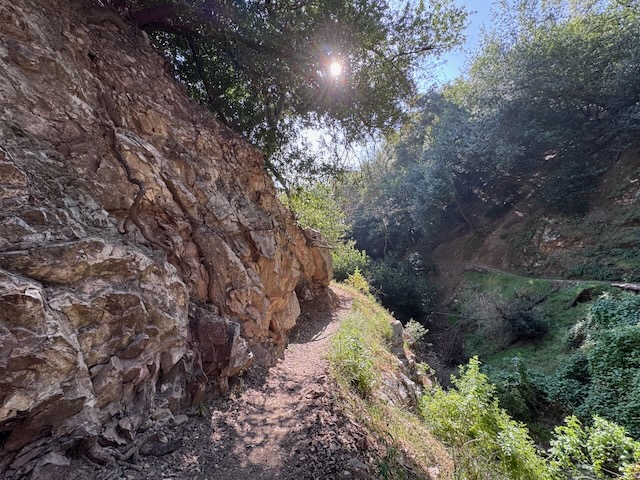
I rounded a corner and the landscape opened up, the valley revealing itself. But as the sun beat down on these rocky cliffsides, I felt like I was teetering on the edge, a mere foot from a potential tragedy, which was very unsettling. Add this to the usual thoughts, of being on the lookout for snakes in the brush. I was monitoring every step far more than I was enjoying the scenery, which felt hectic. I knew I had to stop moving, to have a look around, or I might trip and fall if I got distracted. Multi-tasking was not a good option. So I had to really stay focused, or this hike could end, tragically. To be so close to that possibility and know it, was unsettling. Even if no one had recently died in this vicinity, I would have felt the same.

Flowers, butterflies, sunshine, and many hazards. Still, there were many moments of soaking it all in, carefree.
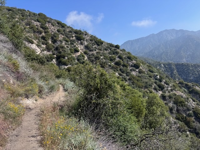
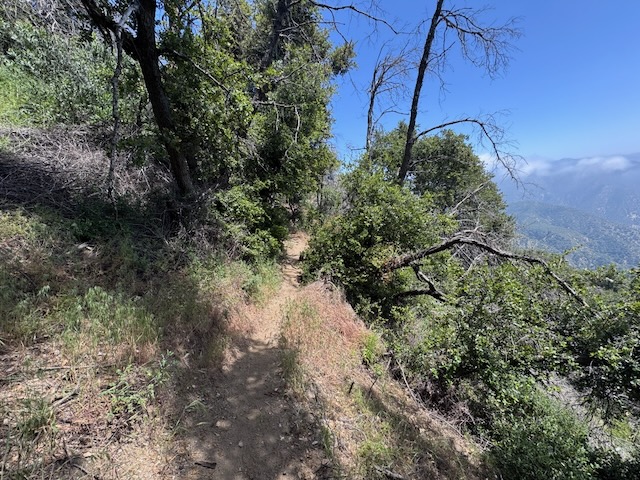
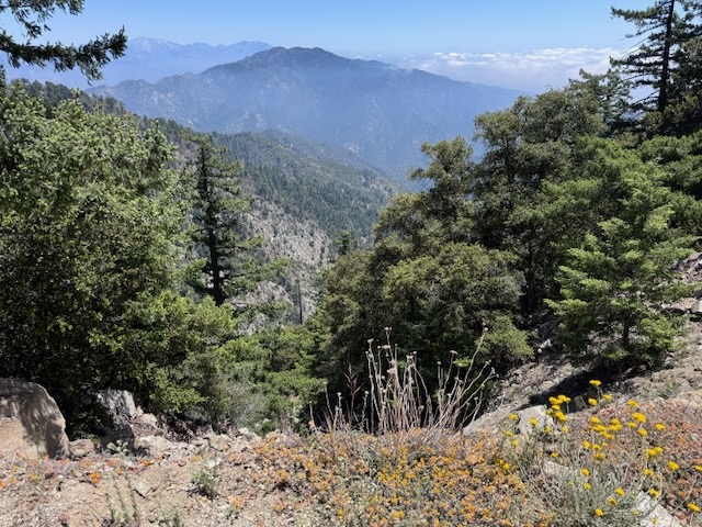
As I rounded the hillside, I was treated to expansive views of Big Santa Anita Canyon as I traveled along the skinny singletrack, which sort of reminded me of ones I had been along before, on sections of the PCT.
Along the first few miles there would be many successive spots with a steep drop off. Along with this a beautiful wildflower, rock formations, nice valley views, and sections of peaceful forest. But always seemed to be followed by yet another steep drop off or hazard. The trail felt unrelenting, crumbling, with evidence of erosion control measures holding it together everywhere.
By 10:00 am I reached the turn off for Hoegee’s Camp, Lower Winter Creek Trail and Mount Zion.
I briefly considered heading to Mount Zion. After heading down the trail, and crossing the stream, on to Lower Winter Creek Trail, I noticed that trail to Mt Zion did not look to be in good shape, so I backtracked, continued up the Upper Winter Creek Trail, saving Mount Zion for another day.
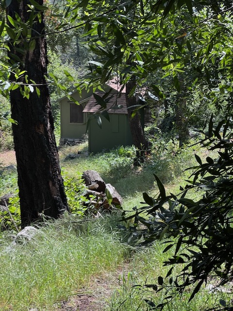
I briefly glanced over at Hoegee’s Camp, a small green cabin above the river.
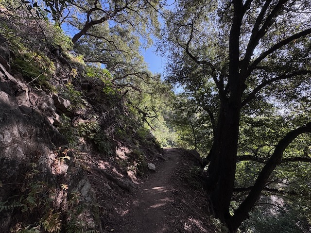
By 10:30 am I had been hiking through a woods of tall trees for some time. The drop offs briefly subsided and it was fairly shaded by tall trees.
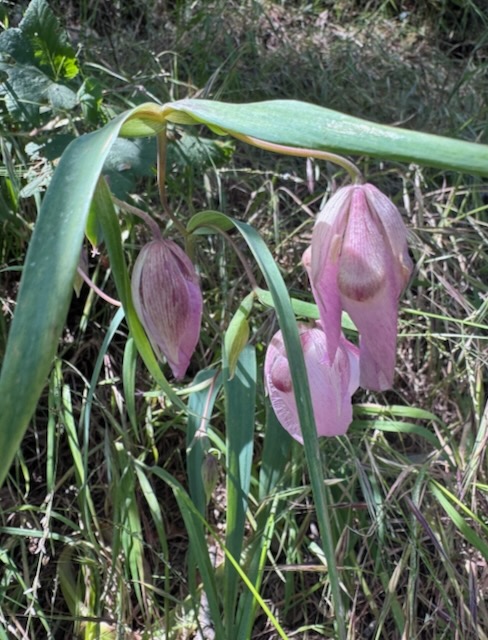
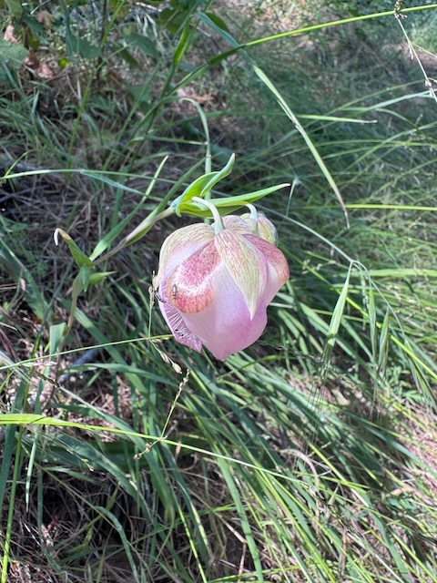
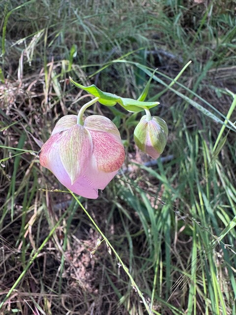
Pink Fairy Lanterns were growing along the trail, something Disney would have loved. It was the first time I ever saw this delicate rare flower.
The trail began to form switchbacks.
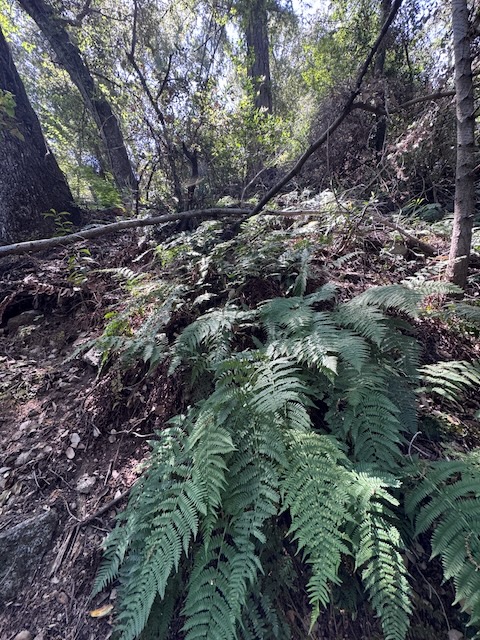
I was now deep in the woods, surrounded by greenery, ferns, tall trees, and lots of flowers.
I had not seen practically no one at all, just one group with two dogs, who had headed down Lower Winter Creek past Hoegees.
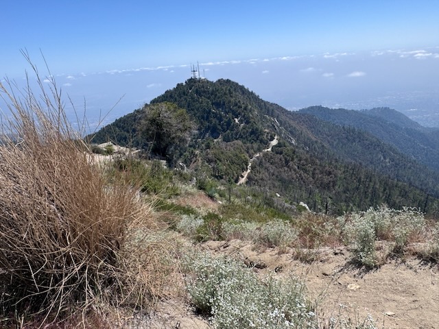
It was 10:30 am, about 2 hours after starting the hike, and the towers of Mount Wilson emerged far in the distance.
By 11:15 I had almost reached a saddle, where the Mount Wilson Trail from Sierra Madre meets this one. The path was all loose dirt, even sloping slightly to the right in places.
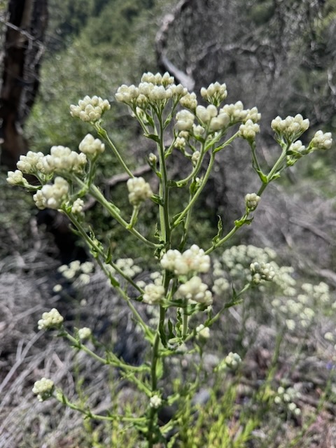
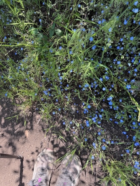
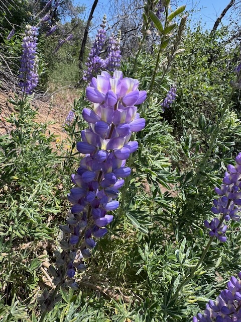
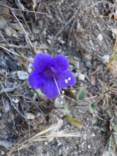
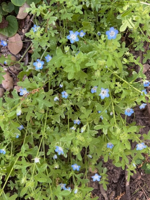
I entered into an area previously damaged by fire, composed of low growing shrubs, punctuated by patches of purple Bush Lupine, cream-colored California Everlasting, and tiny Baby Blue Eyes, all enjoying the sunny exposure. Blue flowers are a color much rarer among wildflowers.
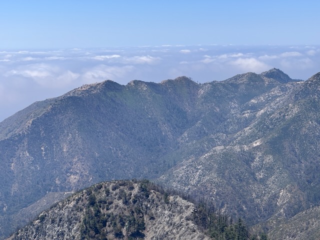
It was just about noon as I passed the 4000 foot mark, now well above Mount Zion off to my right, along with Mount Hilyer and Pacifico Mountain in the distance.

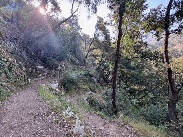
I kept dipping in and out of the shade of the forest canopy, along a trail which was dry, parched, dusty, and increasingly exposed as I neared the saddle.
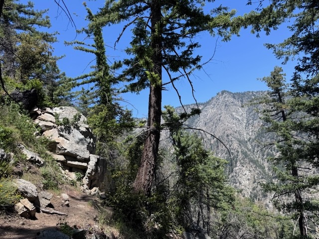
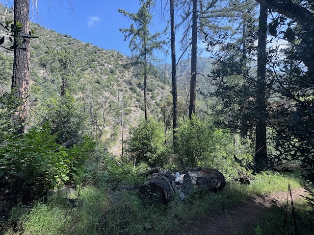
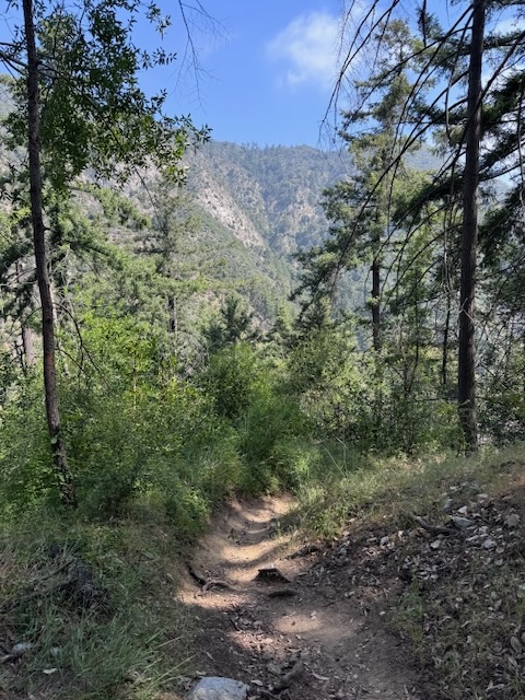
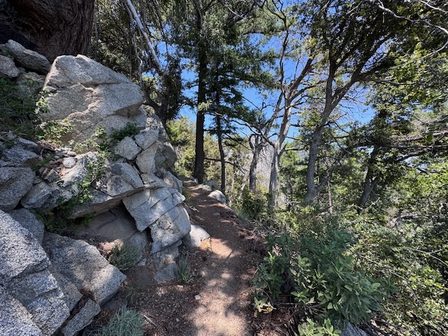
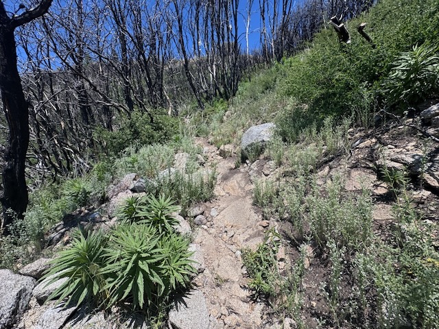
The trail remained narrow and woodsy, and increasingly boulder strewn, as I edged ever closer to the rocky south face of Mount Wilson.

By 12 noon I finally reached the bench, on the saddle, a new milestone and popular turn around point, where Upper Winter Creek trail merges into Mount Wilson Trail from Sierra Madre. I took a ten minute break in the shade there, where I spoke with the only other hiker I would run in to on the way up who had hiked there from Sierra Madre, but was headed back. He let me know that the upper portion of the trail on ahead is filled with poodle dog bush, a nasty plant, that causes terrible skin irritation in everyone. No one is immune to it like poison oak or poison ivy. Not poodle dog. It is the true nemesis of all hikers. Literally no one has a good word to say about poodle dog bush.
I hiked on passing a small rock formation, bound for Mount Wilson toll road.
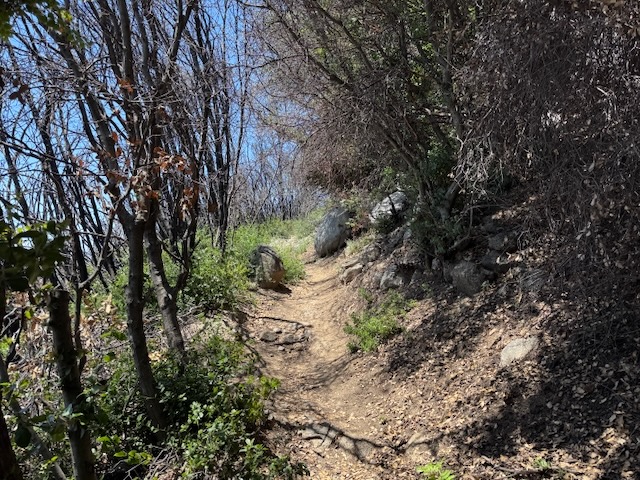
I soon passed through a section of charred woods. The stark reminder of the Eaton Fire.
Somehow flowers managed to grow here along this section, the kind which emerge post-fire.
The trail became even more barren and exposed, rocky, narrow, dusty, and uneven. The sun was beating down, and it was beginning to feel very warm. I still had plenty of water though, and was not dehydrated, so I was grateful for that.
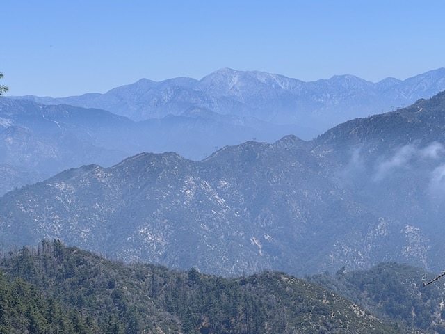
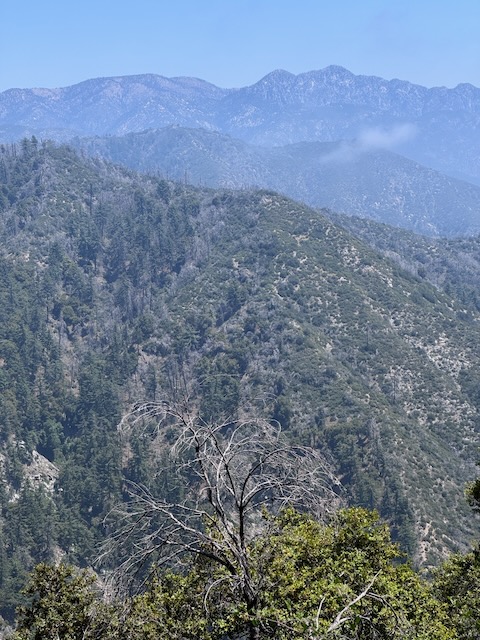
I was now high up in the beautiful San Gabriels.
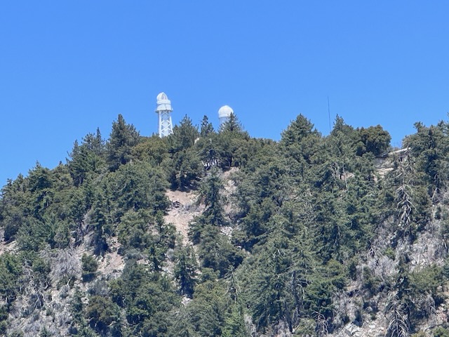
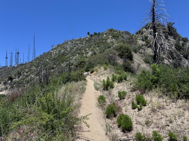
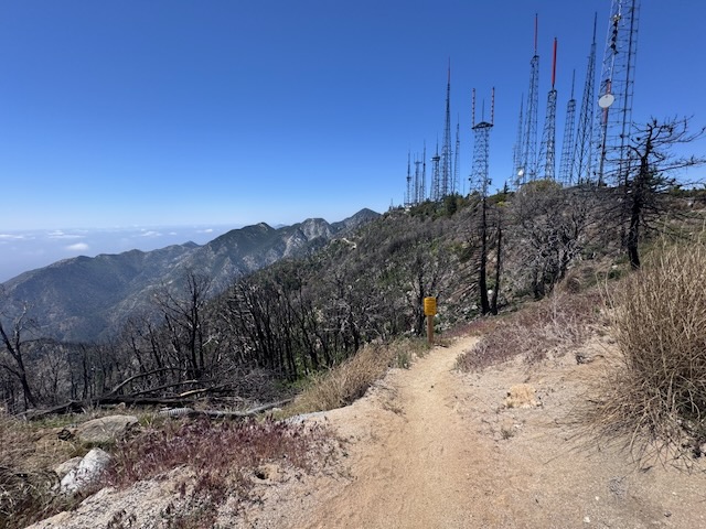
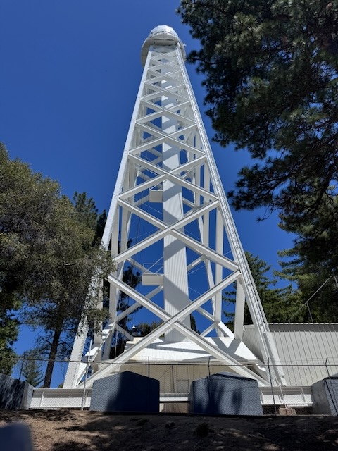
The telescopes of Mount Wilson were clearly visible.
By 12:30 I had passed the 5000 foot mark, as I entered the Mount Wilson Toll Road, which has no actual toll. At one point cars drove this to Mount Wilson, before the road fell into decay. The views along this section were worth the climb.
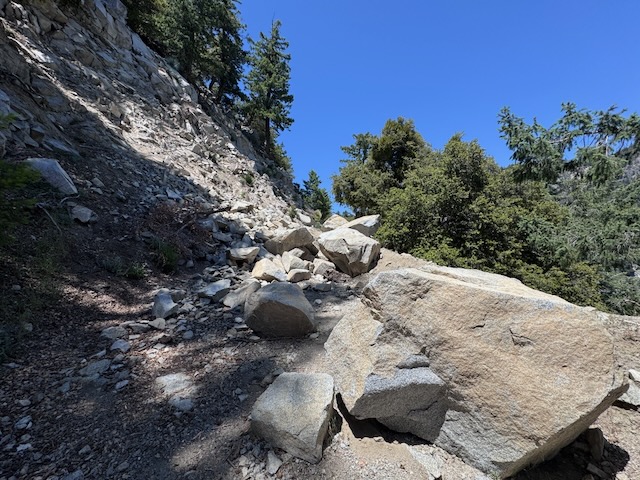
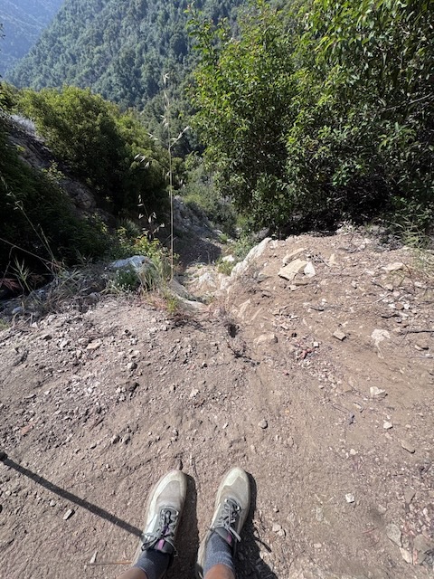
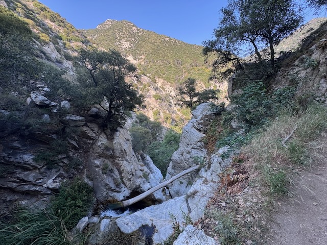
Along this section were huge rock falls composed of giant jagged boulders, with 1000 foot chutes dropping off into nowhere to my right.
By 1 pm I had survived the toll road section and was closing in on Mount Wilson, now less than a mile from the towers.
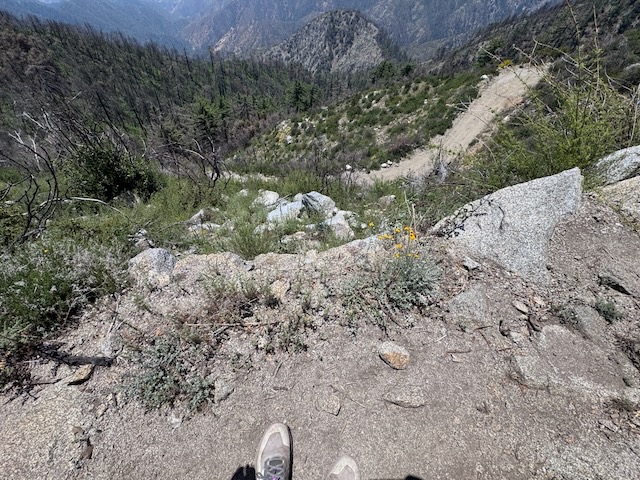
The last 1/2 mile of trail was a sun-filled, completely exposed, narrow, dusty section, of a burn area, with the hillside dropping off 20 feet straight down to the toll road below.
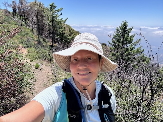
But I was hiking above the clouds now, so feeling optimistic, since I was practically there. There was a beautiful view clear to Altadena.
I finally reached the first of the poodle dog bush and I knew I needed to take care each step of the way, being mere inches from touching it.
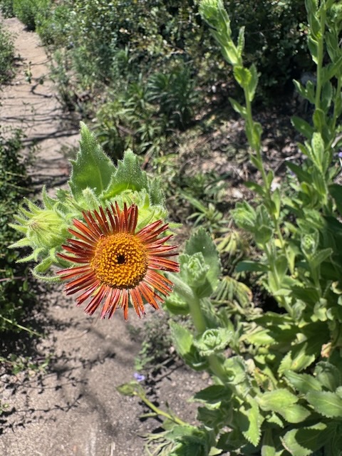
Flowers were rising from the ashes of this charred hillside.
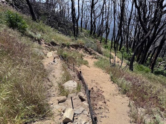
Jagged erosion control methods save the trail, but can be dangerous.
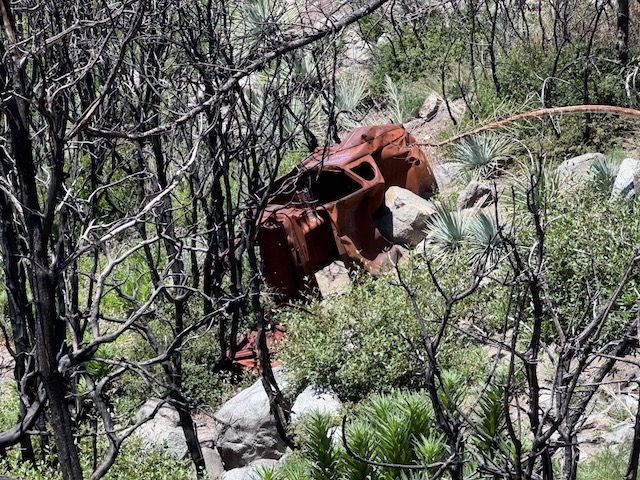
As I passed this old car in a state of arrested decay, I was a few hundred feet from the top, from the summit of Mount Wilson.
It was 1:30 when I finished the climb. I glanced back from the top of the trail, on what I had just experienced to get to this point.
My only thought was, wow, that last part was nothing to write home about. Poodle dog bush, dust, toxic dust, and charred trees, offset by nice views.
Would I trek this way again? I love to explore, but some trails are a one and done. This section I place in that category.
I was grateful to be moving on. I would definitely, without question be taking Sturtevant Trail back. the decision had already been made long ago while navigating the brush and the drop offs along the first mile. It was now affirmative after this section of burn area.
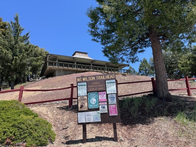
I needed to find the benchmark, since it was not indicated on my map. Sometimes I find them, and sometimes I don’t. But I was at the trailhead nonetheless.
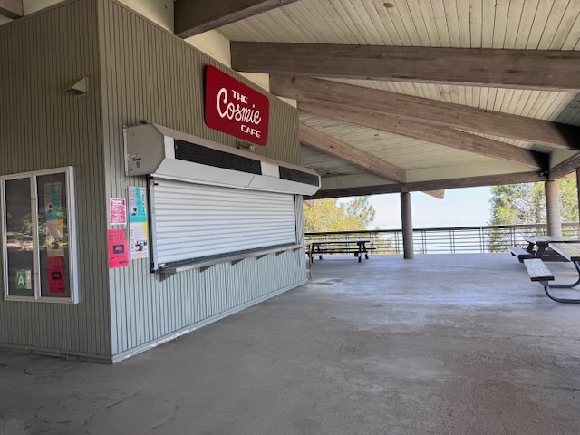
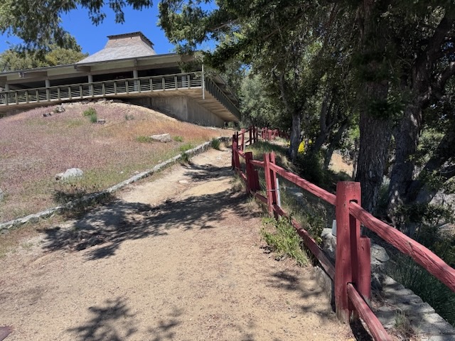
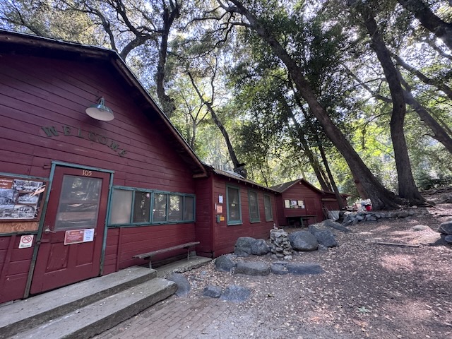
Above the trailhead and parking lot, there are restrooms, and the Cosmic Cafe. I heard good things about the cafe, but it is not open weekdays.
It was nice and shady here on the deck, with mountain views from the picnic tables. I had a snack here, staying about 30 minutes.
It was now time to resume my search for the benchmark. I asked one of the workers passing by, heading into the closed cafe to grab a soda, and he said did not know. Funny thing not to know if you are here a lot.
Rejuvenated and cooled off, I departed the cafe around 2 pm.
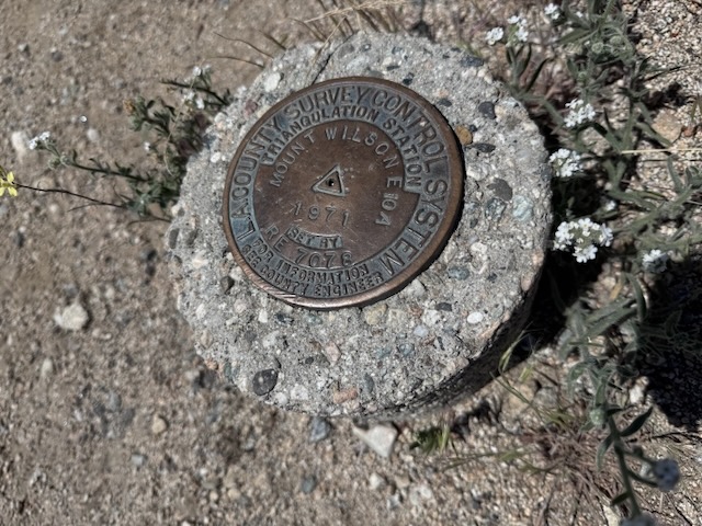
The sign and benchmark were located on the right side of the empty parking lot, if you are facing the cafe, by the fence line, which was not that obvious.
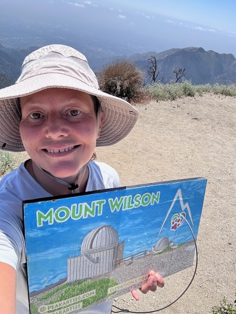
I had made it to Mount Wilson (Elev 5710 ft)!
I continued onward from here toward Sturtevant Trail, past the right side of the cafe.
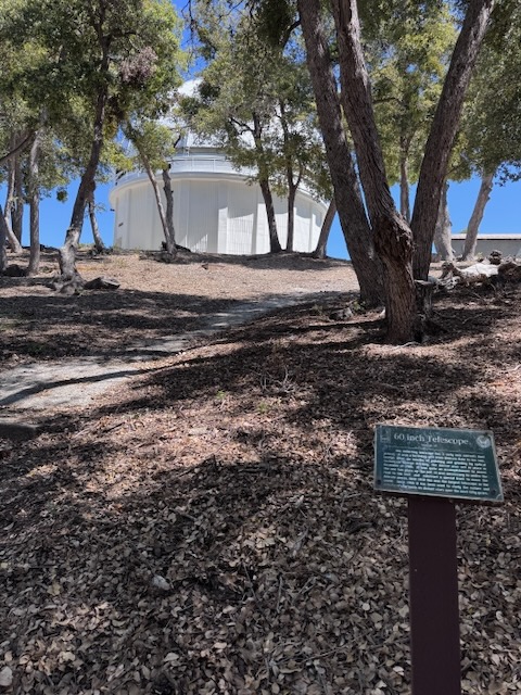
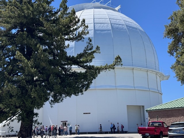
As I walked through the observatory grounds, making my way past several telescopes, I noticed many of which had lines of tourists waiting to have a look. There was a free astronomical museum, open to the public. I knew I would have to come back here again, when I was not in hike finishing mode. The challenge is not met, and the hike is not over until you are back at your car.
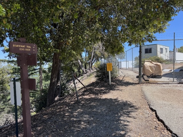
It was about 2:30 pm when I met up with the Sturtevant Trail, which was hidden in plain sight, along a fenceline, so well I walked past it the first time.
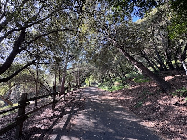
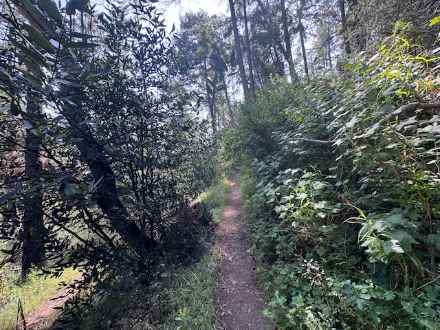
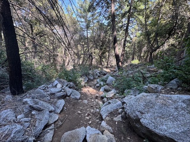
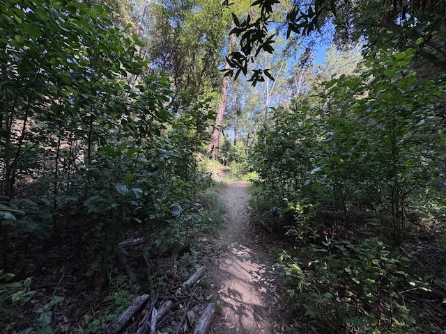
The first thing I noticed about this trail was how much more wooded it was and the ample shade. The second thing, was how slick it was, loose granite over packed clay, makes for a slip and slide. It would get worse. My main concern along this section was sliding, and falling, just on the trail itself, rather than off a cliff. The reason being, that the trail was blanketed in acorns, leaves, and pine needles. At first it seems soft, and cushioned. I could not win on this one. I kept coming close to falling, and finally did, jamming my wrist on the ground catching myself awkwardly. I was this close to hurting my tailbone or my back. I was not out here to hurt myself. I tried to walk directly in the center of the trail, in the lowest area of the trail in the groove, since even a slight slope, laden in debris made it slippery. The pitch was still quite steep, and I could have slid down the hillside if I fell in the wrong spot. In spite of all this, I was enjoying the peaceful forest section more than I expected. No views, just woods, and quiet.
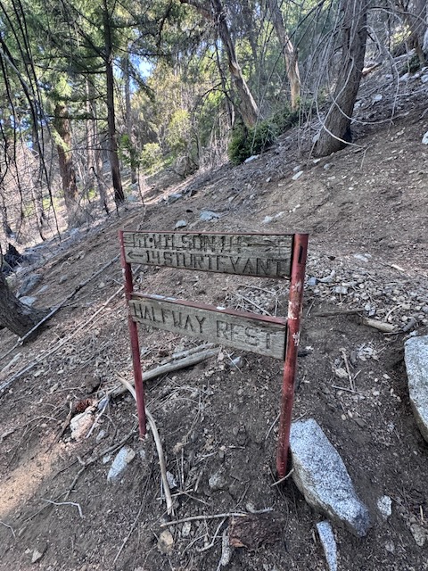
By 3:15 I had passed “Halfway Rest,” another milestone in the hike.
The trail became more rocky as edged closer to Sturtevant Camp, my next stop. I passed a couple hiking, the first people I had seen along this section.
The forest was filled with berry bushes like this, a treat for the bears. I knew they were here, and I just was not sure if I would see them or not. I hoped not.
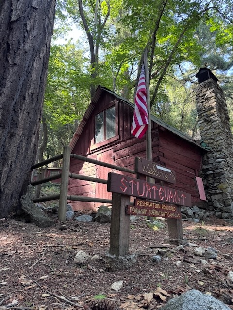
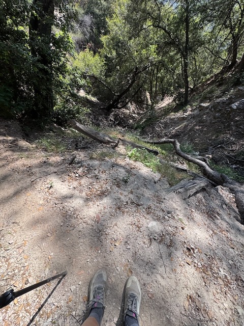
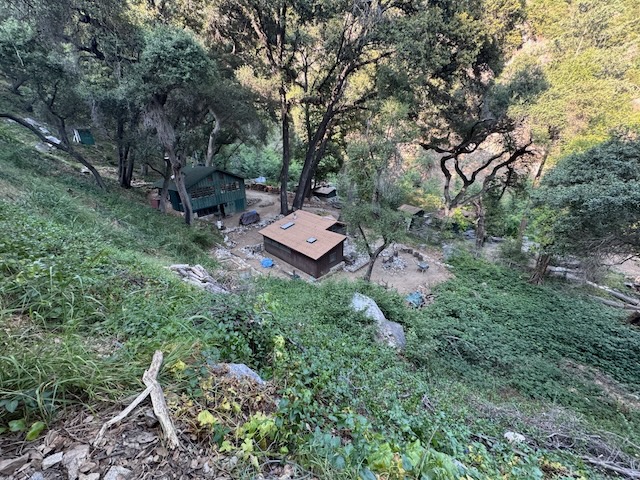
By 4 pm I arrived at Sturtevant Camp, after crossing the stream around the same area as Mount Zion Junction.
At Sturetvant Camp, there were many older forest service cabins painted red, a circle of chairs perfect for a woodsy gathering. They have a website where you can learn about the cabins, and what it takes to maintain it.
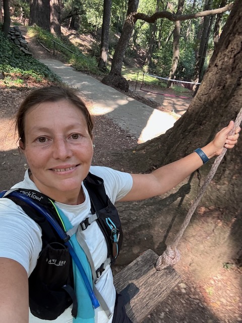
They have a tree swing here, which is sort of iconic. One giant swing in the middle of a big woods, in Santa Anita Canyon. I had seen pictures of the swing and never know where it was until now. It was now about 4 pm, so after a 10 minute break on the swings, I was on my way.
Finally there was some relief from the slippery terrain, as the trail became clearer and composed mainly of packed dirt past Sturtevtant.
The light ever so gently filtered through the trees here. I enjoy being deep in the woods. This is the type of secluded place, you stay a long time, to truly unplug, listen to the birds, read a book, sit by the stream, just dream, and wonder, feeling like your away from it all.
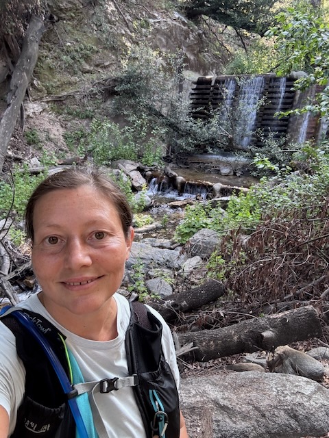
A s I headed down the canyon I began to see the first in a series of many spillways, a type of flood control, each with its own beautiful cascading waterfall.
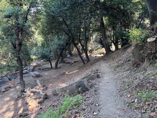
By 4:15 I made it to Spruce Grove, a campground in the woods, with stoves, picnic tables, peace and quiet. There was just one person camping here.
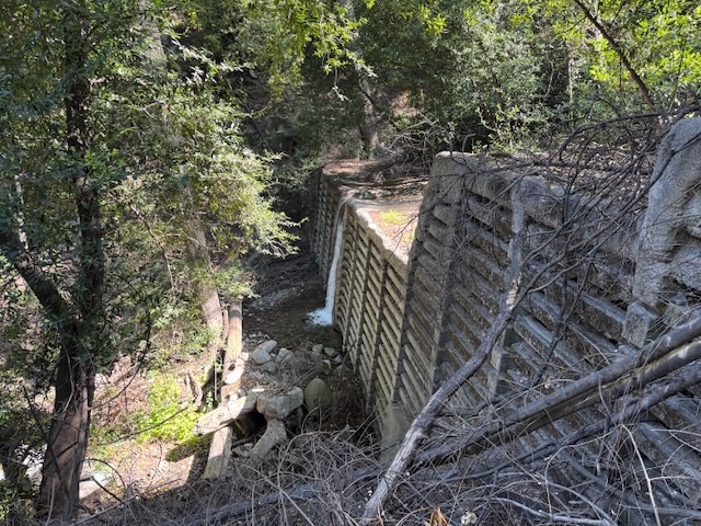
Continuing down the canyon, along the stream, I passed more spillways, trodding through a peaceful forest, overgrown, green and lush.

The tall peaks were far behind me, and I was heading for a low point, Sturtevant Falls. I had been there one time before, just a year prior.
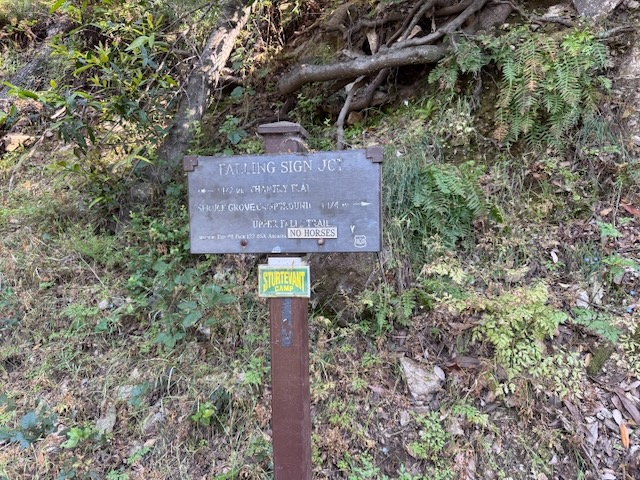
I reached Falling Sign Junction, which takes you past the upper falls, remembering how frightening the drops were along that trail before. But after today, I thought I could manage it, since I wanted to see the upper falls one more time.
The upper falls was flowing much more steadily and stronger than it had been the spring prior.
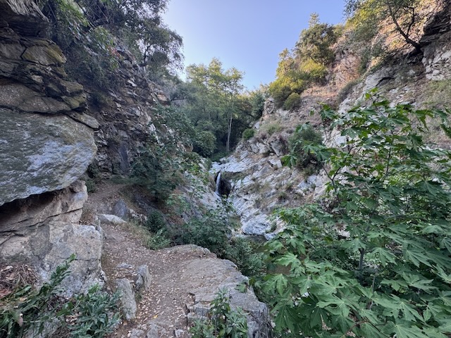
I passed by the narrow section around 5:15 pm, standing high above Sturtevant Falls.
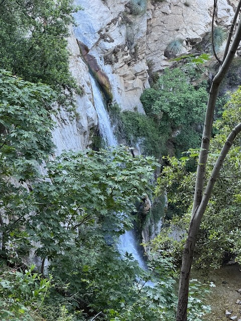
Just around this corner, the trail drops over 100 feet straight down from the rock, and the falls is visible soon afterward, though slightly obscured by trees. There was nobody there, and it was completely empty by the falls.
I arrived where Sturtevant Trail and Lower Winter Creek Trail meet. There are some forest service cabins there. I could see a large party of people hiking back, with the daylight fading. I had a decision to make. Originally I had planned to just hike past the falls, but that thought quickly faded, and I reasoned that I had to go to the actual falls, just another .75 miles of hiking, and with it being so close, I was going.
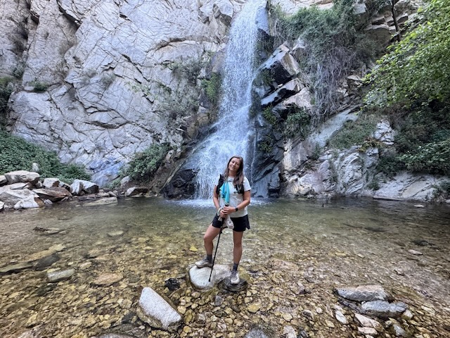
I made it to Sturtevant Falls at 5:30 pm. No one was around and I had it to myself, for about a minute, until a couple walked up.
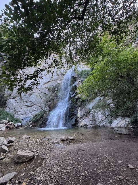
Sturtevant Falls
I decided to take a quick dip in the falls, as the hiker there remarked this was the “worth it part.” I guess it really was worth the extra .75 miles. The water was nice and cool for my feet. I will note that I later had a skin reaction to something in the water, so I cannot consider this clean. If your sensitive to river water, take this into account. Also, clean looking water in the mountains like this, harbors bacteria, such as giardiasis.
I was tired and it would be dark soon enough. I made my way past the many spillways, and old abandoned cabins, up another 400 feet of climbing, crossing over the last bridge over the creek, up on back to Chantry flat, making it there by 6:30 pm, making this a 9.5 hour day of hiking, with a 30 minute break, for a total of 10 hours. I hiked 15.7 miles through all types of terrain, to complete what many consider one of the most iconic hikes in the Angeles Forest, getting to travel the Sturtevant Trail, one of the oldest established hiking trails in these mountains, in it’s entirety. Waterfalls, wildflowers, old cabins, and history. This hike had a little bit of everything, in terms of beauty, and hazards to be aware of.
….
Conclusion
Would I return to this trail? I would hike the Sturtevant Trail any day. I would hike to Mount Zion, in winter time when it is not overgrown. I would not likely do this particular hike again, or at least during this time of the year nor would I return to the Mount Wilson Trail, since it was destroyed by the Eaton Fire, so it needs time to recover. I would instead opt for Sturtevant Trail both ways, if heading to Mount Wilson.
I enjoyed all the wildflowers and mountain views along Upper Winter Creek. But I worried much of the way about falling down the steep slopes, and the sunny exposure made it feel a bit too warm. The rockfalls on Mount Wilson Toll Road were kind of frightening, thinking how a huge granite slab could just go at any moment violently falling with an extreme velocity due to the pitch. Nearing the peak, it was narrow, uneven, brushy, and filled with poodle dog bush. All this sealed the deal for me that this hike might be one and done.
I did enjoy hiking through the peaceful and densely forested area on the way down Mount Wilson along Sturtevant Trail. This section was much more shady and the only issue I had going down was slipping and falling on loose gravel rock, pinecones, acorns, sticks, and mixtures of these. It was otherwise filled with solitude along that section.
What more could I ask for? This trail delivered in many ways, checking all the boxes. If it wasn’t one thing, it was another. My hike was filled with challenges of every variety, not to mention the mileage and the gain. I definitely had some struggles along the way up in terms of how I was feeling too, which had to do with some issues I have been facing. But I have noticed profound changes health-wise, by hiking more, as I continue to feel better and stronger. Everyone has a recipe for health. Mine is being outside, a healthy way of eating, and trying to live a less toxic life. Hiking though a burn area can in no way be considered healthy. The forever chemicals in fire retardant linger for decades. As I said before, this one was one and done. But I do plan to return to this area, and explore more. Would love to stay in a cabin here, maybe at Sturtevant Camp. Not sure how that can be possible. Maybe someday…
Until next time Mount Wilson, and Sturtevant Trail!
I hope you enjoyed reading this, and it is helpful in knowing what to expect, should you decide to visit here.
The Essentials
Just be sure to come prepared, bring the 10 essentials, and Pack Out Your Trash to keep the wilderness pristine for future hikers.
About me
I’m Serafina! I’m a writer and California girl who loves to go exploring. Hope you will get outside today, breathe some fresh air, and be happy!
Like and Subscribe to my Channel!
Follow my Journey @serafinabenjamin
Follow along on My Youtube Channel where I post videos!
Disclaimer:
The work on this blog is my opinion and my opinion alone and I am not responsible for the outcome if someone were to apply these thoughts to their own life. All text and photography copyright 2026 by Serafina, all rights reserved. Information and opinions provided are kept current to the best of the author’s ability. All readers’ usage of the ideas and opinions presented in the blog, are at their own risk. Be aware of the possible dangers of hiking, surfing, walking, cooking, and other activities, which may take place indoors or outdoors. By reading this, you agree not to hold the author or publisher of the content on this web site responsible for any injuries or inconveniences that may result from reading the blog, or partaking in any activity mentioned in the blog. Read the blog, and use its ideas, if you so desire, at your own risk.
