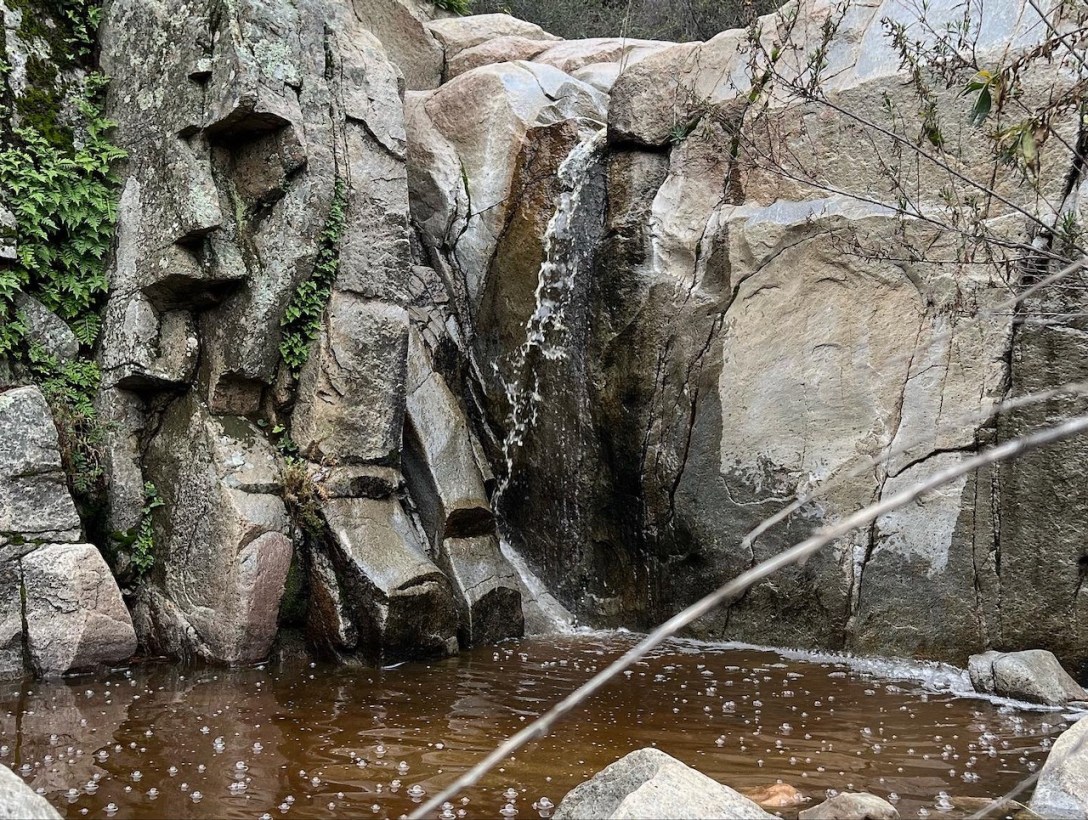
The Town Of Lake Elsinore

The town of Lake Elsinore became developed and took off in1888. It was a stop on the famous Butterfield Stage route. The healing waters of the mineral springs here, drew in visitors from far and wide. Coal and clay mining, gold, ranching, fruit, and nut growing, helped drive growth. A series of boom and bust… Continue reading The Town Of Lake Elsinore

Hiking to San Mateo Peak Elevation 3591 ft

A 10 mile Loop Hike Via Morgan Trail Quick Facts Located within the Cleveland National Forest https://www.fs.usda.gov/cleveland/ Town/State Lake Elsinore, CACounty RiversideRegion  Southern CaliforniaAddress South Main Divide, Decker Canyon Rd, Lake Elsinore, CA 92530GPS Coordinates 33.633599, -117.382071Google Maps - Morgan Trailhead Parking / Trailhead Parking lot at trailhead visible from roadCost Free Pass Required NoRestrooms NoMileage 4.7… Continue reading Hiking to San Mateo Peak Elevation 3591 ft

Hiking to the Bear Creek Oasis

I headed off towards the Bear Creek Oasis from the Cove Trailhead in La Quinta, CA in February. Winter and spring are the best times to visit here. There is a large parking area, and is a popular place to hike. There are plenty of signs, picnic tables, and a restroom here at the trailhead.

Hiking at Peters Canyon Reservoir on a Windy 80 degree day

These trails are a lot of fun for just about anyone who loves hiking.

Bane Canyon in Chino Hills

Quick Facts Trail NameBane Canyon, Bane Ridge, Corral Trail, East Fenceline, and Pomona Trails Peak or High Point1017 feetTrail Length8.5 milesGain1853ParkingFree on street or $15 for Day UseRestroomsYesDogsYesCell ServiceYesLocationChino Hills, CADirectionsSapphire Rd. and Bane Canyon Dr.MapAlltrailsI began the hike into Chino Hills from the east side of the park. I took the Central Avenue exit… Continue reading Bane Canyon in Chino Hills