It was three days before Christmas, and one day before rains were set to sweep through the entire area. I had wanted to hike to the Bridge to Nowhere for some time. After the fire charred the area a year prior, converting it into a burn scar, I was skeptical of whether or not it was worth it to make this trek, based on recent events. The hike had been re-open since the summer, and during that time, hiking to the bridge had been on my mind.
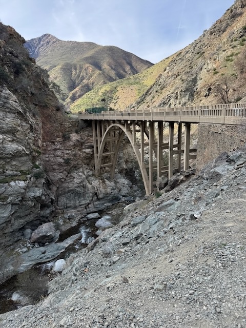
The Bridge to Nowhere is one of the iconic hikes in Southern California that everyone talks about, so I felt it was something I needed to see. The bridge was built in the depression era in 1937, to connect Wrightwood with the San Gabriel Valley.
I heard this canyon can get hot, and being at a lower elevation, that made sense. There have been many reports of rescues, along with fatalities associated with this hike,and the San Gabriel River Valley in general. In 2024, a woman was swept away when crossing the river, just after an atmospheric river. I knew that it was not the ideal time to visit, though thrill seekers may think otherwise. The thought of rushing river waters, and gushing waterfalls can be overly tempting for many hikers and adventure seekers alike.
So I had just been waiting for the right opportunity, when the weather was cooler, and the trail would be dry, along with not too muddy. The opportunity had finally seemed to present itself. I did feel a sense of time being of the essence as well. I had planned to take on this 10 mile trek in fall, before the river began to swell too much from winter rains. I knew the atmospheric river that was approaching would likely wipe out the trails, and cause landslides in this burn scar. There had not been any significant rain since the fires a year prior, so I knew the time was now, to venture toward this mysterious bridge to nowhere.
After driving up the highway, I made a right over a bridge, and began making my way up Glendora Mountain Rd.. On this particular morning it was fairly sunny and cool. I noticed the dam was not empty but not full and the river was not flowing strongly, a good sign of what was to come. I was betting on the river flowing low, since I was not looking to be swept away or be knocked over and tumbled by its strength. Along this road were many abandoned vehicles and ones which appeared to have people camping in them. I started to wonder about how safe this spot actually was based on this.
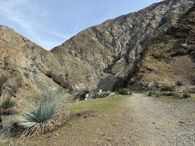
I continued along Glendora Mountain Rd. towards Heaton Flats, which is also the trailhead for the famed Iron Mountain, or BIg Iron, a hike every serious hiker wants to add to their resume. With 7000 feet of gain in 6 miles, it truly is a beast of a mountain to climb. The charred and dusty unstable hillsides make it seem it would be an even greater challenge. I was in no way, shape, or form ready for such a challenge, but hope I someday may be, as I still continue to take it easy, as the healing process continues for me, post-injury. We need to take care of ourselves, or face consequences. So I was working up to big climbs, and today’s hike was all part of the training.
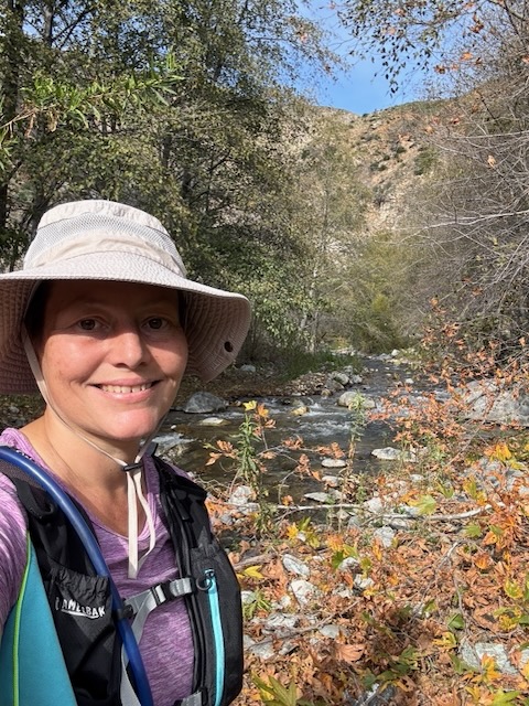
I arrived at the trailhead for Heaton Flats and noticed the parking lot was mostly empty. I wondered if I had come here at the right time. As I was getting ready I noticed two hikers set out ahead of me. It was not going to be crowded, that much was clear. There would not be a significant amount of gain on this hike to the Bridge to Nowhere. But what it lacks in elevation gain, I would find it would make up for with other challenges, in both navigation and crossing rivers, over slippery river rocks, not to mention some steep sketchy drop offs along the cliffs.
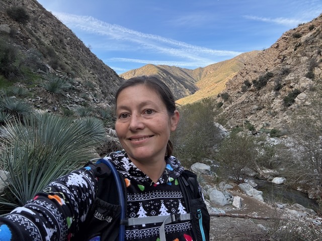
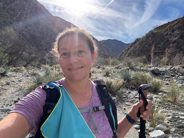
I set out for the Bridge just before 9am, and felt it noticeably chilly out. I was wearing a festive fleece, which I wear during the most joyful time of year, and shorts, along with goretex trail runners. I was not thinking clearly in choosing these, but I would have to make it work. Goretex does not drain, and you always want a shoe that drains for river crossings. I brought my old chacos for this reason, which I would soon find were not up to the task, since they would soon fall apart.
The sun was just starting to rise as I continued down the wide trail, which seems more like a road, heading towards the Sheep Mountain Wilderness.
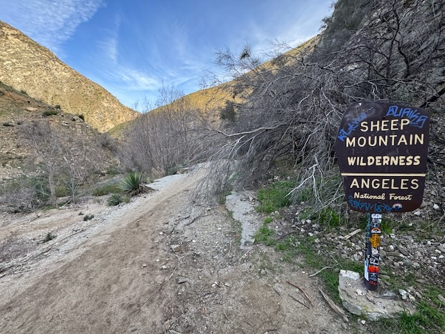
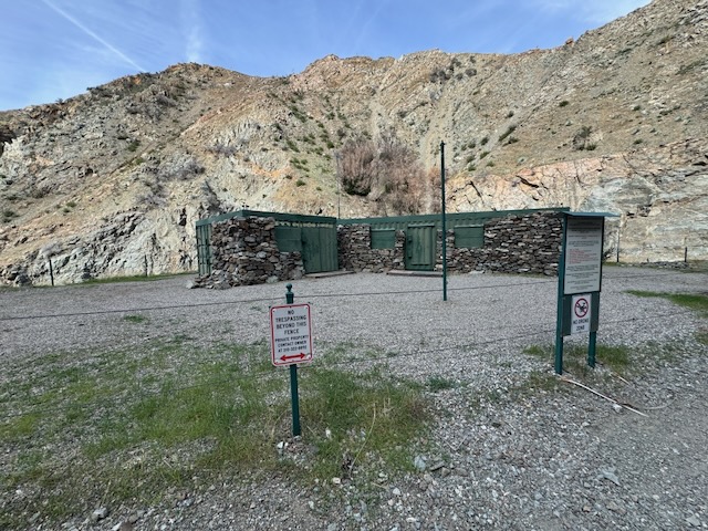
Just after 9am I reached the sign, and I was now officially within the wilderness I love, once again. The spray paint on the sign, sort of set the vibe, giving this hike an urban type of feel. Even though I was in the wilderness, something about this one felt rough around the edges.

I was truly hiking into the unknown, as I approached what would be the first of about five river crossings necessary to reach the bridge. I took off my shoes, switching to Chacos. It seemed some hikers had preferred to scale a sketchy, slippery boulder rather than get wet feet. My consensus was that crossing the river on this hike is mandatory. It was less than 50 degrees out as I donned my chacos and completed a successful crossing. The water was not as cold as it could have been. Being a surfer, I faced upstream, carefully cross-stepping my ways across a wider shallower section.
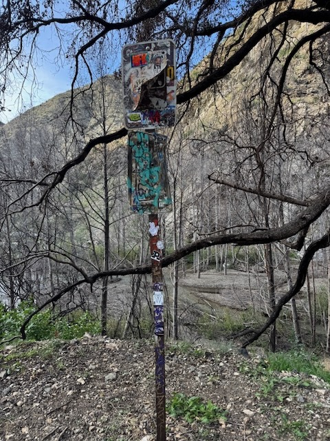
More evidence of humans and spray paint revealed itself as I hiked on realizing that now I was actually cold and my toes were somewhat numb, about 30 minutes into my hike. But that would soon change.
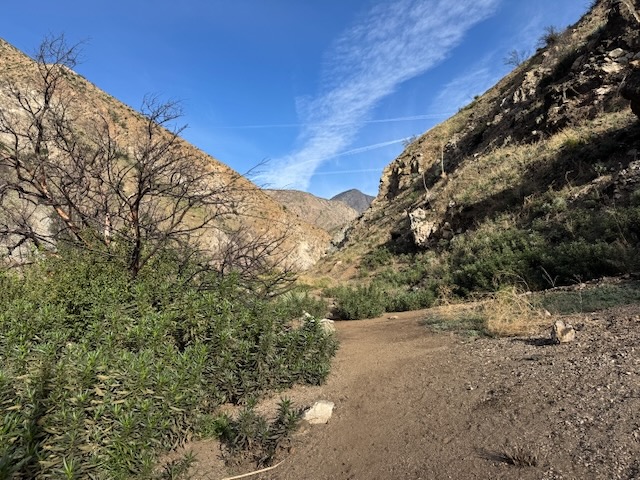
As the sun finally rose over the ridge, illuminating the canyon, I felt a sense of both dread and peace simultaneously. I was grateful to be warmer finally, yet concerned I might get hot very soon as well. Hiking in canyons has its risks and its rewards. The sun reflects off the canyon, making hikers feel far warmer than the forecast predicts. I learned this fact all too well on past hikes. Even a 65 degree hike can feel more like 75 degrees in a canyon. If it is 75, it feels like 90. That is when it can get dangerous. Combine that with lack of hydration, shade, or preparedness, and there can be a problem.
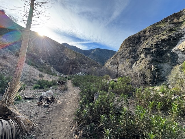
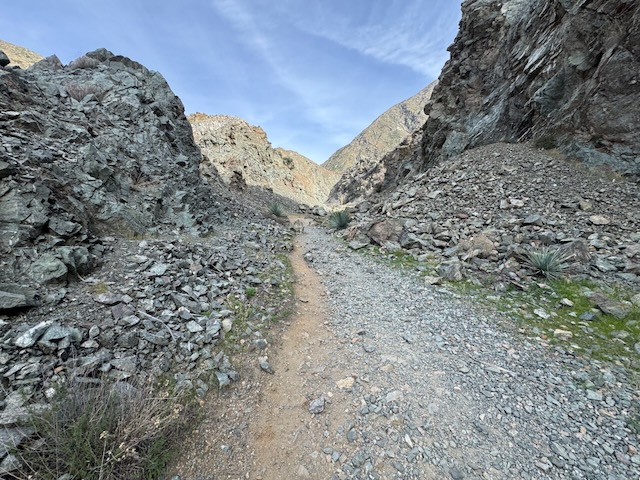
It was now easy to see that this canyon, kissed by fire, was as dusty, and rugged as they come, feeling somewhat post-apocalyptic.
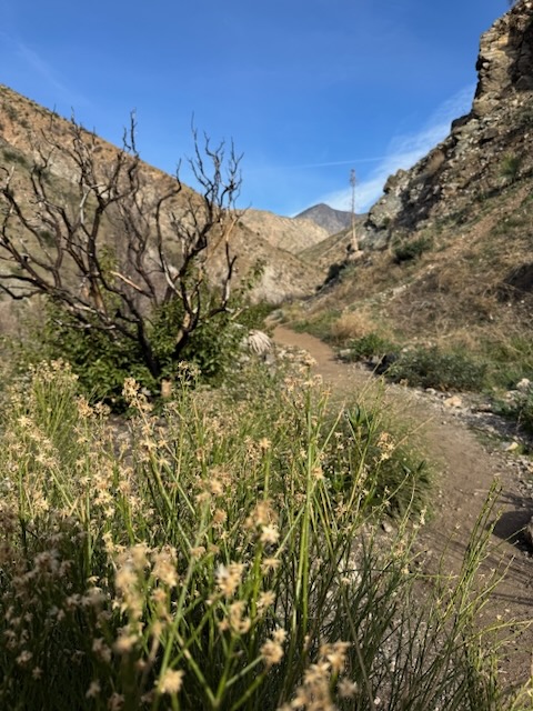
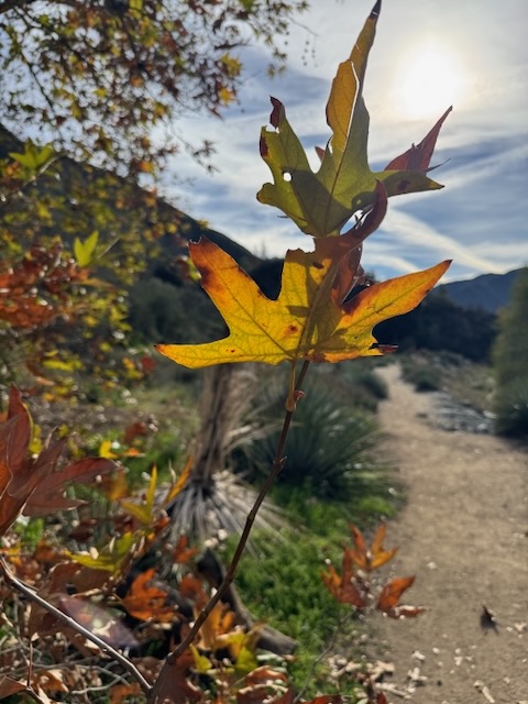
Still there were signs of renewal all around, the charred manzanita bush rising from the ashes, amid fresh green growth.
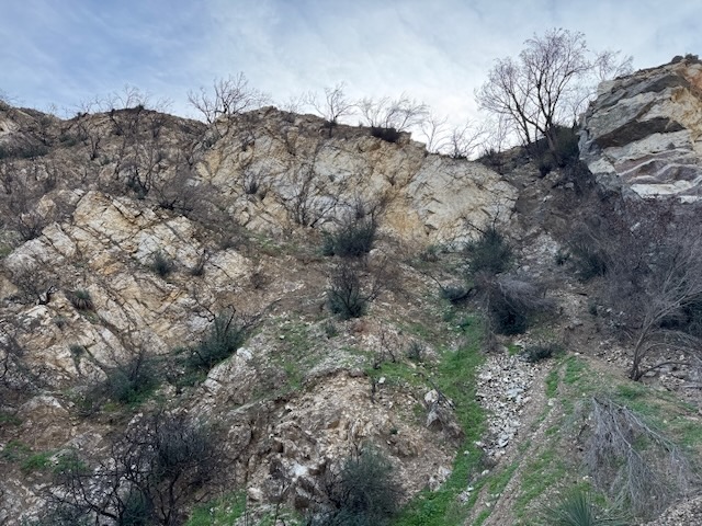
Up above it was clear, there was no escape, and these crumbling hillsides could easily collapse at a moments notice, so I needed to remain on guard.
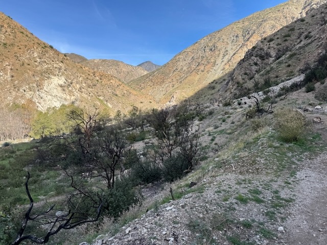
Off in the distance, I had a clear view of Big Iron up ahead.
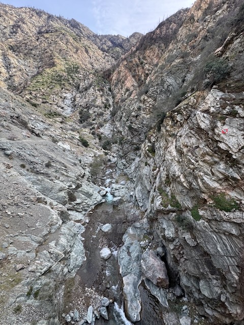
About an hour into my hike, after several twists and wrong turns, I ended up hiking along the riverbed. I actually meant to take a steep trail off to my right, on up to a ridge, but missed it. I noticed a large group of teens and a few parents approaching from behind. They followed one of my wrong turns, and ended up on one highly eroded and steep trail with a 40% pitch, which I avoided, consisting of loose rock. I had made my way back down to the main trail instead. This was a highly risky maneuver they made, in my opinion, with all those tweens and teens. I wondered why they had not backtracked to the actual trail, after I mentioned to them that was not the way. I would see these hikers again along the ridge up above , passing me by along the ridge later on, as I hiked in the riverbed. That’s how I knew I missed the turn. However, I also was aware of an area referred to as Devil’s Gulch, purported to harbor a waterfall of the same name, which was noted on a separate alltrails map I downloaded. I had considered checking it out as a side excursion, if I had the energy after the bridge. Well I guess I was going there first. I decided since I was already going that way, to explore it, before returning to where I made a wrong turn. As I trod on, I wondered if I was making a good decision. What was down here. I had no idea. Thoughts of flash floods passed through my mind. This would not be the place to be in that case.

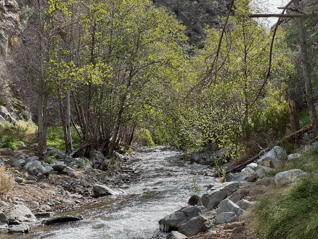
Off to my right was the steep charred hillsides, and to my left the San Gabriel River, fresh green grass and trees, standing in sharp contrast to one another. I hiked through grassy meadows, dotted in fall leaves. What would I find? I truly felt alone here and isolated, and another worry was running into strange creatures or folk. This felt like an off trail excursion. I trod on, in hopes there was a beautiful picturesque waterfall waiting.
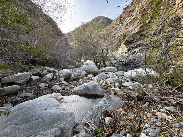
The gulch area was really beautiful with its clear pools of water flowing up against smooth granite cliffs, all of which were shaped by the rushing waters of the sometimes peaceful and other times mighty San Gabriel River.
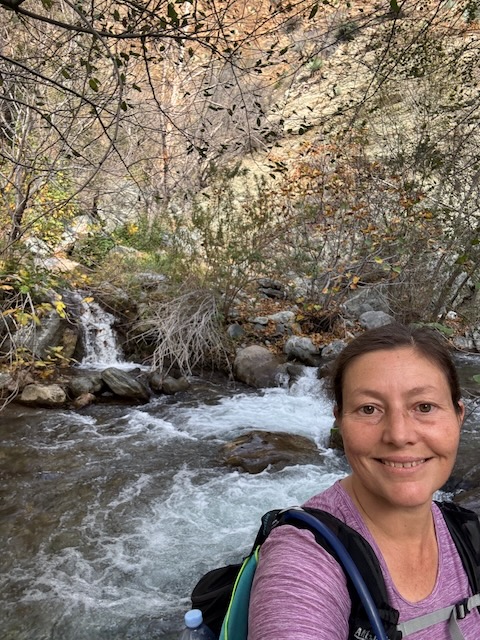
After about a mile, I had made it to the end of the trail, according to all trails, and to where the waterfall should be. I am very much a novice at finding waterfalls and did not find any epic falls here. It is possible they were further down the trail and it was marked wrong. I had spent enough time on this fools errand. There was not much more to write home about than the tiniest waterfall as far as I could see. I feel the actual falls may have been past this deep pool and further up a canyon, through thick brush.
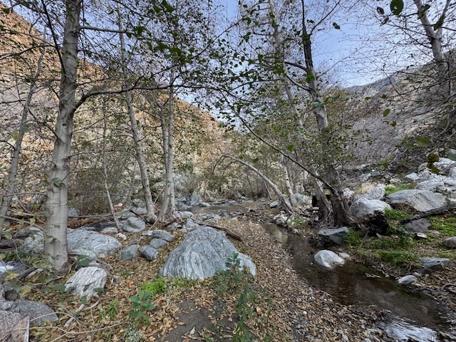
I decided to save bushwacking for another time, heading back to complete the hike to the bridge, backtracking through the forest. I was after all alone out there, and if I injured myself, good chance the garmin might not even work in a narrow canyon with all that granite all around. I made tracks back through the forest, along the riverbed, to the turn off for the bridge, noting where I missed my turn.
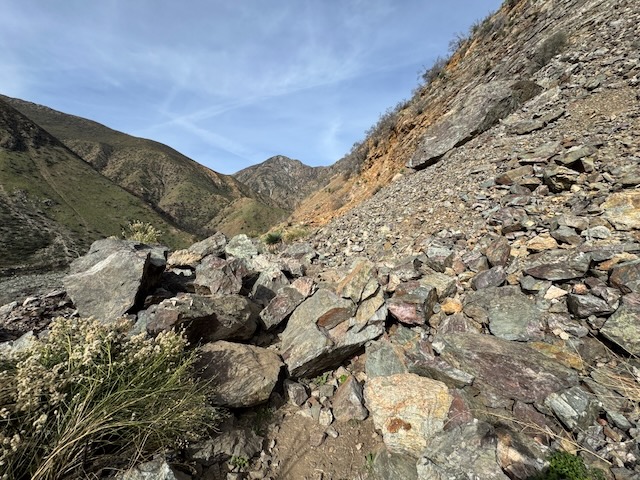
Once back on the trail to the bridge, I crossed over a hefty sized rockfall, a testament to the power of nature and the inherent dangers of hiking through a canyon such as this.
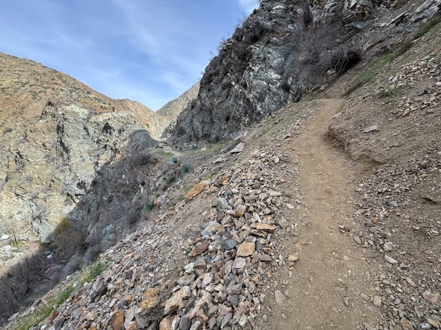
As I hiked on, the remaining mile and a half to the bridge, the trail grew ever more rugged and steep, reminding me of hiking to desert peaks.
I had to take care along this section, as some areas were highly eroded, and the path was loose granite. One misstep, and you would be done for and that is no exaggeration. At this point my consensus was that this hike is not for kids.
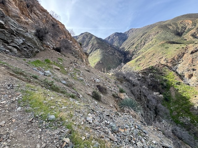
I always look back to have a visual of the area I am coming from set in my memory, so I will always have an idea of how to get back where I came from. The hills, greening up, indicated spring was on its way, and it was early December, which seemed unseasonal.
The last pass to the bridge was by far the sketchiest, and this is where I encountered a trail that was one foot and dropping straight off. Was I hiking in the Sierra? It surely felt like that for a moment while here.
I could finally spot some structures to the left, as I neared the bridge. Were they used by the bungee company? That is what the bridge is used for these days, and otherwise is really nothing more than a folly.
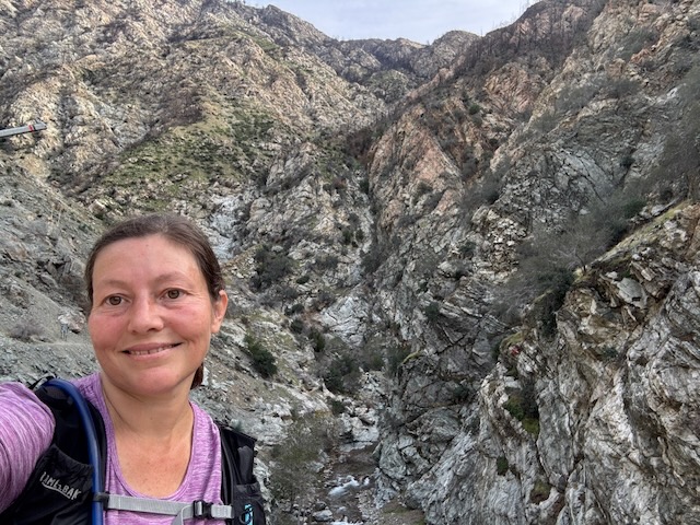
I had made it to the famous bridge!
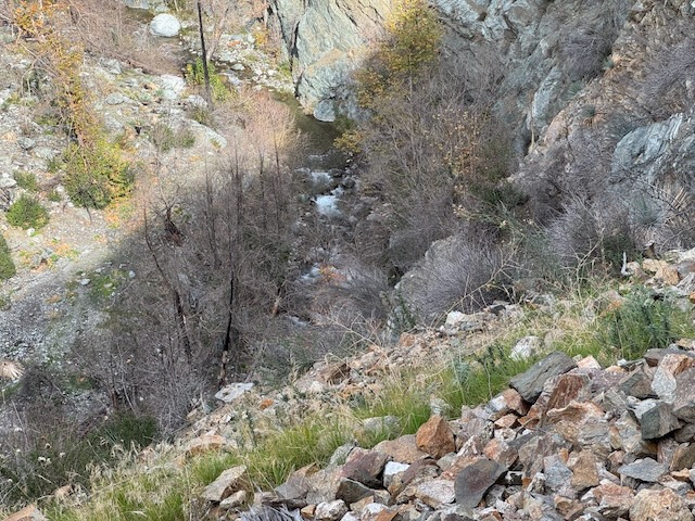
I gazed out at multiple cascading waterfalls. The gorge at the bridge did not disappoint one bit.
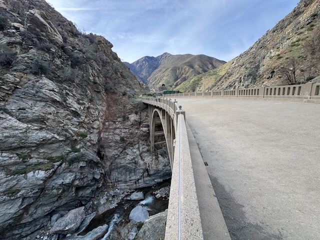
The bridge is a true feat of engineering, to have stood so long, and also withstood the recent fires.
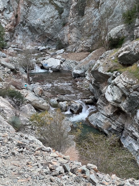
Beyond the bridge, in the canyon below, was a waterfall and pool to swim in.
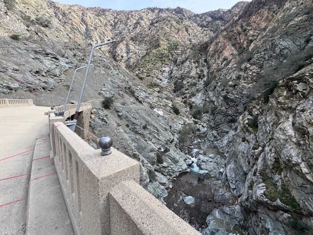
The canyon was fully shaded at this time, which made me think this is more of a seasonal hike. I was here post-season, and it was fairly shady. Going in might have been chilly. I had no plans to swim today, but to explore the area, so I decided to save a swim beneath the waterfalls for next time. The ideal time to hike here might be on a warm summer day after all, starting around 5am, swimming from 8-10am and then hiking back before it gets too warm. The timing of when is best to swim at the bridge is up to interpretation.

It was around 11:30 when I began my hike back from the bridge.

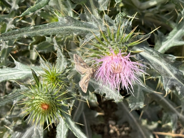
There were beautiful butterflies and moths, feasting on bright purple milk thistle along the way.
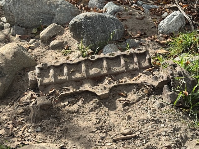
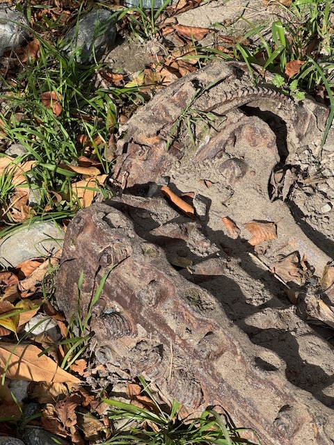
I noticed parts of a washed out car, which at one time was violently tossed about, before being buried here by the sometimes violent San Gabriel River.
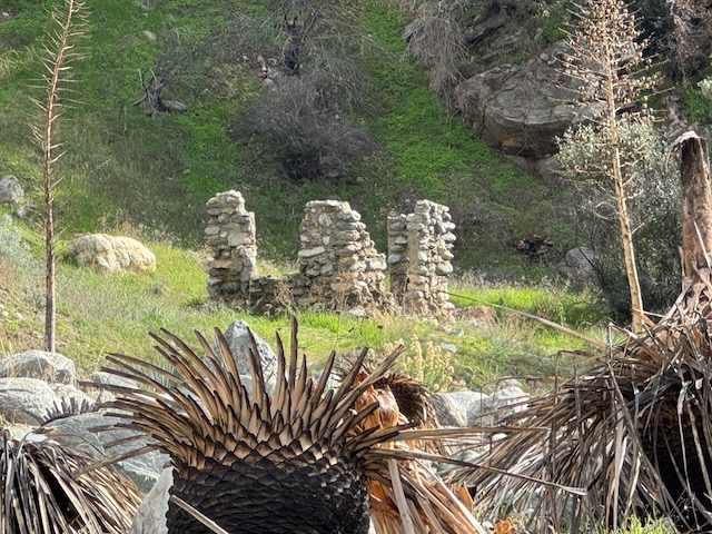
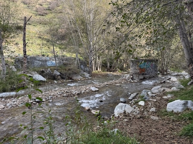
There are lots of ruins here to explore, and the remnants of another bridge, now covered brightly in graffiti, which is all part of the experience of what it is to hike to the Bridge to Nowhere.
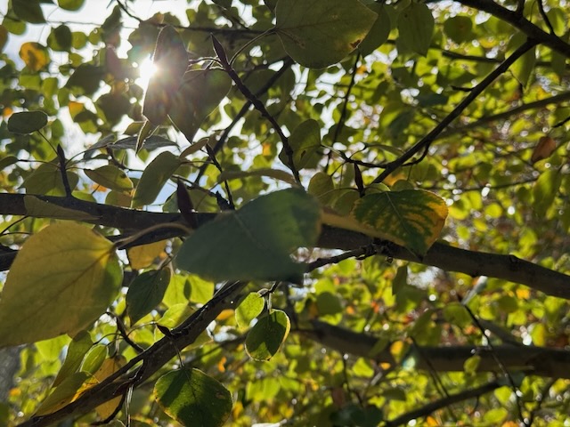

The last portion of the hike, through the forest, was much more brightly illuminated by the sunshine than before, in the early morning. The leaves of the greens backlit, in shades of gold and green greeted me along the last stretch of trail.
I was grateful to have completed the hike, as I bid farewell to this rugged canyon. Until next time San Gabriel River and Bridge to Nowhere!
I hope you enjoyed reading this, and it is helpful in knowing what to expect, should you decide to visit here.
Leave No Trace
Just be sure to come prepared and follow Leave No Trace principles to keep the wilderness pristine for future hikers.
About me
I’m Serafina! I’m a writer and California girl who loves to go exploring. Hope you will get outside today, breathe some fresh air, and be happy!
Like and Subscribe to my Channel!
Follow my Journey @serafinabenjamin
Follow along on My Youtube Channel where I post videos!
Disclaimer:
The work on this blog is my opinion and my opinion alone and I am not responsible for the outcome if someone were to apply these thoughts to their own life. All text and photography copyright 2025 by Serafina, all rights reserved. Information and opinions provided are kept current to the best of the author’s ability. All readers’ usage of the ideas and opinions presented in the blog, are at their own risk. Be aware of the possible dangers of hiking, surfing, walking, cooking, and other activities, which may take place indoors or outdoors. By reading this, you agree not to hold the author or publisher of the content on this web site responsible for any injuries or inconveniences that may result from reading the blog, or partaking in any activity mentioned in the blog. Read the blog, and use its ideas, if you so desire, at your own risk.
