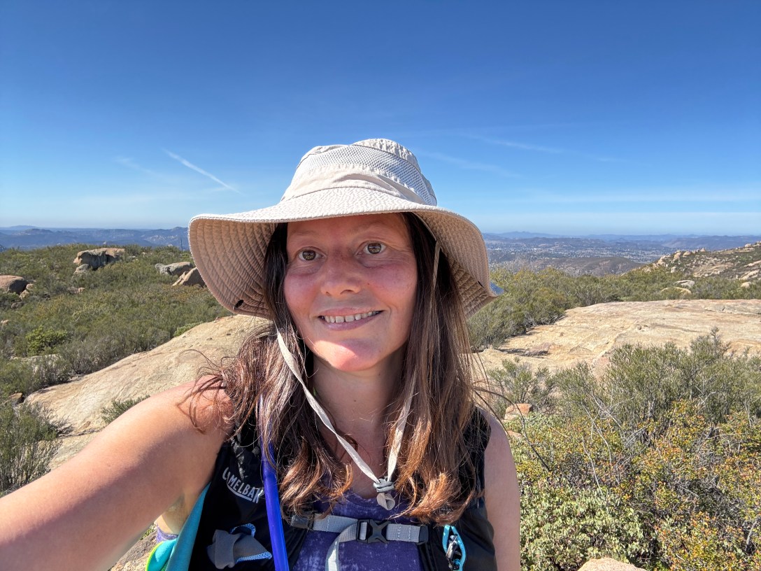
It was early March, and I had been wanting to visit Mount Gower since a year prior, when it popped up in alltrails in a search of any unexplored peaks in the Northern San Diego County area. It was just over an hour away from home in Orange County, said to be under 10 miles, with a hefty amount of gain to boot. I had not heard it talked about much, which was another plus, so I wanted to know more. I had been to nearby areas, but not to Mount Gower, set in a dense wilderness area of few named trails east of Escondido, CA.
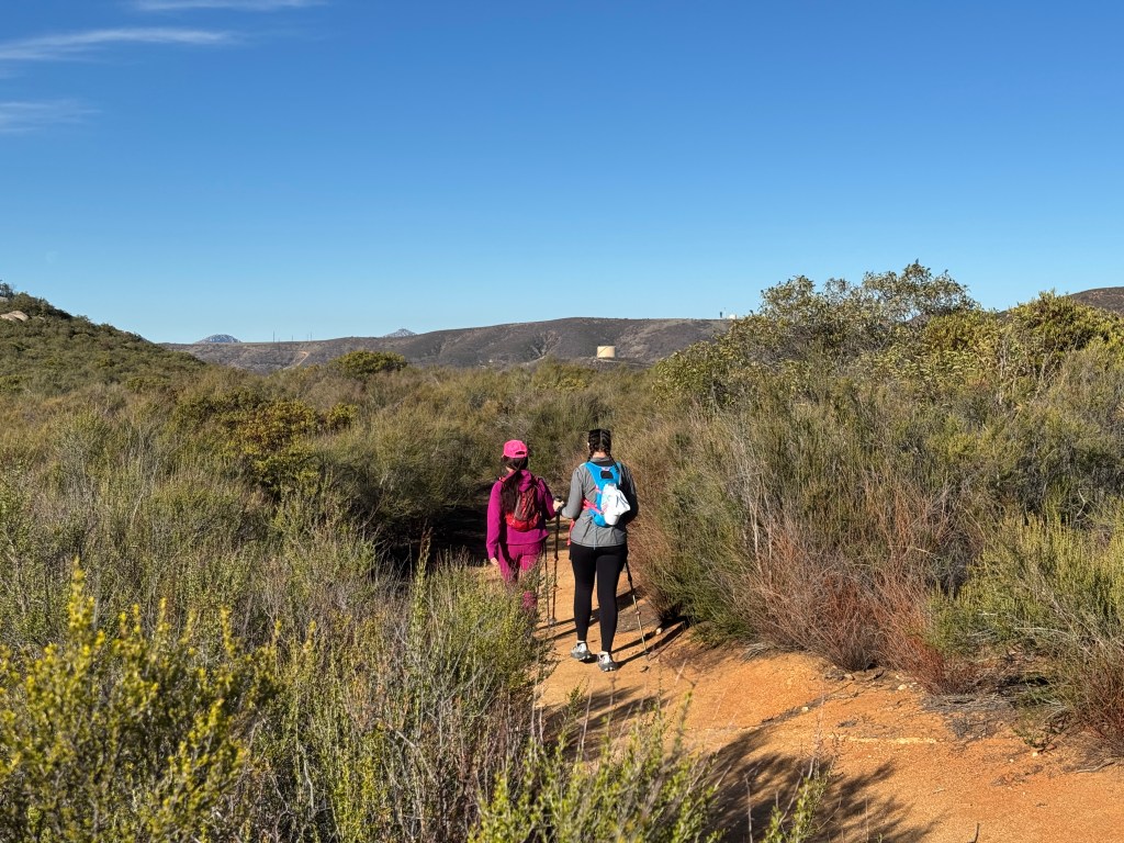
Mount Gower preserve is kinda out of the way. It’s a mini-wilderness hike, with a bit of a scramble. The best time to go is when trails are dry in from December to March on a cool day, with highs less than 65 degrees. So off I went on a cooler late February morning, with two women, one whom I had hiked with multiple times, and another, whom I would just meet that morning.
Intro
Based on the miles and gain, Mount Gower seemed like a fairly attainable peak. I had it in mind for some time, and with winter coming to a close, I knew the time for hiking it successfully was shrinking.
What to Expect
The hike to Mount Gower sits deep within the backcountry of San Diego, in rural Ramona, CA. This area is the site of many popular hikes such as Cedar Creek Falls. It also is prone to becoming notoriously hot, especially in the canyons. Aside from the potential for suffering heat exhaustion, having a run-in with rattlesnakes, and the other wildlife which frequent the area. To minimize my chances of encountering snakes, I had chosen to hike here during a cooler month of the year, early in the morning. This does decrease, though not eliminate the chances for snake encounters.
Preparedness
Carrying enough water on this hike is key, no matter the season, since it’s very exposed to sun. There are some shady areas, but they are few and far in-between. It really depends on the time of day where you will enjoy some needed shade. Bringing the 10 essentials and an In-reach device is recommended.
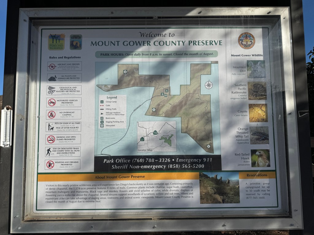
Mount Gower Preserve
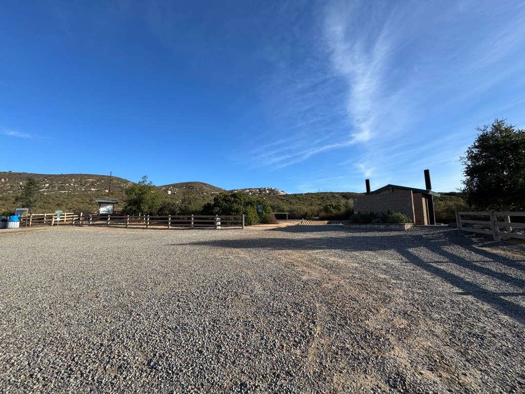
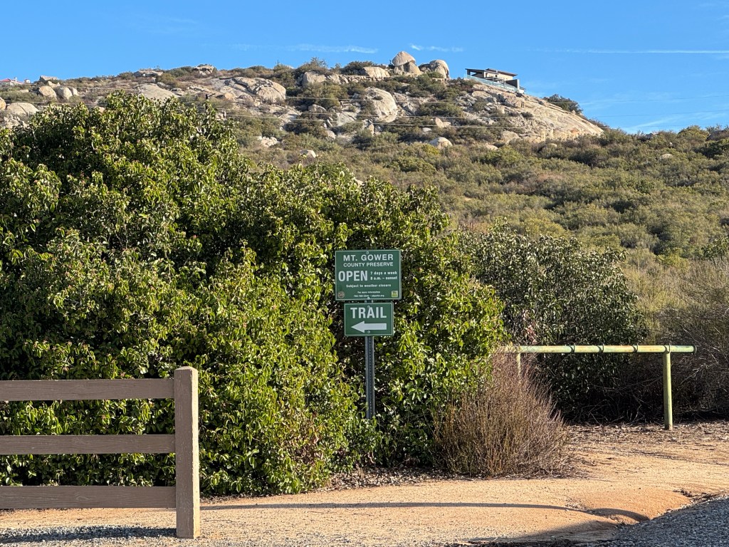
Though there is no fee to enter the preserve, the gates are said to open at 8am and close at 5pm. It’s a short window for hiking. I came to find, there is a lot outside the gates, and that is where most visitors park. It would seem that entering early is commonplace, but I would not find out this fact until later.
The Trailhead
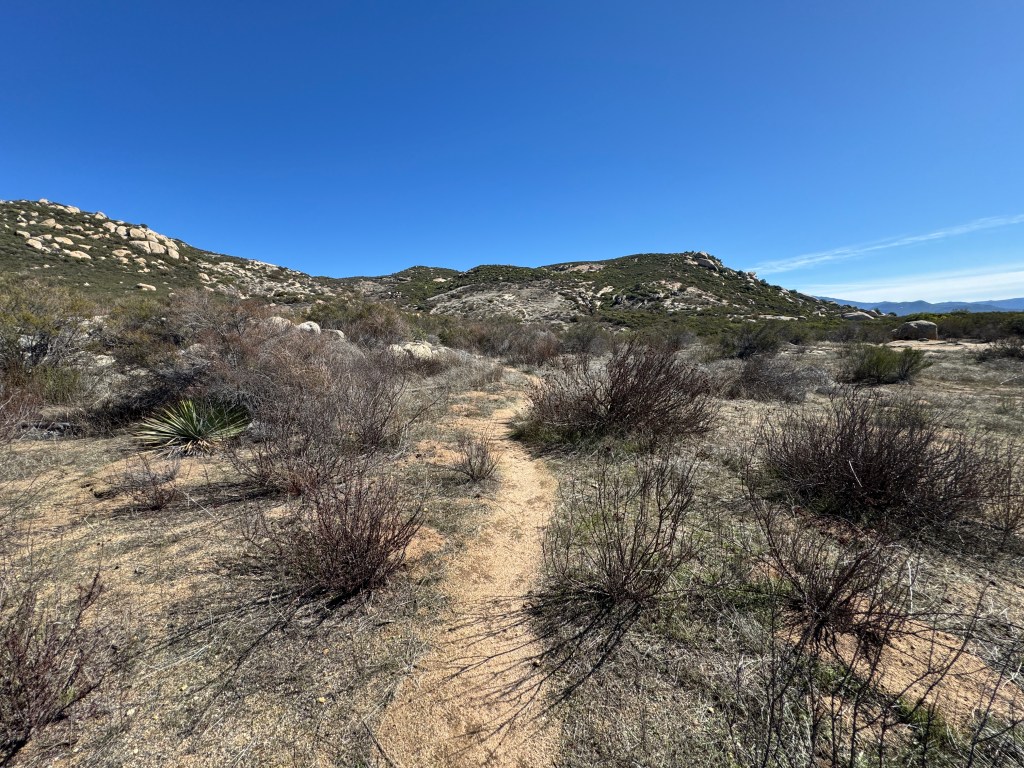
Once inside the preserve, you will find several well maintained pit toilets at the trailhead. Since spring had not yet sprung, the trail was free of brush, and off I went. Critters and heat aside, the true challenge of this hike would be navigation , and having a hiking partner who claimed to have run it before, and knew the way, only served to complicate my efforts to follow my map.
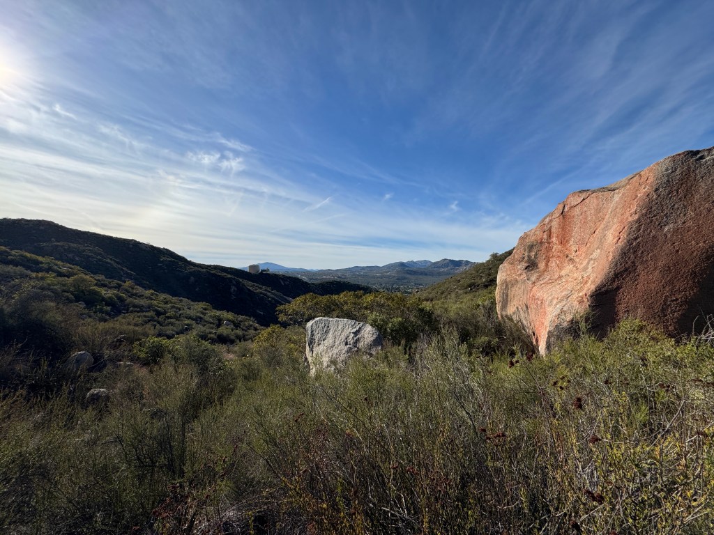
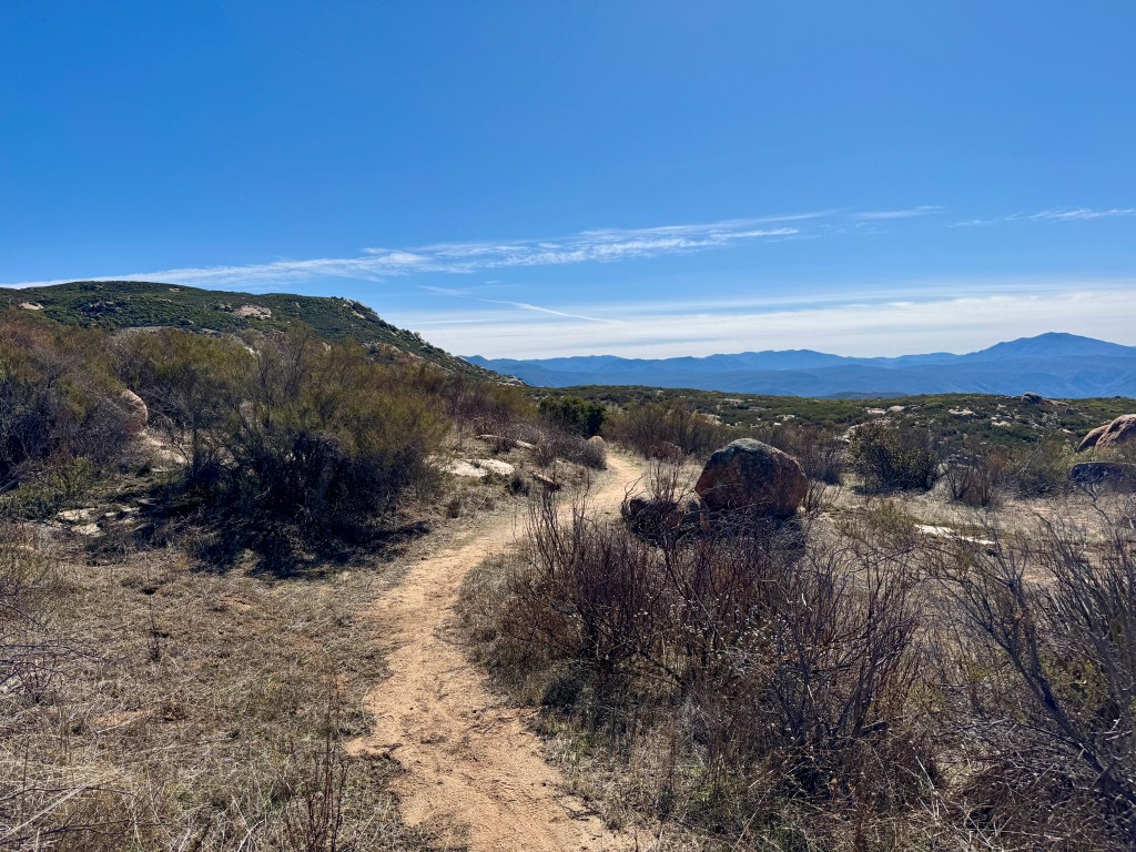
At first you will be hiking upwards slightly a few hundred feet for the first 1/2 mile. The hike starts out simple enough, and you will eventually start to see massive boulders amidst the chaparral of the canyon. Then you begin your hike down for another 1/2 mile. Up and down, up and down are the theme of this hike.
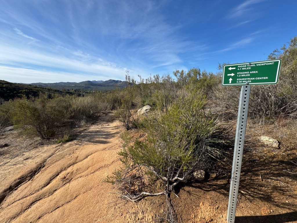
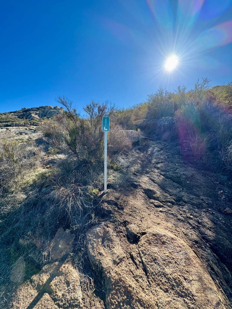
The trail at this point will head down into the canyon until you reach a turnoff for horse parking, which is an alternative entry point. The signs along the trail initially were encouraging, but I would see only a few more. Much of this would require a downloaded map.
Disclaimer: I did not actually get lost, but I definitely could have. Before you reach the end of this, you will know what I did, to avoid catastrophe.
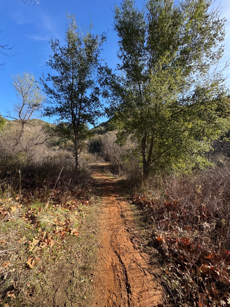
In the canyon was a small patch of trees.
There was not much shade, and it was already beginning to get warm on the trail. I had been warned about hiking in this area anytime, but during the cooler months which are late December to early March.
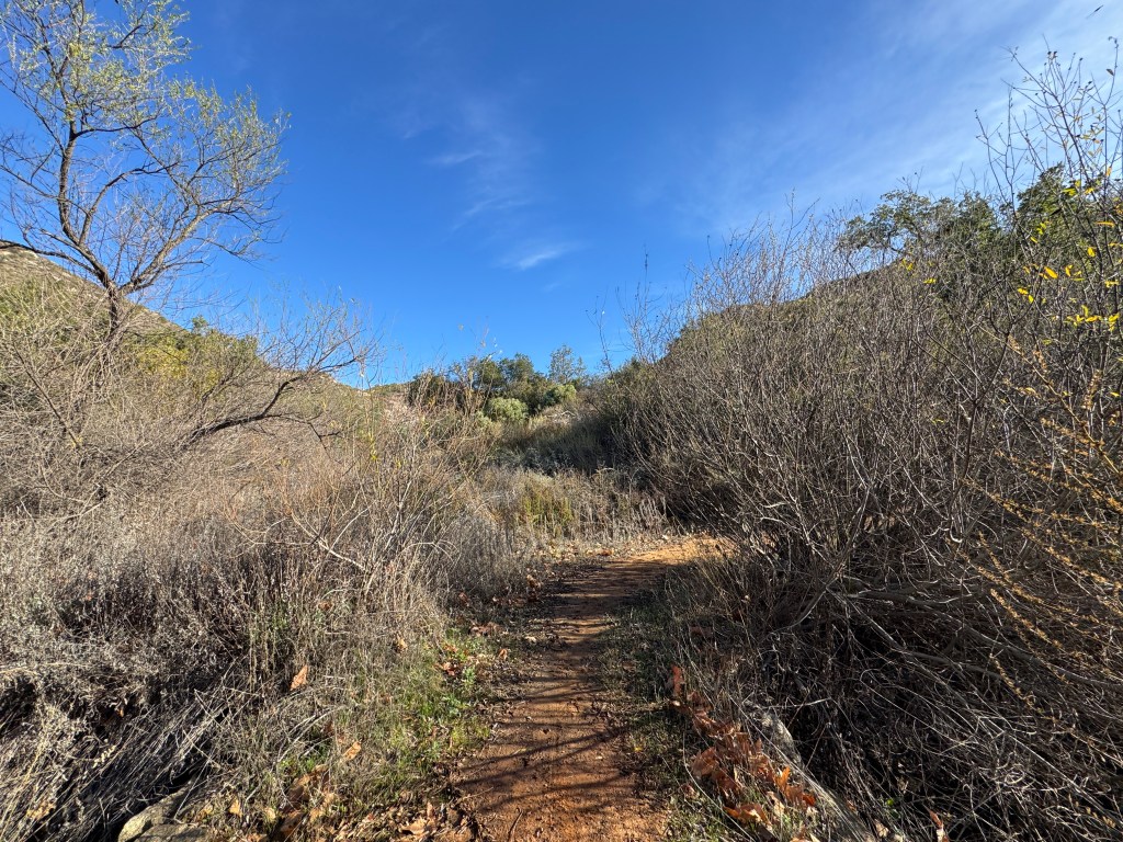
After crossing the first deep canyon, as I stood high above it on the other side, I could see the trail leading up the hillside indicating where I had come from. I always stop to look back, to assess where I am and to get my bearings.
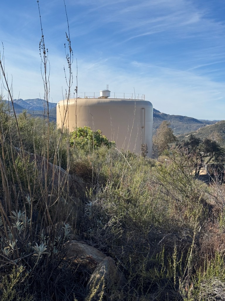
I came to a water tank, now just about 2 miles along.
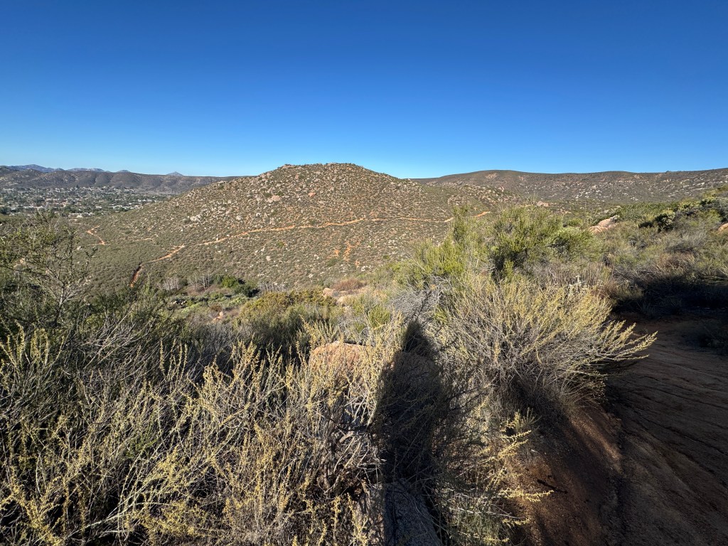
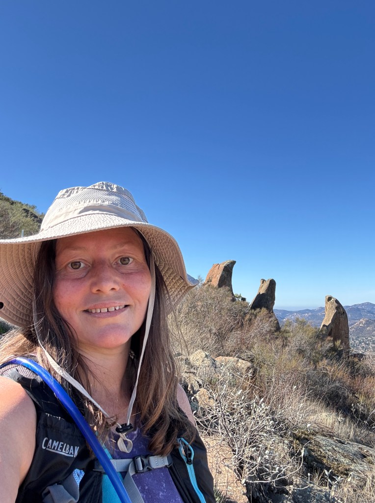
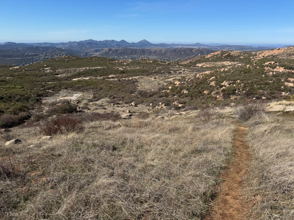
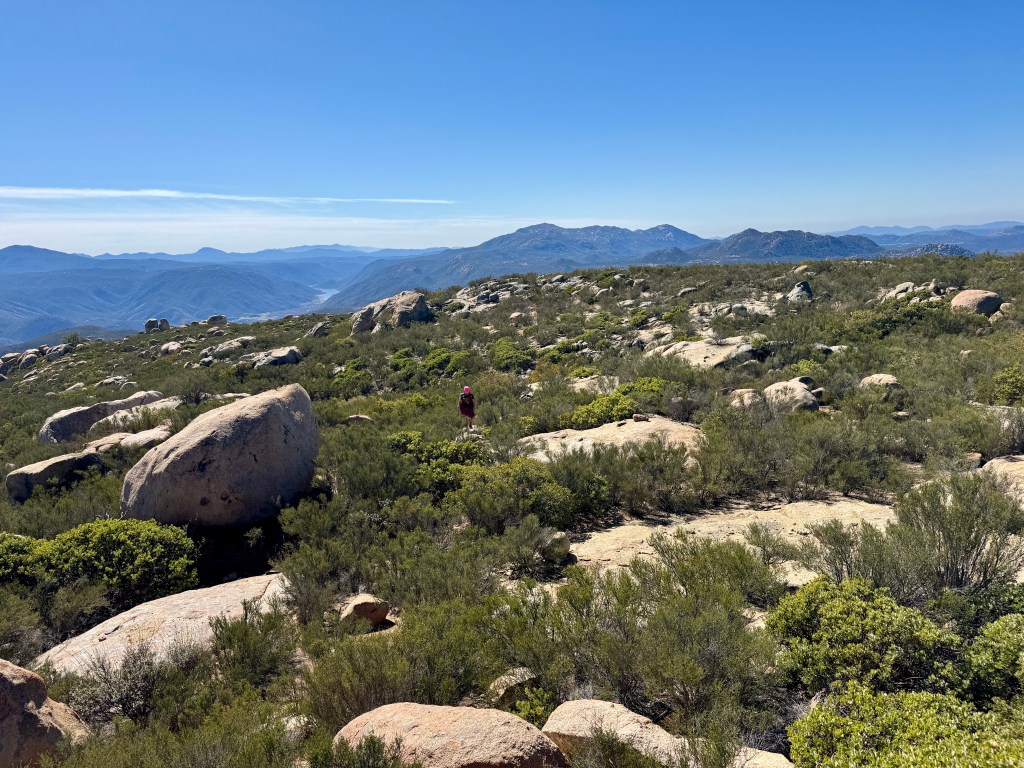
I was now on a Ridgeline leading to Mount Gower and its counterpart, False Gower in the distance.
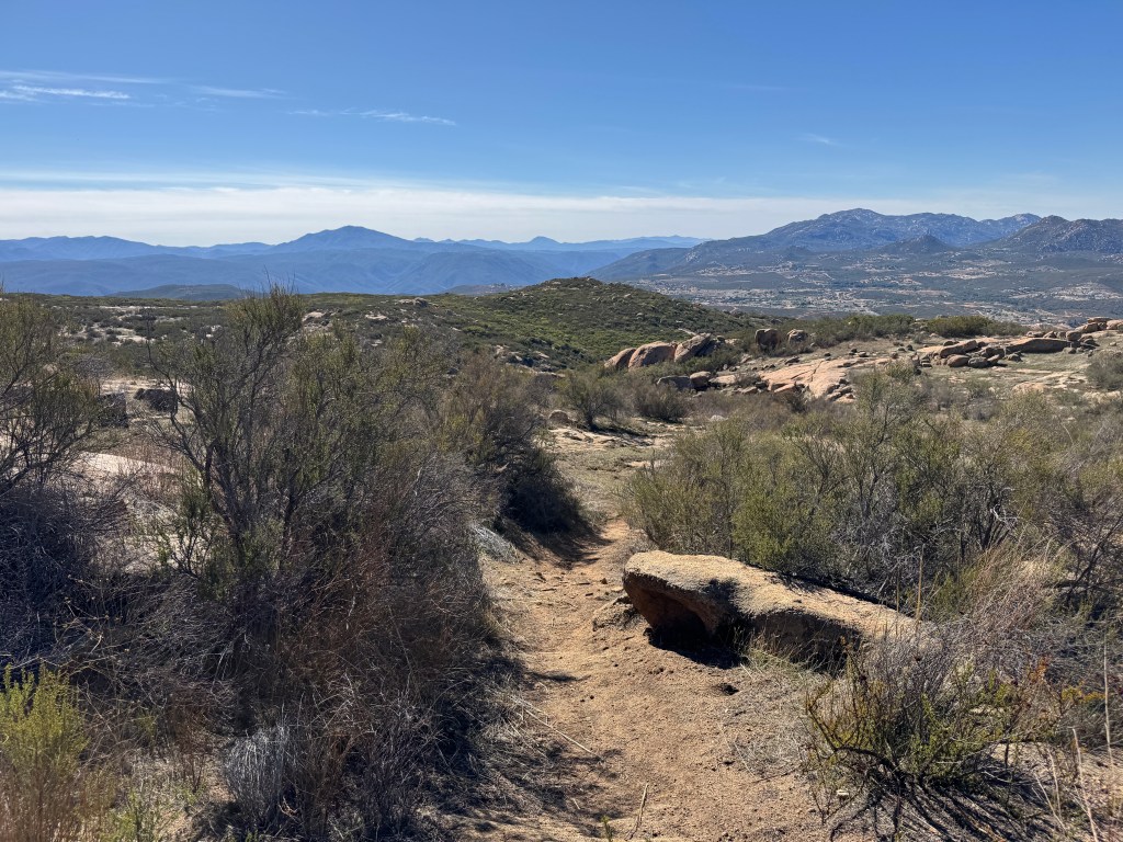
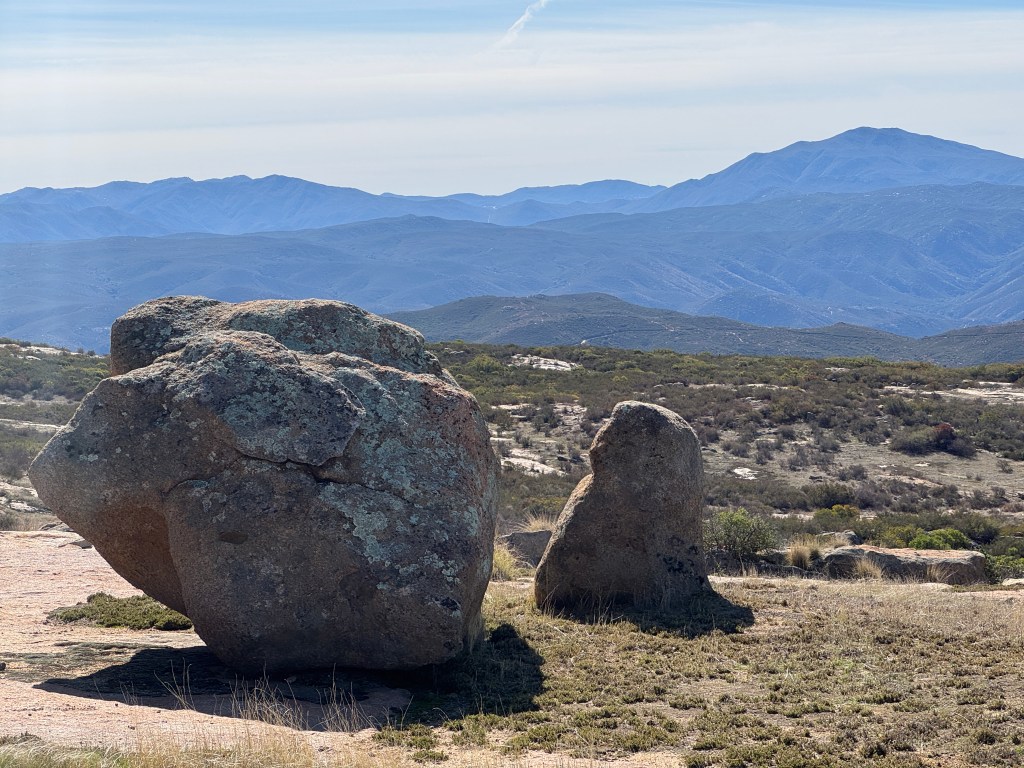
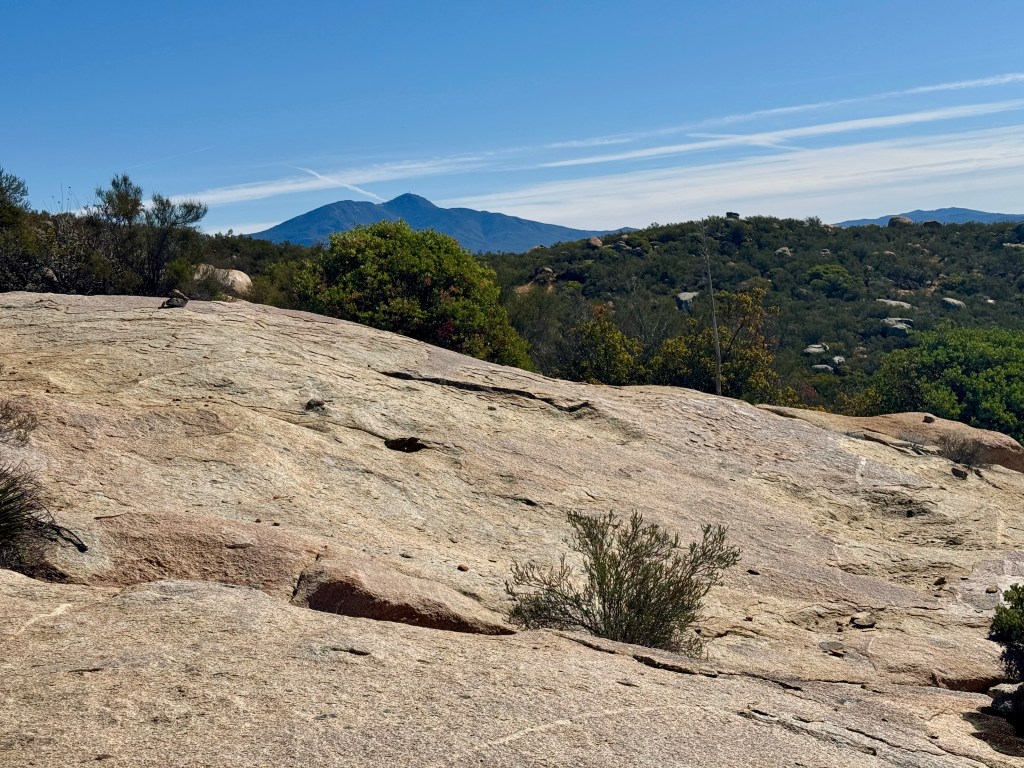
It was now warming up fast, and I knew why this area is infamous for feeling hotter than the forecast predicts. I had nice views across San Diego country at this point.
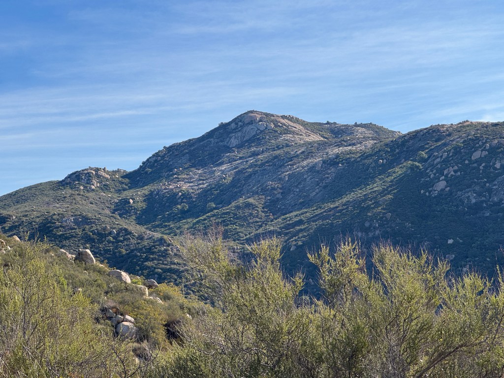
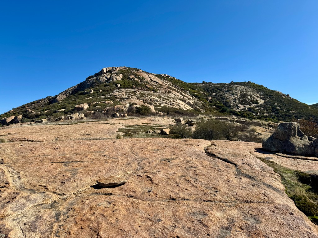
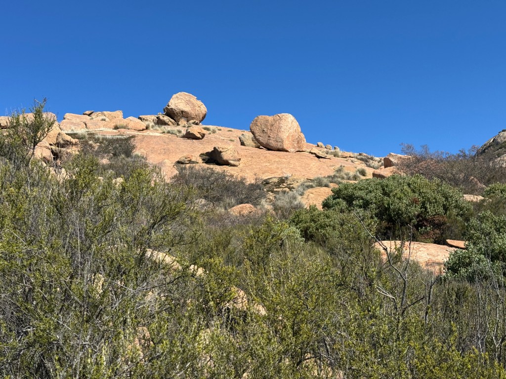
I could now see the interesting rock formations up ahead, but was not sure if this was Mount Gower.
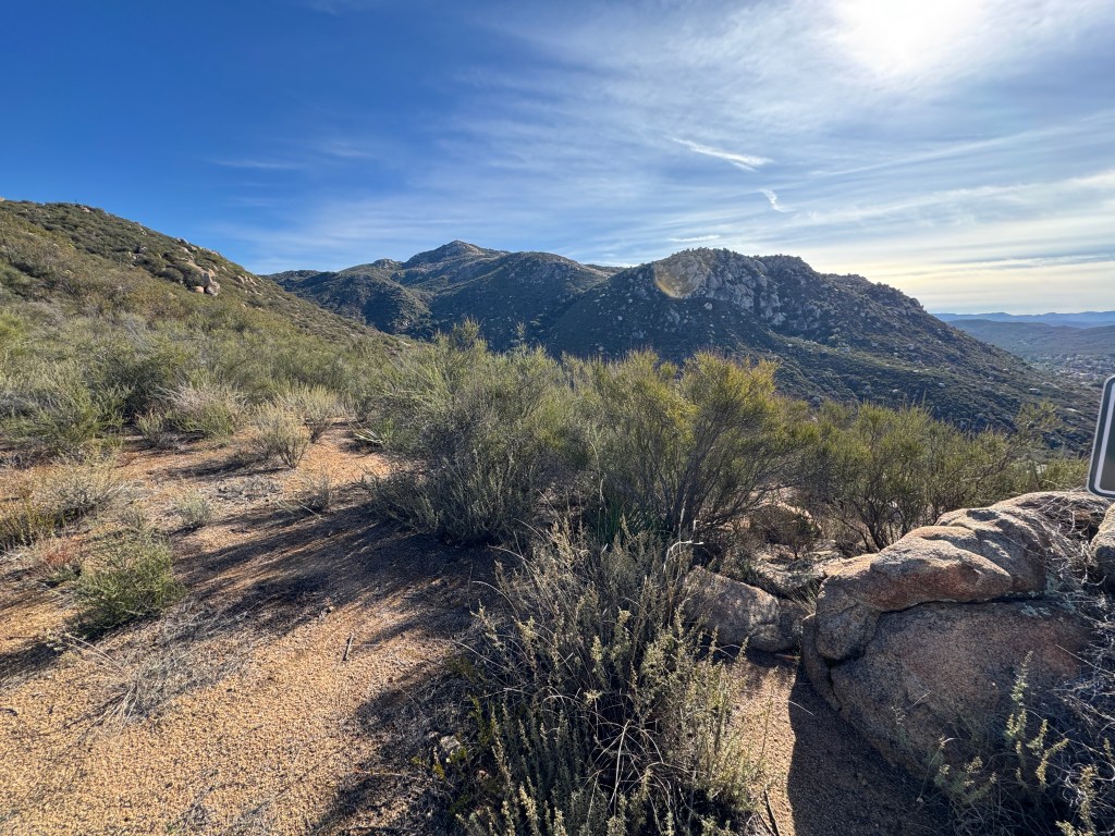
I continued along this ridge a ways and it was a workout. The trail kept going up and then down again. I had now gone about 2.5 miles in at this point, and had about 3 more to go.
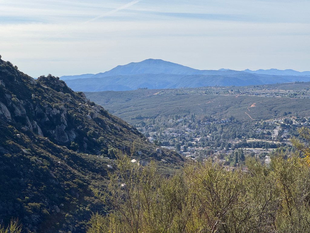
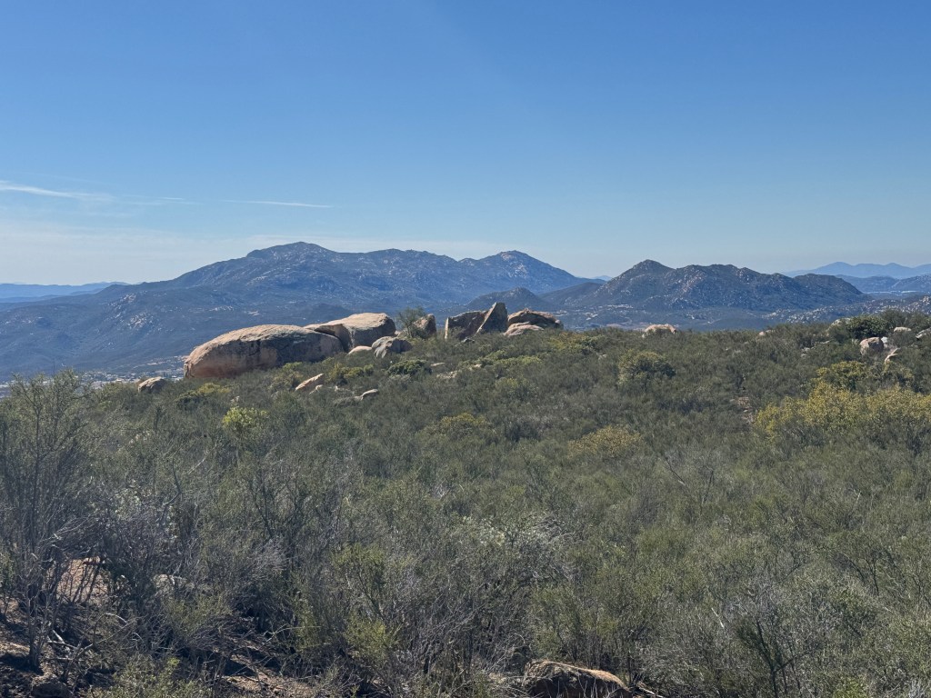
I glanced off toward El Cajon Mountain to the south in the distance.
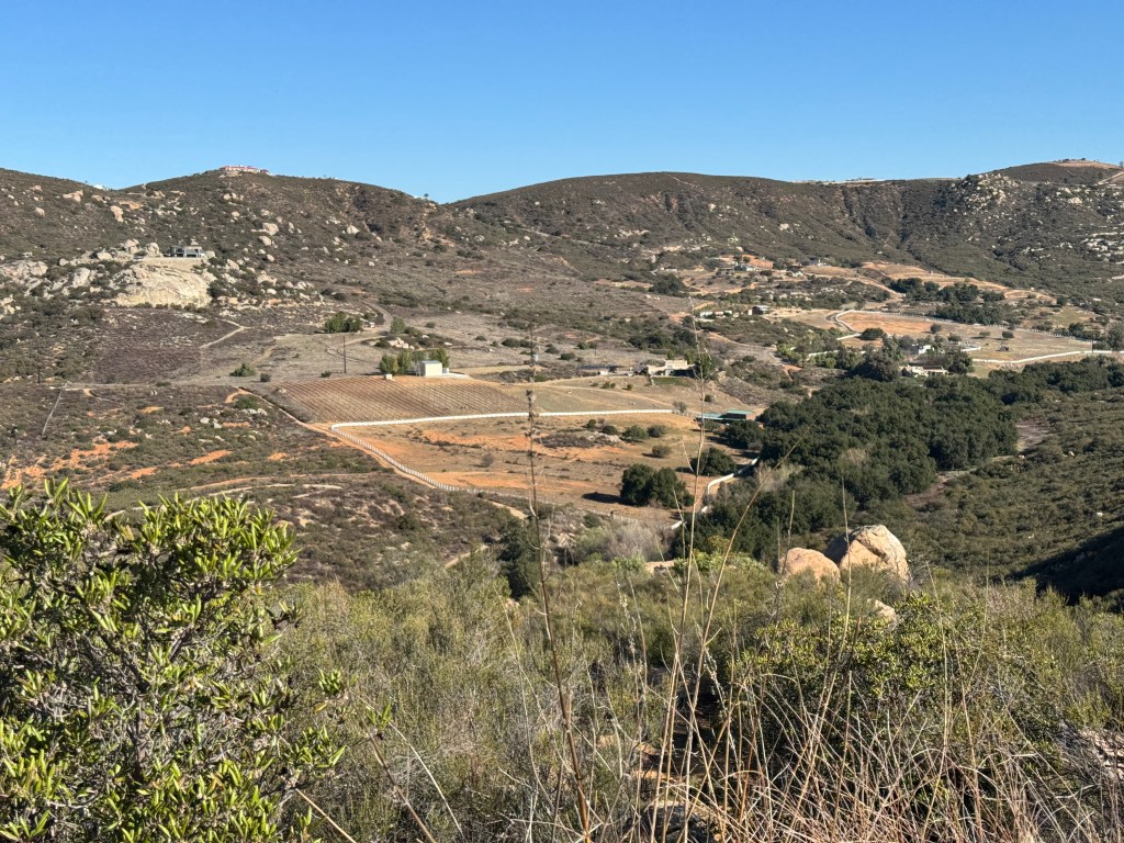
There is a valley alongside this preserve, and nice ranch property.

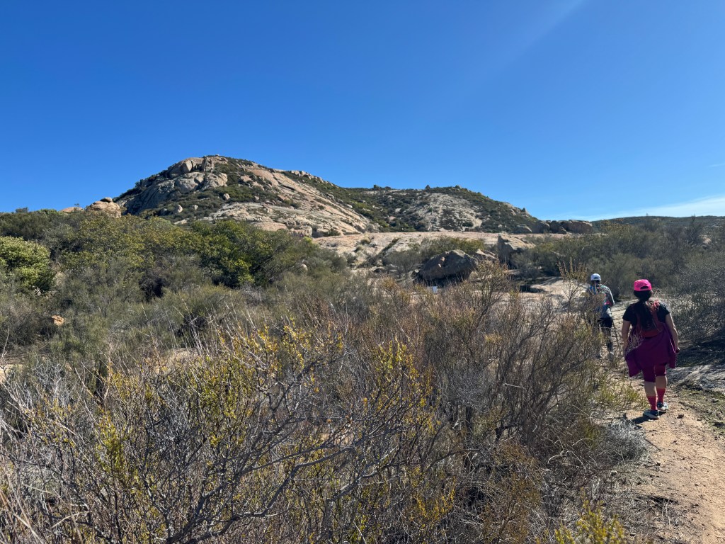
It felt like we were getting somewhere. The trail was clearly leading to this rocky peak ahead of us.
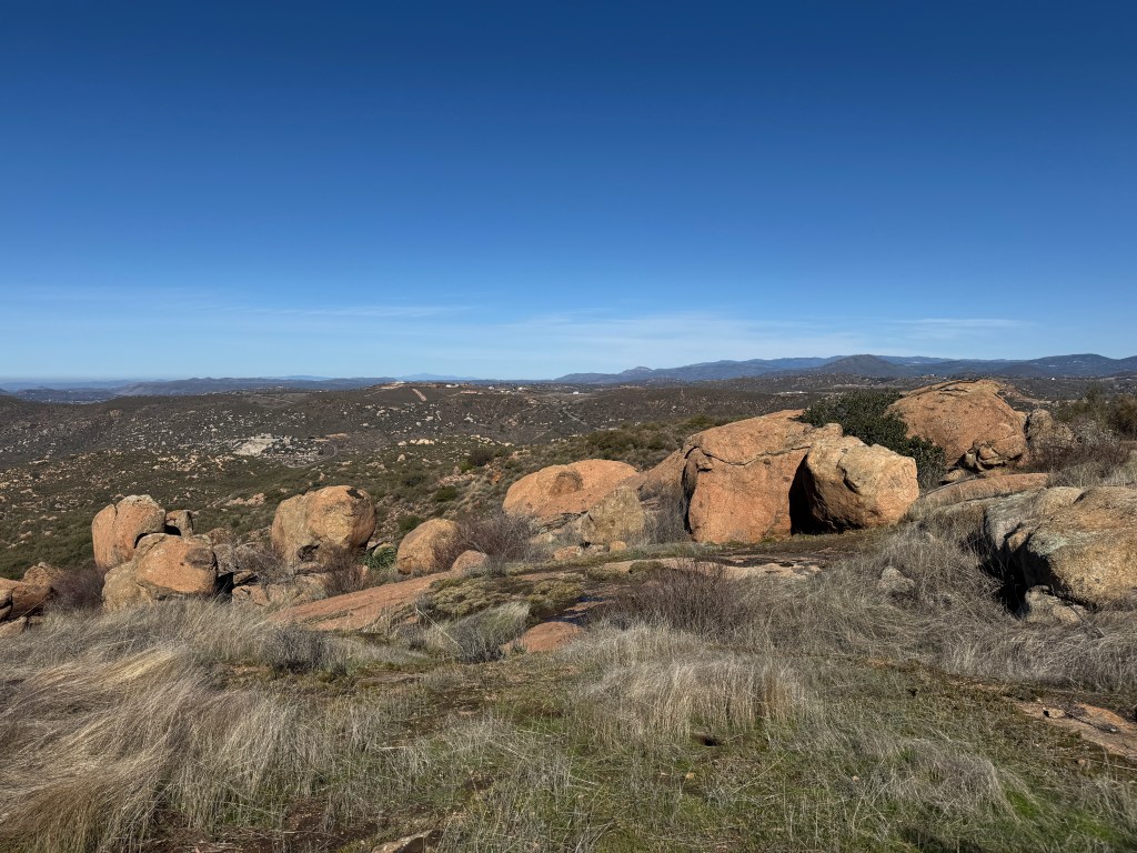
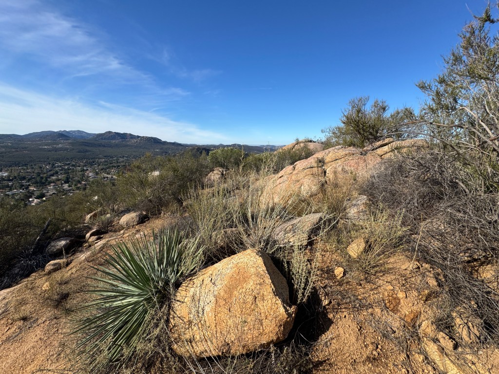
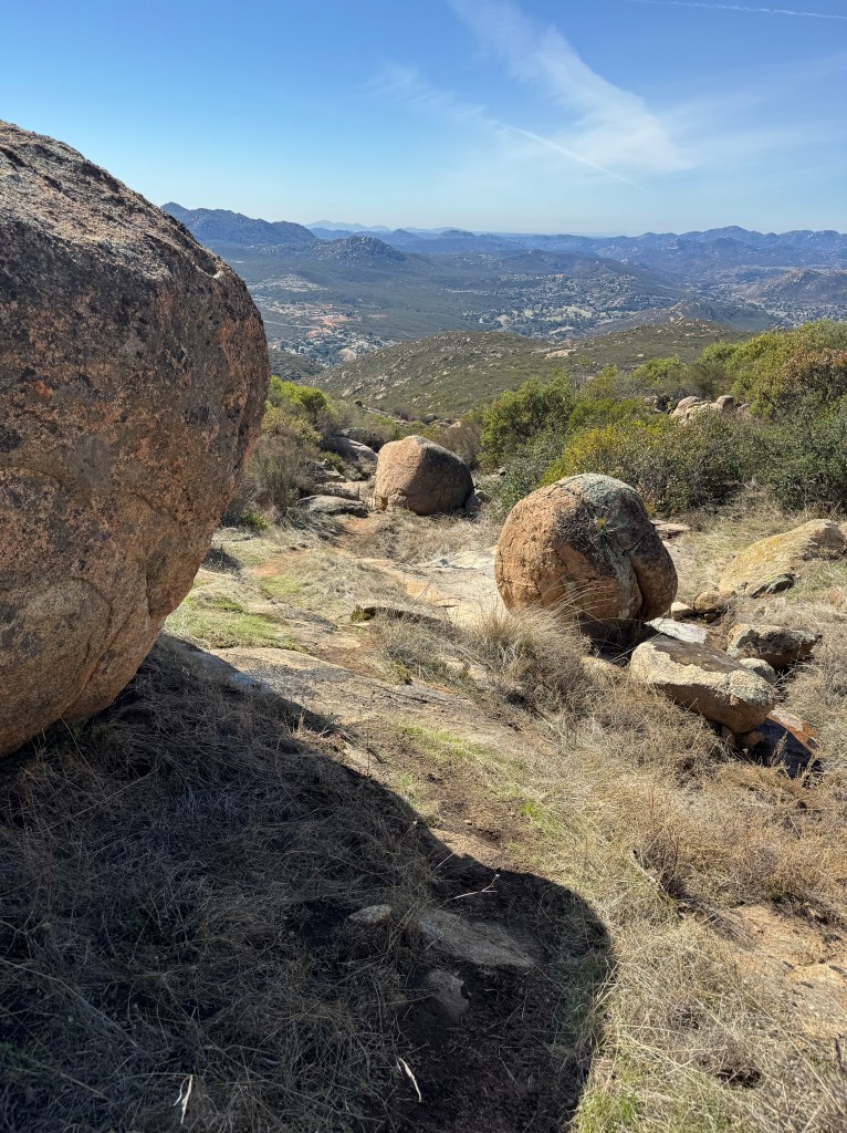
Along the native grass covered hill sides were more rock, and boulders.
Then I came across these strange shaped boulders, which looked like the spines of a dragon.
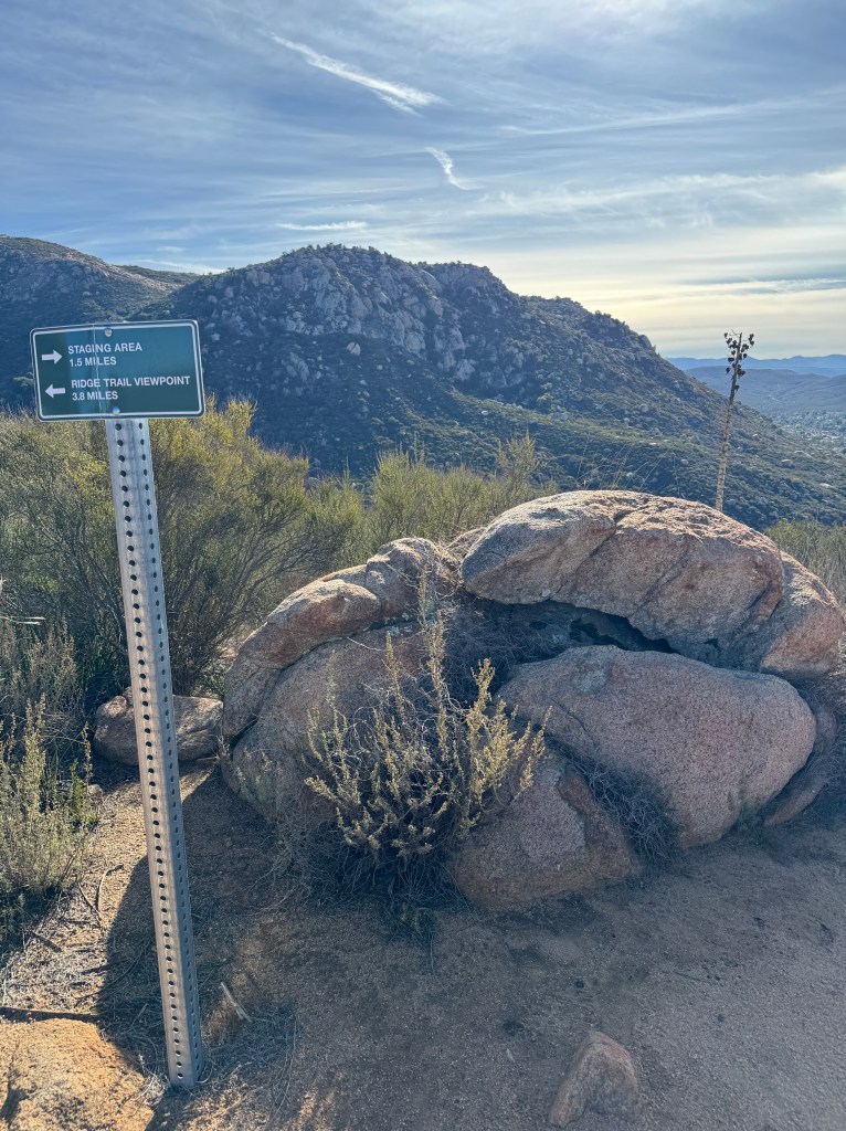
This sign threw me off since it appears to lead straight up a side trail toward the rock face, off trail.
We came to a flat area of rock, where we went off trail. It seemed like this was the way, but upon consulting my map, I knew it was not.

We stopped here a moment and took some photos. This would have been an excellent spot to turnaround, if we just wanted to make this an 8 mile hike, since we had gone about 4 miles. At this point we debated where the trail went.
One companion I had never met before, proposed hiking up some steep rock. I knew that was not the trail. Yet, she insisted it was the way, saying she had been there before.

We briefly explored around, but I knew I was not going to go off my usual formula of using a downloaded map and sticking to that, since I know my safety is my responsibility. Also, I was guiding a friend on this hike, who I was not about to endanger by purposely doing off trail exploration.
So after enjoying the views, I let the new hike buddy who I did not know well…that I was taking the actual trail.
I was not going to go the off trail way as proposed.
So off I went, and I signaled to both of them, that I was heading back on trail, and waited for everyone to make a decision. They decided to follow along at that point, and we continued on to Mount Gower.
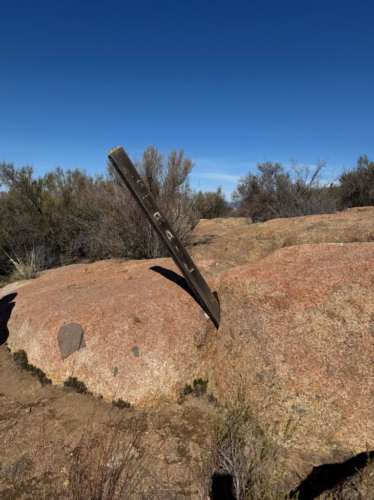
This was the last sign I would see marking the trail, at that crossroads we were turned around at. I will admit the trail was a bit counter intuitive, since it led away from the interesting rock formations. Maybe there was another trail there, but I did not want to take a chance, since being lost was not on my to do list for the day.

This rocky landscape might be fun to explore off-trail, at another time, with caution while keeping my sights on the actual trail.
Here is the actual Mount Gower in the distance on the left.

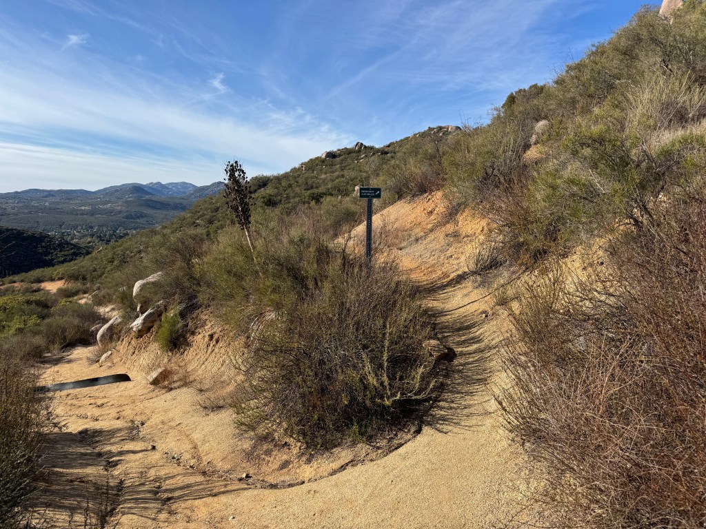
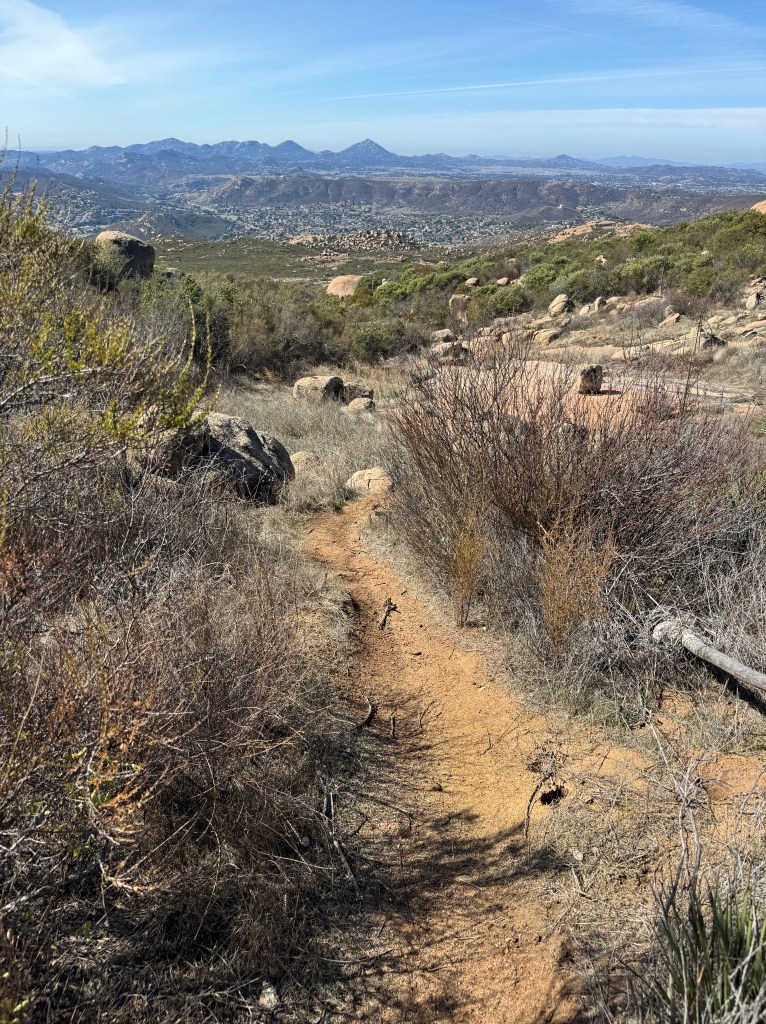
The trail began to dwindle in size at this point.
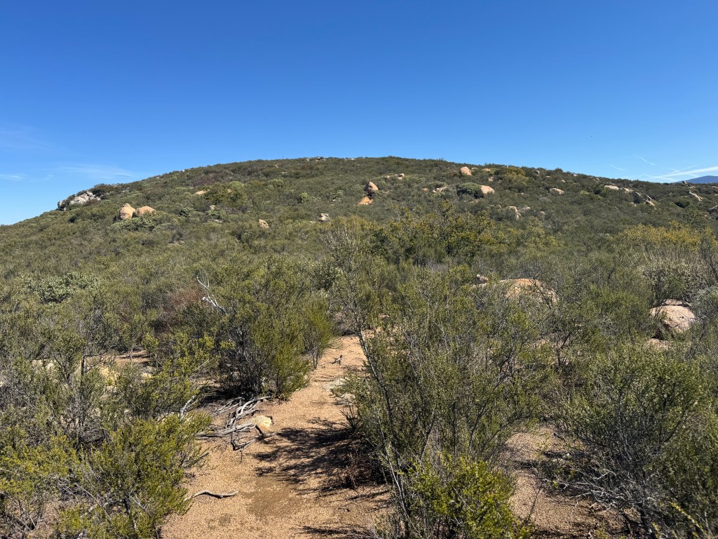
I looked up to a rocky ridge and guessed this was Mt Gower.
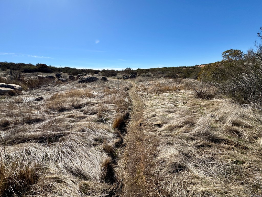
We were walking through waves of dry grass.
The trail became more defined once more.
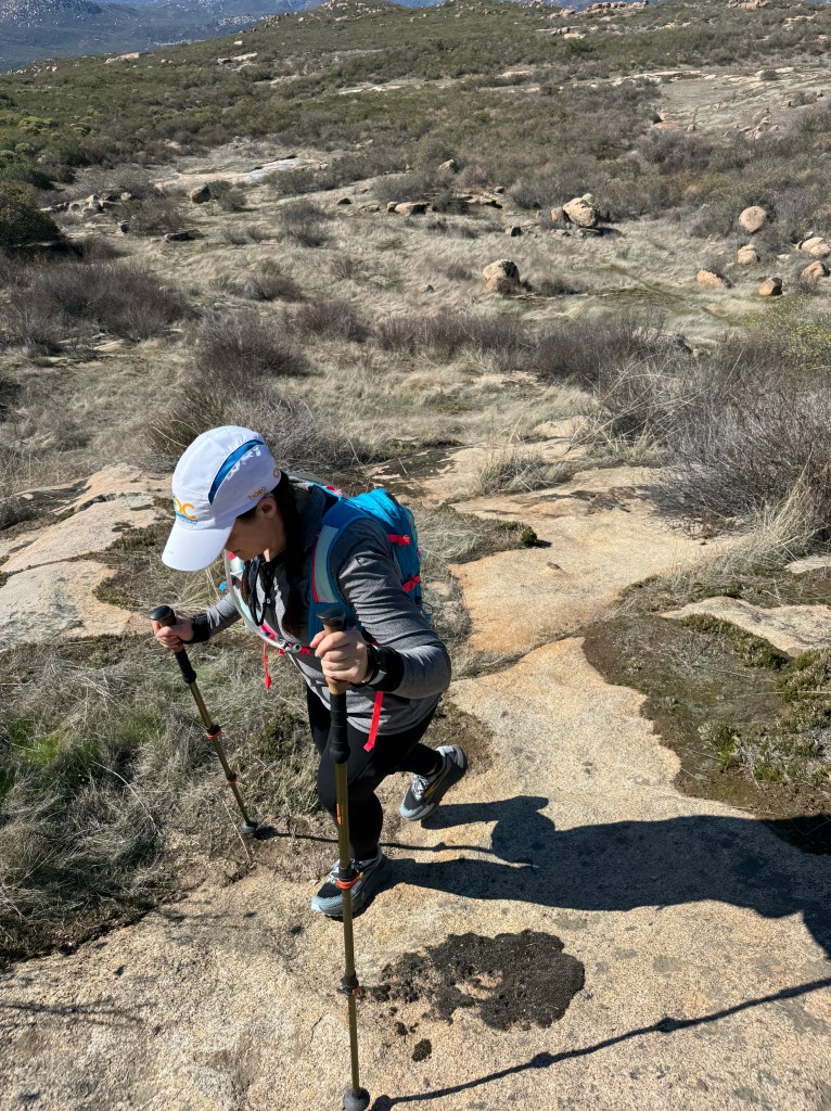
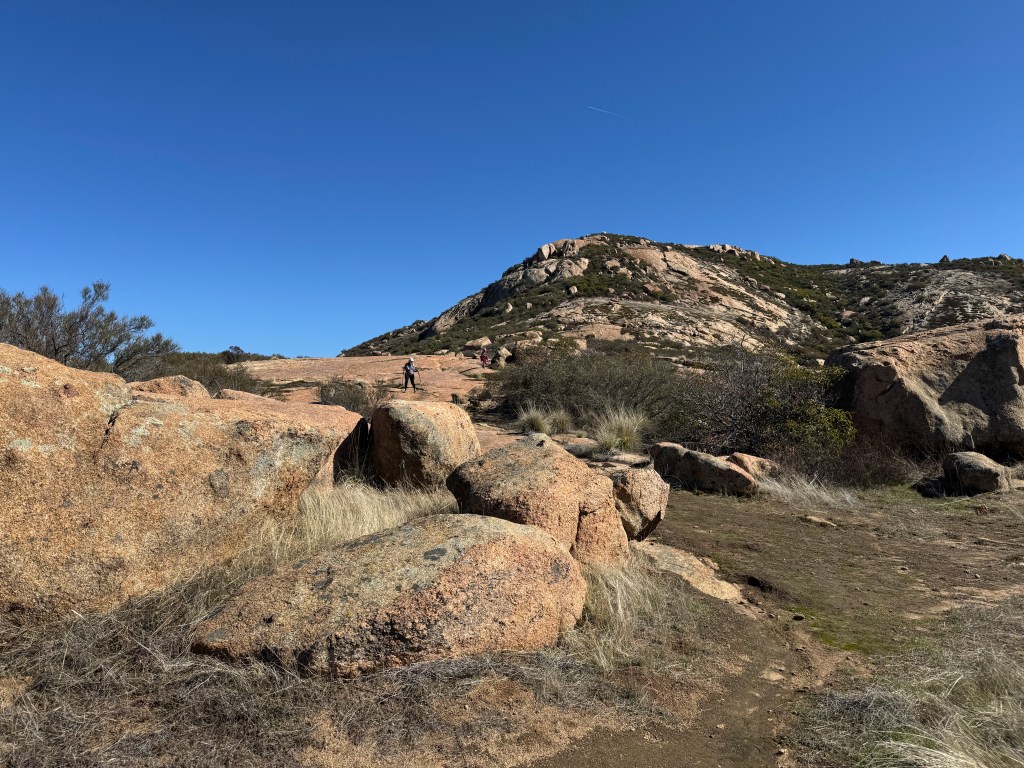
Then we began a big steep climb, where the trail was mostly non-existent again. I was using my downloaded map to navigate us the entire way up.
Occasionally we would pick up a section of trail only to lose it again.
Then came a brief rocky scramble amongst the boulders.
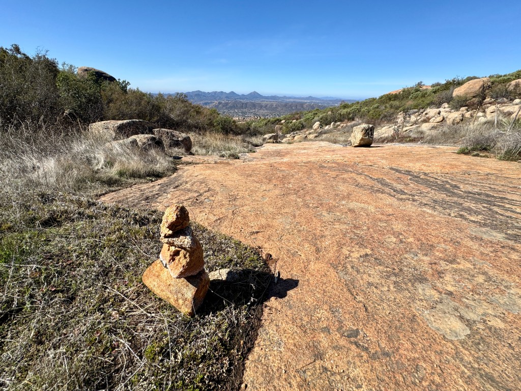
After this point, there was no trail only rock, but cairns were what guided us.

This was the trail, and without cairns, it was a confusing zig zag through the rocks and brush.
I was mostly meandering between shrubs at this point.
When you see these boulders, your edging closer to the goal.

The meandering continued, as there was no actual trail.

We kept connecting a short path, and large swaths of granite, and every time we came to one we searched for cairns or some indicator. We lost a lot of time finding our way for the last half mile.
Which way to go? I usually would choose the most middle path, and search for breaks in the brush that were ways to get through. Eventually I got used to it, and just kind keep my eye on the peak as a reference. It has little prominence compared to its counterpart False Gower.

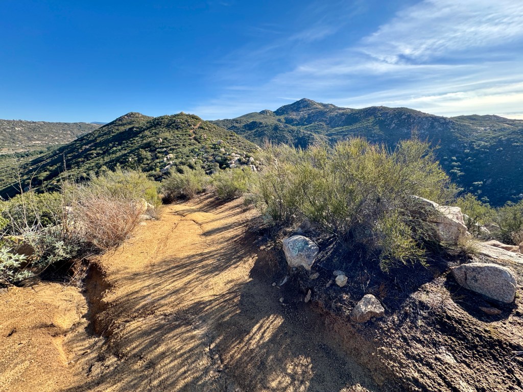
The final stretch of Mount Gower was very gradual, and a trail re-appeared.
We followed it all the way to the summit block. Once there, we could not find any indicators or USGS markers, even after searching all over the place.
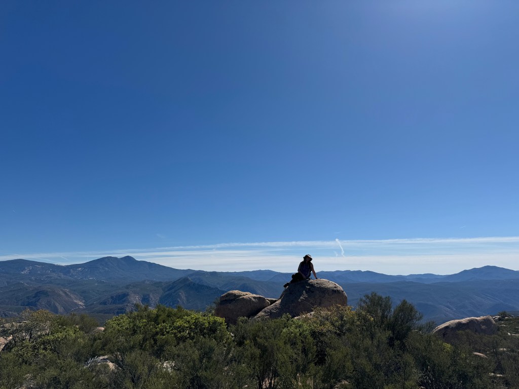
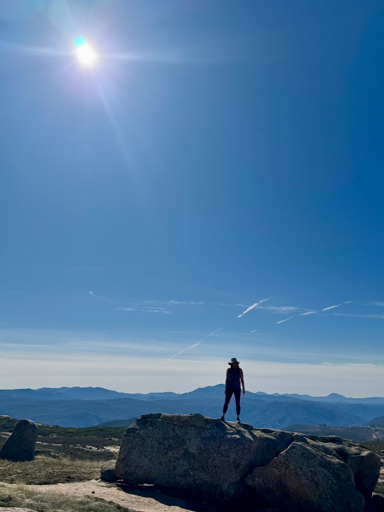
We claimed success and Mount Gower was complete! After enjoying the stunning views, of the surrounding wilderness, we headed back.
It was easier for me to find my way back than up, but if your not someone who looks back a lot, you may feel as confused on the way back as we did on the way up.
Gut Instincts
My gut instincts served me well as I backtracked. Listening would have had me scrambling up a steep grade, potentially injuring myself. The well meaning hiker I just met had later remarked that she “liked that kind of stuff,” indicating she would have preferred to scale that cliff. This is important to know, if you go hiking with a group, whose leader goes off trail. Always have your own map. Good thing I tend to use my own resources (maps and instincts) when hiking. No one gets you out of the wilderness alive but you, at least most of the time.
Serafina is Not Lost
I was able to avoid getting lost on this particular day, since I am not as easily led. I am not the type to just follow along. My comfort zone is to be in charge of myself and hike my own hike. I trust my gut, and my maps, before I trust the advice of strangers I just met. Never be afraid to ignore a request you know if unsafe. I always just stay on the actual trail, and follow my map by default. The last part of this hike, heading up to the actual Mount Gower was full of twists and turns, The trails were extremely tough to follow. Without a downloaded map, I would not have found the peak.
False Gower
The peak I might have scaled is named “False Gower,” since it throws off pretty much everyone who hikes here. You may want to climb that beast, but that was not my goal on this day. I love an adventure, but why does that have to equal danger? There are many ways to define adventure. It was a hiking day not a mountaineering day with steep grades. I say just to get outside and explore in a way your most compfortable. To each their own.

Caring to Cairn
Without the kindness of those leaving cairns along the last mile, I most certainly would have got turned around on the rocky sections. The cairns saved so much time, as they kept me on trail. I have heard some reasons for not leaving cairns. A few small stacked rocks never hurt anyone, and do not damage the wilderness. Don’t forget to care about future hikers, and leave a cairn. Saves search and rescue a whole bunch of problems in rescuing lost hikers too.
“They hurt squirrels.” I will never forget the most creative reason I have ever heard to not cairn. Squirrels can leap hundreds of feet through the air with grace. If you’re worried about disturbing squirrel habitats it is so much better to not hike and stay home.
Avoiding Getting Lost
So how do you avoid getting lost? Number one is to always have a downloaded map and extra batteries for your phone. A paper backup map is advised especially if it’s a long hike, far from civilization, with many twists and turns. Knowing monuments along the way, and turning around to check what the hike looks like on the way back are more keys. Timing is another factor to not being lost, as knowing how long it takes to get there (with your forever pace), and to get back before dark. Hiking in daylight versus the dark are two different animals. I learned this the hard way, and don’t wish to repeat it. Nobody wants to be alone in the dark, without a headlamp, in the wilderness at the mercy of the creatures that hunt by night. Bring that headlamp, especially if you’re hiking near evening. Most of all, trust your gut, and don’t ever “just be a follower.” I have heard it said many times by hikers in groups, that they only follow. A big mistake in my opinion. By hiking your own hike, there is no one to blame but yourself for lack of preparedness. If you want to get lost on purpose…please don’t hike with me. That is not my cup of tea!

I enjoyed this hike, and it was a challenging 10.5 miles. I am glad I did not go when it was forecast to be warmer. If I was to return to the Mount Gower Preserve again, I would park outside the gate, simply to avoid being locked in, were I to get back after 5 pm.
Conclusion
I would not bring friends to Mount Gower, if they are not into scrambling. I say this, because hiking and scrambling are very different. The scramble was very limited, so I don’t feel I would need approach shoes here. Just important to note the scramble, so everyone is comfortable. But sometimes you don’t know until you go. The trail seemed fairly narrow, and prone to being overgrown. I would not visit here, intending to make it all the way to Mount Gower any later than February for this reason. You could most definitely encounter snakes in this type of terrain, though visiting in January and February may minimize that possibility, when it’s out of their peak season. Of course anything is possible, and I have seen rattlesnakes pretty much every month of the year.
Leave No Trace
Just be sure to come prepared and follow Leave No Trace principles to keep the wilderness pristine for future hikers.
Like and Subscribe to my Channel!
I hope you enjoyed reading this, and it is helpful in knowing what to expect, should you decide to visit here.
About me
I’m Serafina! I’m a writer and California girl who loves to go exploring. Hope you will get outside today, breathe some fresh air, and be happy!
Follow my Journey…
Be sure to Like and Subscribe to My Youtube Channel where I post videos!
Disclaimer: The work on this blog is my opinion and my opinion alone and I am not responsible for the outcome if someone were to apply these thoughts to their own life. All text and photography copyright 2025 by Serafina, all rights reserved. Information and opinions provided are kept current to the best of the author’s ability. All readers’ usage of the ideas and opinions presented in the blog, are at their own risk. Be aware of the possible dangers of hiking, surfing, walking, cooking, and other activities, which may take place indoors or outdoors. By reading this, you agree not to hold the author or publisher of the content on this web site responsible for any injuries or inconveniences that may result from reading the blog, or partaking in any activity mentioned in the blog. Read the blog, and use its ideas, if you so desire, at your own risk.
