I hiked to Stoddard Peak, located in the San Gabriel Mountains of the Cucamonga Wilderness. Several mountain peaks surround this one, such as Sunset Peak, Sugarloaf Peak, Potato Mountain, and of course Ontario Peak. There is another prominence called Turtle’s Beak, which I have heard of people hiking to. That one sounds like a mostly off-trail bushwacking affair. Little did I know I would be doing some bushwacking of my own to reach Stoddard Peak today.
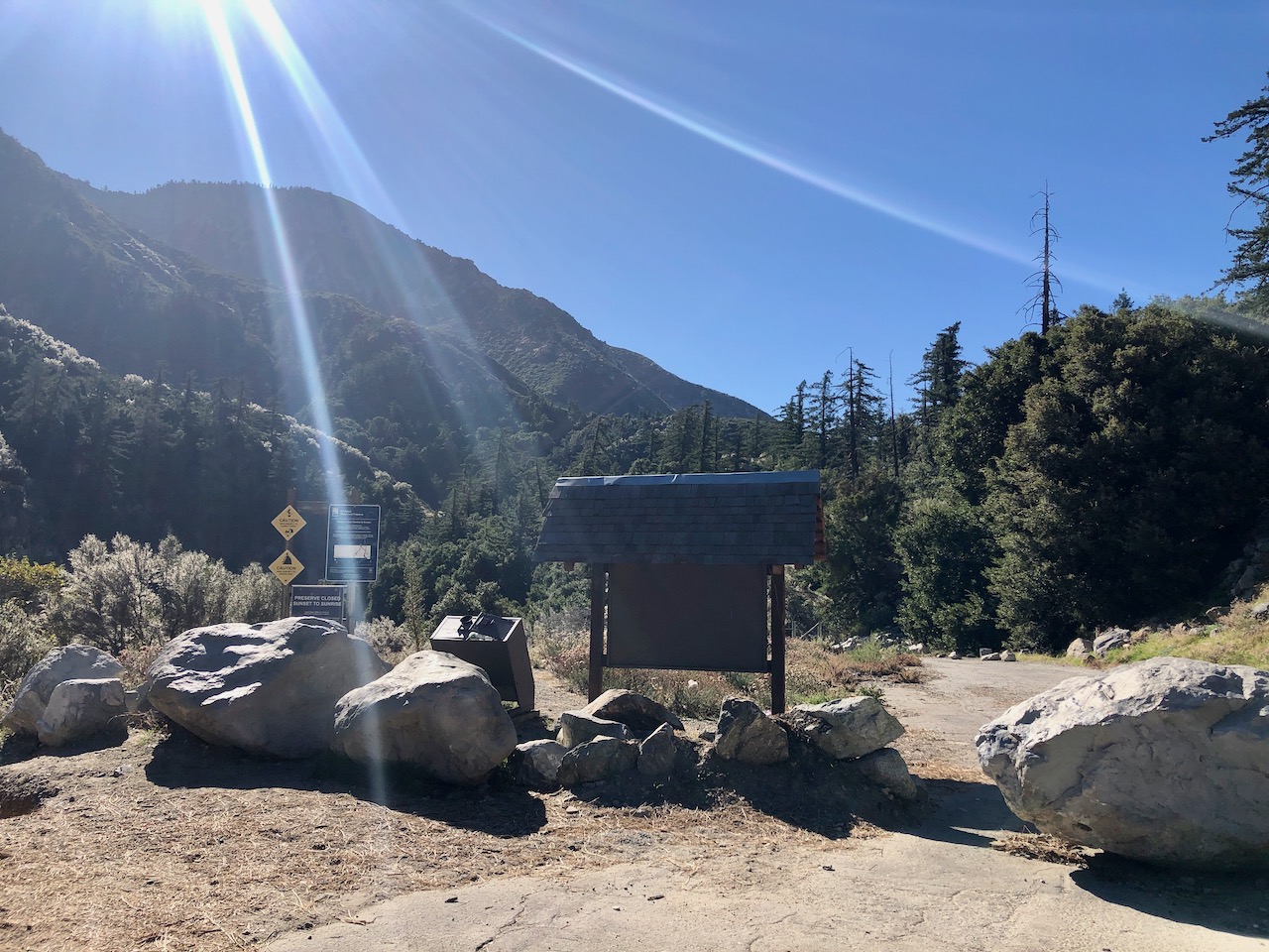
The Trailhead
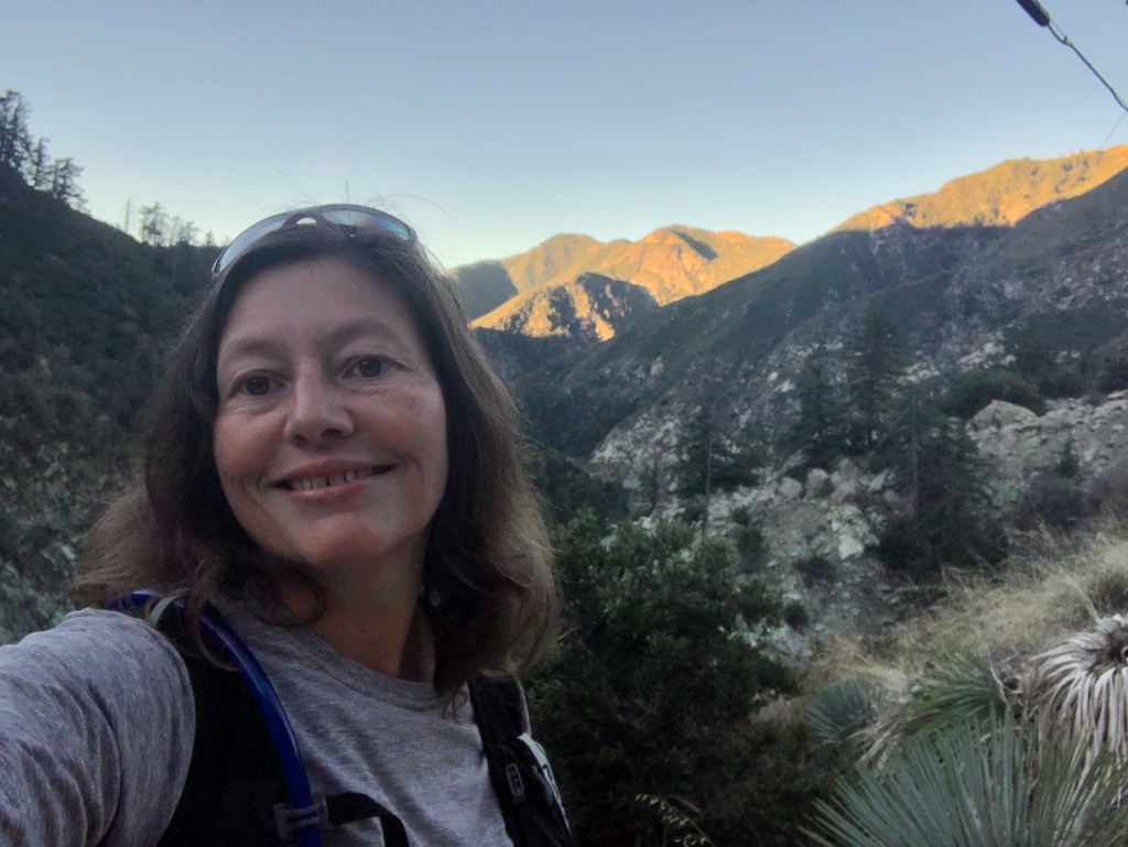
The hike begins at the trailhead along Baldy Road, just north of the city of Claremont. As you drive along the road climbing higher into the wilderness area, you will notice Mount Baldy, one of the most popular mountain peaks in the area, hovering off in the distance, towering above all the rest at 10,005 feet. I love starting my hikes early, and it was a beautiful morning. Mount Baldy was aglow in the distance, and I was back in the place I love, the wilderness.
I have climbed Mount Baldy twice, and some of the surrounding peaks as well. This is one of my favorite hiking destinations, and I was excited to hike to Stoddard Peak for the first time. It was a sunny fall day, and I would be hiking during the solar eclipse.
I had downloaded my map from alltrails in advance of my arrival here, since there is no service here, or anywhere along Baldy Rd.
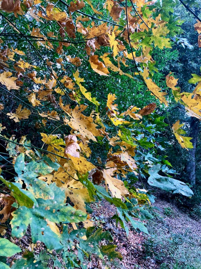
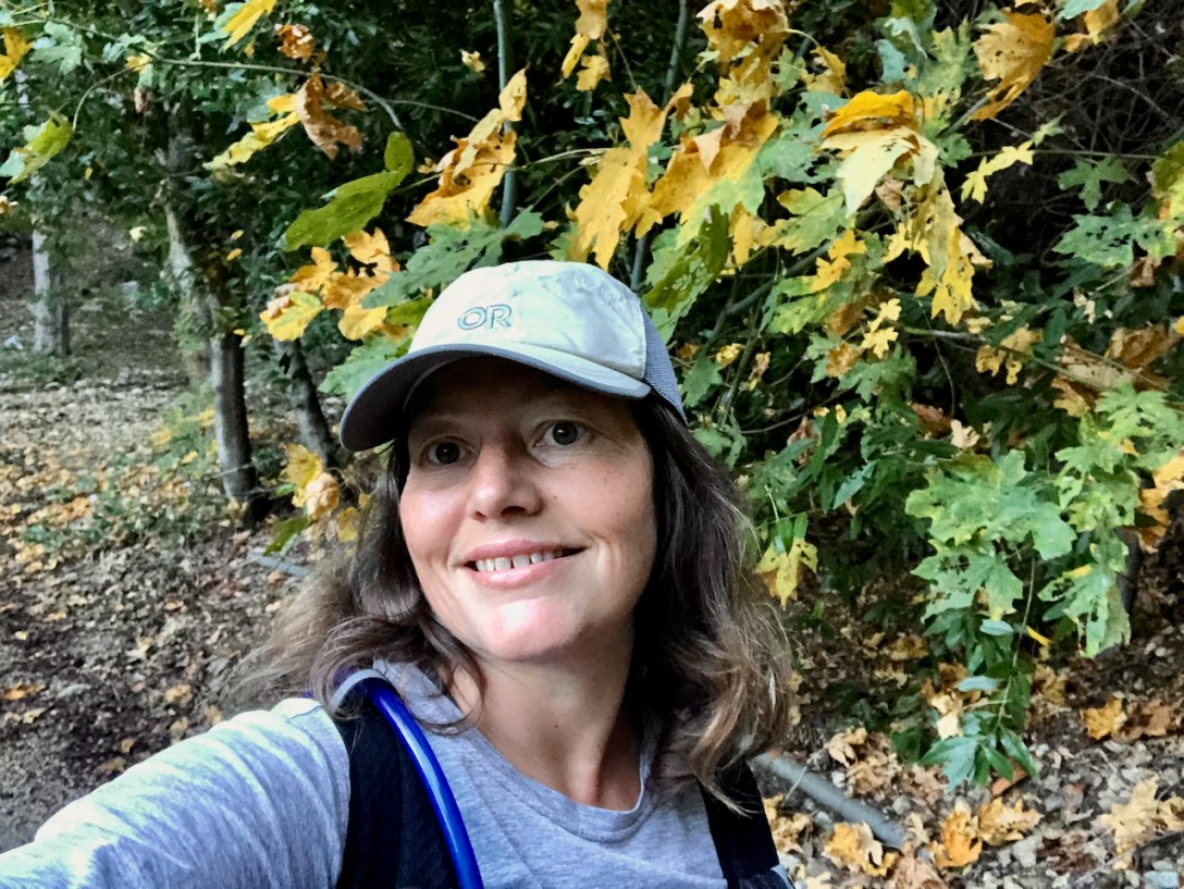
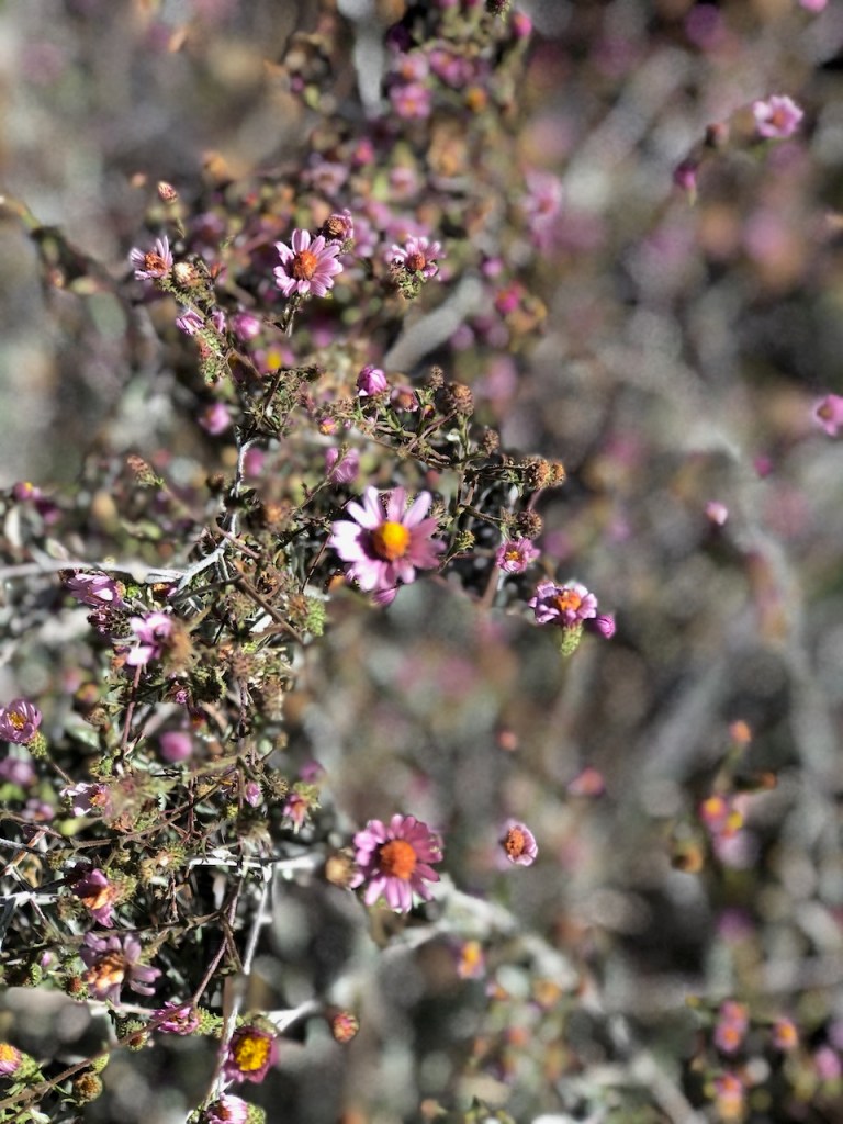
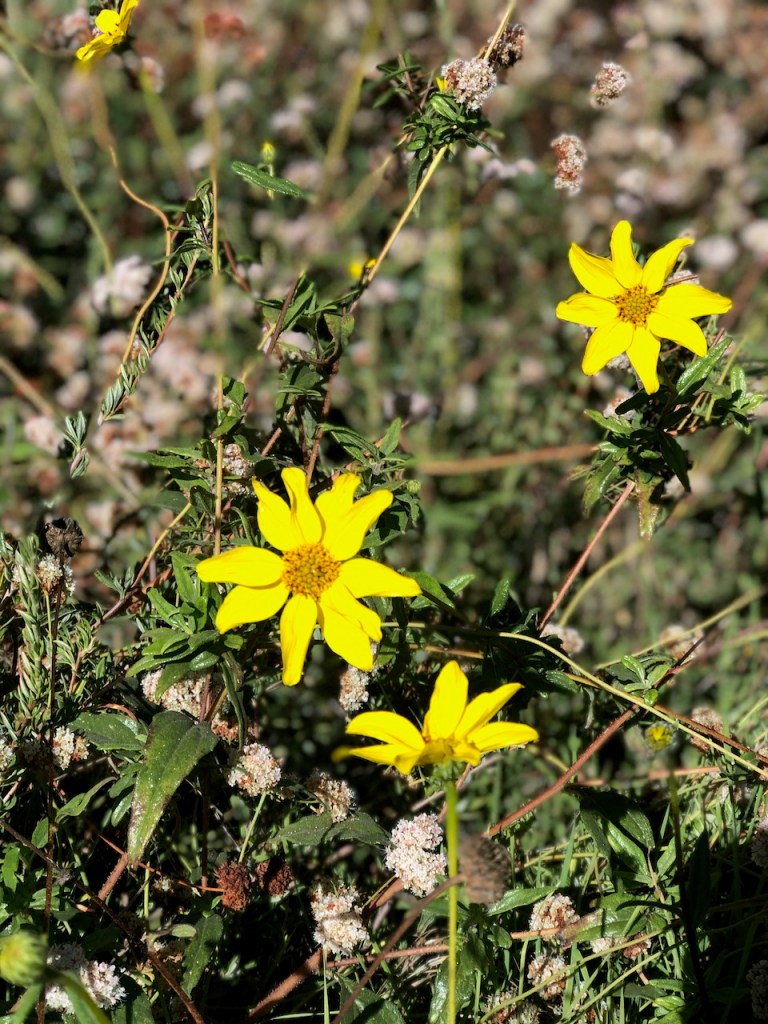
Fall Colors
My favorite time to venture into the wilderness is during October. This is by far the prettiest month to visit the area, due to the abundance of fall colors. As you proceed from the parking area, you will see what I mean. There were sycamores showing off their fall colors, and the rest were mostly pines, and oaks.
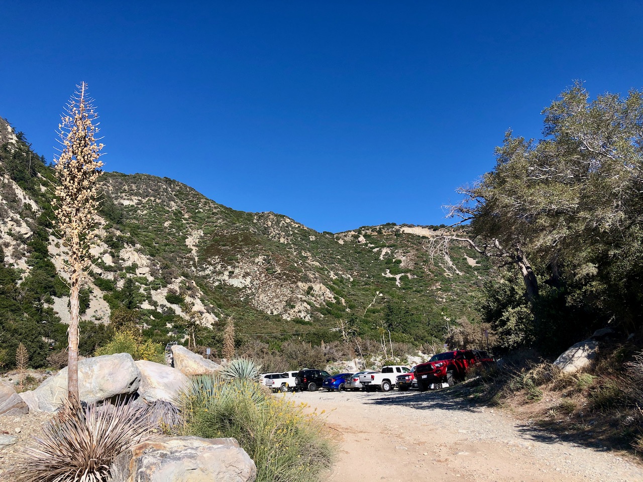
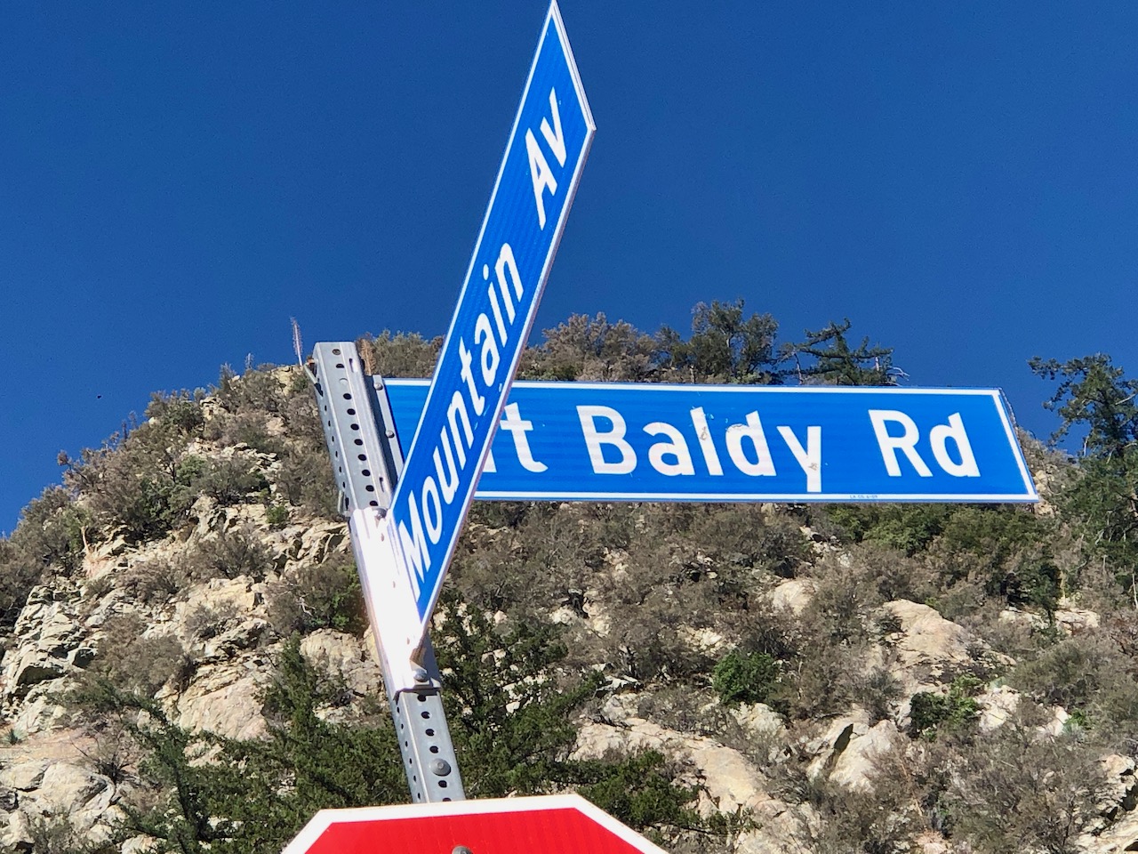
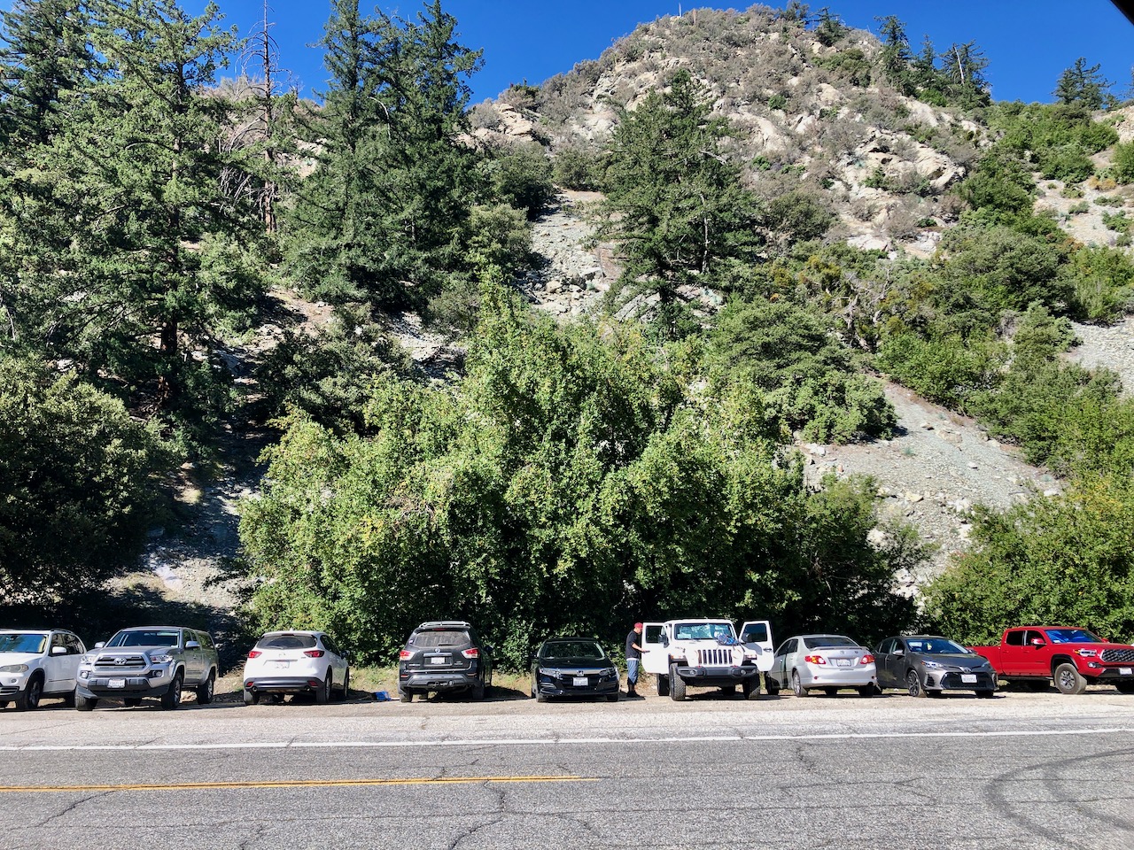
Parking
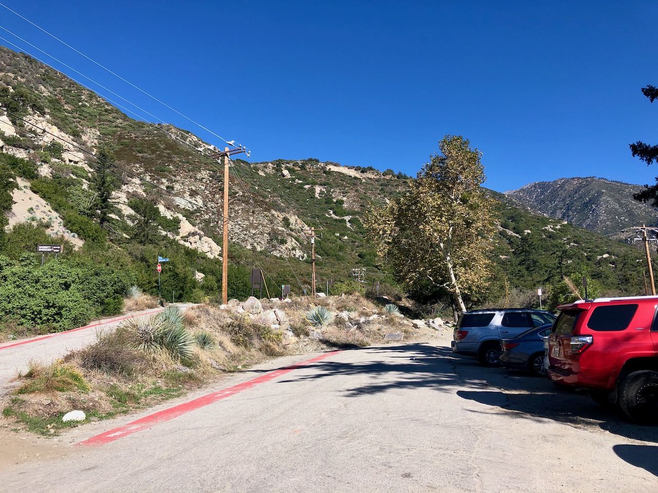
The parking lot is located at Mount Baldy Rd. and Mountain Ave. It was just after sunrise, and I was lucky to find parking here, on a weekend. There are two main sections for parking, an upper one with room for about 12 cars, and a lower one with about room for 18 more. There is also a parking area across the street for overflow.
Stoddard Falls
So much water flows through this canyon, and another popular hike from this trailhead is a short, down climb into Stoddard Falls.
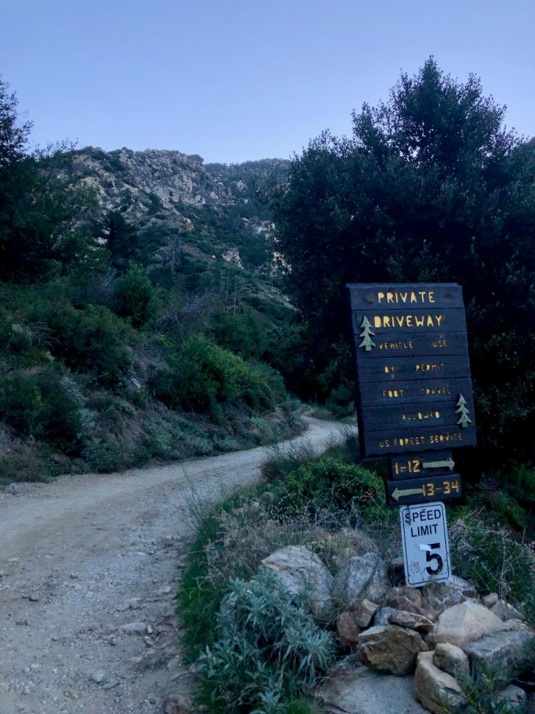
There are several confusing signs as you head up Mountain Ave. which is also the trail. Some say “private,” but are referring to the driveways, to the cabins.
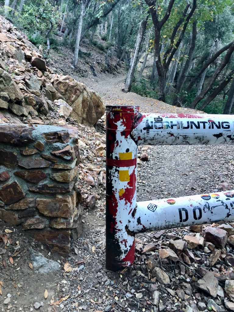
I used common sense, in figuring out that the trail proceeds to the left of this gate. It read “no hunting,” and not soon after I passed three hunters, in full camo attire.
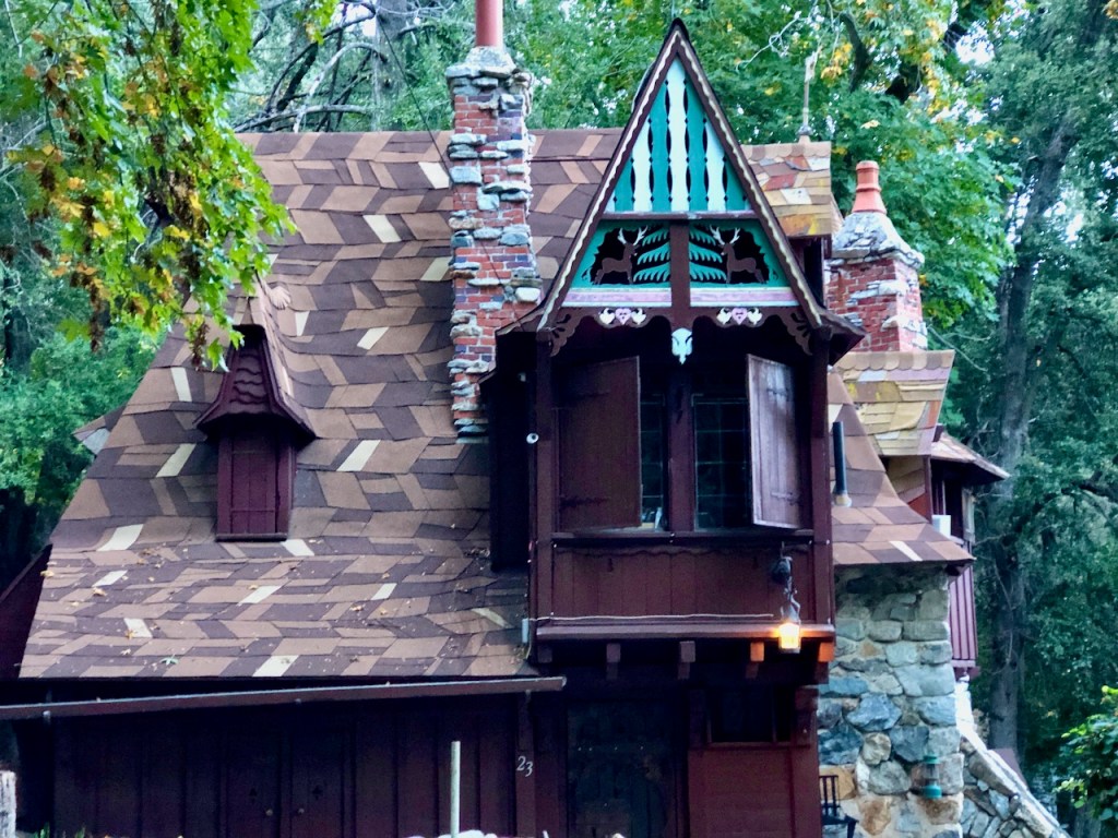
Forest Service Cabins
At first the trail seemed relatively empty, as I hiked long the fire road, passing several interesting forest service cabins. These cabins are on land owned by the Forest Service, and have long land leases. You will notice similar cabins along Baldy Road, heading up Icehouse Canyon, and also up towards San Antonio Falls. It is a perfect place for cabin life. These are seasonal recreation residences, so they cannot be rented out to visitors.
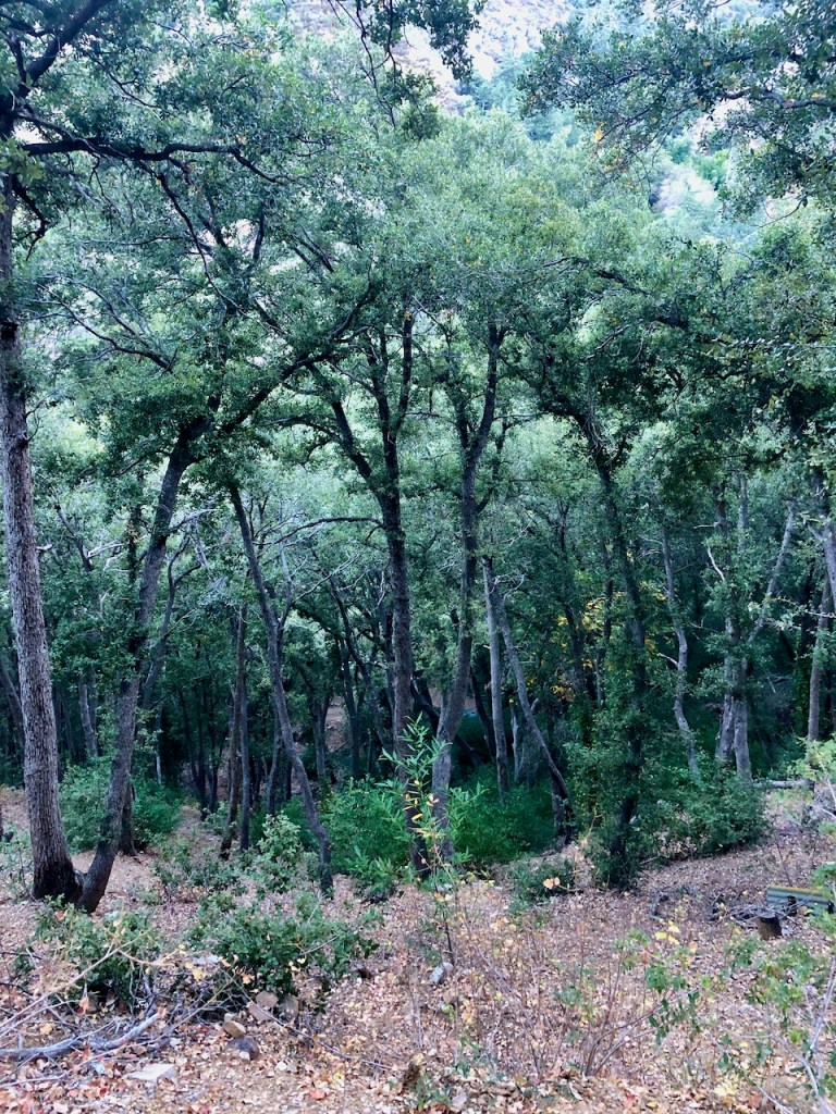
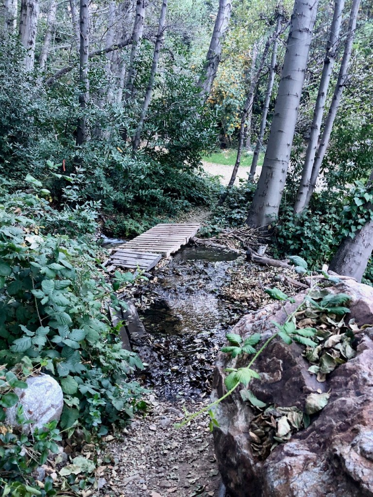
Into the Woods
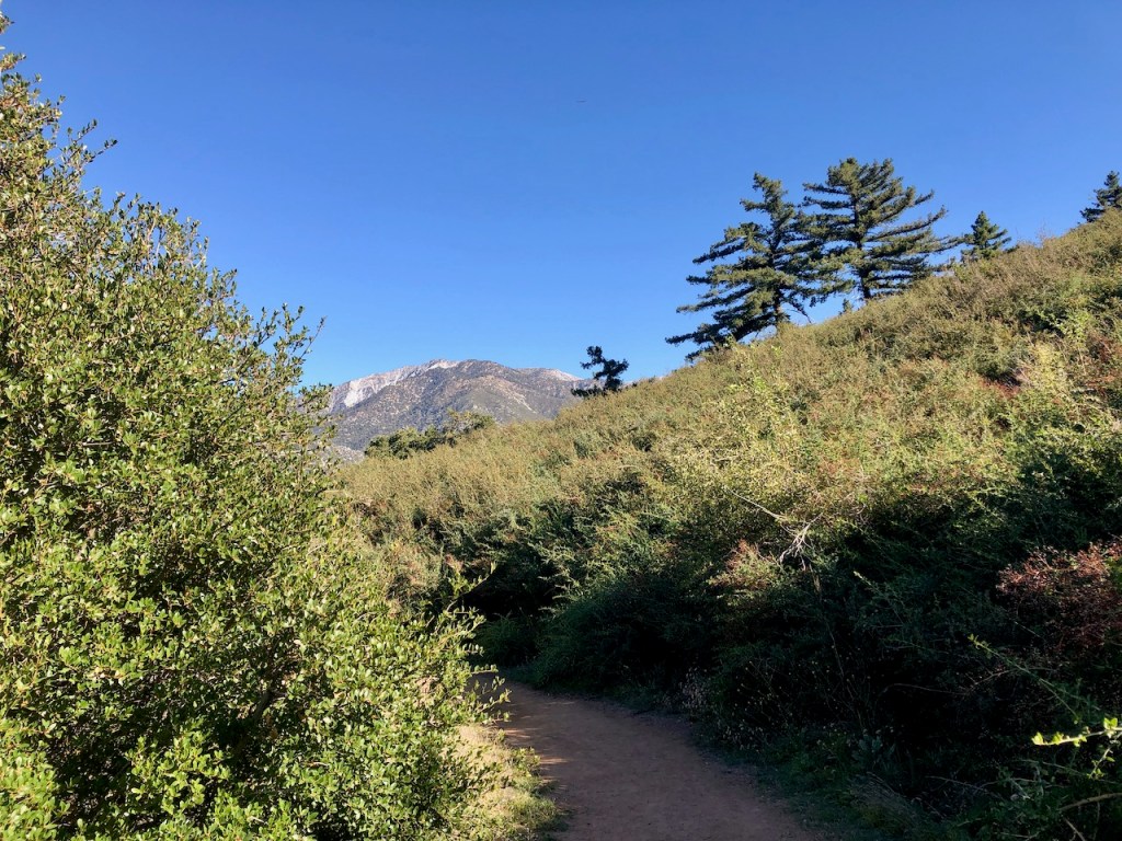
The first part of the hike is wooded and shaded for much of the way.

I passed by a stream, running across the road.

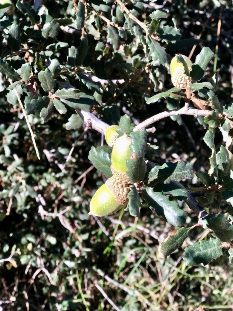
The trail was strewn with fall leaves and lots of acorns.
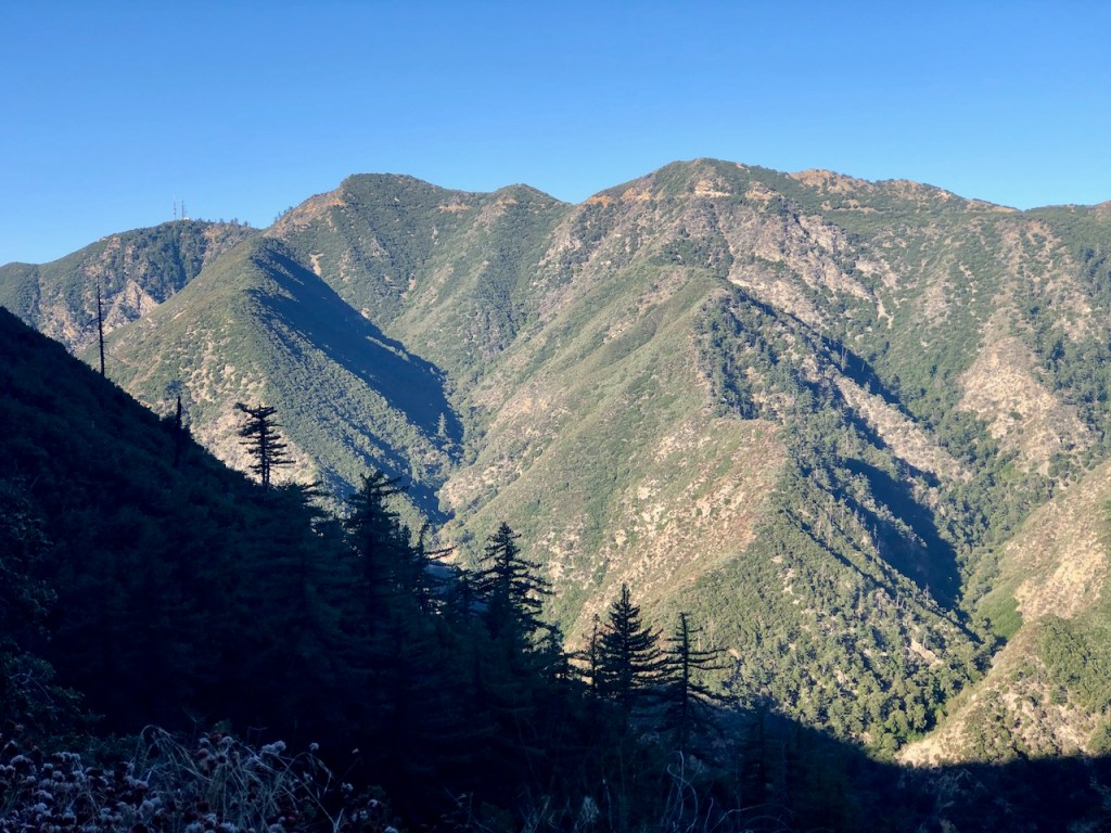
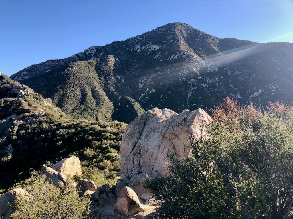
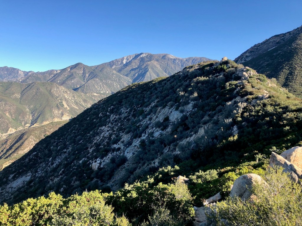
As I climbed higher, the hike became more exposed, but in the morning, the trail was still very much in the shadow of Ontario Peak, up above.
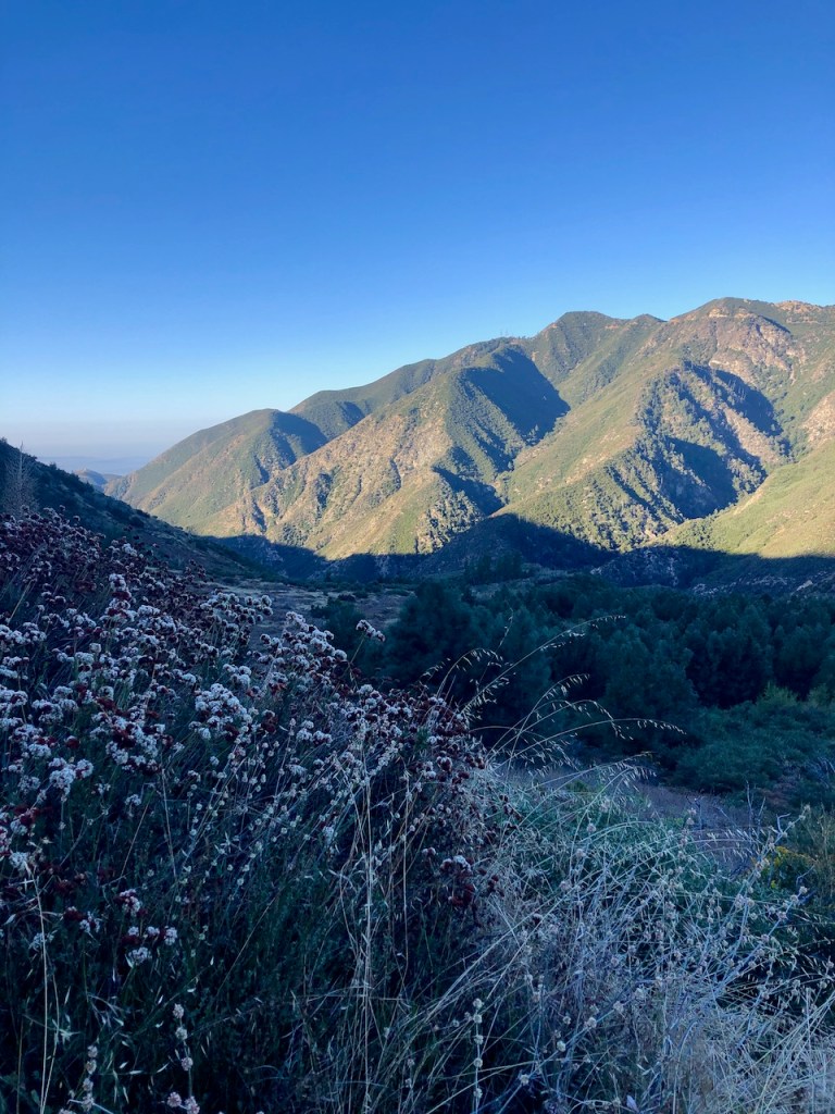
I passed by one small group of hikers, and then another. It had started to get a bit crowded all of a sudden. I could now see Sunset Peak and Potato Mountain, off to my right in the distance.
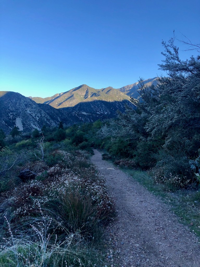
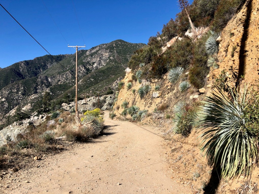
The Last 1/2 Mile
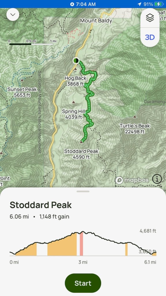
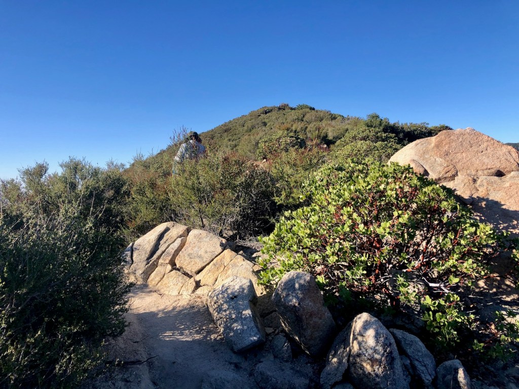
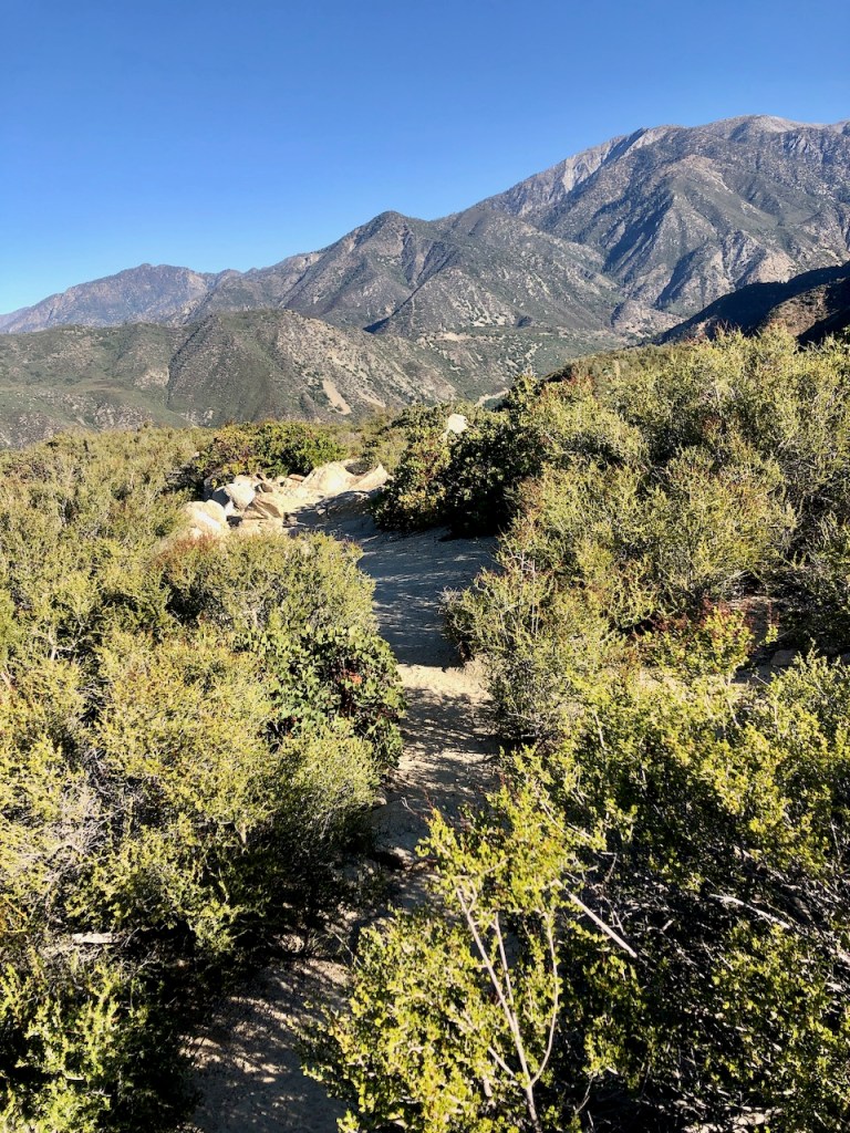
The wide fire road forked about three miles up, and I stayed to the right, heading off into the brush on a slightly overgrown, narrow, and steep singletrack trail.
I had just a 1/2 mile to go to reach Stoddard, and that’s when I ran into a large group of over twenty hikers.
The vegetation at this point became thick, and I put on my hat, to protect my head. I was wearing shorts, and instantly regretted my decision. There were tons of thorn bushes, and some yucca along the trail.
Crowd Factor
As I climbed higher, I gradually began to pass members of a large group, one by one, and eventually passed them all. I came to a rocky outcropping, and false summit. I realized the trail was about to dip once again, down a steep rocky section, where I would have to downclimb. I managed to navigate this part, by staying to the left, hugging the rock formation, rather than taking the slippery looking dirt path to the right.
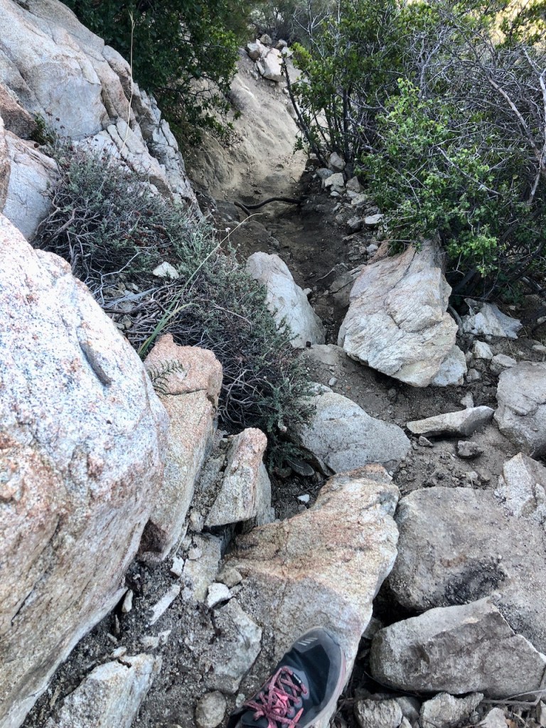
Bushwacking
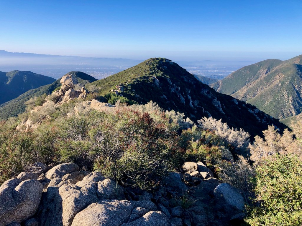
The trail dipped sharply, and became very overgrown. This part of the trail, the last .25 miles, was a bit sketchy. I was getting scratched left and right by thorn bushes, and agave. I tried to be careful to not fall on this section, as I proceeded steadily on to Stoddard Peak. There was yet another large group of people in front of me. I had the trail to myself for the next ten minutes or so though. I made my way towards the peak. The views were quite spectacular.
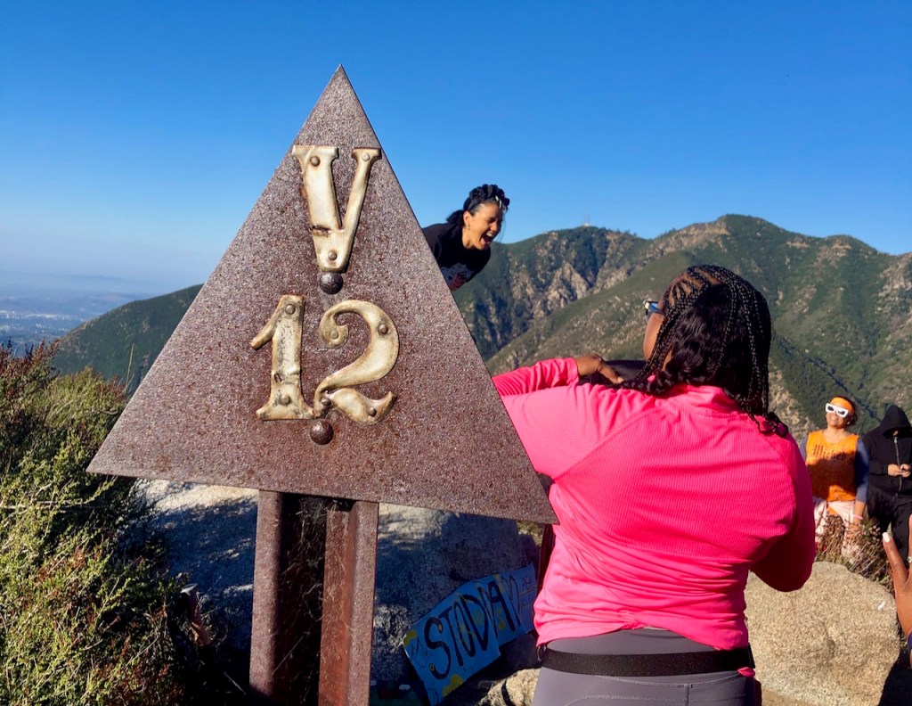
After wading through a bit more brush, I eventually spotted the iron marker for Stoddard Peak (Elevation 4590 ft), and ran into more groups of people, congregating on the summit. I could tell they might be there for a while. They seemed to be having a great time.
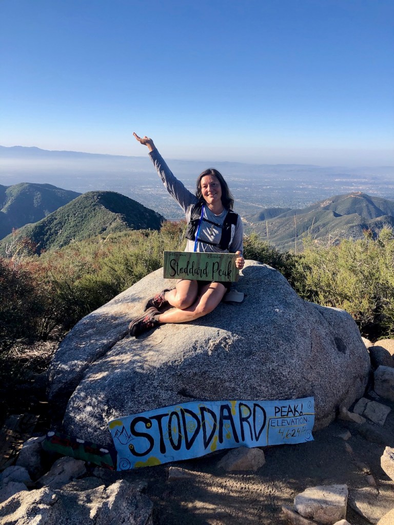
Stoddard Peak (Elev 4621)
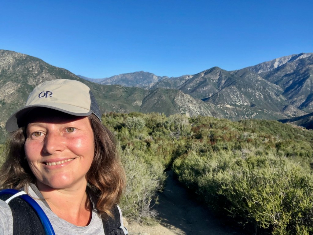
I somehow managed to snag a photo of myself at the peak, between the group members’ photos. One of the ladies in the group was kind enough to snap a photo of me. Typically I will prop up my camera somewhere on a rock. I have started to bring a small backpacker tripod with me at times.
FYI: Don’t go on Saturday, if you like to have the place to yourself.
The Cucamonga Wilderness
I was grateful to have climbed yet another peak in this beautiful Cucamonga Wilderness. It takes me about an hour to arrive here from Orange County without traffic, and even still, I don’t get up to this area nearly as much as I would like. There was another group behind me, so as soon as I took a few photos, I felt it was time to get moving, and begin to jog on back. I try to run up the mountain sometimes too, but I almost always run back down. I love the feeling of mountain running. You just feel like you’re flying, and are free.
The Battle is Won
I headed back the way I came, but at some point after the rocky outcropping, a .25 mile from the summit, I crashed into a sharp bush, got all sliced up, and bloody. But I was ok, after assessing the situation. I felt like I fought a battle with this mountain. With blood dripping all over me, and a deep gash.
I resumed jogging on back, after hiking through this overgrown part. I made a note to self, about doing a better job at keeping my balance, when there are thorn bushes, and it’s steep. I also noted that pants, and trekking poles are recommended for this peak.
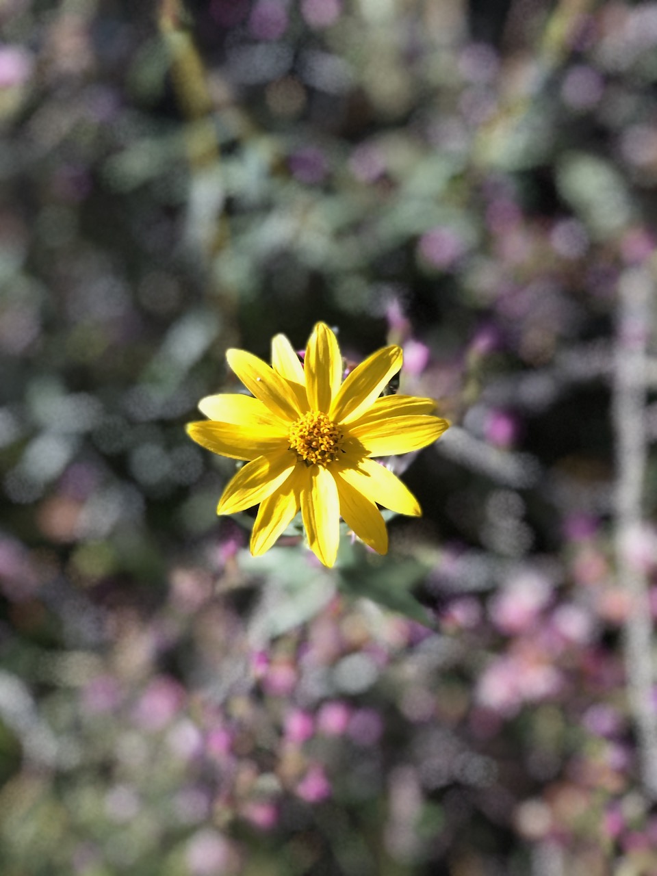
I spotted lots of beautiful wildflowers on the return to my car. The sun was shining, and the solar eclipse was in progress. All these factors caused me to think less about my injury, so I fell more into gratitude instead.
Hiking Solo
So a combination of factors likely lead to a fair amount of crowding on the summit, and on the trail on what would otherwise be a lightly trafficked hiking spot. I love going hiking solo, to challenge myself, and get away from it all. When I was by the summit, and preparing to leave, a few people made remarks to me about the fact that I was hiking solo, along with the fact that I was leaving so soon. Well the truth is, though I don’t mind sharing the summit, and sharing the love with my fellow hikers. But the reason I like to get out into the wilderness, is in part to get away from it all.
Your Not Alone
I never feel like I am alone in the wilderness, because he is always there with me. Thank you Jesus, for walking with me through thick, and thin, through all my storms, you are always there to guide me. I may stumble, but you never fail.
Peace and Quiet
When I hike, I crave the sounds of nature, waterfalls flowing, birds singing, the whistle of the wind through the hills, and just generally experience all the tranquility that there is in places like this. I was not there to join a party, or break out the boom box. I just love to go exploring, enjoying God’s creation, and letting it all sink in.

More Hikes
I made it back to my car in about half the time it took me to climb to the peak. The entire hike took about 2.5 hours roundtrip. I would consider most of the hike moderate, until the last 1/2 mile, which is strenuous. If you’re looking for a nearby hike in this area, without a ton of scrambling, downclimbing, or bushwacking, I recommend hiking in Icehouse Canyon to the saddle. If you’re not exhausted yet, you may want to head further to Ontario Peak from there. Both trails are well maintained, and require no bushwacking of any kind. That is not the case with Stoddard Peak.
The History of Stoddard Peak
The area around Stoddard Peak in the San Gabriel Mountains was once home to the Tongva people, for thousands of years, that was until Europeans began to explore and settle this area. In the 19th century, gold brought miners venturing into the rugged terrain of these mountains.
The peak is named after Amasa Stoddard, an early settler and pioneer in this area, during the 19th century, who played a significant role in developing San Bernardino County. He was a Massachusetts transplant, who moved to California in 1810, before contributing to the growth of farming here. He helped construct the area’s first flume, to transport water for irrigation, and so this peak was named in his honor.
The Solar Eclipse
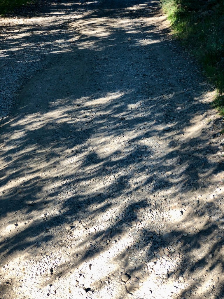
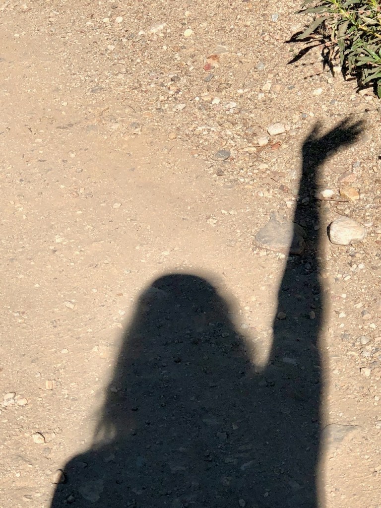
Today was special, since there was a rare solar eclipse in progress. I was fortunate that another woman hiker on trail confirmed to me that the strange shadows I was seeing under the trees were in fact the solar eclipse.
Reflections on the Hike
This hike was about 7 miles, and took me about 2.5 hours to complete. My pace was about 2.5 miles per hour heading up, until the more challenging parts, at which point I slowed. I jogged back for most of the hike, along the fire road, but got slowed down, when I fell in a thorn bush. Even if you hike on a short trail like this, a first aid kit, and a Garmin in Reach are advised. I regretted not bringing them on this trip.
Be Prepared
You never know you’re going to get injured, or hurt. Even fairly experienced hikers have mishaps. So lesson learned today. I recommend you bring those 10 essentials every time, since the time you leave them home might be the time you need one of them. When you’re prepared, you need not hike filled with fear, but with faith.
Just remember, you can do this!
Leave No Trace
Just be sure to come prepared and follow Leave No Trace principles to keep the wilderness pristine for future hikers.
Like and Subscribe to my Channel!
I hope you enjoyed reading this, and it is helpful in knowing what to expect, should you decide to visit here.
About me
I’m Serafina! I’m a writer and California girl who loves to go exploring. Hope you will get outside today, breathe some fresh air, and be happy!
Follow my Journey…
Be sure to Like and Subscribe to My Youtube Channel where I post videos!
Disclaimer: The work on this blog is my opinion and my opinion alone and I am not responsible for the outcome if someone were to apply these thoughts to their own life. All text and photography copyright 2023 by Serafina, all rights reserved. Information and opinions provided are kept current to the best of the author’s ability. All readers’ usage of the ideas and opinions presented in the blog, are at their own risk. Be aware of the possible dangers of hiking, surfing, walking, cooking, and other activities, which may take place indoors or outdoors. By reading this, you agree not to hold the author or publisher of the content on this web site responsible for any injuries or inconveniences that may result from reading the blog, or partaking in any activity mentioned in the blog. Read the blog, and use its ideas, if you so desire, at your own risk.
