
My hike to El Cajon Mountain (ECM summit) and El Capitan, was a long time coming. I had wanted to hike to these two San Diego foothill peaks for a couple of years. I was waiting for the right opportunity to present itself. The weather and conditions were right, it was the right season, and I was finally feeling up for the challenge, fitness wise. For the last year and half I was not able to handle such a long and strenuous hike, with some health struggles I was dealing with. Back in August 2025, both of my knees swelled up considerably, post hike, causing me to have to stop hiking for a month completely, and only gradually get back into it. Before that, I had multiple back issues, which came on post-backpacking. So I had to take it slow, but miraculously, I am able to begin getting back out there, to climb mountains.
By the end of last August, I thought I might be ready for a mountain hike again, and ventured to Mount Waterman only to inflame my knees again. Since then I have gradually been healing, and increasing the difficulty of my hikes. I was now able to hike longer, and up steeper slopes, which opens a world of possibilities. By the end of last November, I finally felt ready for a longer hike, combined with a mountain and hiked to Stonewall Peak in Cuyamaca Rancho. This hike went pretty well and I was finally feeling like I was truly starting to heal. In December, a month ago, I completed several challenging hikes. Now I am finally back to hiking, almost every day. It was time to give El Cajon Mountain a try.
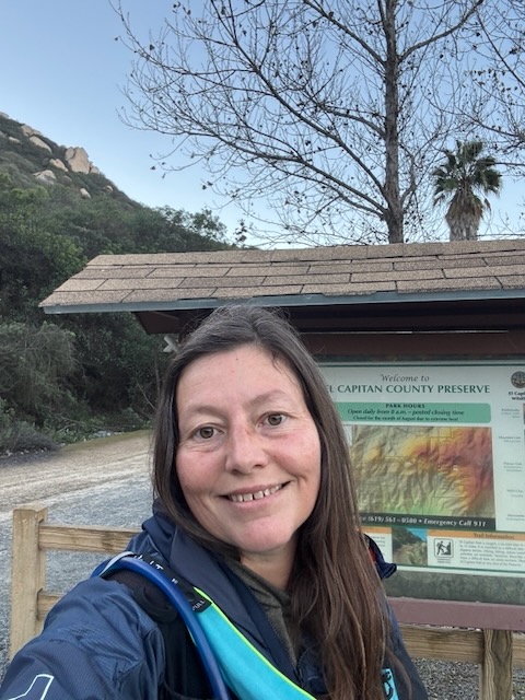
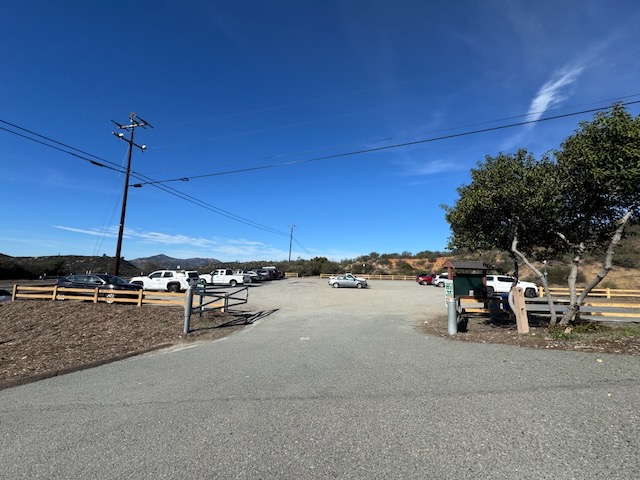
I arrived at the trailhead around 5:30 AM, to meet up with a group of women, who had done this mountain before, multiple times.
I was in good company, and they were very supportive of my first ECM Summit as it’s called. I’m at this group of women through my hiking group, filled with adventurous women who like to take on challenging hikes, some of the most challenging hikes you can even find in Southern California. I was grateful to have found this group and to get out there with, because it’s always better hiking with friends.
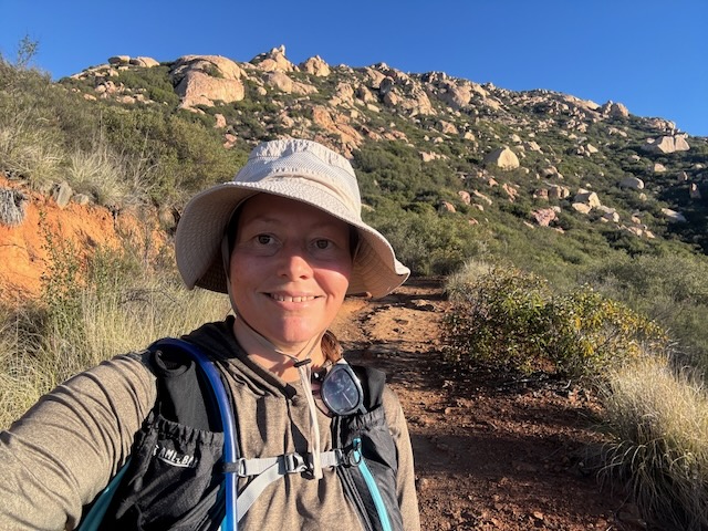
Two of the women I had hiked with before and one of them I would just meet that day. We made our way up the fire road at the beginning of the hike, climbing steadily higher. The hike starts out steep, which is the first thing to know about it. Not a gradual, ease into it, type of hike. So I was huffing and puffing in the first twenty minutes, until I warmed up. These ladies were moving faster than I usually go, but I was able to keep up. I usually like to start my hikes a little bit slower for the first 30 minutes, and work up a momentum, especially if I’m at altitude. I was not at altitude, but in the foothills so I pushed it, giving my heart and lungs an intense morning workout.
After 30 minutes of hiking, I realized that I had forgotten or lost my phone. At this point, I wasn’t sure if I had dropped it or if it was sitting on the seat of my car, which could’ve prompted a break in. That is just a fact of life. If you go hiking a lot occasionally that will happen. So I bid the ladies farewell and headed back to catch up with them later. In reality, I didn’t think that was gonna be possible because they’re fast hikers. I knew I would be on my own for this one, but I knew I would see them at some point, likely passing me on the way back.
I had already hiked one and a half miles with 700 feet of gain at this point when I turned back, so those miles and gain would be added to my miles and gain, to make this an even more challenging hike. I could’ve just gone home at that point and called it, but I decided to continue. I don’t remember a time when I felt more motivated. Knowing they were up there hiking and expecting to see me also motivated me further.
I got back to my car much quicker than it took me to get to where I left my group. I anxiously walked up to my car, knowing I hadn’t seen my phone anywhere. On the trail there it was sitting on the seat and a sense of relief fell over me. I wasted no time getting right back into it hiking as fast as I could to make up those miles that I just lost. On my way back to the car I passed another group of women hiking to the peak, who I would see again later.
It’s a funny feeling you get when you have climbing a particular mountain etched in your mind for a long time, that you spent so much time anticipating, and you’re finally doing it. This was one such hike, and I remember talking to countless people about how I wanted to do it for many years, friends, family, and whoever wanted to listen. It’s the most strenuous peak that you can hike to in San Diego County. It’s long and it’s strenuous and the terrain I would find would be very challenging. It’s kind of similar to wanting to hike to Mount Baldy. It is a famous climb, so the excitement and anticipation builds over time.
Another thing I can say about the hike to El Cajon Mountain is that it is like a series of roller coaster like hills, constantly climbing, and dipping down again, testing you both mentally and physically. It is always a somewhat defeating thing when you’ve hiked up a hill and then you realize you’re gonna have to hike back down and get back up again. I would always feel more tired on these types of climbs. Climbing mountains is one part strength, another part mental game.
I was back at the trailhead again.
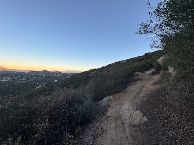
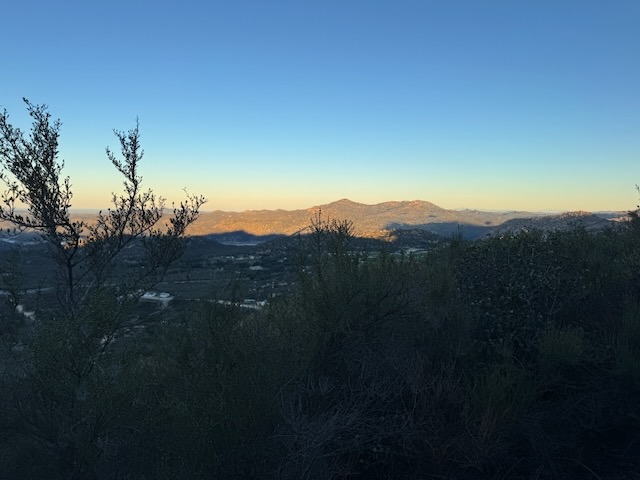
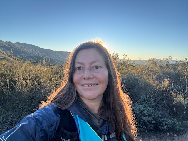
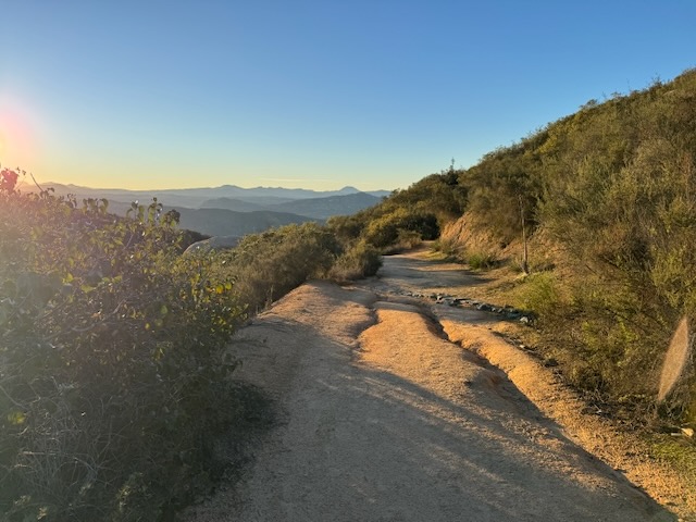
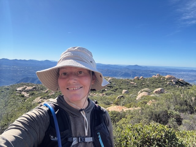
The sun started to rise over the hills. This was the most beautiful wilderness area I had been in a long time. I just felt so grateful to be here, to have healed this much and to be able to get out there doing a full day hike.
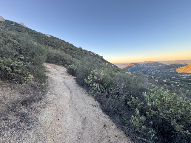
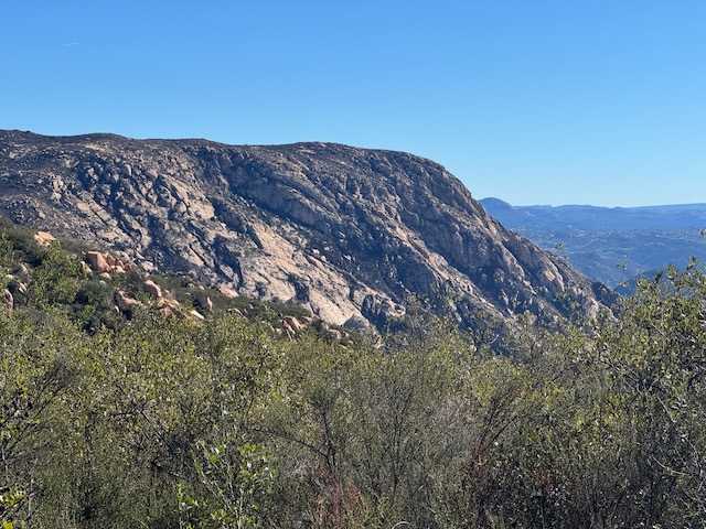
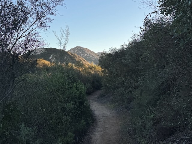
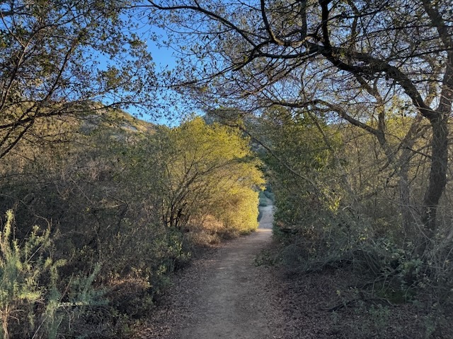
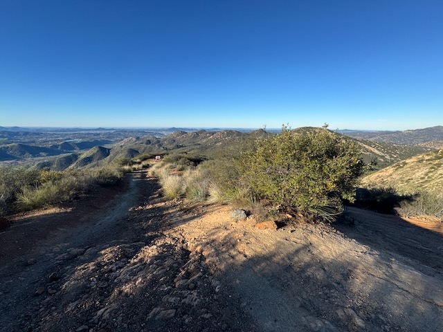
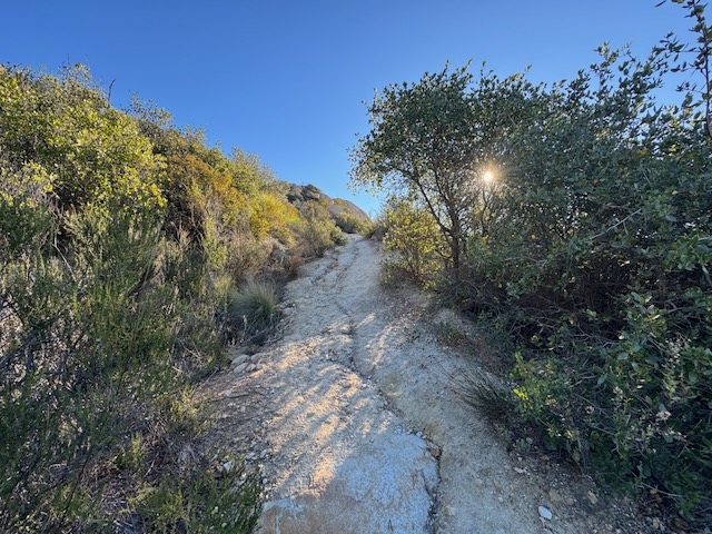
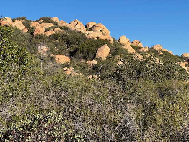
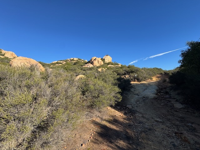
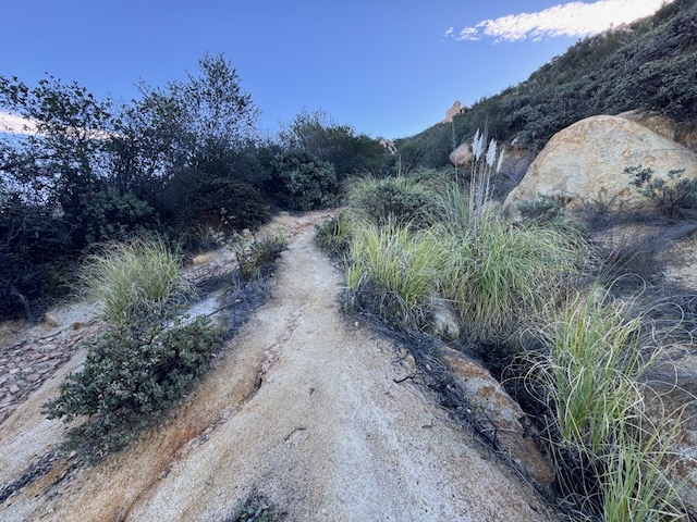
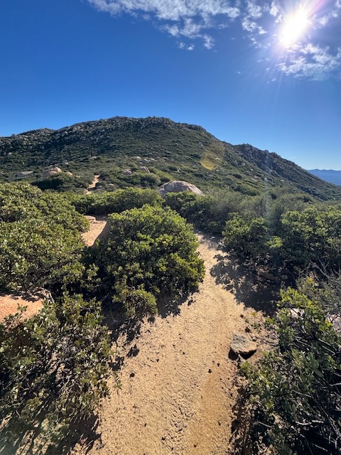
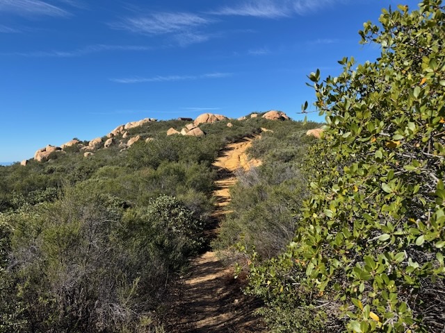
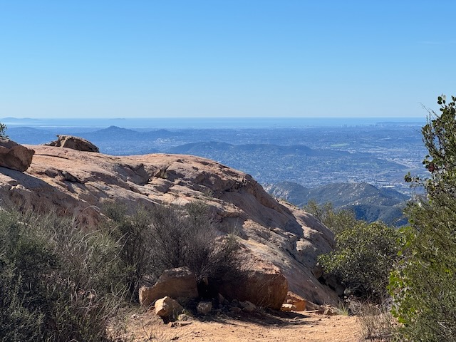
Parts of the trail became somewhat narrow, lined with shrubs, and a scattering of Oak and Sycamore trees. The hills in the distance were dotted in giant boulders of many shapes, and sizes. It is a rugged area of impenetrable brush, everywhere you look.
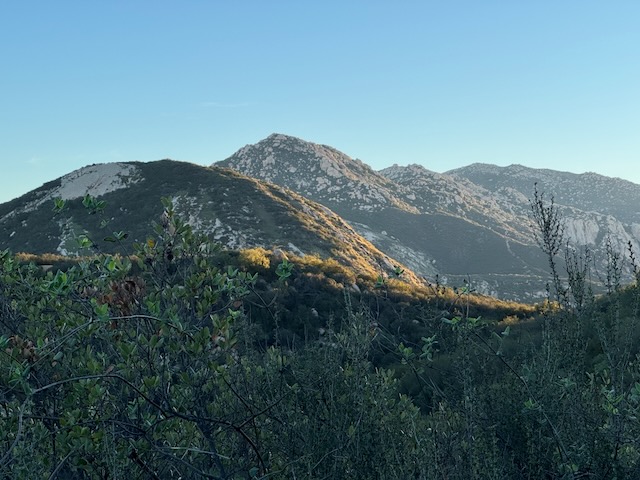
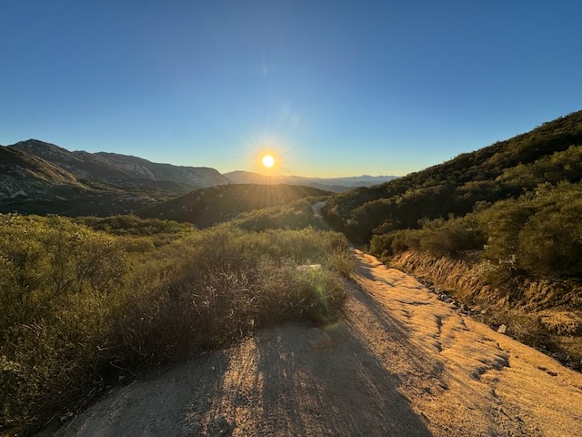
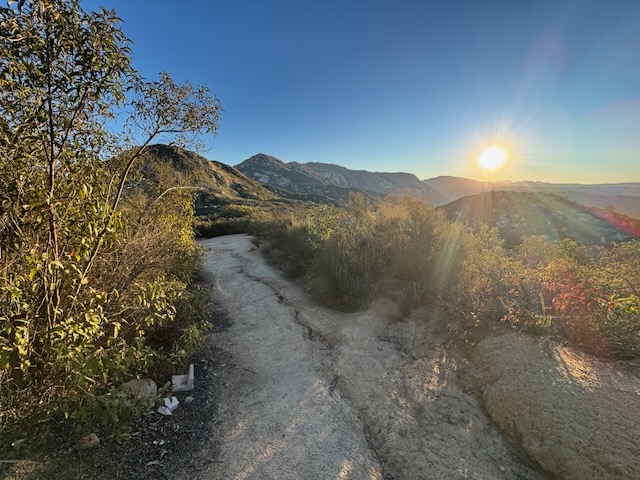
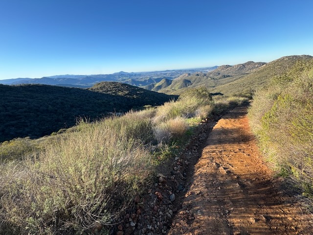
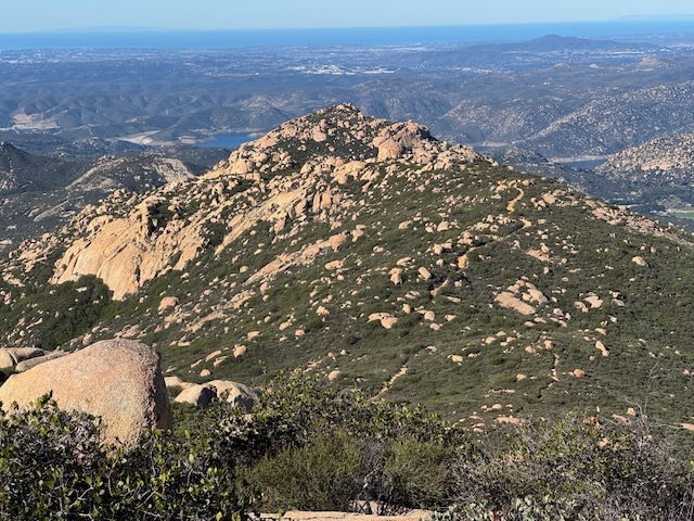
By 7:15 AM I could start to see the distant peaks all around me, and the first peak along this trail called Silverdome, but I could not quite make out El Cajon Mountain yet. I didn’t know much about that one and I didn’t see any trail leading up to it, but I’m sure where there’s a will, there’s a way to get up to any peak if you put your mind to it.
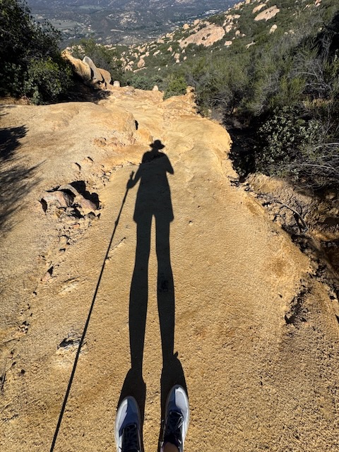
The sun had started to rise over the hills, and I was feeling optimistic. The boulder strewn hills turned golden as I pushed onward.
I ascended another hillside and noticed several distant peaks, peak number one in peak number two in the distance.
The cool morning air was in my favor, and it’s always much easier to do a strenuous hike like this when it’s cooler out.
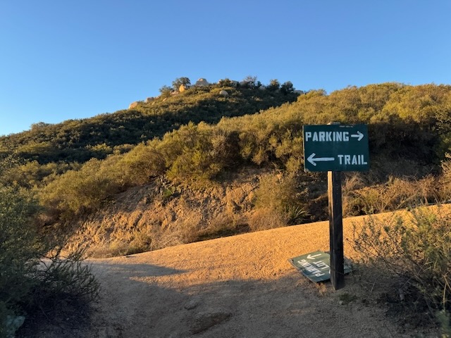
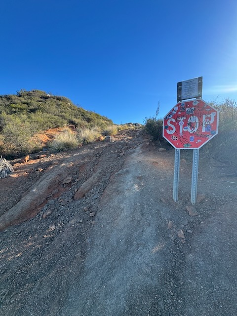
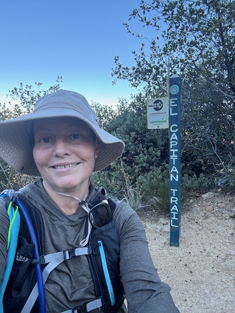
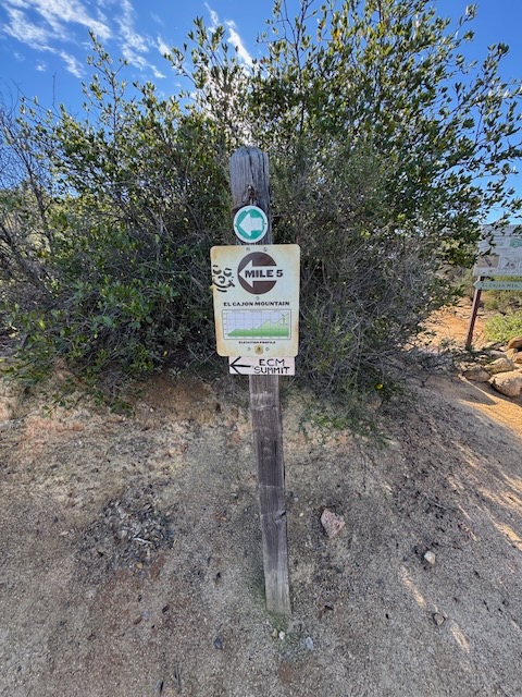
About 20 minutes later, I came to a sign which directs you to the peak or to the parking area. I would remember the sign on the way back. This is one of the few turn offs along this hike, which you want to take note of for the way back. I made a left here towards the peak.
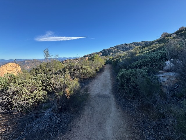
The wide trail was easy to follow. I don’t remember being at all confused about where to go either.
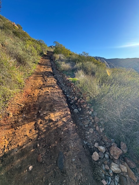
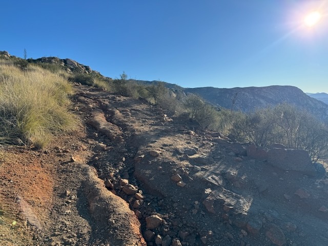
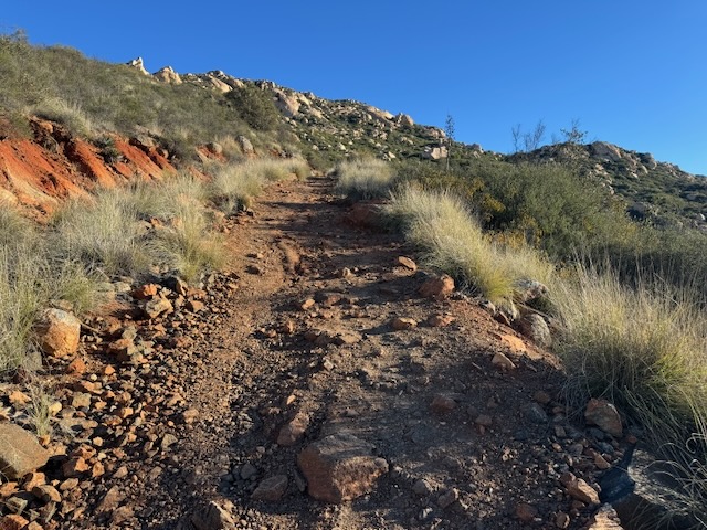
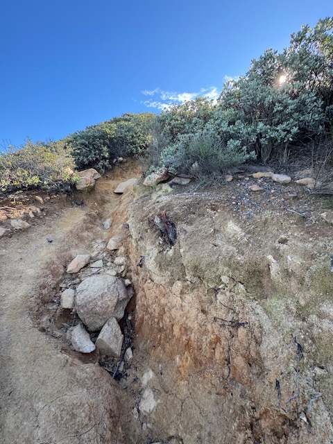
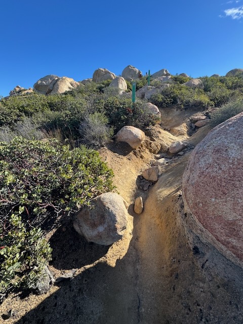
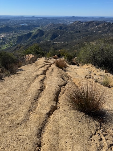
I started to notice that the trail was damaged from recent rains. There were deep ruts in the trail, caused by erosion. I had to be careful around these so as to not lose my footing and roll an ankle.
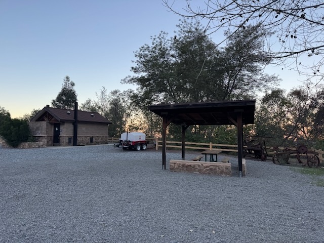
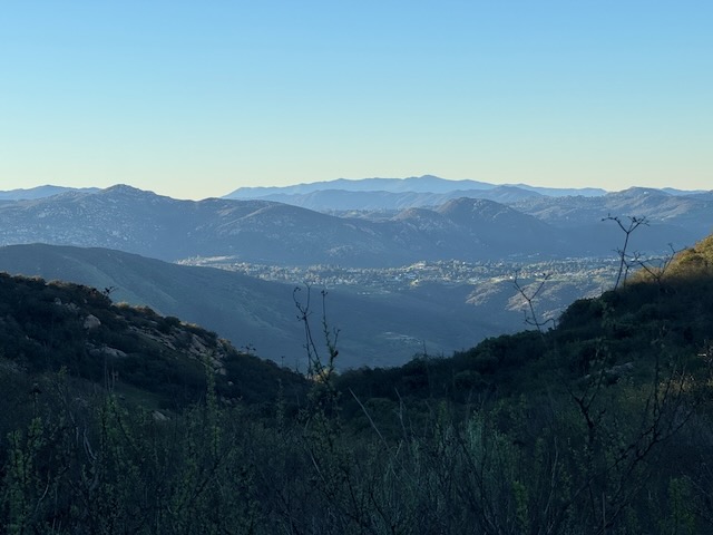
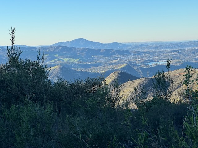
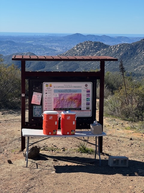
Looking out towards the high peaks of San Diego County, Cuyamaca, Peak, and Stonewall Peak. By 7:25 AM I came to a wide swath of trail, passing a shade structure with an El Capitan Preserve sign.
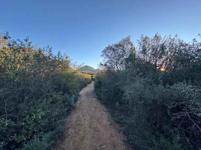
Onward, the trail narrowed and flattened out for a bit.
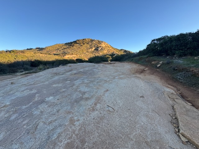
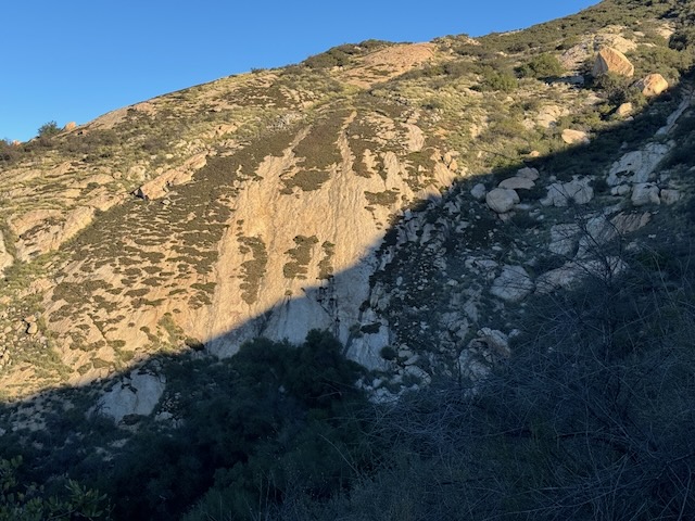
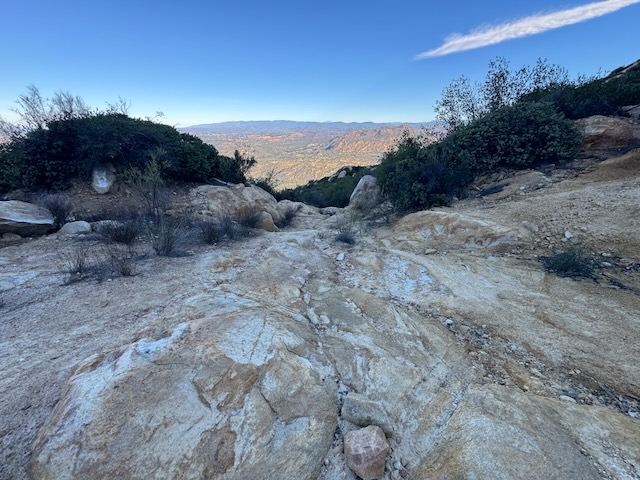
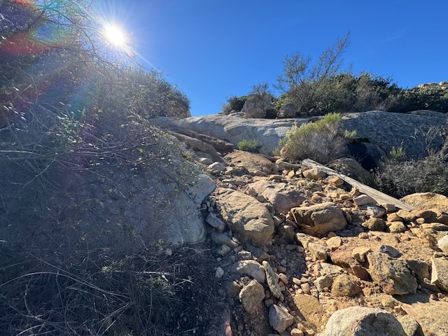
Further along, the trail became entirely granite, while passing Silverdome.
The trail continued through a forest which was illuminated in the morning sunlight.
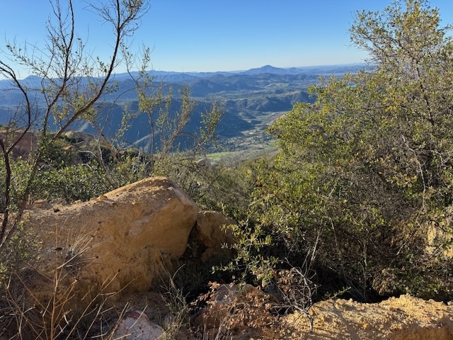
I had an excellent view to the south of Corte Madera, another peak I would love to climb. From what I have read, this peak is very overgrown and includes some bushwhacking.
By about 7:45 am I came to a steep section of trail that was very rocky, which slowed me down a bit. I took my time and small steps as I climbed this section. There was a trail fork, with two options and I took the one to the left on the way up. I would take the way on the right to the way back.

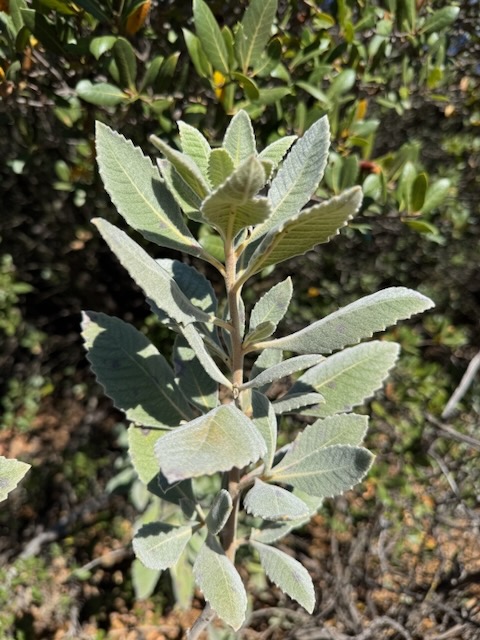
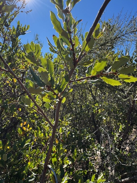
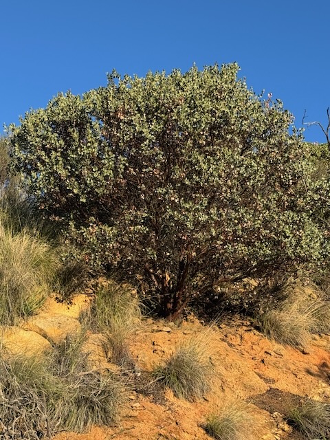
This manzanita is abundant along this hike. Low growing natives like this thrive in dry air desert regions like this. They are also excellent fuel for wildfires, which always seem to regrow post fire. Plenty of white sage grows along this trail. It starts to come up in winter time, just about now.
I was feeling pretty good at this point, and it was almost 8 am. I felt like I was making pretty good time at this point because it wasn’t hot yet. It was still very cool and I was about halfway to the peak at this point.
The trail steepened again and now the sun was starting to warm things up a bit, and it was time to shed layers. The trail had branched off in two ways.
Looking back to where I came from is something I do a lot.
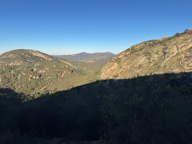
Looking out towards Cuyamaca Peak.
By 8:20 AM I had made it up another steep section. I climbed one hill only to need to proceed down another that was also steep and even more rugged than the previous sections of trail that I had come across.
The next section of the head was even more challenging, much more rocky and rugged. There were deep grooves in the trail at this point so I had to take my time.
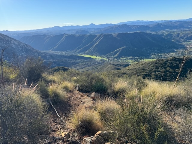
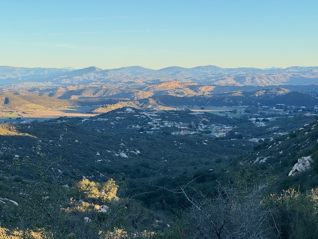
I could now see a peaceful green valley off to my right, likely of small farms or ranches. San Diego County is full of these types of places. It has such a rural feel, but you’re so close to civilization.
I continued on amongst the red rock and rugged landscape.
Despite it being just some January, it felt like summer.
A boulder rests so gracefully alongside a trail carved by several streams of water during a recent rain.
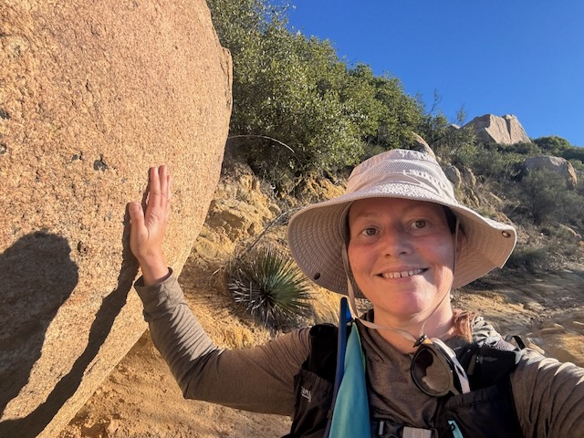
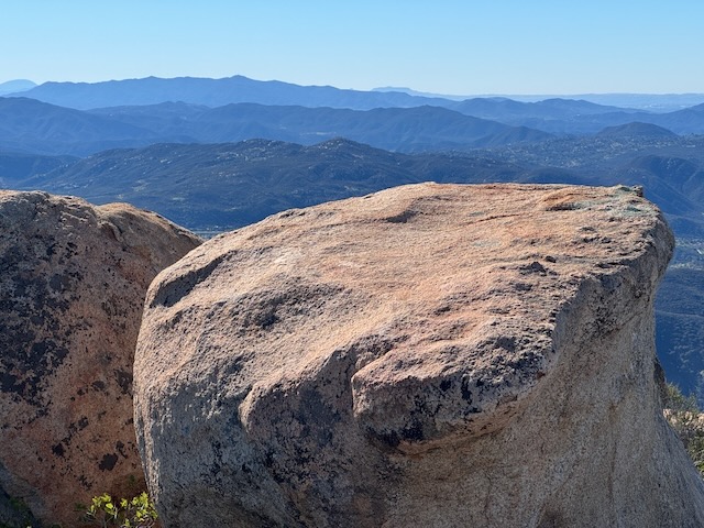
By 8:30 AM it was definitely feeling warm out. Standing next to this large boulder, it puts you in your place, as to where you are in this big universe of ours.
A few hikers had passed me, but not many, I basically had this trail all to myself, each section holding new challenges, in maintaining my footing and not hurting myself further. That was my whole goal.
I started my hike today fast, keeping up with my group. But today and every day hiking, my goal is not to go fast, not to set a record, just to get there, without hurting myself. That is kind of my mindset, ever since battling past injuries that stopped me doing this all together. Not pushing it, just doing what I’m able to do, and being reasonable about it, is my goal.
I remember meeting a lady who was close to 80 jogging her way down Mount Baldy one day while I was hiking up Ski Hut Trail. That lady completely inspired me and reminded me; That’s what I want be doing when I’m old and gray. I want to be high up in the mountains on places like Mount Baldy.
If I wanted to be in the mountains in old age then I’m gonna have to take care of myself. Hiking solo is all about calculated risk or during any adventurous activity. Self preservation, is always in the back of your mind.
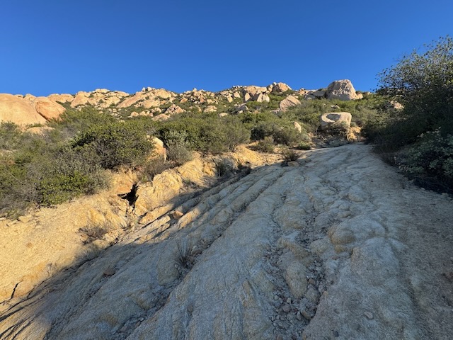
Giant slabs of granite were all around me. I continued the climb toward El Cajon Mountain.
It was 8:30 AM and the trail did not get easier in any way.
I had arrived at a false summit of sorts by the turn off for some old mines. I had probably gained about 3000 feet at this point.
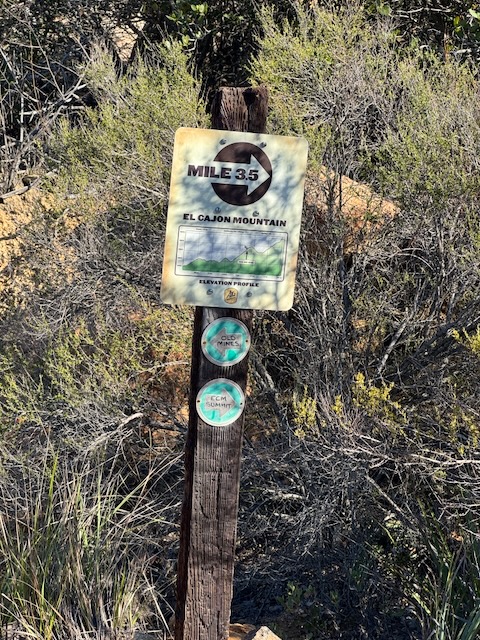
According to the sign, I had 3 1/2 miles to go. I was actually further than I thought I would be to El Capitan and El Cajon Mountain.
At this point, I began to descend deep down into another canyon, and this trail section would prove to be the most technical of all and the most damaged by the rain.
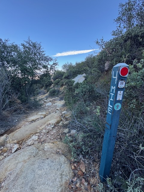
I had shed many layers at this point as I approached the 4 mile marker, another milestone. In reality, I had gone more miles than that.
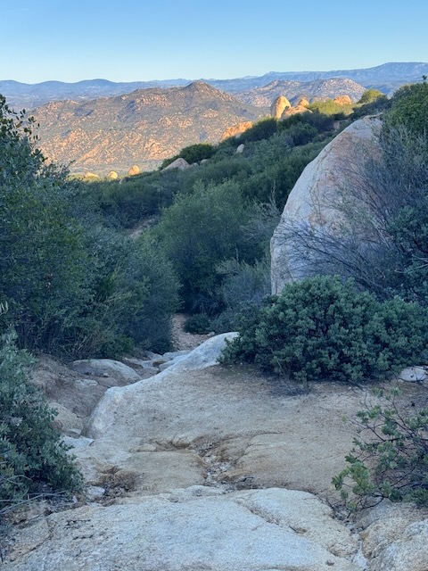
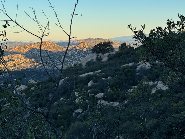
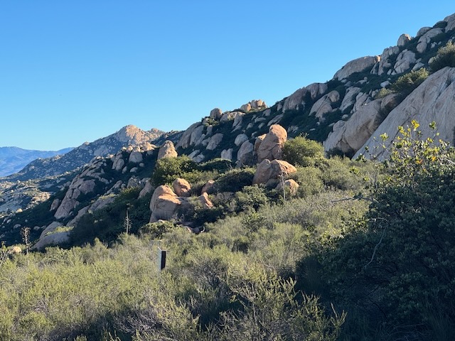
There were beautiful inland views along the stretch. Everywhere you looked was boulder after giant boulder.
As I dipped down into the canyon along the granite laden trail, it felt much cooler and I was wondering if I actually needed to shed those layers, or not.
The trail passed over solid rock while remaining shady for the next 15 minutes or so.
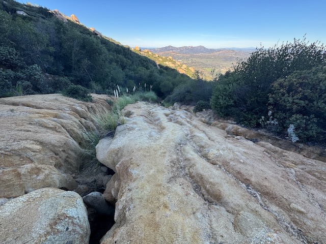
It was just after 9 AM as I began an uphill climb once again. This was where the trail was the most damaged of all, with deep ruts over a foot deep and several feet wide.
I was now about a half mile to El Capitan Summit, when I received a text from one of my hiking partners who organized the hike. She was at the peak there and wanted to know where I was. I had only seen a few other hikers the last few hours. I would run into her soon. She had decided to cut her hike short and head back.
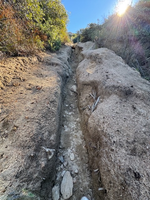
There was so much erosion that I had to put one foot in front of the other to make it through.
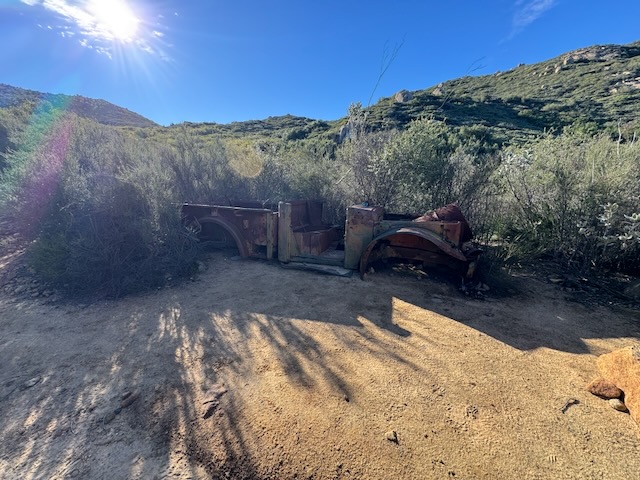
By 9:30 AM I had made it to the site of this old car wreck.
By 9:40 I was near El Capitain and bid my hiking partner farewell, and she headed back. According to the signage, I now had just .5 miles to go until I reached LK Hong Mountain.
It was 9:45 AM when I began my accent, on the homestretch.
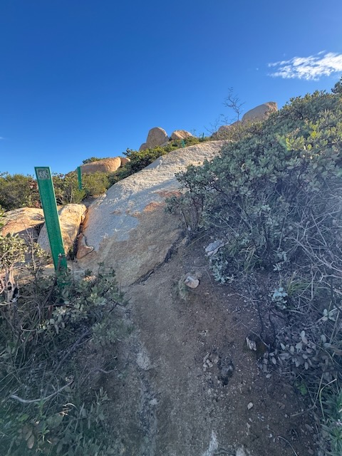
There would be a series of green markers, to guide you up the mountain. It was a bit challenging, and at this point there was some scrambling involved, to make it to the peak.
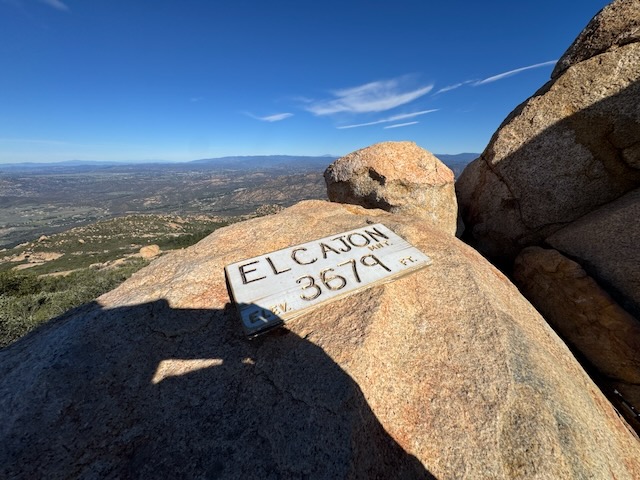
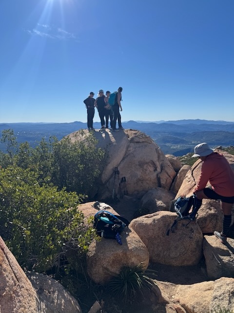
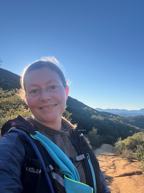
I made it to the ECM summit by 10 am.
I was so grateful that the ladies that I had begun the hike with were there and waited for me and we were able to take a photo together. These are the kinds of women you wanna know and hike with who support each other, and are just fun to be around.
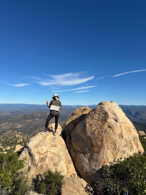
El Cajon Mountain 3679 ft
After meeting up at the summit and taking photos with one another, I headed it off, and set on making it to El Capitan. My hiking partners hiked back to the trailhead, so I was again solo, something I do most of the time.
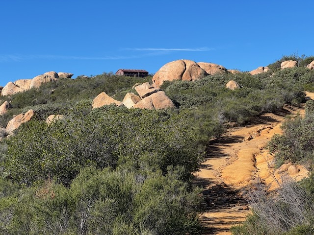
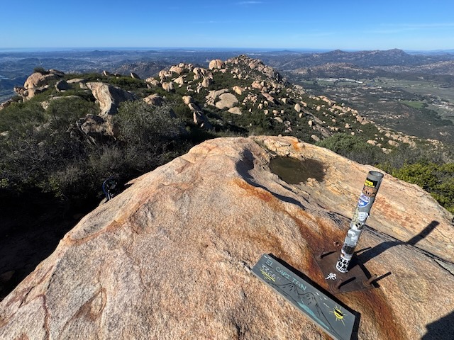
By 10:30 AM, I made it to El Capitan. The summit has some sort of building, and the peak is atop a massive granite boulder.
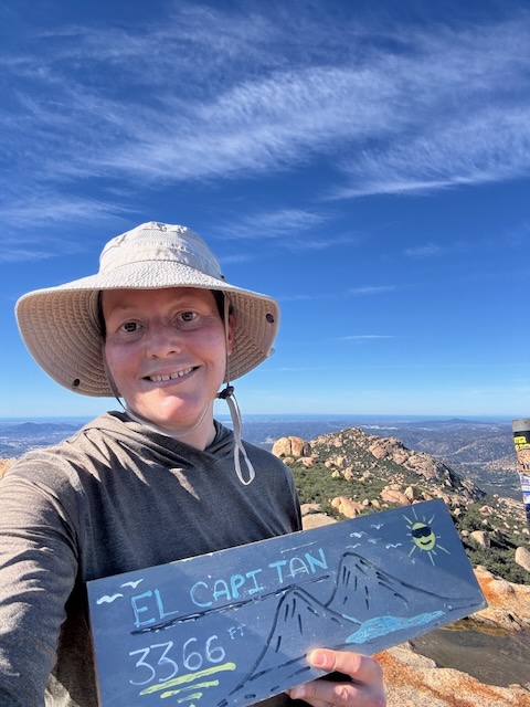
El Capitan Elev 3366 ft
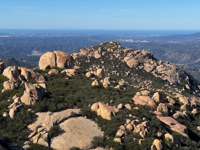
I had hiked to two peaks in one day! Off to the west I could see far into the distance, across a rock garden of epic proportions.
Everywhere, just boulders. Geology is an interesting thing. These giant rock boulders formed a millenia ago. I had the summit all to myself for about 20 minutes, where I took a much needed break and had a snack, before trodding off back toward the trail the way I came, for an out and back hike.
I made really good time on the way back.
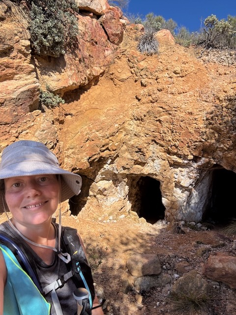
By 11:30 AM I was at the mine, since I had to check that out. I didn’t go inside, but it was interesting to see. Perhaps next time I may, but going into mines is potentially dangerous. I can’t imagine what they were thinking back then, digging these mines in such remote places, but one thought comes to mind, they were driven by desperation and hunger. People were very hungry back then, and it drove them to accomplish amazing feats.
Caves and mine history are interesting, but exploring inside them, is not my thing. I prefer wide open spaces. I appreciate seeing places like this, learning more about our local history, and seeing where it all took place.
There was a bit more uphill involved during the last mile, and after hiking over 13 miles, and I was feeling it. The sun was shining bright the entire way back, and it gradually grew warmer, so I took every opportunity to take a break in the shade. I slowed down my pace a bit the last mile or so since it was warm out. I had more company along the last stretch, as some of the hikers from the summit caught up with me.
I made it back to my car by 1:30 PM
Conclusion
My hike to El Cajon Mountain and El Capitan was a strenuous climb, one of the most challenging hikes you can embark on within San Diego County. I was grateful to have been in good company and for all the support I received from my fellow woman hikers along the way. If you are planning a hike here I believe the best season and most ideal time of year to visit is anywhere between December and early February, when temperatures are cooler, and the trail is not yet overgrown. It is likely beautiful in springtime as well, but snakes may be more active during this time. They like to hide in the shade and underneath rocks. Trails overgrown with brush make it tough to see them.
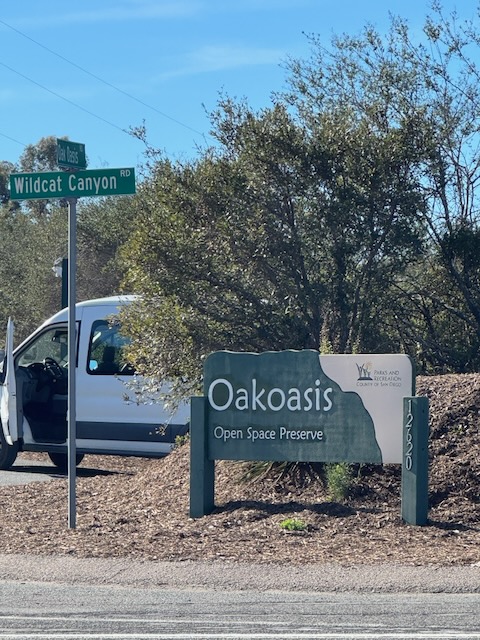
A few of the ladies decided to check out the Oakoasis across the street. I mean we only just climbed a mountain, so why not?
I hope you enjoyed reading this, and it is helpful in knowing what to expect, should you decide to visit here.
The Essentials
Just be sure to come prepared, bring the 10 essentials, and Pack Out Your Trash to keep the wilderness pristine for future hikers.
About me
I’m Serafina! I’m a writer and California girl who loves to go exploring. Hope you will get outside today, breathe some fresh air, and be happy!
Like and Subscribe to my Channel!
Follow my Journey @serafinabenjamin
Follow along on My Youtube Channel where I post videos!
Disclaimer:
The work on this blog is my opinion and my opinion alone and I am not responsible for the outcome if someone were to apply these thoughts to their own life. All text and photography copyright 2025 by Serafina, all rights reserved. Information and opinions provided are kept current to the best of the author’s ability. All readers’ usage of the ideas and opinions presented in the blog, are at their own risk. Be aware of the possible dangers of hiking, surfing, walking, cooking, and other activities, which may take place indoors or outdoors. By reading this, you agree not to hold the author or publisher of the content on this web site responsible for any injuries or inconveniences that may result from reading the blog, or partaking in any activity mentioned in the blog. Read the blog, and use its ideas, if you so desire, at your own risk.
