A storm was soon approaching California. It is the second week in November, and storms like the one on its way won’t stop me from hiking. They will alter my plans and options for places I can safely venture out. My vehicle is sadly not meant for snow travel on icy roads. It’s not meant for off-road adventuring either. That may someday change, but for now, I have to take care to avoid steep mountain roads filled with ice. I had a close call sliding down a road out of control once. I have been to Mt Baldy on a day when every vehicle was sliding out of control and crashing into one another. With all these lovely thoughts in my mind, I anticipate winter, and try to get in as many mountain hikes as possible, during November and December, before the roads ice over. At that point, my perspective shifts to lower altitude climbs, and trailheads accessible with my vehicle.
So I knew this trip to SR-2, may very well be my last this season, and the road past Mt Baden Powell, may very well be closed again. I was headed for Mt Williamson, and potentially was going to extend the hike along Pleasant View Ridge on to Pallet Mountain. That would make it a 10 mile day. But another option lingered in my mind, to check out some of the shorter hikes along SR-2 I had skipped over, such as Mount Lewis.
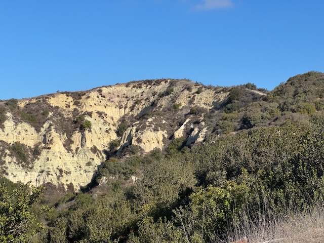
It was my second time driving past Wrightwood, along SR-2 since the fires a year ago. I had been up this way in July, to hike to Mount Baden Powell. At that time, the road was still closed beyond Vincent Gap, but no longer. I could now drive the entire length of SR-2 if I so desired, well past Mount Islip, and onward further. This was exciting to me, since this rugged scenic byway, prone to rockslides due to the dynamic nature of the mountainscape, is a destination in itself.
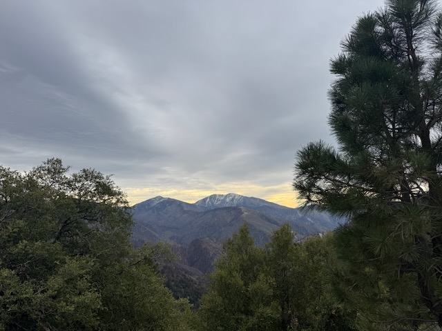
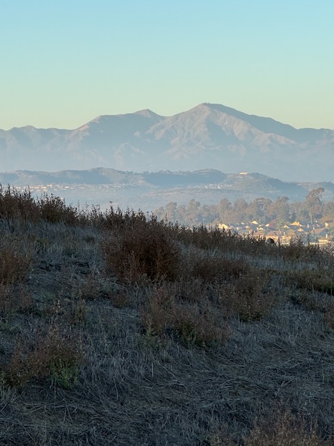
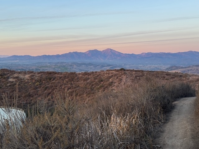
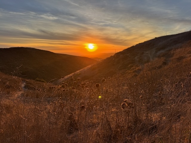
As I drove higher along SR-2, passing Inspiration Point, I noticed the gate leading down the road to Guffy Camp and Wright Mountain was closed. I now had a clear view toward Mount Baldy and Pine Mountain. I could clearly see the north face was snow covered. I thought to myself that today and tomorrow may be the last chance to drive up and hike to these high peaks before winter has truly arrived in the mountains, which usually happens sometimes in November. It was going to be arriving a bit earlier this year though.
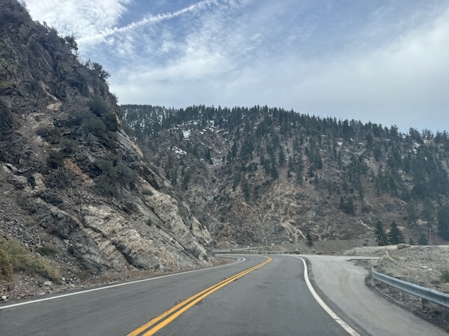
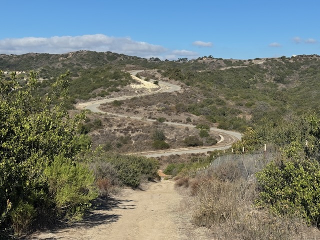
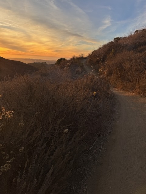
As I pass by Mount Baden Powell the true nature of this highway unfolds, as you wind your way through rockslide areas, and jagged cliffs climbing higher.

There are several places to pull off and stare off in awe of the stark beauty to be found here.
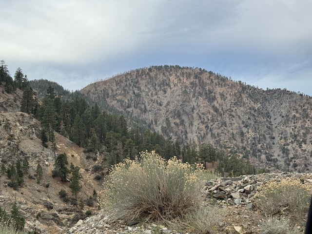
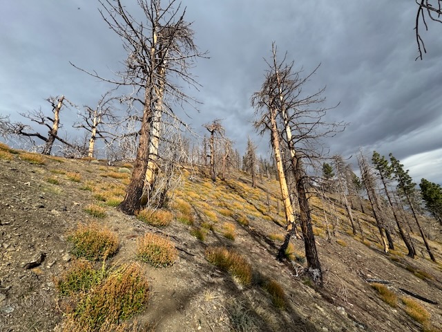
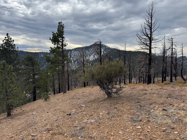
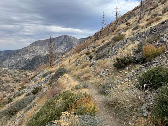
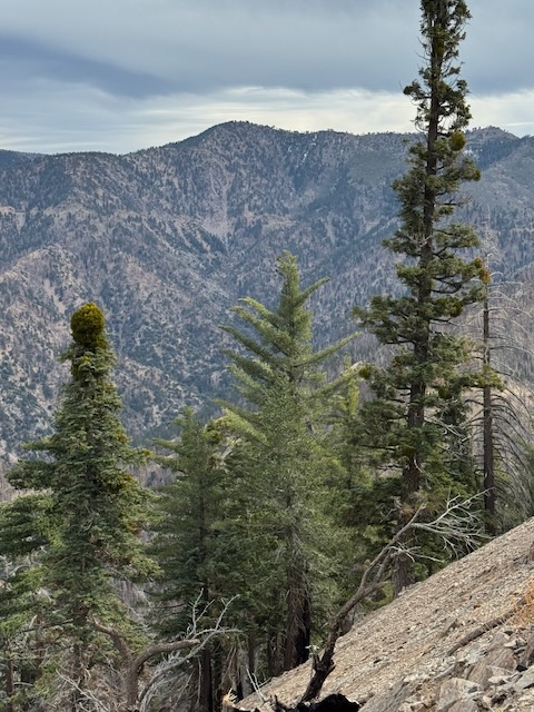
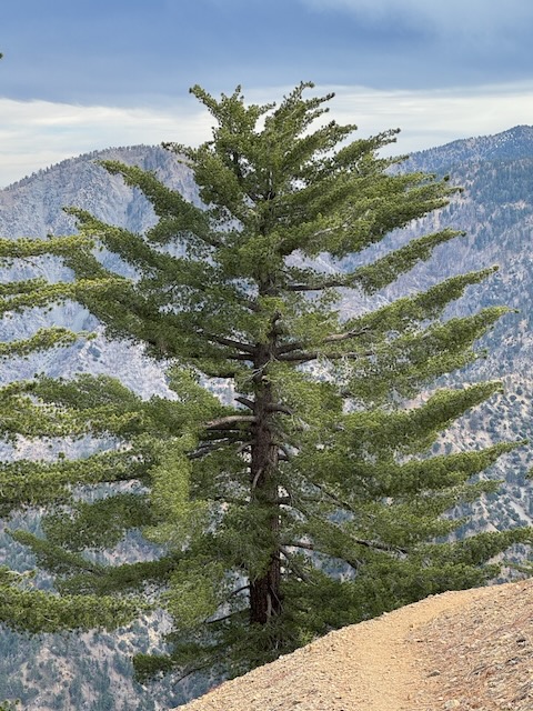
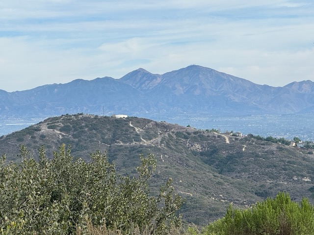
Soon Mount Lewis came into view. Standing tall off to the north side of SR-2, at over 8000 feet, being one of the shortest yet steepest climbs (so I had read), I felt today might be a perfect day to add it to the list of San Gabriel’s peaks climbed.
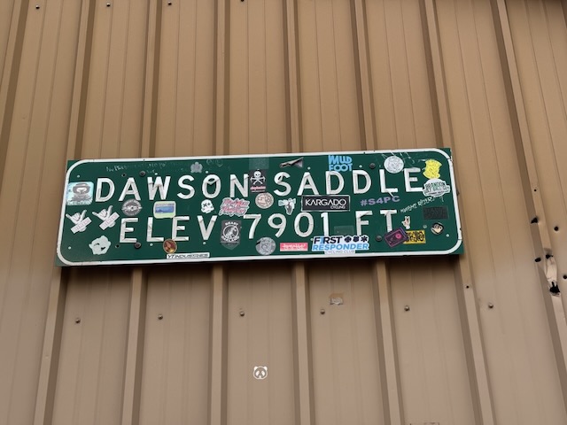
I pulled off the road at Dawson Saddle, where there is just a beige storage building, and not much parking to speak of. The wind was just howling, to the point where you have to hold on to your car door so it does not smack you with it. I said to myself, hopefully this wind does not indicate the storm is coming earlier, and does not blow me off the mountain. I was having second thoughts about my plans, and wondering if Mount Williamson was actually in the cards today.
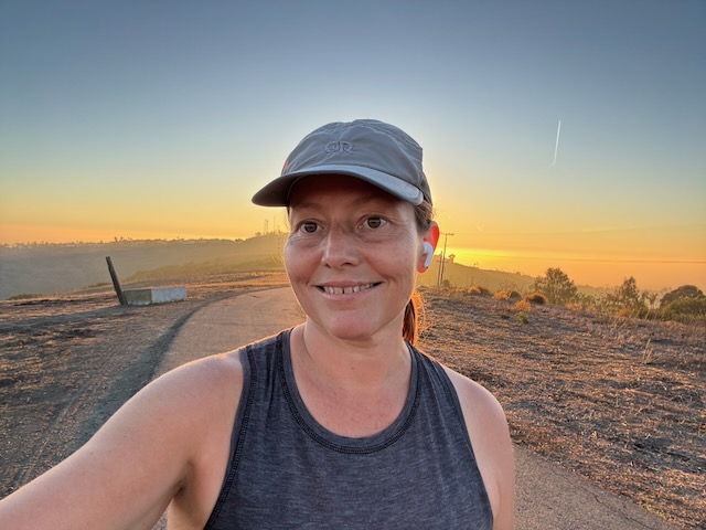
Still I got ready for the one mile hike in the same way I would for any other, bringing all my gear, since you just never know. I had my Garmin, since despite this hike being one mile roundtrip, what if…you never know what can happen. There was nobody driving the road today, I will also mention. It was just me out there and only me, so I was not going to take chances.
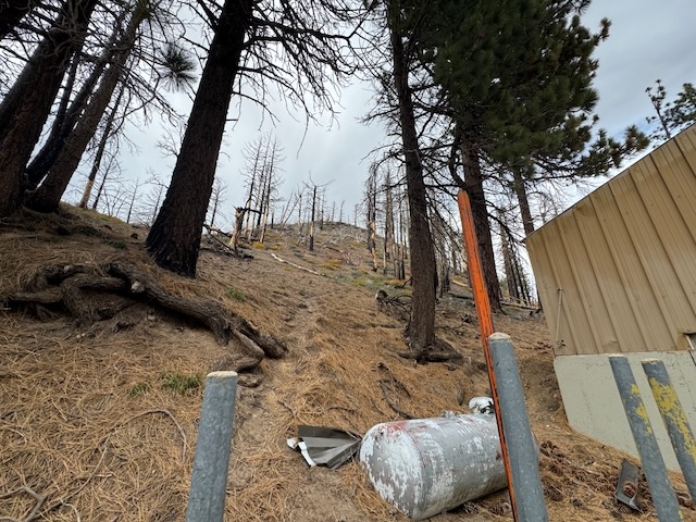
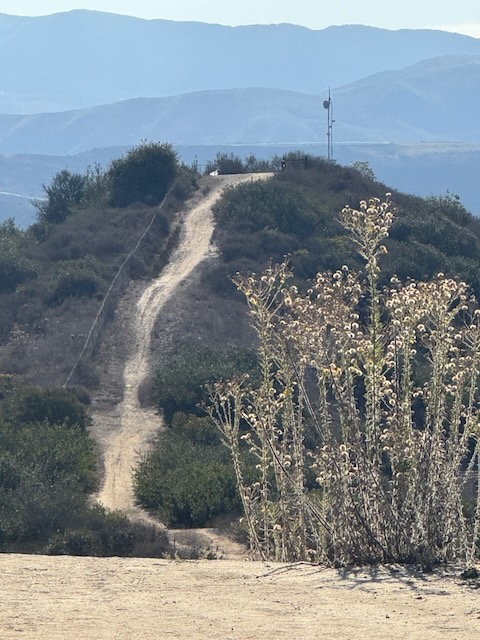
As I stood at the foot of the trail, I felt discouraged already, due to the steepness of it, true to what I had read.
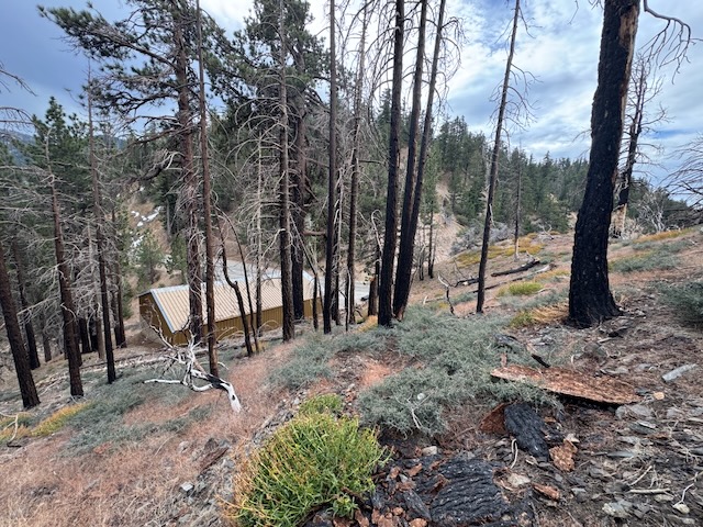
I began climbing, sliding around on the loose bark, rocks, and pine cones, as I wondered if this was even safe to attempt. I looked back on the road and saddle realizing I was l climbing rapidly about 100 feet every 10th of a mile, which is very steep. I always look back, especially on trails like this, since it helps to know how things look from the opposite direction. This is my best defense again getting lost, second to having a map, like Alltrails, which pinpoints my location.
Still I was feeling like this was doable with the right mindset. Sometimes you just have to look at a challenge in a new way. Hard yes, was this climb impossible no. I felt up for the challenge today.
I took my time, leaning in heavily since the pitch here could have sent me tumbling down easily. This short trail was challenging in choosing the right footing.

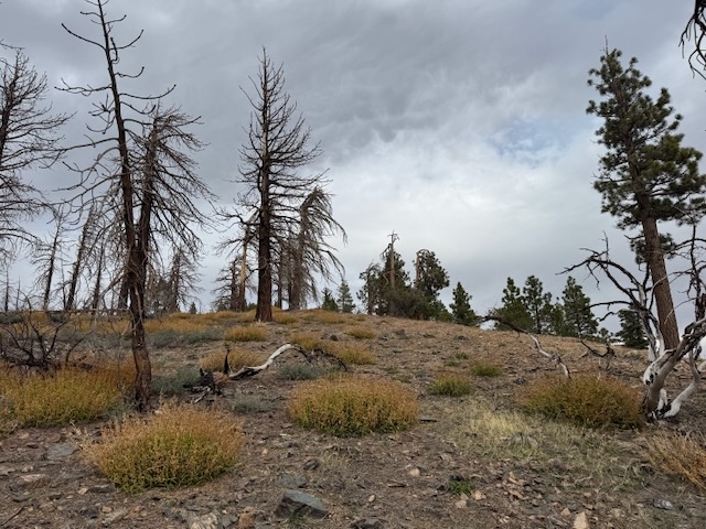
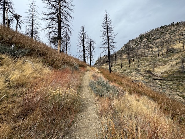
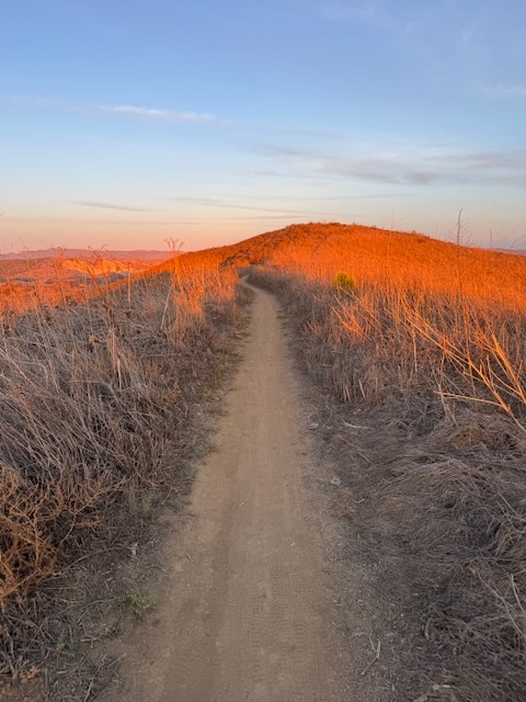
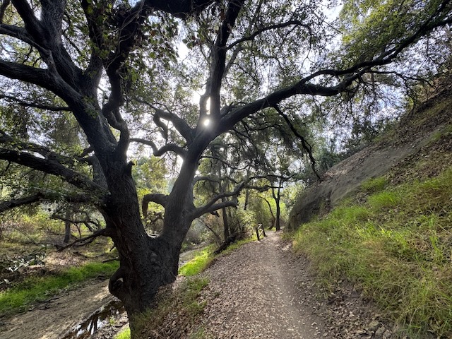
This trail was the essence of everything that the San Gabriels are, the landscape may be charred, but the inner beauty of this place still shined through the ashes.
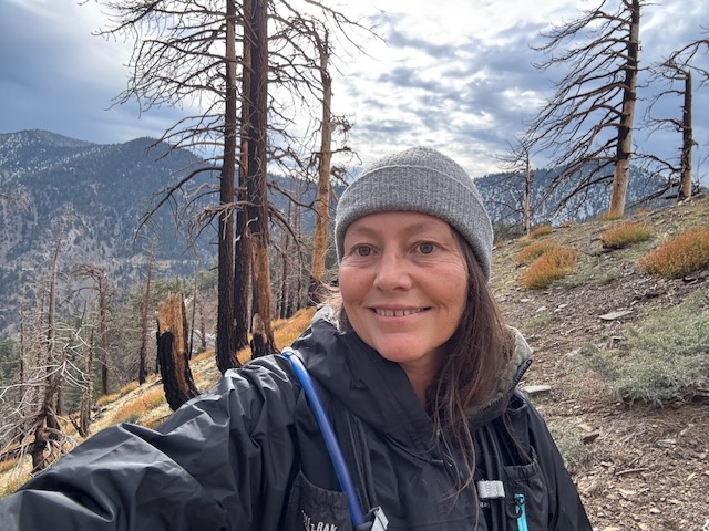
After about 20 minutes of climbing, I was almost to the peak, and on the saddle, where the trail leveled out.
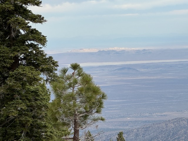
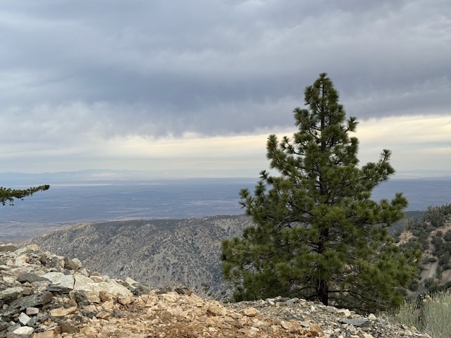
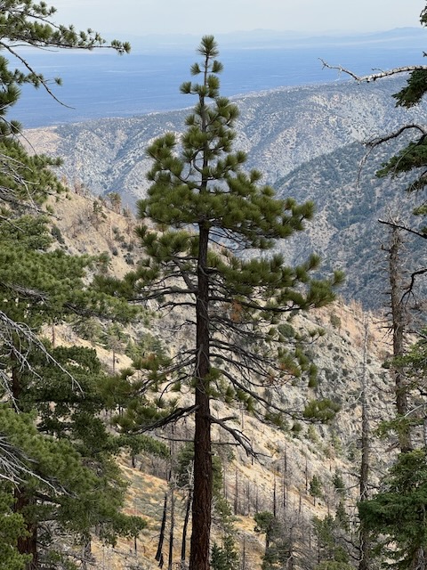
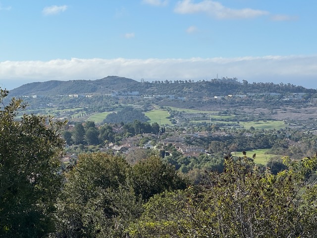
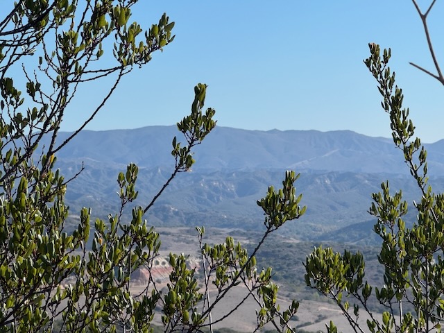
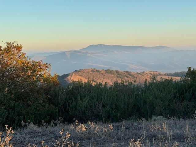
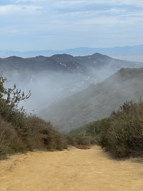
The views off towards the Mojave were beautiful from here.
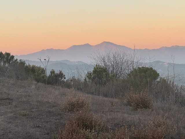
Looking back towards Throop Peak in the backdrop, which seemed fairly snow covered on its north face.
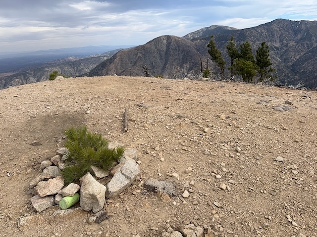
I reached the peak and searched the summit for signs, gazing off towards Mount Williamson off to the west.
I had reached Mount Lewis Elevation 8353!
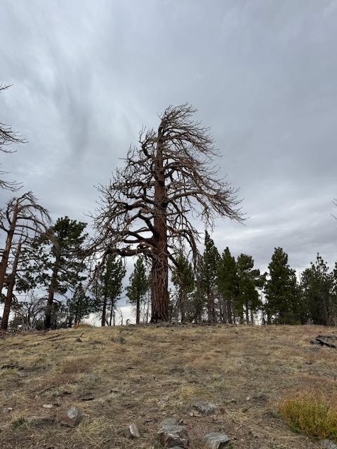
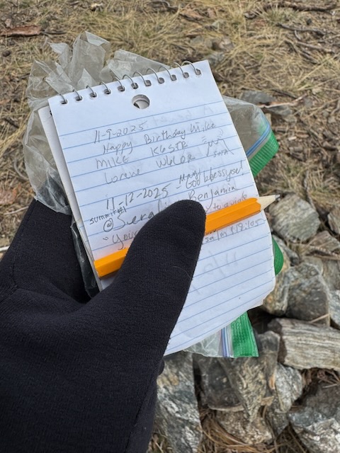
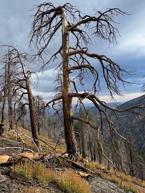
The peak has a large charred pine in the center, and next to it, I found the register. I noticed that the last hiker to sign this before me, was several days ago, indicating how infrequently this peak is visited.

I stopped for a few minutes on the way down, on a large rock, to enjoy the view, before continuing carefully down the steep slope back to my car. Mount Lewis was a highly doable peak, with some care, but could easily be dangerous, due to the pitch of the slopes, so keep that in mind.

The wind had died down a bit, so I continued on to Islip Saddle, the trailhead for Mount Williamson, where the PCT meets it. Before briefly debating heading to Mount Islip one more time, I decided to head to Mount Williamson, and possibly Pallett Mountain, while along Pleasant View Ridge.
I was greeted by the PCT marker, which added to my enthusiasm since I was about to be back on one of my favorite historic long trails. I have hiked several sections of this trail, and even backpacked along Section A back in 2023.

This section of trail again characterized the rugged beauty of the wilderness, somewhat scarred by fires, yet still tranquil and serene nonetheless.
As I continued along the narrow trail of the PCT, I glanced back towards Mount Islip and Mount Hawkins, peaks I have visited before starting from Crystal Lake Recreation Area.
The hills were painted tones of gold and copper, with small splotches of green evergreen shrubs intertwined within it.
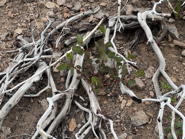
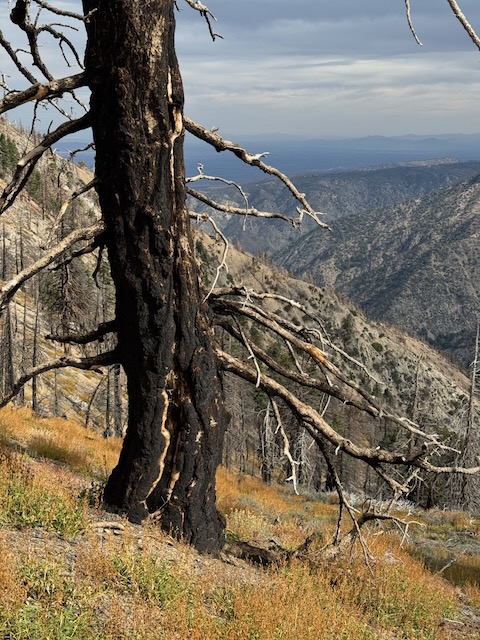
I see the evidence of nature renewing itself all around. Resembling the arms of an outstretched skeleton, the remains of mature manzanita cover the hillside., victims of fire. Yet, from all this, new seedlings emerge.
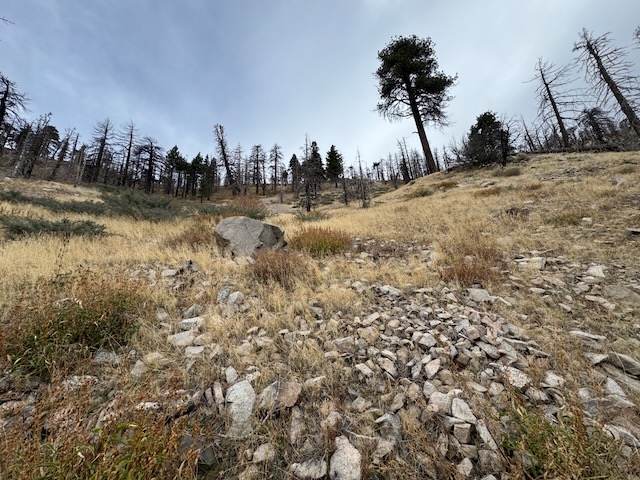
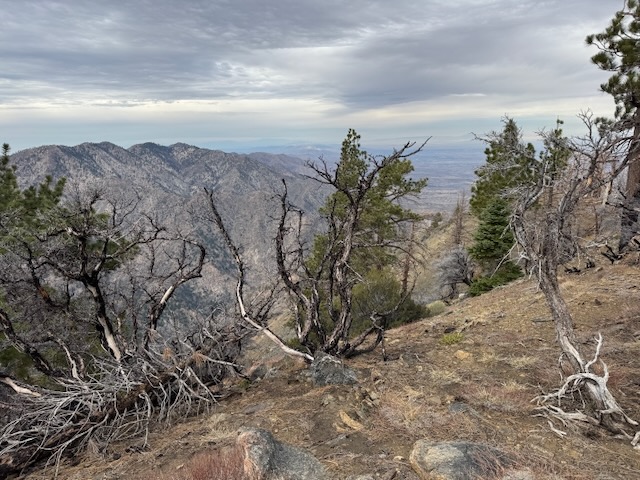
As I climb higher, the landscape grows ever more alpine and rocky.
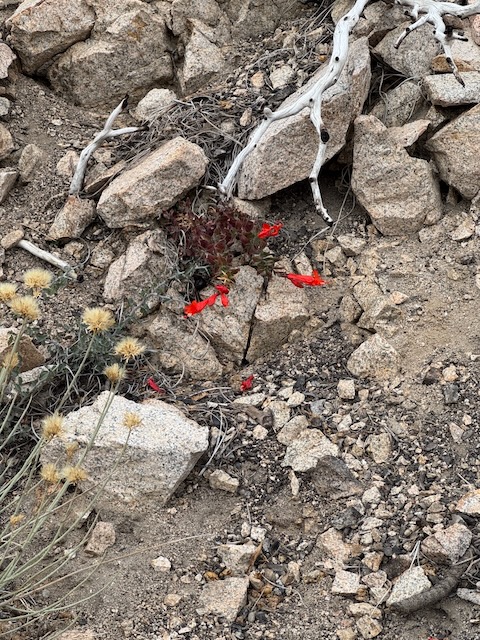
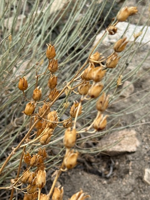

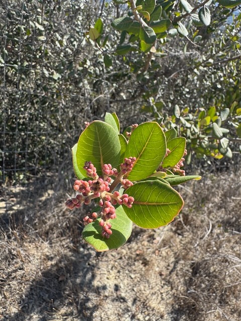
From the granite, late fall wildflowers manage to grow and thrive. Withered seed pods of the flowers and the trees, still have an unusual beauty.
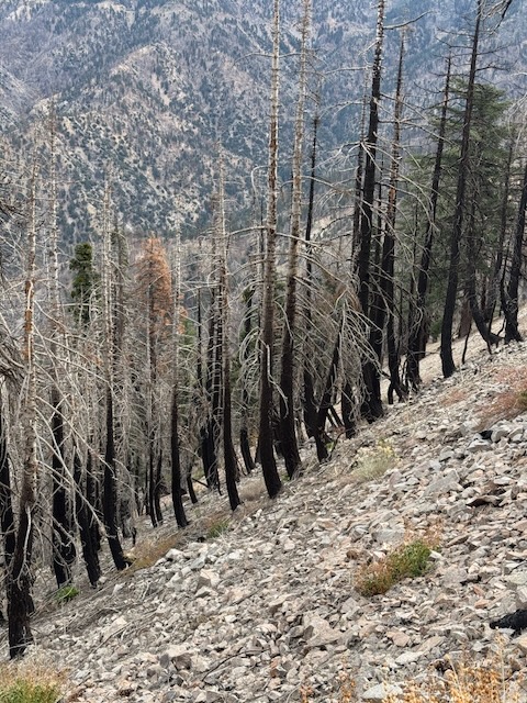
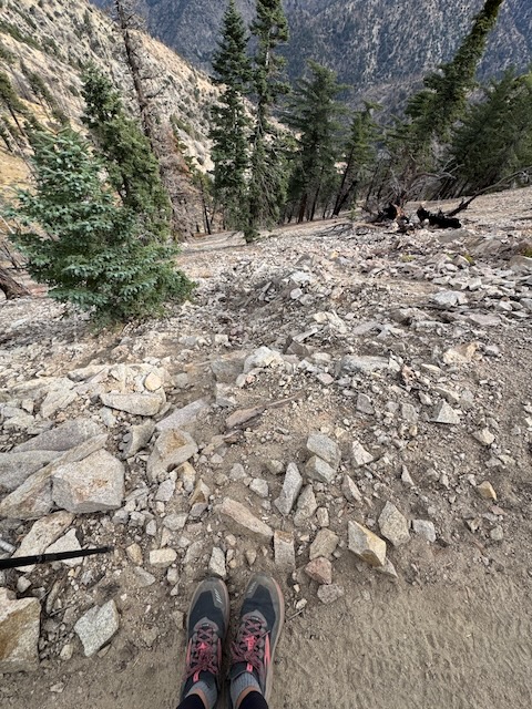
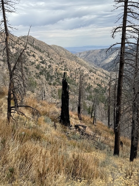
The trail eventually leads me over dynamic granite filled rockfalls, cascading down steeply pitched hillsides, leading toward charred trees resembling lit matchsticks.
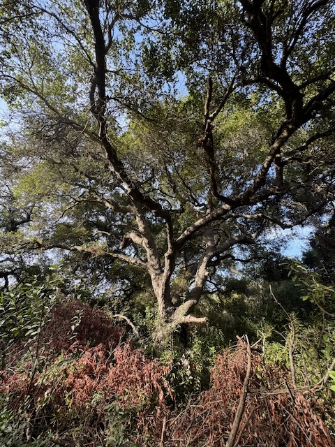
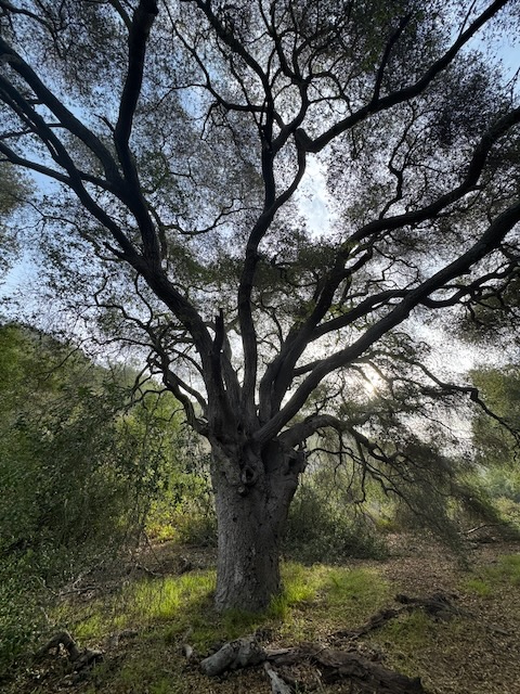
Still while gazing across the divide, some of this forest seems relatively untouched.
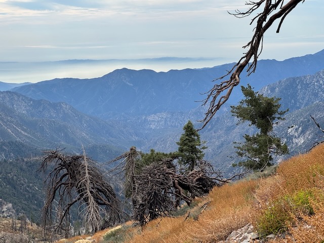
Despite the impending weather on the horizon, the landscape still yields somewhat bold and inspiring colors, deep blues, and golden tones.
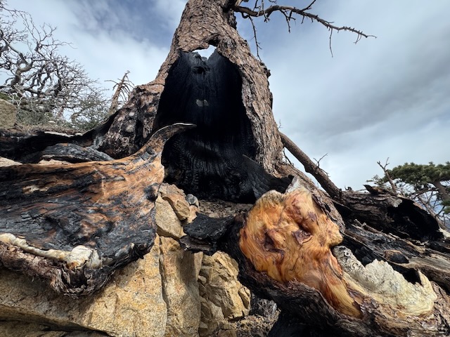
Many of the tree trunks still stood, charred from the inside out, victims of the fires a year ago. I came to one particular standing deadfall, resembling a spindly looking chimney imagined from a fairytale.
The tree’s, backlit by the mountains in the distance, each had their own individual beauty. I feel like I am collecting Christmas trees, on hikes like this. Each one more perfect than the next.
Eventually, I began to close in on my destination, as I climbed higher.


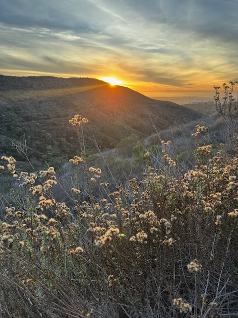
Gazing off towards to the west was Pallet Mountain. By around 11:30 am, I left the PCT, as it made a sharp left down the mountainside, heading west, continuing on toPleasant View Ridge.
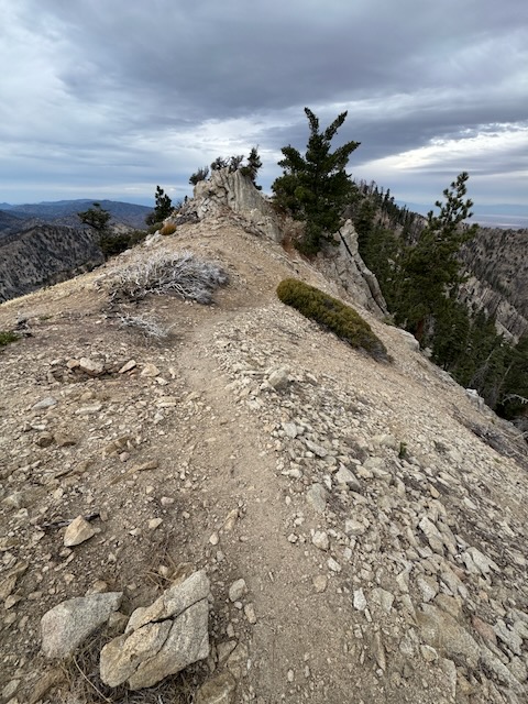
I reached Pleasant View Ridge around 11:45, initially missing the sharp right turn-off for Mount Williamson.
I hiked further along Pleasant View Ridge, which was true to its name. From this point, after taking in the views, I decided the wind was too intense and decided to head back to Mount WIlliamson, rather than continue on to Pallet Mountain.
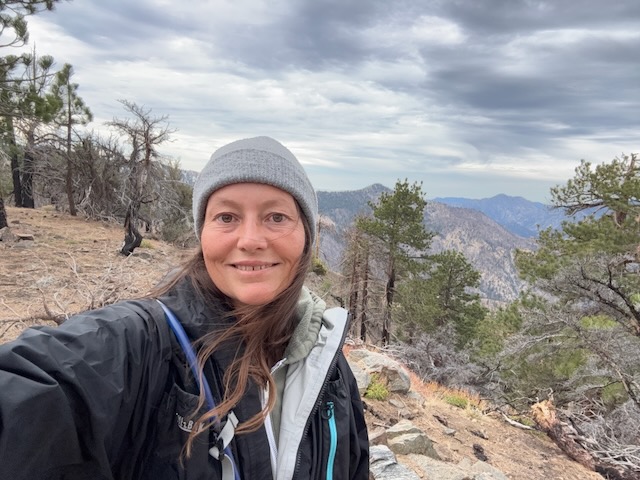
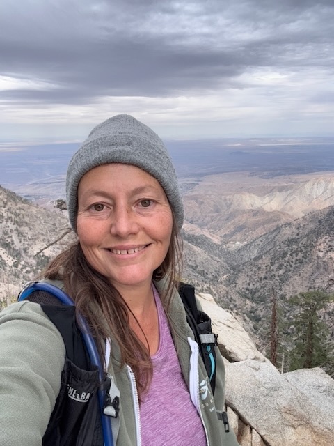
It was about 12 noon when I reached the summit of Mount Williamson Elevation 8215! I had to backtrack a bit from Pleasant View Ridge, which had been truly a pleasant gazing off in all directions.
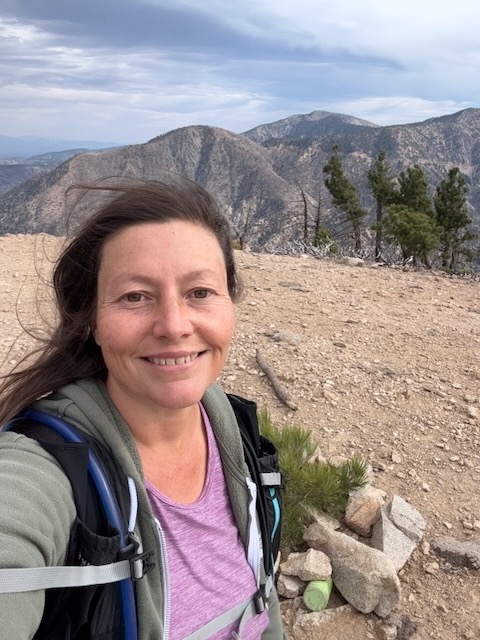

It truly is a beautiful summit, which reminds me a bit of Mount Baldy, since it is mostly devoid of trees to obscure the view.
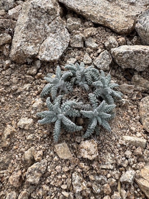
Unusual alpine plants grow at the highest altitudes like this.

After enjoying the beautiful views, I decided to head back, eventually getting back on the PCT, taking it back to the trailhead at Islip Saddle.

Until next time Mount Williamson, and Mount Lewis!
I love these mountains and here are a few more places I have visited within the San Gabriels: Mount Waterman, Pacifico Mountain, and Josephine Peak.
I hope you enjoyed reading this, and it is helpful in knowing what to expect, should you decide to visit here.
Weekly Recap
I logged over 34 miles of hiking this week. I have been back to hiking everyday from 2-6 miles usually, and it really does add up, all the miles. It feels good to be able to get in the miles once again. A year ago was a different story, but so much healing has taken place. I am truly grateful for this, because I am getting outside once again, with frequency. Ask me if I like to hike everyday and the answer is yes.
Last Thursday I hiked the Talega Trail, for about 5 miles, taking in the views of the wilderness of the Cleveland National Forest.
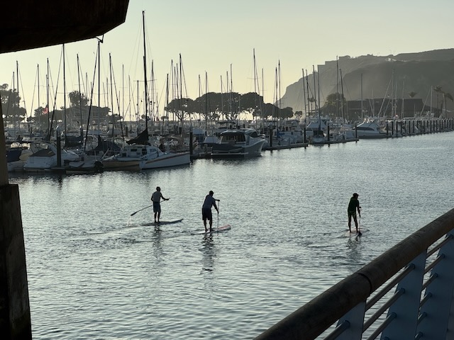
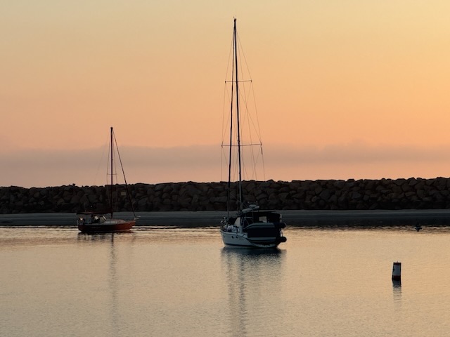
Then on Friday I headed to Dana Point headlands, at sunset for a peaceful 4 mile walk around the harbor.


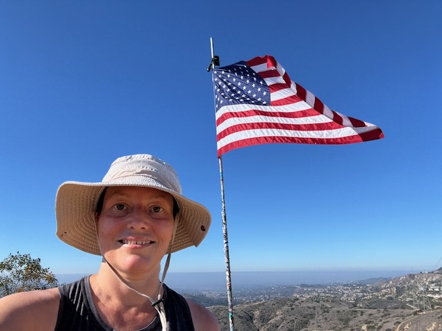
On Saturday I headed to Santiago Oaks for a 4 mile hike to the flag to celebrate Veteran’s Day weekend. Thank you veterans for your service and for my freedom.

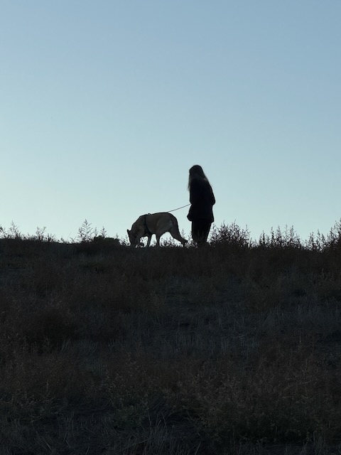

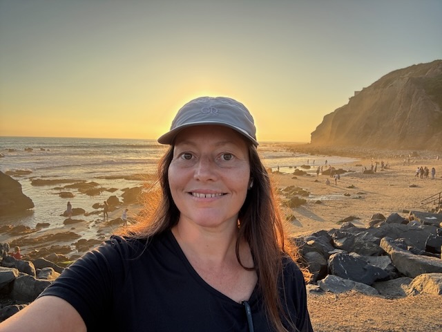
Then on Sunday I did a short 1/2 mile morning beach hike with my pup, before hiking the Ridgeline Trail for 4 miles at sunset.

On Monday, I was able to make it up Harbor View Trail in the hills above Dana Point, squeezing in a 2.5 mile hike, at sunset, making it back to my car at dusk.


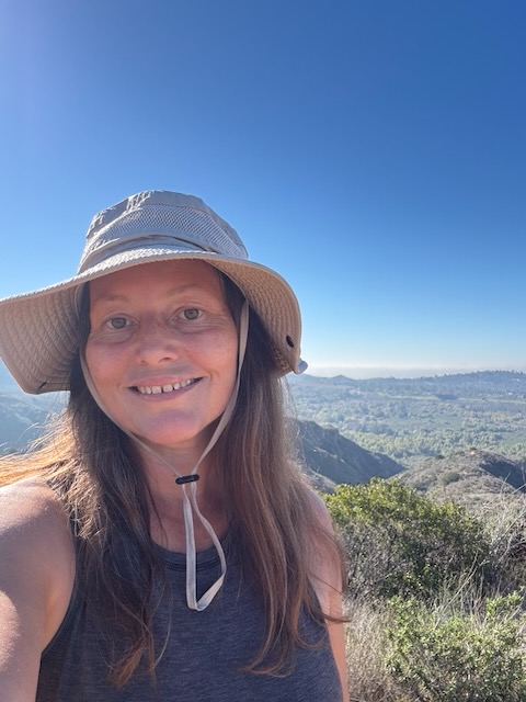
On Tuesday I met up with friends, one of whom is a veteran, for a Veteran’s Day hike through the forest of Wood Canyon, up along Mathis Canyon, and back down the West Ridge on to Cholla Trail in Aliso and Wood Canyon’s Wilderness Park. It was a 7 mile loop hike with about 1000 feet of gain.
I also made experimental Kale Chips that morning. I mean why not? I used almond butter, spices, and nutritional yeast. Then I dehydrate them. It’s easy! Cooking and baking are another of my hobbies.
…and then Thursday and I got in about 5.5 miles between hiking to Mount Lewis and Mt Williamson with 2200 feet of gain.
After a rainy Friday, that evening I took to a paved trail, for a quick 2.5 mile post rain walk along the Santiago Creek Trail, which runs from Santa Ana, all the way to Anaheim Hills.
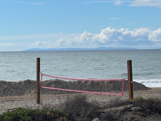

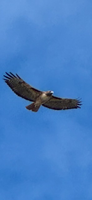

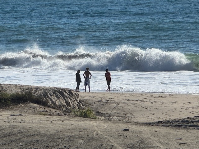
My week came to a close with another 3 mile beach hike, that was short and sweet, where I did some hawk watching and wave watching (were huge).
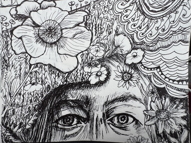
My Artistic Side
It is more than a side. I can now say, I am an artist. We are all made for a purpose. Mine was revealed to me in childhood, since I loved to draw. I studied painting in junior high, and attended a magnet high school, where my focus was fine arts. I continued to develop a foundation in college. Then I just stopped. This week I have been drawing a lot. I kinda put being an artist on hold, for reasons I better understand now as an adult.
Why I Stopped Creating Art
When I went to art school, the teachers were not usually very encouraging about the potential careers you can have in the art field. They made it out to be a very difficult way to make a living. The whole starving artist lie we get told, which I believed. You can be starving in any profession. So much was unknown back then. We did not have Chat GPT and communications were not what they are today, where the answers are available in an instant. So my excuse for not believing being an artist was a valid career earlier in life were multi-fold.
But I now know there are so many opportunities for artists, if you stay true to yourself, develop a personal style, and continually develop yourself as an artist, you can succeed. So I am just drawing everyday, resurrecting my art bin, dusting off art supplies from so many years ago, to see what is still viable. It is a process, and I am just trusting that my true purpose will be revealed when I am true to myself.
As a hiker, I explore the wilderness, gazing out on God’s creation, always inspired by that which is awesome and perfect in its own way. The wilderness is perfectly imperfect, in all its many forms. Being outside within it reminds me not to be the judge of myself, and my talents. We are all created in his image. I am no longer allowing “the world,” to be my judge. I am going to use the gifts I was given for good.
For we are God’s masterpiece. He has created us anew in Christ Jesus, so we can do the good things he planned for us long ago. - Ephesians 2:10
Leave No Trace
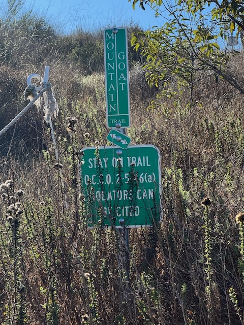
Just be sure to come prepared and follow Leave No Trace principles to keep the wilderness pristine for future hikers.
About me
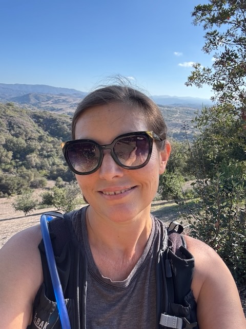
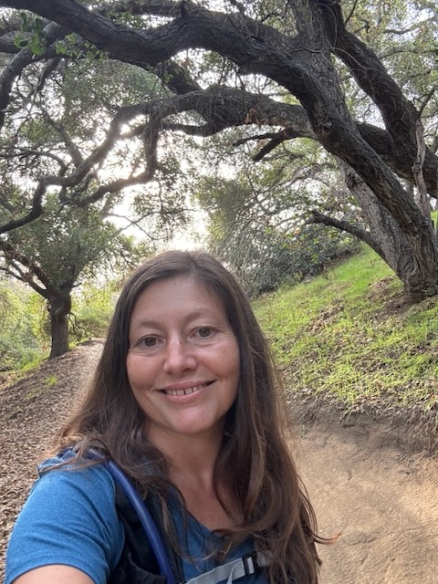
I’m Serafina! I’m a writer and California girl who loves to go exploring. Hope you will get outside today, breathe some fresh air, and be happy!
Like and Subscribe to my Channel!
Follow my Journey @serafinabenjamin
Follow along on My Youtube Channel where I post videos!
Disclaimer:
The work on this blog is my opinion and my opinion alone and I am not responsible for the outcome if someone were to apply these thoughts to their own life. All text and photography copyright 2025 by Serafina, all rights reserved. Information and opinions provided are kept current to the best of the author’s ability. All readers’ usage of the ideas and opinions presented in the blog, are at their own risk. Be aware of the possible dangers of hiking, surfing, walking, cooking, and other activities, which may take place indoors or outdoors. By reading this, you agree not to hold the author or publisher of the content on this web site responsible for any injuries or inconveniences that may result from reading the blog, or partaking in any activity mentioned in the blog. Read the blog, and use its ideas, if you so desire, at your own risk.
