
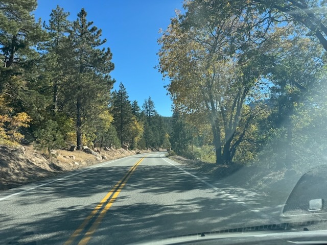
I began my drive to Big Bear later in the morning than I usually would. By 10 am I was heading up the narrow winding scenic byway, approaching the mountain towns of Running Springs and Arrowbear. The leaves of the sycamore trees were turning golden and fall was here in the mountains.
I made it to Big Bear Lake, driving along the north side of the lake before making a left heading up Rim of the World Drive, an unpaved mountain road. I took my time driving about 10 mph, occasionally avoiding ruts. After about a mile or so I was at the trailhead.

There was hardly any parking here, and what was available was not designed for normal cars. I parked at the corner in front of the signage, as I had done before, when hiking Crafts Peak.
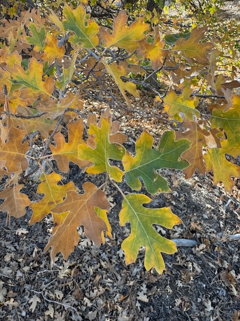
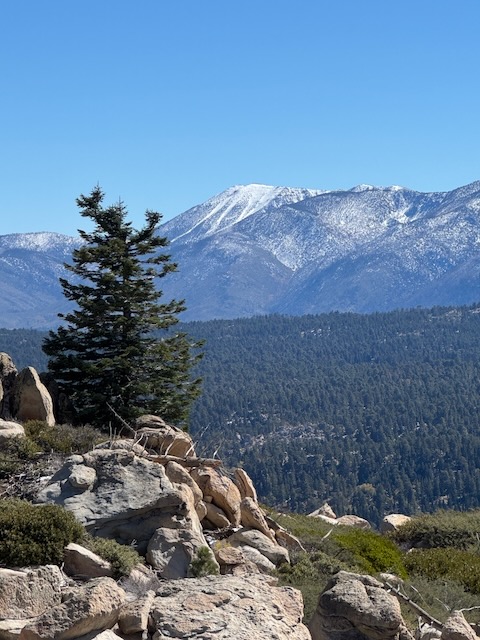
It felt great to be out here once again, during peak fall colors. It was a sunny day with bright blue skies, so the conditions could not have been better for enjoying all this.
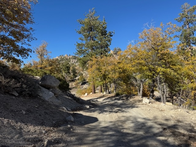
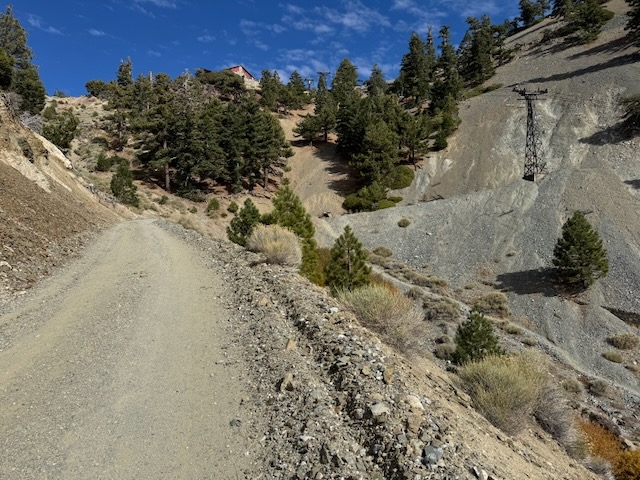
I headed up the wide paved road to the Butler Peak Fire Lookout. The road is also a popular OHV route, and I started to be passed by multiple off-road vehicles.

The landscape was dry and parched, characteristic of fall in California, but brightened by the flecks of color, as the leaves changed their shade.

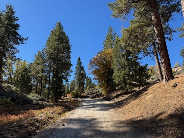
The landscape here was quite peaceful despite the occasional traffic pouring through.

There were occasional forest service road signs, such as this one marking “2N13.” The 2N corresponds to the township as part of the Federal Township and Range Survey System, and the 13 is the number of this road.
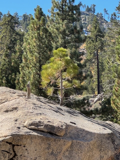


The trail has a gradual incline, and in the distance were interesting rock formations, a mix of sunny open spaces, and shaded forest.

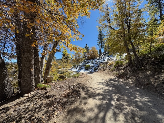
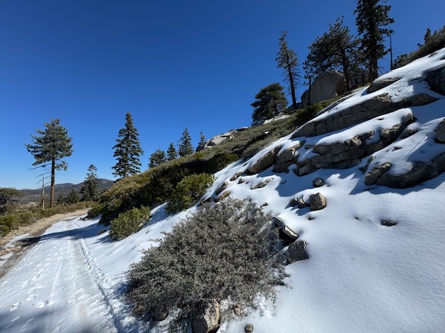
After hiking for about an hour, I began to see some snow alongside the road in spots. At this point I passed the first hiker, a solo woman, who had just visited the peak.


As I continued onward there were stunning views of snow capped peaks, and I was so fixated on the views that I missed my turn, since there is no signage, as the trail made a sharp left. Multiple OHV drivers had sort of blocked the view as well, since they stopped at the locked gate, having a party there.
The trail makes a sharp left off the road and begins the last 2.5 mile climb to the summit. At this point the road was closed to traffic, which was a blessing.


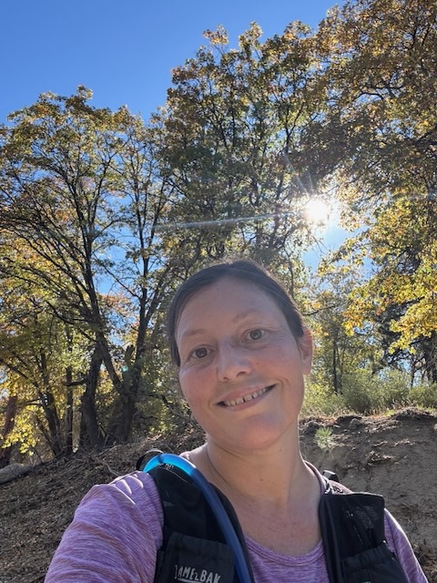
I was feeling pretty good on this hike after experiencing knee issues throughout the last three months. I knew there was not much steepness to this hike, which is one reason I chose it. Slow and steady wins the race. I may not have been going fast, but I was out here. That was good enough for me.

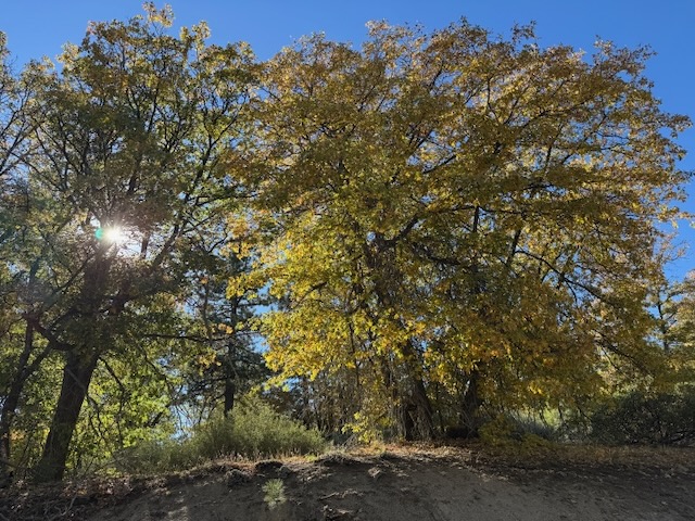
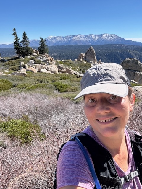
The higher I climbed it was a mix of more snow, fall colors, and was very serene. I remembered mentioning this hike to multiple people, who mostly thought it was “just a fire road.” Well, that’s not how I see it.
The width of the trail does not necessarily predict the beauty. Hiking Mt Baldy Road to the notch, is quite enjoyable, despite being a fire-road. I enjoy gazing at the dynamic drop offs, the precariously placed rocks, and the excellent birdwatching. I see many mountain bluebirds there, all of which makes it worth it to me. Beauty is all in the eye of the beholder.
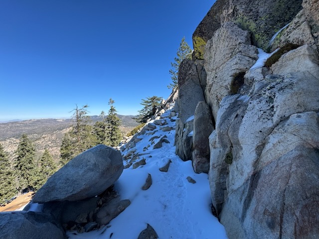
The scene grew ever more dynamic the higher I climbed.
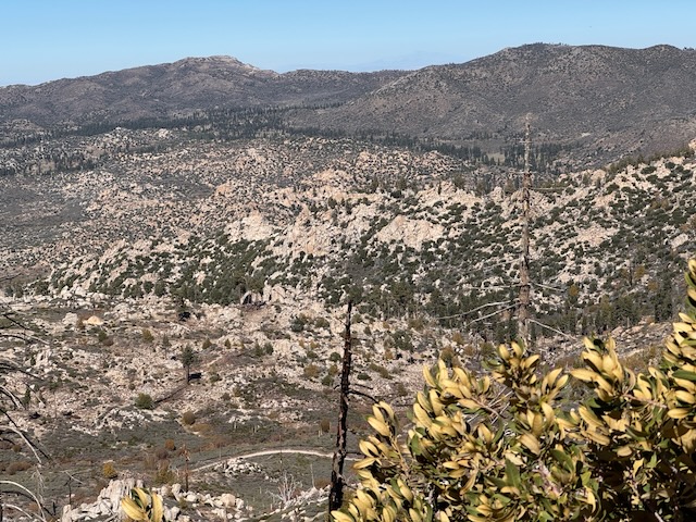
The view to the north, toward South Peak and White Mountain, an area mostly accessed by OHV drivers.
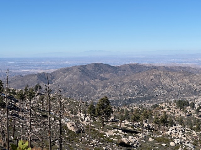
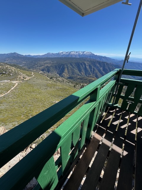
But the views toward Mount San Gorgonio to the south from this point were absolutely epic.
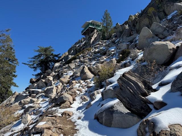
By 1:30 pm I had reached the fire tower. All that was left to do was climb the switchbacks, which were covered in snow.

This would be my first snow hike of the season. I came prepared with microspikes for this reason. On the way up I did not feel I needed them. I knew I would be wearing them on the way down though.
The first few steps of the fire tower were caked in icy sheets which I kicked off.
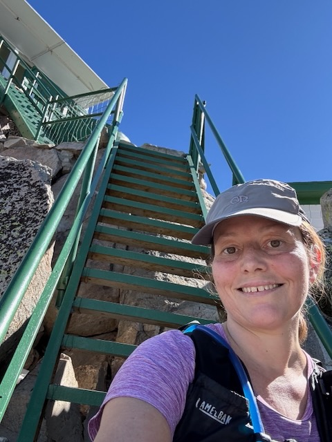
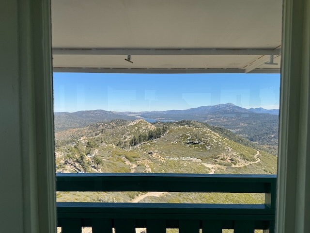
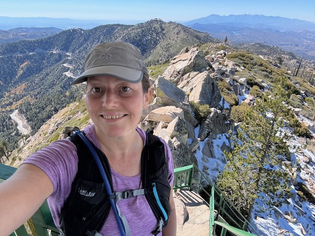
I had made it to Butler Peak (Elev 8435 ft)! It felt good to make it to this tower, which I had been dreaming about visiting for at least a year or two, since I first became fascinated with these vintage fire towers. Sadly I never made it to the one on Miller Mountain, nearby, before it was claimed by the line fire.
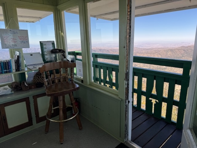
I was greeted by several friendly folks, who staff the tower. They gave me a grand tour of the place. They told me I was the fourth visitor that day. I was astounded that more people did not visit here in a day.

The tower has everything one would need to survive up here, while scouting for fires. There was a gas stove, and a wood stove. Some items appear to have been brought, such as this backpacker stove.
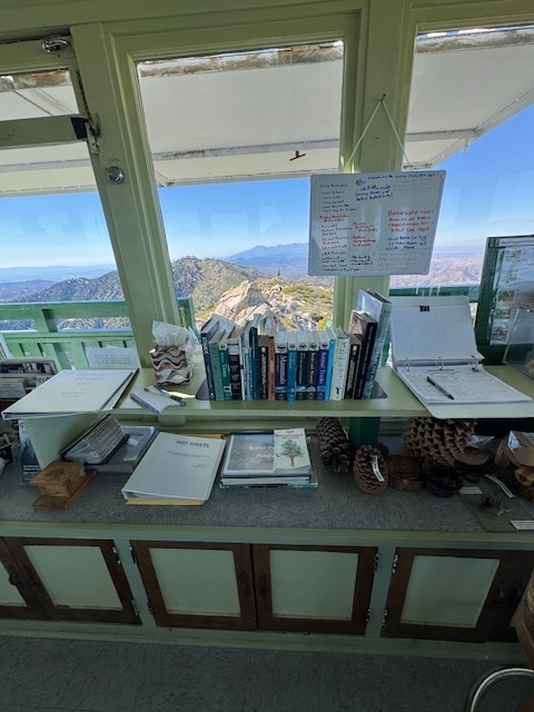
There was a selection of books to read about, you guessed it, hiking and the outdoors. Those are definitely my cup of tea. There also were notes on the conditions and a visitors log.
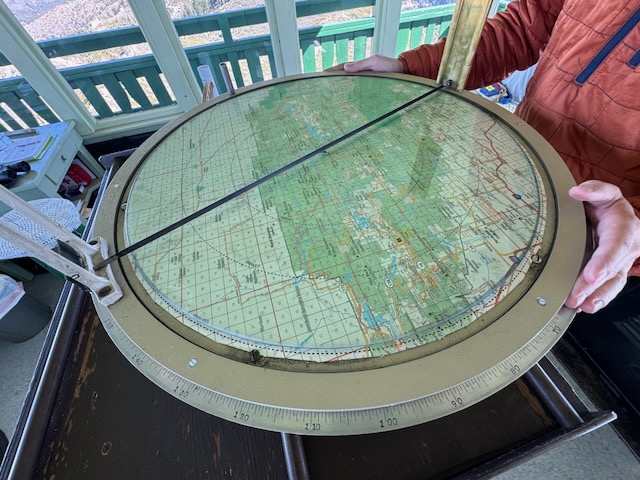
Possibly most intriguing was how the firefighters know how far away the fires actually are, and pinpoint their location, through this mapping tool.

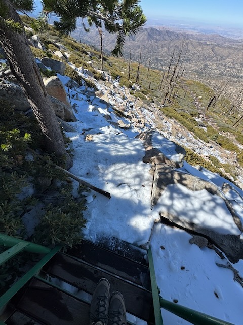
I cannot picture a better place to wake up in the morning. They say this fire tower is known to have the best 360 views of all the towers and I must agree with this statement.
I would never get tired of looking out a window like this. Sign me up!
The tower is in phenomenal shape, and has been well maintained.
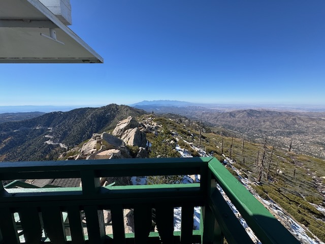
Anywhere I walked along this catwalk, there was some new scene to marvel at.
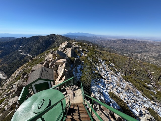
I was sad to leave so soon, but after spending about 30 minutes there, I had to get on the move. I was supposed to attend a birthday celebration that evening, so I bid farewell to both of my two tour guides, and Butler Peak Fire Lookout. I put on my micro-spikes as soon as I was down the ladder for the descent, since it was icy on this shaded slope.
The micro-spikes then came off for the remainder of the hike. I headed back down the sometimes snow covered fire road, and made it back to my car by about 3:30 pm. All in all it was a beautiful day in the wilderness.
Until next time Butler Peak!
I hope you enjoyed reading this, and it is helpful in knowing what to expect, should you decide to visit here.
Leave No Trace
Just be sure to come prepared and follow Leave No Trace principles to keep the wilderness pristine for future hikers.
About me
I’m Serafina! I’m a writer and California girl who loves to go exploring. Hope you will get outside today, breathe some fresh air, and be happy!
Like and Subscribe to my Channel!
Follow my Journey @serafinabenjamin
Follow along on My Youtube Channel where I post videos!
Disclaimer:
The work on this blog is my opinion and my opinion alone and I am not responsible for the outcome if someone were to apply these thoughts to their own life. All text and photography copyright 2025 by Serafina, all rights reserved. Information and opinions provided are kept current to the best of the author’s ability. All readers’ usage of the ideas and opinions presented in the blog, are at their own risk. Be aware of the possible dangers of hiking, surfing, walking, cooking, and other activities, which may take place indoors or outdoors. By reading this, you agree not to hold the author or publisher of the content on this web site responsible for any injuries or inconveniences that may result from reading the blog, or partaking in any activity mentioned in the blog. Read the blog, and use its ideas, if you so desire, at your own risk.
