My goal for today’s hike was to explore the Waterman Mountain loop, that sits within a scenic wilderness area of the San Gabriel Mountains. The trailhead sits along SR-2, the Angeles Crest Highway, and is a bit out of the way. It is well past Chilao Campground, and Mount Williamson, along with most of civilization. The highway had been closed for repairs for sometime, which made visiting here again exciting.
The PCT passes right by Waterman Mountain, and it’s remnants of a ski resort. Mount Waterman resort was established in 1939 by the Newcomb family. The peak is also known as “Lady Waterman’s Peak, after the wife of pioneer Robert B. Waterman.”
This mountain has been known to claim lives, mainly in winter-time, when a woman went hiking solo after a snowstorm in March. More recently a woman disappeared from this area and still has not been found.
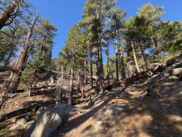
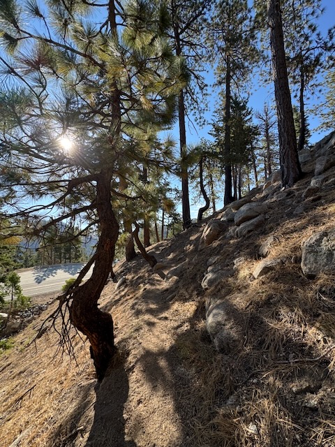
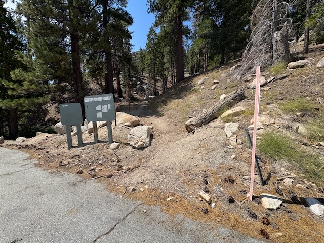
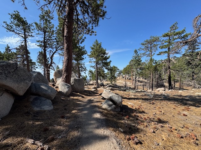
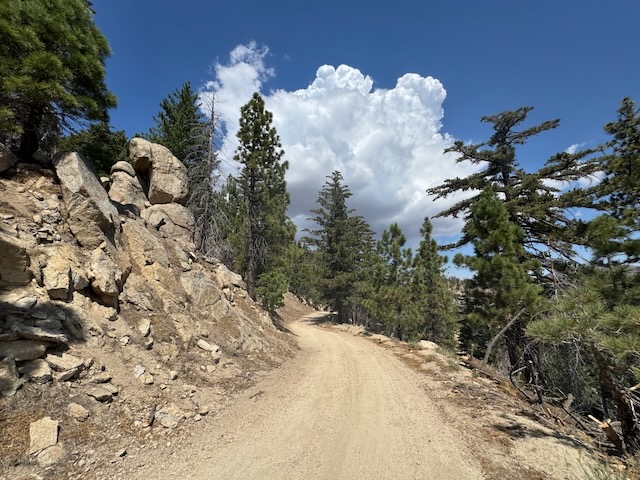
I began my hike at the trailhead located along Angeles Crest Highway, SR-2. The first part of the hike is within a shaded forest, as is much of the hike.
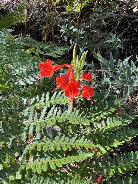
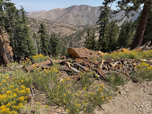
There were some wildflowers in bloom, since spring blossoms in August at high altitude.
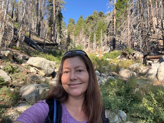
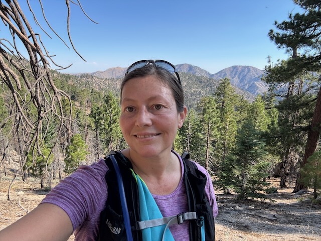
I was feeling optimistic since I had not hiked in weeks, since hurting my knee. I could walk, but stairs were still a problem. I heard this is a fairly easy peak, so I was hopeful I would do ok. However long I hiked, I was grateful to be in the wilderness once more.

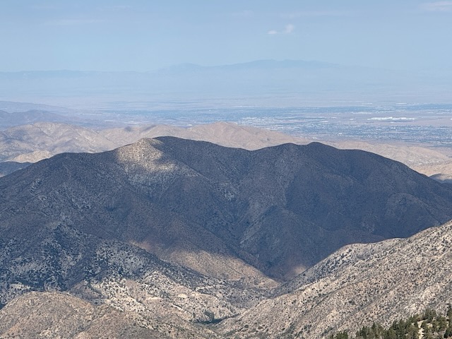
As I climbed higher, the adjoining peaks such as Mount Baden Powell, came into view.
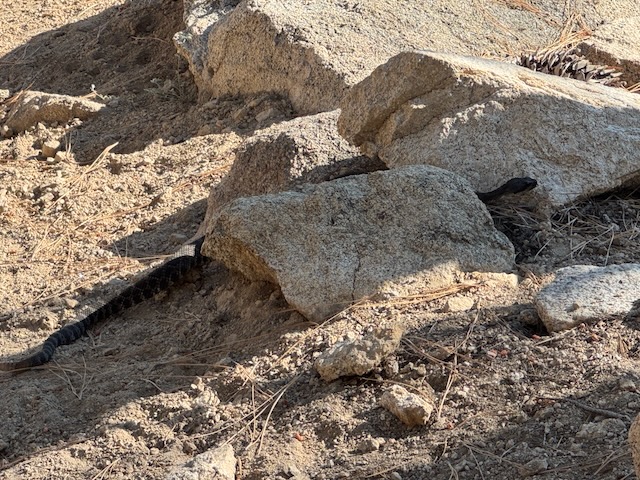
Not fifteen minutes into my hike, I got up close and personal with a giant rattlesnake, a mere foot from me, coiling and readying itself to strike. I ran off, and after I was far off, it began to then shake its rattle. It was in the shadows and I did not see it at all, when I walked next to it, since it was camouflaged. Fortunately for me, it was just a close call.
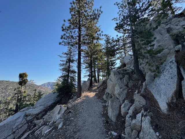
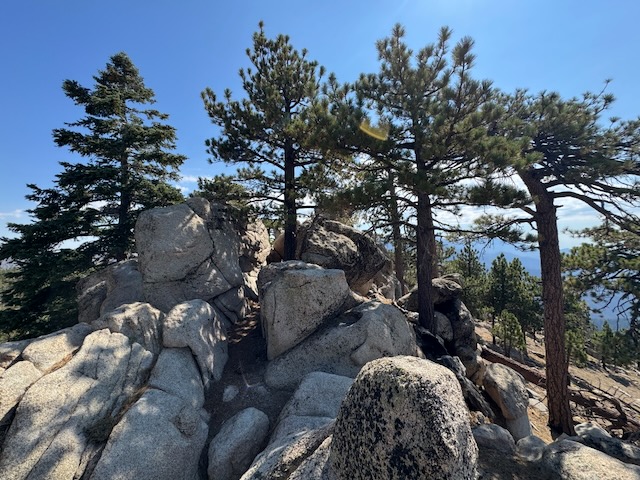
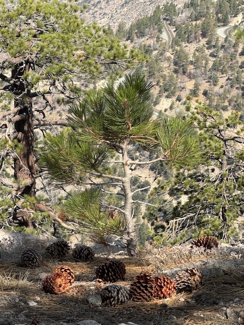
The scenery became increasingly rocky, the higher I climbed.
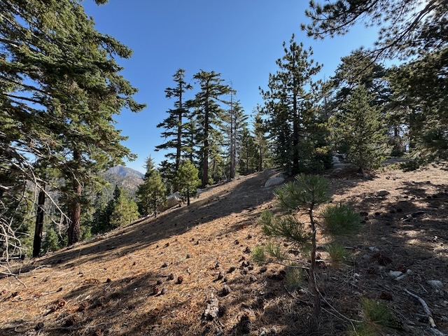
After a few miles, by 9am I was still walking within a shaded pine forest.
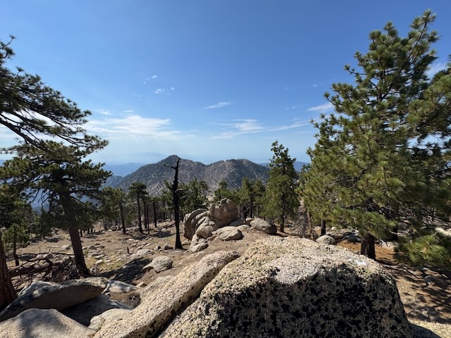
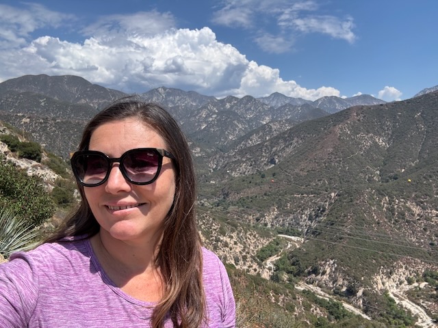
Along the first ridge, were stunning views of the San Gabriels.
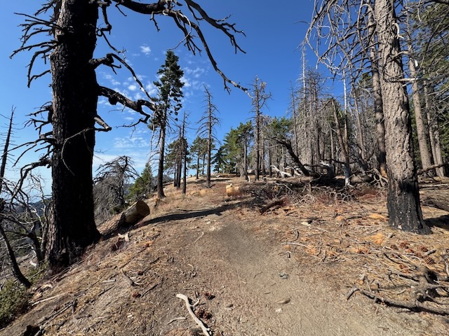
The terrain began to change a bit, as I ventured through a charred section of trees.
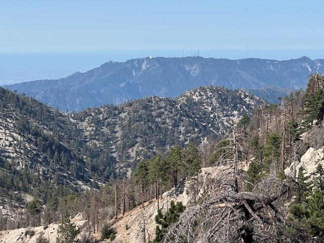
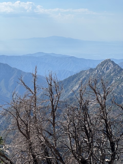
It was easy to spot Mount Wilson off in the distance.
I was feeling pretty good so far, and continued on, my main concern shifted from my knees to looking out for snakes.
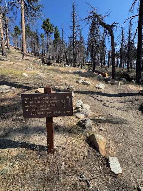
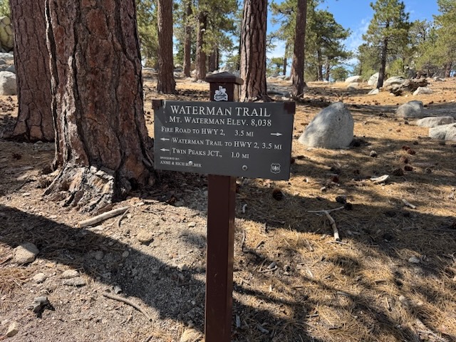
By 9:30 am I had reached signage pointing the way to Waterman Summit and also Twin Peaks.
Twin Peaks is known to be a very challenging hike involving climbing most of the way up Waterman Mountain before then dipping back down into a canyon, which you must climb back out of to make it back to the trailhead. Due to the nature of it, I have not done it yet. You expend a lot of energy climbing, and a descent is not usually an issue afterward. When climbing to a summit, you can easily turn around and head back if you run out of steam. However, if you must climb out of a canyon after running out of steam, then you would be in trouble. That is one reason I avoid hikes like Twin Peaks. An ascent at the tail end of a tough hike is somewhat soul crushing not to mention dangerous. Twin Peaks has the same gain as hiking Mount Baldy, but the uphill at the end makes it more challenging. Also, I have heard the trail is not well maintained to Twin Peaks. So hikes like this one I will avoid doing solo. One such hike with an uphill at the end after reaching the peak I have done was Pyles Peak in San Diego. I did that one with a friend. Another nearby hike, with an uphill after a peak is Ross Mountain, by Mount Baden Powell.
By 10 am I was nearing the summit, and the trail began to level out.
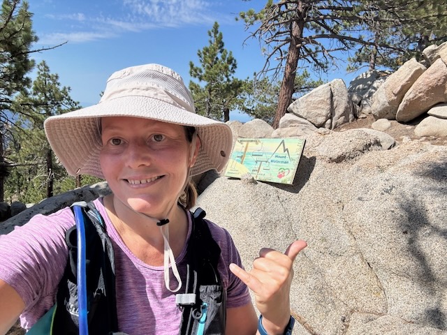
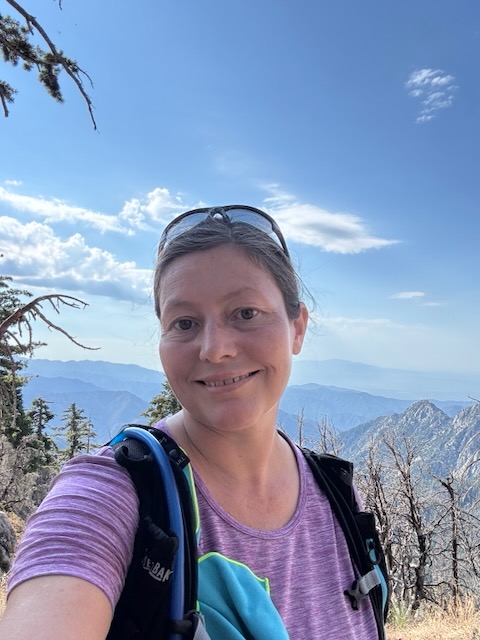
By 10am I had finally arrived at the summit of Waterman Mountain, elevation 7983 ft. It had taken just 1 hour and 45 minutes to reach the peak, without breaks.
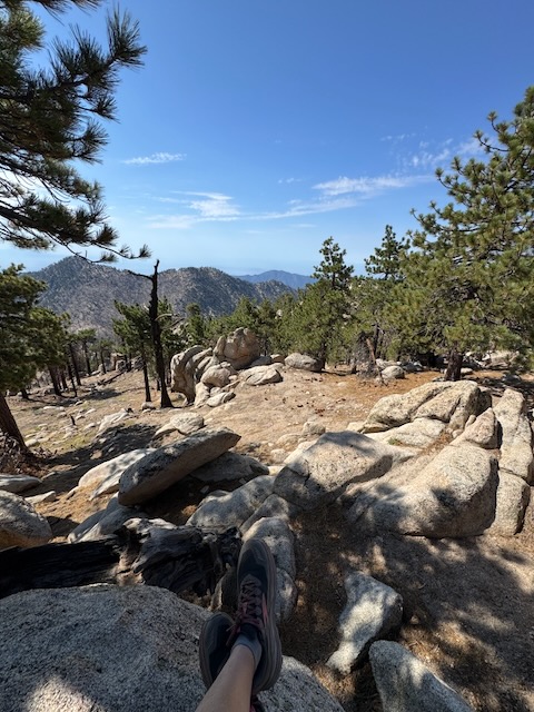
I sat atop the many large rocks admiring the view.
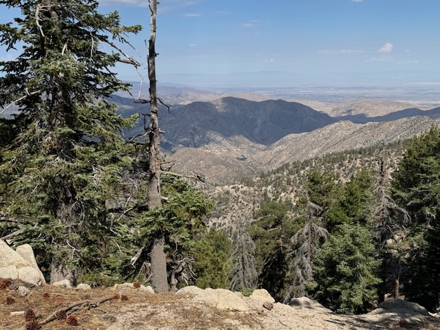
The summit is full of trees, yet still has awesome views to the south.
While I was taking a break, atop a large boulder admiring the view, another hiker, only the second I had seen that day, walked up and asked me if I was alone. It felt like a strange thing to ask at first, but she quickly elaborated. She was part of a search party, to recover a woman named Monica who vanished hiking alone enroute to this peak along this trail, several months prior.

After contemplating my own life, and choices, along with the woman’s disappearance, I wished this hiker well after her hiking buddy joined her, before continuing on back. Somehow, it felt strange to hang out there much longer after that conversation. She had implied being out here alone was not advised.
The way was clearly marked by signs, and I continued the loop back, along a fire road.
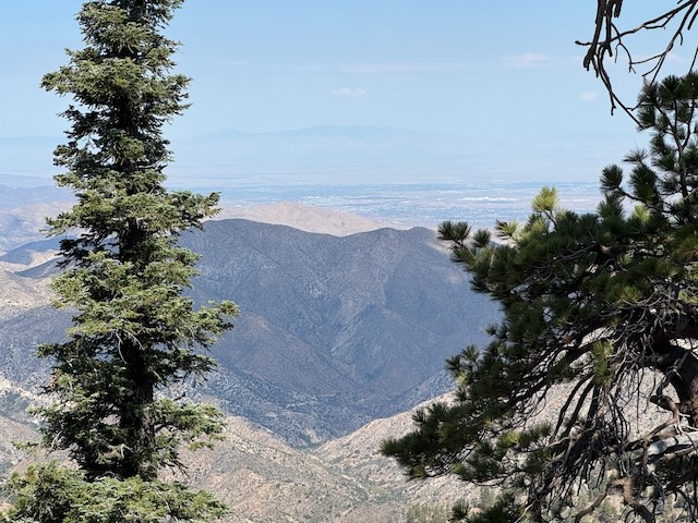
As I wound my way along the backside of Mount Waterman, where there were scenic views of the desert side, and adjoining peaks.
I was surprised I did not see more hikers along this trail. I spent a bit of time searching for the missing hiker as well, but did not notice her red flannel or green backpack mentioned. It was a very sad thought, and there were a thousand different scenarios which could have occurred. I hope she is found so her family has closure.
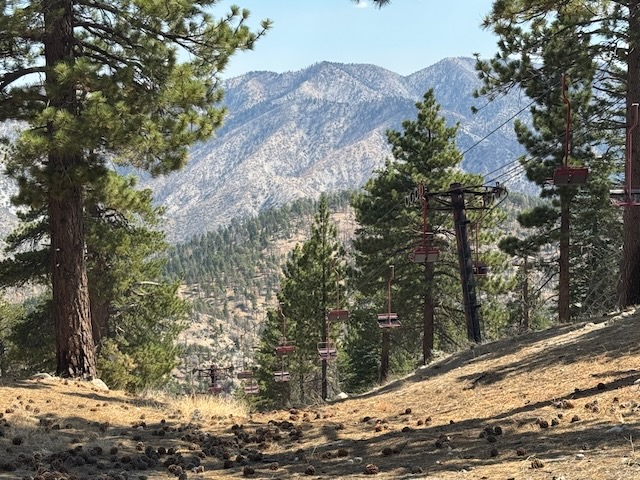
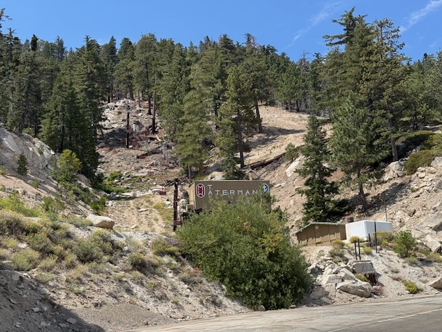
I continued past the now defunct ski resort.
It was a beautiful sunny August day, and I felt grateful to check a new trail off my list of places.
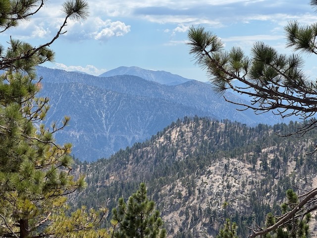
In the distance was looked to be Mount Baden Powell, further along SR-2.
The sun was out and it got very warm by 11:30 as I made my way back.
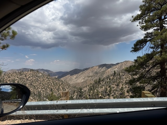
I noticed a cloudburst over “Cloudburst summit,” on the drive back
All in all, a beautiful day in the San Gabriels.
I hope you enjoyed reading this, and it is helpful in knowing what to expect, should you decide to visit here.
Leave No Trace
Just be sure to come prepared and follow Leave No Trace principles to keep the wilderness pristine for future hikers.
About me
I’m Serafina! I’m a writer and California girl who loves to go exploring. Hope you will get outside today, breathe some fresh air, and be happy!
Like and Subscribe to my Channel!
Follow my Journey @serafinabenjamin
Follow along on My Youtube Channel where I post videos!
Disclaimer:
The work on this blog is my opinion and my opinion alone and I am not responsible for the outcome if someone were to apply these thoughts to their own life. All text and photography copyright 2025 by Serafina, all rights reserved. Information and opinions provided are kept current to the best of the author’s ability. All readers’ usage of the ideas and opinions presented in the blog, are at their own risk. Be aware of the possible dangers of hiking, surfing, walking, cooking, and other activities, which may take place indoors or outdoors. By reading this, you agree not to hold the author or publisher of the content on this web site responsible for any injuries or inconveniences that may result from reading the blog, or partaking in any activity mentioned in the blog. Read the blog, and use its ideas, if you so desire, at your own risk.
