In 2021 I obtained a permit to hike the JMT starting from Cottonwood Pass, late in the season, during the first week of September. I had been dreaming about hiking this trail for sometime. I knew all about the PCT, Kennedy Meadows, and the idea of entering the Sierra solo felt both scary and like a bold move to make, signaling to myself, I was no longer letting fear get in my way. I had all the gear, and was going to throw myself headfirst into an epic journey. But a large fire engulfed Sequoia Park that year, and my permit was sadly cancelled.
But I still wanted to hike the JMT, so in 2022, I was at it again, on the hunt for a permit. As time came to pass, I did even more research on the logistics of a JMT hike. I came to find, my original idea to start at Cottonwood Lakes late in the season, would be problematic. The reason being, the shuttle buses would cease running by the time I would finish in mid-September, making getting back to where I planned to leave the car in Lone Pine impossible, at least from Yosemite. So I knew I needed a different plan. I was not married to leaving Cottonwood Lakes, and was leaning more toward Happy Isles at this point. After all, that shaves off about 50 miles of hiking.
Still, I did not end up hiking the JMT that year, and opted instead for the High Sierra Trail, because I wanted to bring someone along. I was not sure I was ready for the 200 miles. I figured the High Sierra Trail could be a great intro to backpacking across the Sierra, and is about 70 miles. I thought the JMT could wait a year. But I never would get another chance at the JMT since I developed a back condition. I have kept on dreaming of visiting the Sierra in any way shape or form, and the time to visit Cottonwood Lakes had finally come. It was a miracle that I was here at all. You can never give up hope.
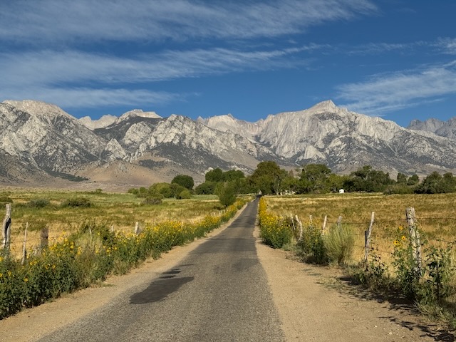
So after leaving Big Pine Lakes early in the morning, I drove south towards Cottonwood Lakes. By about 7:30 am I was turning right off Hwy-395 onto Lubkin Canyon Rd., a scenic country road, driving toward the Golden Trout Wilderness with Mount Langley off in the distance.

I made a left onto Horseshoe Meadows Rd. which I would be taking all the way to the trailhead, at Horseshoe Meadows, serving as the gateway to Cottonwood Lakes and Mount Langley.
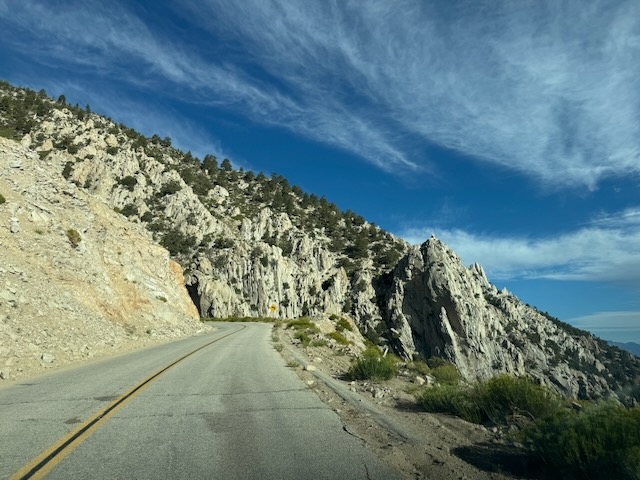
The road wound its way alongside towering cliffs, and had amazing scenery the entire way. I had to pay attention on this road, since there were no guardrails along much of it.

I arrived at the campground about 40 minutes later, and noticed the campsites were empty on a Monday morning. I knew I had arrived about 3-5 hours late for a Langley attempt. That aside I was so grateful to see this place, that had been on my mind for a long time.
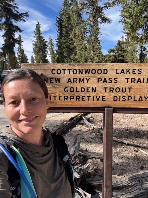

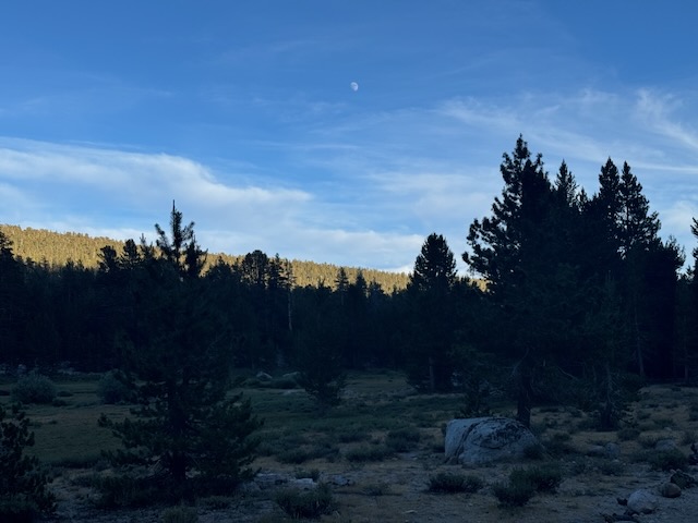
By 9am I had my gear organized and headed out on trail.

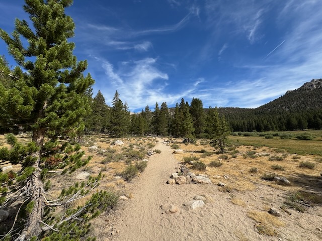
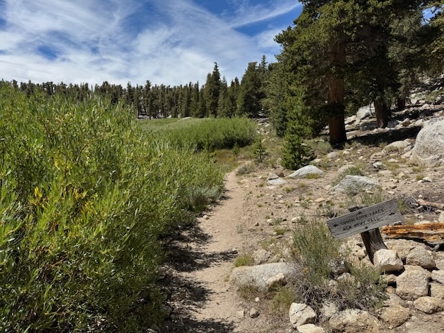
For the first 30 minutes of hiking, I was heading through a peaceful forest heading downhill. I know knew why so many people said the last mile or so were the hardest on this hike. Hiking uphill on the way back, after climbing Mt Langley or a long hike, would be a challenge. I crossed over my first water source, the first of many streams.
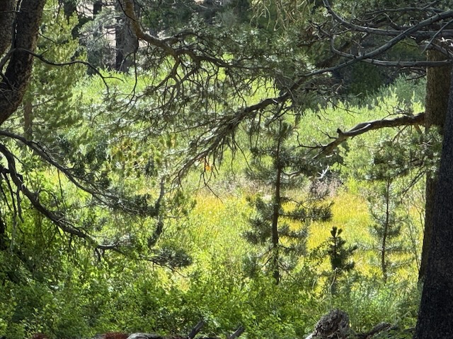
There were peaceful meadows along the first few miles of trail.

Soon, the terrain became more rocky, the higher I climbed, as I wove my way amongst massive boulders.
There were patches of peaceful sun filled meadows, flecked with pines, and clear blue skies.
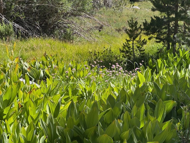
There were vibrant green marsh areas, filled with interesting flowering plants.

I finally crossed from the Golden Trout Wilderness into the the John Muir Wilderness.
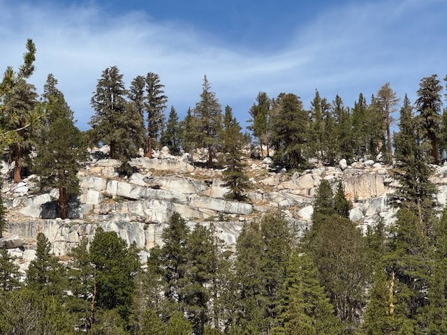
Trees were clinging precariously to granite ledges in the distance.
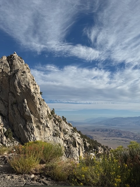
As I edged ever closer to the lakes, I noticed increasing cloud cover in the sky, and wondered if that indicated a potential weather event.
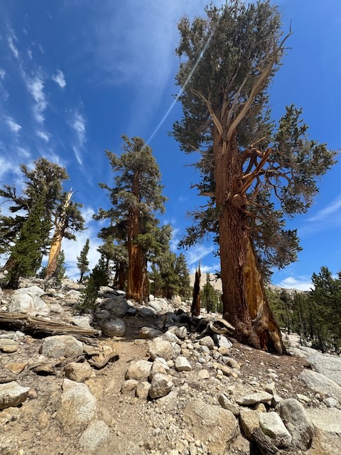
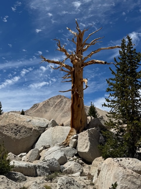
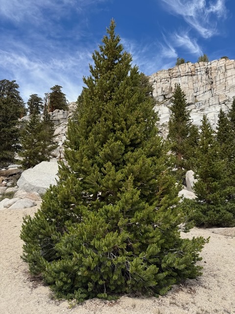
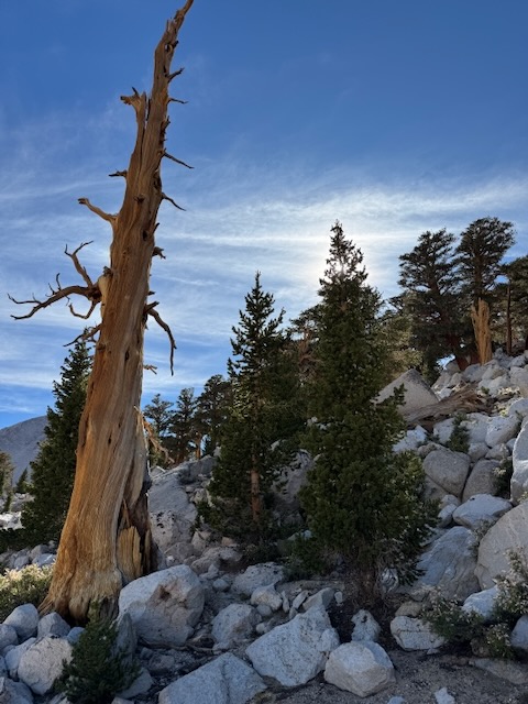
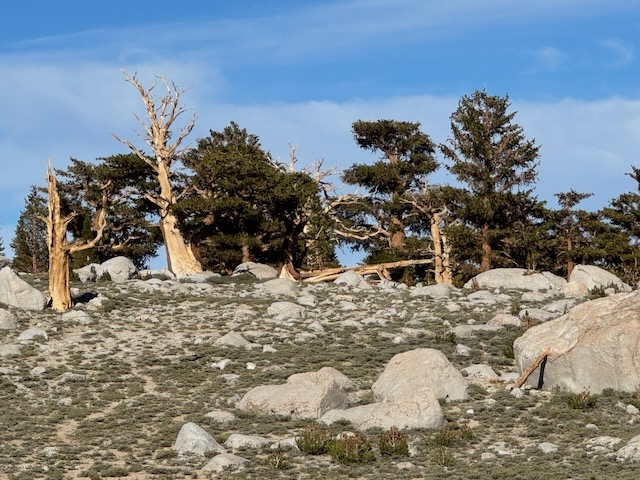
I was now well above 11,000 feet and with that came additional changes in the scenery, such as these ancient Limber pines which grow in the most unforgiving places, at high altitude.
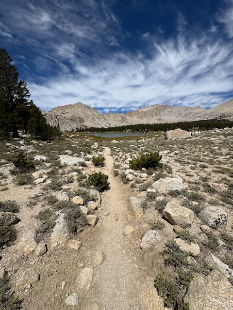
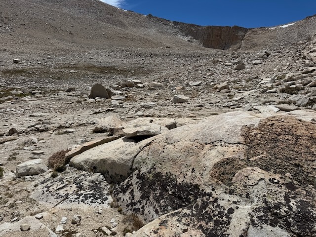
Just beyond these massive granite monoliths, would be the long awaited lake area of the hike.
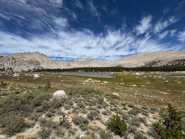
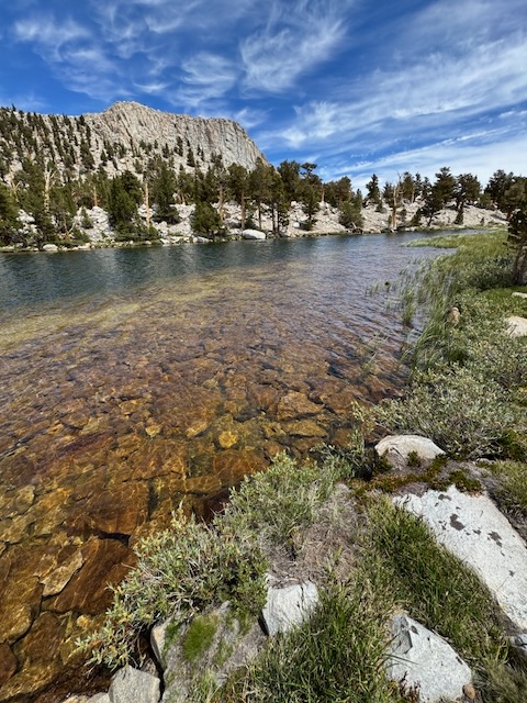
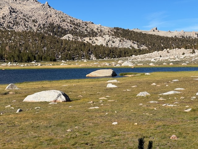
I had now hiked over 7.5 miles and climbed about 2000 feet of gain, to reach Cottonwood Lake #1.
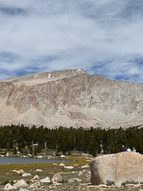
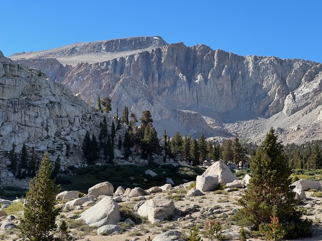
A huge granite bowl was before me, with Mount Langley in the distance.
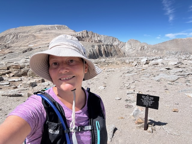
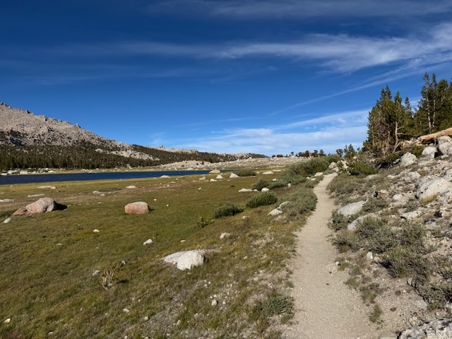
I hiked along the lake edging closer to New Army Pass, my destination for this hike. I knew the chances of summiting Mount Langley today were slim. I was already exhausted, yet I hiked on a bit further.
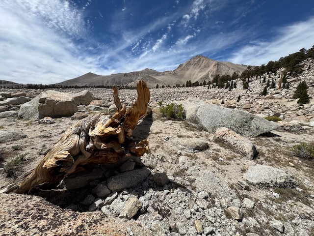
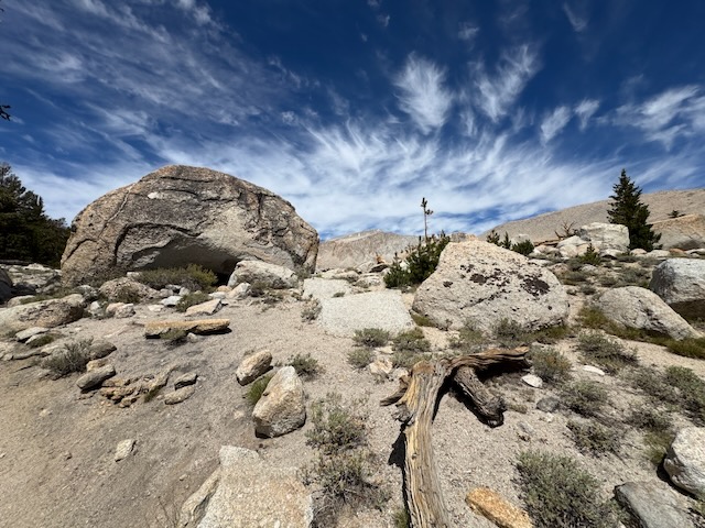
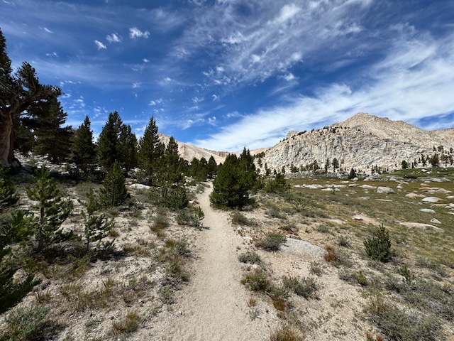
I passed Lake #1 and #2 and was bound for Long Lake, where I planned to fill up on water, and head up towards Mount Langley (still a glimmer of possibility). As I edged closer to the trail leading up to New Army Pass, I entered a field of boulders, and bare freestanding trees standing, looking more like sculptures than alive.
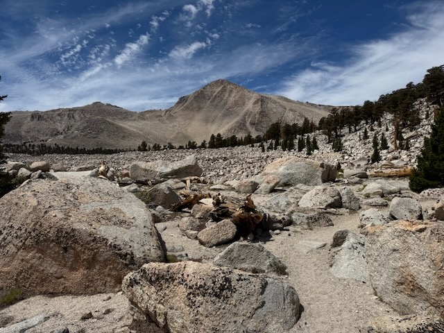
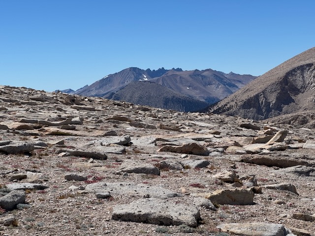
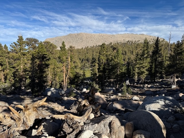
I started hiking through a field of boulders toward Cirque Peak.
It was a stark and beautiful place, where I truly felt I was in an alpine zone, surrounded by so much granite. The power that moved these boulders though. That is something to contemplate for a minute.

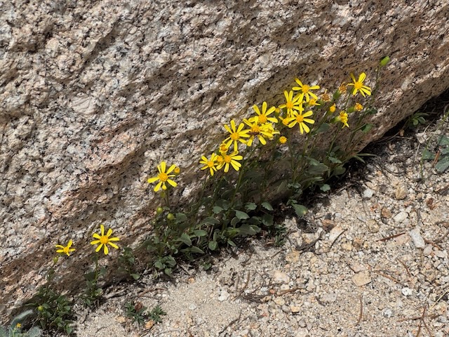
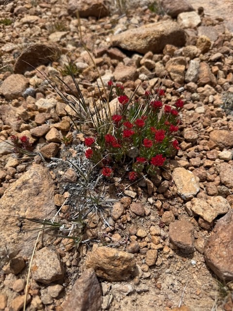
In spite of all this starkness, there were signs of life peeking out from the granite rock.
It was beginning to feel a lot like Christmas.

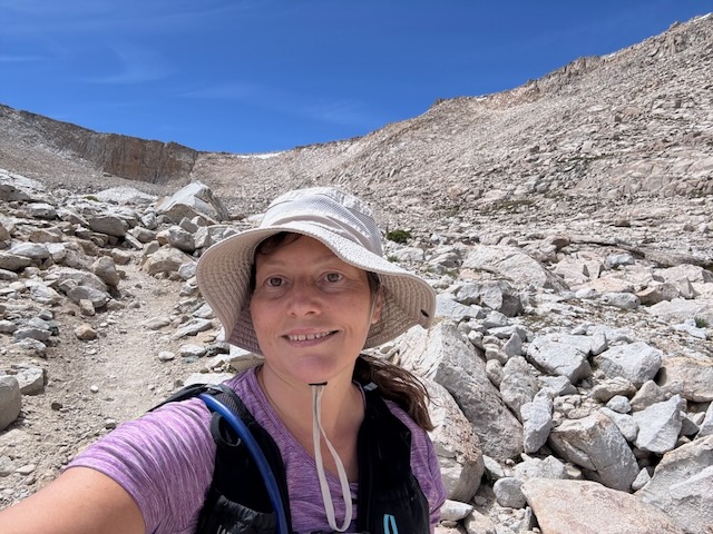
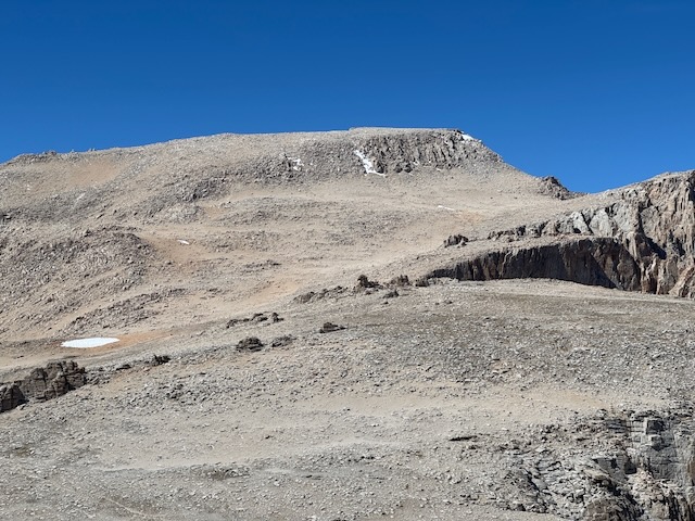
I had my first glimpse of my destination, New Army Pass up ahead. I was truly fascinated by the reddish granite face of this wall up ahead. I now had a better idea of where the trail was taking me, onto the ridge.
I crossed over Long Lake, and paused for about 30 minutes to fill up on water. This would have been an ideal camping spot.
After a bit more climbing, I was fully within a towering granite bowl, reminiscent of when I visited Guitar Lake and summited Mt. Whitney via the High Sierra Trail, on the backside of Mt. Whitney.
I was surrounded by granite rock, some precariously perched and in a perpetual state of falling and crumbling. I just had to navigate through this. The trail was well marked as I headed for the switchbacks.

Within this moonscape I would see the first of two marmots, who somehow have taken ownership of this unforgiving environment.
The beautiful scenery kept me feeling inspired the entire way, as I began making my way up the switchbacks, climbing higher.

I was on the home stretch now, having climbed at least fifteen switchbacks (lost count), and was now on the final few hundred feet of climbing up the pass. I had officially run out of steam, about halfway up to the pass. Maybe the altitude had gotten me. I had not been this high up in a long time. Still, I kept inching forward, taking small steps and frequent breaks, doing anything possible to try and make it up to this pass. The rocky uneven terrain made it even more challenging.
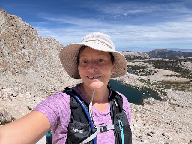
After thoughts of giving up two hundred feet from it, and hundred feet from it, one foot in front of another, I was now standing atop New Army Pass. I had hiked 9.5 miles to get here, from the trailhead. I was feeling both exhilarated and exhausted, almost completely out of steam. I knew I did not have anymore uphill in me and summiting Mount Langley would have to wait for another day, despite the near epic conditions. After all, my first Mt Whitney attempt ended up being a 15 miles roundtrip hike to Trail Camp and back, so I knew, sometimes you just need to accept it is not going to your day. Better safe than sorry. So I headed back.

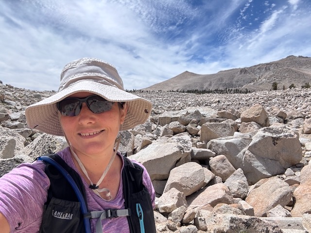
I had met two hikers, one younger one with an old school frame pack from Florida, and one much older gentleman from California, both backpacking their way to Mount Whitney together. The younger of the two was kind enough to snap this photo for me. I returned the favor. I did not really see many people along the trail past the lakes, so I had this mostly all to myself.
I had heard terrible things about going down Old Army Pass, due to how steep it was, and that trail runners would ski down it, sliding in loose rock. That did not seem like my cup of tea. I knew I was going back the way I came, down New Army Pass. I was concerned about even making it back due to my level of exhaustion, which was setting in. My saving grace would be that I know I make great time going downhill. Today, might be an exception though.
It was not about 3:15 pm, and late in the day when I began my descent, leaving this alpine wonderland behind. I could spot many day hikers in the distance, making their way back from Mount Langley, making long switchbacks down its face. So after briefly exploring the area around the pass, I bid New Army Pass and Mount Langley farewell.
I headed back the way I came, through the twisted maze of granite, and a small stand of hardy pines.
Once past Long Lake, and back at the lower lakes, I decided I needed a short break.
If I were able to backpack again, this is where I would want to campout.
It was not 5:30 pm, as I was finally departing the lake area, with all its stunning beauty.
I proceeded back through the dense forest, for the remainder of the hike.
The once sunny meadows were now moonlit, as sunlight had begun to fade, by around 6:30 pm. The last few miles included a true fight to stay in it. I felt completely miserable and was hiking in a daze the last 2.5 miles. My knees were hurting, and I felt unstable. I knew from how I felt and my slow speed, I had passed the point of exhaustion.
Time for Reflection
During this time I thought about what endurance athletes go through, and ultra-runners. I know I am far from one of those. I knew was not in shape to just throw myself into hikes like this, after being busy with work, not having time to put in the time to train. Hiking is like any sport. You just need to work up to things and put in the time. It does not count if you were in shape 2 years ago. What mattered was the here and now. But I needed to get back, and had a few moments where I was concerned for myself on the last few miles. I took many rest breaks, but with that, hoped to make it back before dark. I saw not one other hiker for those last two hours of hiking. I was truly alone out there, walking in the moonlight. I prayed my way out of this one, just trusting I would get carried through.

Car Camping
I made it back to the trailhead after sunset, well past 8pm. I crashed out, car camping, since I was in no state to drive. I slept poorly, and was in a lot of pain, from the inflammation of my knees, yet I was also too tired to search my car for motrin if that makes sense.
Heading Back Home
I drove home at 3am, feeling barely rested, and made it back in time for a 10am appointment I had. I am hoping next time, I can have more time for a road trip like this.
Recovery Mode
So, I ended up blowing out my knees for two months after this 19.5 mile trek. My left knee had just healed after over a month off of it, not hiking most of July. So now the right knee was completely inflamed. Lessons learned. Listen to your body. Don’t push it too far if you’re not in shape to do so.
Backpacking?
I decided the next time I am ultralight backpacking if I can work up to it, sleeping at the Lakes, and trying for Langley from there at 3 or 4am. I have been researching and think I can get my baseweight to 8-10 lbs. It’s ok to set goals, but how realistic they are depends on many different factors. No way to know if it will be possible, but it’s ok to have hope. Right now it’s just an idea, to hike Mount Langley. Perhaps next year. Only time will tell.
Despite some poor decisions on this trip, mainly in overdoing it, which could have cost me, I was grateful to visit this place I had long dreamt about. Until next time Cottonwood Lakes.
I hope you enjoyed reading this, and it is helpful in knowing what to expect, should you decide to visit here.
Leave No Trace
Just be sure to come prepared and follow Leave No Trace principles to keep the wilderness pristine for future hikers.
About me
I’m Serafina! I’m a writer and California girl who loves to go exploring. Hope you will get outside today, breathe some fresh air, and be happy!
Like and Subscribe to my Channel!
Follow my Journey @serafinabenjamin
Follow along on My Youtube Channel where I post videos!
Disclaimer:
The work on this blog is my opinion and my opinion alone and I am not responsible for the outcome if someone were to apply these thoughts to their own life. All text and photography copyright 2025 by Serafina, all rights reserved. Information and opinions provided are kept current to the best of the author’s ability. All readers’ usage of the ideas and opinions presented in the blog, are at their own risk. Be aware of the possible dangers of hiking, surfing, walking, cooking, and other activities, which may take place indoors or outdoors. By reading this, you agree not to hold the author or publisher of the content on this web site responsible for any injuries or inconveniences that may result from reading the blog, or partaking in any activity mentioned in the blog. Read the blog, and use its ideas, if you so desire, at your own risk.
