About Yosemite
Yosemite first became protected in 1864 and has been enjoyed ever since. Currently, it spans 1,200 square miles and is a true national treasure. I feel blessed to live in the state of California, home to places such as Yosemite National Park, a vast wilderness park first popularized by explorer John Muir. He started a conservation movement here, which would continue to this day. He once walked all the way to Yosemite from the San Francisco Bay, in the days when there were few defined trails, as a true trailblazer.
Clark Trail & John Muir Trail (JMT)
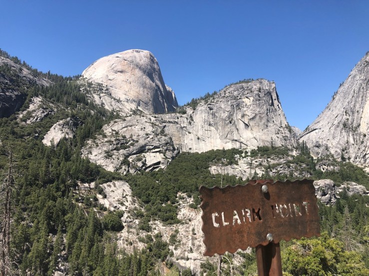
A few of the trails I have hiked in the park in past are the Mist Trail, John Muir Trail, and the Clark Trail. The Panorama Trail connects with the John Muir Trail at Clark Point, where you get your first glimpse of Nevada Falls after a strenuous climb from the valley floor. According to Outside Magazine, “Galen Clark was officially appointed the first Guardian of the Yosemite Grant, a position that he held for most of the next 35 years, accompanied John Muir, Ralph Waldo Emerson, and other well-known scientists, writers, painters, and tourists on outings around the park.”

Terrain
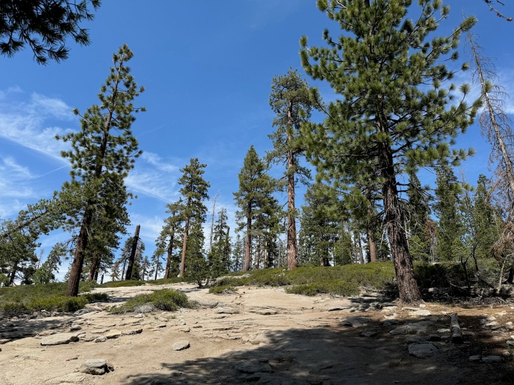
There is a rocky and rugged alpine landscape here, characterized by granite domes, with several tall waterfalls flowing through a deep valley, filled with forests, and meadows. There are distinct areas to explore, such as ancient giant sequoias, a vast wilderness area, and much more.
Crowd Factor
The crowds stream into the valley all year round, but the peak season is typically June through October, with July and August being the most crowded of all.
My Gear List
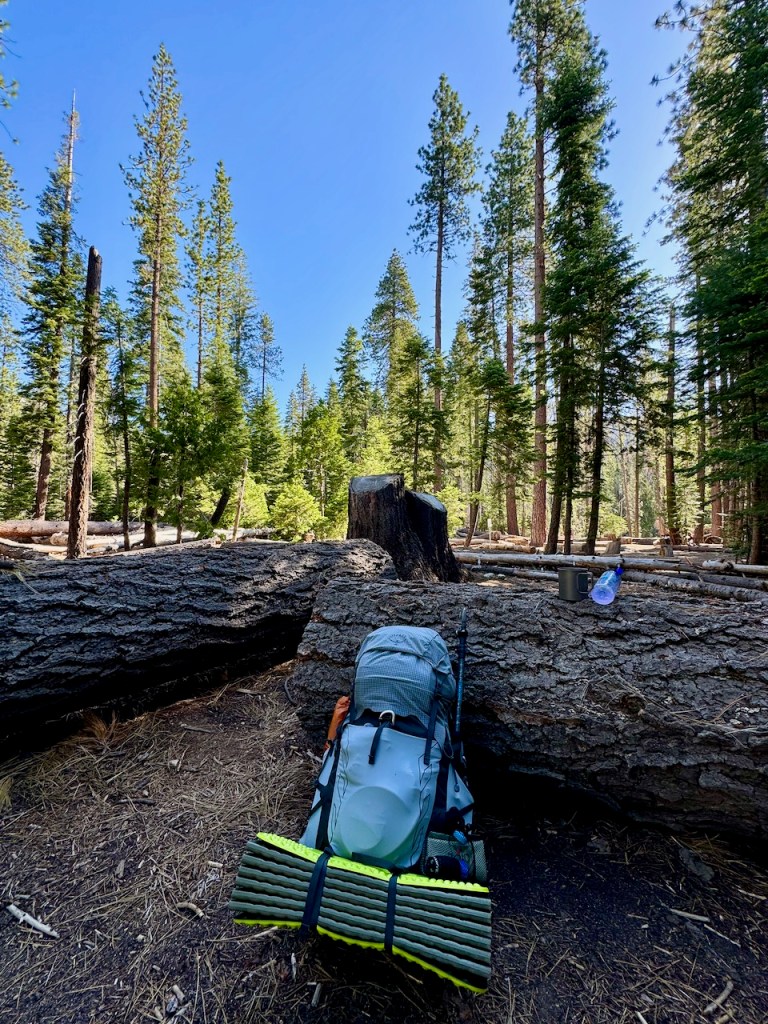
- Backpack: Osprey Tempest Pro (First time on trail)
- Tent: Big Agnes Copper Spur UL2
- Sleep Pad: Exped Flex Mat (First time on Trail)
- Sleeping Bag: Sea to Summit 0 Degree ( I sleep cold)
- Cook System: MSR Pocket Rocket, Isobutane Canister, and Toaks 750 ml Cook Pot
- Bear Can: Bearvault BV450 Jaunt Bear Canister
- Water Filtration System: CNOC 2 liter bag with Sawyer MicroMo and 2 Smart Bottles
- Garmin In Reach
- Whistle + Air Horn
- Anker 4-5 charge battery pack + Goal Zero 2 charge battery pack
- First Aid Kit with Bleed Stopper Powder, Butterflies, and Stitch Kit
- Emergency Rain Poncho
- Synthetic Down Jacket
- Microspikes/ Gaiters (in case of spring snow travel)
- Trekking Pole
- 4-5 Days of Food/Snacks (Lots of dried fruit)
- Bolt and Nuun Electrolytes
Clothing
I brought what I consider minimal clothing, such as leggings, dance pants, shorts, two tank tops, a sun shirt, extra wool socks, a warm hat, a ball cap, a neck gaiter, warm down gloves, a dollar store lightweight umbrella, and a sun hat. I wanted to be prepared for any conditions I encountered from cold night temps to rain storms or heat.
Backcountry Permits
If you’re wanting to backpack in the Sierra, depending on the trailhead you wish to depart from, there can be restrictions. Here is a list of the available trailheads for backcountry trips in Yosemite. National Parks like Yosemite don’t make it that easy to obtain permits. They require you to pick them up in person, rather than printing them at home online. This complicates a backpacking trip considerably, since it makes for a very short pickup window, compounded by traffic of visitors heading into the park. They offer a late pickup option, and if you’re aware of it, you can select it online. Being a Southern Californian on a budget, driving to Yosemite, and heading straight into the wilderness from my car is the most cost-effective option, rather than booking stays in hotels near the park to get there early for pickup.
Waiting At the Gate
Even though I selected late pickup, and arrived around 11 am at the park entrance, after departing Orange County in the wee hours of the morning, I still found myself in a two-hour traffic jam at the south entrance. The set-up at Yosemite’s South Entrance is not great. They were turning cars around without reservations. But my question is, what if you were looking to pick up a backcountry reservation in person, and just take whatever was left? Would you even be able to access the permit office? Walk-up permits are a thing, but you would have to get there early enough to be let into the park. Again,it is a very complicated process.

Half Dome
Half Dome permits book by lottery early in the season, but the option to add one to a backcountry reservation is something that is more possible, even last minute. But not every trailhead is eligible to add Half Dome, so do your research first. I booked my backpacking reservation via recreation.gov a week prior to it. The park will open up a select number of spots a week prior, along with a few number walk-ups. I actually made two reservations, learning from experience, that Yosemite may cancel your reservation last minute. I had to have a backup plan this time. I chose Glacier Point to LYV, and Happy Isles (Donahue Pass eligible). At the time I was thinking big. I was going to attempt to section hike the JMT to Mammoth Lakes. Alas in my excitement, I neglected to realize the bus would not run until July 1st, and I was a week early. Oh well, I thought, let me just see how it goes. I had big ideas and plans, to say the least.
A 3-Day Sierra Backpacking Trip
I visited Yosemite for a day a year prior, in late July, hiking to Vernal and Nevada Falls along the Clark Trail, and down the Mist Trail. It was one of the most beautiful waterfall chasing experiences of my life. After leaving the valley floor, parking past Yosemite Falls, along the roadside, we hiked to the bu stop just over a mile away, taking the shuttle to Happy Isles. The park was packed with visitors then, and there was a heat wave. I have wanted to return to Yosemite ever since. This national park is one of the most beautiful and majestic places in the entire USA. With its granite domes, rambling river, and hundreds of miles of hiking trails tucked away in the beautiful Sierra, there is something for everyone to enjoy.
A Return to Nature
John Muir made a major discovery with this valley, starting a movement, and calling people to return to nature. It’s tough to imagine the forces responsible for natural wonders like Yosemite all taking shape. It draws people from all over the world due to its beauty, and its danger. Every rock climber dreams of climbing big walls like El Capitan, and every hardcore hiker dreams of summiting Half Dome. These granite faces have an eerie beauty to them with their strange allure, given so many people have died on these climbs. I certainly did not want to add myself as a statistic.
Last Summer
On my last trips to Yosemite, there were unfortunate events that occurred, from rock falls to people being swept over Vernal Falls after crossing the barrier. Just after visiting here two hikers were killed by falling boulders. Yosemite, although beautiful, has some teeth. It can spit you out at a moment’s notice. It’s not Disneyland, as there are inherent dangers with a visit here. Summertime warms the valley while bringing freak thunderstorms to the high peaks in the afternoons. It’s good to do research so you can know what to expect.
Tioga Pass
I had been to Yosemite several times before, three times in the valley, and once to Tioga Pass. I had never been to Glacier Point, where I would be heading today, to begin my backcountry journey in the wilderness. I really had no idea what I was doing on this backpacking trip. My itinerary was really loose and more of a see how I feel, type of itinerary. I knew I wanted to hike no more than five days and four nights, based on the food I was taking as well as the weight of it. I wanted to explore all the beauty, without being overcome by mosquitos, freaked out camping alone with bears, or any other mishaps. I wanted to get away from it all, but not so much that I got into trouble. It’s tricky when there are so many options. Something like a hike on the HST or the PCT is a little more straightforward. One trail, and one way to go, and it’s a whole lot simpler to plan it. I had not backpacked since hiking the PCT just over a year ago, and I felt like this trip was long overdue.
Day 1
I arrived at Yosemite National Park’s south entrance, far later than I should have. I had made a stop at Walmart for work gloves and a small tripod, thinking I would need it to take pictures on the trip. I wasted about an hour there. The result was my arriving an hour too late at the entrance, and thus waiting two hours in line to enter the park. They were turning anyone without a permit or reservation around. This is 11 am on a Tuesday in June. It was sucky for them, the people who waited. The ranger lets me pass.
The Gate
Finally, at the gate, I show my park pass and the woman checking me blurts out in a sassy sort of way, “Now you look like a woman without a reservation.” I reply that no, I actually have one. She proceeds to ask for my name, and my reservation and then replies that she can’t find me. Next, she asked for my reservation number, which I had the good sense to write down. But she still couldn’t find me, and requested to see a copy of it on my phone, of which I happened to have a photo of my receipt, knowing there would be no service there, so I had screen captured it. Imagine I had not, then what? Finally, I was found and allowed to pass.
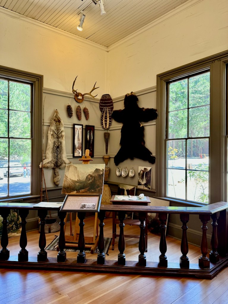
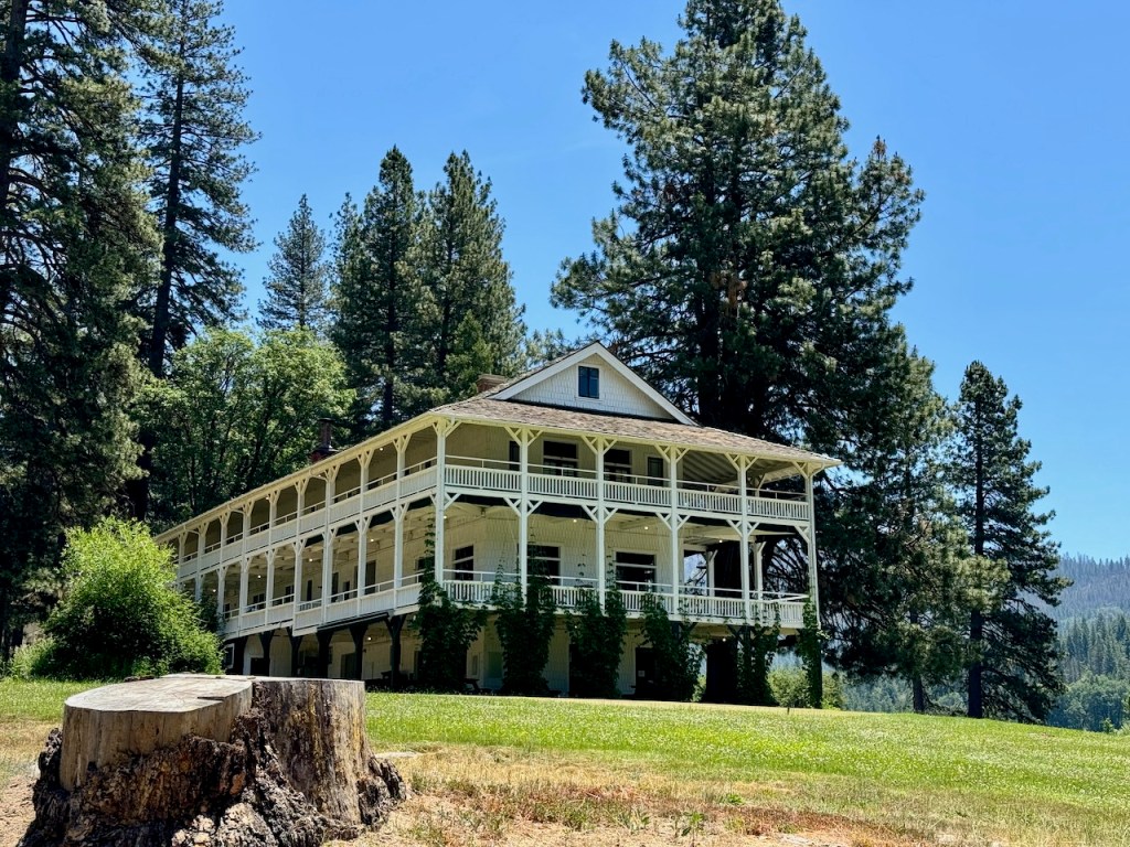
Wawona Wilderness Permit Office
I picked up the permit at office, which has a small museum, and gift shop. I asked about bugs, bears, trail conditions, and snow levels. The ranger in charge did what most rangers have done in the past, giving me a mix of accurate and mostly inaccurate information on where I was going. Note: The info on Little Yosemite Valley’s bug report could not have been further off. There would be bugs for days, everywhere I went, especially where she said they would not be, all along the Merced River. River valleys of lush vegetation and bugs are lovers, just remember that.
Where to Camp
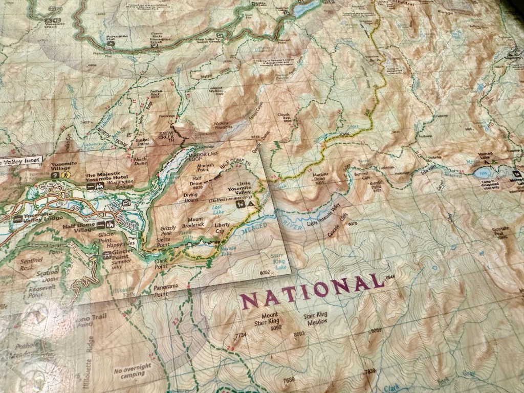
According to the FAQ page, at the nps.org, “The trailhead quota system limits use based on where you begin your hike, and in some cases, on where you camp the first night of your trip. After the first night, you may camp wherever you can hike to within the wilderness.” I’m thinking, well that is awfully vague. They go on to say, “Since there are only a few designated campgrounds, you can camp anywhere you like, provided you follow all wilderness regulations. The exceptions are near the five High Sierra Camps and in the Little Yosemite Valley area, where you must you camp at the designated campgrounds.” So if I am “near” these places, I must camp at these campgrounds. How do you define near though?
Wawona Visitors Center
The ranger at Wawona Visitors Center,” in response to my inquiry of the best places to camp, let me know where it was ok to camp, pointing to purple areas on the map, as off limits. I asked if the Yosemite map handed to me at the kiosk when I drove in had this shading, and she said it did not. So I took pictures of it. I had previously been told by a ranger over the phone, a year before that you are allowed to camp one air mile from the trailhead. There are many sets of rules in Yosemite, and it’s kind of baffling to figure it all out.
*You can reach a Yosemite National Park ranger at (209) 372-0826 Monday-Friday from 9 am to noon and 1 to 4:30 pm, from May to October.*
The Forest
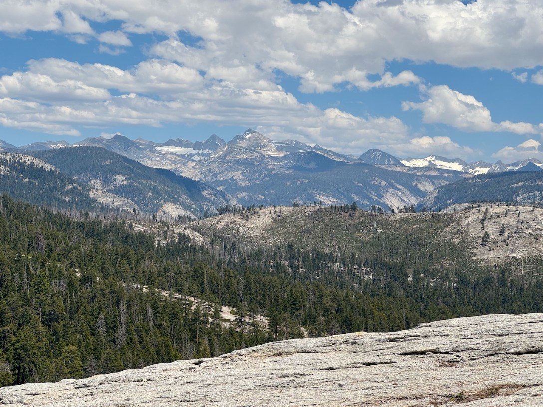
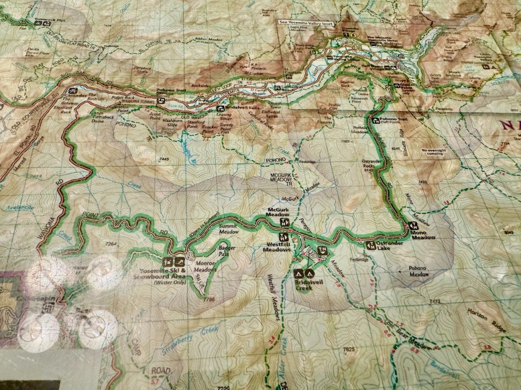
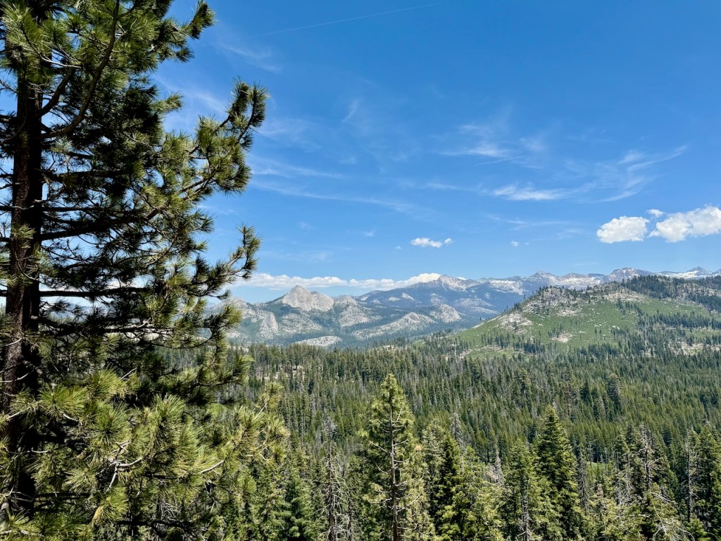
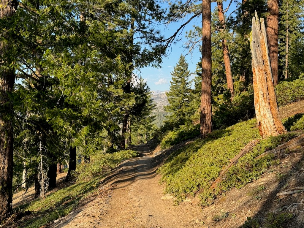
I was finally on my way and began the drive through dense woods, which eventually became a narrow highway hugging the cliffside. It took another 45 minutes to reach the trailhead. I drove steadily upward in elevation, passing by deep canyons, where within them were the charred remains of a dense forest, a victim of a huge wildfire two years prior. I had a backcountry permit that year, which was not canceled and refunded, even though I feel it should have been given the dense smoke the fire produced in the valley. I stopped off at a few scenic overlooks along the drive. It was particularly beautiful after making the turn onto Glacier Point Road. The views near Mono Meadow were stunning and gave a nice glimpse of what to expect, the pristine high-country beauty of the Sierra.
The Trailhead
I arrived at the parking area near Sentinel Dome. I knew I needed to stash any scented or food items in bear lockers at my trailhead. The ranger had urged me to use the bear locker at Glacier Point. But I knew it could be busy there, and that the parking could be an issue at this time of the day. To expedite my hike, I decided to throw in an extra 2.5 miles and park on the way to Sentinel, a scenic granite dome, I had only seen in the distance before from the valley. You are to park close to your trailhead but can park in nearby lots as well.
Feeling Ambitious
So I parked just before Sentinel, and was feeling very ambitious. For some reason, I felt 10 miles was an awfully short distance. I felt I would be at Little Yosemite Valley before I knew it. I thought I had time on my hands. All of which were the wrong mindset to have going into this. After organizing my stuff for about an hour, I was off heading through the woods towards Sentinel. The first hour of my trek was the least strenuous of the trip, and most exhilarating. It was all downhill from there was my mindset. I thought I had this backpacking trip all figured out.
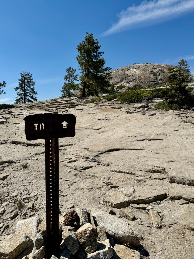
Sentinel
After about half an hour, and a mile and a half of hiking I was nearing Sentinel Dome. I followed the rusted metal signs to the base of the dome.
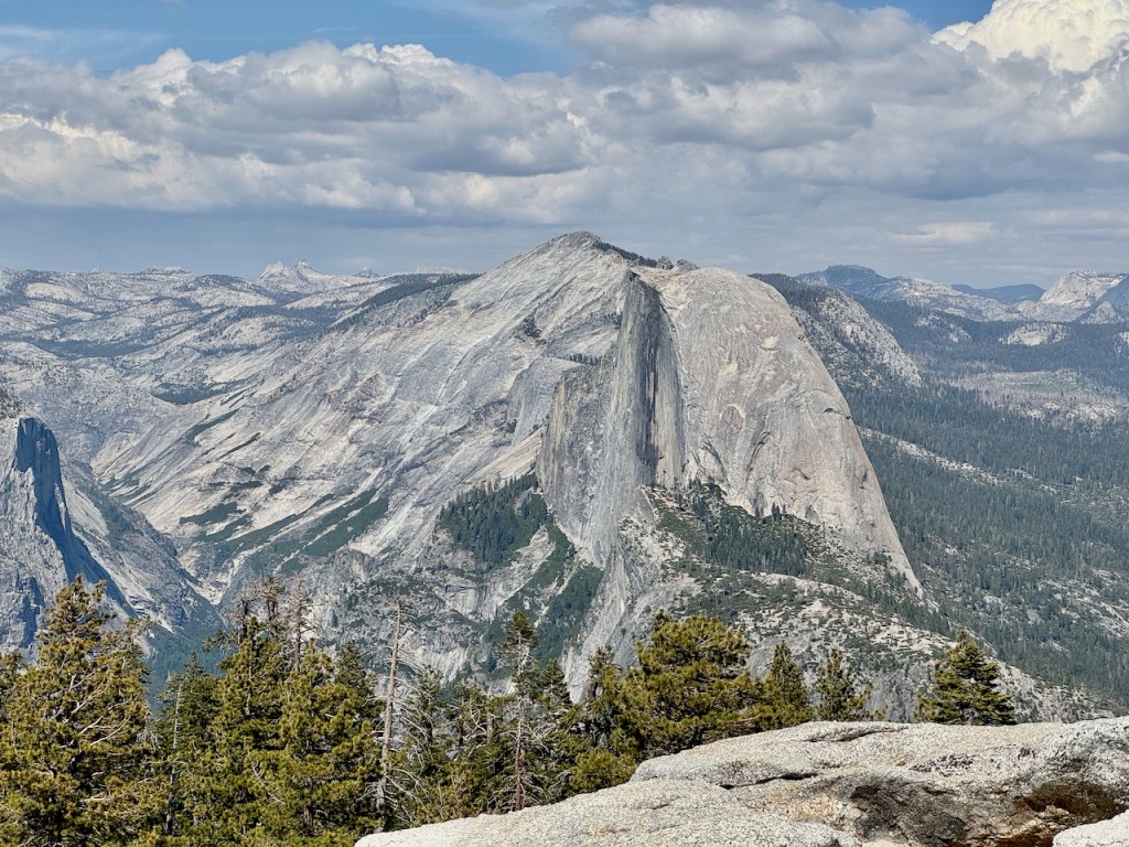
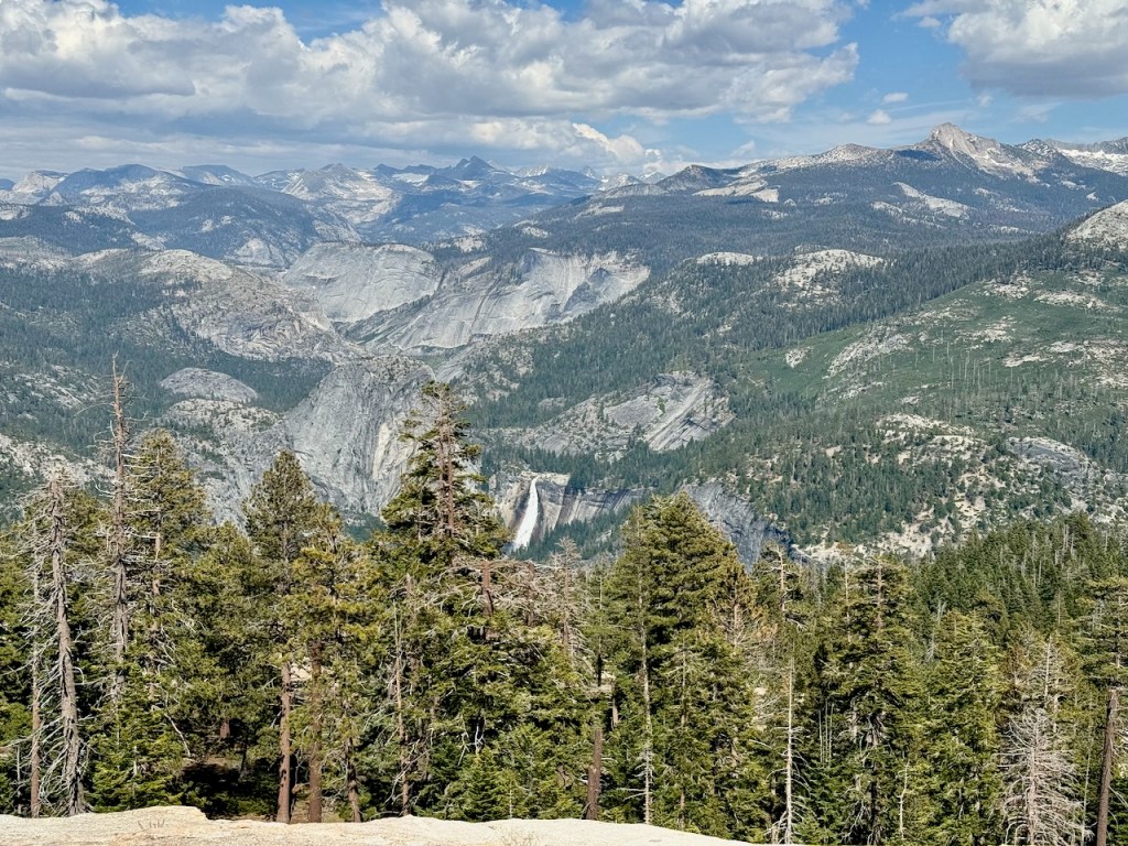
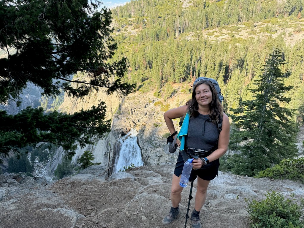
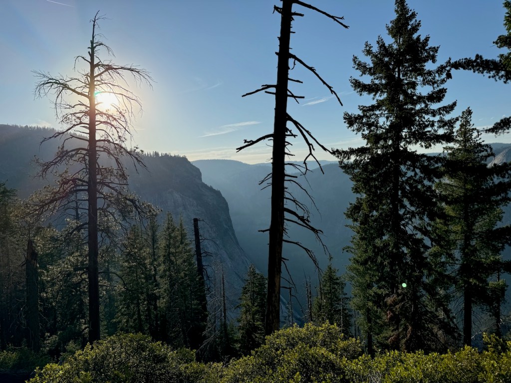
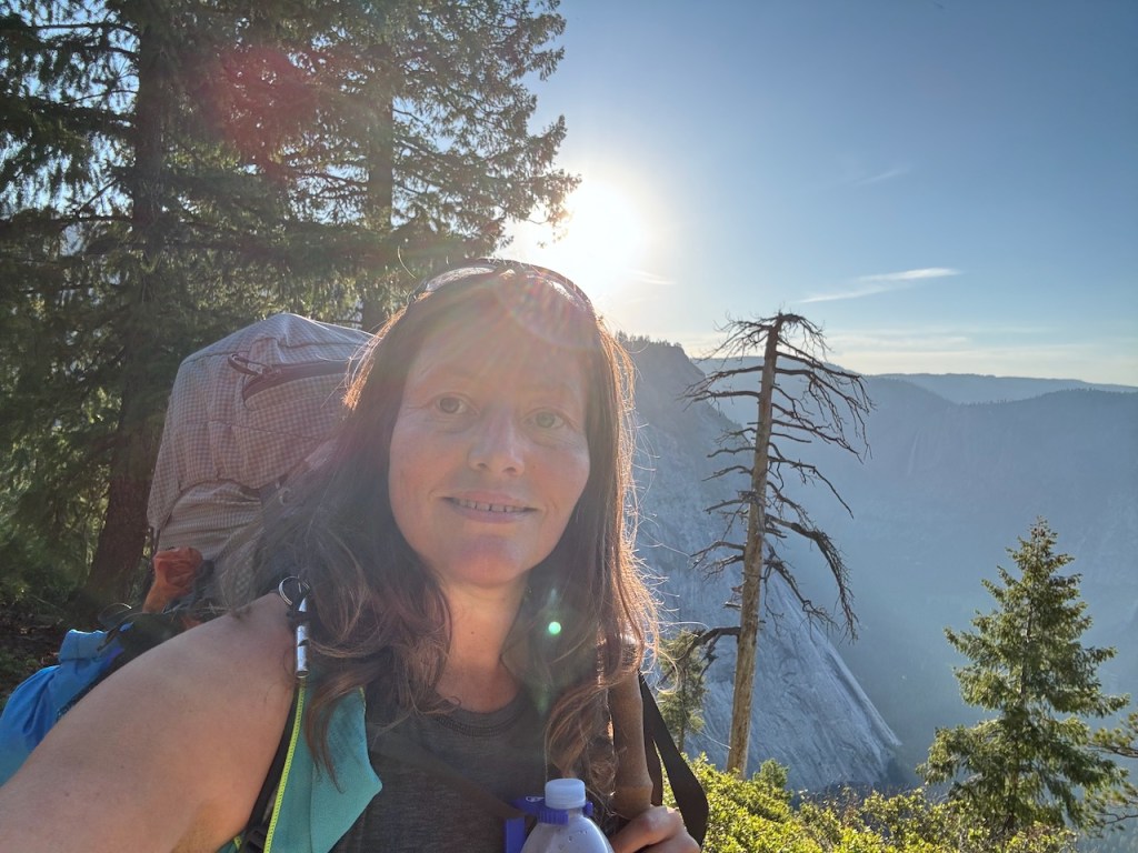
I hiked up about halfway, before dropping my pack by a log. The views from up here towards Half Dome were insane. I was so full of energy early on in my trek and had no trouble jogging up to the very top of the dome with minimal effort exerted. As I continued on up the granite dome, I began to catch a glimpse of Upper and Lower Yosemite Falls, along with El Capitan. I was having a John Muir moment, feeling like an explorer, taking in new vistas for the first time ever.

I took a short break, gazing out across the valley and high country, towards Yosemite Falls in the distance. There was an absence of snow covering the highest peaks over 10,000 feet. The ranger seemed correct in stating that trails like Clouds Rest, would be snow-free. That was no lie since it was clear, there were only snow chutes remaining on the furthest tallest peaks, like Mount Dana. Everywhere else was in the clear. I thought I could go anywhere I wanted on this trip, and would probably not even need to pull out my micro spikes. Still, I toted them along, prepared for anything.
On Top of the World
After sitting atop Sentinel for a few moments, feeling like I was on top of the world, which would be one of the highlights of the trip, I prepared to venture down into the valley. I would be traveling along the Panorama Trail, heading into the unknown, with no idea what it would be like there. I planned on hiking all the way to Little Yosemite Valley from this point, verses from the valley floor, on up the Mist Trail, or Clark Trail as I had before in the past.
Expectations
The woman at the entrance gate had cracked a joke, that “it would be easy,” since I was only going downhill. Those kinds of comments set the stage for hubris to set in, and for one to imagine their backpacking trip is going to be some kind of cakewalk. For some reason, I was not prepared for the struggles I would face as the day progressed. I had very high expectations, and thought I would breeze on through my day.
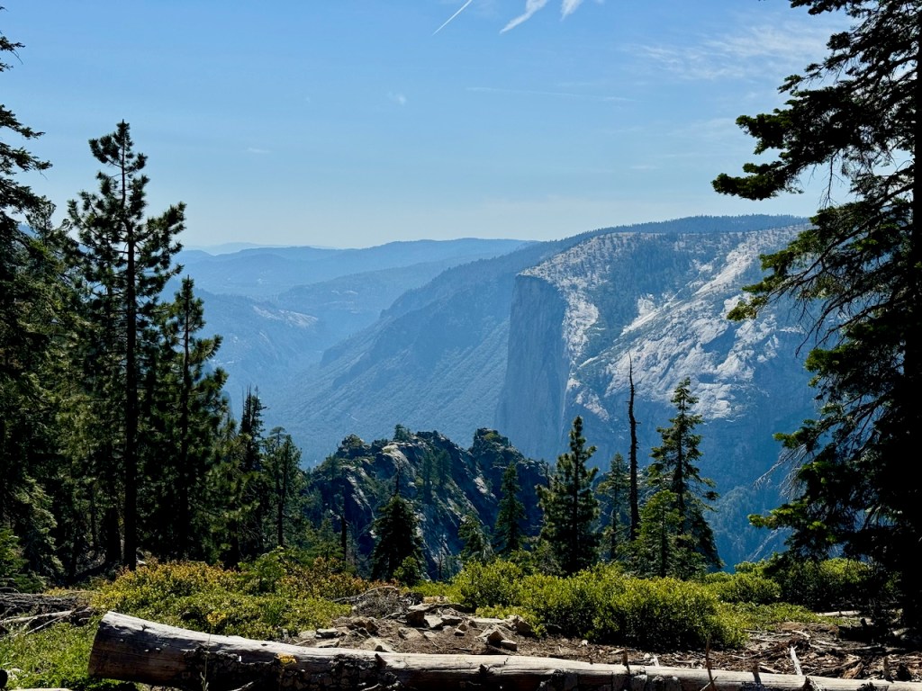
After hiking through some dense forest for another mile or so, I approached Glacier Point. At this point, as the trail dropped down further into the valley, I was treated to excellent views yet again of El Capitan, the famed big wall climb.
Glacier Point
Glacier Point was bustling with tourists as I approached it, but I veered right, skipping this area, to head out on my journey. Something told me, the views along the trail ahead would be even more awesome, and to just keep going, since I could always stop there on the way back.
Panorama Trail
My first stop would be Illilouette Falls, on the Panorama Trail. The sign read it would be just 1.5 miles to the falls, which was a lie. It also read it was just 5 miles to Nevada Falls, which was also not accurate. Little Yosemite Valley was about 2 miles past that. Even though I would record my hike on my watch, apple watches don’t do well in recording hikes like this for some reason. There is a lot of steepness and granite, which does throw things off a bit. So don’t expect an accurate recording of the mileage.
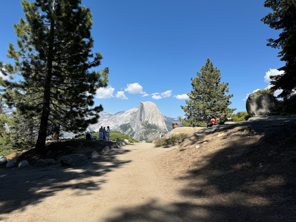
It was a Tuesday, around 3:30 pm, as I proceeded along the granite-flanked trail, through a pine forest. The entire Yosemite Valley was before me. I could already spot Half Dome, Upper and Lower Yosemite Falls, and Nevada Falls. The area was mostly shady at that time of the day.

There was dense vegetation along the hillsides, which was lush and green characteristic of springtime in the Sierra. Right away I began to hear the sounds of redtail hawks, various songbirds, and the distinctive call of the Sooty Grouse. I would soon pass a mother Grouse, and her baby chick along the trail. They were unafraid of me, something I noticed before in Yosemite, that wildlife will come close to you, perhaps because they are protected here, so they don’t fear people.
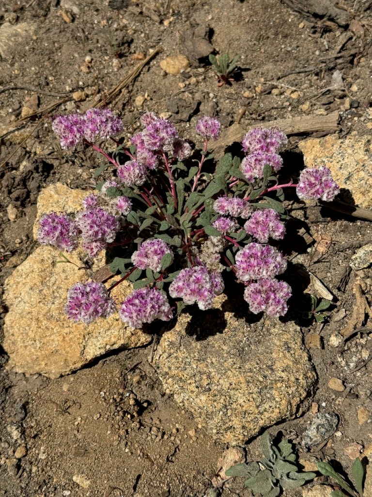
I continued downward into the valley and noticed many interesting wildflowers along the way.
I had no idea how busy it would be along the trail today. I passed just a few hikers making their way back from the falls but basically was hiking alone. There were at first a few short switchbacks followed by one long continuous switchback. As I continued further into the valley, I caught a glimpse of Vernal Falls, along with Nevada Falls. The views along the Panorama Trail were spectacular.
The expanse of the high country, Mount Starr King, and a myriad of unmanned distant peaks was rather breathtaking. There was so much to explore here, and it was slightly overwhelming. I simply could not see it all in a few days-long trek, but I could head to Little Yosemite Valley and go from there. I had a permit for Half Dome, and I was excited about it, if not just to get to the area below the cables. I knew it was a treacherous climb and was not sure I was even up for it.
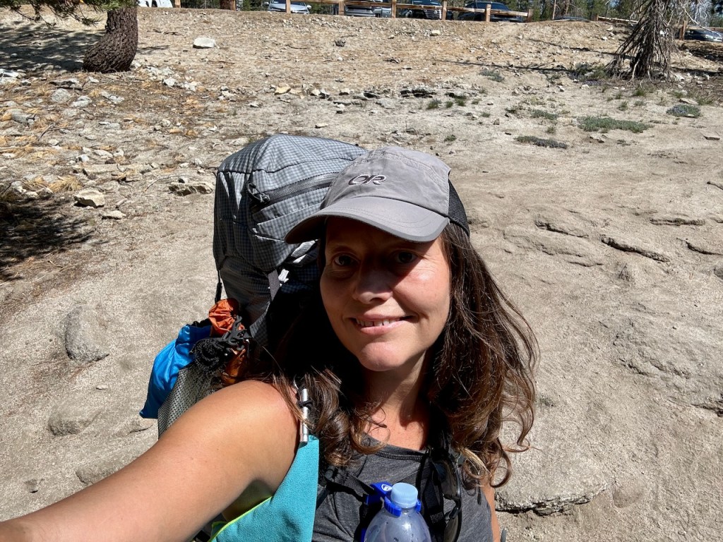
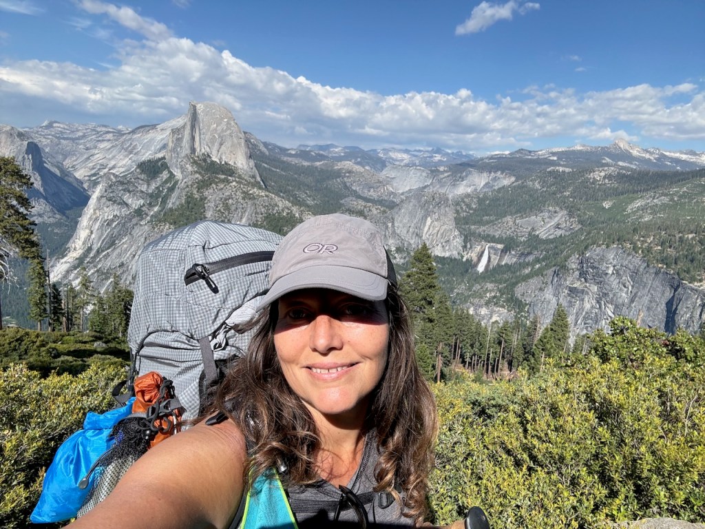
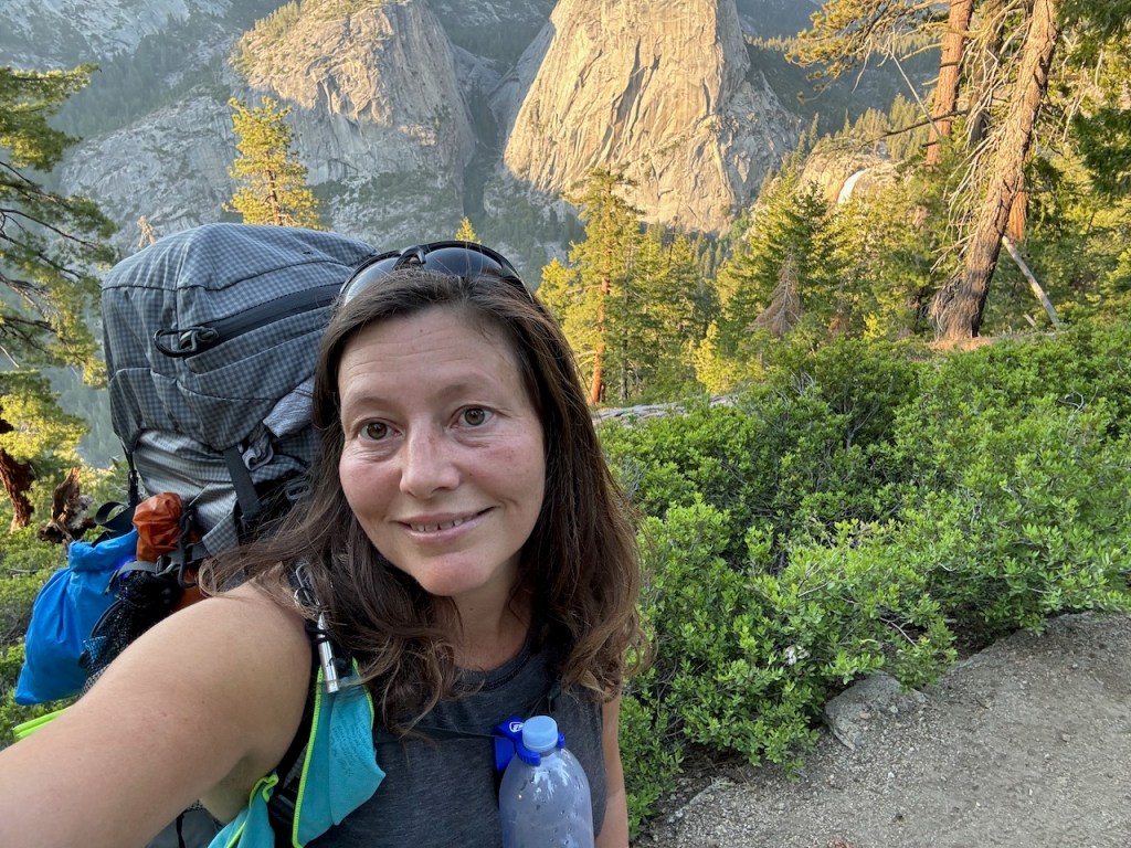
The trail dipped down into the forest canopy, and I edged ever closer to the falls. There were a series of what felt like a hundred short switchbacks along the way. By the time I was approaching the falls, I knew one thing for sure. My collarbone and shoulders were screaming at me. My new Osprey Tempest Pro, with its DWR-treated finish, subtle grey color, and stretch expandable side pockets, was hurting me. The backpack did not fit me, and I was now over 1500 feet down into the valley from where I started.

I came to another milestone of the hike, gazing out over Illilouette Falls, It was a glorious waterfall, even in the fading light.

A couple was perched there, at the overlook. They quickly got up, as if to make room for the next person to enjoy the falls. They took my photo, with the falls in the backdrop, and proceeded to climb back out of the valley back towards Glacier Point.
Day hiking sounded so awesome at this point. I was in a lot of pain, so I did not hang around at the overlook long. The thing about backpacking and making miles, is you feel like you have to constantly be on the move. You are a consumer of miles and scenery. But it’s also nice to just drive to a spot, hike a mile or two, and just sit there contemplating all the beauty.
I kept thinking and rethinking this backpacking trip. What was I trying to prove by this? Could I not have enjoyed Yosemite just as much from atop Sentinel Dome and with a day hike to this overlook? Why do I have to go so extreme, was the question on my mind. Now I was paying the price for my hubris, and thinking “I can do this.” Maybe I can, but do I need to? So many questions floated through my mind. I just kept praying, and trying to stay in gratitude.
I had traveled about 4.5 miles, and it was now getting late. It was after 5 pm, far later than I anticipated. I was also exhausted, having slept 3 hours the night before. All these factors played into the next few hours being torturous. Sure it was beautiful along the Panorama Trail, and yes I was excited, but the backpack situation was not improving. The only thing that would improve things is getting it off my back, setting up my tent, and sleeping. I needed rest, but a proper campsite was many miles away.
Upon checking in and picking up my permit for Half Dome earlier in the day, the ranger had made a big point about where I could camp and where I could not. The shaded purple areas on her map in the office were off-limits. According to rangers I had spoken to on the phone on previous occasions, I was allowed to camp one air mile from any trailhead, with a few exceptions, in areas that were off-limits. I knew I could not camp near Glacier Point or Bridalveil Creek. Aside from that, I had to squint at the photo on my phone of the map from the wilderness permit office. Why were these off-limits areas not marked on the map handed to me? Did it even matter?
As I edged closer to Illilouette Creek, I noticed a huge group with a tarp spread out by the river and the falls to my right. For a moment, in my agony, considered walking over to ask them about camping. But something said to keep going so I did. I decided this area was off-limits. Well it was not, and I had misread the map. I could have camped right there and been done with it. But had I done so, I have a feeling I never would have continued this trip as planned.

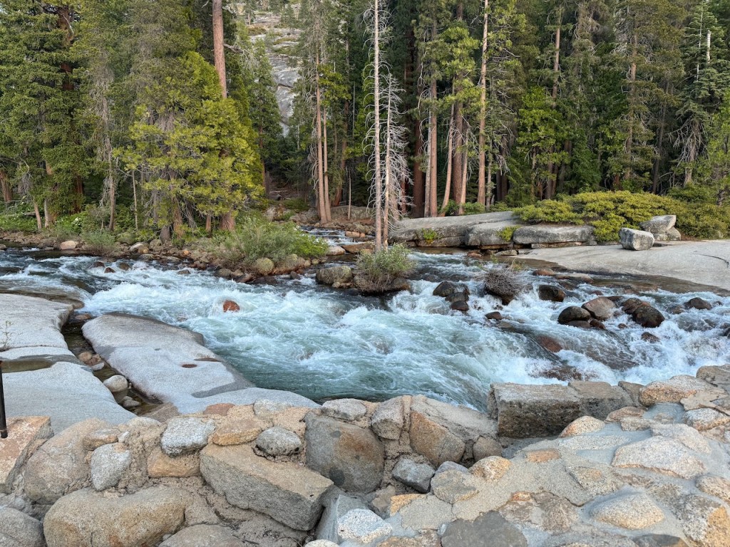
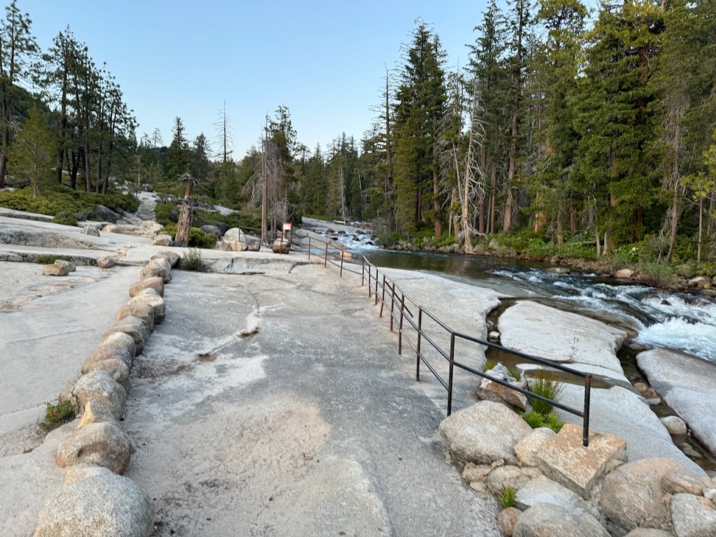
Instead, I crossed the bridge, taking in all the beauty of the river, with its smooth slabs resembling a waterslide, intermingling with large boulders, and eddies, with small pools one could take a refreshing dip in. This was a destination in itself, yet I continued on, heading further along the Panorama Trail edging ever closer towards my goal for the day, to camp at Little Yosemite Valley.
It was an uphill battle from here on out for most of the way. As I ascended a number of switchbacks, the late afternoon sun shone down on the granite. It felt very warm, and I did my best to stay cool. I was on the lookout for high Sierra rattlesnakes, just emerging from the safety of their wintertime boroughs to warm themselves on the rocky trail. Thankfully I saw and heard not one hiss, as I climbed. I will admit, I really wanted to give up, throw down my pack, and just quit. I was in such pain, and I had hiked a mere 5.5 miles according to my watch. It felt like I was still only halfway there, and it was already about 6:30 pm. This was feeling like a massive fail as far as backpacking trips were concerned.
I knew with the uncomfortable pack situation, there was no way I was going to be completing the High Sierra Loop, or trekking all the way to North Dome before heading down the Yosemite Falls Trail, and hiking the JMT out and back also seemed to be an impossibility.
At this point, my mind would flutter back and forth between my aching shoulders and the awesome beauty all around me. I tried to be optimistic and have faith that whatever the circumstance, God would find a way to give me the strength to get me somewhere safe to camp tonight. It was not just a mental game to keep on going and I knew I had to, if I was to camp safely at a defined campsite, with a bear box, amongst fellow backpackers. The alternative was to camp solo in an undesignated camping area, alone, with bears and mountain lions. That sounded like a last resort. I would do all I could to make it to the next camping area, which seemed to be either Little Yosemite Valley or all the way down to the valley floor.
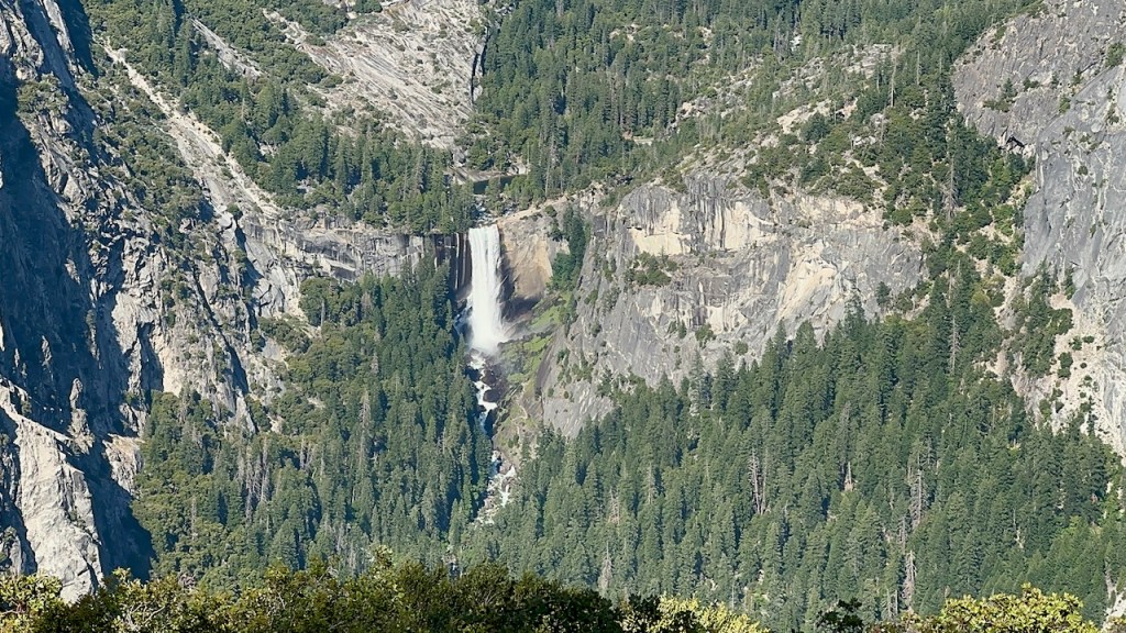
I got my first glimpse of Nevada Falls which encouraged me to keep going. I really did not want to have to bail out, but I was prepared to do so if need be, being exhausted. I had read on the Yosemite National Park website about recent trail updates, which so far were mostly inaccurate. One update mentioned the JMT being closed just past the juncture of the Clark Trail and the Mist Trail on the way to Nevada Falls. It mentioned that JMT hikers must instead take the Mist Trail. So I was prepared to do so but felt that I simply would not have the energy for another 4 miles of climbing, and instead would be forced to bail back down to the valley (in defeat), to stay at the backpacker campground by Happy Isles. I knew I could then take the Glacier Point Shuttle back to my car from there for an additional $47. None of that sounded good, but it’s nice to have options.
I came to a series of humongous boulders overlooking the canyon where Illilouette Creek cascades down to meet the Merced River, along the Mist Trail. Somewhere above all this was Mount Starr King. Something about this open flat area told me it was a potential campsite. I explored around and noticed a fire pit behind the boulder. It seemed like a great stealth campsite. The problem was, I did not want to camp here alone. It was now 6:30 pm and I had some decisions to make. I dropped my pack on the pine needles and debated for about 10 minutes here whether I had it in me to go on.
In a do-or-die type of moment, I decided I would hike on, and at least try to make it, even if it was dusk or dark when I arrived. If my legs could carry me I would go. Waves of exhaustion continued for the next three hours. I was alone for much of this time and had the trail to myself. This was an eerie feeling, not knowing what was out there. I had noticed defined bear and mountain lion tracks. This area was wild and prone to rockslides. Maybe camping was not allowed here for safety reasons. I knew I needed to hike on.
As the afternoon sun began to fade away behind the tall granite hillsides, so did my hope of reaching Little Yosemite Valley. I reached a turnoff on the Panorama Trail. Had I taken it, hiking further uphill, then camping would supposedly be allowed there. I considered camping past the turnoff again briefly. But my resolve took over, after seeing pawprints in the soft sand. I took off downhill, heading towards the Clark Trail, through a dense forest. The bugs came out, and there were many muddy sections. I was not in a great mood, since aside from my backpack not fitting me, my clip-on water bottle holder had apparently come to the end of its use. It kept popping off and falling. I was beyond annoyed with the gear problems I was experiencing. Nothing about this was a dreamy backpacking journey. It was a suffer fest, and I was filled to the brim with regrets for not starting earlier, along with not testing my pack on a short overnight trip first. But I needed to see that these troubles were an opportunity to grow.
.
2 Dear brothers and sisters, when troubles of any kind come your way, consider it an opportunity for great joy.3 For you know that when your faith is tested, your endurance has a chance to grow. 4 So let it grow, for when your endurance is fully developed, you will be perfect and complete, needing nothing.
James 1:2-4
Just when I felt like I could hike not a half mile more, I finally reached the end of the last switchback of the Panorama Trail where it meets up with the Clark and John Muir Trails. There were signs to my left and right, but neither one of them indicated a closure. It appeared my prayers were answered. I had a glimmer of hope I could in fact take the John Muir Trail on to Nevada Falls, continuing past it to Little Yosemite, hiking alongside the Merced River. Would the trail be closed further ahead? In a daze, I headed towards Nevada Falls.
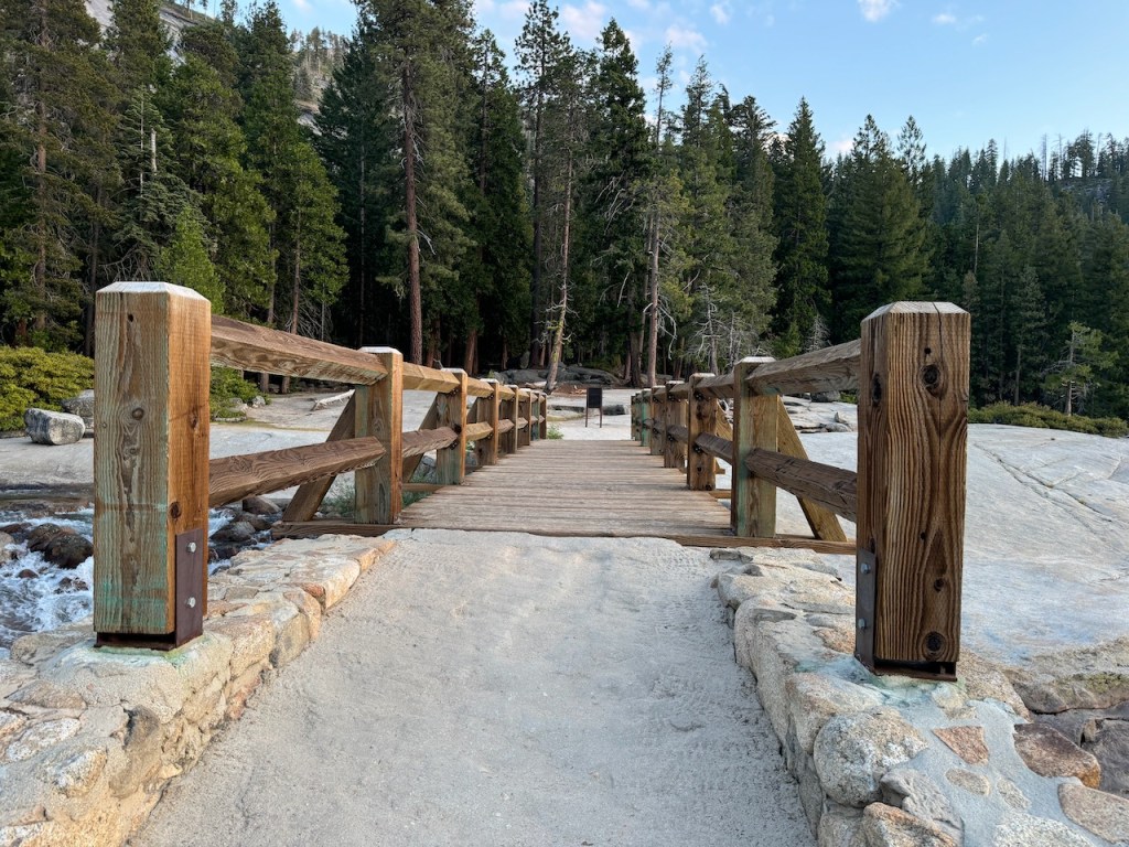
The trail was open, and by the time I reached the falls, there was not a soul around. The bridge was in my sights.
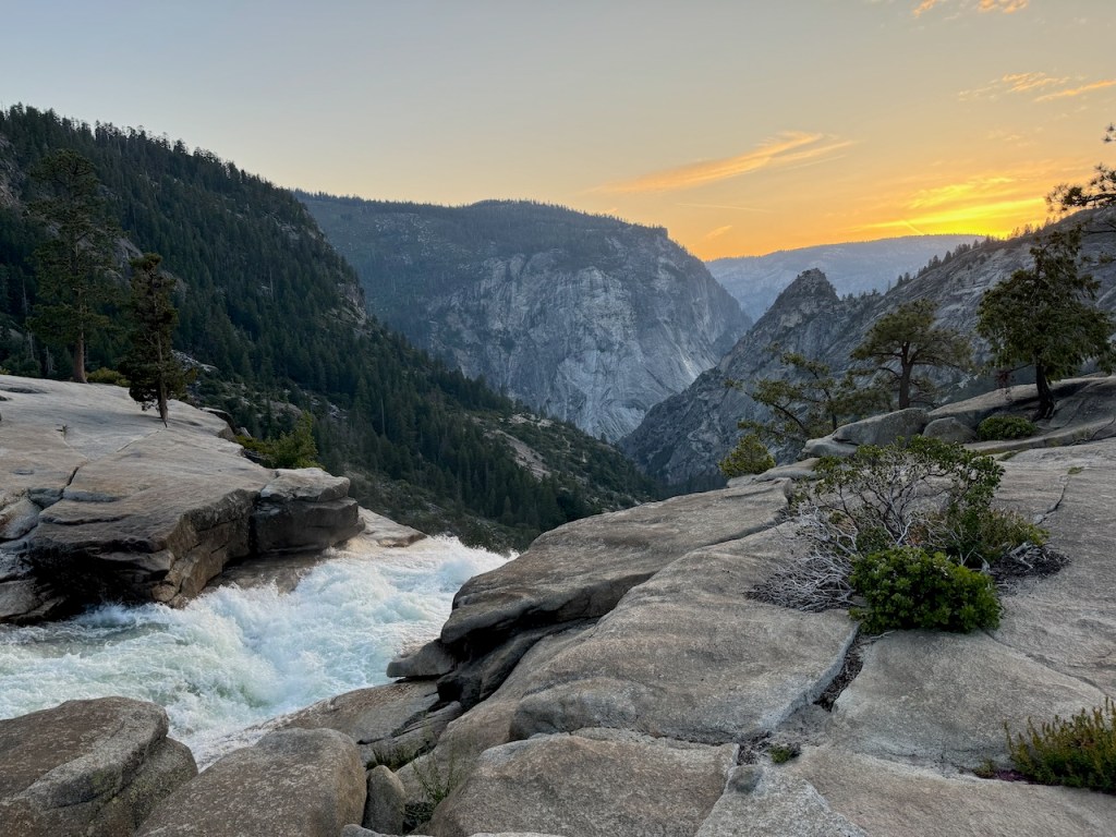
I crossed over the sturdy wooden bridge, with the dynamic falls spilling over below, just as the sun was setting. It was the best feeling I had all day.
There was a sense of relief as I gazed out at the rushing waters of the Merced to the right. I was just over two miles shy of the campground, where I could finally set up camp and drift off to sleep.
I had passed another milestone on my journey. I was now much more full of optimism. I now knew I could push through the uncomfortable backpack situation, along with my exhaustion, to make camp before dark. The last 2 miles or so would be brutal since there was even more uphill climbing to do. Within the shadow of Liberty Cap hovering above, I trudged along the John Muir Trail. Each step felt like a chore as I trudged up the rocky uneven path carved of granite.
Every minute or so I was checking my watch to see how far I had gone. As the minutes ticked by, I kept moving, though my whole body wanted nothing more than to quit. The trail leveled off and I was in was now immersed in the woods, growing ever more dark with each passing moment. The sun had set over thirty minutes ago, and it was officially dusk.
I arrived at camp, just before it was pitch black, with just enough time to locate a campsite, and the bear locker, where I would store my food. The campground sites were separated rather haphazardly by down-tree trunks. Some of these behemoths were about 3 feet wide. I chose a site with the largest of tree trunks surrounding it since it added a nice layer of privacy. All I knew was that the river was close by, and there were plenty of tents, and hikers there. I was far from alone now, and I was glad to have it that way. Sleeping alone at night in the wilderness is far different from hiking alone in it by day. When wild animals are a factor and tend to be active at night, it helps to know there are other hikers around.
I set up my Big Agnes Copper Spur UL2 tent by the light of my headlamp, as the last light was fading away. I was so grateful to finally crawl into my sleeping bag, and as I drifted off, my thoughts were on half dome. Would I hike it or not? I was achy from head to toe, but especially in my shoulders, and on my collarbone. An ill-fitting pack will do that. I was not sure I would have anything left in me to hike to Half Dome. I would wait until morning and see how I felt. I might have to bail out, hike down to the valley, and get the first Glacier Point shuttle to my car. The trip felt like it was officially canceled with my uncomfortable pack. Here I was at Little Yosemite, so I might as well take at least one hike while here, to Clouds Rest or Half Dome. I had planned on visiting both on this trip, along with so many other places. Plans had definitely changed a bit.
Leave No Trace
Just be sure to come prepared and follow Leave No Trace principles to keep the wilderness pristine for future hikers.
Like and Subscribe to my Channel!
I hope you enjoyed reading this, and it is helpful in knowing what to expect, should you decide to visit here.
About me
I’m Serafina! I’m a writer and California girl who loves to go exploring. Hope you will get outside today, breathe some fresh air, and be happy!
Follow my Journey…
Be sure to Like and Subscribe to My Youtube Channel where I post videos!
Disclaimer: The work on this blog is my opinion and my opinion alone and I am not responsible for the outcome if someone were to apply these thoughts to their own life. All text and photography copyright 2023 by Serafina, all rights reserved. Information and opinions provided are kept current to the best of the author’s ability. All readers’ usage of the ideas and opinions presented in the blog, are at their own risk. Be aware of the possible dangers of hiking, surfing, walking, cooking, and other activities, which may take place indoors or outdoors. By reading this, you agree not to hold the author or publisher of the content on this web site responsible for any injuries or inconveniences that may result from reading the blog, or partaking in any activity mentioned in the blog. Read the blog, and use its ideas, if you so desire, at your own risk.
