Backstory
I had wanted to return to hike on the PCT from where I left off in 2023. Sometimes life happens, and you can’t control the outcome. Last year, while hiking along the PCT, intent on finishing Section A, I had a gear failure around Mount Laguna. I ended up hiking as far as Storm Canyon, with one of the aluminum frame stays, protruding out of my Zpacks Arc air, into my hip. I managed to put several holes in my cheap Amazon sit pad, to make it to that milestone, while padding my hip area. Amid a celebratory dinner, for how far I had come, the thought had not even crossed my mind, that I would not be back again soon. Well life happened, and it weighed on my mind, on not finishing what I started. I wanted to finish hiking PCT Section A. We all have goals and milestones in life, and this was one of mine. Challenge accepted, and now I just had to keep on walking, to meet my goal.
Setting Goals
Some goals were not so important, but this one was to me. So much so, that I planned a campout at Big Laguna later that summer, for some R&R, along with a chance to get back on the PCT, where I left off. My boyfriend and I hiked along Big Laguna Mountain Loop, onto the PCT beginning at Storm Canyon, hiking all the way to Garnet Mountain. As the wind howled at 30-40 mph, and we could barely stand, we summited it. I felt great accomplishing another section of the PCT. Amid the other hikes we did on our trip, such as Volcan Mountain, the fact I had not accomplished my goal, continued to weigh on my mind. My boyfriend can’t hike far right now, and did not really want to. So I had to keep the hikes short.
Sunrise Highway
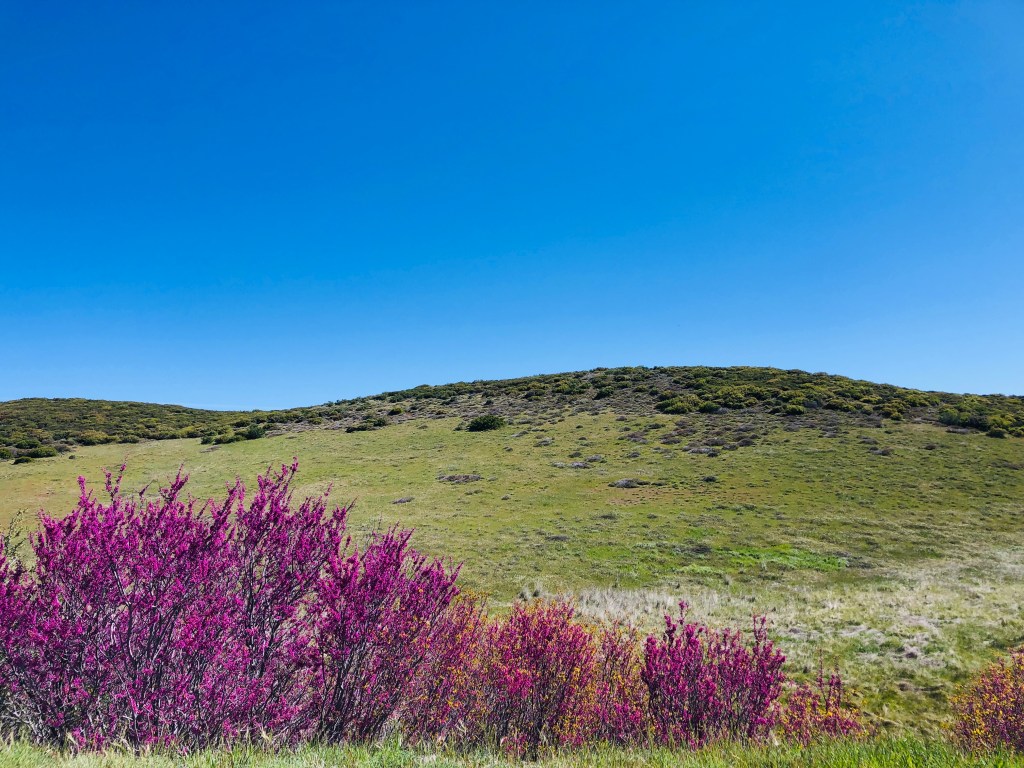
It was early May, 2024, as I drove up Sunrise Highway from Julian. There were bright fuchsia blooms of Western Redbud in bloom all along the roadside.
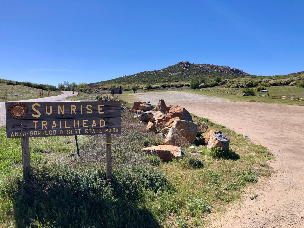
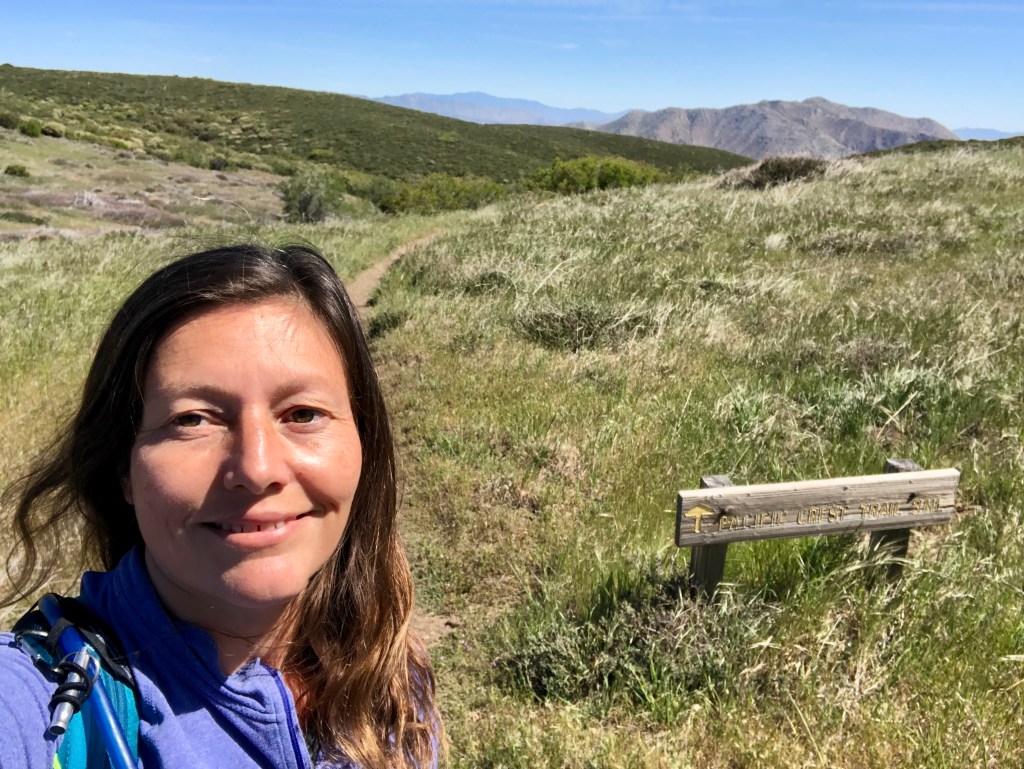
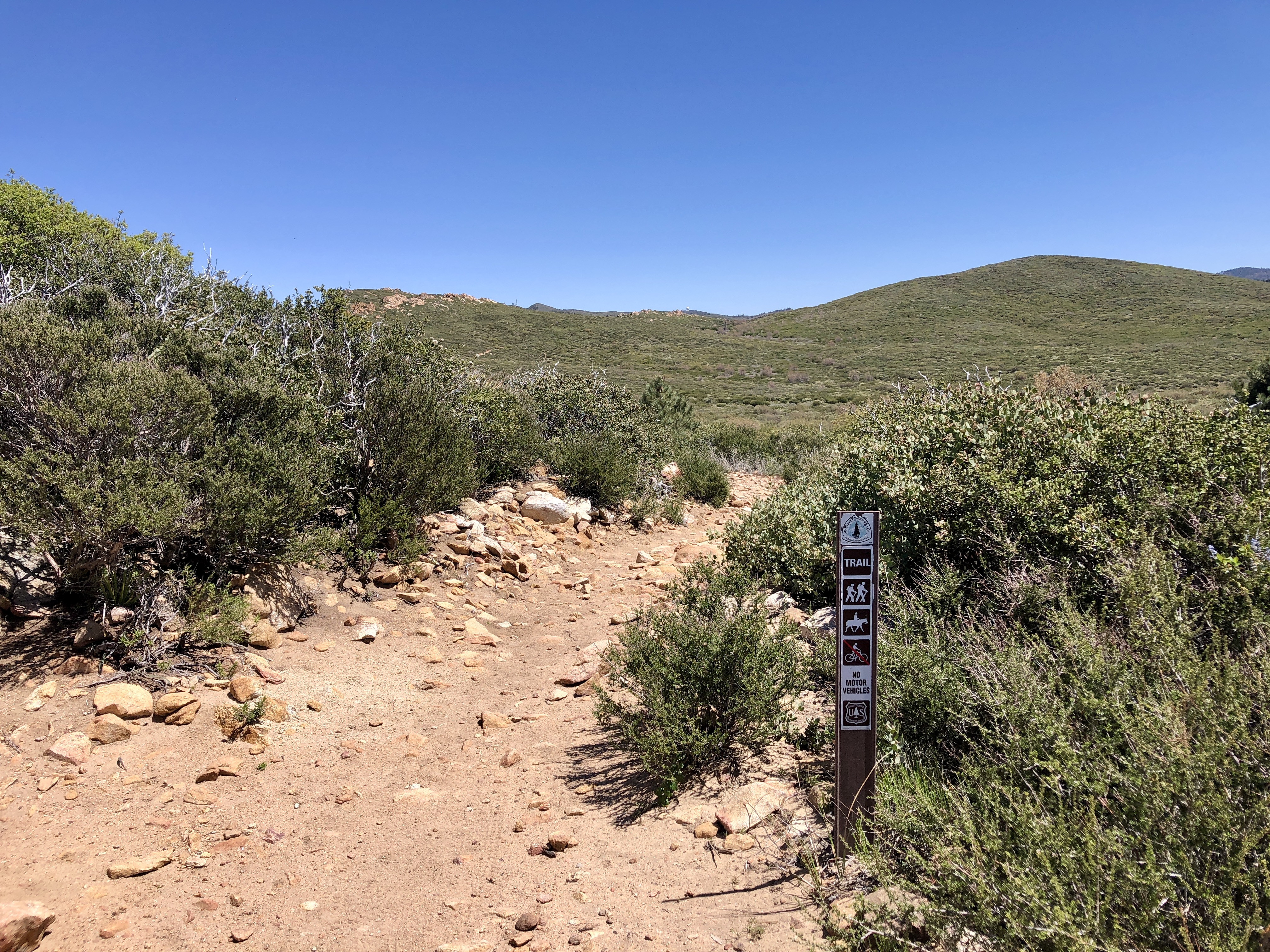
Sunrise Trailhead
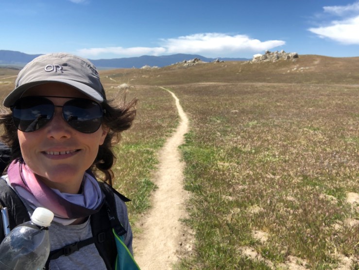
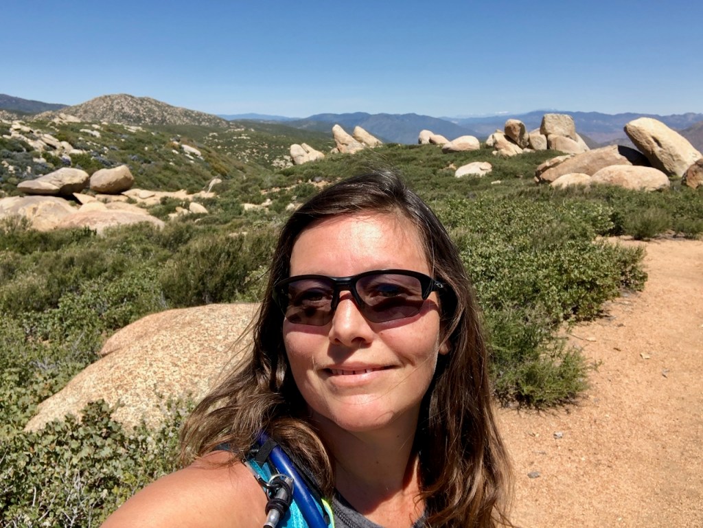
I arrived at the trailhead, where a .25 mile trail leads to the PCT, along with La Cima Trail. It was around 10am, far later than I had planned. Here I was a year later, planning to hike as far as I could, to complete more of PCT Section A.
My Route
It was cool and mild that morning at 10:15 am when I started. Starting at Sunrise trailhead, I made my way onto the PCT through the spring grasslands. It was the first warm day we had in the last few months of rainy weekends. Either someone had a birthday event or it rained every weekend, and as the weeks of spring had passed. So many weekends, plans to hike the PCT had been cancelled. But I kept on thinking about finishing Section A of the PCT. My choices were to hike to the Pioneer Mail Picnic area, which was 16.5 miles roundtrip, or to continue past that point I left off at the base of Garnet Mountain, possibly bagging that peak a second time.
A Cool Sunny Morning
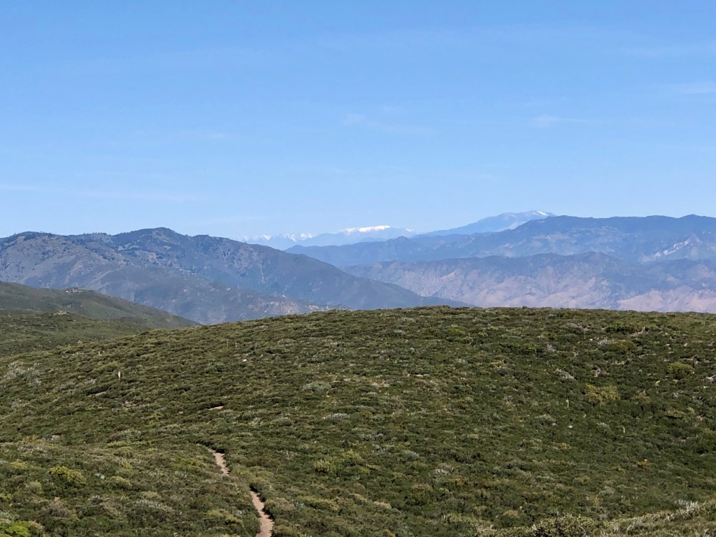
The first thing I noticed on trail on this abundantly sunny morning were the nice views. It was clear all the way to Mount San Jacinto, which was now snow covered. It was lush, green and beautiful out on the trail. The conditions could not be more perfect today. So many wildflowers were in bloom now at 5000 feet in elevation at the trailhead, since spring starts later, the higher you go in altitude. Down at the coast, it was coming to a close.
A Gradual Climb
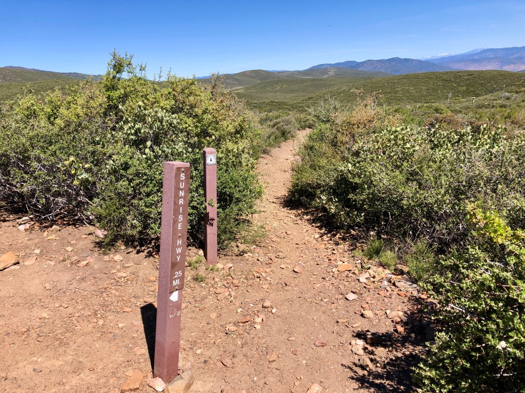
As I set out on the trail I began a gradual climb. About fifteen minutes after leaving Sunrise trailhead, I met up with the PCT, making a right, heading south or sobo. The gain would only be about 250 feet per mile on average throughout the hike, for a total of 1800 feet of gain, which is not a whole lot in my mind. Some parts of the trail would have more gain than others. The elevation change on the other hand, would only be 500 feet total, as I headed to 5500 feet, the high point of the hike.
PCT Nobo Hikers
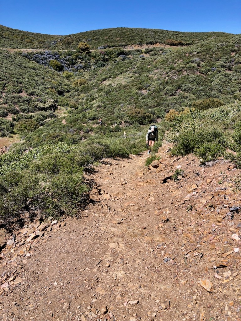
I began to descend into a canyon for the next few miles, and pass several Nobo PCT hikers, almost immediately within the first half hour of my hike. Throughout the day, I would pass mostly couples, groups of two, or the occasional solo hiker. I was not jealous to carry my house on my back today. I was embracing the freedom of a PCT day hike, with a lighter pack in gratitude, while also in search of a ultralight state of mind.
Falling into Place
The world had been weighing heavy on me the last few weeks. Someone I was not that close to, passed away. It was my stepson from a former marriage. I never really knew him, yet his death was causing my thoughts to drift back, to revisiting my past, so much of it painful. Sure, there were a few flickering moments of joy peppered in with it all. I have always tried to be optimistic in the most challenging situations. I knew I was free of my past, if I wanted to be, and let God be in control from here on out.
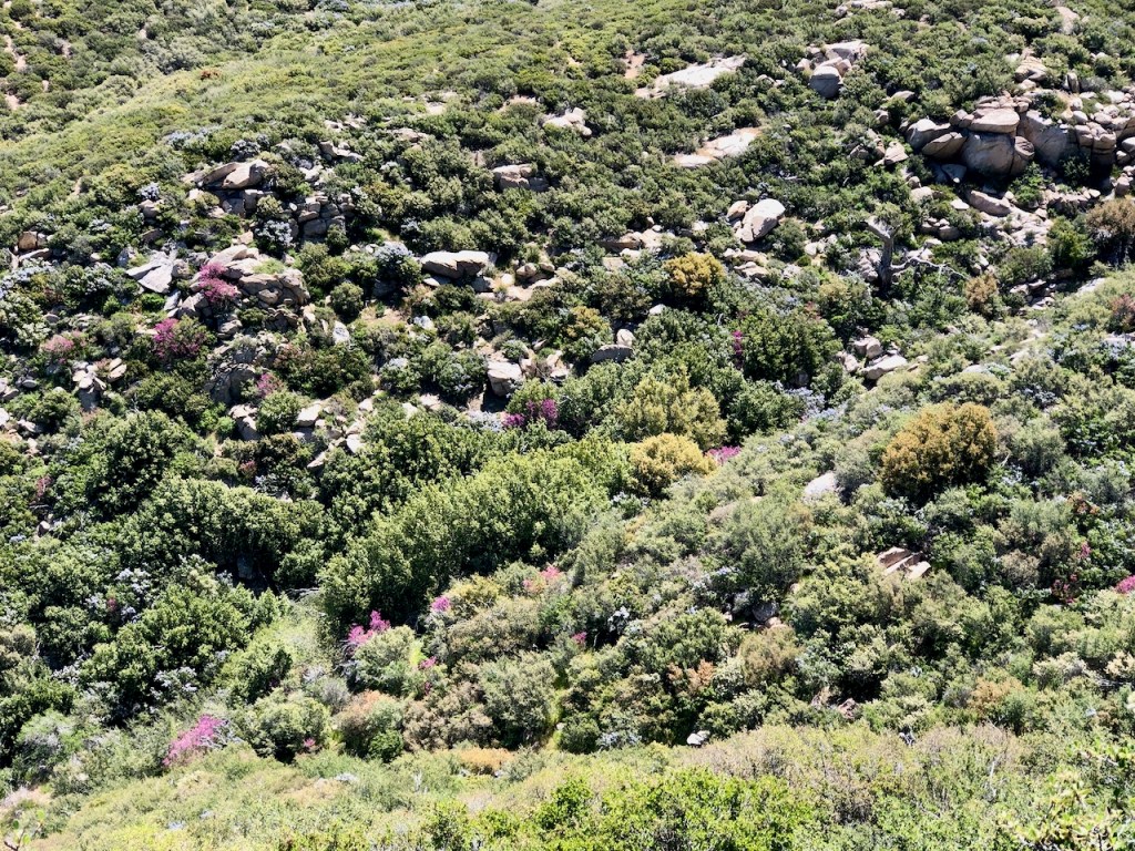
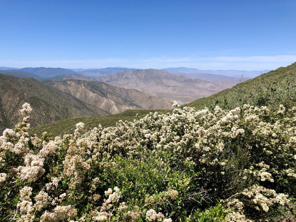
There were many flecks of bright fuchsia intermingling with abundant green growth.
Spring had come later this year since it had been a cooler year than normal. As a result, there was less of an abundance of wildflowers.
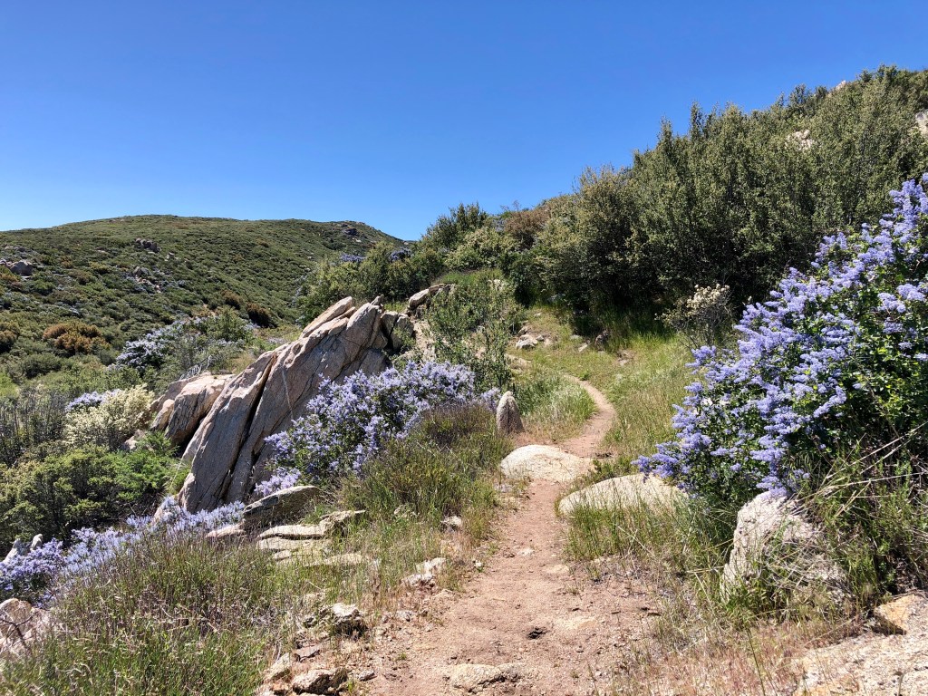
The California Lilac or Ceanothus thyrsiflorus was in full bloom along the trail.
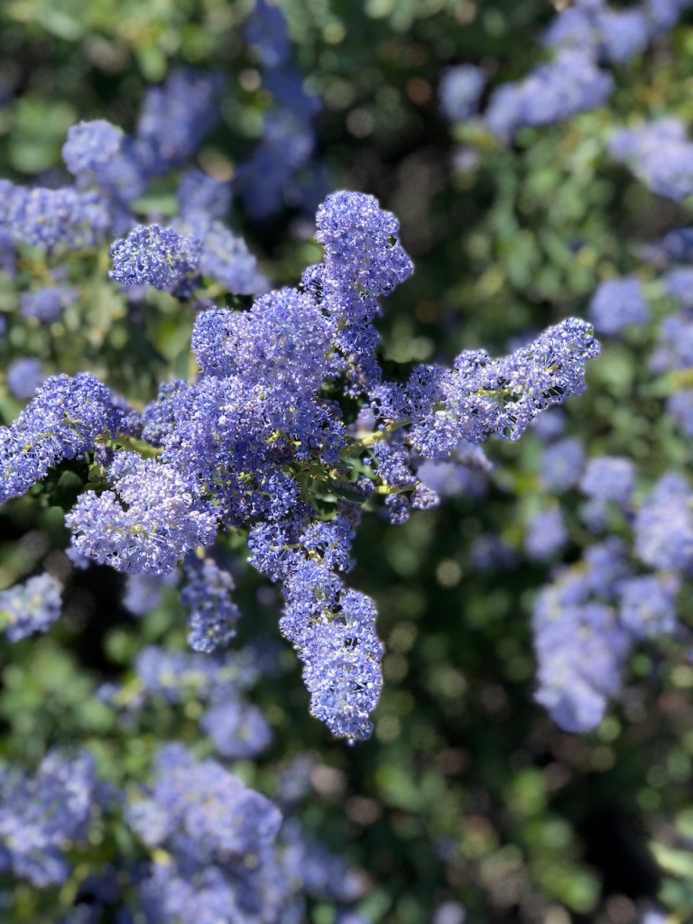
Lilac or Blueblossom was about two months past its peak in coastal San Diego, where it grows abundantly in Mission Trails. When I recently hiked to Fortuna Mountain in early April, Wild lilac was the main attraction.
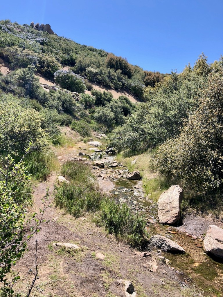
By about 11 am I passed the first water source, a small flowing creek. I was now about 2 miles along the trail, at about mile 56 on the Far Out App.
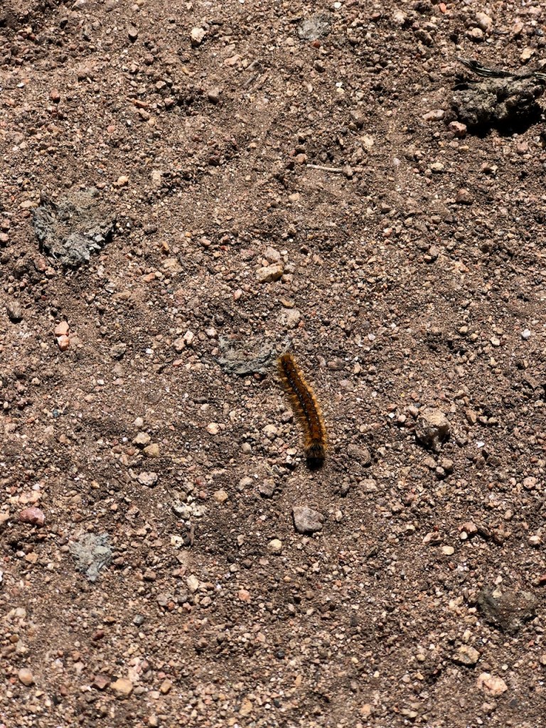
Not soon after, I noticed the trail was covered in fuzzy caterpillars. They were Western Fence Caterpillars, which emerge from their cocoons in spring, to become brown moths. As I hiked on, there were literally hundreds of them, for the next few miles, and it became a caterpillar obstacle course.
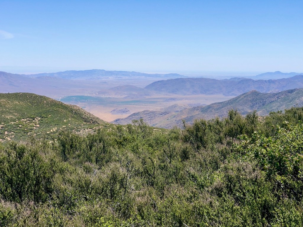
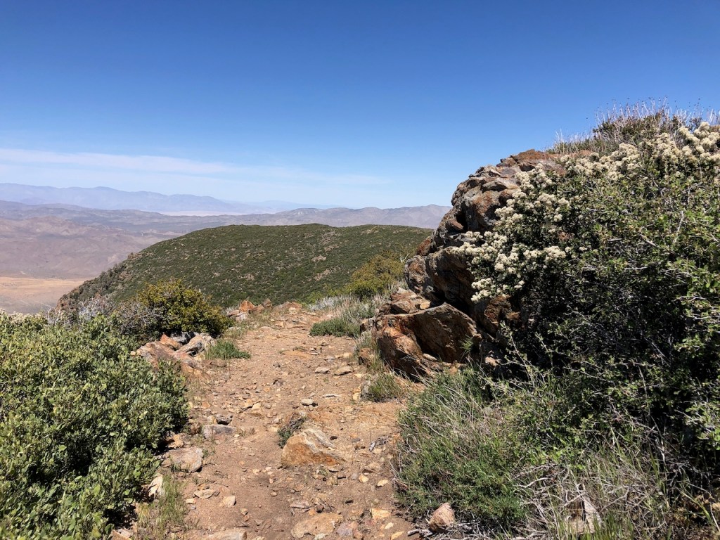
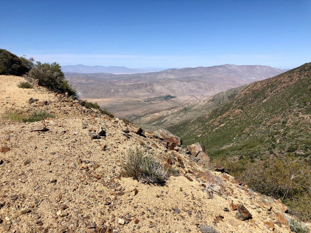
Not soon after the desert expanse became visible, as the trail winded to the east.
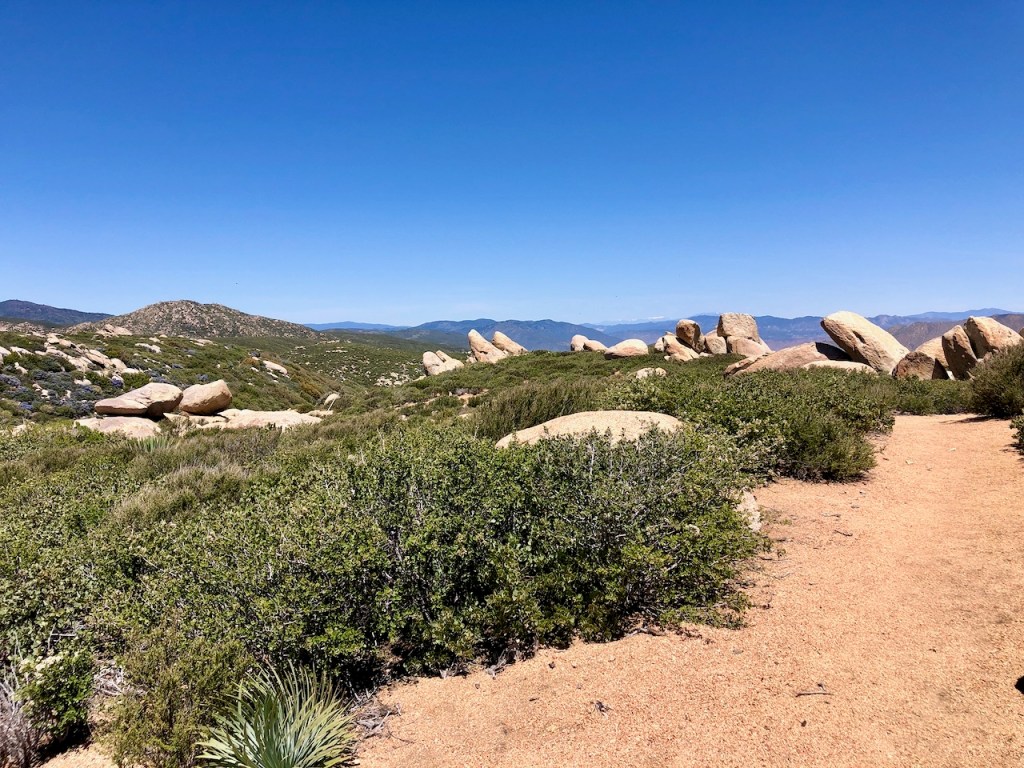
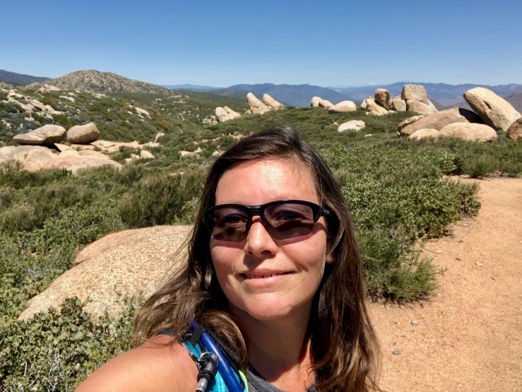
By about 11:30, I began to approach a boulder field of standing monoliths, overlooking the desert landscapes of Anza Borrego in the distance.

There were absolutely massive granite boulders strewn all around, and it sort of resembled Stonehenge along this ridge.

I had a clear view of Granite Mountain, Whale Peak, and several other rocky-looking desert peaks from here.
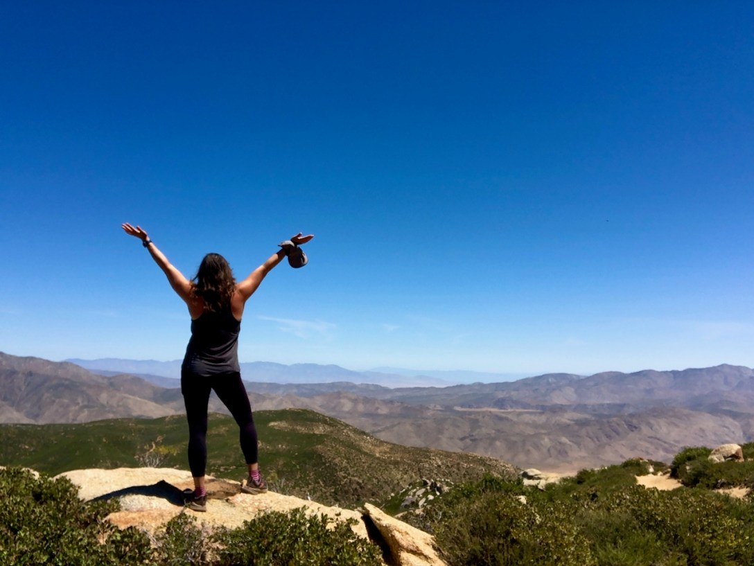
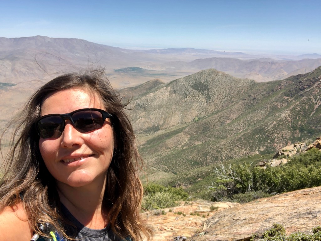
I had to stop and admire all this awesome scenery.
I was feeling grateful for all this. It felt like such a gift to be out there on the PCT again, even if for just one day.
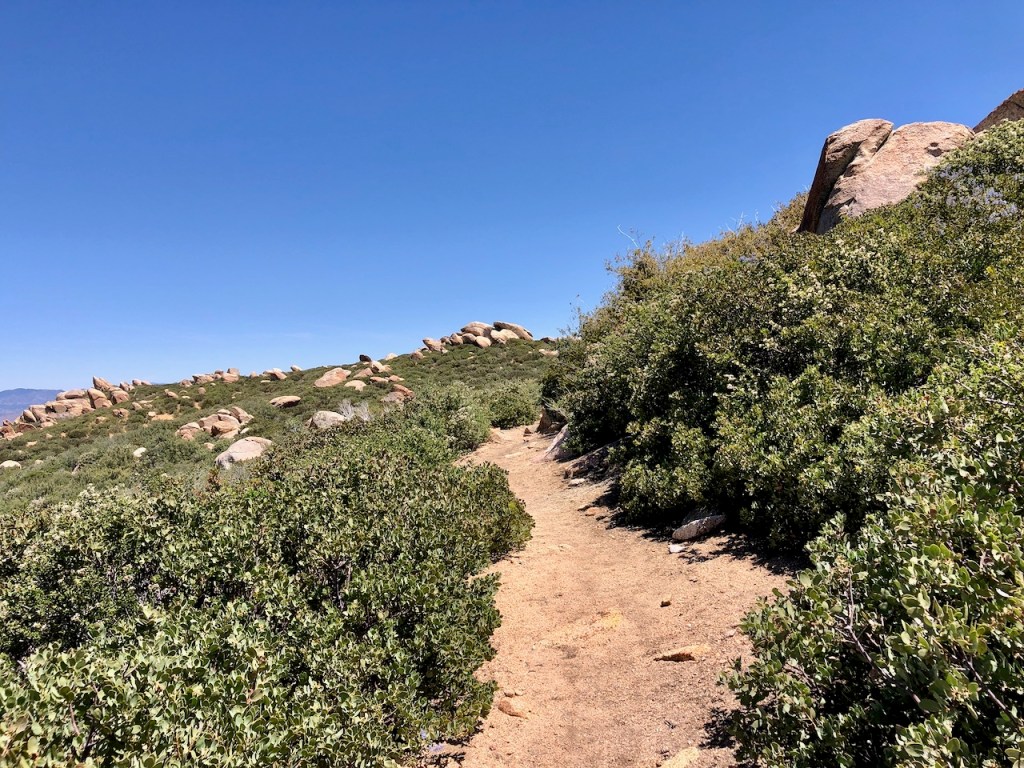
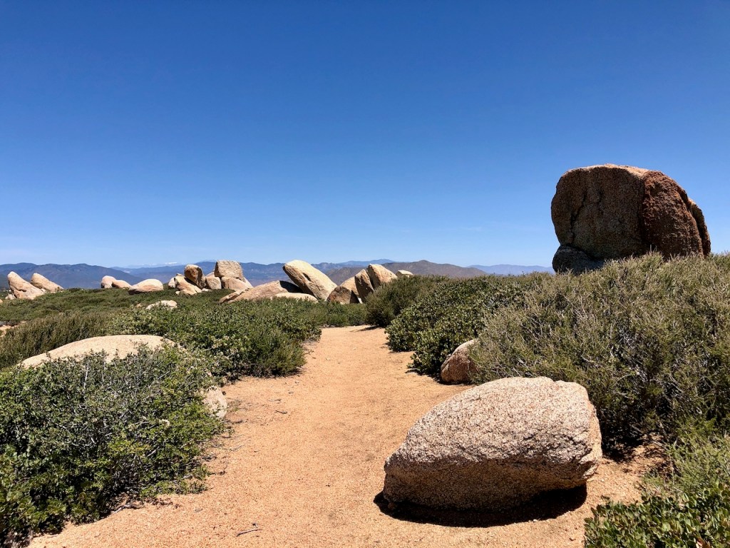
I hiked on, amongst a boulder strewn ridge, enjoying the sunshine, and solitude.
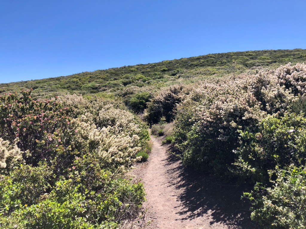
The trail remained narrow as I continued on. It was not overgrown at all, fairly level, and well maintained. One thing about the PCT – it is maintained independently of other trails in the state. It has its very own trail crew paid for by PCTA supporters, through a yearly membership fee, myself being one of them. After hiking most of Section A, in 2023, I felt it was the least I could do. I had to support the trail, which gave me so much joy.
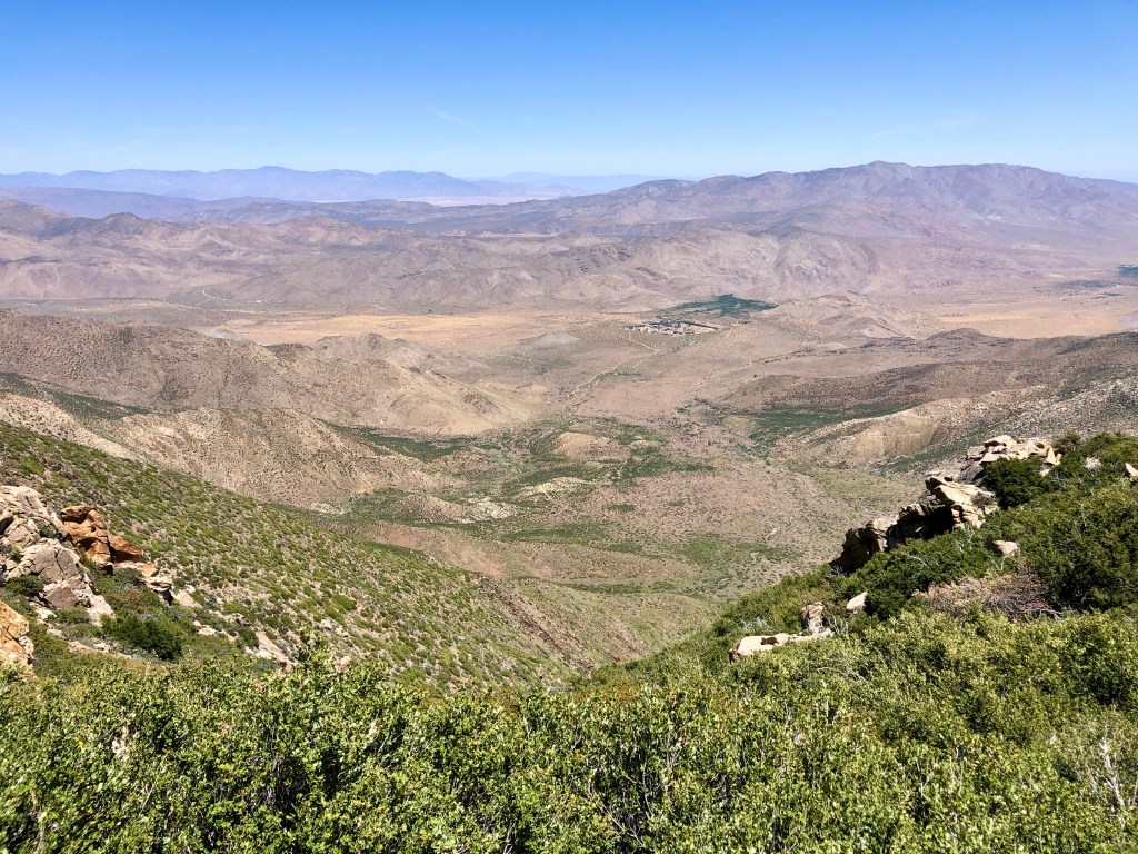
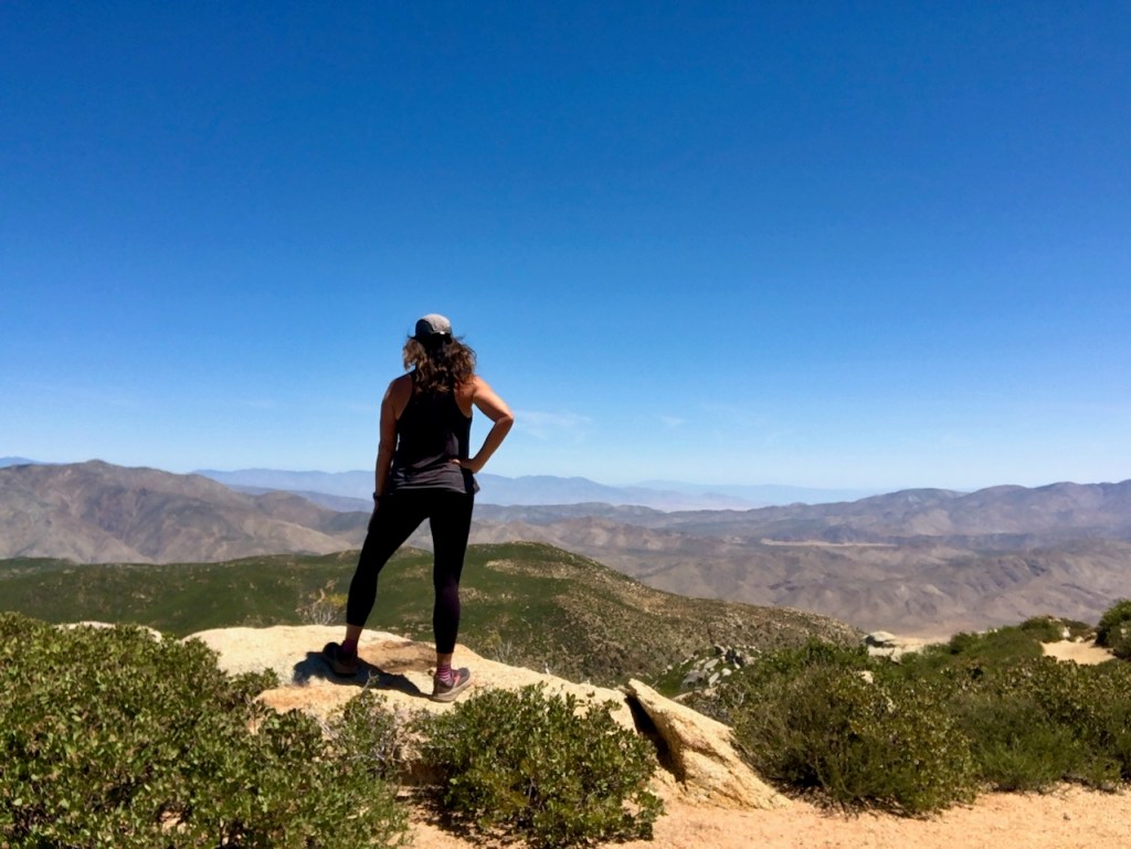
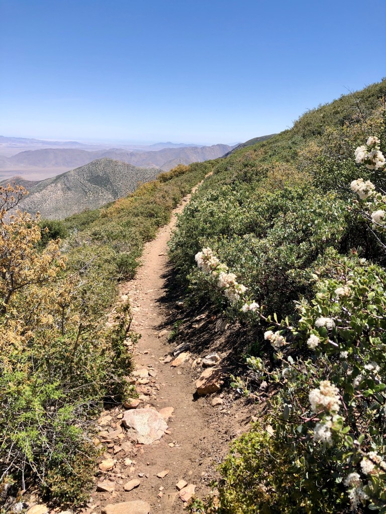
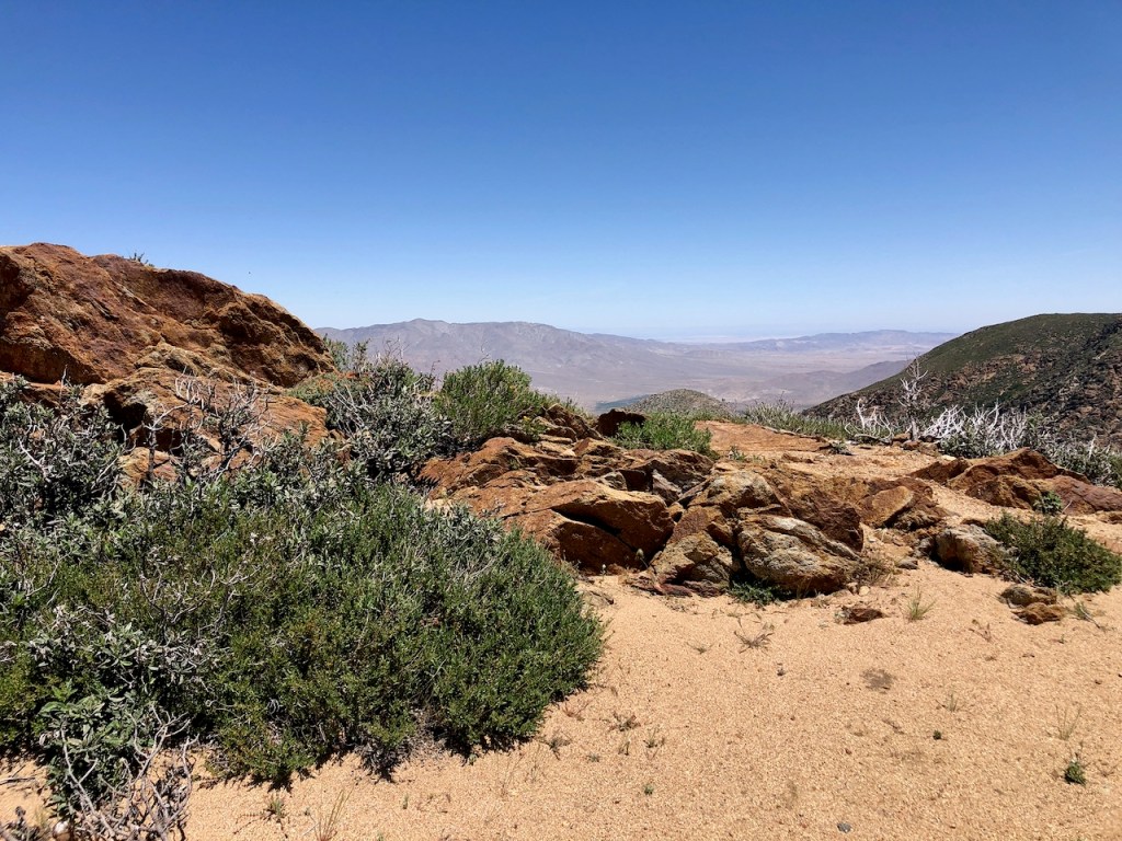
By noon, I was hiking along, making good time, enjoying the purplish and tannish views of the desert landscapes in the distance.
It was almost 12:30 by the time I reached a high point of the hike, around 5500 feet. I was not yet to Kwaaymii Point or Pioneer Mail Picnic Area.
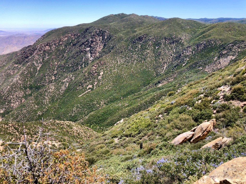
The views along this section were stunning. I could see Garnet Mountain, up ahead, which I hiked last June, when I camped at Big Laguna, and hiked along the PCT to it past Storm Canyon.

I gazed off down into the deep canyon below and realized this section was steep. It had me recalling my hike on the High Sierra Trail, with its dynamic granite cliff faces, dropping off into the middle of nowhere. There was nowhere to go if you stumbled in a few spots here, but it was not too bad either.
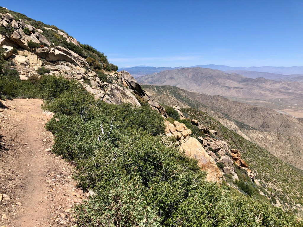
I took my time and tried to keep a low stance. Surfers bend at the knees to create a spring-like mechanism, to stay on their boards riding in choppy surf. I was applying that principle now, and staying near the inside.
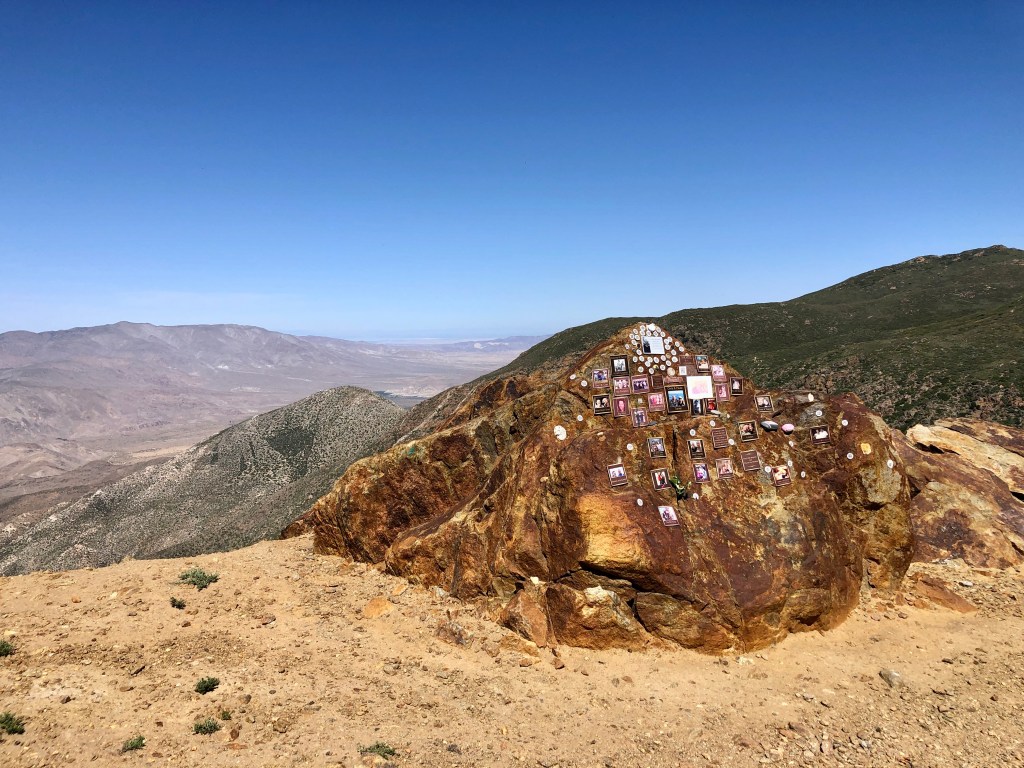
By about 1 pm I had finally made at Kwaaymii Point, a memorial to soldiers who served in our military. It stands in reddish granite rock, beneath a huge towering rock face.
It is located along what looked like the old highway with giant fallen boulders, shattered in thousands of pieces. It is a unique place for sure. One lone female PCT hiker was studying the photos set in the rock, as I passed, oblivious to my presence.
I approached Pioneer Mail Picnic Area having hiked 7.75 miles in 2.5 hours while making many stops to take photos, which was none too shabby of a time.
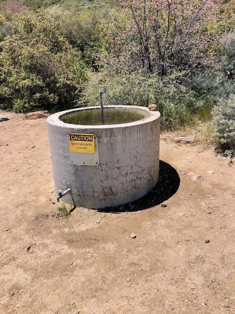
There was a water trough with a faucet there, which read non-potable water. I imagined it would be if you filtered it.

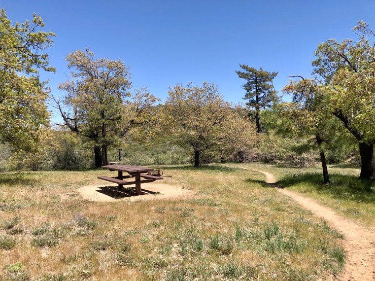
Pioneer Mail Picnic Area
As I walked through the picnic area, an older gentleman with a big white beard called out and asked how I was doing. The man resembled Cowboy, a trail angel I had seen on the Julian Trail Angels Facebook page, of which I am a member. He was talking about trail magic to hikers passing through and seemed to be ready to shuttle them into Julian for their re-supply. I was not completely sure, but had I asked for a ride, there is a good chance I might have scored. You just never know when asking for free rides. Asking for rides is something I am trying to avoid, unless absolutely necessary. I continued on intent on making it to Garnet Mountain.
I knew I had limited time on this particular day. If I was going to make it back home to have a dinner so unsure if I should proceed. I decided to give myself 30 minutes more. After speaking with my boyfriend who was expecting me for dinner, it was clear I should continue on, to complete my goal, since I was just two miles shy of it.
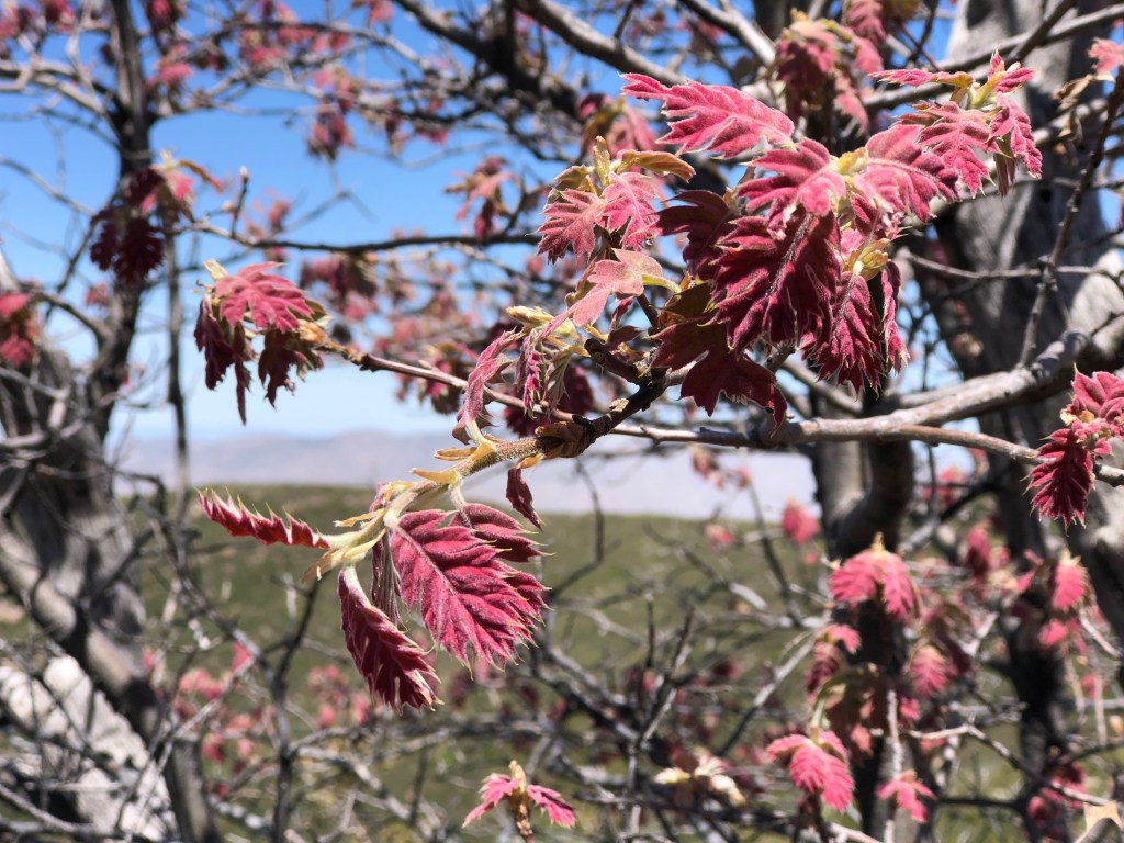
There were red-leafed California Black Oaks aka Kellogg Oaks, along the trail, a variety I have not seen that much in many other places.
The Cup Leafed Ceoanthus flowers were in full bloom, buzzing with bees. I was hopeful they were too preoccupied with the flowers to leave me alone. Beyond the flowering bushes, were many rugged peaks.
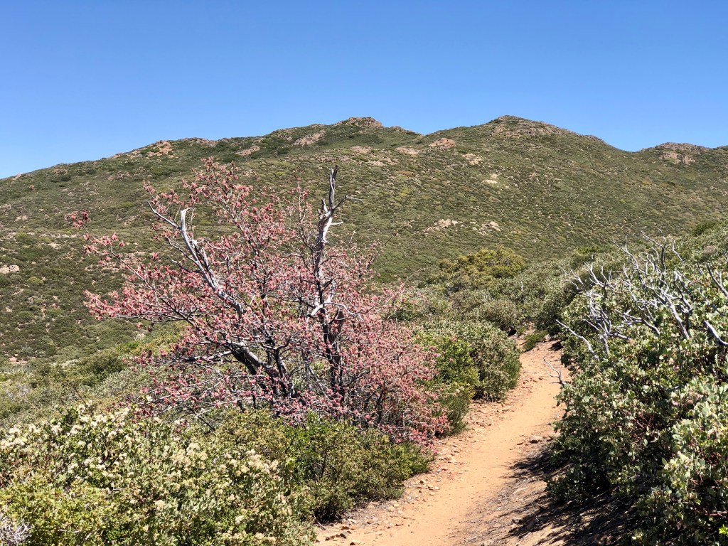
Garnet Mountain was not much further, and I made my final push towards it, determined, now approaching 9.5 miles on my watch. This hike had morphed into a 20 mile full day hike.
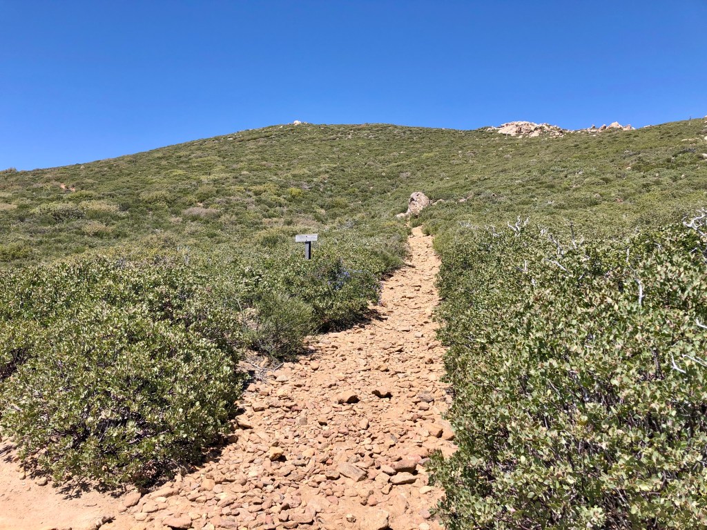
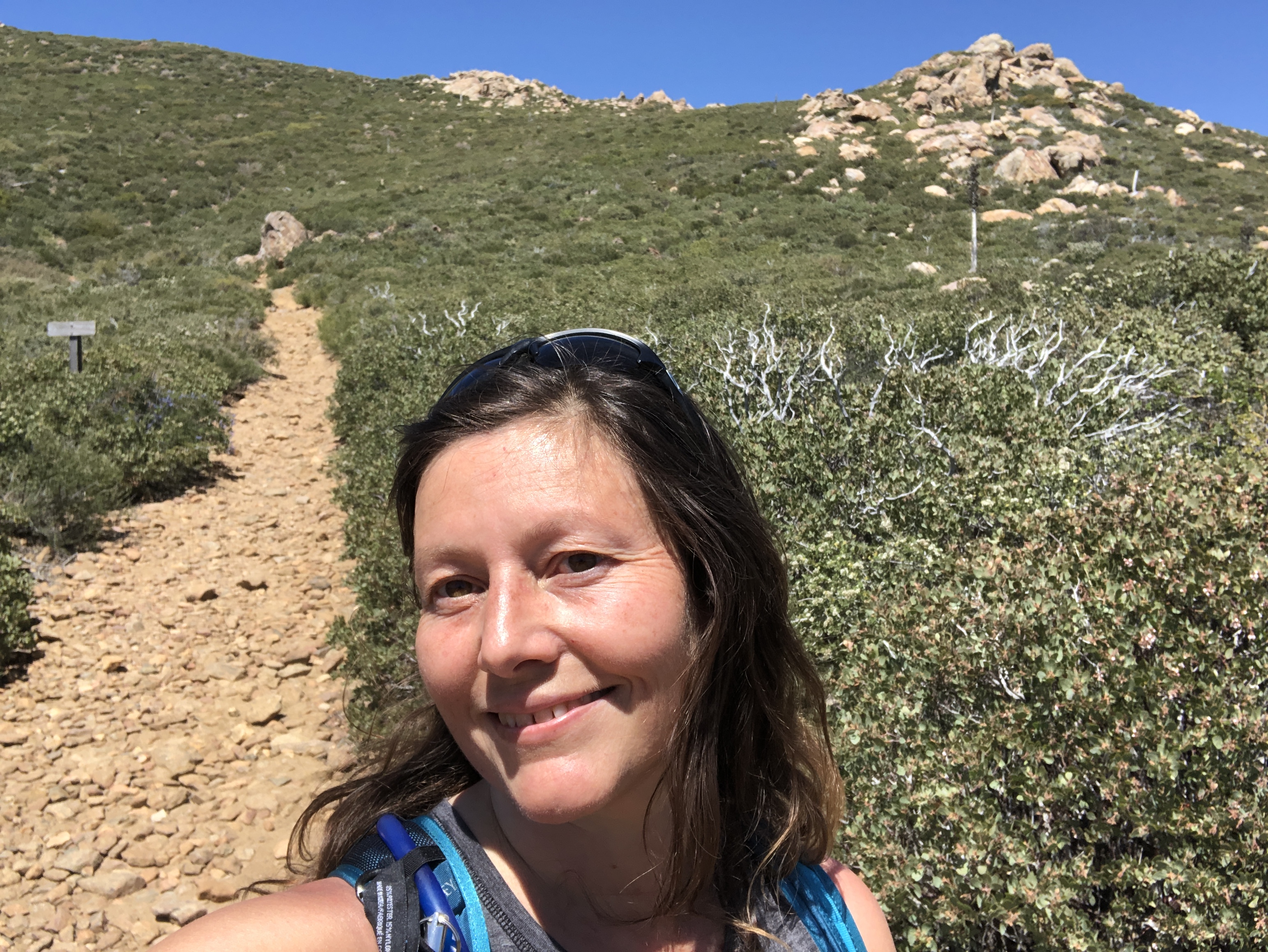
By 2:15 I was at the turnoff for Garnet Mountain, with its steep, and rocky trail.
I simply did not have time, with my late start to bag Garnet Mountain a second time today. So I continued back the way I came, content with connecting up with where I left off on the PCT last time.
I stopped for a snack break in the shady Pioneer Mail Picnic area, where several people were having picnics. The trail magic which was here before had since moved on.
Though there was more downhill than up on the way back, there was still plenty of uphill, and the last two miles would be uphill most of the way. I only passed one more hiker stopped trailside just enjoying the view, from the highpoint around 5500 feet.
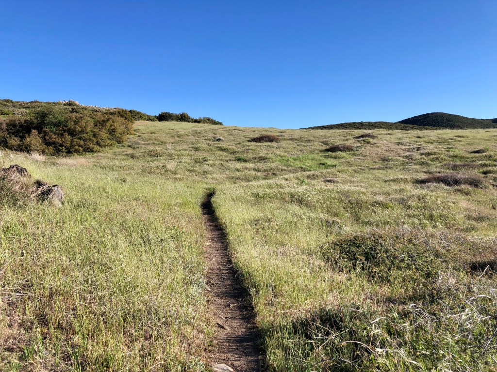
I made it back to my car, through the final stretch of grasslands, to Sunrise trailhead, by just before 6 pm, just in time to make the 2 hour drive back to Orange County, and have a late dinner.
About Hiking the PCT
Embarking on the Pacific Crest Trail along Section A takes you through the heart of the wilderness and rural San Diego County. With so much gorgeous scenery all around, it’s tough to find a reason not to hike here. The Pacific Crest Trail (PCT) stretches over 2,650 miles from Mexico to Canada, meandering through some of the most breathtaking landscapes in the United States. Along section A, the terrain at times can be unforgiving. A sturdy pair of hiking boots or trail runners, and the 10 Essentials, are recommended when hiking here.
The Terminus
Section A begins near the small town of Campo, California, before winding its way along a dusty path, edging further and further from the looming border wall. The towering mountain peaks in the distance urge you to continue, climbing higher and higher toward Mount Laguna, the first high point of the hike. This section has some steep climbs that will test the endurance of just about everyone who attempts this trail, either as a section hiker or in its entirety.
What is Trail Magic?
The phenomenon known as “trail magic,” frequently comes in the form of a cooler filled with icy-cold drinks. Trail angels stationed at certain points along the way will offer rides into town, and words of encouragement. This brings solo hikers, and people from all walks of life together in a trail community, sometimes referred to as a trail family, or tramily. It truly is the adventure of a lifetime, but also one not possible, without teamwork, and the kindness of strangers.
A Special Place
No hiker is ever the same after hiking the PCT, which is one reason this is a special place and more than “just a trail.” I know I am forever changed by it, in a good way. There is so much peace and tranquility, along with a level of predictability, and great community. These are the reasons I keep coming back here again and again, as much as I can. My current goal is to complete Section A, and I have just 15 miles to go. Until next time PCT.

Prayers for Healing
At the time of this hike, I was navigating supporting my daughter, who had lost her half-brother, all the while dealing with a challenging incident at work, so having my ex-husband, who lost a son in the back of my mind was not a good thing. The last few weeks I had been praying for people who were no longer part of my life who I would probably never see again…my ex and his family. Having a person on my mind, who harmed me, for year and years, was traumatic for me. I forgave him already, but I didn’t need to think about him. That was hard to do, since he just lost his son. I never really got to know Luke, and only saw him a handful of times over the years. My goal was to let go of thoughts which do not serve me, trust in God, and hopefully get a better mindset by the end of this long day hike. I wanted to be more forgiving, more accepting of what I cannot control, and rest in God’s strength. This had become my mantra for the day. I felt shaken up, and not centered at the beginning of the hike, though no longer. I gave to God what he can handle, better than me.
Hiking out in nature, just wipes the slate clean.
They say to Leave it Better Than You Found it. I stick to that rule. Share the Love and Leave No Trace when venturing in the wilderness.
I hope you enjoyed reading this, and it is helpful in knowing what to expect, should you decide to visit here.
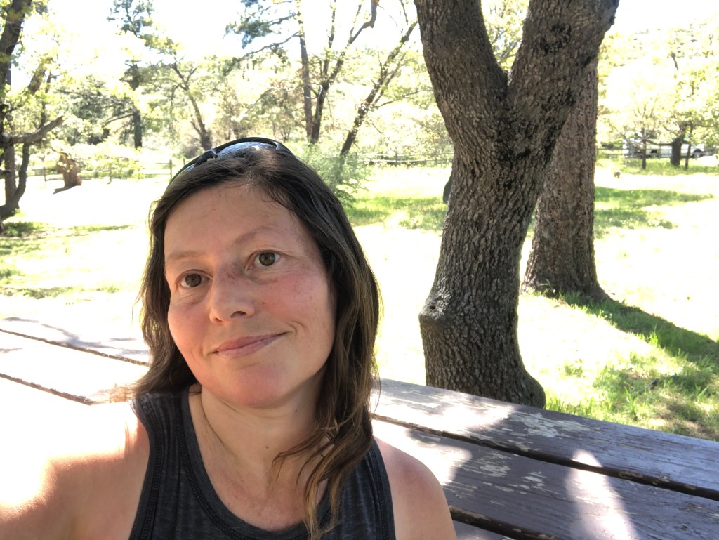
About me
I’m Serafina! I’m a writer and California girl who loves to go exploring. Hope you will get outside today, breathe some fresh air, and be happy!
Follow my Journey…
Be sure to Like and Subscribe to My Youtube Channel where I post videos!
Disclaimer: The work on this blog is my opinion and my opinion alone and I am not responsible for the outcome if someone were to apply these thoughts to their own life. All text and photography copyright 2024 by Serafina, all rights reserved. Information and opinions provided are kept current to the best of the author’s ability. All readers’ usage of the ideas and opinions presented in the blog, are at their own risk. Be aware of the possible dangers of hiking, surfing, walking, cooking, and other activities, which may take place indoors or outdoors. By reading this, you agree not to hold the author or publisher of the content on this web site responsible for any injuries or inconveniences that may result from reading the blog, or partaking in any activity mentioned in the blog. Read the blog, and use its ideas, if you so desire, at your own risk.
