It’a mid February and I am driving north from Orange County toward the LA mountains to hike to Etiwanda Falls. There has been an abundance of snow covering the high peaks of the Angeles Forest, a mere hour drive from my home.
How it Got its Name
In 1882 early settlers of the area named the area Etiwanda after a Lake Michigan tribe of the same name. The reason for this is unknown. My only guess if they were from Michigan.
How it was Established
This preserve was established as a habitat preservation area on February 10, 1998, by the San Bernardino County to create a Riversidean Alluvial Fan Sage Scrub Plant Community (that’s a mouthful) and habitat for the Coastal California Gnatcatcher.
I was meeting up with a friend for a much anticipated waterfall hike. After searching through a list of hundreds of different trails, I came upon the Etiwanda Falls Loop. I wanted to hike to a waterfall I had never seen before. I wanted to avoid icy mountain roads, ruling out some of the other options in the area such as Switzer Falls. So Etiwanda Falls seemed to fit the bill.
The 1200 acre Etiwanda Preserve is a vast hiking area, of open space, rocky hills, a watershed, and rugged canyons, dotted with oak trees.
Fun Facts:
- The North Etiwanda Preserve was the site of the 2003 Old Fire, one of the worst fires in Southern California’s history.
- The preserve has one of the earliest water pipelines in the area.
- There are early settler ruins, such as that of George Day.
- There is an interpretive center displaying the history of this preserve.
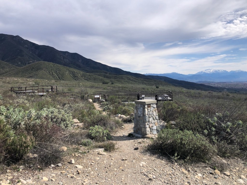
- There are interpretive signs at the trailhead, and along the trail.
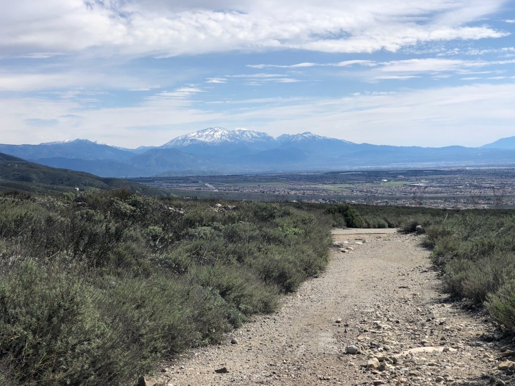
This preserve is criss-crossed by numerous hiking trails. It is one of the more popular hikes in the foothills near Rancho Cucamonga. With the beautiful scenic mountain views, this area is no doubt, a hikers and mountain lovers paradise.
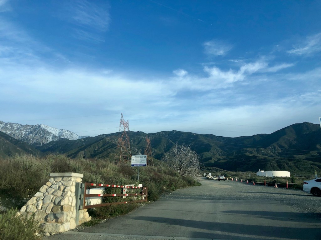

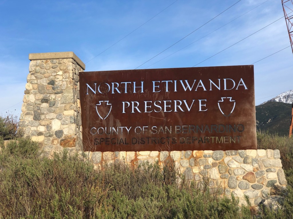
We arrived at the typically overcrowded parking area. There were several posted signs, about the parking fees, and how to pay.
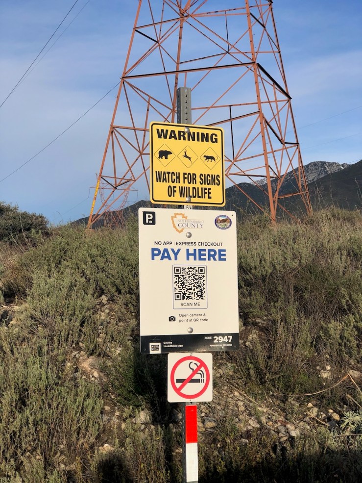
The parking was $3 for a half day which was more than adequate for the 6.5 mile hike, encompassing the entire preserve. You could simply scan the qr code, and pay via an app.
Upon exiting the car, realized we were in the midst of a wild windstorm. What I thought might be mild temperatures this morning, had turned frigid with the high winds, occasionally gusting to 50 mph. We bundled up in puffy jackets, as the breeze threatened to blow anything not firmly attached to us away.

This is the map of the preserve, marking all the points of interest here, of which there are many.
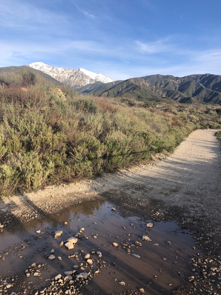
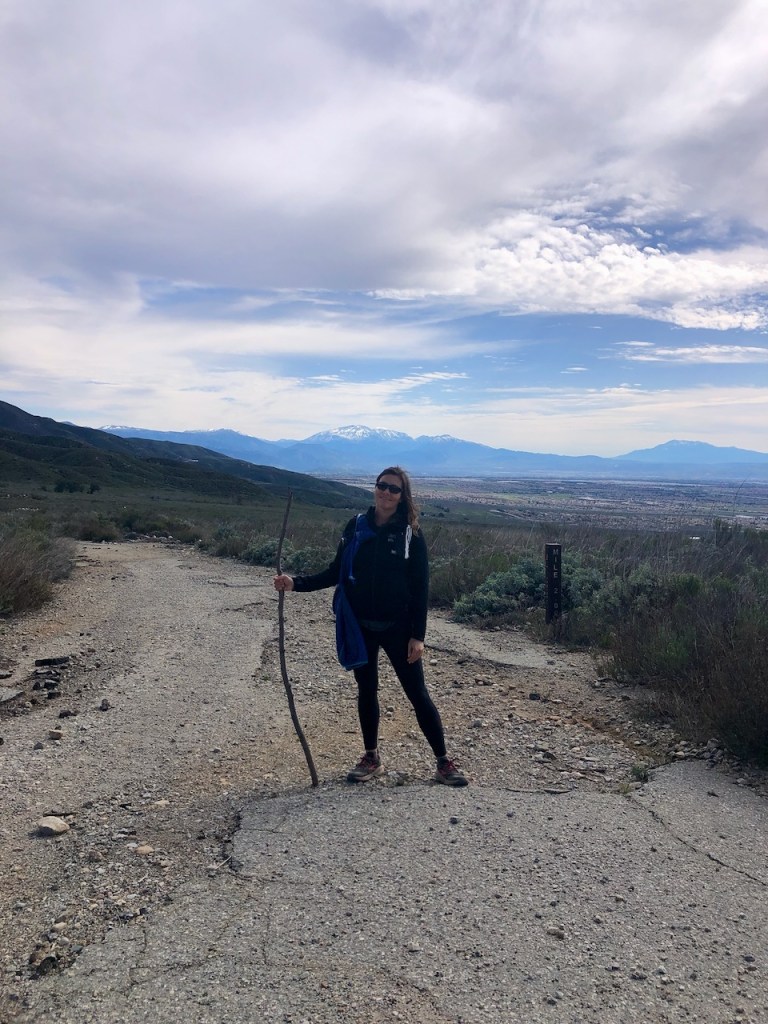
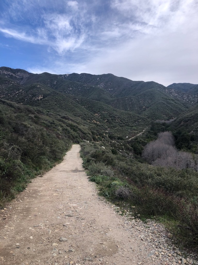
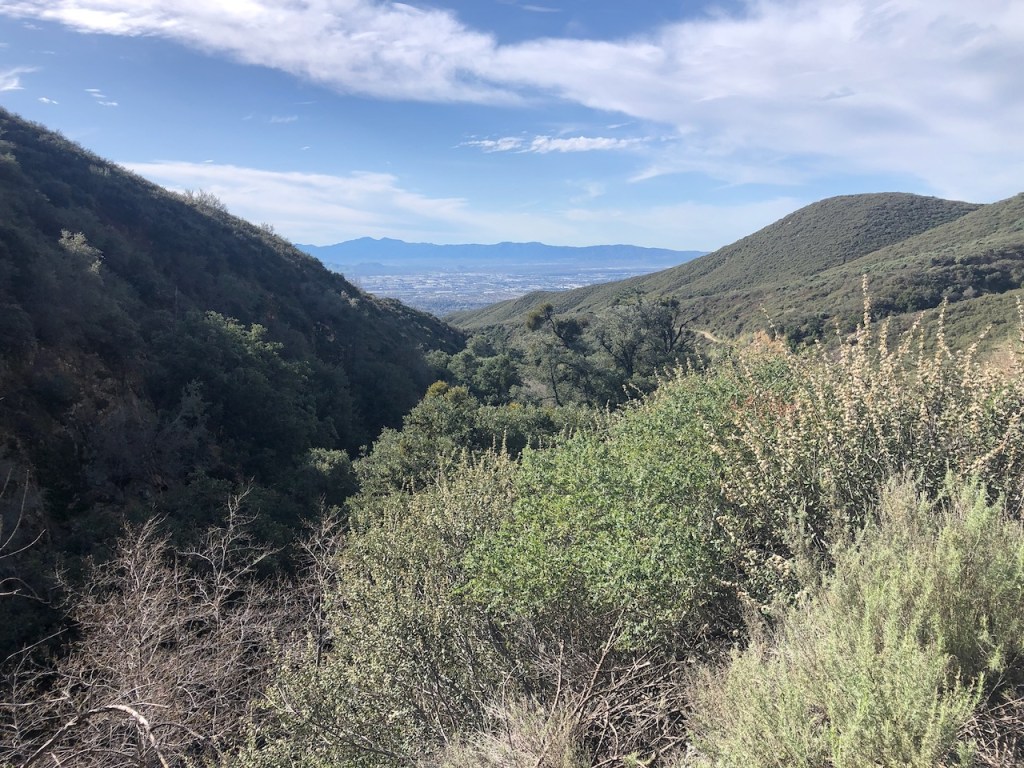
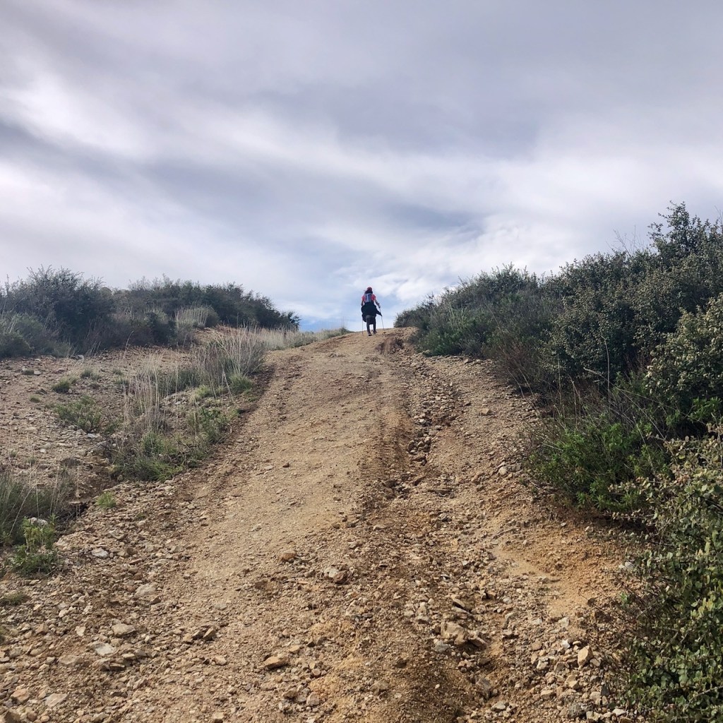
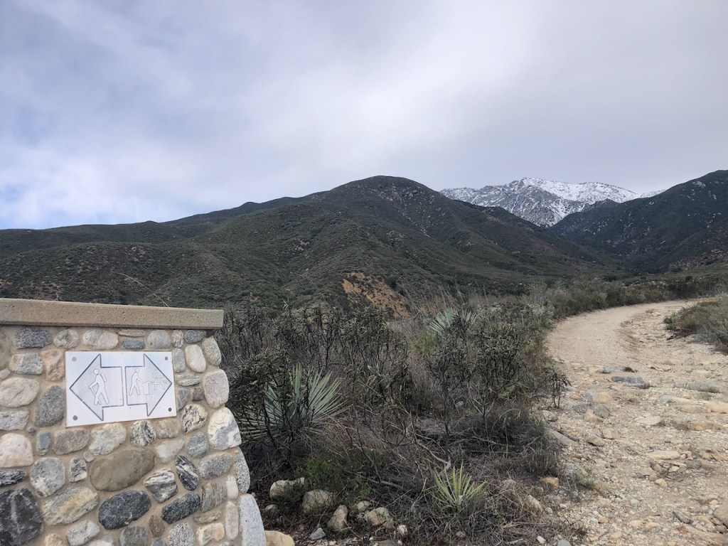
The first mile or so of the hike was a gradual upward climb along a wide fire road, which gradually became more rough, rutted, and rocky.

Huge gully’s were cut into the trail from recent rains and atmospheric rivers, which drenched Southern California. These same rains make for beautiful flowing waterfalls though.
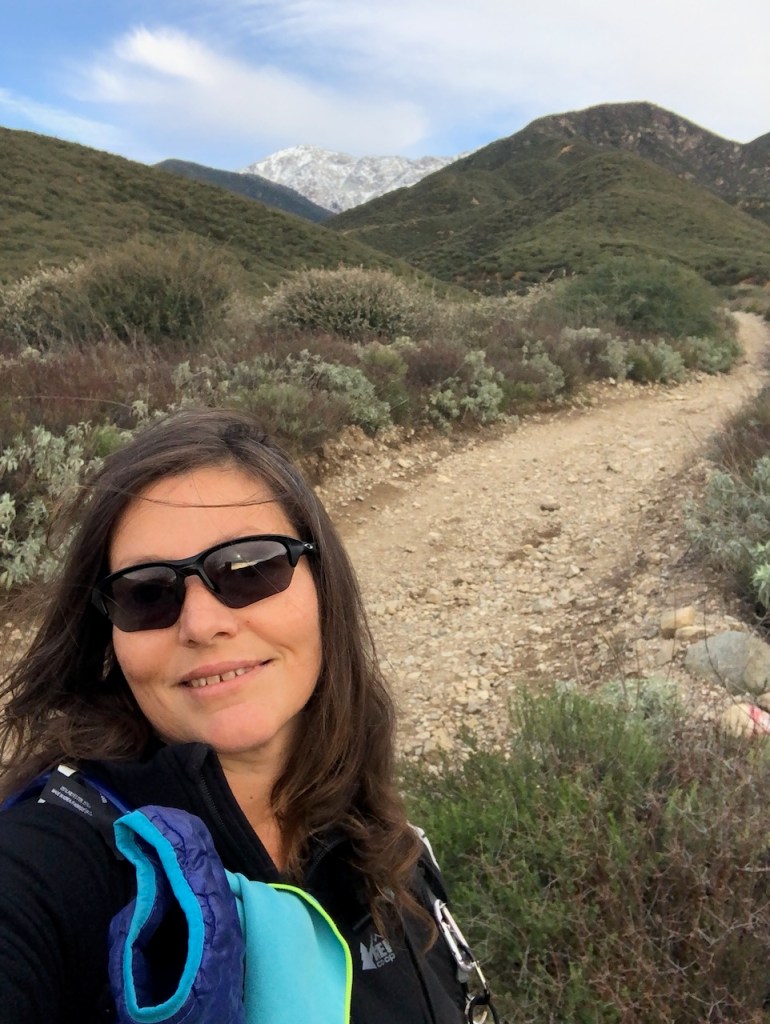
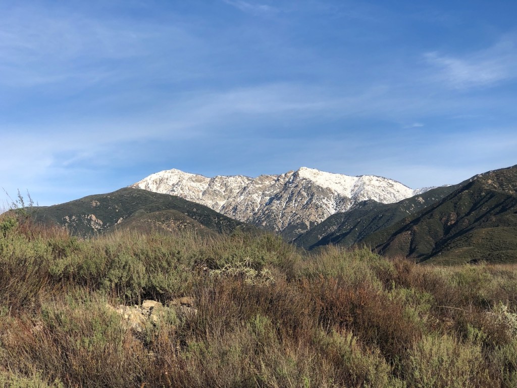
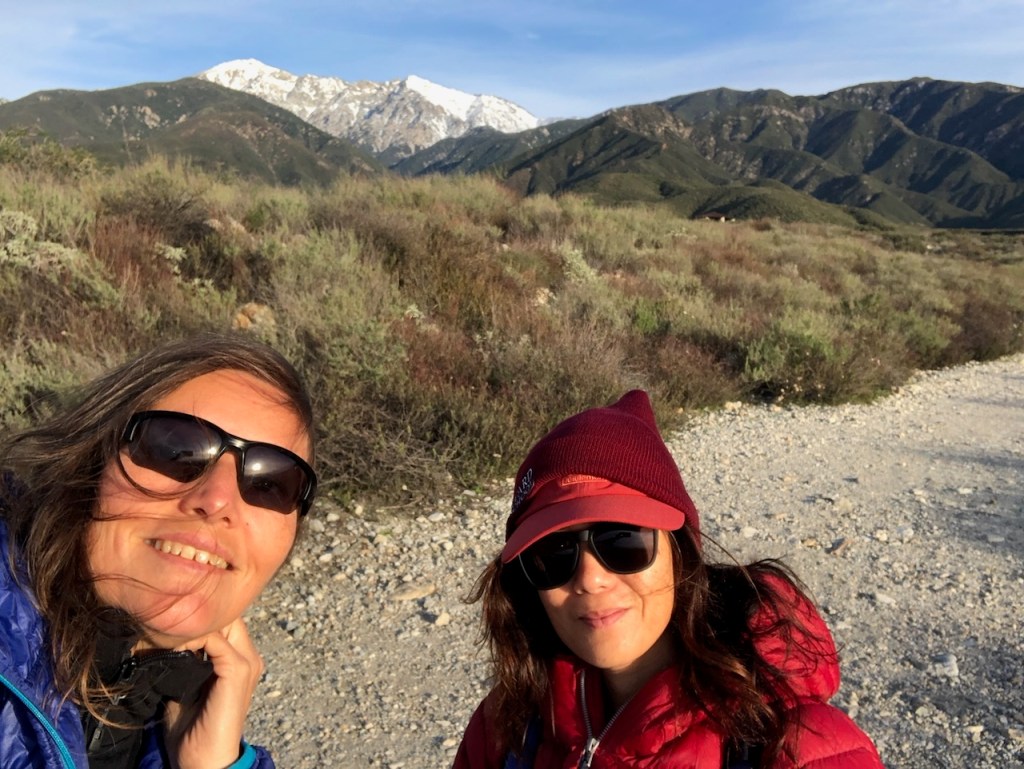
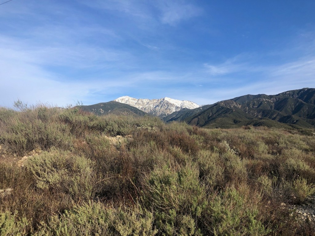
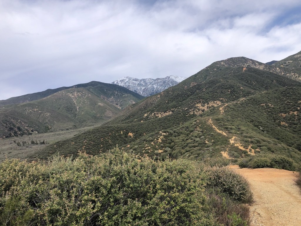
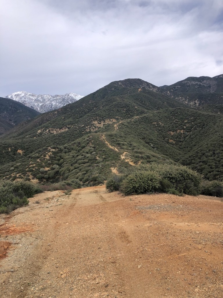
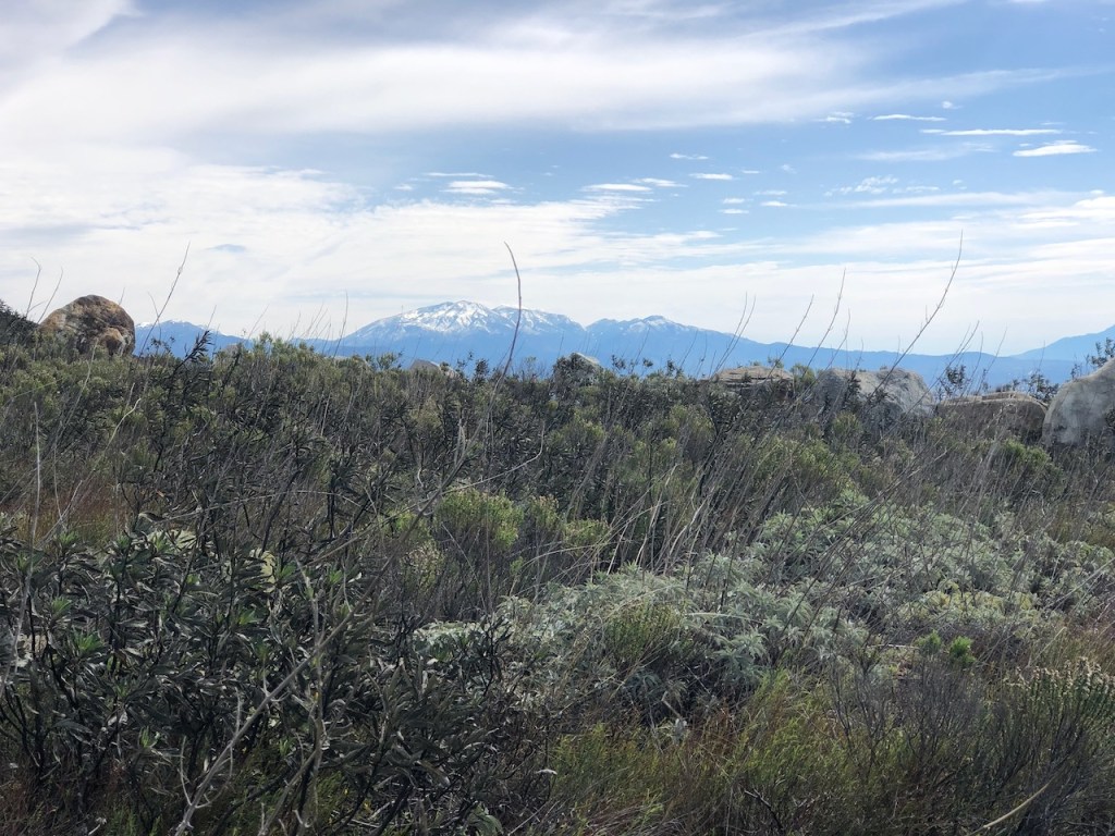
It was still overcast on much of our climb. Winter was just coming to a close, and snow covered Cucamonga Peak hovered in the distance above, along with Etiwanda Peak. My hiking partner for the day had climbed that same peak with me, years ago.
We started discussing the peaks we still want to climb, as we continued climbing. That is what die hard hiking fanatics do. You hike and dream of more hikes.
As we climbed further we began to pass the remains of some sort of water or irrigation system. Water would occasionally overflow the trail, and I started to wonder if there would be any water crossings.
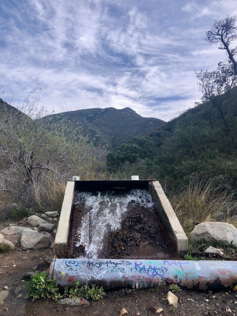
Though there would not be any significant water crossings, we continued to see these strange water pipes, gushing like fountains on either side of the trail. This preserve has several historic sites and the pipes are what remains of one of the earliest irrigation systems in the area. It was first constructed in 1893, to capture the flowing waters of Etiwanda Creek, and continues to provide water to the City of Rancho Cucamonga, to this day.
The trail forked, and we stayed to the right, continuing on to the falls, along the edge of the steep mountainsides. The canyon began to narrow. As we hiked on, there were more relics of the waterworks, and more water flowing everywhere.
I notice a few trees off in the distance. Not soon after that we reached an overlook, over a deep canyon. I hear the distinct sound of water flowing.
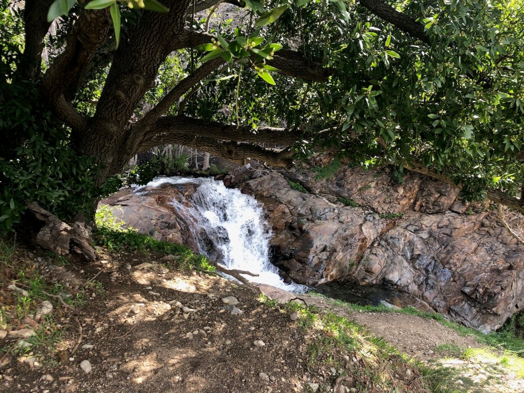
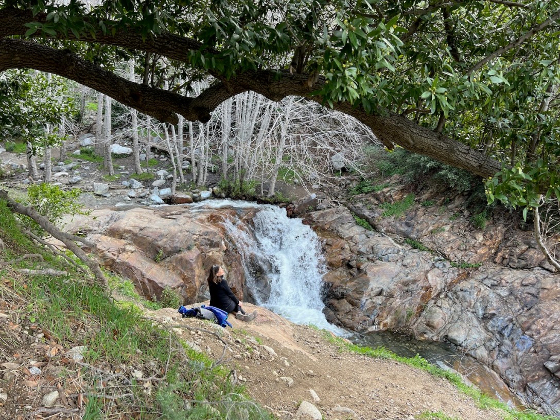
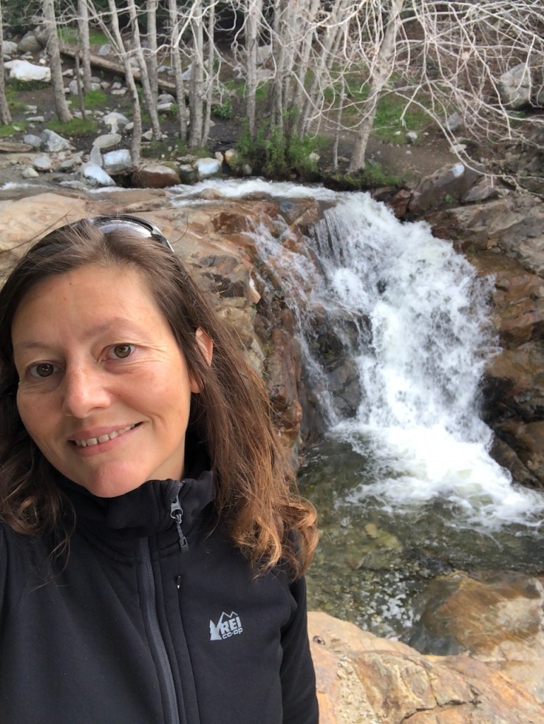
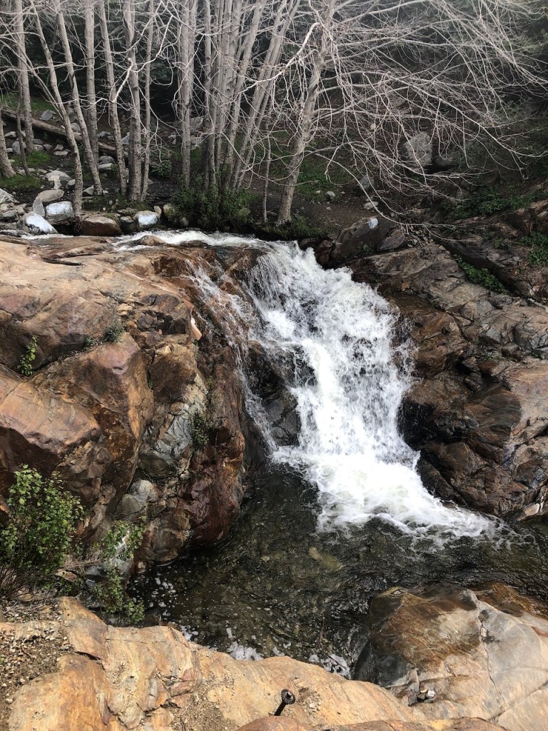
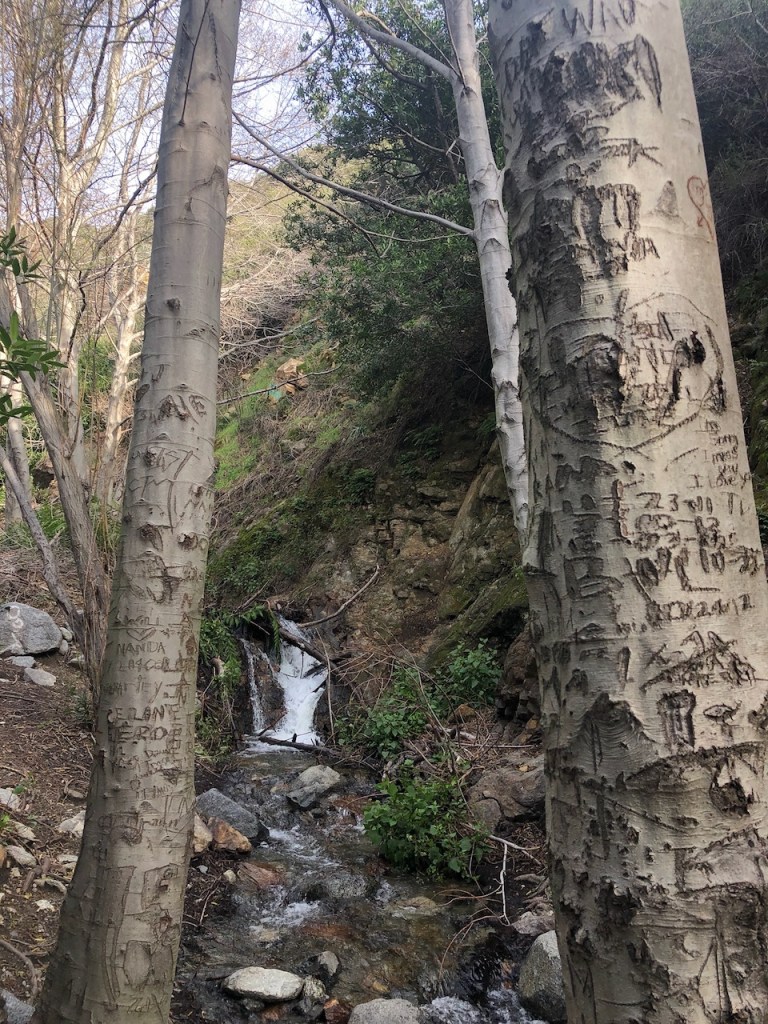
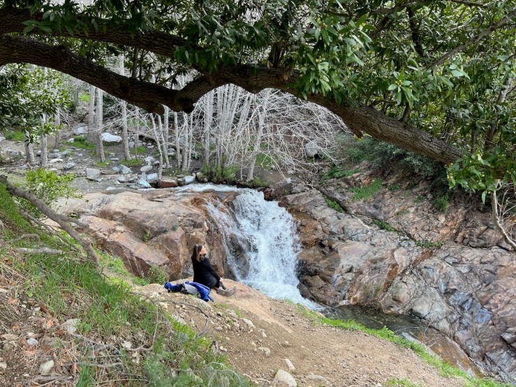
Beneath a large oak tree I am treated to my first glimpse of Etiwanda Falls.
Streams were converging via two canyons, before tumbling off into the rocky gorge. There was no way to tell how deep it was, or how far it dropped off
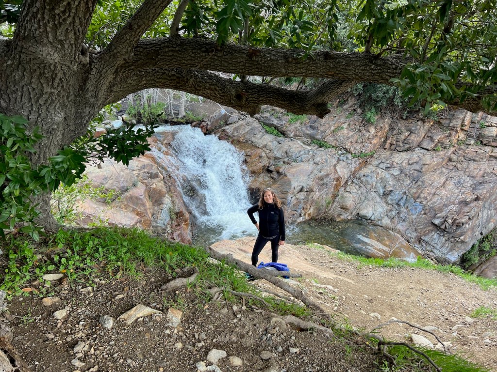
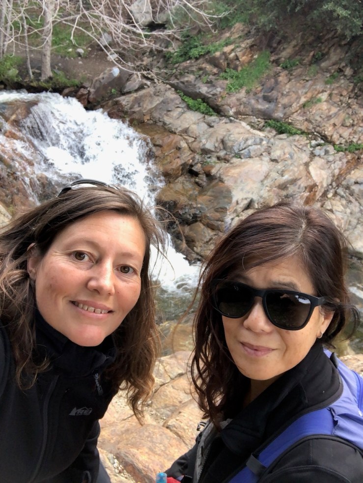
The falls were much taller and more dynamic than I had imagined it to be. We took turns taking photos there. I had to be careful because there was slippery terrain, a narrow path, and a steep drop off to the falls. I was not disappointed at all, it was so pretty.
I kept the fact that waterfalls are a prime place for hikers to be injured, in mind. I was treading as carefully as possible, and tried to make good choices, while enjoying all this.
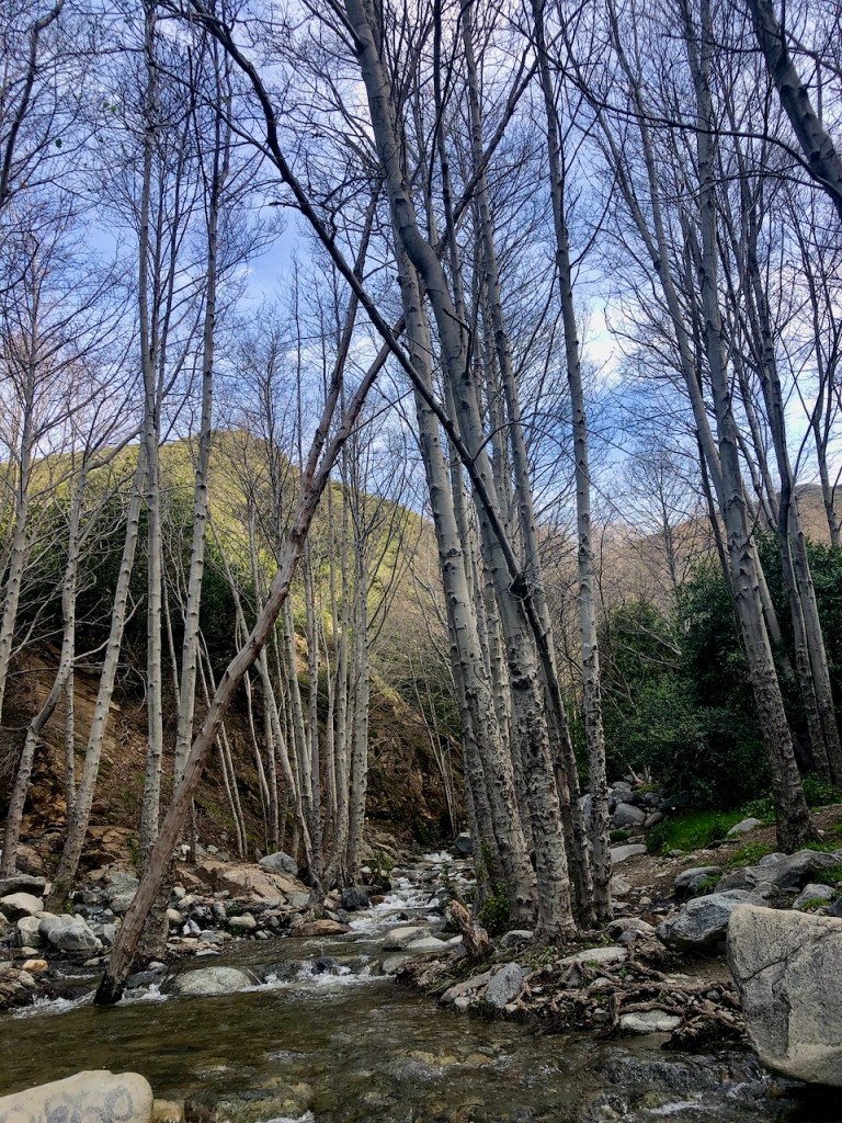
The creek ran straight through a woodland of sycamores, with their distinct pale gray bark.
There was just one other small group alongside us at the falls, and we were fortunate to enjoy unobstructed views.
It if was not chilly out, I could imagine this falls would be irresistible to take a cool dip in.
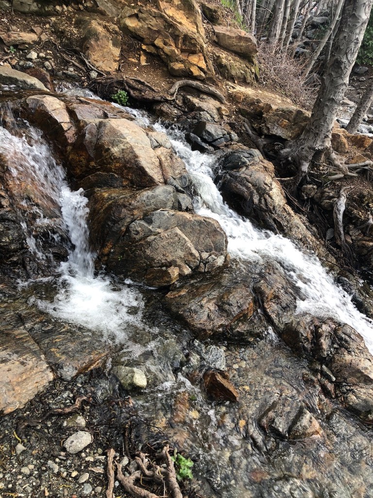
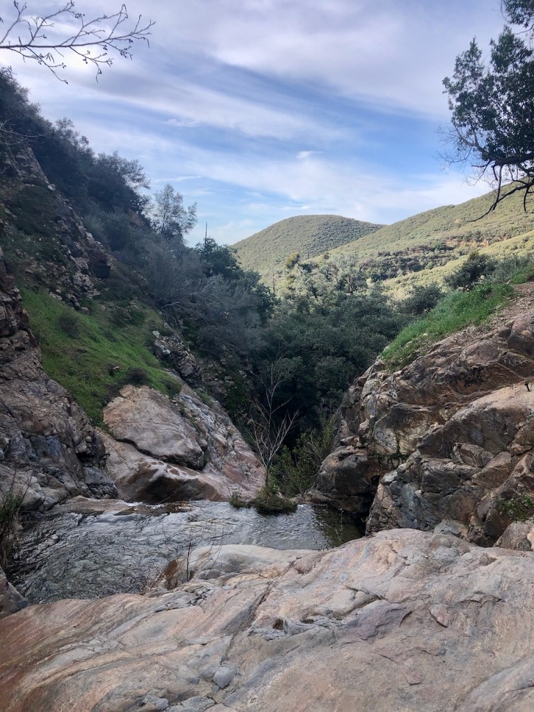
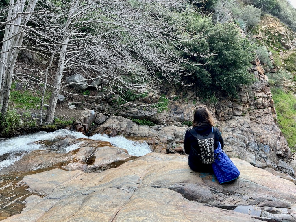
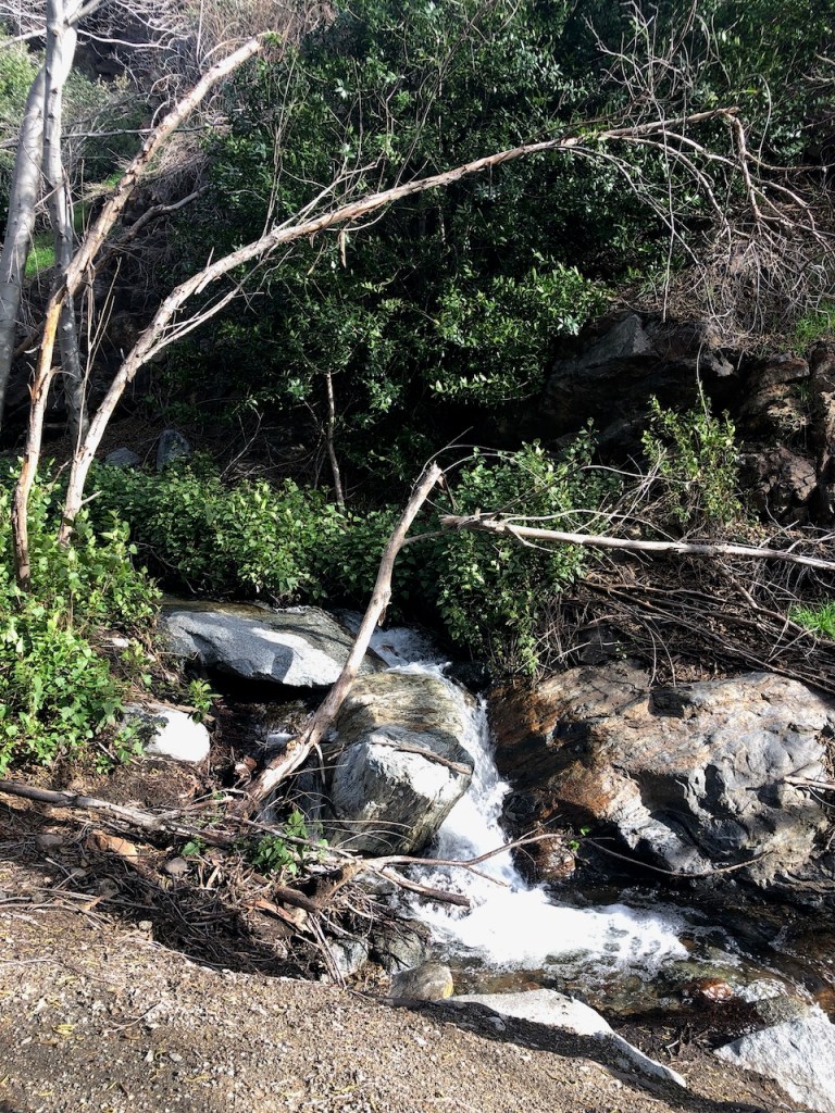
We noticed a “social trail,” to the left of the fork. Water was flowing everywhere, and we navigated amongst tree roots, and mud, following the stream along a narrow dirt path, to see what was up there.
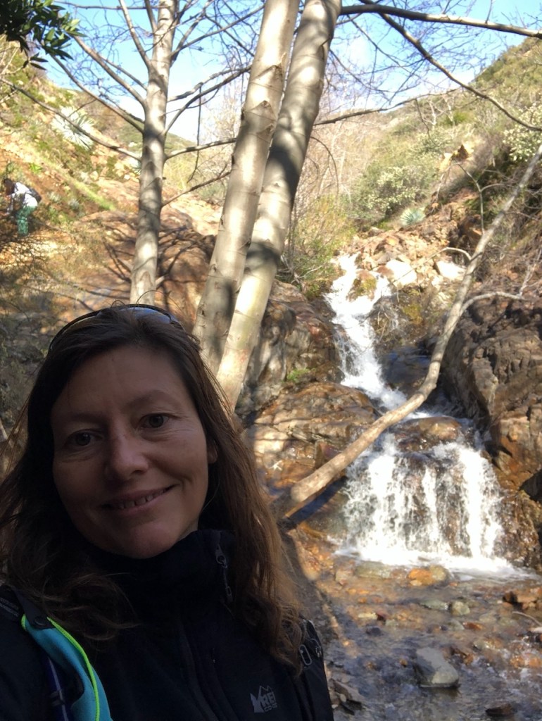
We were soon rewarded with another falls, which I will refer to as Upper Etiwanda Falls. This falls was flowing over giant granite boulders.

Beyond the second waterfall, the trail continued on further, over the rock, and up a steep path.
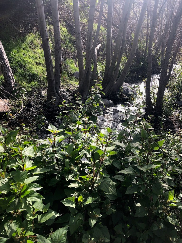
We ended up hiking through what I will refer to as Etiwanda Canyon for another 30 minutes or so, enjoying the fresh new spring growth, and wildflowers.
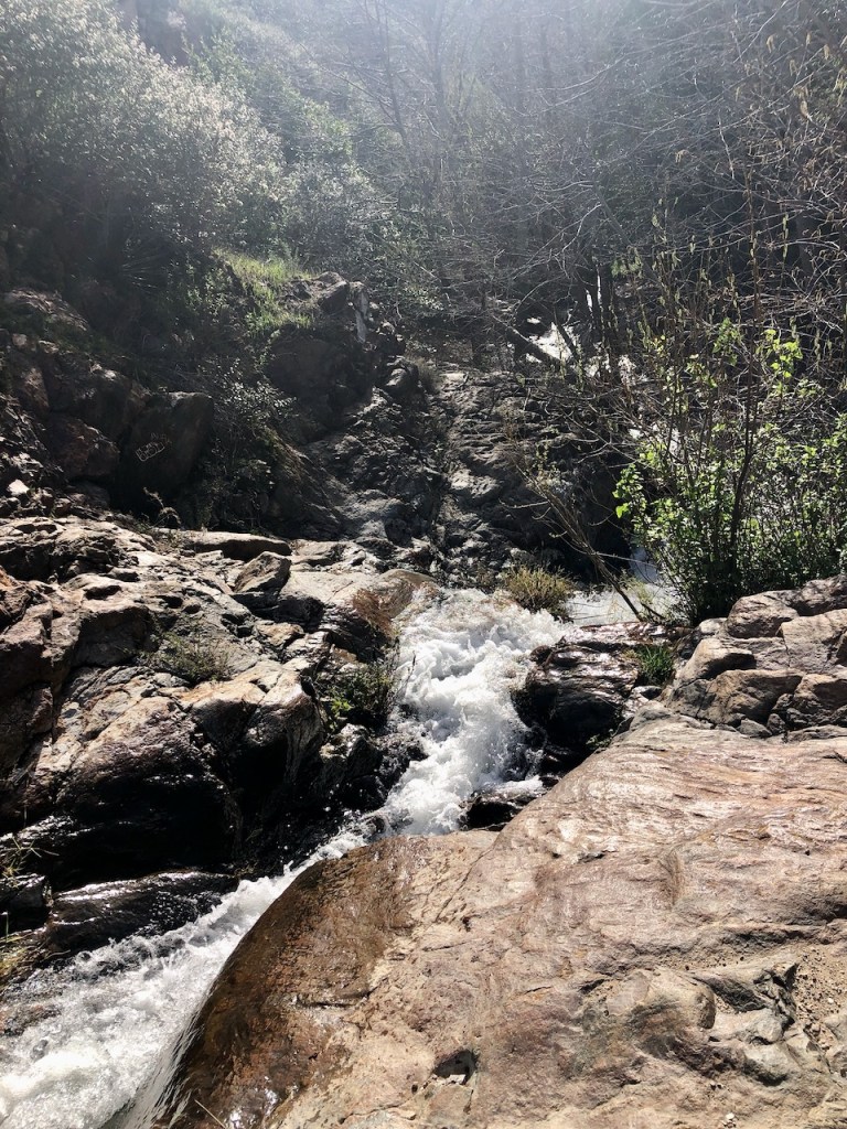
Eventually we began to lose the trail since it got overgrown, and narrow.

It was tough to see any more waterfalls up ahead through the trees, though most likely was another one. We never intended to do bushwacking. We decided it was time to head back.
Still there were many more waterfalls throughout the canyon, and it felt like more of an adventure searching for them.
The wind continued to wail through the canyon with all its new spring growth.
Deadfall are standing dead trees. They are a genuine concern for hikers, especially when there is a strong wind whipping through a canyon. I knew it was better to not hang around too long under trees in a windstorm. Loose branches could fall, and it’s generally not a great place to be.
So we continued back the way we came, but when we arrived at the fork in the road, this time, after consulting my map, we decided on hiking the entire Etiwanda Loop.
We ventured along the wide trail, hugging the ridge northward, and there was a small amount of gain we added to our hike as the trail climbed the ridge.
We noticed a small steep hill off to the left of the main trail, and imagined it would be nice for photos, so we decided to hike up it and check it out.
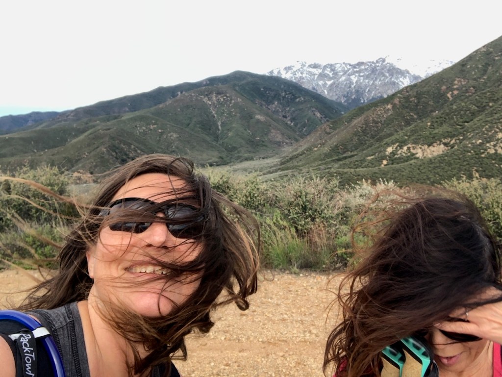
The wind was brutal up there, blowing our hair, as we struggled to hold the camera steady to take a photo.
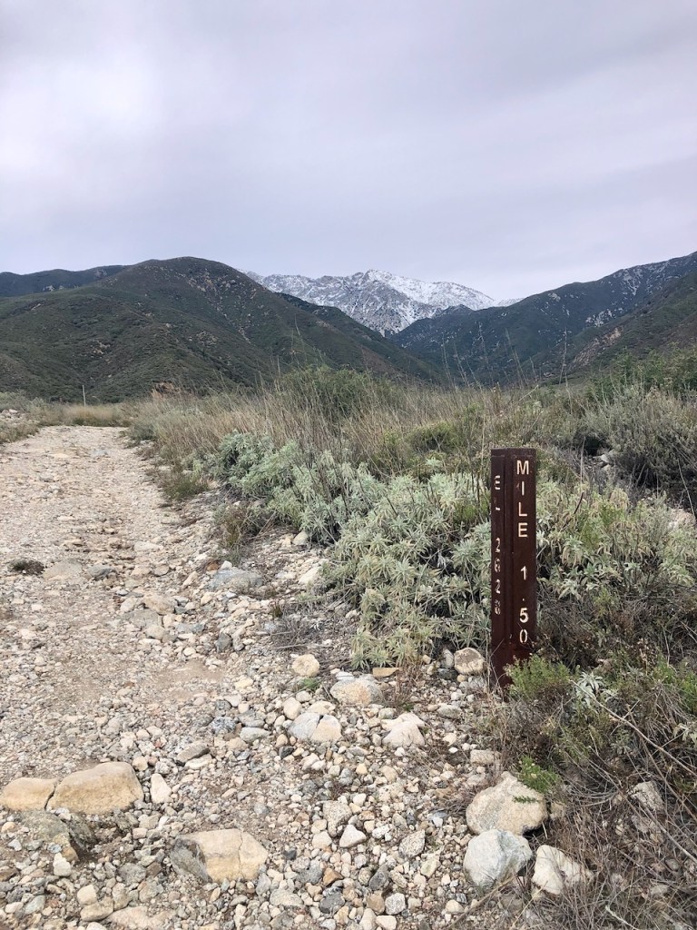
There were some helpful mile markers along the trail. Was this mile 1 or 1.5? I knew we had hiked over 5 miles so far. So it seems the hike is meant to be a clockwise loop.
There was a reservoir up ahead and a river marked on the map up ahead, so I decided to check it out.
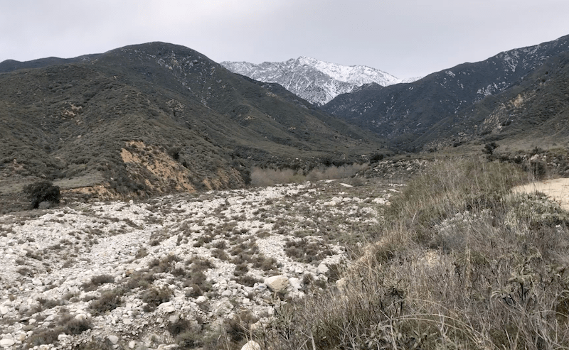
We continued to the opposite end of the preserve, gazing down at the dry creek, filled with huge boulders, likely tossed about violently in a big storm, during runoff. It would not be a place you would want to be during a flash flood.
I noticed several benches and nice picnic areas, with awesome views in this part of the preserve.
The residents of Rancho Cucamonga are fairly lucky to have such a beautiful hiking area in their backyard. Several trail runners and groups began to pass us.
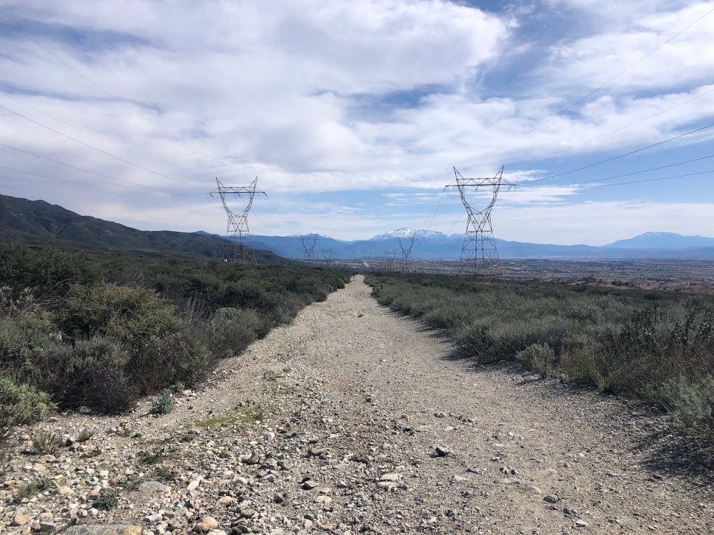
The last half mile was fairly uneventful and the trail traveled beneath two sets of power lines.
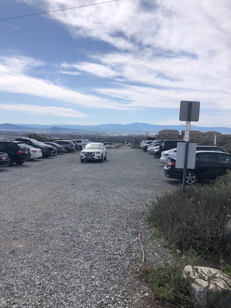
Arriving back at the trailhead, we found the parking area to be a zoo of cars trying to snag a parking space. Every single spot was full, of the 30 or so spots that were available. Going early was a good plan, and the windstorm likely was the reason we had the trails mostly to ourselves.
It was a peaceful morning and there is not much I did not enjoy about the Etiwanda Preserve.
I hope you enjoyed reading this, and it is helpful in knowing what to expect, should you decide to visit here.
Maps
Trail Map: https://specialdistricts.sbcounty.gov/nep/north-etiwanda-trail-map/
North Etiwanda Preserve Loop: https://www.alltrails.com/trail/us/california/north-etiwanda-preserve-loop–2
About me
I’m Serafina! I’m a writer and California girl who loves to go exploring. Hope you will get outside today, breathe some fresh air, and be happy!
Follow my Journey…
Be sure to Like and Subscribe to My Youtube Channel where I post videos!
Disclaimer: The work on this blog is my opinion and my opinion alone and I am not responsible for the outcome if someone were to apply these thoughts to their own life. All text and photography copyright 2024 by Serafina, all rights reserved. Information and opinions provided are kept current to the best of the author’s ability. All readers’ usage of the ideas and opinions presented in the blog, are at their own risk. Be aware of the possible dangers of hiking, surfing, walking, cooking, and other activities, which may take place indoors or outdoors. By reading this, you agree not to hold the author or publisher of the content on this web site responsible for any injuries or inconveniences that may result from reading the blog, or partaking in any activity mentioned in the blog. Read the blog, and use its ideas, if you so desire, at your own risk.
