It reminded me of my hike up Mount Whitney somehow, this toe-crushing, and somewhat soul crushing peak. I had truly met my match with this one.
The first thing people mention is that there is no water, the second thing, is about how much water they brought, and the third is about running out of water here. I knew that much about this hike, to bring plenty of hydration. Beyond that, so much was unknown to me about this place.
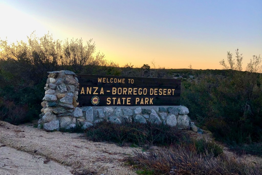
The thought of hiking to one of the tallest peaks in Anza Borrego State Park sounded so exciting. I had been to several other hiking spots in the area in recent years, and this desert oasis just kept drawing me back in.
Extremes
Exposure to extreme heat is probably the most common danger to befall visitors in the desert. Lack of shade can lead to heatstroke. Most people don’t carry their own shade structure or hiking umbrellas. I have a small umbrella, and it is a must for me in the desert, along with a wide sun hat. Despite all this, heat stroke can still occur, if your electrolytes are not in balance.
Warning Signs
Hiking in the desert is not everyone’s cup of tea, but I love it. It is a place to heed the posted warnings and come prepared. If you don’t, you may pay the price.
Drawn In
Despite the inherent dangers of exploring a place like Anza Borrego, this desert state park holds a huge draw for me. It has a unique, picturesque beauty, and stillness. All kinds of people, from all walks of life flock here, during every season for the many opportunities to participate in various forms of outdoor recreation. You can take a hike, go off-roading, ride ATVs, camp, and just stargaze at night. Borrego Springs is a dark sky community after all.
Font’s Point
One of the most popular hikes here is to Fonts Point, to enjoy a view of the beautiful wavy cliff faces. This spot is best enjoyed at sunrise, and sunset, after a short trek down an unpaved road.
The Slot
Then there are the jagged sandstone cliffs of the badlands further east toward the Salton Sea. Off to the south, are desert washes, wind caves, and a narrow slot canyon. These natural wonders are formed by flash floods, wind, rain, and consistent erosion over time. It is easy to meander around, and you can easily get lost without a map.
The Wind Caves
Even with a downloaded all-trails map, technology can fail. While exploring The Wind Caves and The Slot, years ago, my map stalled and froze. I was truly in a pickle then. I didn’t know where to go, or how much further I had, as the sun began to set. I made it out in one piece, hiking in the dark, with only the light of my phone as my guide.
Palm Canyon
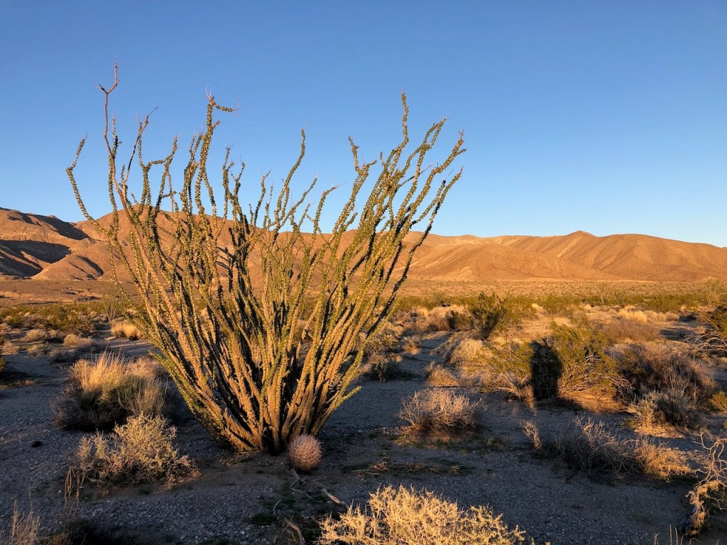
I also enjoyed Palm Canyon, with its blooming Ocotillos, and waterfall. There are many palm tree oases and usually dry waterfalls, in the canyons throughout this desert valley, amidst jagged, rugged desert terrain.
Desert Peaks
Anza Borrego has several peaks to explore. The first desert peak I ever climbed was Ghost Mountain. After hiking to the Marshall South homestead, which sits alongside this mountain, I continued on to the peak. It was here, I realized what desert mountain hiking is all about.
Ghost Mountain
The last mile or so to Ghost Mountain’s summit was thick with spiny yucca, giant boulders, and prickly cholla cactus. It resembled a devil’s obstacle course, more so than a trail. I began to wonder if other area peaks, had similar terrain.
Even More Peaks
Scanning a map of the area, I spotted several more mountain peaks to make plans to climb. Just in the area around Borrego Springs are Coyote Peak, San Ysidro Mountain, Granite Mountain, Whale Peak, Wilson Peak, Grapevine Mountain, and Indianhead Mountain.
Epic Hikes
I was obviously drawn to the more technical and “epic” long hikes, like Villager Peak. Though I was not entirely ready for multi-day trips, such as Rabbit Peak, or Dawn’s Peak yet. I wanted a challenge, and after hearing about Villager for years, here I was, ready for my first attempt.
A Scenic Drive
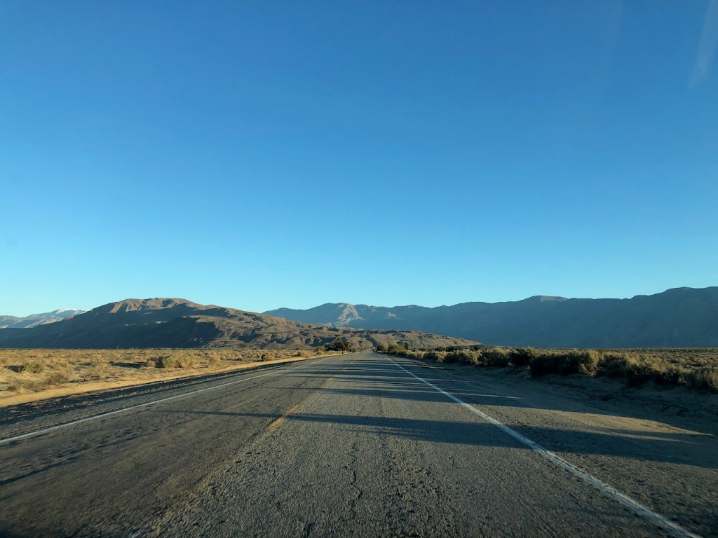
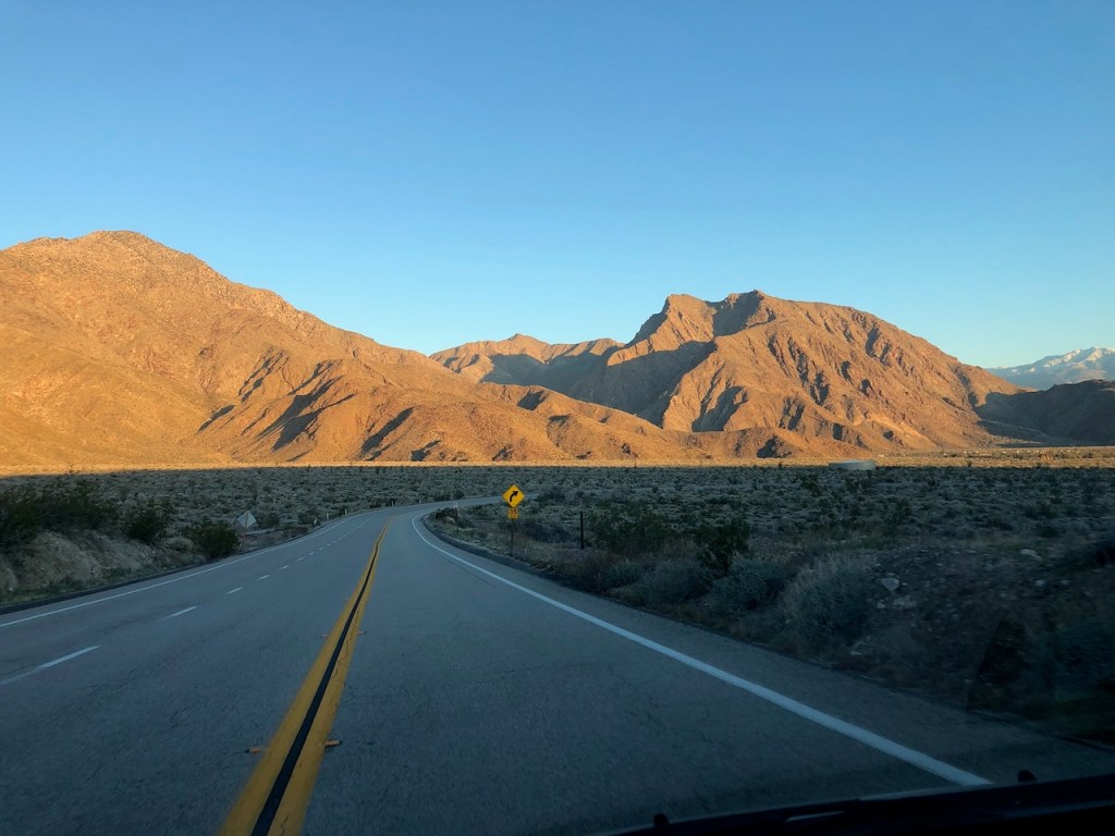
It early February, and just before sunrise, as I drove through rural San Diego County, passing by the scenic rolling hills along Route 76. I began heading through the Pauma Valley, during the twilight hours, passing the casino, and making good time.
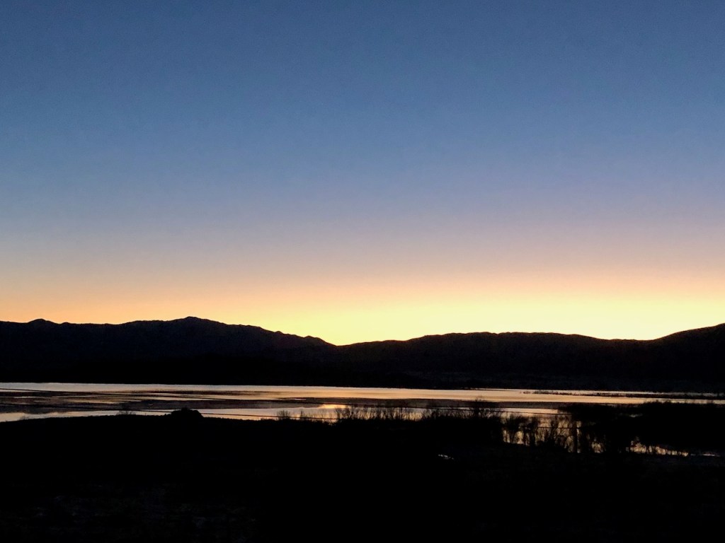
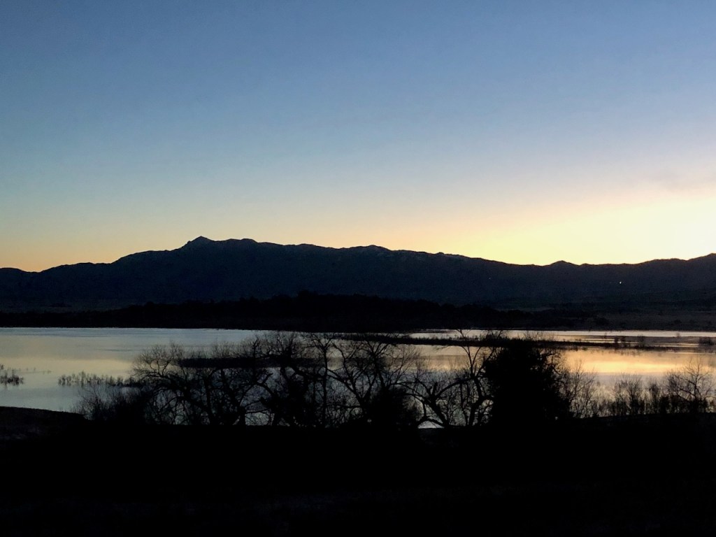
Lake Henshaw
Eventually, I passed Lake Henshaw, which was filled to capacity from recent rains. This is a major watering hole for migratory birds along the Pacific Flyway. The grasses surrounding the lake were covered in frost, as temperatures hovered around freezing. You can pretty much expect it to be chilly here in mid-February.
Hwy 79
I drove on further, turning north on Hwy 79 at Moretti’s Junction. It was evident that the valley, glistening in white frost, was due to temperatures well below freezing, last night. After turning right on San Felipe Road, it was all coming back to me.
I passed by one of the trailheads of the PCT, which just a year ago, I had hiked along, heading north toward Warner Springs.
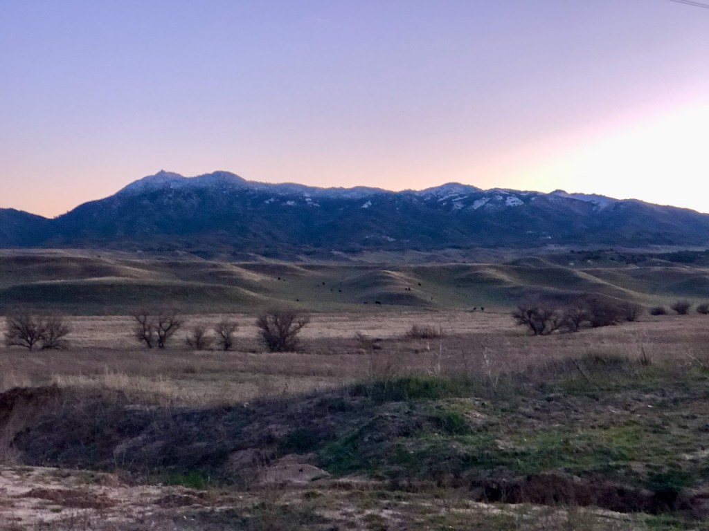
Hot Springs Mountain
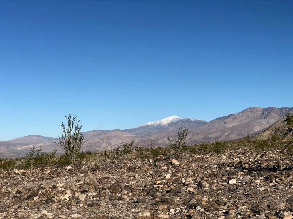
To my right were a few snow-capped peaks, over 6000 feet in elevation. As I drove east I could see Hot Springs Mountain, all covered in snow, to the north in the Los Coyotes Indian Reservation. This is a hike I have wanted to check out for some time, despite the small admission fee.

Sunrise Over The Valley
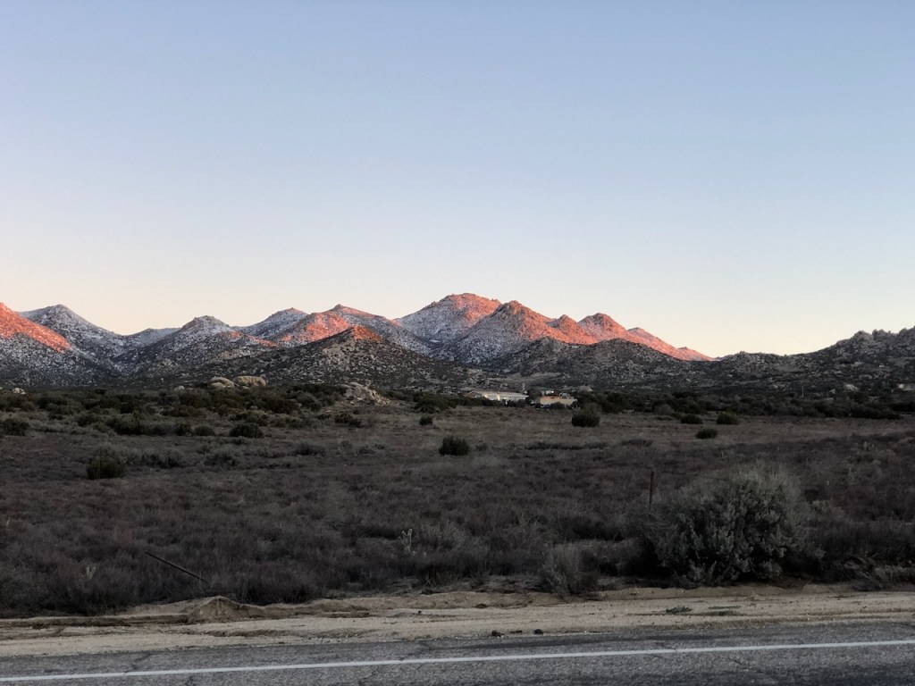
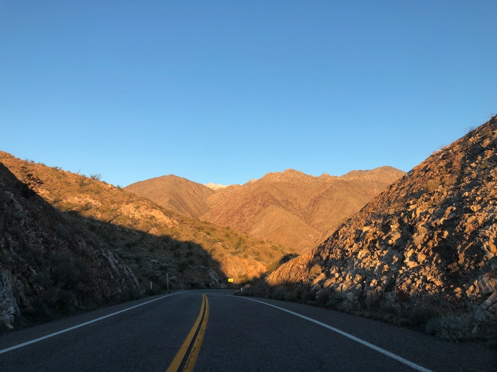
I began to descend along winding Montezuma Valley Road, just as the sun was beginning to rise, after passing through the rural town of Ranchita. I was heading into the valley below, toward the town of Borrego Springs. This section of road had lots of rocky boulders and resembled a rock garden.
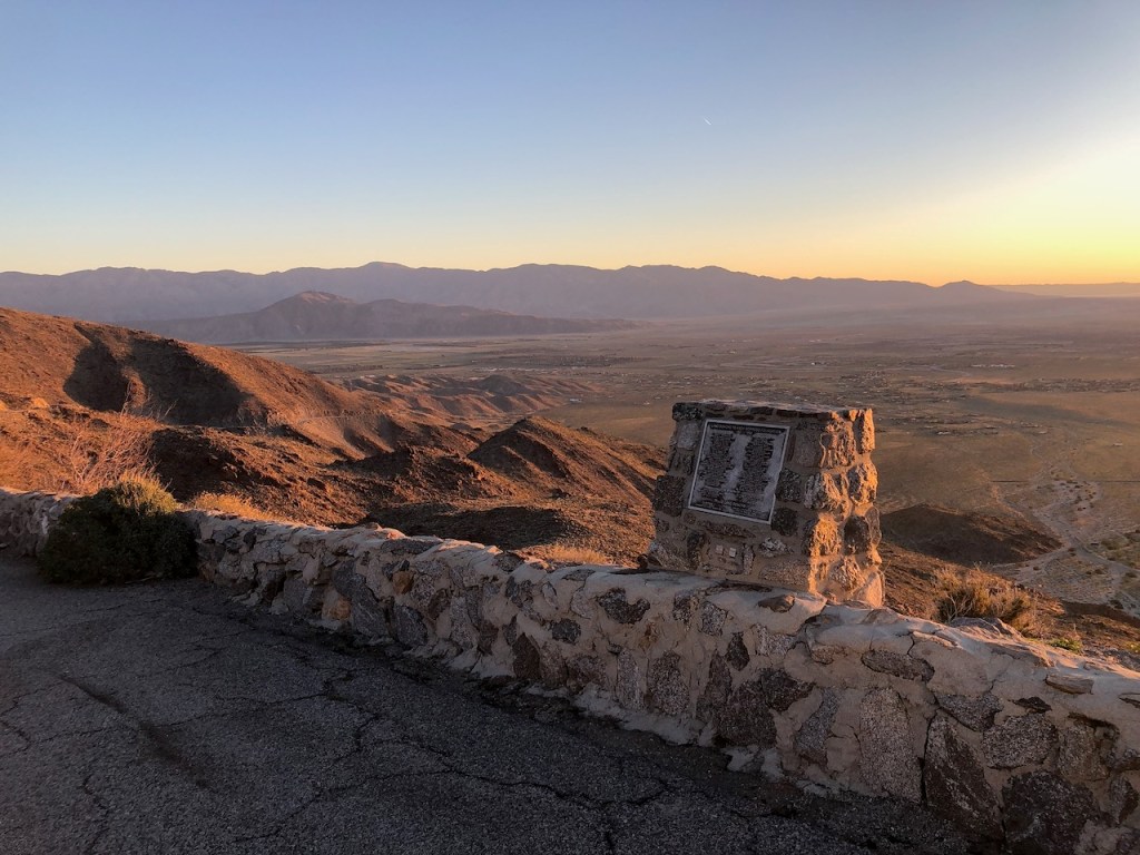
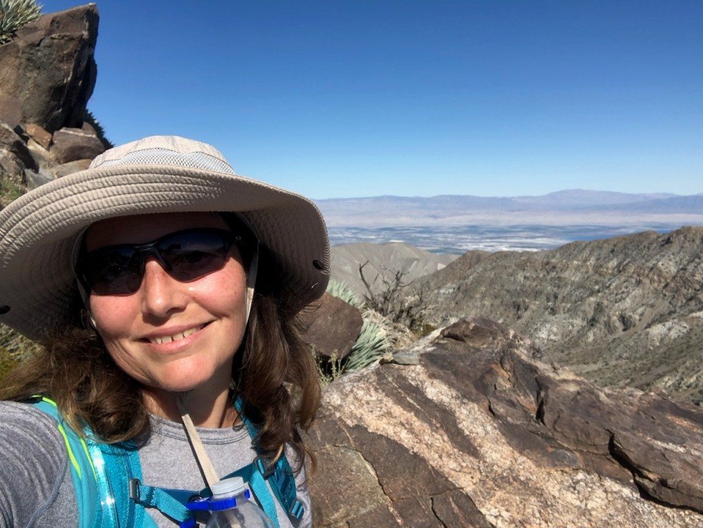
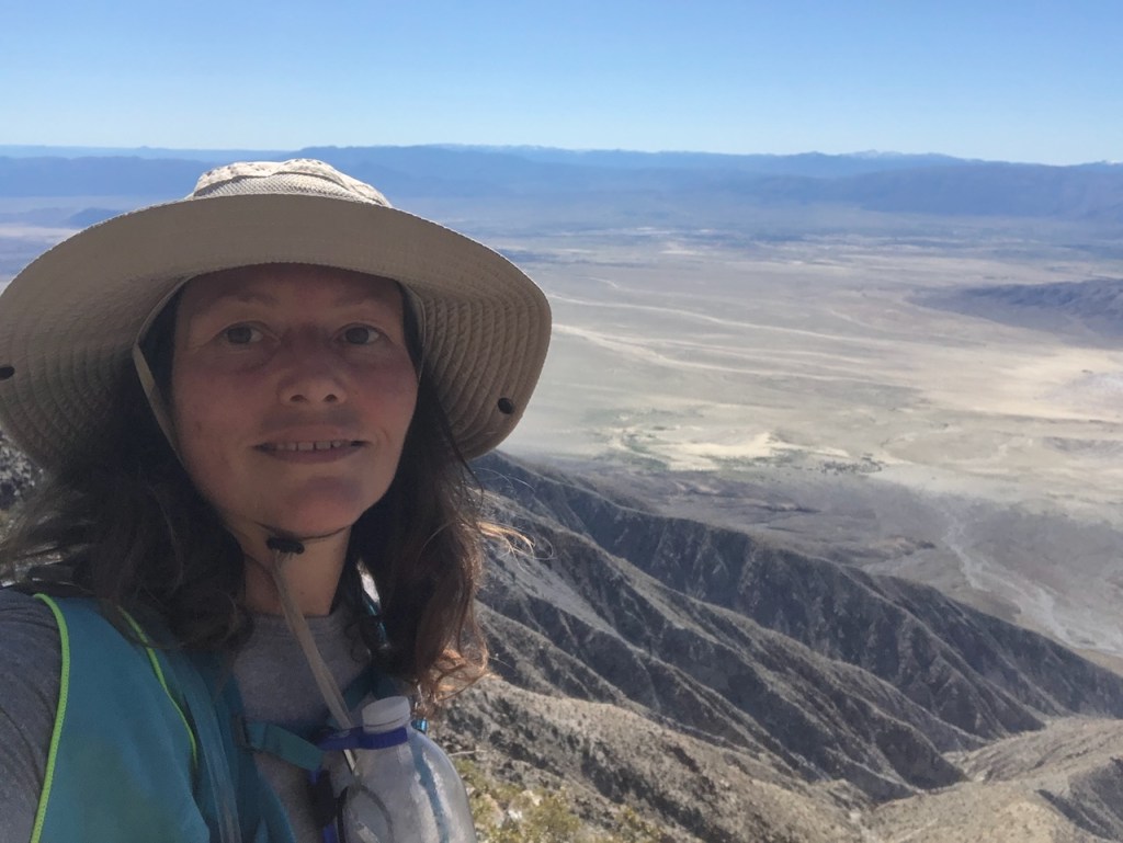
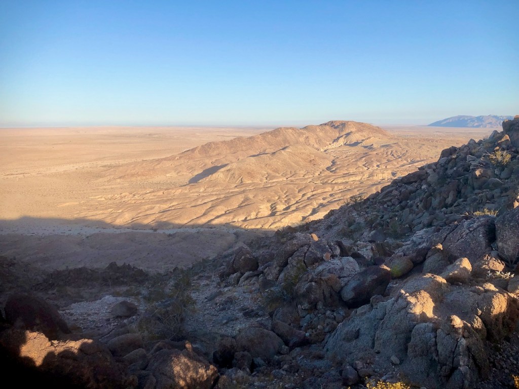
The Overlook
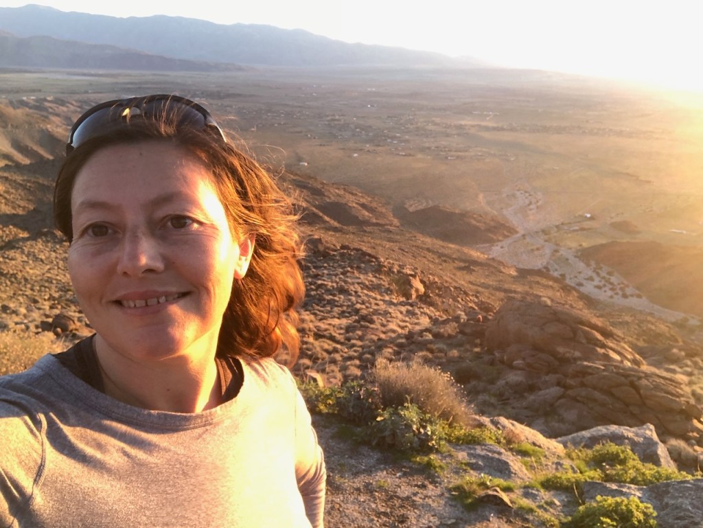
The rockfaces were aglow at this hour. It was around 7 am when I arrived at an overlook and gazed out over the desert valley below. Back when I first took a trip to the desert, I had made my own assumptions about it. Thoughts of a dark, desolate, and isolated place would come to mind. Of course, the desert is anything but, especially when the ocotillo were lit up aflame in red spring flowers, like some burning bush. So here I was in Anza Borrego once again.

Borrego Springs
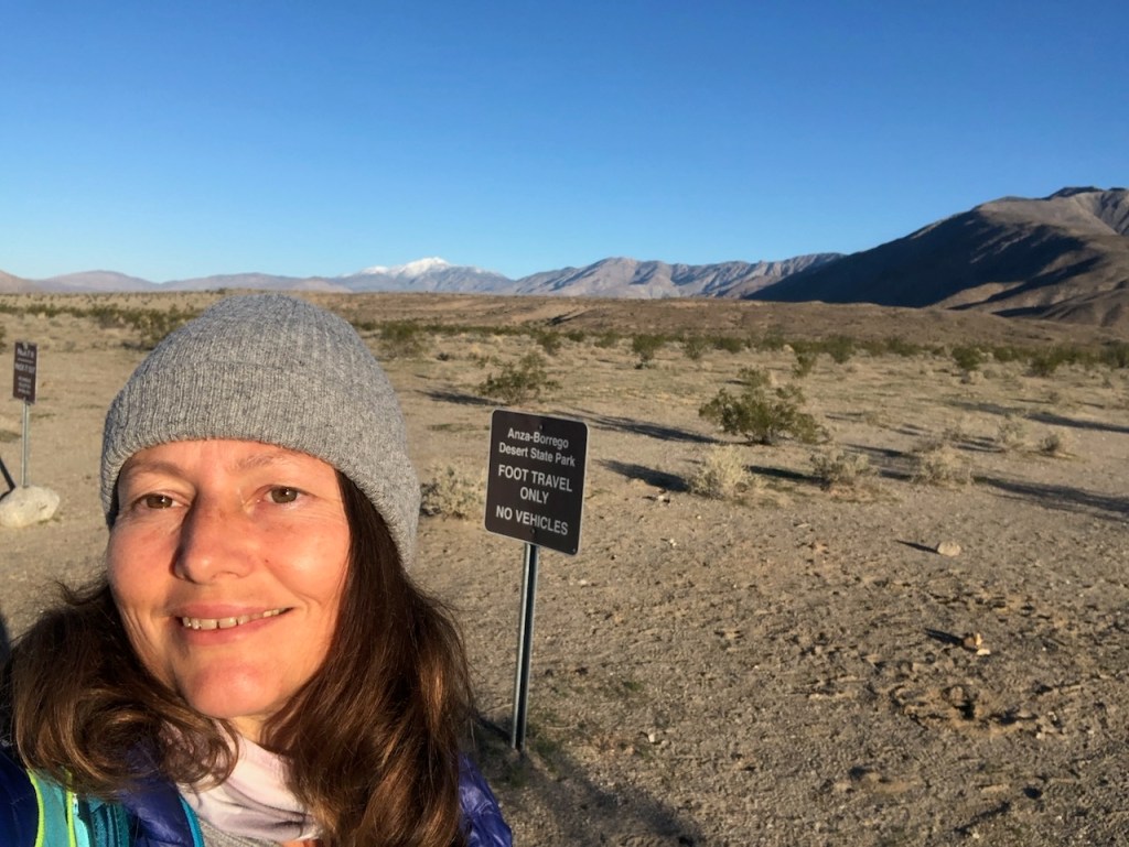
I was now almost two hours from home, and had another 15 minutes of driving to go, to reach the trailhead for Villager Peak. I would pass through the town of Borrego Springs, making a right on Palm Canyon Road, before turning left on Pegleg Road and making a right onto Borrego Salton Sea Parkway. The trailhead is about 15 minutes from the center of town.

The Parking
I arrived at the trailhead, on the north side of the highway, and found there was a single available spot to park. Seeing the small parking area filled, had me thinking I had gotten lucky, and scored. I just assumed there would be other hikers out there.
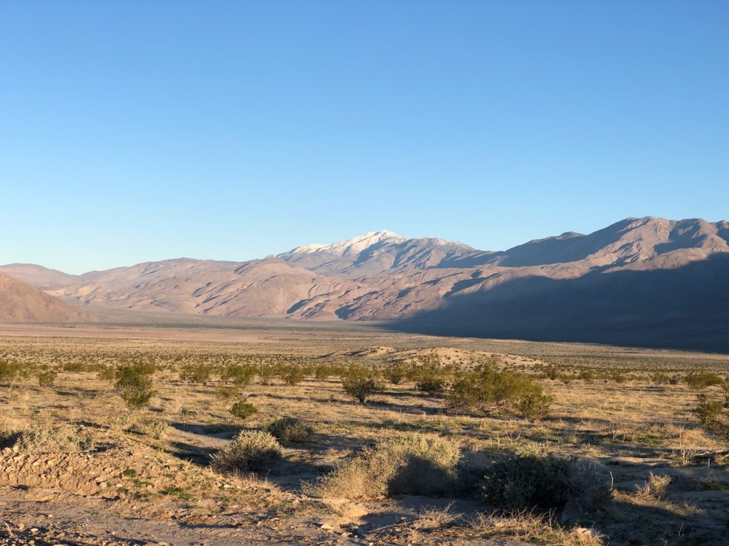
Snowy Peaks
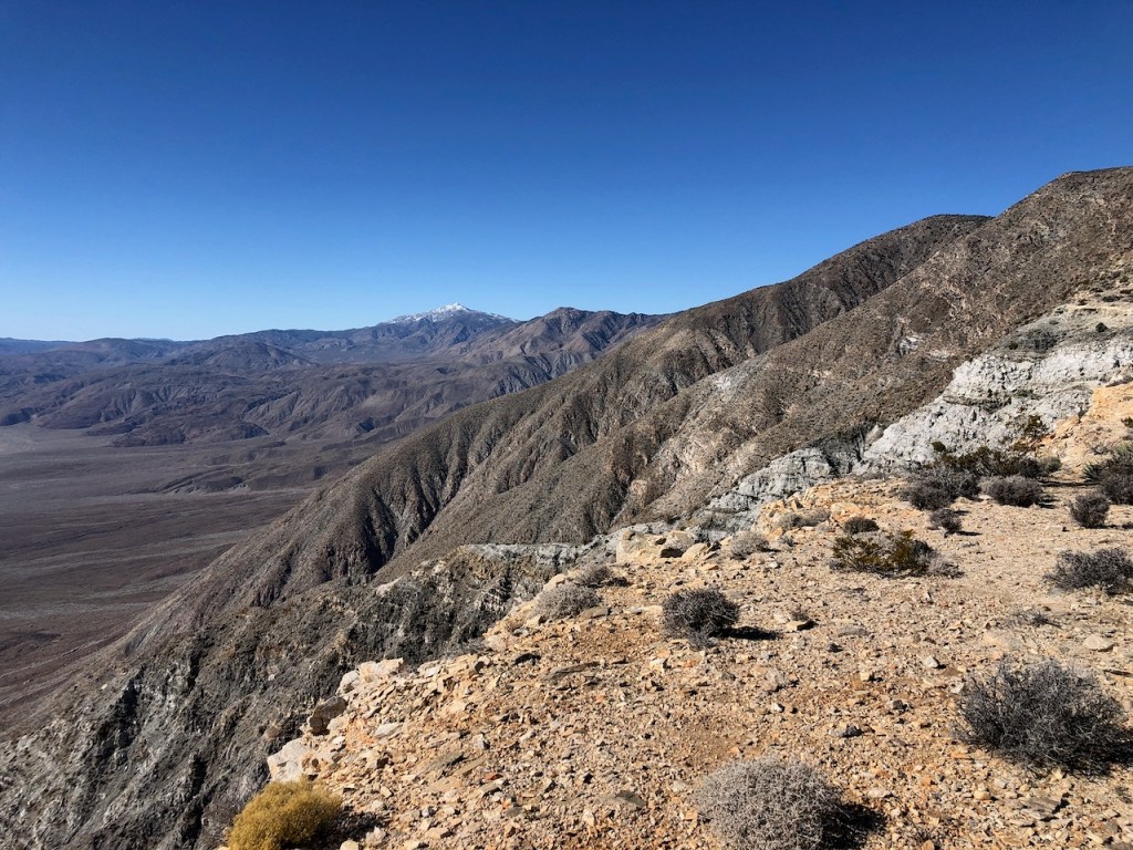
Further off to the north were other distant snow-capped peaks; Santa Rosa Peak, Toro Peak, and Sheep Mountain, all covered in snow.
A Tough One
There was more on my mind than simply the terrain on this particular day in February. I assumed Villager Peak would be a tough climb. I never assumed that I might meet my match with this one.
Beta
I had gathered as much beta on Villager Peak as I could. People in the mountaineering crowd, who like danger, will talk this peak up pretty well. People would brag about it. It’s one for your hiking resume. Having climbed this one means something to some people. But the people who climbed it did not want to go into much detail about it. The beta on this one was not very recent. Also I never 100% trust all trails, or trip reports. Hikers will often lie, omit details, and embellish.
Trail Reports
I tried to get the best and most up-to-date information online in hiking groups, and reading trip reports on Alltrails. Two average-looking hiking women had recently posted about their hike to Rabbit Peak. I figured if they made it all the way there, I surely could make it just to Villager Peak. Not only that, they claimed to make it there and back in one day. In spite of all this positive, hopeful thinking, I would be in for a rude awakening.
Damage Ahead
I almost always expect to make it to a peak. But this one peak would be a different kind of animal. I had some reservations about hiking to it since storms had just wreaked havoc across the southland, Trail damage and closures were everywhere I had hiked in the past week. My local trail had huge four-foot-deep and three to six-foot-wide sinkholes. I had no idea what to expect as far as conditions were concerned at Villager Peak. It was a mere two days after an atmospheric river event and rains had barrelled on through.
Decisions
I was yet again thrusting myself into the unknown, onto an isolated lightly trafficked trail in the desert, as a solo female hiker. I planned on fully immersing myself in this place, without letting fear take hold, the true goal in mind. My success today rested on my decision-making skills. That was my true test today. My legs can only carry me so fast, and so far. My mind is what truly keeps me safe out in the wilderness, along with the ability to make good decisions, and not get carried away.
No Risk No Reward
I had my sights set on Villager Peak. I knew somewhat what I was up against. I knew it would be a brutal, butt-kicker of a climb. I did not expect much of a reward for this, other than to prove my own endurance, and hopefully not get injured.
A Late Start
Off I went down the trail at 7:30 am, after watching another gentleman leave from the trailhead, in full-on desert safari gear. He was heading slightly more south and seemed to not be heading toward Villager Peak. I didn’t yet know I would be the only one out there all day. I should have left two hours earlier, to give myself wiggle room. A 7:30 am start was cutting it close.
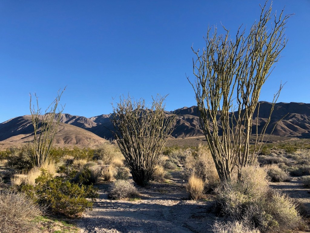
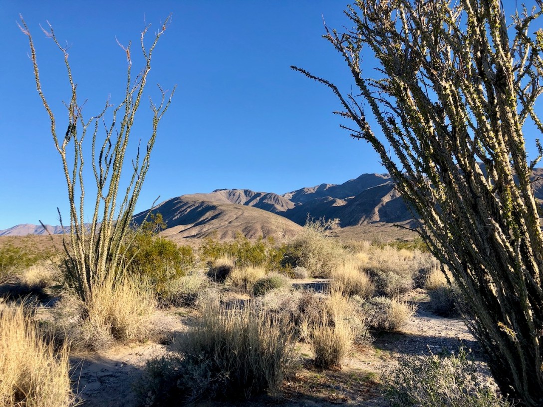
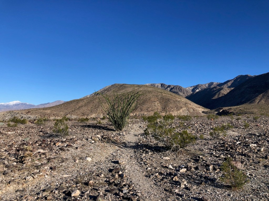
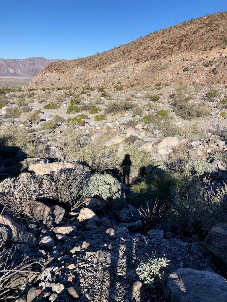
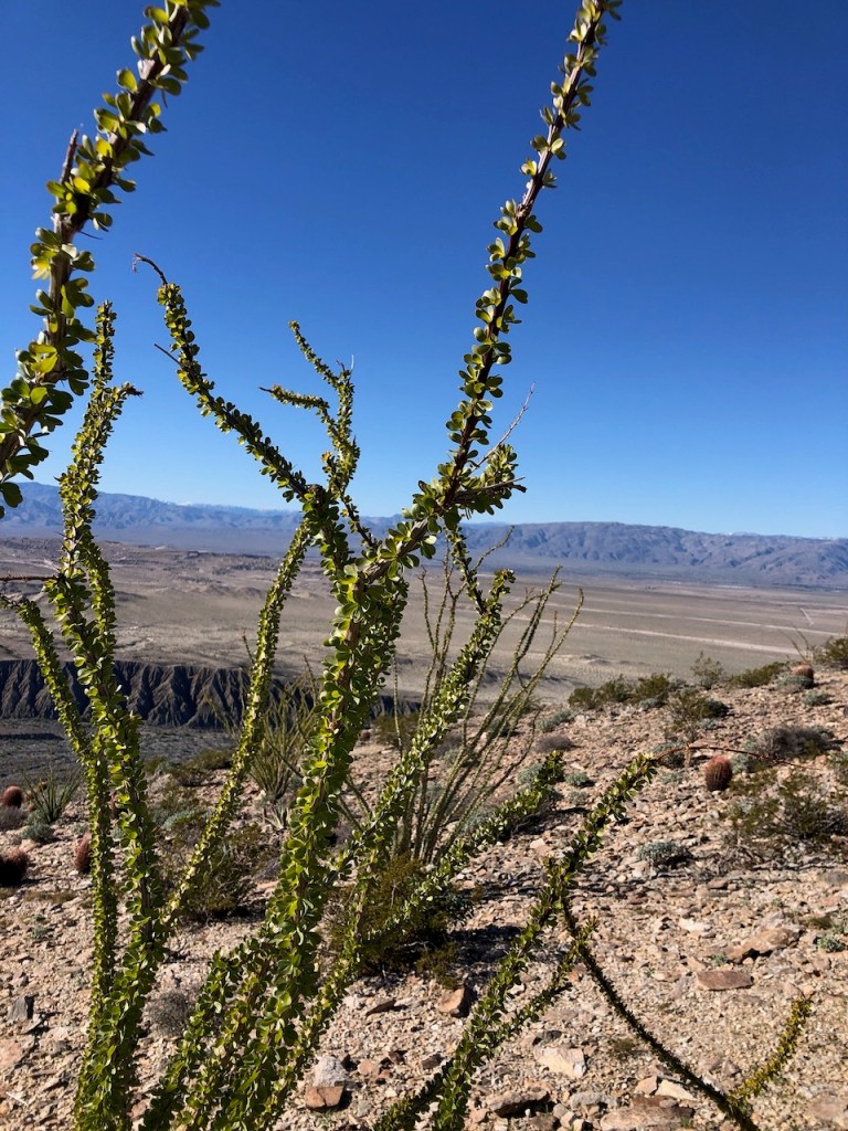
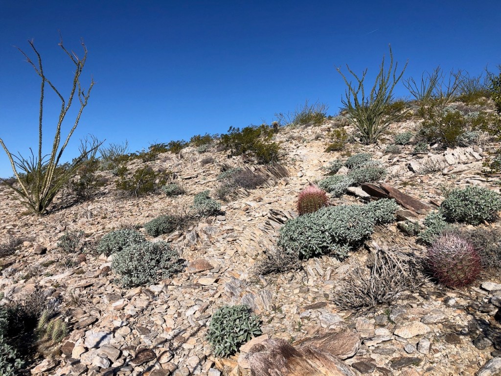
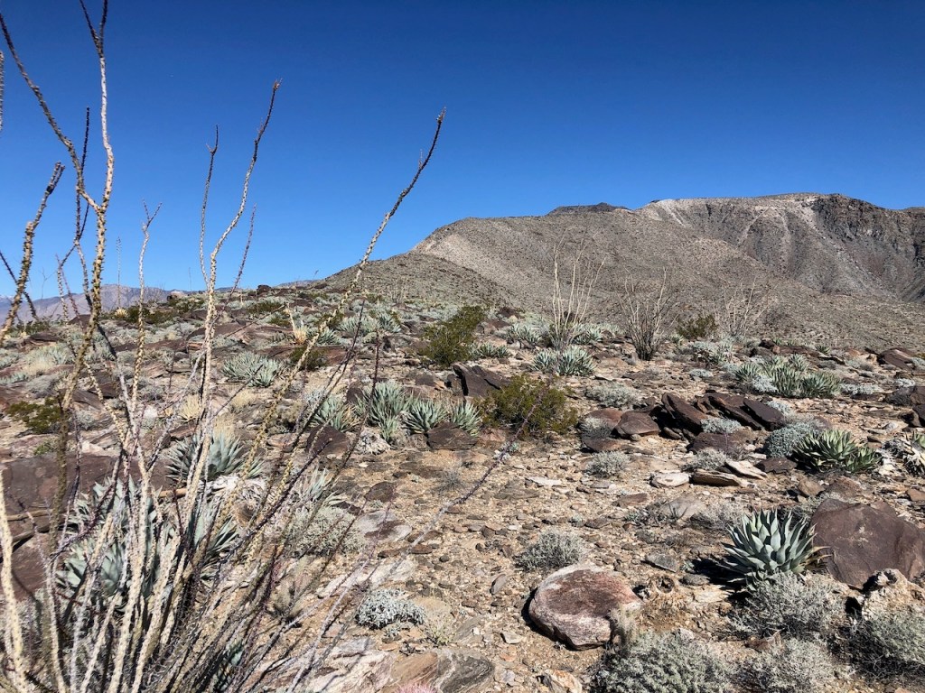
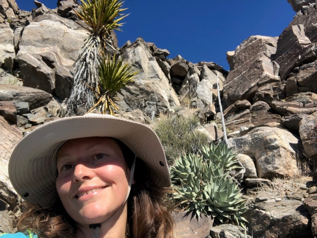
A Desert Garden
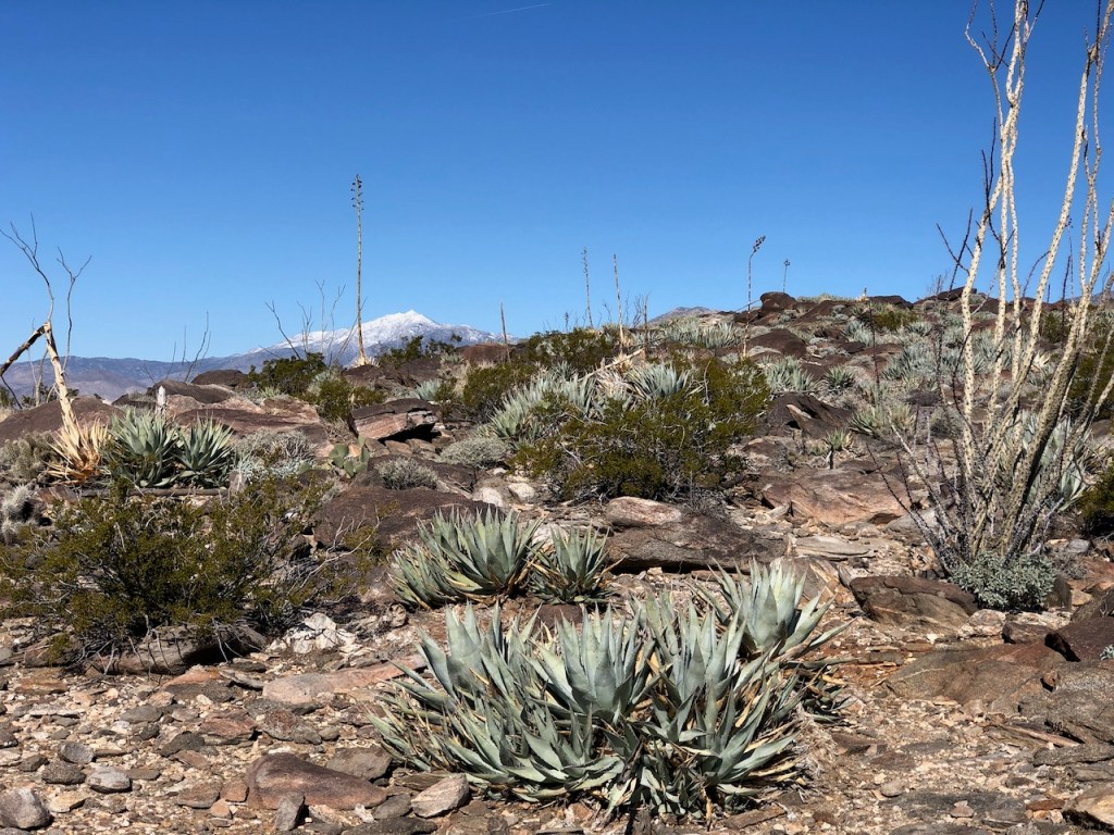
As I trekked off through the desert gardens, of low-growing shrubs, thorn bushes, cacti, and spiny ocotillo, I gazed north along the path. I spotted a few snow-capped high peaks in the distance. I loosely envisioned climbing one of these peaks someday when they are covered in snow, but who knows when that will be?
I knew it was a rare time to be here, with snow frosting the peaks of the desert. It would surely be fleeting and last maybe a day if that.
Temperature Fluctuations
The desert temperatures quickly fluctuated from day to night. It was chilly and frozen just an hour ago, and now it was beginning to thaw. The sun was warming me up fast. I took off my puffy jacket within the first half hour and mile of the hike. There is safety in having this piece of gear. Caught out here after dark, it could be the difference, and save your life. Never let the warm days fool you. It gets below freezing here on a 60-degree day, come nightfall.
The Miles Ahead
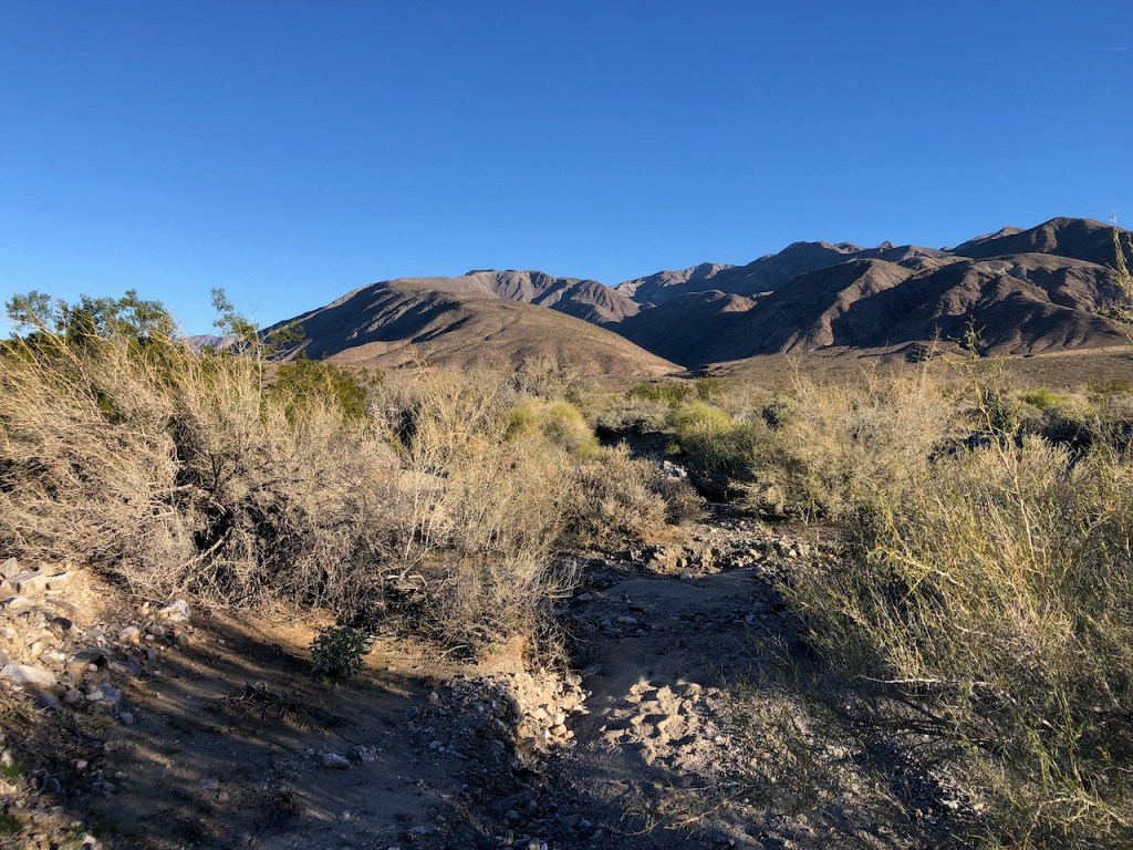
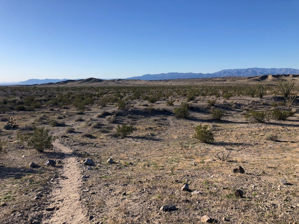
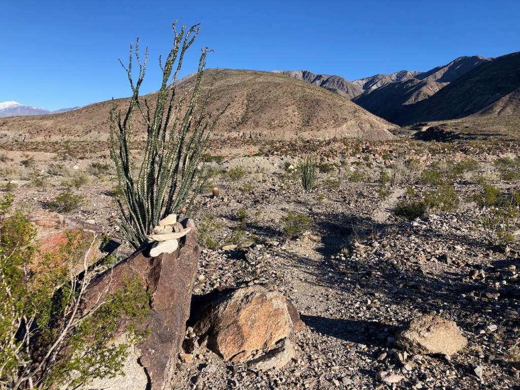
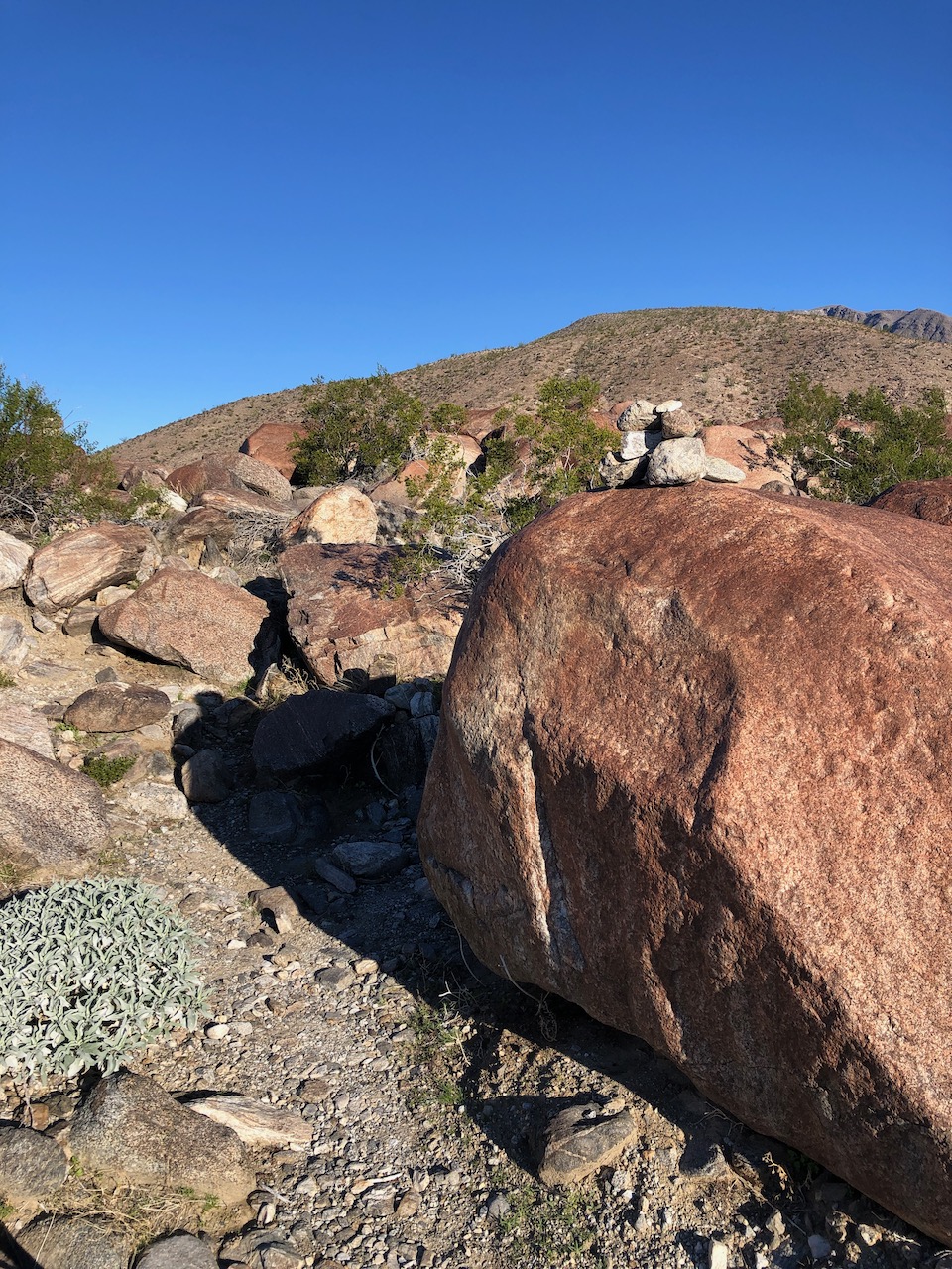
For the first 1.2 miles of the hike, I proceeded through a desert wash, crossing a rocky dry arroyo, one you would not want to be caught in during a flash flood. I listened carefully for the sound and thunder of water. Hearing nothing, I crossed, following the cairns. Early on, I realized there was no trail, just stacks of rocks, leading the way.
The Sands of Time
The terrain was sandy all along the way, though slightly compacted by the recent rains. Save a few bootprints, there was a very slight trail for the first mile. I would rely mainly on my Alltrails map for navigating the way, for much of this hike to stay on track. I last thing I wanted was to get lost. Even though this trail seemed to follow a ridge upward the entire way, after the first mile or so, I knew it would be easy to veer off the “trail,” if I did not monitor my map. In the desert, everything looks the same, and so far, it felt like a maze of vegetation.
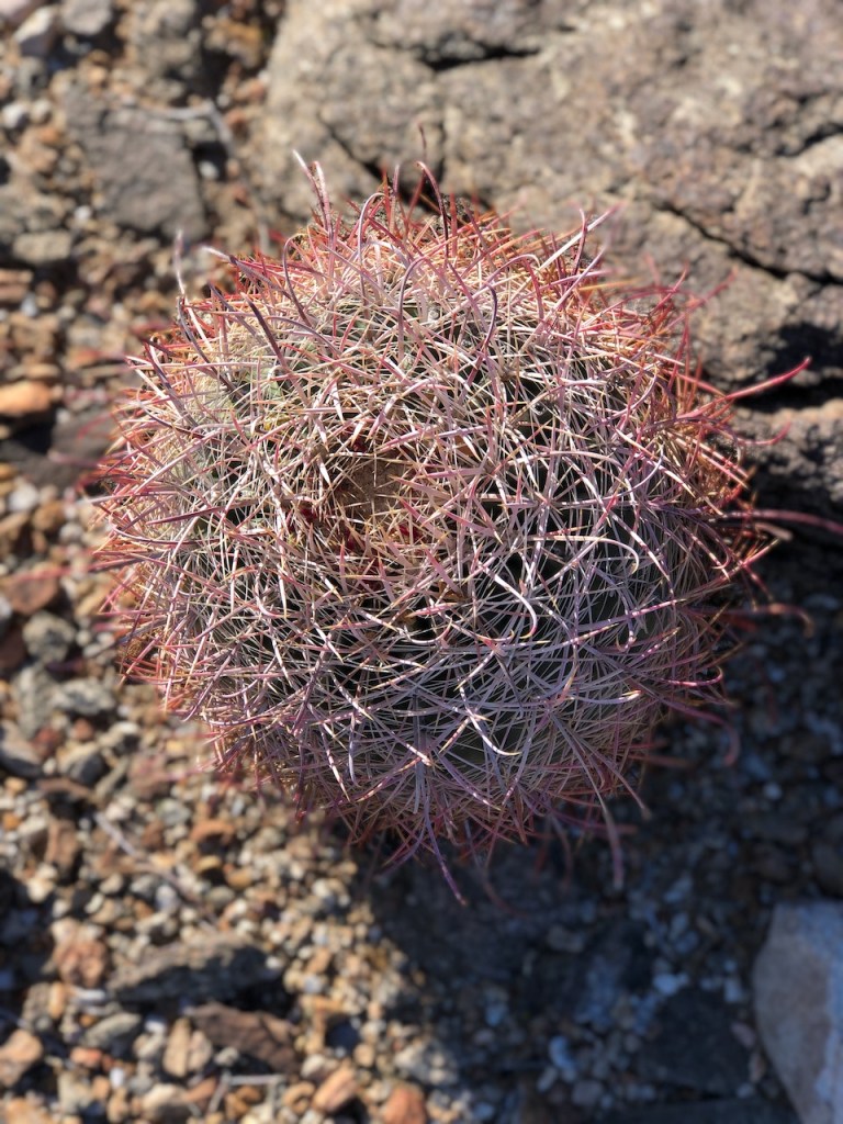
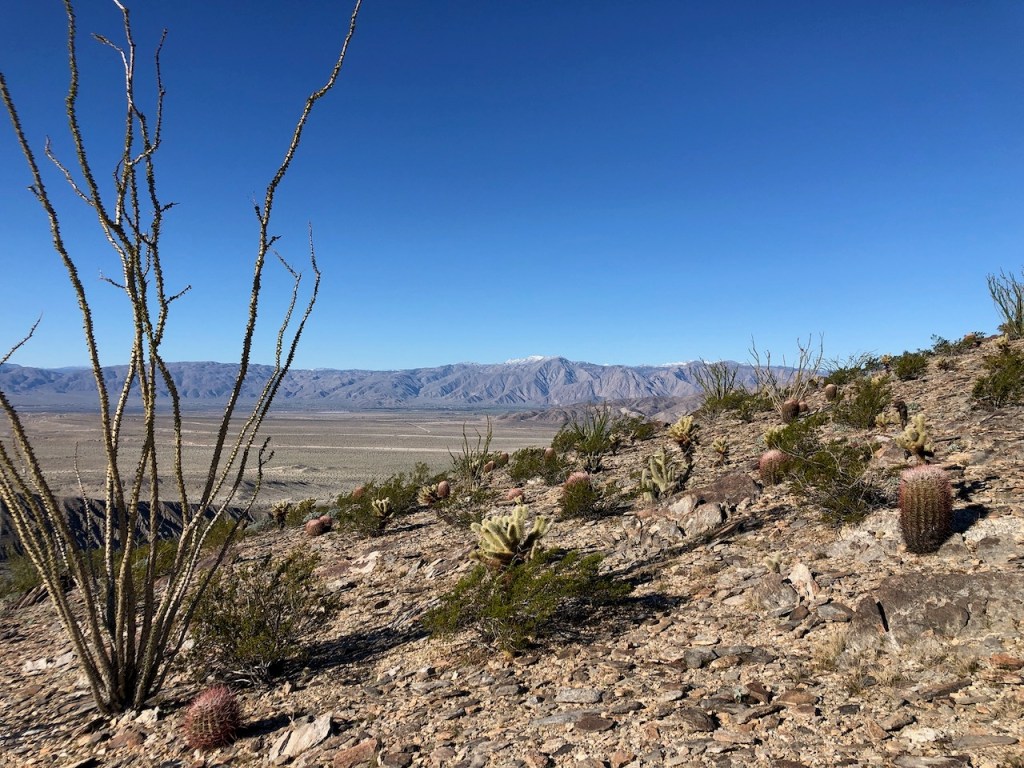
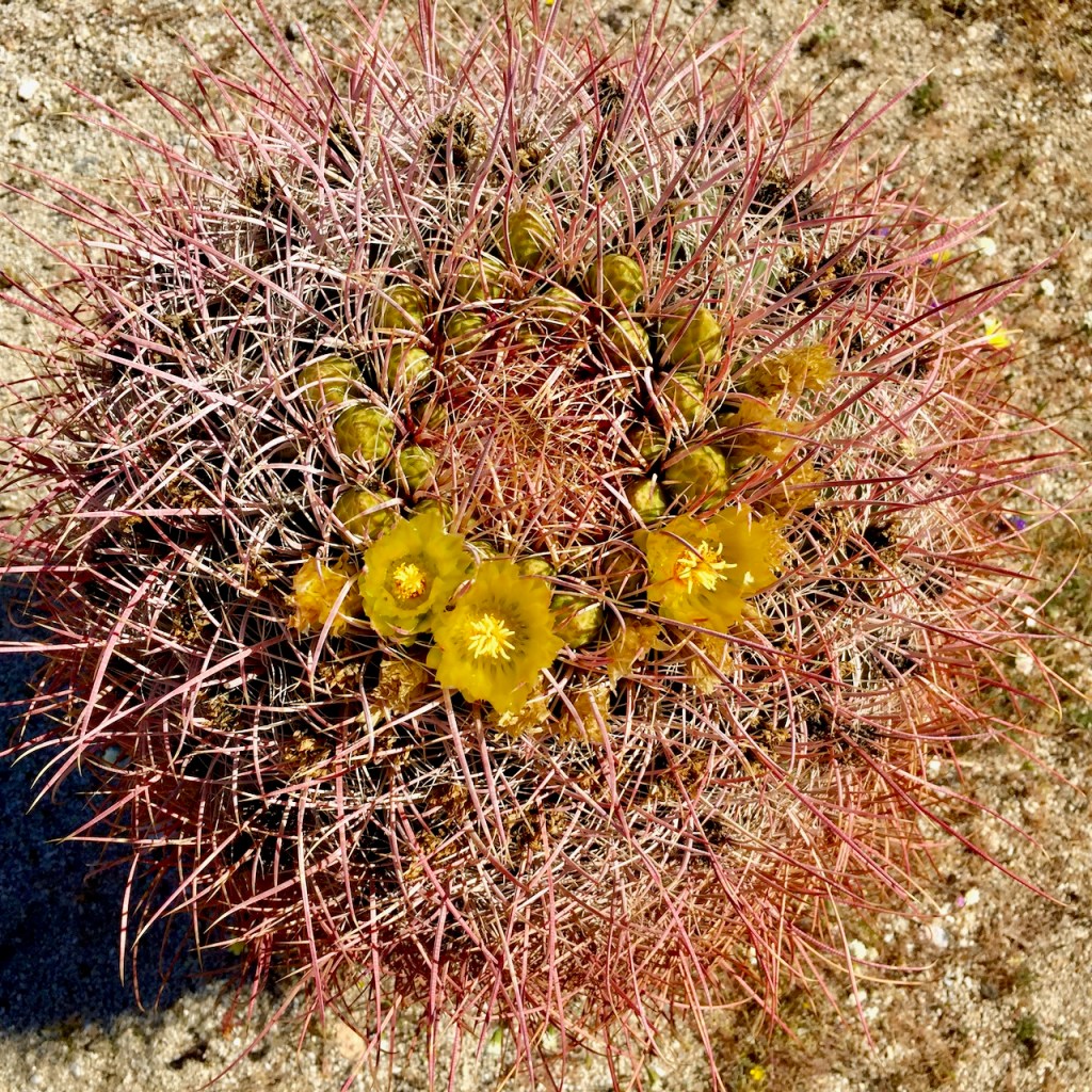
Getting Barreled
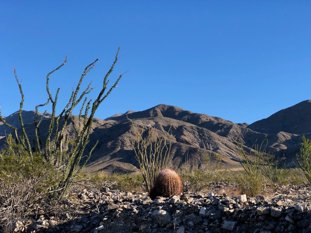
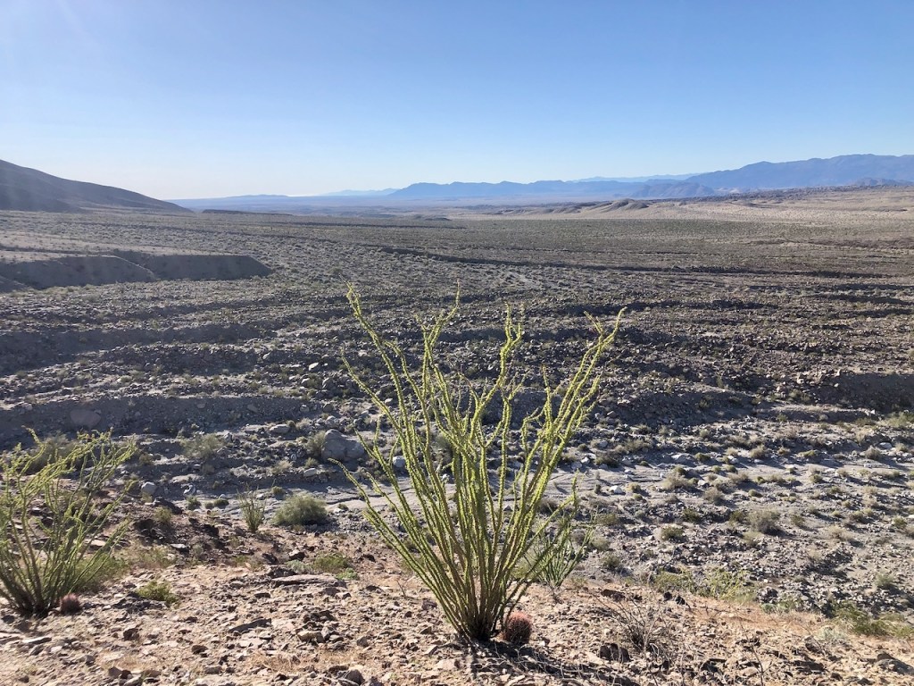
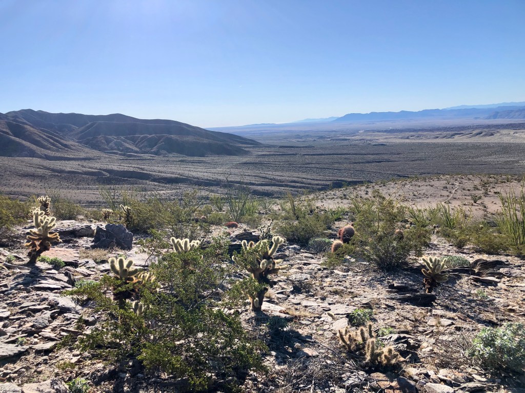
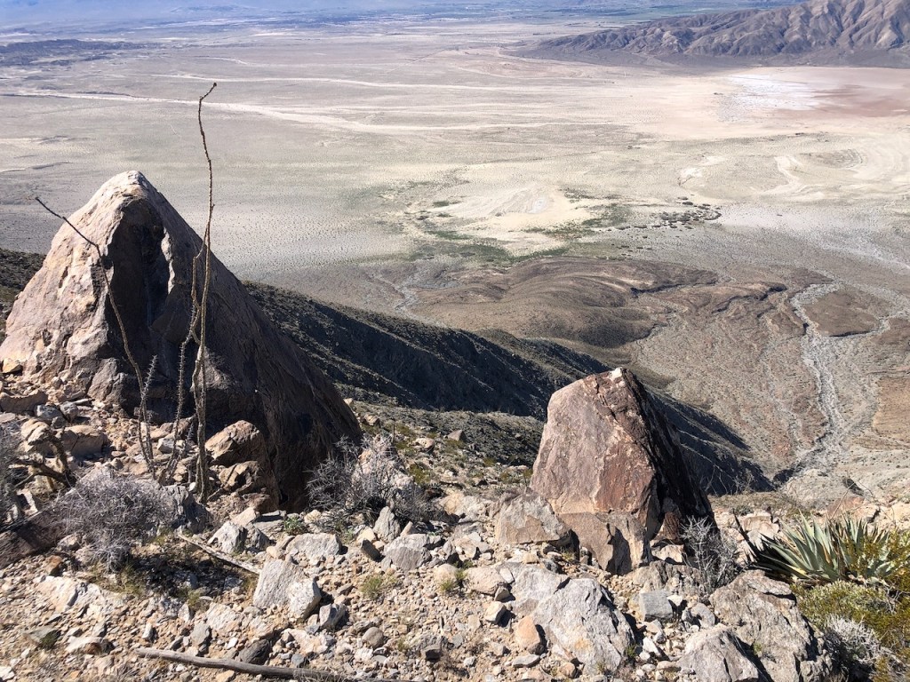
I was greeted with humongous barrel cactuses, standing tall with their vibrant red spines. The scene was a mix of boulders, chola, and low-growing shrubs, with desolate-looking pyramidal desert peaks all around.
History and Mystery
These many unnamed hills are little explored, a mystery, and what lies within them, is largely not talked about. I had heard of old historic homes and archeological remains dotting the valley. There were miners here once, and the remains of their mines, along with other remnants of the past, were scattered throughout this valley.
An Early Spring Trek
As I began my trek, the bright sun shone down on the rocks, and everything turned golden. Since it was just before spring, only a few flowers were in bloom. I could tell, from how green everything was, that spring was just around the corner.

The First Mile
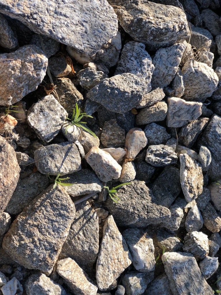
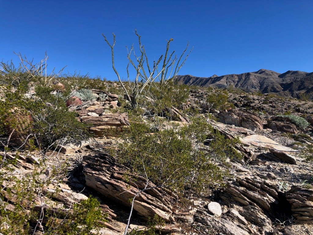
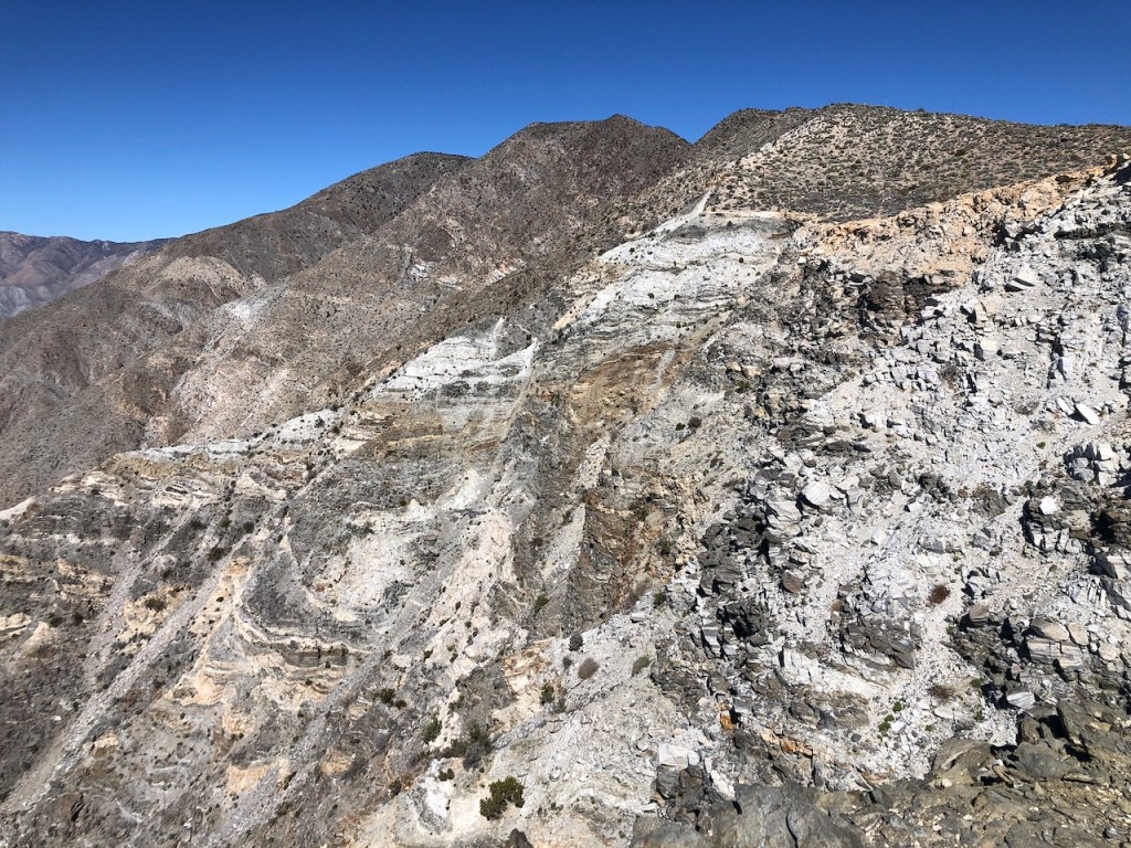
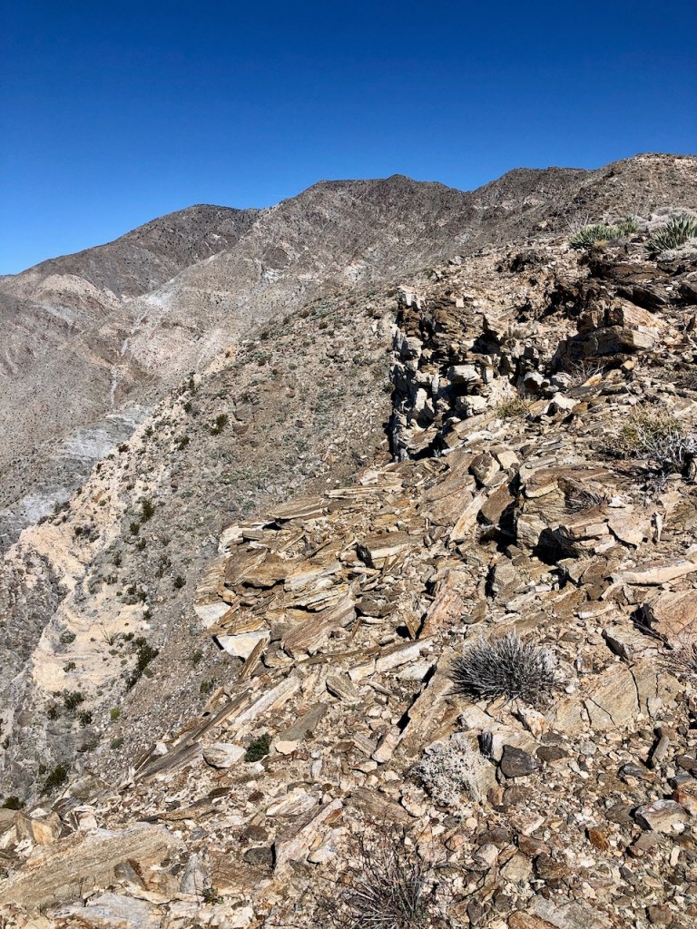
About 1.2 miles in, after crossing two rocky arroyos, and meandering through the sandy wash, I made it to the base of the mountain. From this point, the trail steepened and headed sharply upward in a series of narrow switchbacks. As I proceeded up the trail, I began to slide around. The loose, and slippery decomposed granite made this a challenge. The trail was rocky, steep, and rugged from the start.

It Gets Rocky
I had read this trail was rocky in trail reports, but did not know the extent of that. I was already making mental notes, that coming back in the dark, was not an option for me. It was steep and narrow, so I knew this would be hard to follow at night. As a lone solo hiker, I know not to take chances. The terrain was so slippery, that falling became a big concern just a mere mile or so into this.
The Climb
The scenery continued to be more and more interesting as I climbed. The desert unfolded right before me. I felt like I was truly getting away from it all on this trail. Solitude seekers take note.
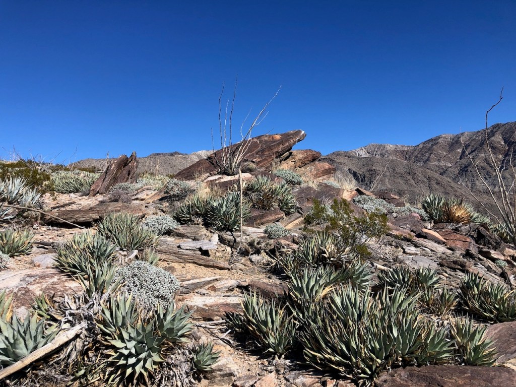
Steep Terrain
There would be a series of big steep climbs, followed by mostly level plateaus. I found myself walking through a garden of Ocotillo, the most I had ever seen growing in one place.

The Expanse
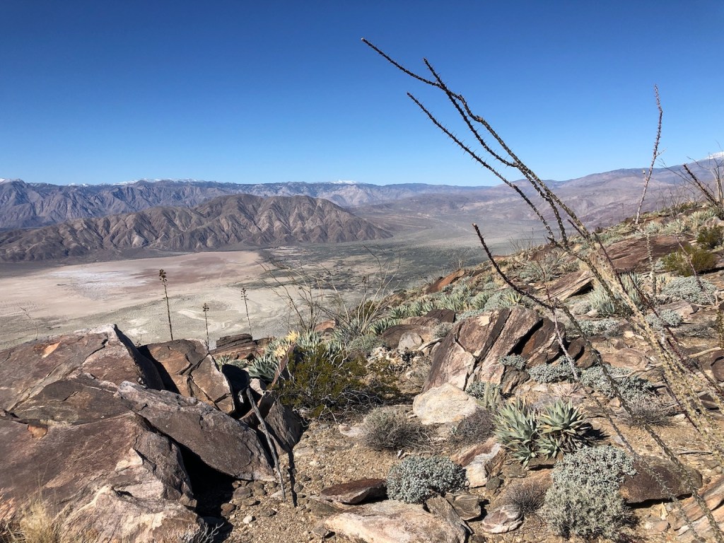
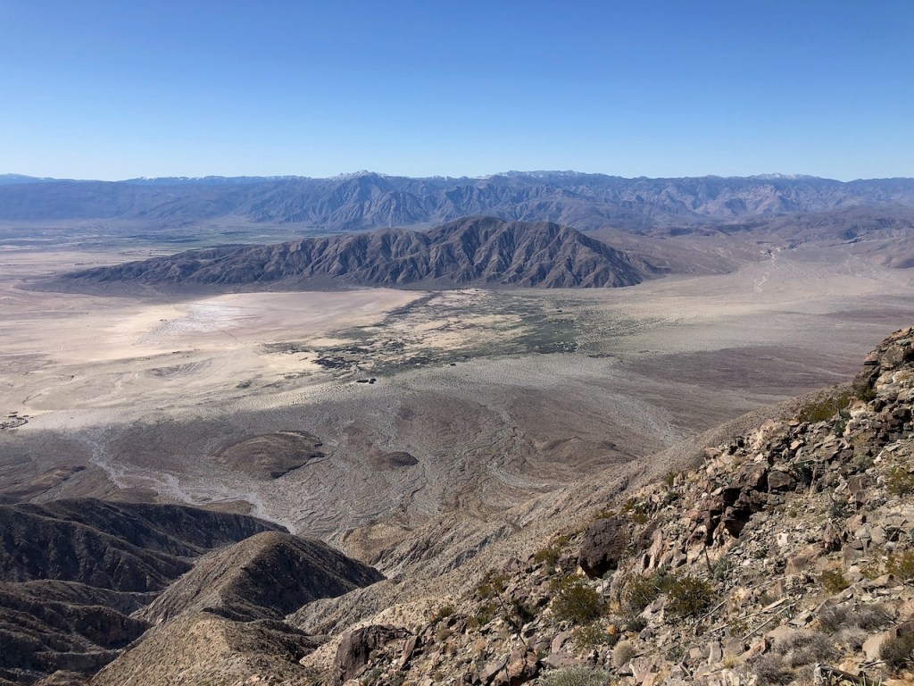
I gazed back out over the expanse of Anza Borrego, past the backlit cholla, with their silhouettes standing in stark contrast with the valley below. I was not feeling in a rush, but more contemplative today. I wanted to stop frequently and take it all in. At the same time, I knew I needed to keep steadily gaining, were I to make it to the peak.
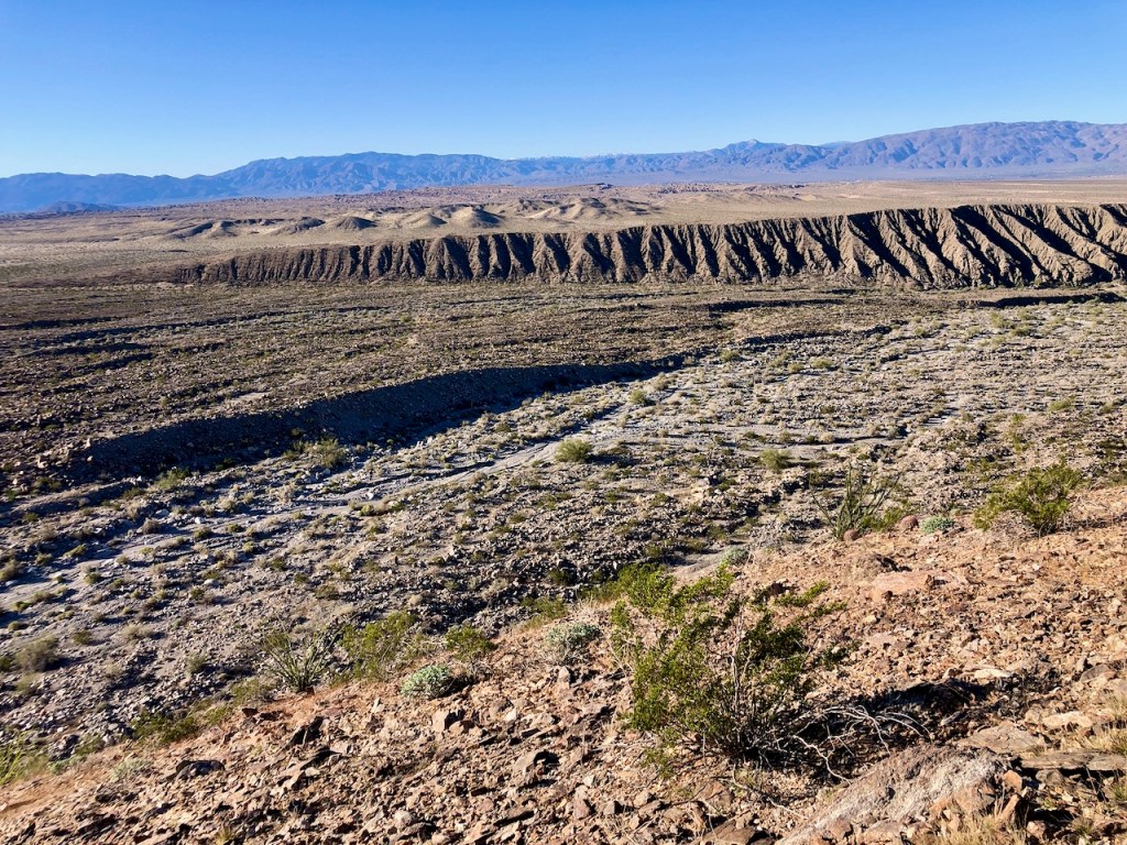
A Desert Valley
The valley had so many striking features about it, The hills were whittled away, by the sands of time. It was easy to see where water flowed, the widespread arroyos, and where sediment had spread out in an alluvial fan.
Checking My Surroundings
As I gazed out, I could see clear across to where the Wind Caves were. That was a place I ventured to back in 2021. I tried my best to keep tabs on where I had hiked from, looking back on a regular basis, and noting geologic features, is typically the best way to do that. There is always that chance your phone with your downloaded map dies, and you have to navigate your way back from memory. So I keep that in mind. I had a charging block with four charges in it. I tried to be prepared for anything.
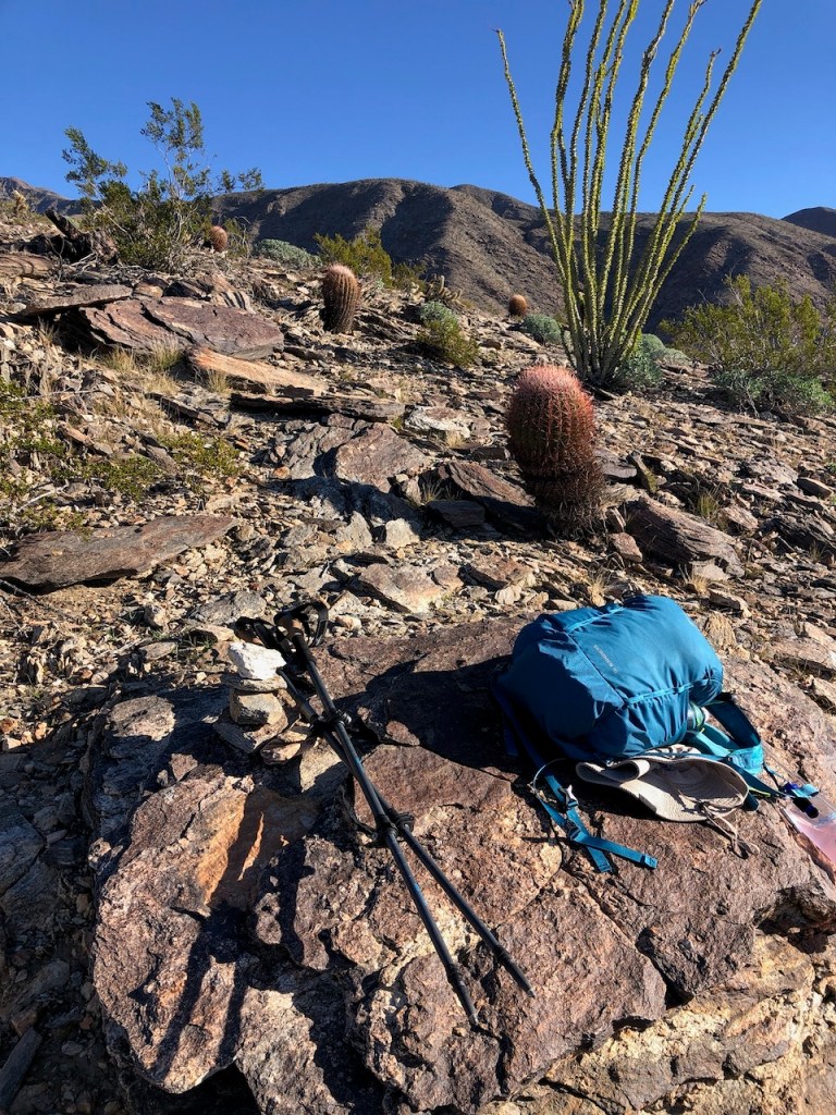
A Much Needed Break
Eventually, I found a flat, wide rock about 2 miles up the trail. I decided to rest a bit here and recharge myself with some snacks. Today it was fruit bars and a protein bar.
A Rock Garden
I sat there on this rock for about 10-15 minutes, surrounded by a beautiful rock garden of ocotillo, cholla, and barrel cactus. This landscape would not change for much of the hike. When I felt sufficiently rested, I continued onward, knowing consistent effort was the key to making it there.
Granite Underfoot
By about 9 am, I had climbed just over 2 miles, and the terrain had begun to change. The softer decomposed granite gave way to larger somewhat rounded, flat rectangular flakes of granite. These stones would grind together constantly as I walked, and it was as if someone was writing on a chalkboard, but under my feet.
Alpine Memories
The consistent sound of stones grinding against one another reminded me of hiking at high altitude in an alpine zone. It brought back memories of hiking to Mt Baldy, or Mt Whitney, where I recalled hearing the sound of clanging granite, below my feet. Either way, this consistent grinding of rocks, continued much of the way up, defining the vibe of this hike.
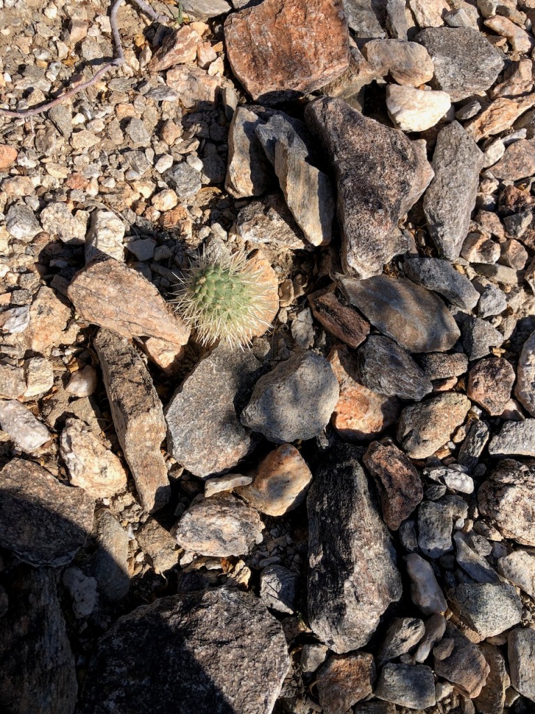
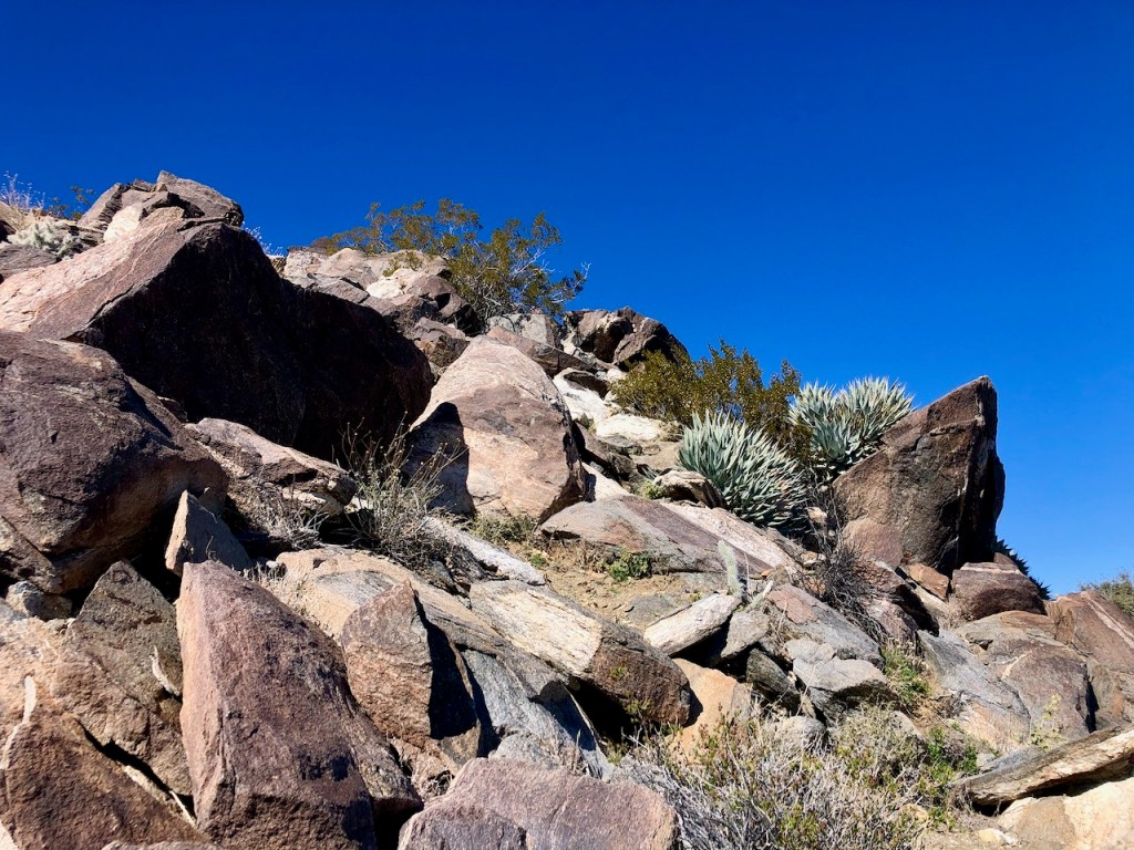
Cactus Bombs
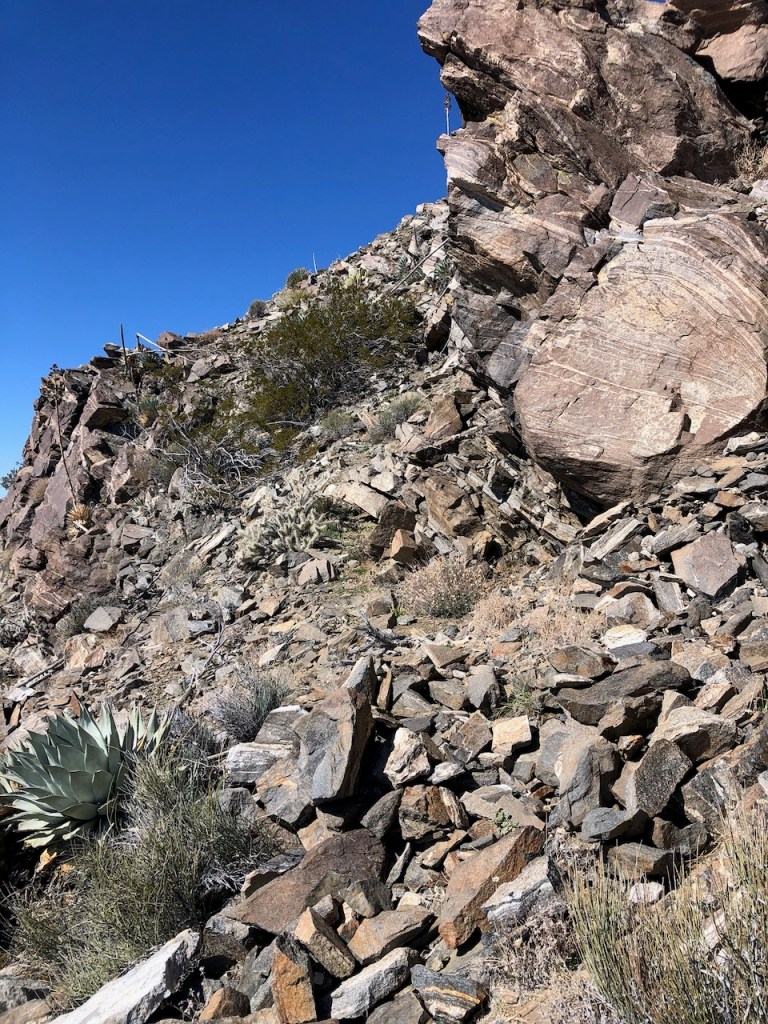
I started to notice puffs of cactus along the trail. The here cholla seemed to be shedding and scattering small round spiky light green cactus balls, all along the trail. They were like landmines, ready to pierce into the soft part of a trail running shoe or be accidentally brushed against, potentially piercing an ankle. I would feel terrible for the poor dog’s paws, that happened to be hiking here.
Sticking to the Path
The challenge on this trail was not going off trail. The last thing I ever want to do is blaze my own trail. I try to stick to where some evidence of a path was created. This proved to be an immense challenge. I would start going one way, check my map, and realize I was way off trail again.
Switchbacks
It was easy to follow the steep switchbacking sections, where there really was one way to go. On the plateaus and rock gardens, I kept stopping, and analyzing which path to take. It all looked the same, and I lost a lot of time just stopping.
Yucca
As I was approaching 3 miles, I started to see more yucca plants. If it was not cactus to navigate around, it was razor-sharp yucca. The area was fairly open so far, so I kept going, but staying on the trail remained a challenge.
More Cairns Please
There were not nearly enough cairns to follow. I even stopped to make a few, feeling the need to support each other.

3 Miles In
For the first three miles, large rocks for taking a break were few and far between. Not only that, there was no shade whatsoever. I was banking on temperatures remaining cool this time of year. It was supposed to be a high of 64 degrees, which can sometimes feel warmer. I had a hat, and umbrella as well, as backup.
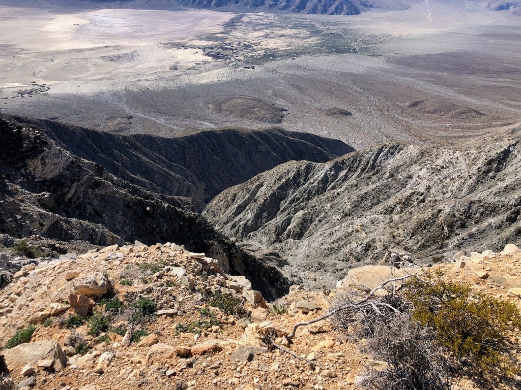
Canyons Below
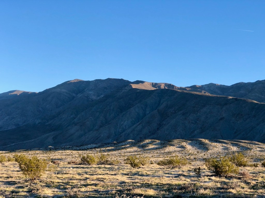
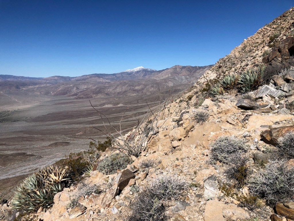
The wide swath of Coyote Canyon was to my left, a place accessible only via 4WD. Distant snow-capped peaks were all around now. They stood out amongst the otherwise muted hills.
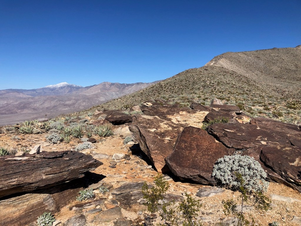
Snow in the Desert
I remember the first time I ever witnessed snow in the desert. I spent much of the last two years in La Quinta, at my boyfriend’s parents’ vacation house. One morning after it had rained, I noticed the high peaks of the Santa Rosa Mountains, in the backdrop of the Boo Hoff Trail, were covered in snow. I will never forget when one morning, which was the first time I ever got to see snow in the desert.
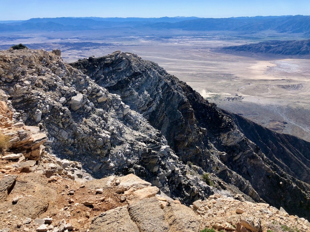
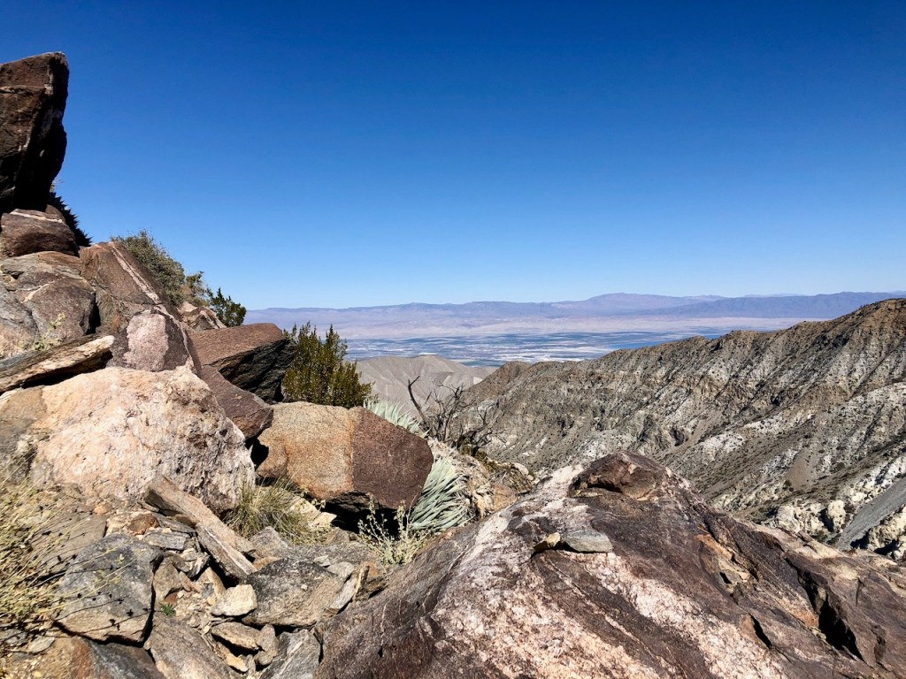
Salton Sea
Slowly the Salton Sea began to glimmer in the distance. I climbed higher playing hopscotch with the cactus, yucca, and cholla. I tried to avoid loose wobbly rocks.
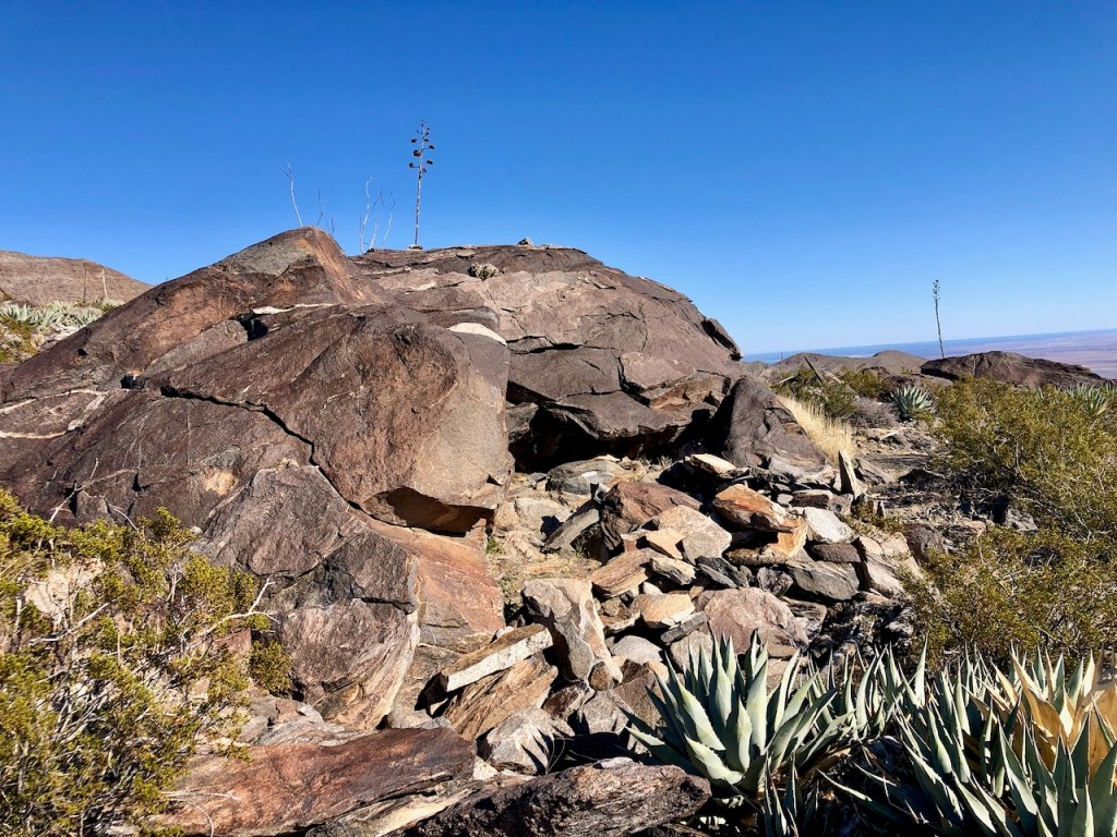
A Campsite
Around 3.5 miles in I noticed a large boulder to my right, and evidence of a windbreak constructed, around a flat area, that was likely fit for pitching one tent, to stay out of the wind. In the desert, the gusts can be obsessive. Best of luck to anyone trying to sleep in a flapping tent in a windstorm. Been there and done that. Hoping to avoid that scenario again.


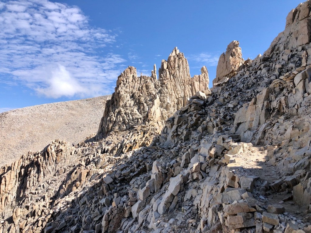
Little Mount Whitney
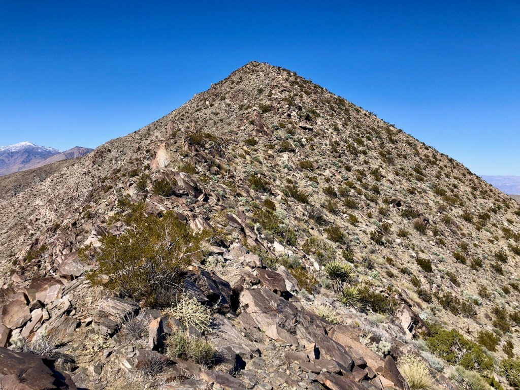
In the distance, I began to see some jagged rocky spires jutting out to the right, which loosely resembled those on Mount Whitney.
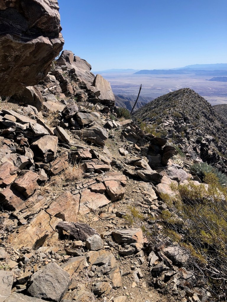
I came to a steep section of trail, with a skinny backbone that dropped off on both sides. One side was a true abyss and went straight down. The other would have sent you tumbling for hundreds of feet, were you to slide off. Neither were appealing options.
4 Miles In
From this point on, as I passed the four-mile mark, things started to get hairy. I kept on climbing as the temperatures warmed, around 12 noon. I had brought shorts, but it would be leggings and a long-sleeved shirt all day. The temps never rose above 60 degrees on this particular day.
Let the Scramble Begin
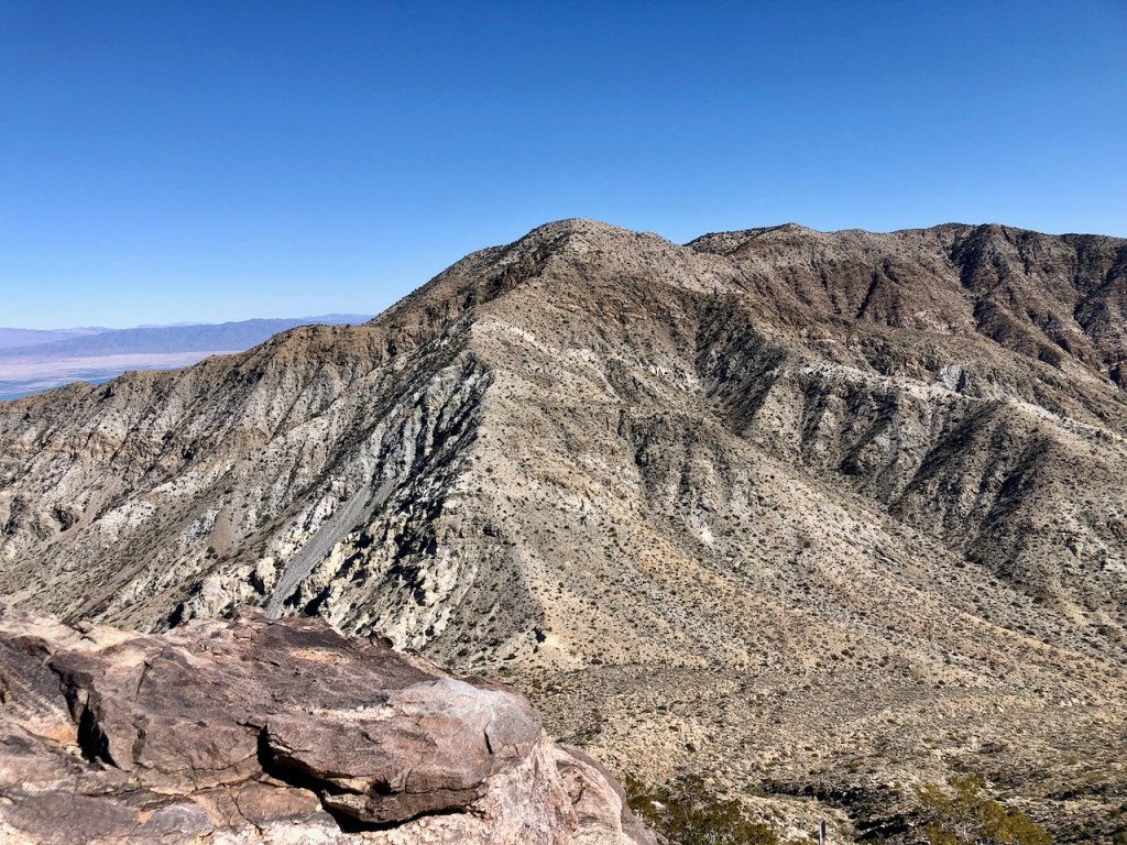
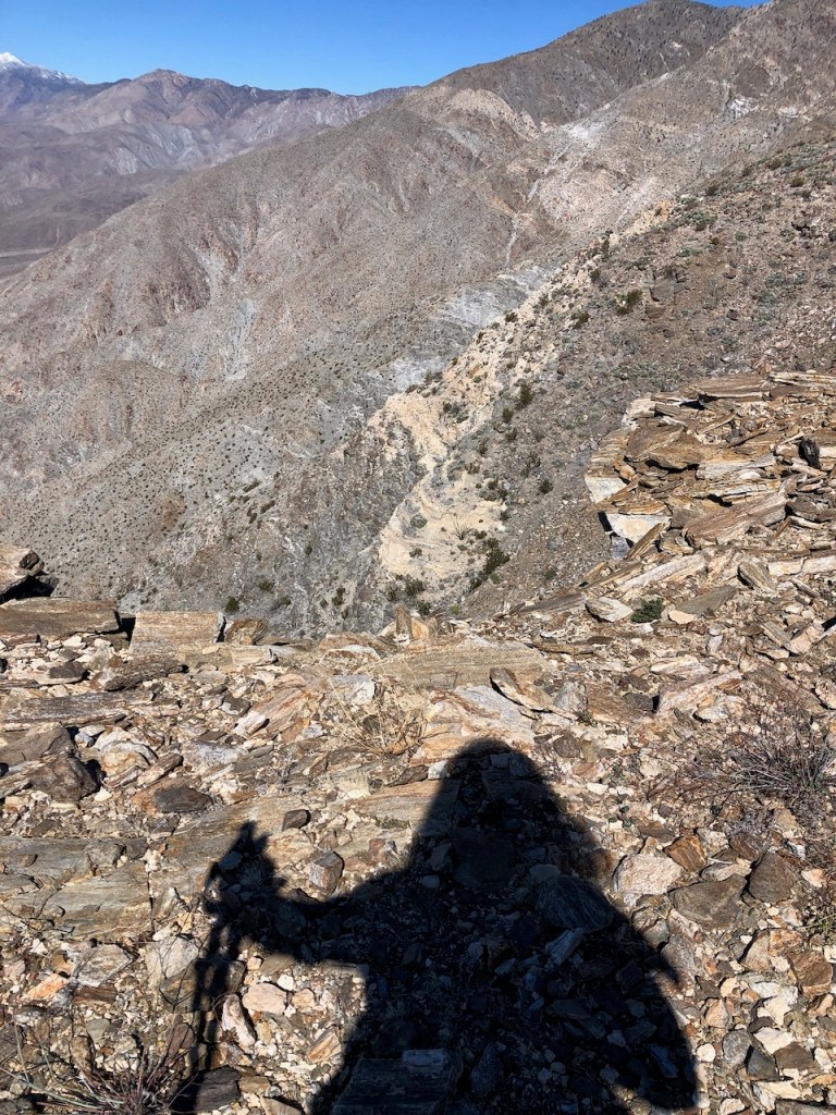
I passed the 5-mile mark, climbing one more sketchy steep ridge of loose granite, only to spend the next 30 minutes maneuvering around boulders, and never finding a clear trail. Up and down I climbed, and it felt never-ending.
The Danger Zone
Eventually, around 5.7 miles in, I found myself stuck below some huge jagged teetering boulders. There did not seem like there was any safe way to go on from this point. I tried to stay optimistic, but knew there was no way to continue.
I would backtrack again. I realized I could easily fall and slide off here down the mountainside. Thoughts of defeat flashed through my mind. I could keep going, but if I did, something bad could definitely happen.

Off to my right, the Salton Sea looked like a real ocean, reflecting the blue sky above. Another steep series of un-named peaks stood between this and the far-off sea.
I wanted to keep going, but I had an instinct and knew that climbing these boulders, could send them toppling over me. I felt very unsafe here. I also didn’t know how much more of this lay ahead. I knew one thing for sure though. I was behind on time, and now 30 minutes past my turnaround time. This rocky traverse was more than I bargained for.
This was as far as I would make it today. I had officially met my match.
It was late in the day and I had miscalculated how long it would take to hike up this beast. Today the test would be not of endurance, but in knowing when to stop. Had there actually been a trail, I definitely would have finished this one, and even hiked in the dark, but there was no trail. I knew I could easily become a statistic here, with this rocky obstacle course before of me.
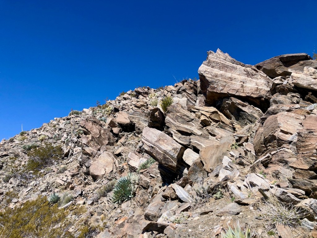
There was too much room for error here. The huge, gnarly-looking loose boulders could roll down and crush me at moments notice. There was no telling how much of this I would have to maneuver and scramble around to get to the peak. I knew that the safe move was to continue back.
I still had the energy, but would soon run out of daylight. I was all alone out here, not having seen one hiker all day. I knew this was verging on a recipe for disaster.
I knew one thing. I wanted to get home to my daughter, and this peak was not worth risking life and limb. My priorities were crystal clear at this point. I was in over my head, and looking after my own safety, by making the right choice, was the new challenge for today. Making the call was a tough one.

Heading Back
Rather than risk life and limb hiking and scrambling along a non-existent trail, alone in the dark, I choose to turn around hiking the 6 miles back to my car. I only had just 1.5 to 2 miles to go, which would have taken up to two more hours, given the terrain. Were there an actual trail, I could have made it to the peak for sure. I could have jogged there in 30 minutes. That was not an option. In fact, jogging was not really an option anywhere here. Mountain runners may disagree, but I’m not experienced with that kind of running.
Backtracking
With every movement, as I backtracked my way down the mountain, I soaked up feelings of defeat while pondering my mostly logical decision-making. Thoughts of “what if,” churned around in my head the whole way. It was very slow going, heading back. I had to watch where I placed my foot with each step. I was doing a pretty good job not falling on the way up.but on the way down that was another story.

Smashed Toes
I was officially out of time, and it would be dark at 5 pm today. Now the challenge was to get down the mountain, faster than I went up, to make up time, so I was not hiking alone in the dark, with the company of desert sidewinders. I tried jogging as best I could. With every step, my toes got smashed in the toe box of my trail runners, with how steep this was. It would be four more hours of toe-smashing. As I write this, my right foot still has not recovered from this hike and is still in pain.
Daylight Fades
There was not enough daylight to complete what I set out to do. I would have had to hike in the dark, for at least an hour or two, to bag this peak. That is what you get, hiking in the winter and early spring, leaving late. Would this have been any other mountain with this much gain, I would have made it. On an actual trail, I move at about 1000 feet of gain per hour or at least 2 mph. This was not a normal trail.
Not Recommended Solo
This is one trail, I would not recommend doing solo, as I did. There were too many opportunities to be injured, or fall off into the abyss, be sliced by yucca, or crushed by rocks. This is a hike, that will take twice as long as all the others you have done. Villager Peak, like most of the desert peaks, could be considered to be more challenging, than the trail up to like Mount Whitney.
I don’t hike to prove things to people, other than myself. But the story of overcoming my own obstacles I will willingly share. I turned around and made it back safely. That is the lesson learned. No matter how much you desire an outcome, the lessons along the way, are the true takeaway from our adventures, and experiences in the great outdoors, as well as in life.
We were not put on this earth all-knowing, and not one of us does everything perfectly. Nonetheless, we are all perfect in our own ways. It’s all by design.
Pretty much every peak I have ever climbed, I made it to. From the summit of Mount Whitney to Mount Baldy to Mount San Gorgonio. I would put my mind to it, and go. It is a mental game. You set your sights somewhere. They say slow and steady wins the race. Sometimes the prize is not to make it to a peak, but to make it out alive.
3rd Times the Charm
I have only turned around twice from a peak. The first time was on my very first solo hike to Sitton Peak. But I made it on the second try. I also turned around on my first solo attempt at Mount Whitney. A combination of things not going according to plan, lack of sleep, and a late start, all factored in at my decision to turn around at Trail Camp, making it a 15-mile day. Add to that, I drove 4 hours there, and 4 hours back to Orange County all in the span of 24 hours. This hike would be number three.
Reflections
Back at my vehicle, I had a combination of feeling relieved, now heading home by sunset to my warm bed, along with contemplation, of how it could have gone differently. I felt officially wiped out after all this. I knew I could have made it there, had I planned better, and left at 3 am.
Lack of Beta
I lacked true and accurate information on the conditions here. There was no trail, and nobody gave me an accurate assessment of the conditions. Had I known better, I would have made an earlier start, or perhaps, made this an overnight trek, camping there along the ridgeline. There was after all a defined camping spot about 3 miles up, next to a large boulder.
Comparisons
I climbed Mount Whitney back in 2022, after crossing the Sierra on the High Sierra Trail. Nothing I encountered there within that vast mountain range was near as steep, or required as much stamina, as hiking up toward Villager Peak.

Conclusion
My hike to Villager Peak took it out of me. I fell and tripped many times over the jagged rocks on the way down, along with piling head-first into yucca, which could have taken out my eyeball. I cannot call it a trail, since I struggled to find my way the entire time. It was like climbing a desert version of an alpine peak. I was bruised and bloody after this one. Villager Peak definitely has teeth.
When to Go
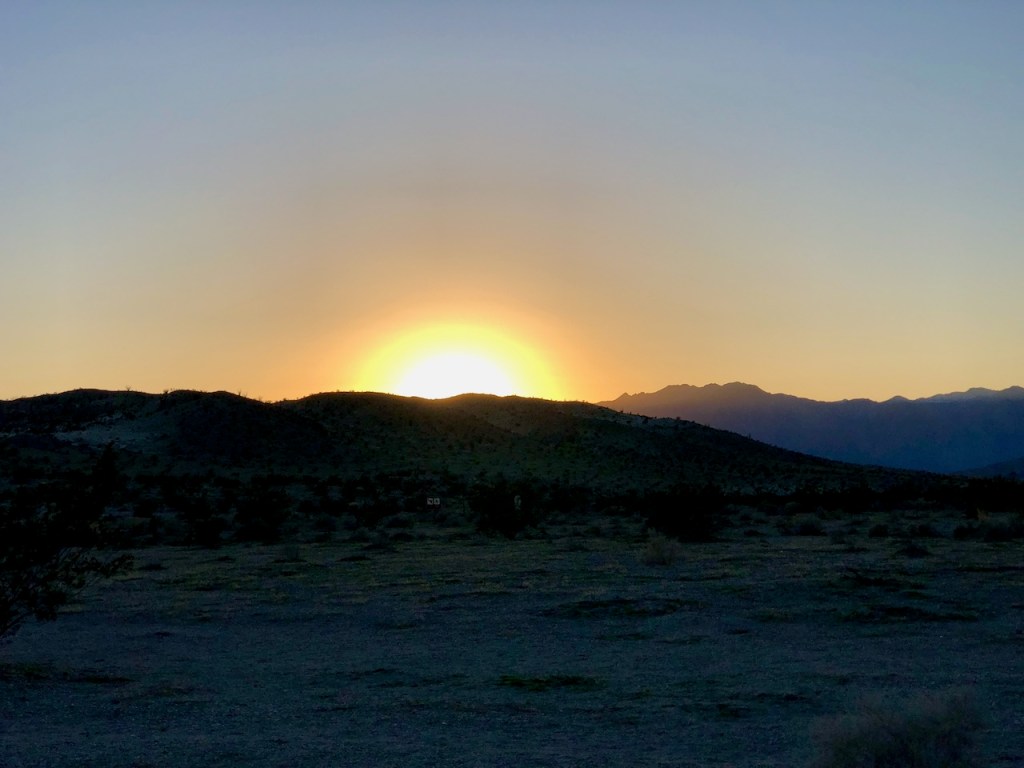
If you’re thinking of hiking in Anza Borrego, the park is best enjoyed from late fall to late spring, which is when the desert flowers burst into bloom. Winter time makes for milder temperatures, but can also mean freezing temperatures, especially early morning. An early start is essential for hiking to distant peaks like Villager Peak.
A Living Desert
The desert is not some dry, barren lifeless place, and there is so much beauty here if you know where to look. Places like the popular Palm Canyon Oasis, though beautiful, are not all there is to see in Anza Borrego.
Natural History
From historic sites to rare flowers and bighorn sheep to high peaks, hovering above the far-off glistening Salton Sea, the desert has a story, all its own.
Be Prepared
Sometimes the desert can prove to be a deadly excursion, if you come unprepared, or simply don’t listen to your gut. Sometimes not going to a place or turning back, is tough to gauge, especially when the allure of some interesting slot canyon, or mud cave, beckons you to keep going.
What’s Out There?
Exploring alone in the desert is a risky business in itself. If nature does not get to you, then there are interesting characters who live out here too. The numerous trailers, spray painted abandoned homes, and junk piles speak for themselves. The desert is a place to get away from things. People come here not to be judged. They come here for a variety of reasons.
True Freedom
We sometimes let fear control our lives. Hiking for me is about finding a path to freedom, and none of this would be possible, without he who is all powerful. I always thank God for giving me momentum, and getting me further along my path to freedom, where there is no fear, only faith.
“It is for freedom that Christ has set us free. Stand firm, then, and do not let yourselves be burdened again by a yoke of slavery.” – Galatians 5:1
Inspiring Others
I get inspired by ultrarunners, like Sally McCrae and their pure ambition to push themselves to their limits, in spite of the huge obstacles they face. According to Sally, after running and not doing as well as she hoped the first time running the Badwater 100, she believed it was important to “be ok with it, even if you don’t get the outcome you hoped for.” She ended up winning it in 2021.
No Guarantees
Every adventure has an outcome, and sometimes it’s not what you expect. That’s why it is called an adventure. There are no guarantees in a race, or anything you set out to do, especially if the stakes are high. There is always risk. Decisions get made in the moment.
We can’t go on to doubt ourselves based on our outcomes, only learn from them. That’s how we actually win. I always hope I can inspire others in some way with my adventures too. It’s not the outcome, but the journey along the way that matters.

Leave No Trace
Just be sure to come prepared and follow Leave No Trace principles to keep the wilderness pristine for future hikers.
Like and Subscribe to my Channel!
I hope you enjoyed reading this, and it is helpful in knowing what to expect, should you decide to visit here.
About me
I’m Serafina! I’m a writer and California girl who loves to go exploring. Hope you will get outside today, breathe some fresh air, and be happy!
Follow my Journey…
Be sure to Like and Subscribe to My Youtube Channel where I post videos!
Disclaimer: The work on this blog is my opinion and my opinion alone and I am not responsible for the outcome if someone were to apply these thoughts to their own life. All text and photography copyright 2024 by Serafina, all rights reserved. Information and opinions provided are kept current to the best of the author’s ability. All readers’ usage of the ideas and opinions presented in the blog, are at their own risk. Be aware of the possible dangers of hiking, surfing, walking, cooking, and other activities, which may take place indoors or outdoors. By reading this, you agree not to hold the author or publisher of the content on this web site responsible for any injuries or inconveniences that may result from reading the blog, or partaking in any activity mentioned in the blog. Read the blog, and use its ideas, if you so desire, at your own risk.
