
“Yet God has made everything beautiful for its own time. He has planted eternity in the human heart, but even so, people cannot see the whole scope of God’s work from beginning to end.”
— Ecclesiastes 3:11
It Was A Year Ago…
I had decided to hike to Pleasants Peak (Elevation 4007 ft) over a year ago, but for some reason felt I better bring a friend along on this one. It’s a long hike, way out into the middle of nowhere, in the Santa Ana Mountains. This is a place full of rumors, where mysterious things have happened over the years. Not only that, big cats roam these mountains, and though there have not been attacks recently, there have been many encounters. So I was not sure going alone was the best plan.
So I sought out a hiking buddy, and asked other women in hiking groups I had joined. None were all that committed or interested in hiking over 17 miles to a peak that is frankly, not that talked about. Spring came, brush had begun to overgrow the trails, and April arrived, which is the start of snake season, when rattlesnakes are most active. I decided Pleasants Peak was best left for next year.
I love exploring just about any scenic wilderness area, admiring God’s creation, and these beautiful mountains rising up in the backdrop of Orange County always seem to call my name. They are so majestic, and ever present in my day to day life. On my drive to work, I see them, sometimes cloaked in clouds, and sometimes bathed in the glow of morning sunshine. Either way, they are always there, calling my name. My goal to explore all the trails in the Santa Ana Mountains, eventually.
So far I have explored my fair share of the Santa Anas, having been on many great trails. I have been to Sierra Peak via Coal Canyon, up Black Star Canyon, ventured through the Mariposa Reserve, bagged Pinos Peak, along with Bedford Peak, and driven down winding Silverado Canyon from Maple Springs. I have even braved the rutted Trabuco Creek Road, hiking all the way to Holy Jim Falls. That was three miles of an unpaved road. All of these trails are worth checking out, and next up was Pleasants Peak.
Despite sitting close to a few million people, the Santa Ana Mountain trails can be practically devoid of visitors. Black Star Canyon always seems to draw in a lot of hikers heading to the falls, along with mountain bikers climbing to the fire road toward Beeks Place. The Maple Springs trailhead is popular with hikers heading to nearby Bedford Peak (Elevation 3760 ft), a mere 3.5 miles up. The road to Santiago Peak from Maple Springs is also popular, especially with the off-roading crowd, who like to take in the views, without breaking a sweat.
History buffs may be drawn to these mountains, due to the mining history. Waterfall chasers, have many to choose from here. There are unique plant and animal communities, not found anywhere else, like the Tecate Cypress Reserve, near Coal Canyon. Not everything about the Santa Ana Mountains is even known yet, and so much of it is rather unexplored. Steeply pitched slopes and deep canyons make exploring here a challenge. Many mysterious occurrences have happened here, too and it is popular with the paranormal crowd, especially around Black Star Canyon, where sad and tragic events have occurred. No place is completely safe, and these mountains are no exception.
So I knew I needed a plan, proper safety gear, and perhaps a hiking partner, if I was to head deeper into the Santa Ana Mountains than I had gone before. I enjoy hiking solo, just listening to the sounds of nature, and jogging along when I feel like it. But these mountains are wild, and sometimes it’s nice to bring a friend along. Thankfully, a year after initially considering this hike to Pleasants Peak, I found a hiking buddy, who enjoys long hikes like I do, and was willing to join me for this journey.
I feel the best time to hike to a place like Pleasants Peak (Elevation 4007 ft), or anywhere in these mountains is between late fall, and early spring, which is from Mid November to Early February. As soon as snow begins to dust the peaks of Mount Baldy, anywhere from Late November to December, is my cue to switch to hiking in the foothills. The weather is always milder in the foothills below 5000 feet, versus up at high altitude. If mountains are calling your name during winter, and you want to hike without needing winter safety gear, the Santa Anas are where you might consider going, and December is an ideal time.
An Early Start
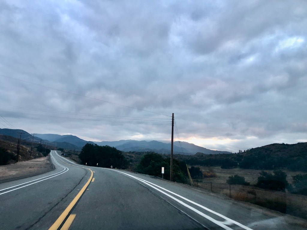
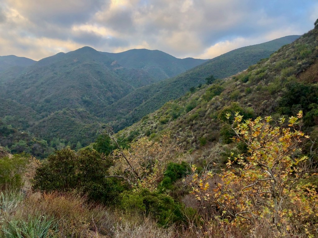
It was close to 7am, as I drove up Santiago Canyon Road toward Silverado Canyon, the mountains rose up majestically, in the backdrop. As I gazed up at them, the clouds circled around, and the sun was just beginning to rise, as I made my way toward the trailhead at Maple Springs, at the end of Silverado Canyon Road.
As I entered Silverado Canyon, the view of the surrounding mountains began to be obscured. The shady, narrow canyon road has steeply pitched canyon walls, and homes sitting right alongside the edge of the road. Shady oaks and Sycamores grow here, their arms outstretched across the narrow two lane road. The trees were still showing their fall colors, in late December.
There is no shoulder on Silverado Canyon Road, and traffic can sometimes be slow moving. During rains, this canyon always seems to experience mudslides, which sometimes are devastating to the homes. It had just rained a day or so ago, and more was expected with a 10% chance on this particular day. I was betting on it not raining, but had my rain shell just in case.
The biggest hike in the Santa Anas which is most popular with hikers is Santiago Peak (Elevation 5689 ft). It is also included in the Six Pack of Peaks Challenge, popular with most Socal Hikers who like to challenge themselves. Since that is another hike I have on my radar, to head from Holy Jim Falls up to Santiago Peak, I initially proposed it as an alternative. But my hiking buddy was unsure about driving on an unpaved dirt road for so many miles. So Pleasants Peak it would be.
Maple Springs
I was grateful to snag the last parking spot at Maple Springs, when I arrived at 7:15. My hiking buddy had already arrived, and was getting ready to head out. The gate was closed, and for some reason, I did not think it would be. When the gate is open, parking is plentiful along the road, near the trailhead for Bedford Peak.

A Christmas Eve Hike
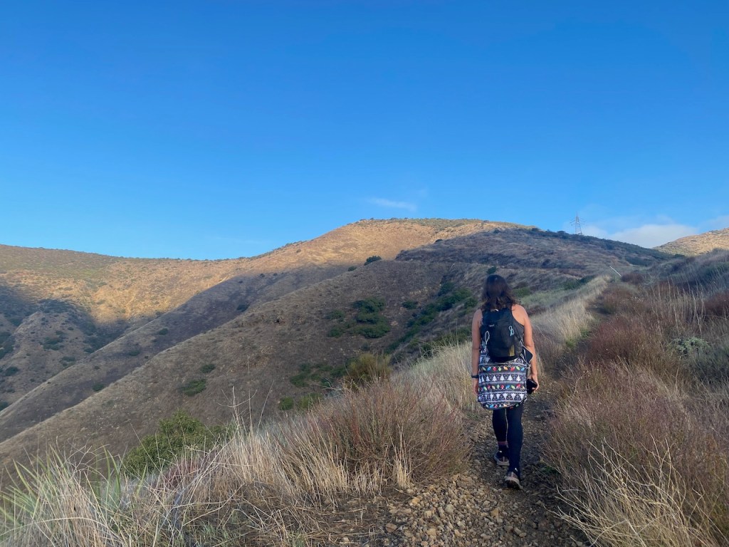
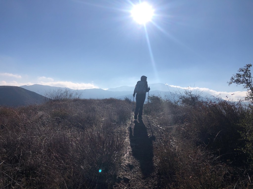
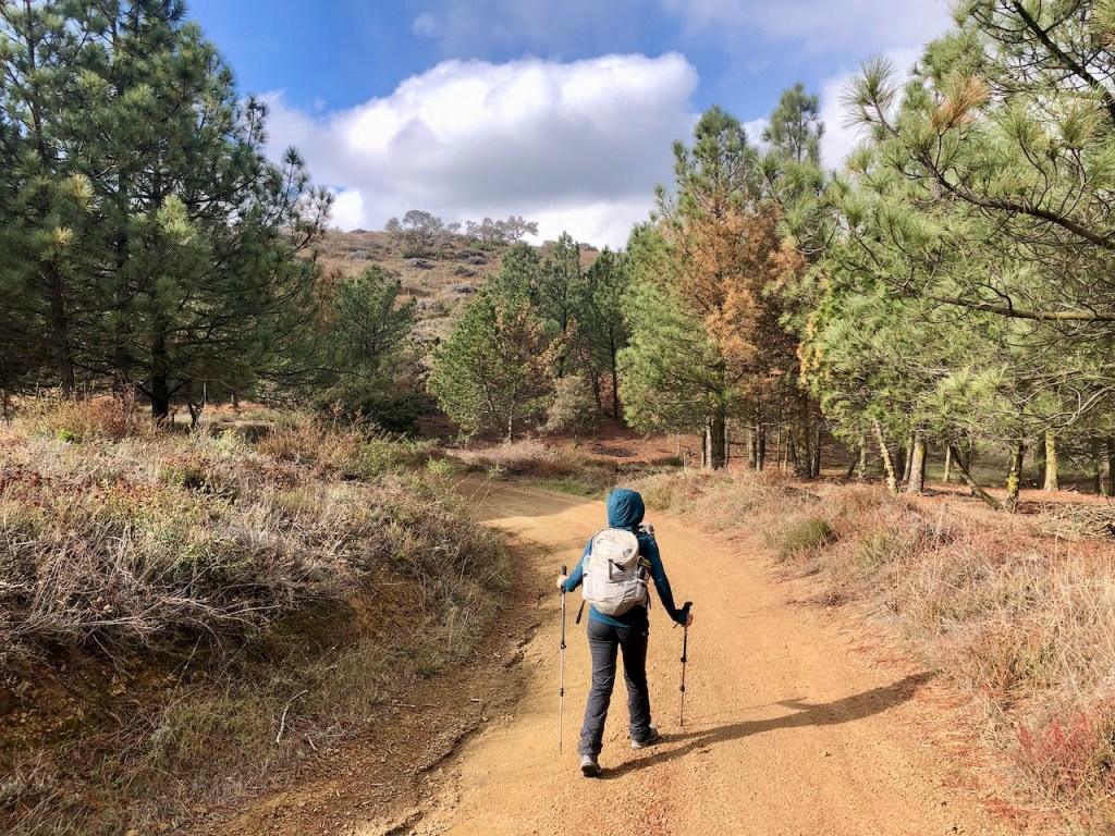
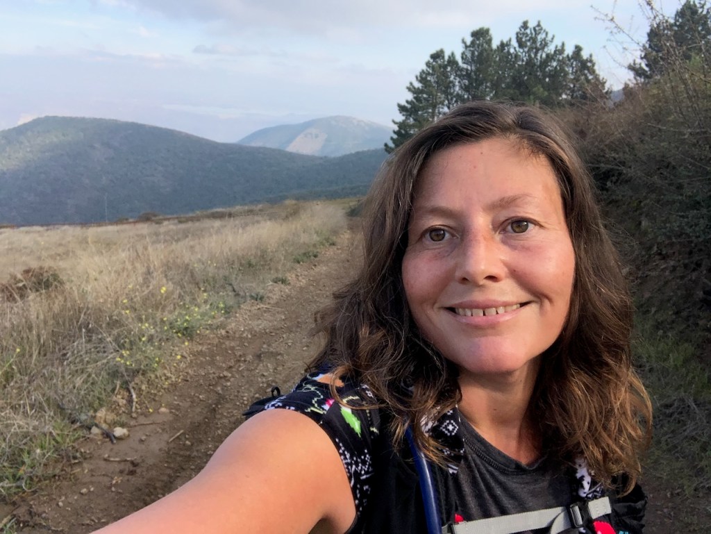
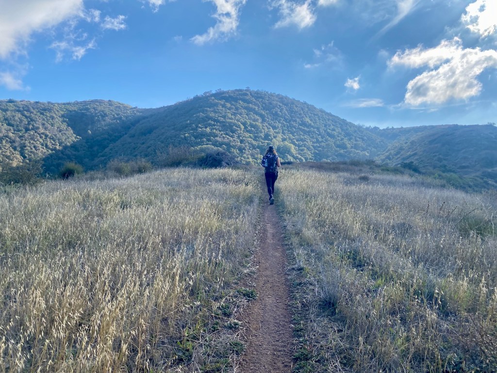
It was Christmas Eve 2023, and a beautiful winter day. I met my hiking buddy at her car, and we proceeded toward the trailhead to start our trek around 7:30 am. The idea was to hike up to Bedford Peak (Elevation 3760 ft), before proceeding on to Pleasants Peak (Elevation 3973 ft) along North Main Divide Road, for two peaks in one day!
Clouds swirled around the high peaks of the mountains as we began our trek up the narrow rocky trail. The trail was still a bit wet from recent rains, but not muddy.
Fall Hangs Around
There was lots of greenery in the canyon. Some, but not all of the deciduous trees had lost their leaves. So it felt like fall was still here, even though it was December. The seasons in California are not quite in sync with the rest of the United States. Our summer goes on forever, and our fall stays late. Winters are very short here, and typically last from late December to late January.
Just Look Up
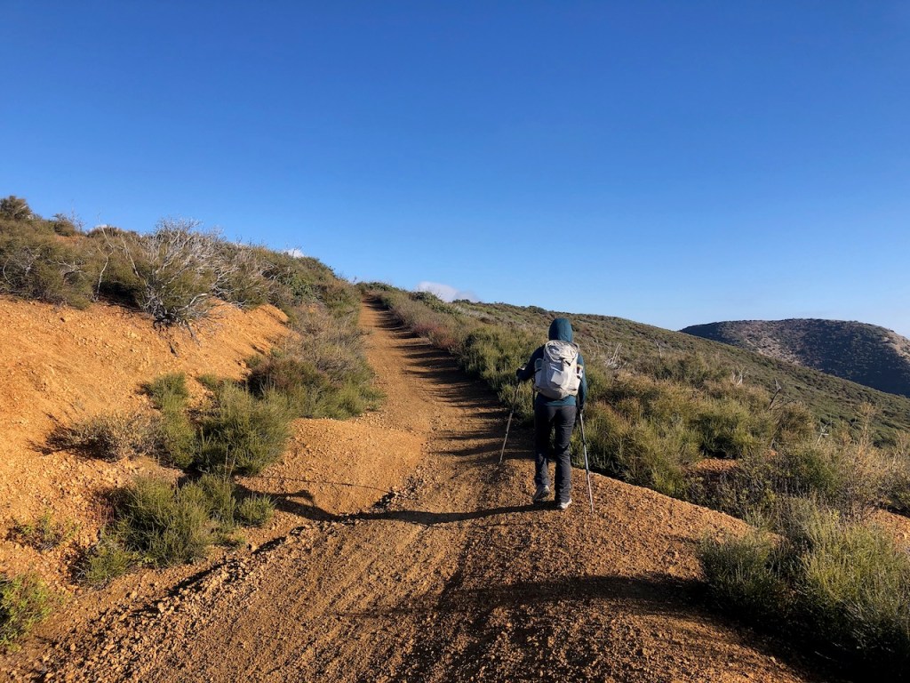
The trail began zig zagging it’s way up. There were switchbacks alongside the steep canyon, as I made my way steadily up. The gain was about 500-600 feet per mile on the way towards Bedford Peak, and I was starting to warm up fast, already shedding layers not 20 minutes into the hike.
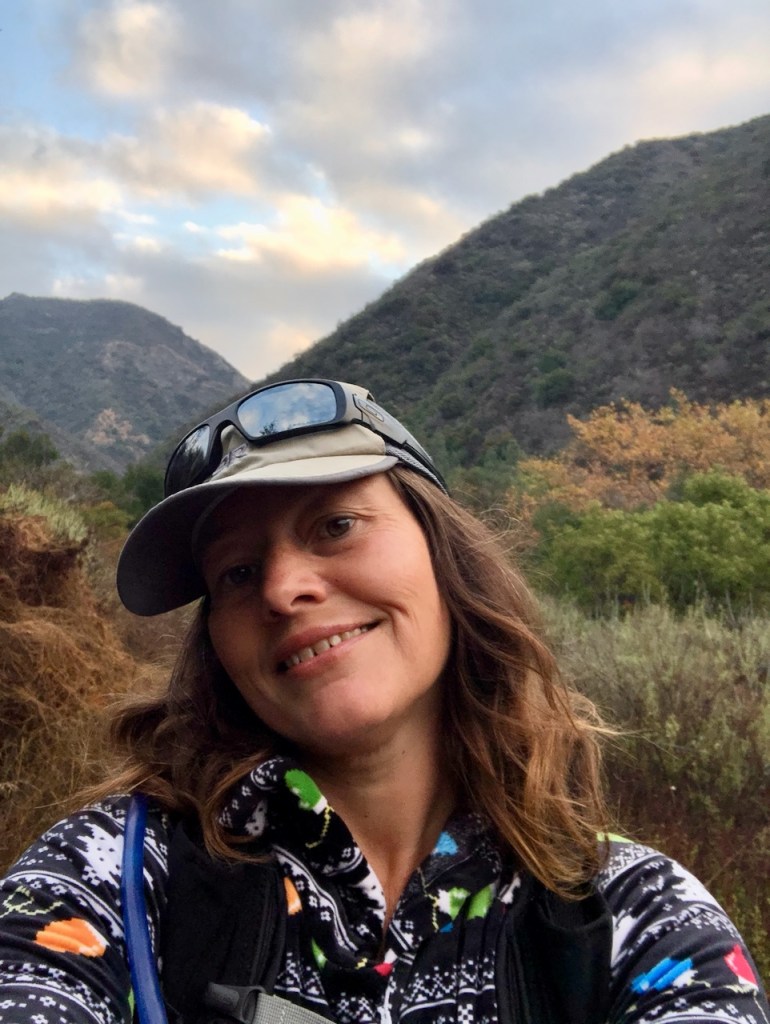
My Oakley’s
I had thrown off my hat about 10 minutes into the hike, forgetting I had put my favorite Oakleys on top of it. I was distracted by conversations going on, and lost my sunglasses. When you’re not hiking solo, it’s easy to not pay attention to stuff. Losing my nice sunglasses, a gift from my boyfriend, and go to sun protection for the last 2.5 years, was a total bummer. I now had nothing shielding my eyes from the broad daylight for the remainder of the hike. I did not go back, because by the time I realized I lost them I had hiked another 20 minutes, and that would not have been fair to my hiking buddy.
* If you are reading this, and found my Oakley sunglasses on Christmas Eve, please message me on instagram @serafinabenjamin. Thanks.*
The Morning Light
As we climbed out of Silverado Canyon, mist was hovering about in the air, and the scenery was quite dramatic from the start. The rays of the sun pierced through the clouds ever so softly.
This was my second time heading to Bedford Peak. The first time I hiked there was a few years ago, and I had gone solo.

It was all coming back to me, how steep this trail was. I was really feeling the burn, and getting in a good workout. I am a much better hiker now than I was, and I really felt no need to stop, except for photos.
The sun was really beginning to radiate off the canyon walls by 8am, which was somewhat welcome, as it was a chilly morning.
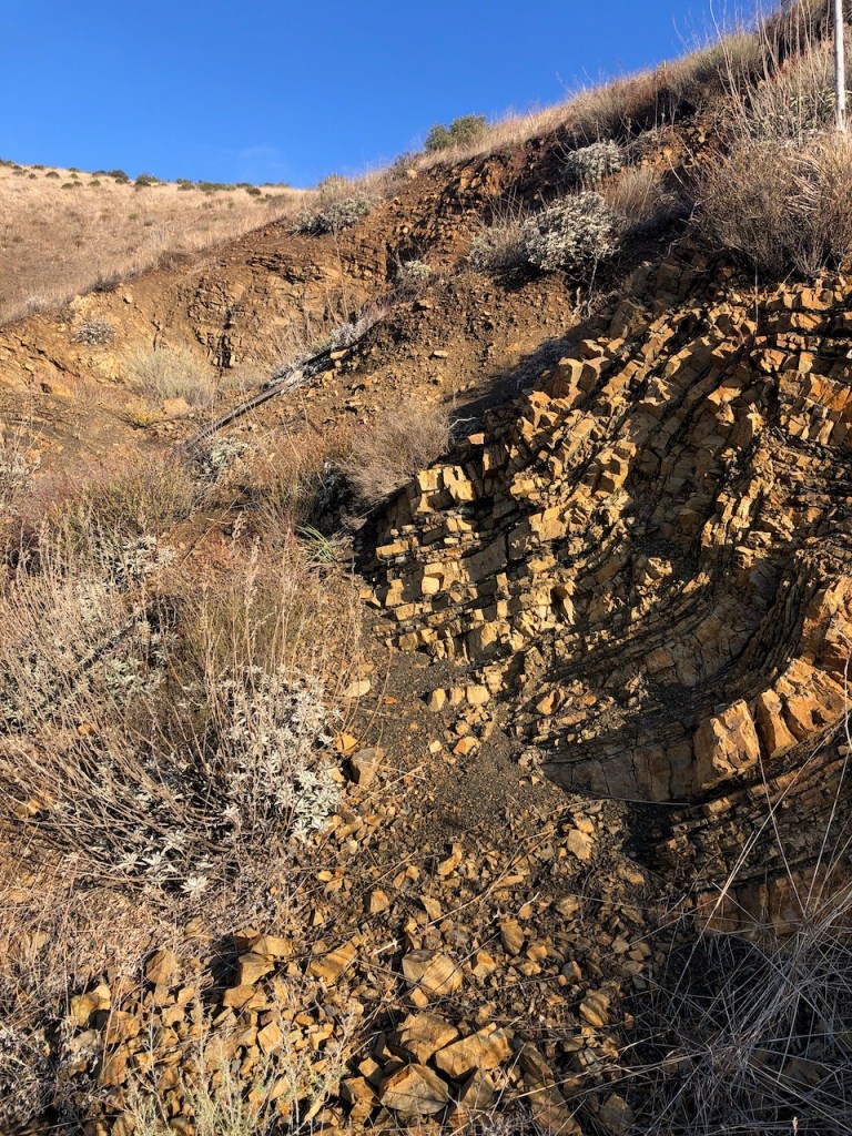
The views got better as we climbed. My hiking partner, a PHD student in Biology, discussed the geologic rock formations along the canyon. We also discussed plant life a bit, but she revealed her true interests revolved around marine life.

A Steady Climb
Our climb would continue to be steep and steady all the way to Bedford Peak. The trail is narrow, and rocky, yet well maintained.
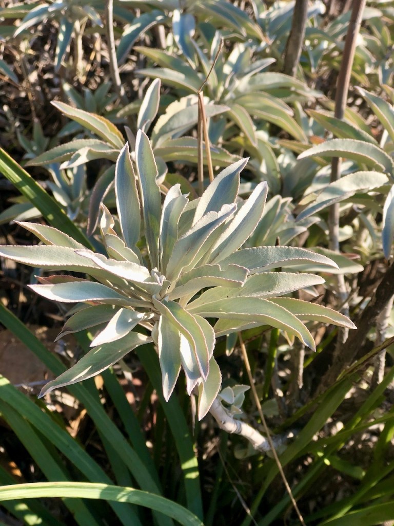
White sage was growing abundantly all along the trail. I still remember the first time I hiked to Bedford Peak in spring of 2021. I had never seen so much sage. I remembered a lady I used to know who would go pick sage, and I marveled at how lucky she was to find it. But it was everywhere here. Apparently the Native Americans used this plant for it’s effect on one’s consciousness, and to purify spaces.
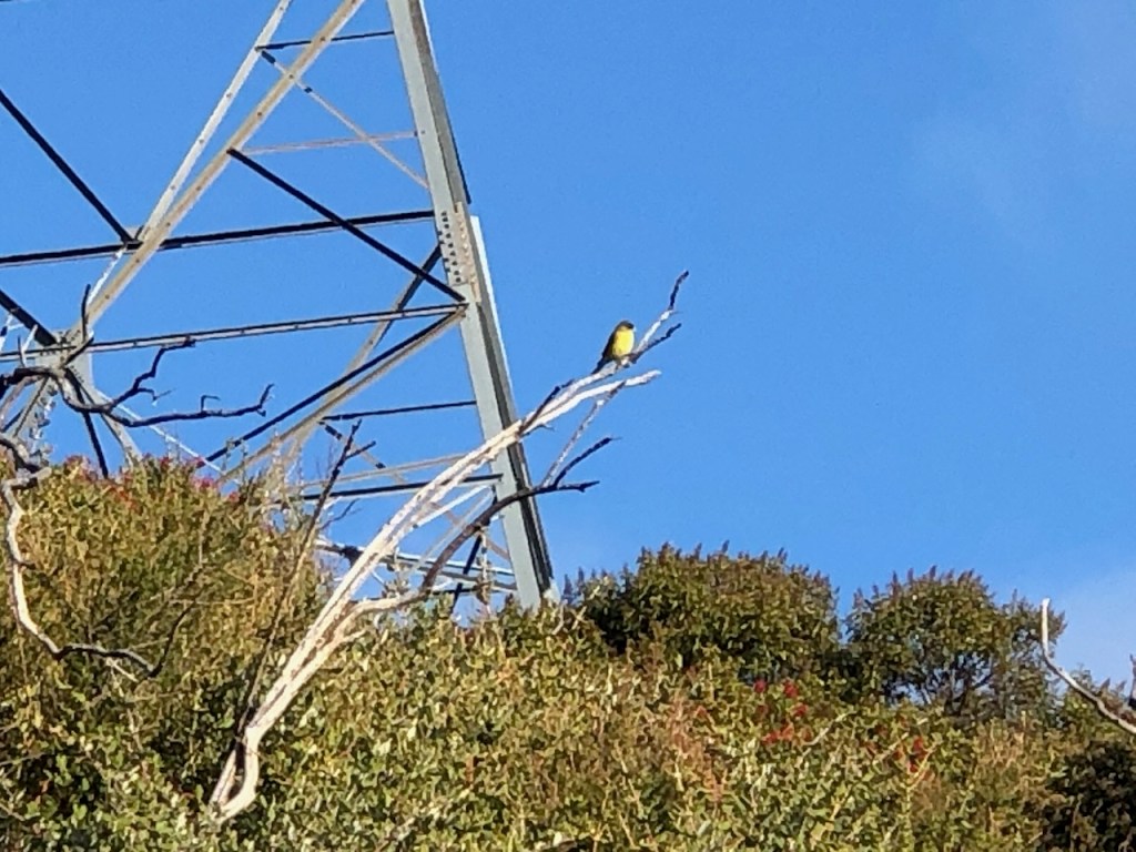
We spotted a few small yellow songbirds, possibly California Goldfinch.
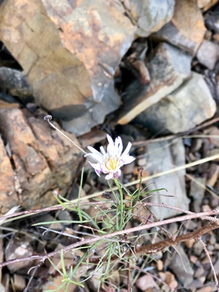
Tiny pink flowers, new green grass, and evidence of spring were everywhere, with the recent rains. It would not be long now. Winter is typically short and sweet in socal.
A mountain biker passed us heading downhill along the fire road, as we were climbing. The backcountry trails here are shared by hikers, mountain bikers, off road vehicles, and motocross riders. From any given trailhead, to a peak, it is at least 4 miles, and most of the peaks around here are around 8-10 miles from a trailhead, with Pleasants Peak being no exception. So it would be no wonder, if we were all alone out there. Only time would tell, as we pressed on towards Bedford Peak.
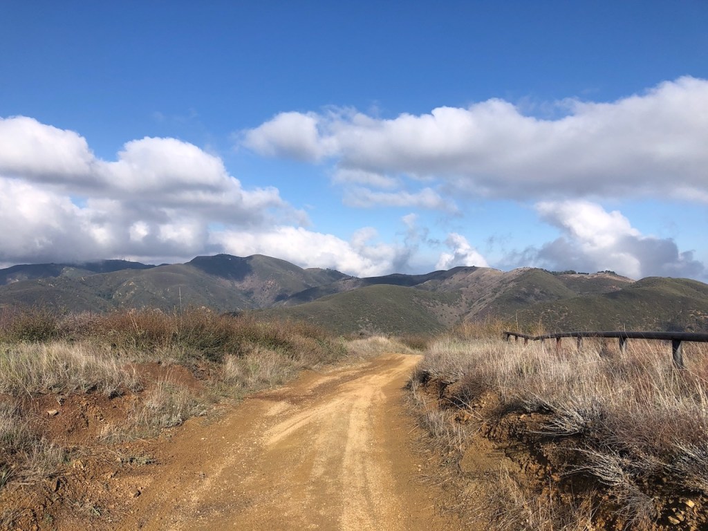
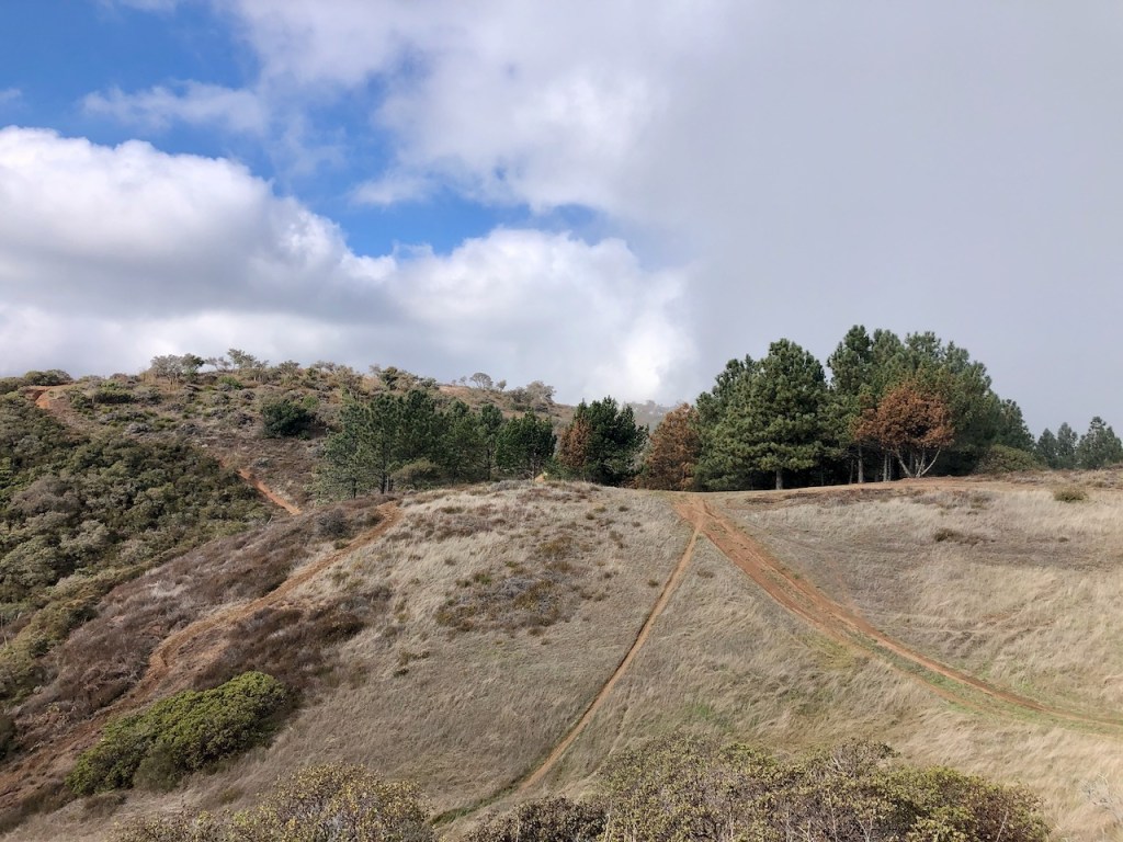
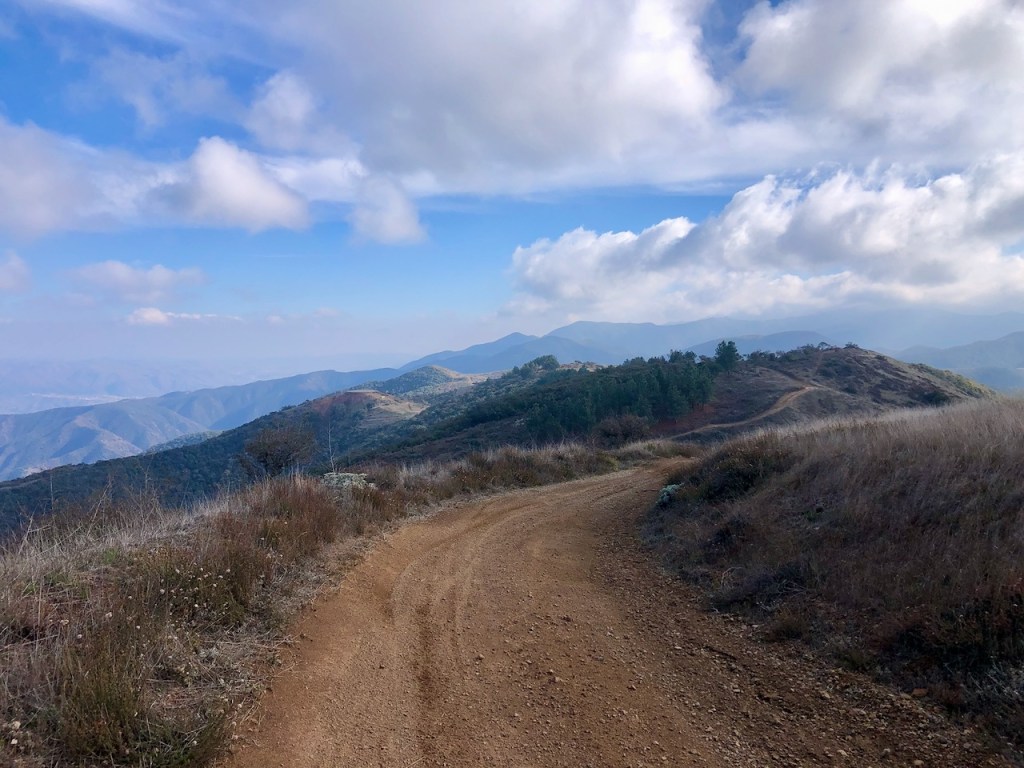
After about 3 miles of climbing, we reached a plateau of sorts, and the trail widened. It also started to flatten out a bit, as we entered an even wider stretch of fire road. All the ridges here in the Santa Anas have a fire road, and much of it is off limits to vehicle traffic, reserved for firefighters, maintaining fire lines. This mountain area experiences fires frequently, and this wide road is one of the main ways firefighters access this wilderness with their fire trucks.

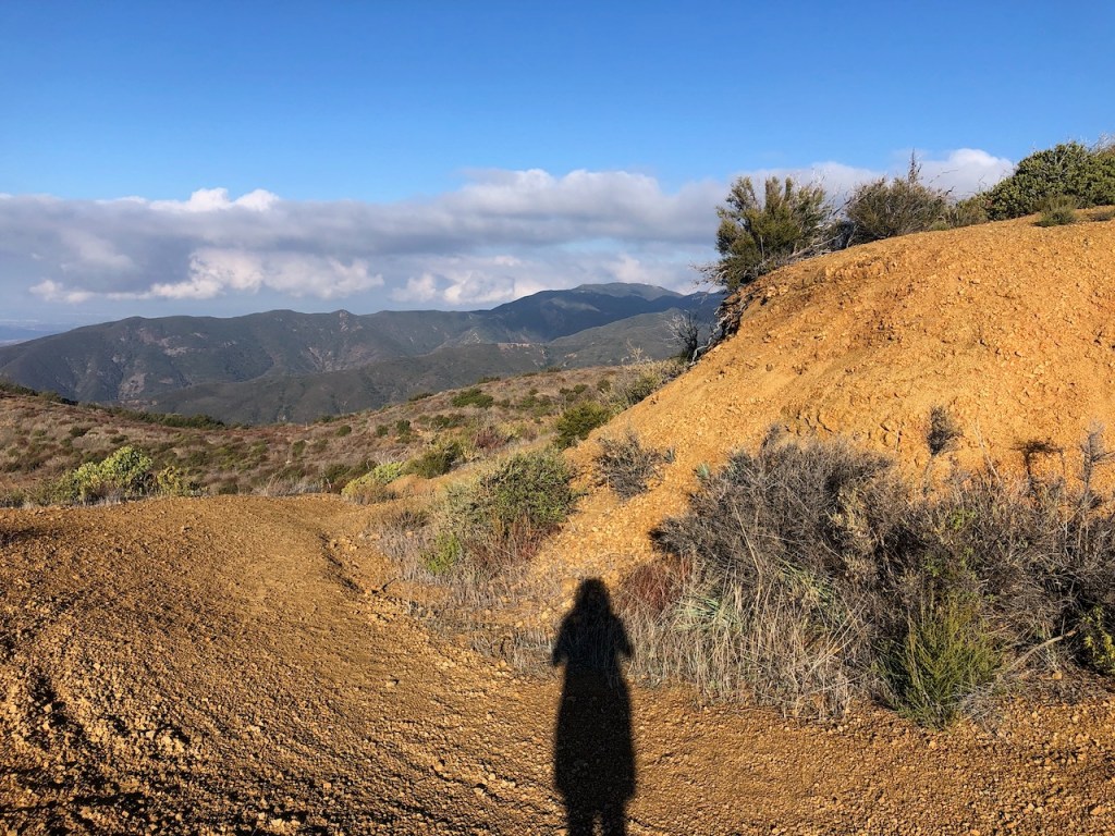
On both sides of the trail, there were awesome views in all directions. Tons of bushy, low growing, Manzanita trees flanked the trail on both sides. Past fires left their imprints on these shrub like trees. Their charred limbs and trunks had turned an ashen gray, resembling skeletons. Yet tons of new growth was still springing forth, well before spring had spring. The chaparral, otherwise known as cowboy cologne stays green year round. I love the smell of it. There were even a few wildflowers in bloom.
Nature has a way of renewing itself and us along with it, hen we take a hike, immersing ourselves in it. Forest bathing or shinrin-yoku is a tradition practiced in Japan, with a goal of taking in the forest atmosphere, and reconnecting with nature.
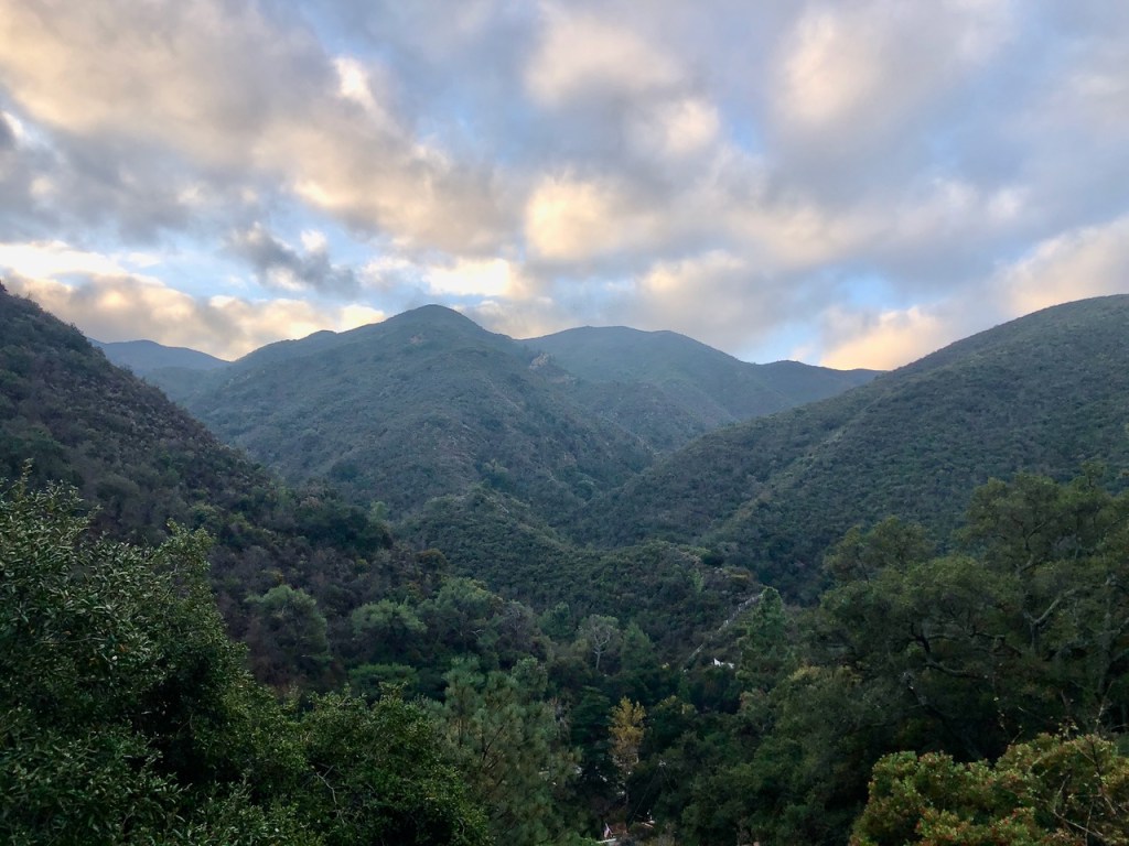
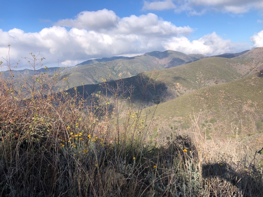
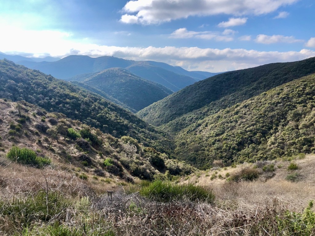
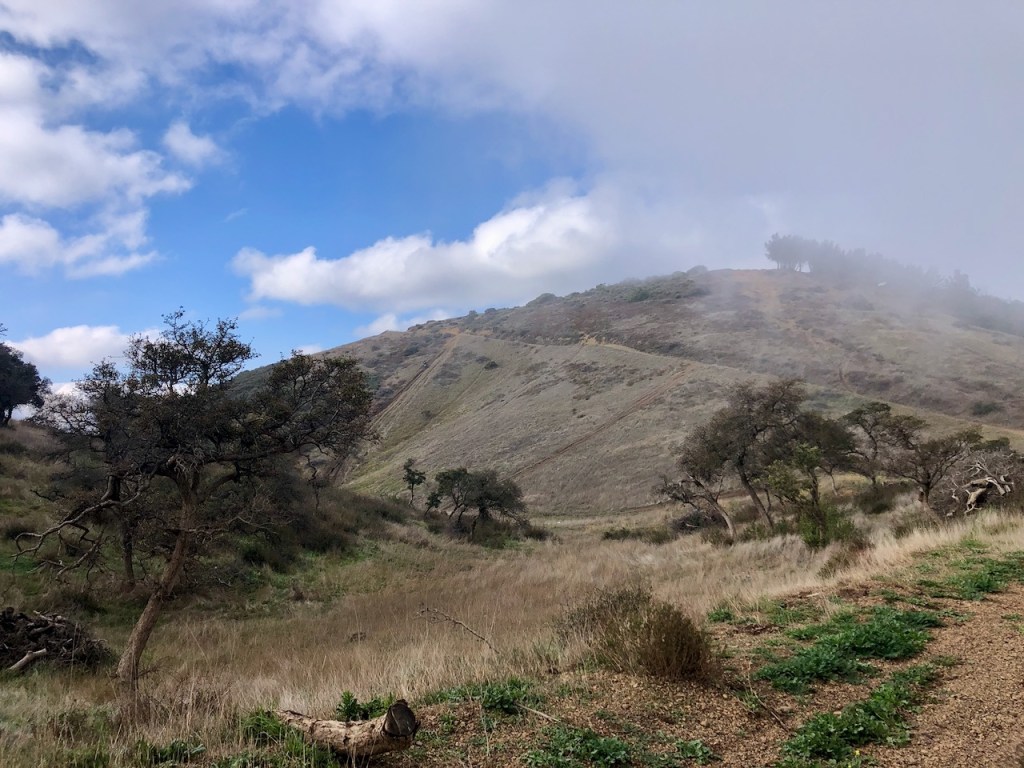
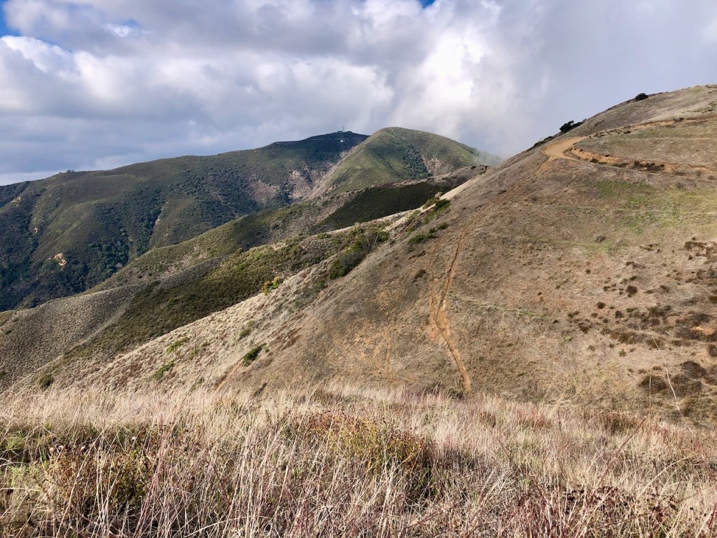
Mountains and wilderness were all around me. The clouds hovered low in the distance over Santiago and Modjeska Peaks.

The hike became a bit easier from this point on to Bedford, as most of the steep section was done. I could see down to Lake Elsinore through the low clouds.

I finally glimpsed Bedford Peak off to my right, along with Bald Peak further off in the distance. As we edged closer to the peak, we came to a fork in the road.
Off in the distance were a handful of motocross riders zipping their way along the ridge. Last time I went to Bedford Peak, I also saw motocross riders here on this trail, in about the same spot. This trail was maybe more popular with bikes today, than hikers, at least it would appear. So we were not alone out there for the moment.
There was a hefty iron barrier, where the fire road meets the trail. We made a right onto North Main Divide Road towards Bedford Peak. We would take this same road on to Pleasants Peak. Just as we passed through this opening we heard the sound of engines revving.
It was fairly straightforward all the way to Bedford Peak. After about another 1/2 mile, we headed right, off North Main Divide Road, on to a singletrack trail over another steel barrier, which was bent, and sunken in the ground, no doubt in part to bikes. After a short somewhat muddy hill climb, we were there, at a false summit. There are two Bedford Peaks on the alltrails map. So we continued on, and after about 5 more minutes, found the actual Bedford Peak, complete with proper signage.

Bedford Peak
We made it to Bedford Peak (Elevation 3760 ft)! This was my second time to this peak. The first time I hiked here was solo in 2021. It was one of a handful of peaks I did, when I was fairly new to peak bagging.
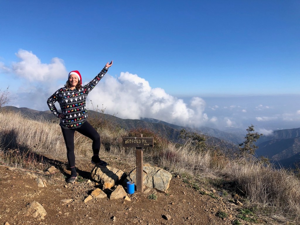
It’s always fun to do a Christmas hike. I thought I better wear my best ugly Christmas fleece, to have fun with this one, complete with Santa hat. Anyone who knows me, knows I am not that great about getting into costume, but this is one holiday I really like to celebrate. After all it is the birth of my Lord and savior Jesus Christ.
We took a break here to eat some snacks, before venturing back the way we came.
Just as we set off, in the distance once again we heard the sound of engines revving. In less than a minute, we were forced to get off the trail to allow the motocross riders to pass. With the smell of gasoline in the air, we headed back along North Main Divide Road.
We passed the initial turnoff for Bedford Peak, and stayed to the right, heading on to Pleasants Peak. I had never hiked his way before, and little was known about the trail, or what the conditions would be like.
In all my hiking groups, nothing was ever said about bagging this particular peak. More the reason to go in my opinion, since I like seeing new places, for the first time, and not just going off what others have experienced. I still read all I can on a place before I go, in trail guides, and try to get as much info as I can, so I’m not going in blind.
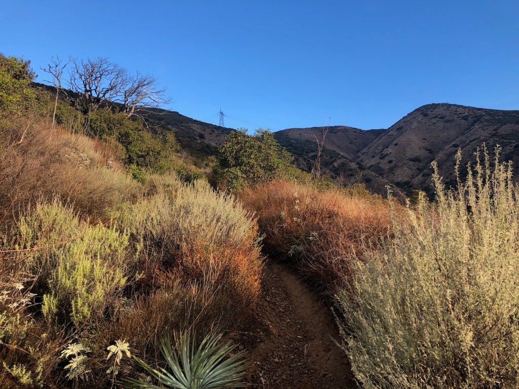
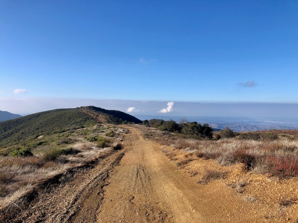
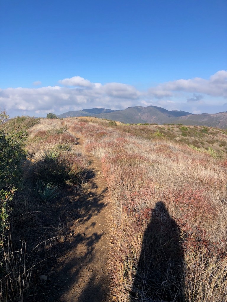
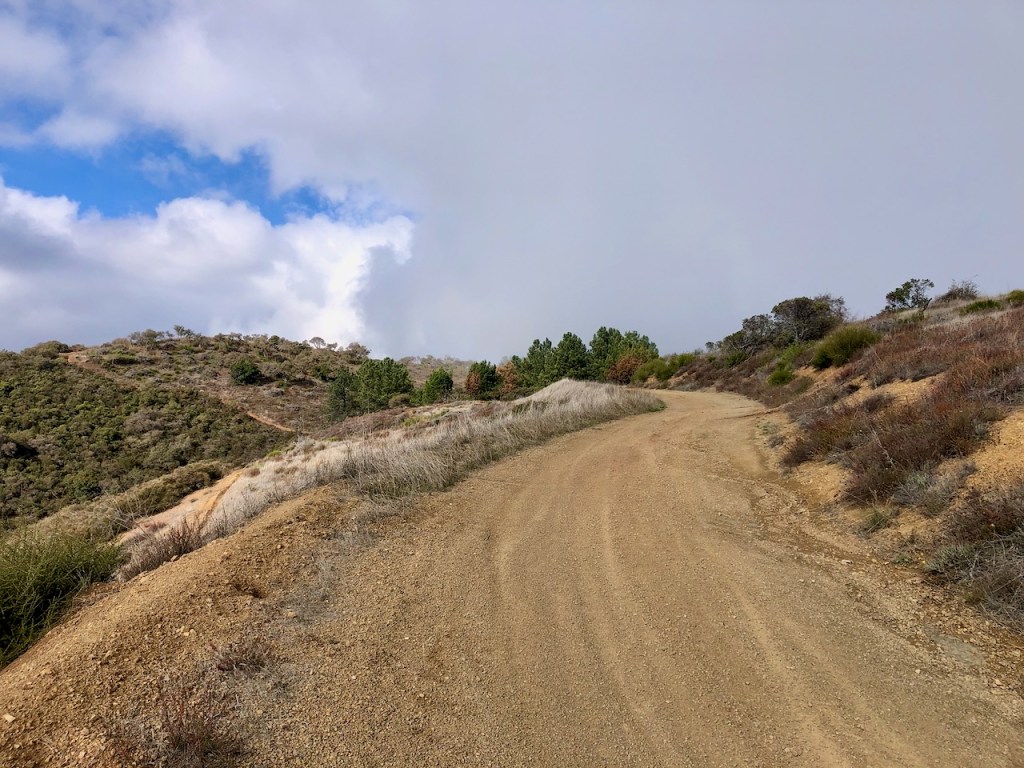
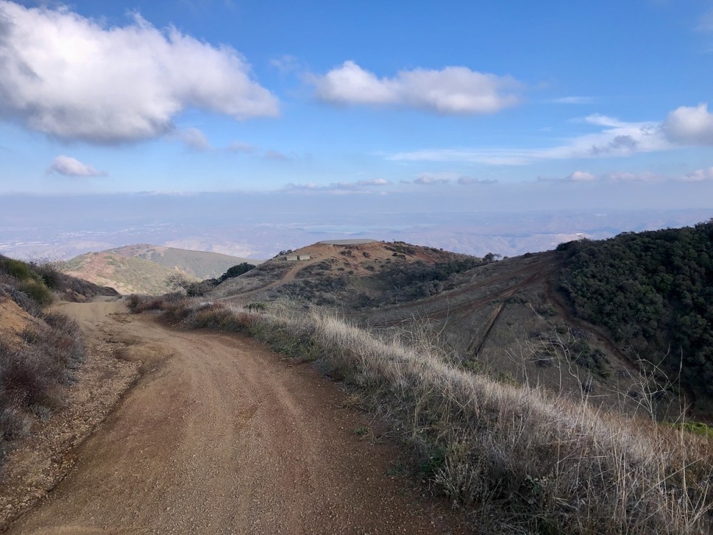
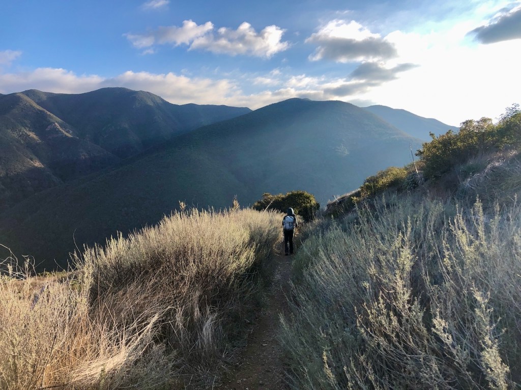
As we headed off down the fire road, I noticed we are descending a whole bunch. I can see Pleasants Peak off in the distance. It looked so far off along the ridge over countless peaks and valleys. I began to realize this hike was going to resemble a rollercoaster, and would have far more gain than a few hundred feet.

I had no idea how long it would be exactly, or how much total gain we would experience. Both of us had climbed Mount Whitney. That seems to be the standard, that if you climbed Whitney, well any other climb is pretty much fair game.
A December Hike
According to alltrails, there was a small difference in elevation. Alltrails always underestimates mileage, and sometimes the gain. Either way, it was a beautiful December day and rains were still lingering in the air. We had just experienced a week of storms roll on through. I made it clear that turning back was always an option, because I try to put safety first, turning back whenever there is doubt.

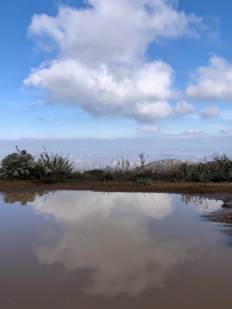
Between the two peaks there was said to be a difference of about 300 feet in elevation. But I knew it wasn’t just gonna be 300 feet of extra gain, it would have to be much more. As we hiked on, all the new scenery was rather exciting to me. Each canyon I passed was something new to behold. I was on the lookout for animal trails, and unmarked trails, not marked on the map. There were several large puddles of standing water on the fire road from recent rains.
Ladd Canyon
Off to my left I noticed a narrow trail leading into a steep rugged canyon. Based on my Alltrails map, it was Ladd Canyon, and there was a spring there. I had heard about this canyon before, because a naturalist and hiking guide that I know had lived there, at least until the Holy Fire swept through, years ago. I really didn’t know much more about this one, nor did I hear any water flowing, so I imagined there wasn’t a waterfall there. If there was, it was flowing very small.
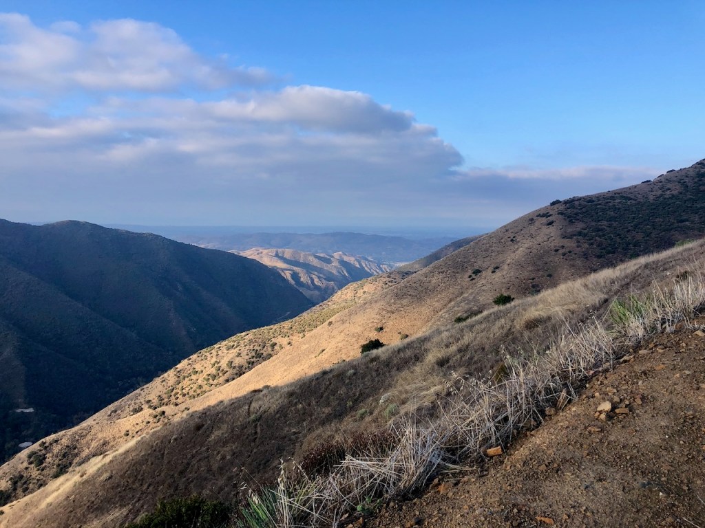
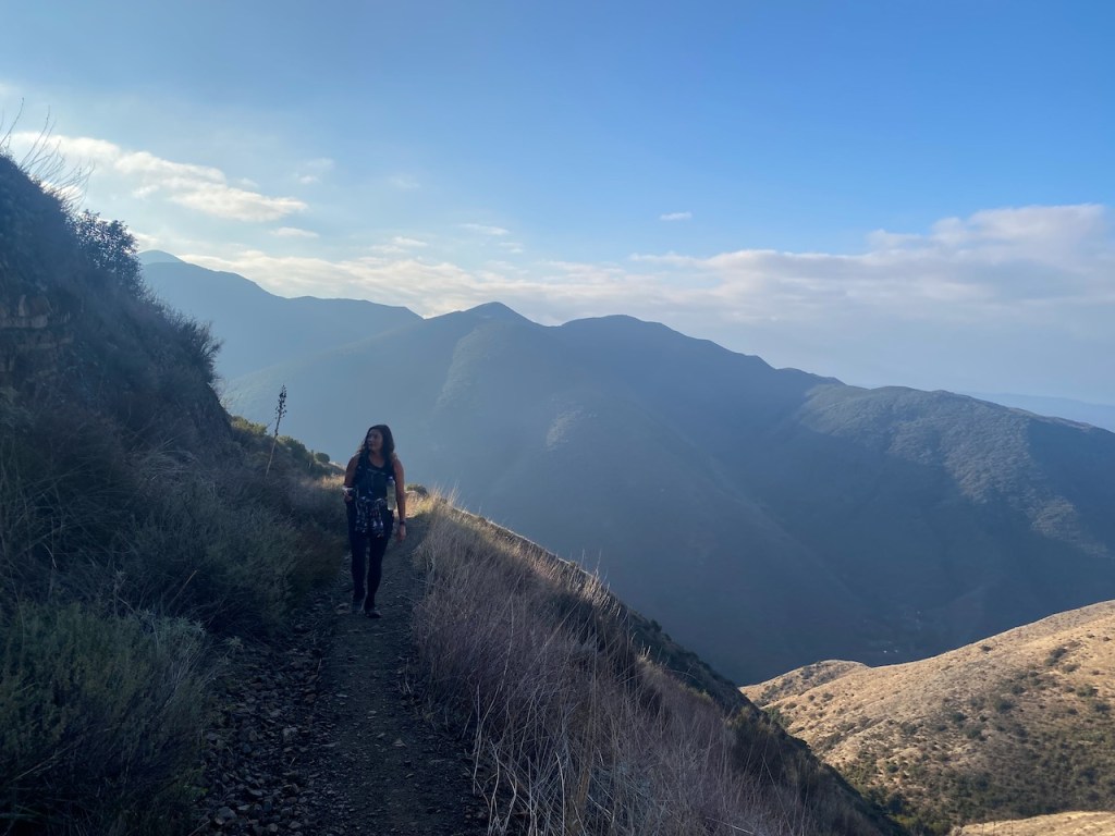
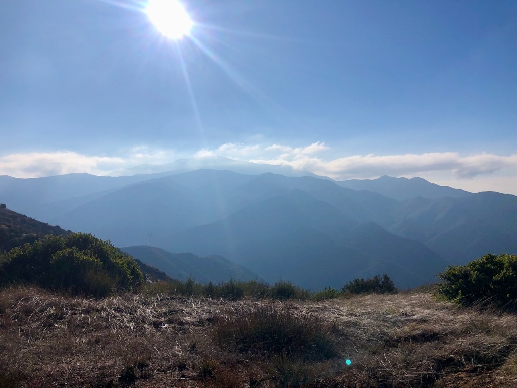
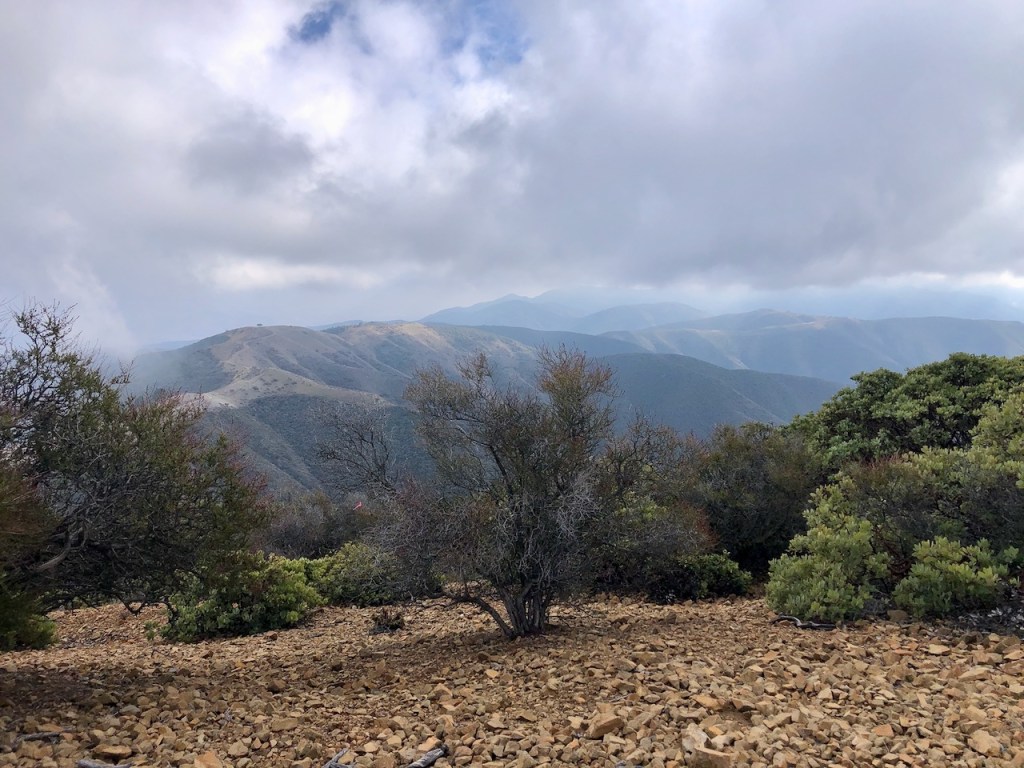
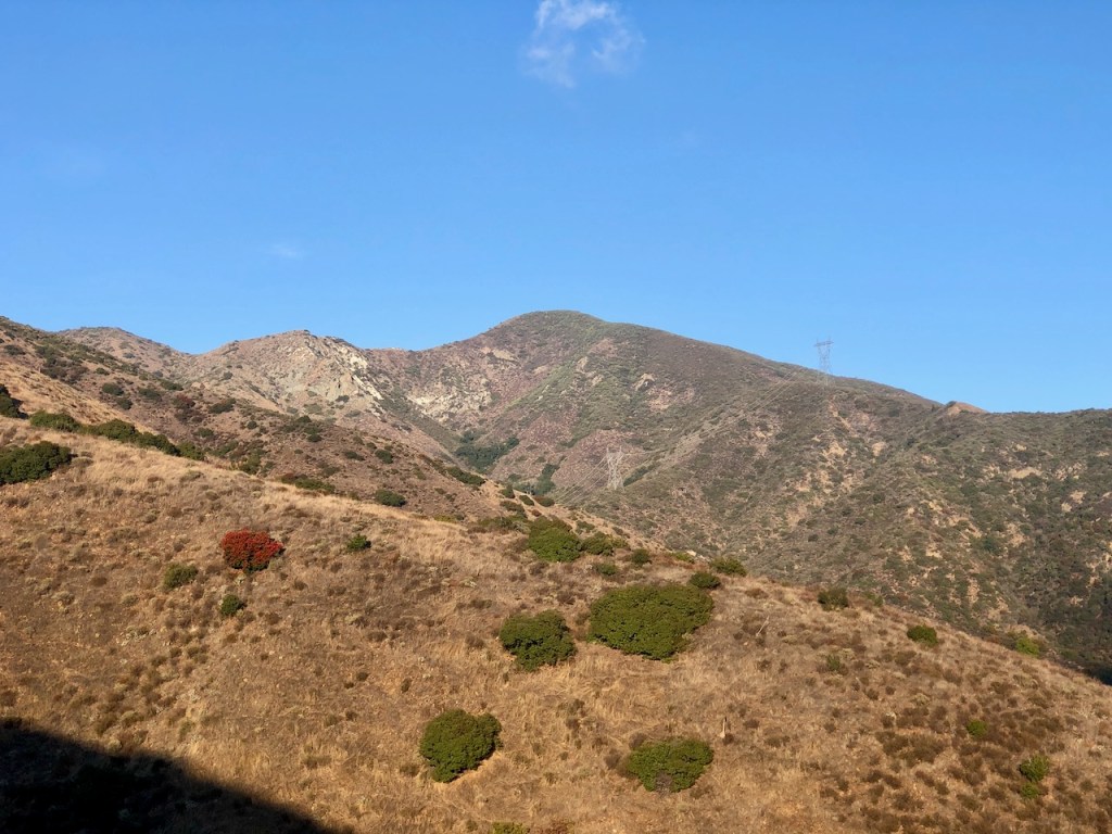
The vastness of the Inland Empire, of Riverside, Corona, and Lake Elsinore, was to my right. It was a beautiful scene, with the clouds still hanging low. I could only see a small glimpse of Lake Elsinore, though views of Mount San Jacinto were completely obscured. As we hiked on I could see Pleasants Peak in the distance. It would be a 5 mile hike from that turnoff to the peak. The low clouds began to threaten to engulf us, and I wondered how long the sun would last. Would there even be a view from the peak?
Truck Trails
A series of truck trails lead up to this ridge from the Riverside County side. I had not hiked any of these yet, but had seen pictures of some. Another female hiker on Instagram, who I follow posted pictures of a rather rugged one named Indian Truck Trail, and in the caption it was mentioned that it became impassable due to a landslide. That is the type of foreboding post you hear about, when you read about this place.
There are other popular hikes along truck trails, like Skyline Drive in Corona, which sound pretty tame. I don’t live on that side, but the Orange County side. So I have not explored that area as much, since it’s a little out of my way, requiring braving the 91 freeway, which frankly is more scary than hiking solo in the wilderness.
Unnamed Trails
On my map were several unnamed trails coming up ahead. They could be truck trails or steep singletracks, geared towards mountain bikers. I would have to keep going, and just find out.
The motocross riders passed us once again, and we got off to the side quickly. One of them waved and was grateful that we got out of the way for them. Aside from the smell of gasoline, it didn’t turn out to be any kind of an issue. They would pass us many more times. They looked to be about high school age. It was good that someone else was out here, just in case we did need help.
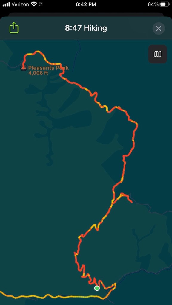
Just as we had ascended one big climb, we were descending once again. It was tough to tell at first, but this ridge truly was a roller coaster, and we were getting quite a work out. I could see the peak growing ever closer. This was gonna be a long one, and a full day affair. As we hiked on, I didn’t yet know it was going to be a full 10 miles more, than simply hiking to Bedford Peak, which is about 7 miles roundtrip.
Eventually, we came to a truck trail that looked very rocky and rutted with an open gate called Eagle Road.

The gate was open, and I could see this road was strewn with boulders. It looked to be a challenging one, which I sure was meant more for trucks, than hikers.

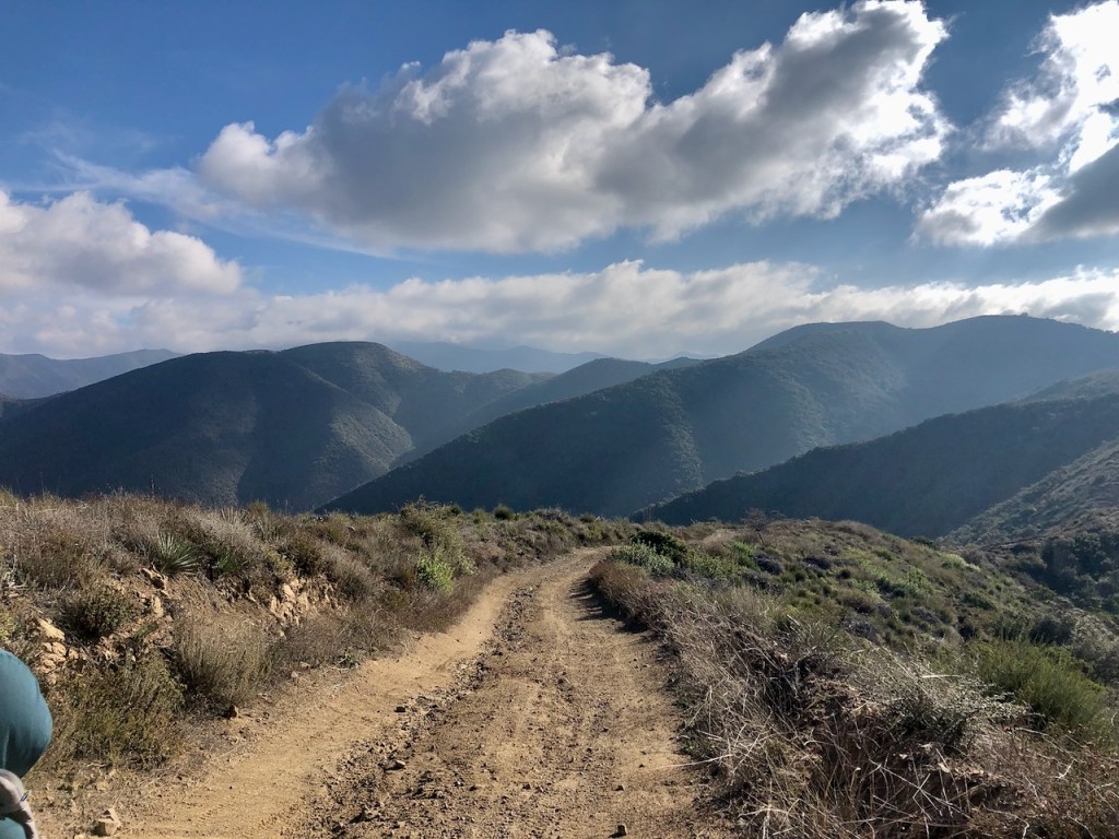
We hiked along, enjoying the views, watching the clouds close in. Eventually it was as if we were hiking right into the clouds.
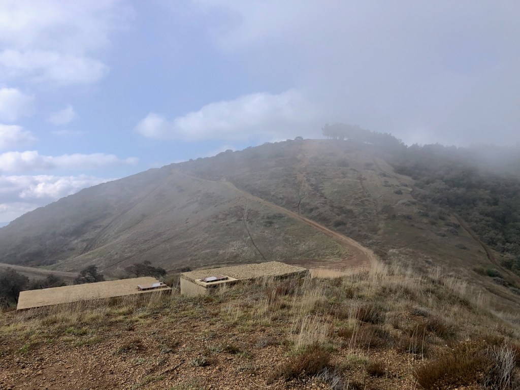
I noticed a sort of foundation off to my right, and went to go check it out. I wondered if it was an old fire lookout that had burned down. I was mistaken, and could not have been further off.
Launch Pad
As it turned out, it was a helicopter pad. There was other concrete infrastructure here, and a bunch of pipes leading to it. I imagined this was for fire crews, news helicopters, and official business, not for landing for joy rides…but I could be wrong.
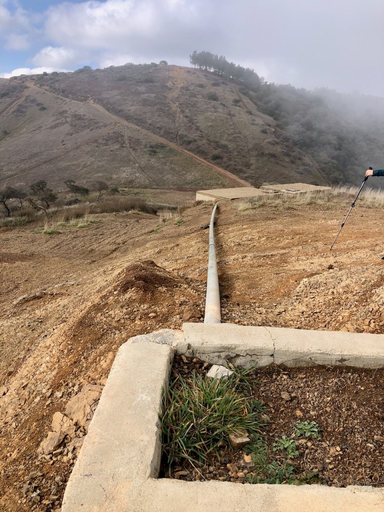
I did not know what the concrete box like structures were used for. I figured they must be some sort of cistern for storing water.
I stared down into the expanse, of the foggy forested hillsides. They looked very spooky, and reminiscent of Japan. It was a unique and tranquil mountain scene.
The view towards Lake Elsinore was now completely obscured. I was now less than a mile or so from Pleasants Peak.
The trio of motocross riders returned for the third or fourth time, passing us by. I was growing ever more concerned that we weren’t going to be able to see anything at all from the peak, with all the clouds.
After we passed the helicopter pad, up ahead were some pines lining the ridge.
We passed through a small patch of forest, that didn’t look like it belonged there at all.
There were additional trails carved out, likely for motocross riding and mountain biking.
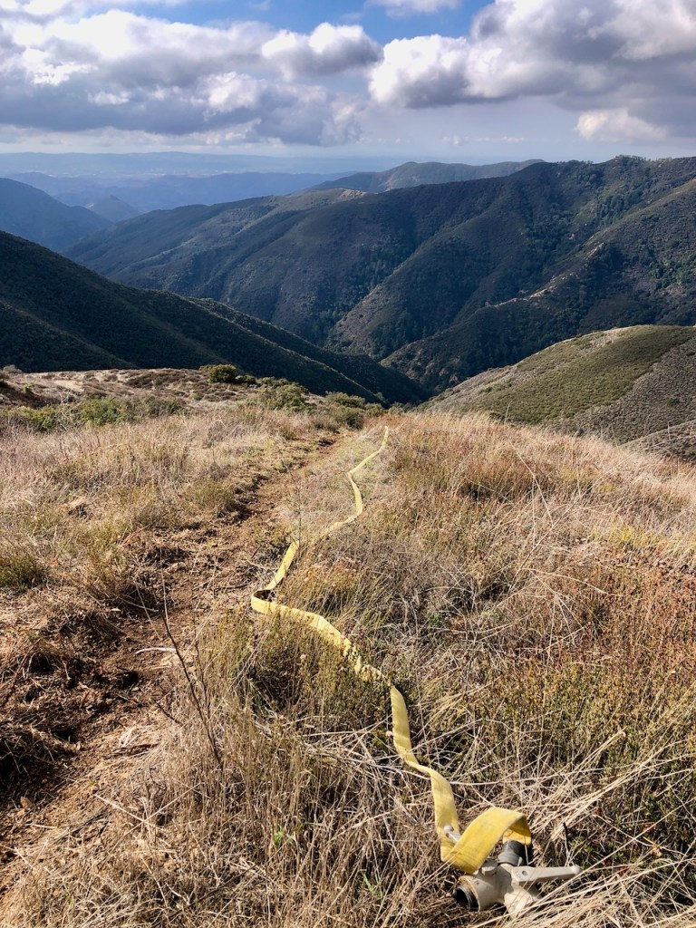
We passed by fire hoses, installed in the ground, loosely strung down the hillsides.
Some of the unmarked trails did not make a whole lot of sense. This one in particular was so steep. It could only be for downhill mountain biking or possibly firefighting.
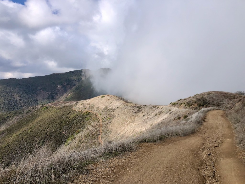
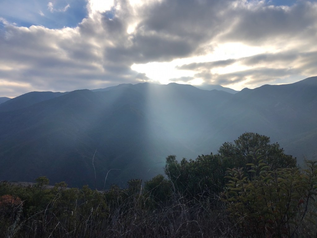
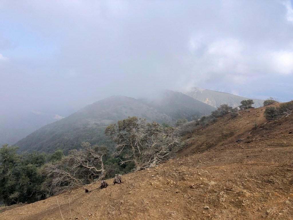
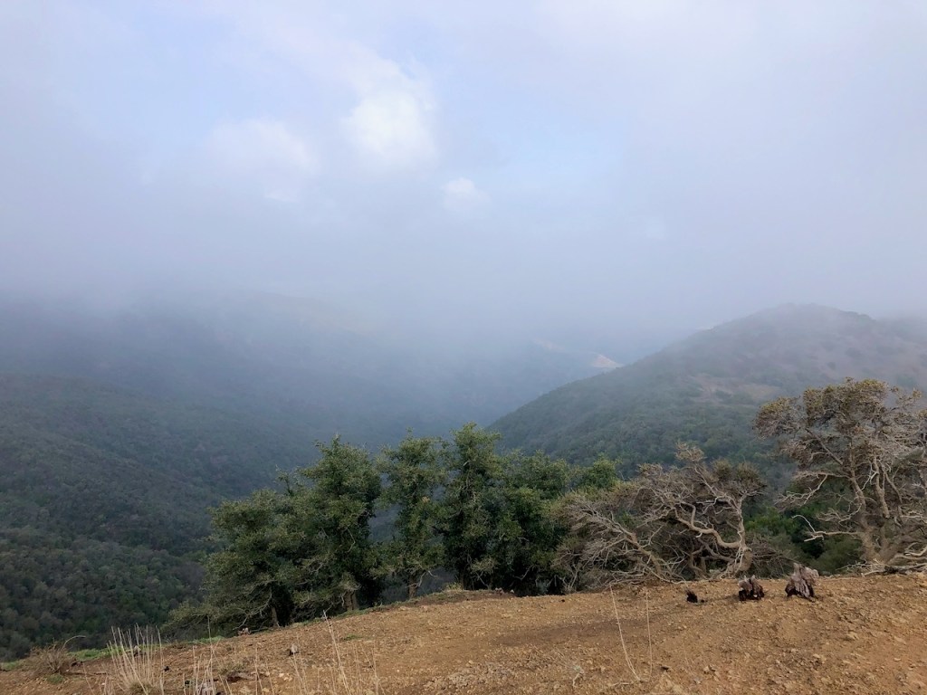
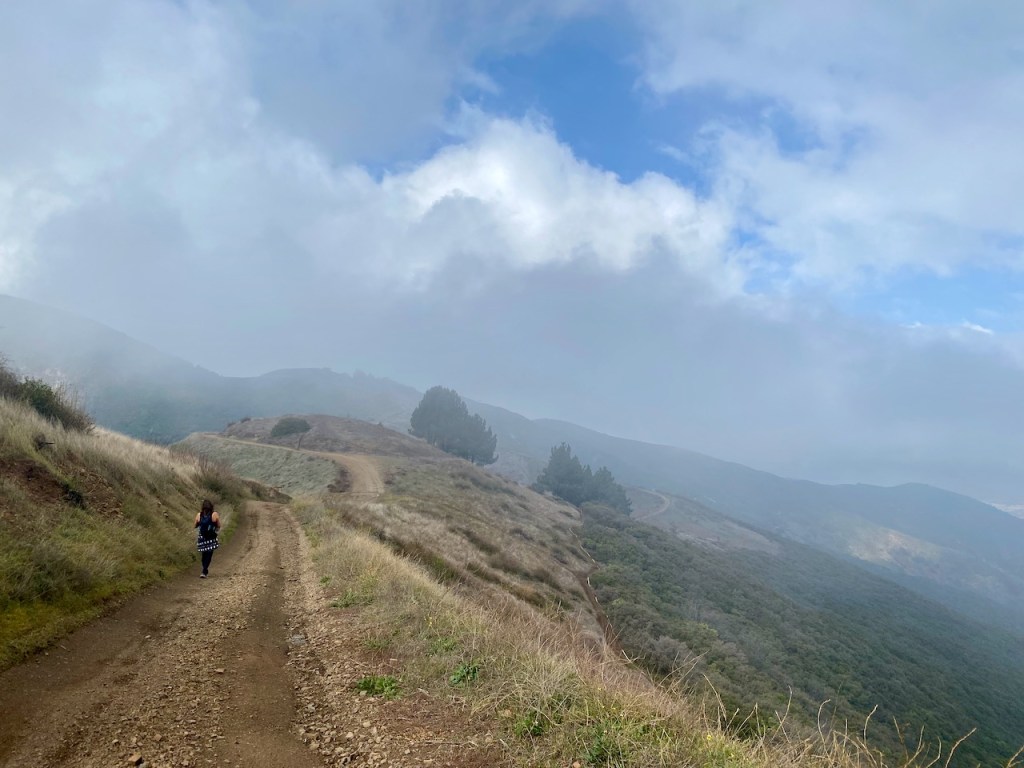
Approaching Pleasants Peak the ridge was enshrouded in clouds.

I found myself walking straight into the clouds. The cool mist of the clouds was all around. What was out there? It was sort of spooky, but I was not afraid. How often do you get to walk in the clouds? I like to think God was right there in front of me, but unseen. The clouds were him reaching out with his loving arms.

The peak was now clearly visible, if not for long. But would there even be a view from the top with all this cloud cover?

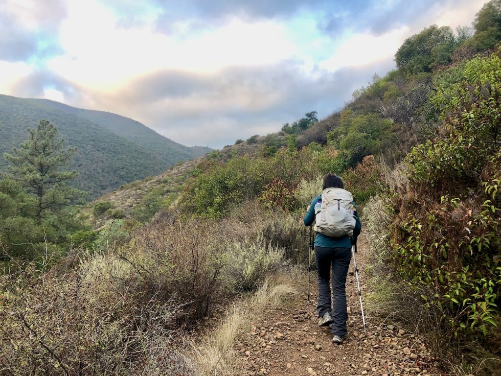
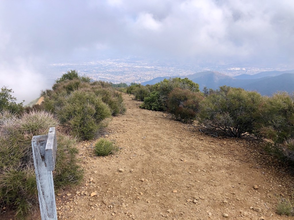
Finally, we reached had the trail leading up to Pleasants Peak. It was a bit hard to notice it, off to the left. We ventured off Main divide Road, and began what would be a very steep climb to the peak.

As we began the climb, we waded through overgrown brush along a rocky trail, dotted with pines, and manzanita.
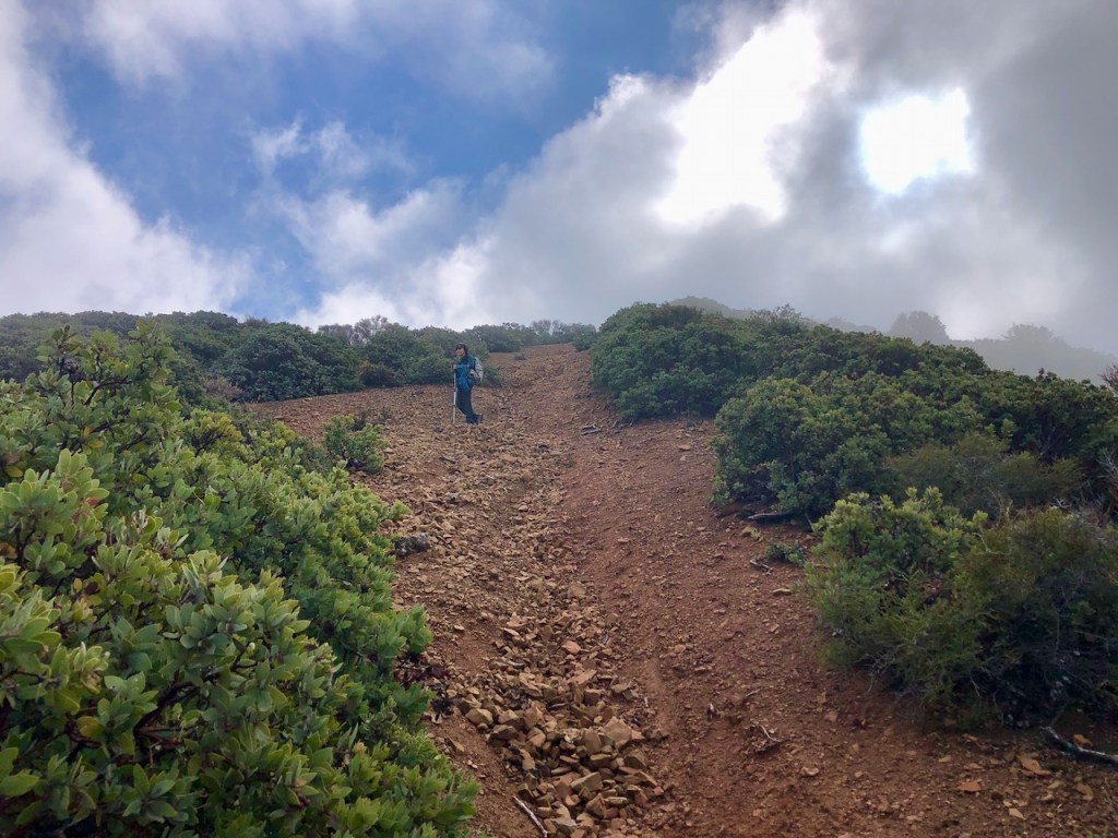
The trail was washed out and quite eroded from recent rains. Not only that, it was very steep, I knew I would have to down-climb on the way back down. Falling became a concern, the higher I climbed. This was by far the steepest part of the hike and I had not brought any trekking poles.

I stopped for a moment to catch my breath, and glanced back at North Main Divide Rd. down below. I was in the middle of nowhere for real, surrounded by clouds.
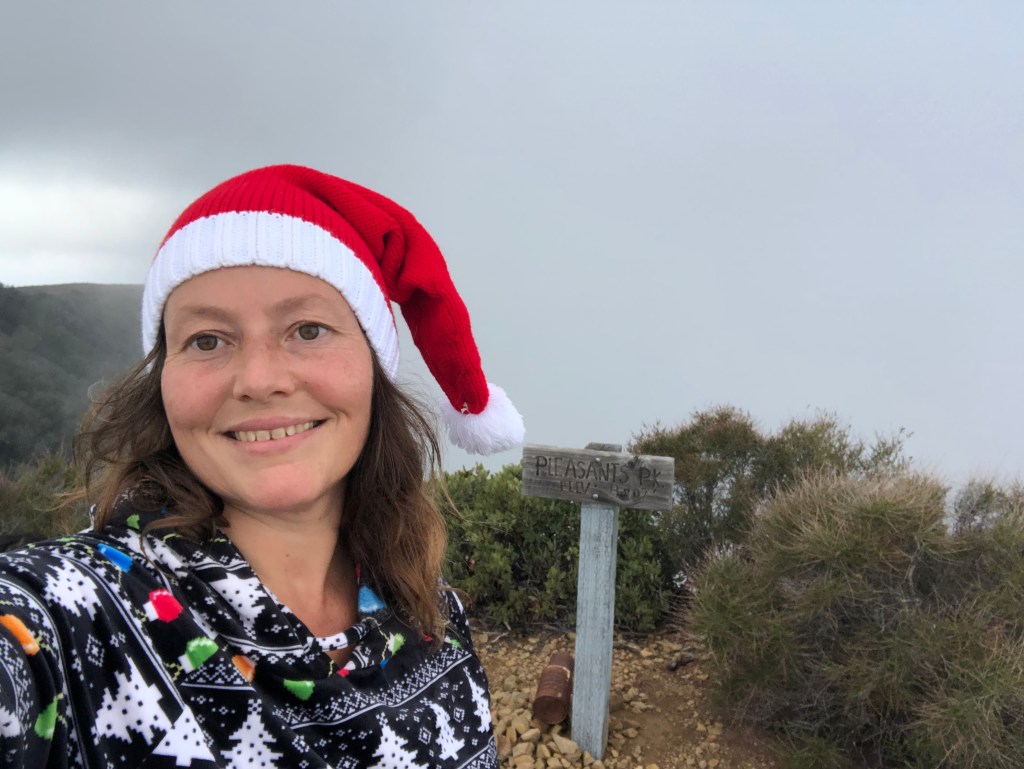
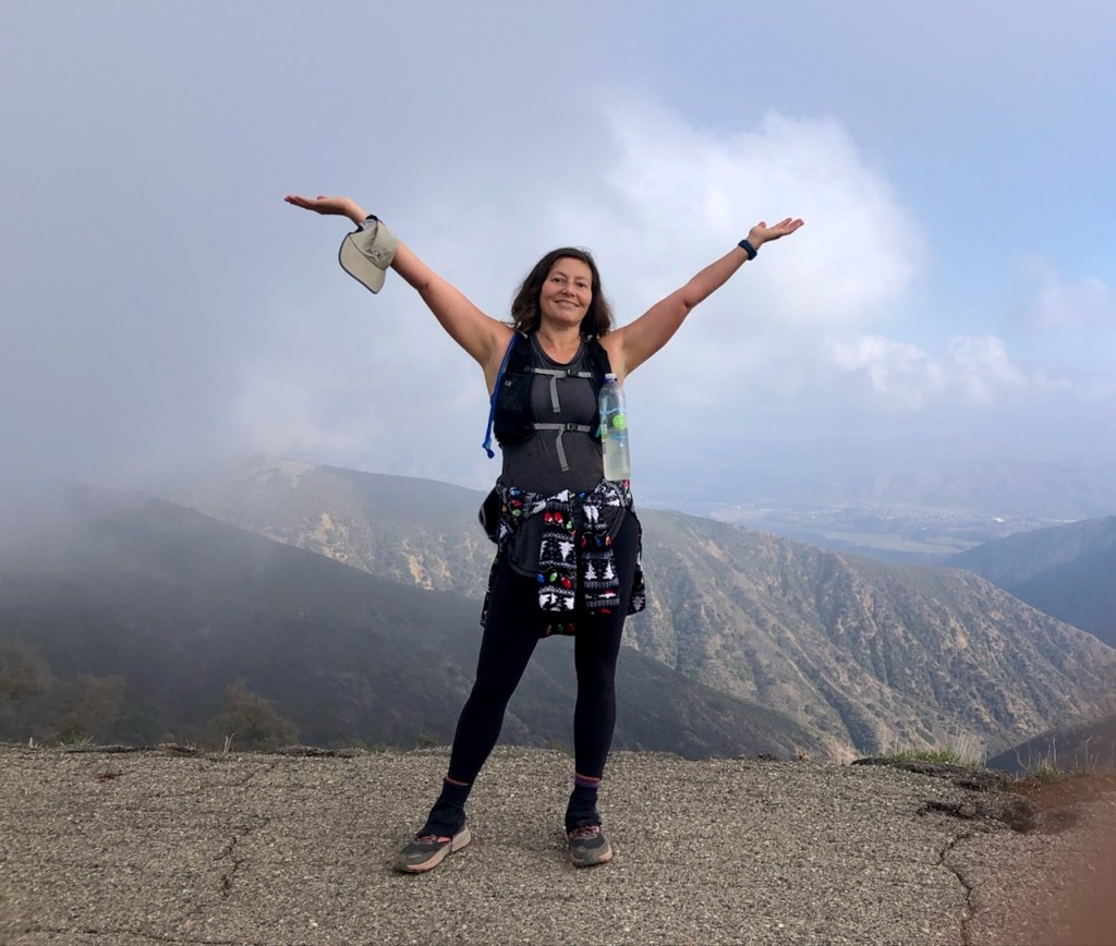
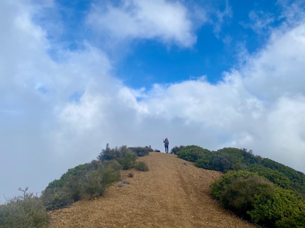
Pleasants Peak
This was quite the Christmas gift, to complete a hike I had planned for over a year. Finally I had made it to the long awaited Pleasants Peak, enshrouded by clouds. There was still some sun and views to the west though.

There were a handful of radio towers further along the ridge. We decided to take another celebratory snack break.
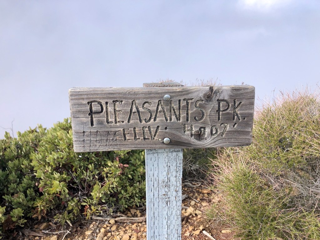
It felt really good to have made it to this elusive peak not just because I had been thinking about it for a long time, but since I got to trek along a road less traveled, which was kind of exciting. I had not heard about it from anyone, but had simply found it on my map. It was a roll of the dice, and here I was.
It’s fun to meet your goals and complete a challenge that you set out for yourself. But the challenge was not over. We still needed to make it back. We were over 8 miles from the trail head.
I took plenty of pictures and enjoyed the view from Pleasants Peak. It was a very scenic spot, and after a 20 minute break we were ready to head back.
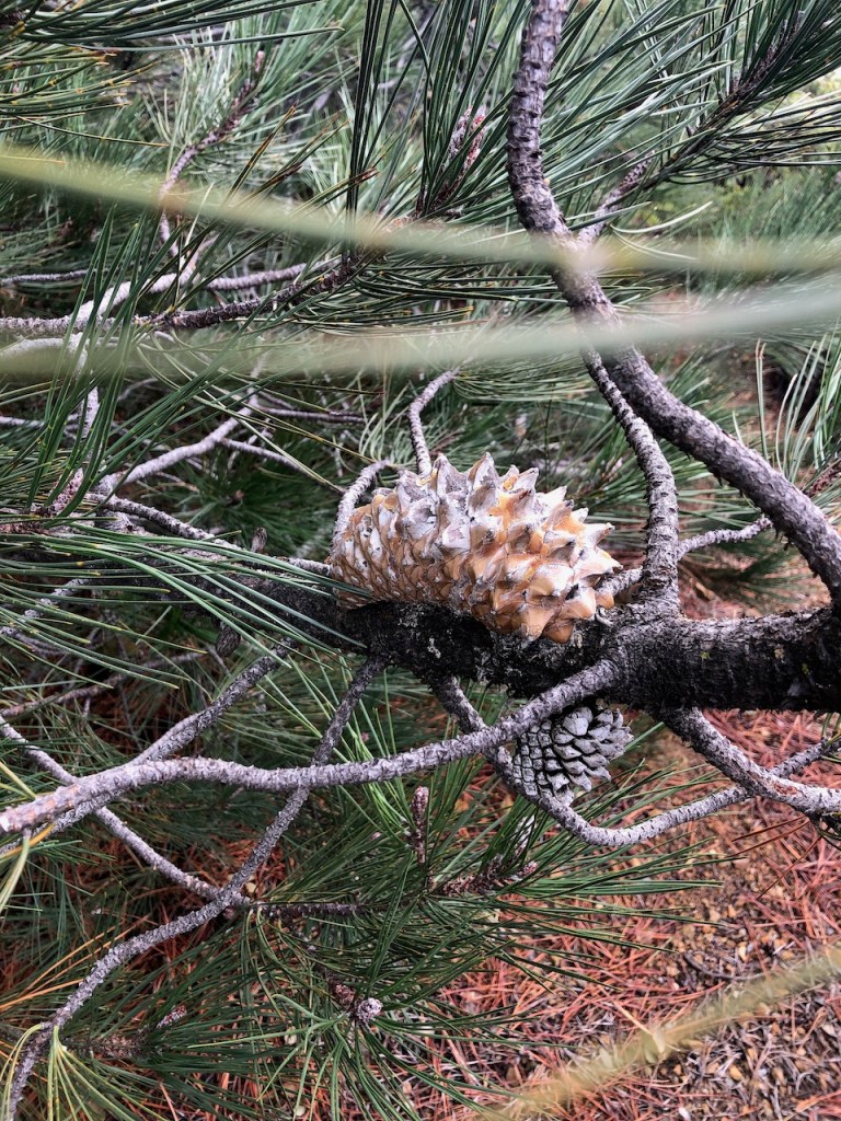

I was slightly concerned about time, and that we might make it back just before dark. We stopped on the way down the ridge to marvel at nature, and the cones of the strange knobcone pine tree.
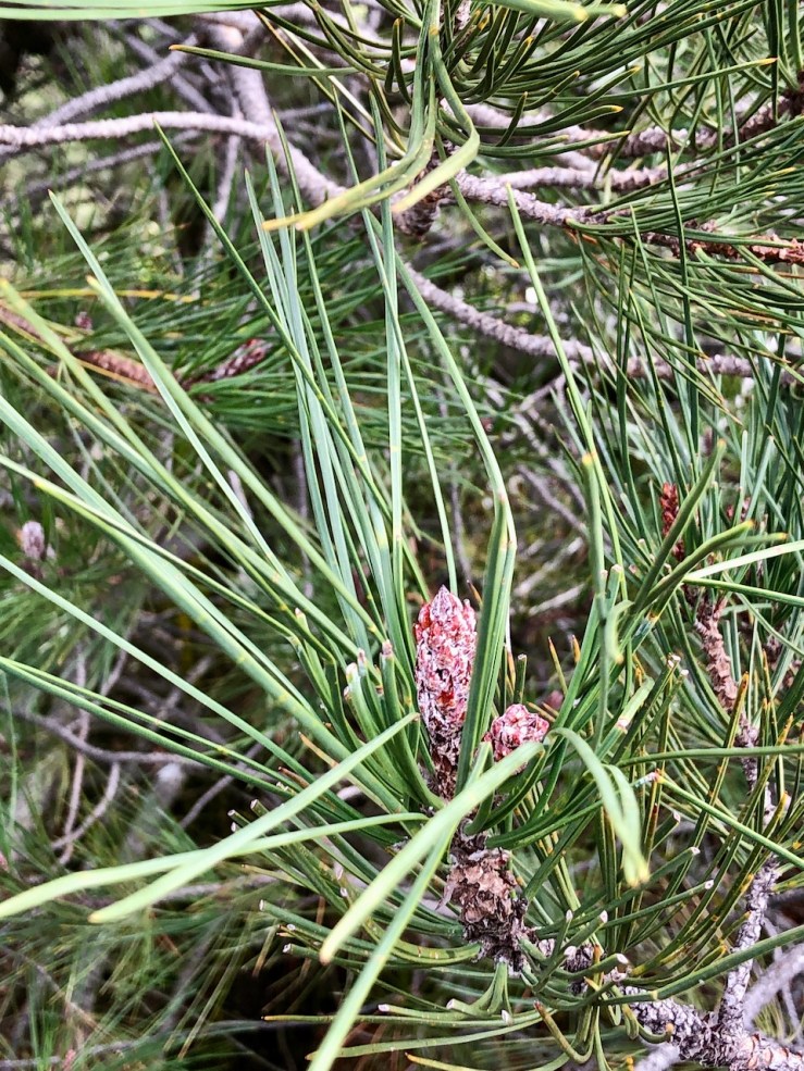
There are so many varieties of pines in this wilderness here and they are quite hardy. They have to have good roots to withstand the frequent high winds. There have been gusts of 100 mph up here. This is not where you want to be during Santa Ana winds, the strong gale force winds that blow from the Northeast, usually during Fall, and fire season.

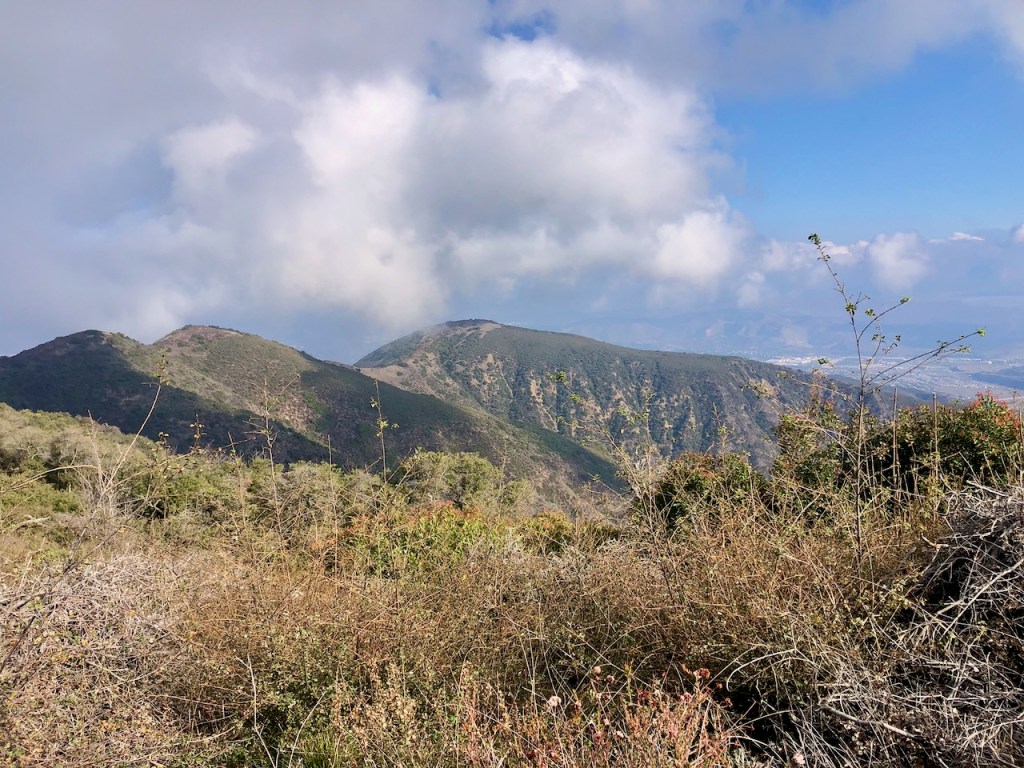
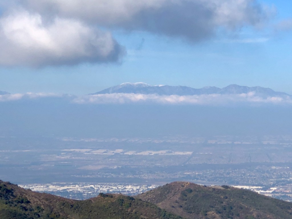
On the way back, the sun really started to come out, and in the distance were awe inspiring views clear to Mount Baldy.
There is something about just taking a walk in nature, free of headphones, listening to the sounds of your footsteps, and having time to contemplate life. One thing about living life, it is really just one great big long journey. You just need to keep going, and when the going gets tough, just have faith.
Jesus told him, “Stand, pick up your mat, and walk!” — John 5:8

It seemed like I had just one more climb to finish, before I would be back at the turnoff for Bedford Peak. It would be downhill from that point on. I started to lag a bit, in part because I kept taking pictures. My energy was just about spent at this point.

They don’t call it the wild west for nothing.
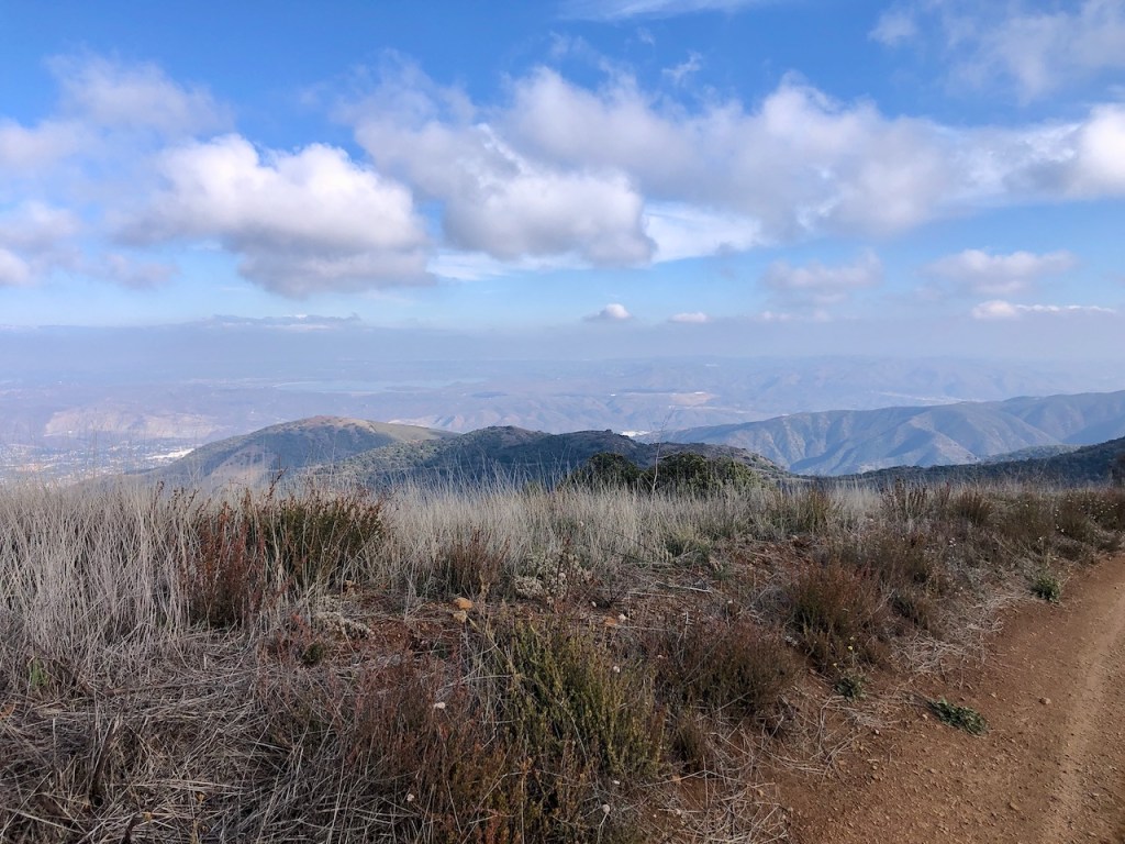
The views were just about crystal clear with distant Lake Elsinore clearly in view.

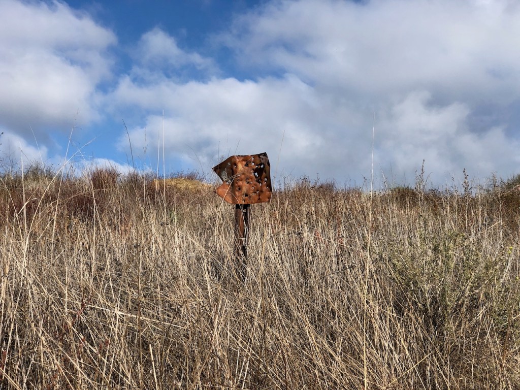
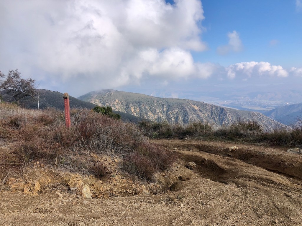
I came to this marker, which read 3s04, and what it stood for was unclear. It was likely a mile marker of some sort. What it stands for to me, is being about 5 or 6 miles from the trailhead, and still pretty much in the middle of nowhere.
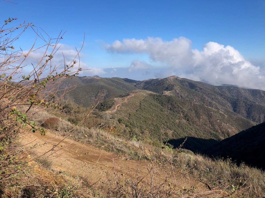
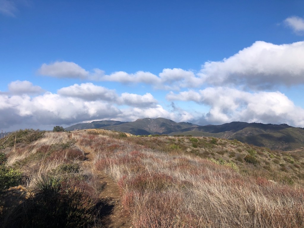
As the clouds began to clear somewhat, I was continually awestruck with the views along this ridge line fire road. It felt like I was in some kind of fairytale land.
This was one of the many standing mud puddles along the ridge. It is possible fairy shrimp may reside here in these pools. They are a rare shrimp, that lives underground in a few scattered ecological communities called vernal pools, here in Southern California. I have visited two other places you can find vernal pools, the Santa Rosa Plateau, and by San Onofre.
Looking back I could see the helicopter pad much more clearly. Now whenever I see SAR flying about, or helicopters hovering above these mountains, I will have an idea where they are headed.
Making Good Time
It was about 2:30 pm when we finally made it back to the turn off for Bedford Peak, making a right, exiting North Main Divide Rd, passing over the sunken metal barrier.
As we headed back towards the trailhead along the plateau, before beginning our descent, I noticed the flag pole again, amongst the Manzanitas.

Freedom
The flag is a symbol of my freedom, to explore the wilderness, and enjoy so many other freedoms, protected under our constitution. I live in a country where women are free to roam, and I don’t take that for granted. Freedom was not free, and I hope our country stays a free republic for generations to come. It will so long as we uphold our constitution. We don’t live in a democracy where majority rules, but a republic with some democratic principles, where individual liberties are upheld. Forever may we roam, freely.
*A hike to this flag is a destination in itself, and would be about 5.5 miles roundtrip, if Bedford Peak and Pleasants Peak are a bit too much.*
A Few Surprises
In the bushes I was surprised to notice two hikers, seated amongst the shrubs, somewhat concealed, having a snack break, just a few feet off the trail. It was a pretty good hiding spot. Keep that in mind, when hiking here, that there could be people around, that you don’t see. That’s why it’s good to have ways to protect yourself, whenever you take a hike, however long or short. Mace, whistles, airhorns, or whatever makes you feel safe, is the way to go. But bring something along with you, whenever you hike in the wilderness as a woman.
Afternoon Sun
We hiked on, and I kept my hopes held high, I would find my sunglasses I lost on the way up. Alas, they were lost, as I did not end up finding them. I asked the few people I encountered on the way back. One of them said that “hopefully someone finds them.” My thought was that hopefully someone doesn’t find them and leaves them where I dropped them, so I can find them. Was that comment an admittance of guilt? Hmmm.
Grateful
I was grateful to get in a good hike before Christmas, in the mountains, near my home, and to get outside, witnessing God’s beautiful creation. I was also grateful to have a hiking buddy along for this one too, for safety and companionship.
Thank you Jesus for this beautiful day!


Making Good Time
We actually made really good time and ended up getting back by 3:45. I even broke a new record, according to my watch. I guess I’m doing alright, if I am breaking records, even if it’s my own. Constant progress and improvement is a good way to live life. Your always a little bit better at something, the more your work at it, with consistent effort. Hiking is no exception.
I had officially checked Pleasant Peak, and Bedford Peak (x2) off my list!
You Can Do This
Whatever you do today, it’s one foot in front of the other. You’ll get there, if you just make a start. You will finish, if you don’t stop, until you reach where you want to go. Slow and steady wins the race!
The Lay of the Land
If you’re considering visiting the Santa Ana Mountains, I recommend first reading up a bit on the history of this range, so you know before you go. I like to know the lay of the land, and study maps before I take a hike, especially in the wilderness. This rugged wilderness has a few main trails, and some lesser known ones. Knowing the route, and having it somewhat memorized is something I like to do. That way, if my phone stops working, I have a backup plan to get back to where I started.
From North to South
The northernmost summit of the Santa Anas, at is Sierra Peak (Elevation 3,045 feet), followed by Little Pleasants Peak aka Hagador Peak (Elevation 3867 ft), Pleasants Peak (Elevation 4,007 feet), Bedford Peak (Elevation 3,800 feet) Bald Peak (Elevation 3,947 feet), Modjeska Peak (Elevation 5,496 feet) and Santiago Peak (Elevation 5,689 feet), which is the highest summit in this mountain range. Modjeska and Santiago Peaks together are referred to as Saddleback Mountain.
I hope you enjoyed reading this, and it is helpful in knowing what to expect, should you decide to visit here.
About me
I’m Serafina! I’m a writer and California girl who loves to go exploring. Hope you will get outside today, breathe some fresh air, and be happy!
Follow my Journey…
Be sure to Like and Subscribe to My Youtube Channel where I post videos!
Disclaimer: The work on this blog is my opinion and my opinion alone and I am not responsible for the outcome if someone were to apply these thoughts to their own life. All text and photography copyright 2023 by Serafina, all rights reserved. Information and opinions provided are kept current to the best of the author’s ability. All readers’ usage of the ideas and opinions presented in the blog, are at their own risk. Be aware of the possible dangers of hiking, surfing, walking, cooking, and other activities, which may take place indoors or outdoors. By reading this, you agree not to hold the author or publisher of the content on this web site responsible for any injuries or inconveniences that may result from reading the blog, or partaking in any activity mentioned in the blog. Read the blog, and use its ideas, if you so desire, at your own risk.
