It was early December of 2023, and I decided to hike to Tahquitz Peak, within the Santa Rosa and San Jacinto Wilderness. My plan was to hike there before winter set in, but plans got delayed. In my search for backpacking partners to hike the PCT with, I met a woman in a hiking group who wanted to join me on the PCT. We decided on meeting for my hike to Tahquitz Peak, and made plans.
PCT Dreams
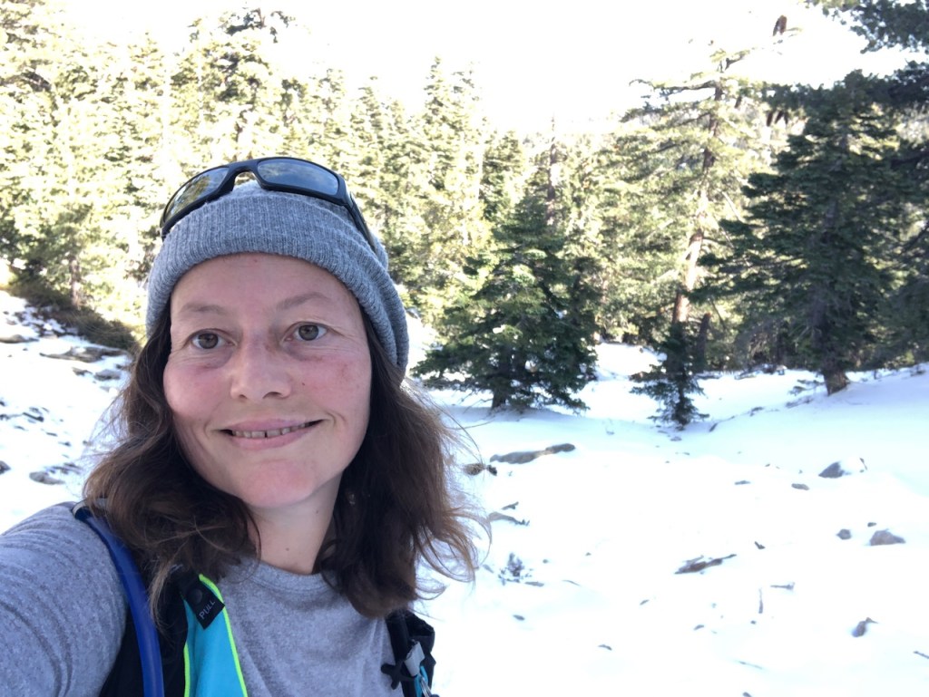
My hiking buddy had big dreams to hike the entire PCT, with a long distance permit she just obtained. She was in the process of getting into condition for it. This was our first meetup, and a bigger hike. I did not think it would be a problem, based on the things she mentioned about herself. I was excited to meet her, and hike to Tahquitz Peak, something I had been planning to do for over two years.
The Weather Report
I checked the weather report on socalsnow.org to see what I was getting myself into. The first dusting of snow had just covered the mountains and Tahquitz Peak. Weatherwise, there was a small window for this hike, and it happened to be on Thanksgiving weekend. The trip ended up getting postponed to the first week of December, and now there was at least 2 inches of snow on the ground.
Trip Planning
Another source of info I consulted for hiking near Mount San Jacinto is the famous trail report found at sanjacjon.com. It’s a great resource for the current conditions. The owner of this blog, frequently hikes up this mountain, about once a week, and gives out his report. So definitely check it out before your go.
Trip Reports
Lastly I checked the weather on noaa.gov, and alltrails, for recent reports. I even went so far as to scroll around on hiking groups, and ask questions. I really like to be informed, especially during winter conditions.
The First Snow
The first storm of the season had just rolled through earlier in the week. I planned on wearing microspikes today, since the report indicated 2-3 inches of fresh snow had fallen. There was a good chance of ice, most likely on lower sections of the trail, exposed to sun, where freeze, and thaw cycles had occurred.
Testing Our Gear
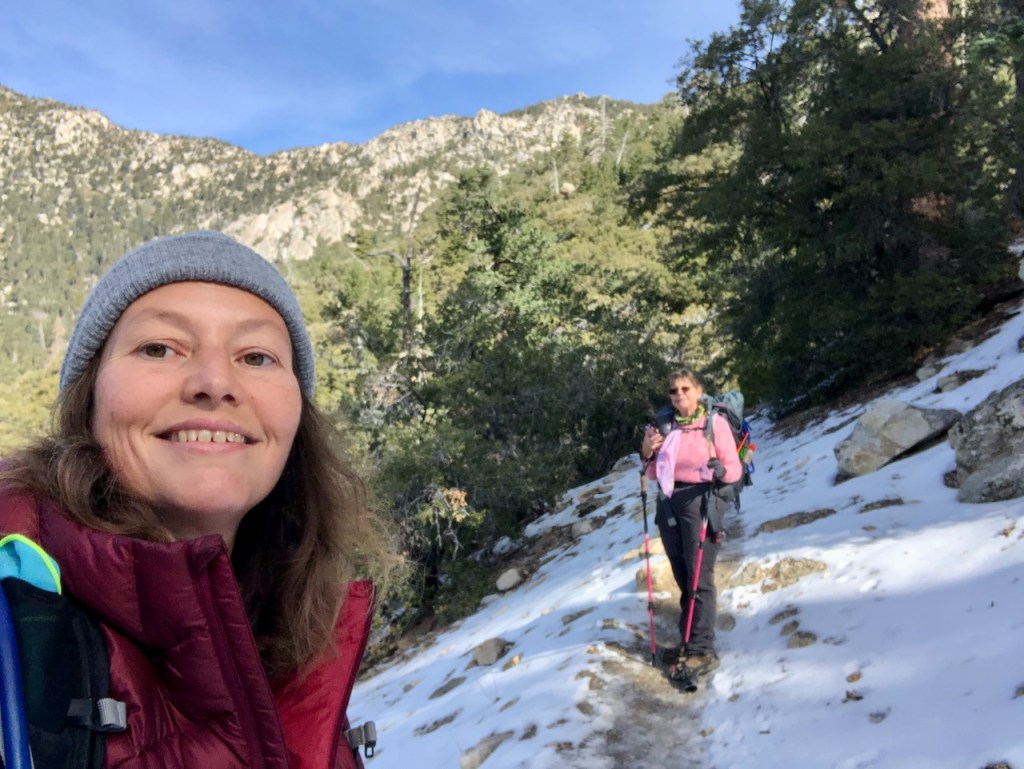
This would be a good way to test myself a bit, hiking in snow for much longer than I had done before. This was also my hiking buddy’s first time trying out her new Kahtoola microspikes she had just ordered.
Hiking in Winter
I had planned on hiking to Tahquitz Peak outside the quota season, and while the fire tower was still staffed, in early November, before snows had fallen. But I missed that window of opportunity.
The Quota System
The Devil’s Slide Trail to Tahquitz Peak is on a quota system much of the year due to its popularity, but going during the off season, you merely walk up and grab a permit from the kiosk, 24 hours a day. What that means is the quota limits the visitors per day to protect the integrity of the trail.
Highway 243
I drove up the steep and winding Hwy 243 early on a Sunday morning, passing through Hemet, and Pine Cove, heading towards the Idyllwild Ranger Station. The sun gradually began to rise as I drove the steep and winding road into the mountains. It’s a very scenic drive, and I spotted a few other trailheads, with cars parked along the way.
Mt San Jacinto 2021
I have only visited this area twice before, and my hiking buddy had not been here at all, even though she lives much closer to here than me. The first time I hiked up the Devil’s Slide Trail from Humber Park, was on my way to bag San Jacinto Peak. It was my birthday hike in October of 2021. Being an avid hiker, a big hike is a tradition I have, and a gift I like to give myself every year. It’s a way to get outside, and say thank you to God for all this beauty, to make it another year.
Humber Park
On my first hiking trip in Idyllwild, I could not find a ranger station to get a wilderness permit. Contrary to what I thought, there was no ranger station by the parking area at Humber Park. There was no kiosk or box to self-issue one, or even a place to sign in. Nor were there any directions to get to the ranger station. There was also close to no cell service at Humber Park to google where to go at that time, and still isn’t any. Keep that in mind if you decide to visit here.
Wilderness Permits
Lessons learned, and for this visit, I did much more research. The US Forest Service websites don’t have great information, and it is confusing. There are some broken links, and you can waste a lot of time there. One link I found seemed to urge mailing in a form. But that’s not even necessary, unless you’re trying to book an overnight stay. So this time I knew exactly where the ranger station was, and bothered to find the proper procedures for hiking up to Tahquitz Peak. So no excuses for not having a permit now.
Idyllwild Ranger Station
I arrived at 8am at the ranger station in Idyllwild, a quaint little mountain town of outdoors stores, cafes, and cabins. It was about two hours drive from where I live in Orange County. This was where we would meet and pick up our self-issued wilderness permits.
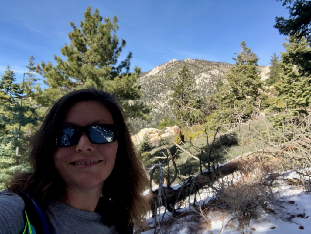
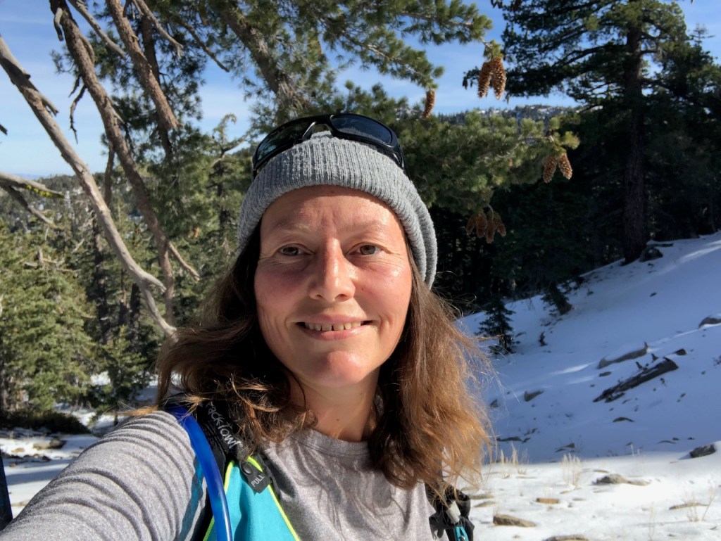
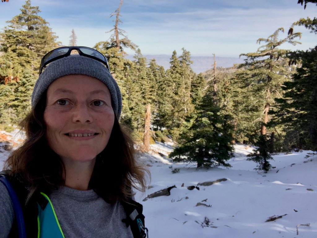
Women to the Peak
I met my hiking buddy there for the first time. It was a chilly morning, in the upper 40’s, and we discussed briefly our plans, there by the ranger station. We met each other in an online hiking group, of which I belong to more than I can count. She also decided to join my small hiking group Socal Women to the Peak. I was glad to have her as a new member, and have our first meetup.
Picking Up Permits
At the Ranger Station we headed to the kiosk to fill out our permits. It was pretty self-explanatory. We filled out the forms, dropping one copy in the box, and keeping the other as proof of permit for our hike. Afterward we headed off to the trailhead, at Humber Park.
Parking
The parking lot at Humber Park resembled an ice rink. I was not driving a 4wd vehicle, and neither was she. This is a reason I don’t head to the mountains In winter, since my car is not equipped for ice. I somehow manage to park in a non icy spot, after slipping and sliding a bit driving in. I knew this was likely my last Idyllwild trip of the season. Sliding off an icy road is not something I enjoy. Been there, and done that. I almost slid into a pond once, in a Suburu that was 4WD, or AWD as they claim. Ice and black ice are not something to mess with.
Being Prepared
We got straight to work gathering all of our necessary gear for a hike up a mountain. I have my Garmin In-Reach, first aid kit, a rain shell, snacks, trekking poles, and plenty of water, along with other miscellaneous safety gear, such as my whistle.
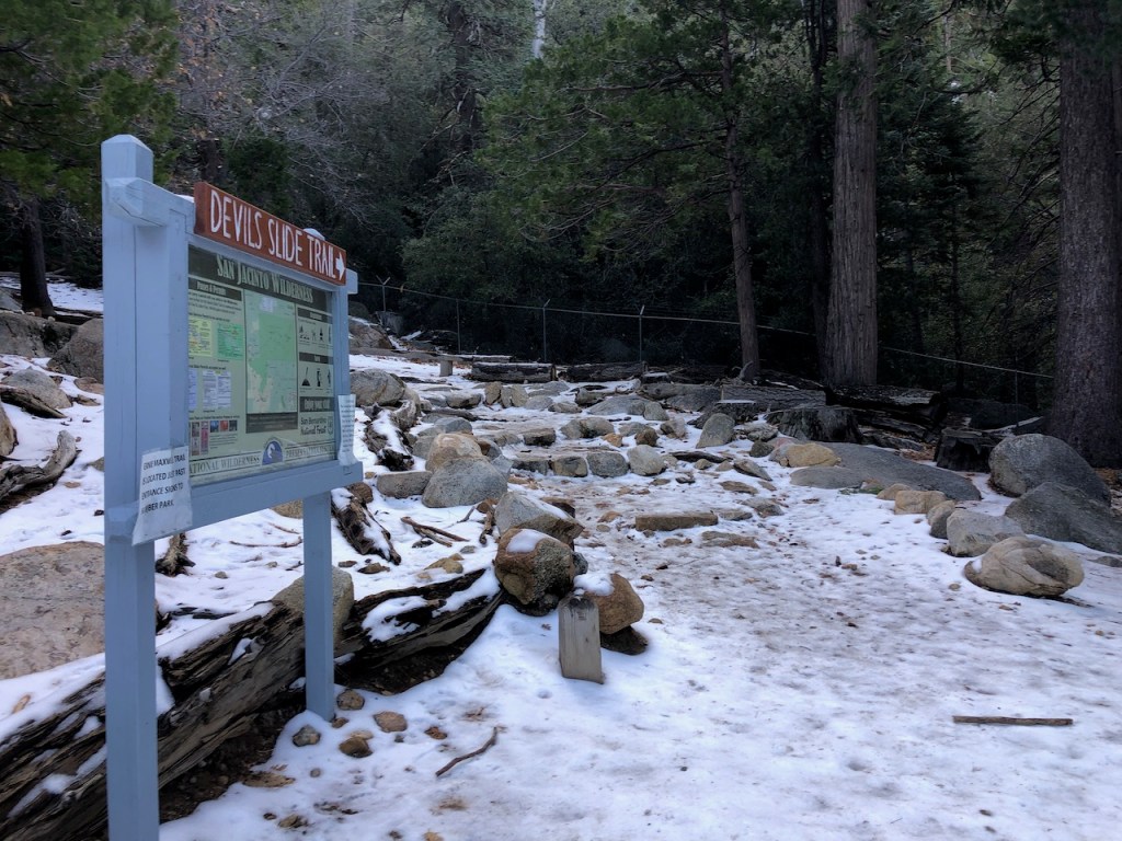
The Devils Slide Trail
Finally we set off along the Devil’s Slide, on our way to Tahquitz Peak. This is not a trail to take for granted. I did not have an ice axe, but I did have trekking poles, and my microspikes. They call it Devil’s Slide, since a few hikers have slipped, and fallen to their deaths from this trail. That’s why I had plenty of extra traction. Later in the season, crampons, mountaineering gear, and an axe might be a necessity.

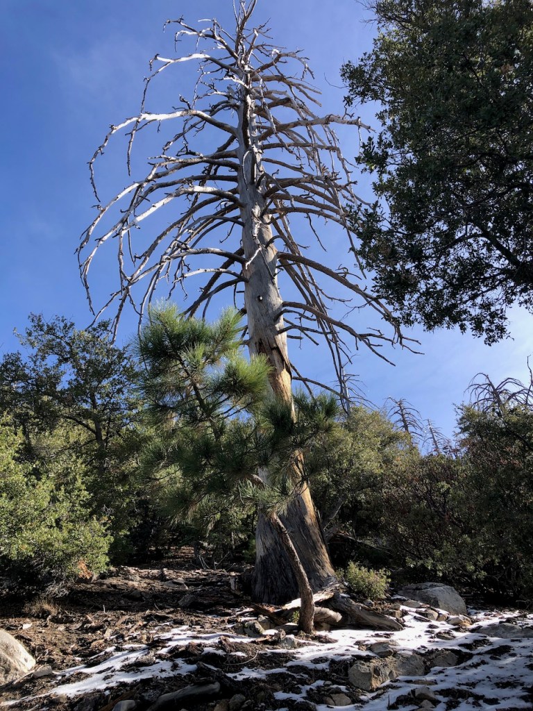
Oaks and Sycamores
The trail began through a grove forest of oaks, and sycamores, with withered leaves strewn about, frosted lightly in snow. Off to our right was Lily Rock, an ice climbing spot, towering above us. This is a great place to see fall colors in the fall months of October and November too.
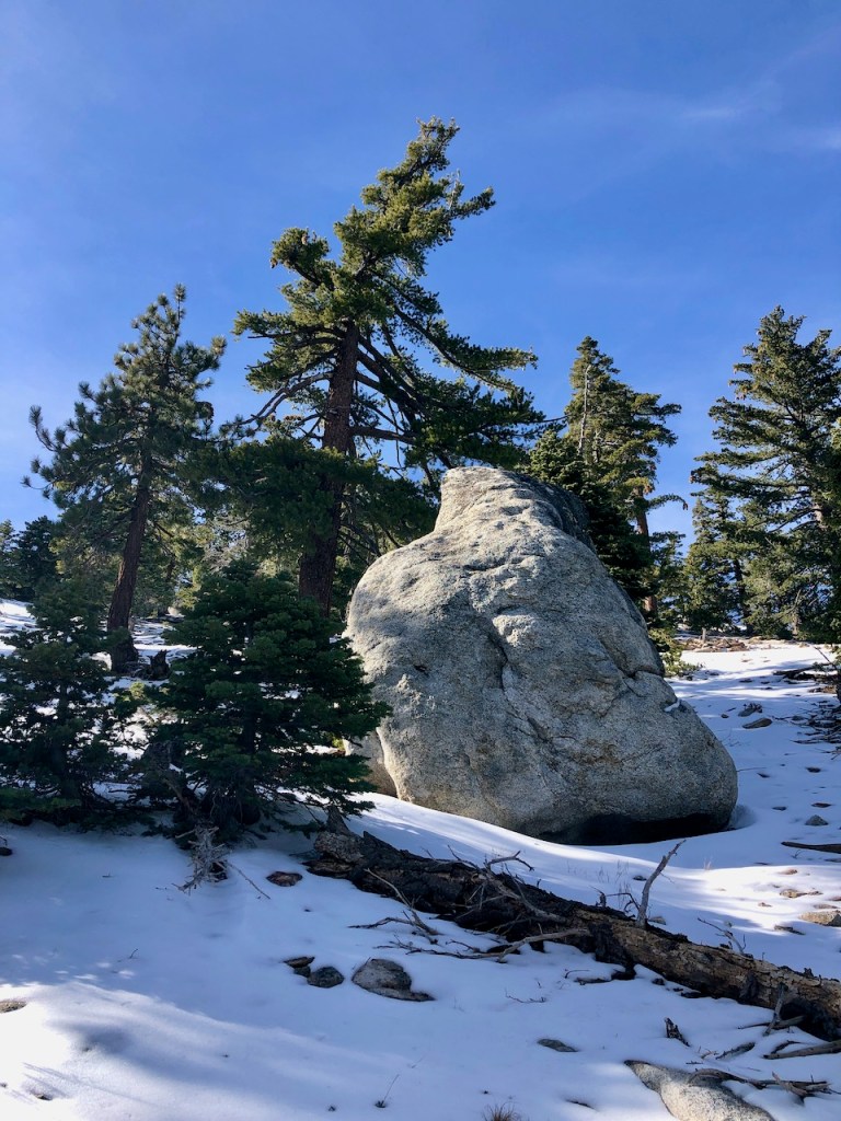
Bouldering
We passed an enormous boulder, as a reminder of rockfalls. Trails don’t need to have caution tape strewn about to alert you to potential dangers. It was self-explanatory, that hiking is not safe.
Garmin in Reach
We both had a Garmin InReach with us. I have begun to insist on hiking partners having their own sos devices and maps, because in the wilderness we are all responsible for ourselves. Getting separated is a reality, even just using the restroom.
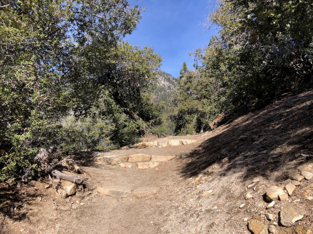
The Trail
As we hiked on, gradually gaining altitude along the trail, we periodically took off our microspikes for sections with no snow, but rock, and dirt. This was cumbersome, but necessary not to damage the spikes. It felt warmer than I thought it would be, and so I ended up periodically removing my coat whenever we were in the sun.

Slow and Steady Wins the Race
People kept passing up, about every 20-30 minutes during the first hour or so of hiking. We were not going real fast or even at a moderate pace, just slow. It was too early on to reason what this all meant.
Staying Warm
I was wearing a brand new down coat from REI, that I just got quite a sweet deal on. It was so warm, and perfect for this kind of hike in chilly dry conditions.
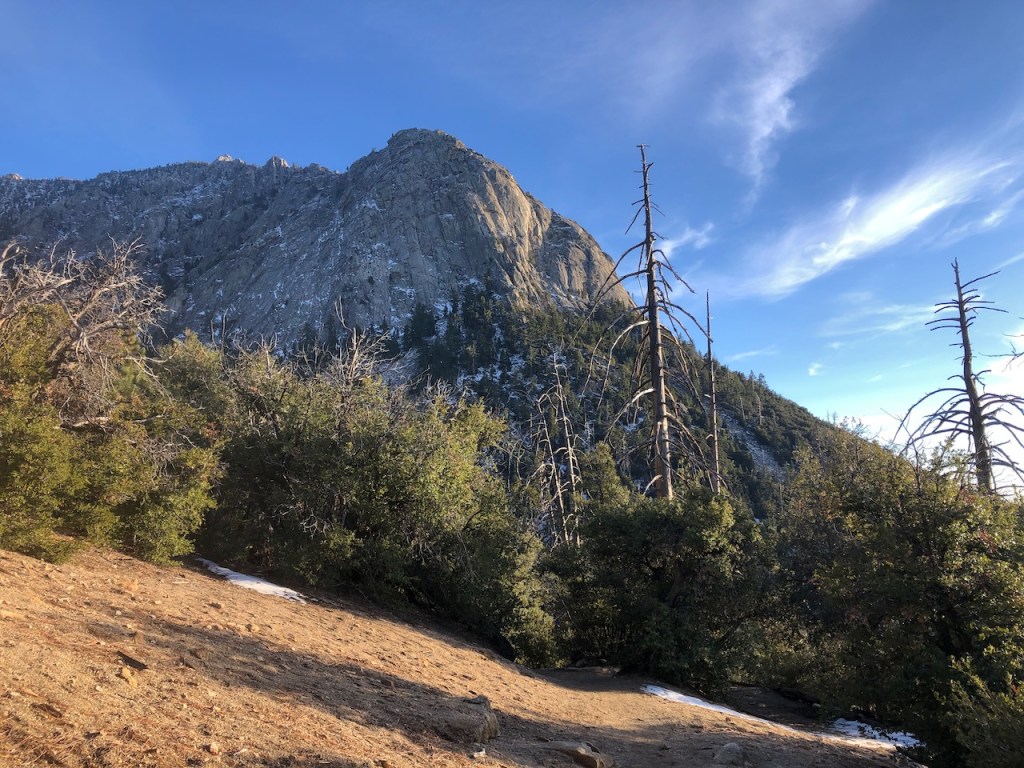
Suicide Rock
As we hiked higher, I spotted a large granite rock formation to my left, called Suicide Rock. It is a popular hike, and rock climbing spot, with over 300 climbing routes. I have not hiked to it yet, or been drawn to it, because of the name. I have lost people I know to suicide. The rock was named for two lovers in a Native American tribe, from long ago. Rather than be separated, they jumped off the rock.
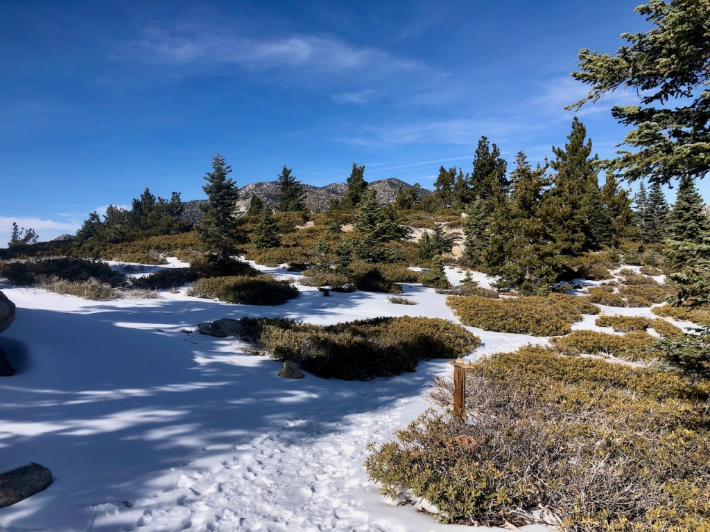
A Winter Scene
Off to my left was a beautiful snowy mountain scene, even more beautiful than the first time I hiked here during October of 2021, to San Jacinto Peak.

Microspikes
The trail was a mixture of snow and ice, and our microspikes were working great on this terrain. We were feeling fairly confident, with the abundant sunshine, and lack of wind, we had perhaps picked a good day for this.
Pacing Yourself
About a mile into the hike, my hiking buddy had wanted to slow down. So we took our time, and continued on, gauging what that meant for making it to Tahquitz Peak. With snow, its hard to go fast, and you have to play it by ear, whether you will make it to a peak or not.

Into the Woods
My hiking buddy started not feeling well. As we hiked through the majestic snow covered pines, we discussed the options, of turning back together, or separating.
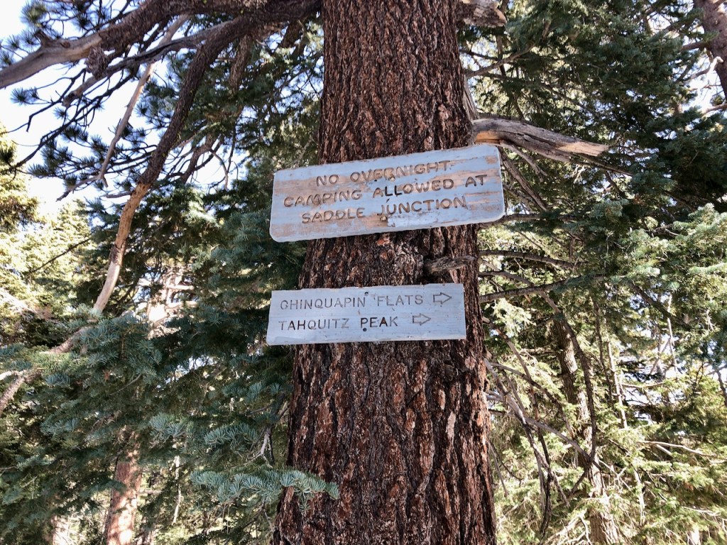
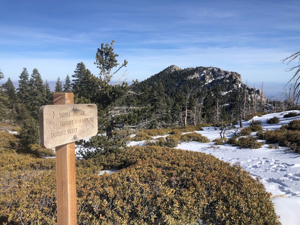
Saddle Junction
Her health was a priority, but she kept insisting I go on ahead of her. Our plan was to meet at Saddle Junction, about 3 miles up. I would head to the peak, and we would hike back together, if she did not decide to go back sooner.

Hiking On
I figured I would at least try to still make it to Tahquitz Peak, now that I was short on time. In the last 2 hours, we had gone just over 2 miles, so it made sense that there was no way we could make it there at such a slow pace. She wanted to hike solo to Saddle Junction. After describing the spot where the trails converge by a big boulder, for San Jacinto Peak, and Tahquitz Peak, I headed off up the trail ahead of her, and she continued at her own pace.
On to Tahquitz
After less than 30 minutes I was at the notch, referred to as Saddle Junction, another mile up the trail. I would be making a right, hiking on to Tahquitz Peak. I had picked up the pace, and was now moving at close to 2.5 mph. I had made up for lost time, and was feeling I could still make it there.

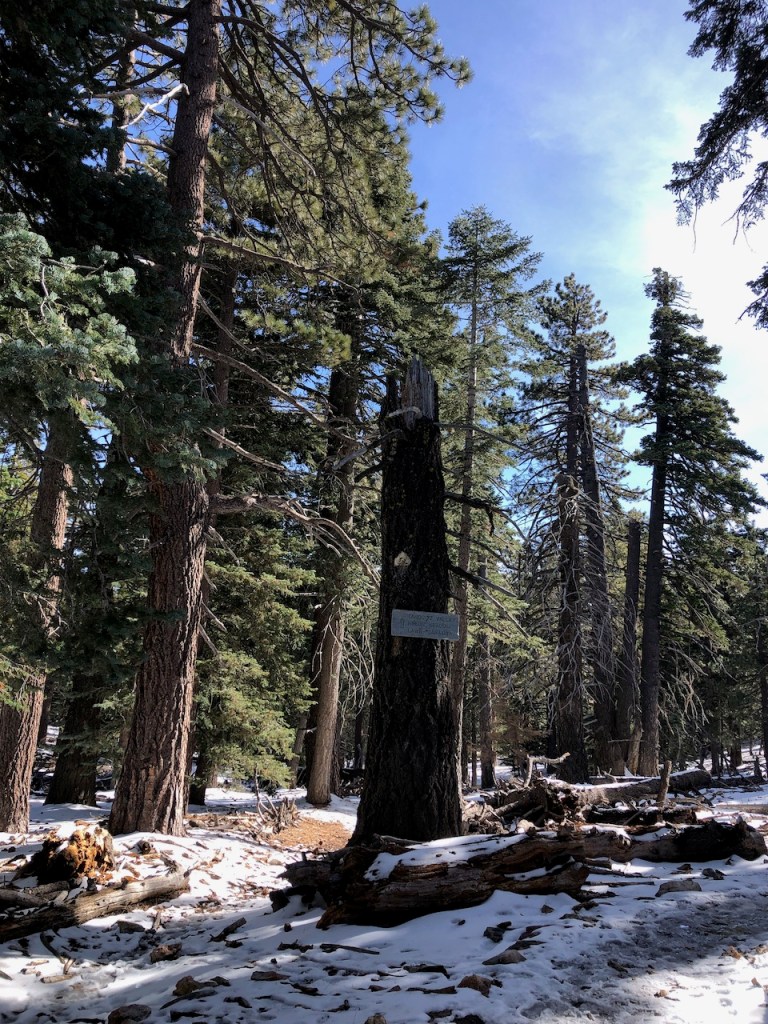
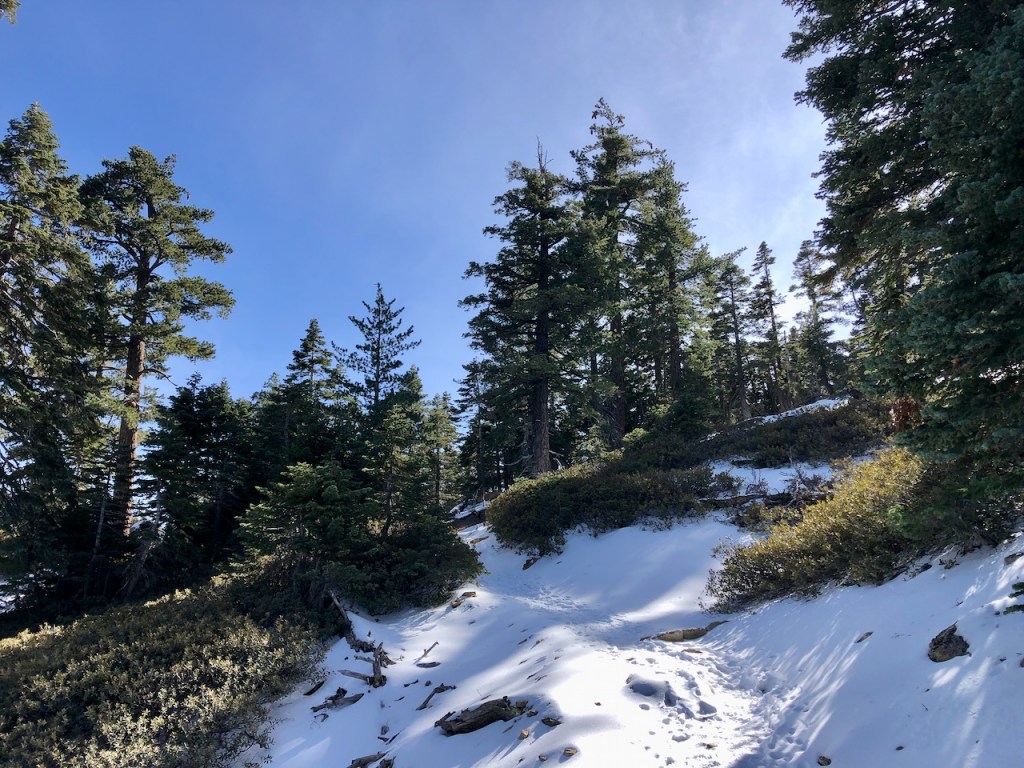
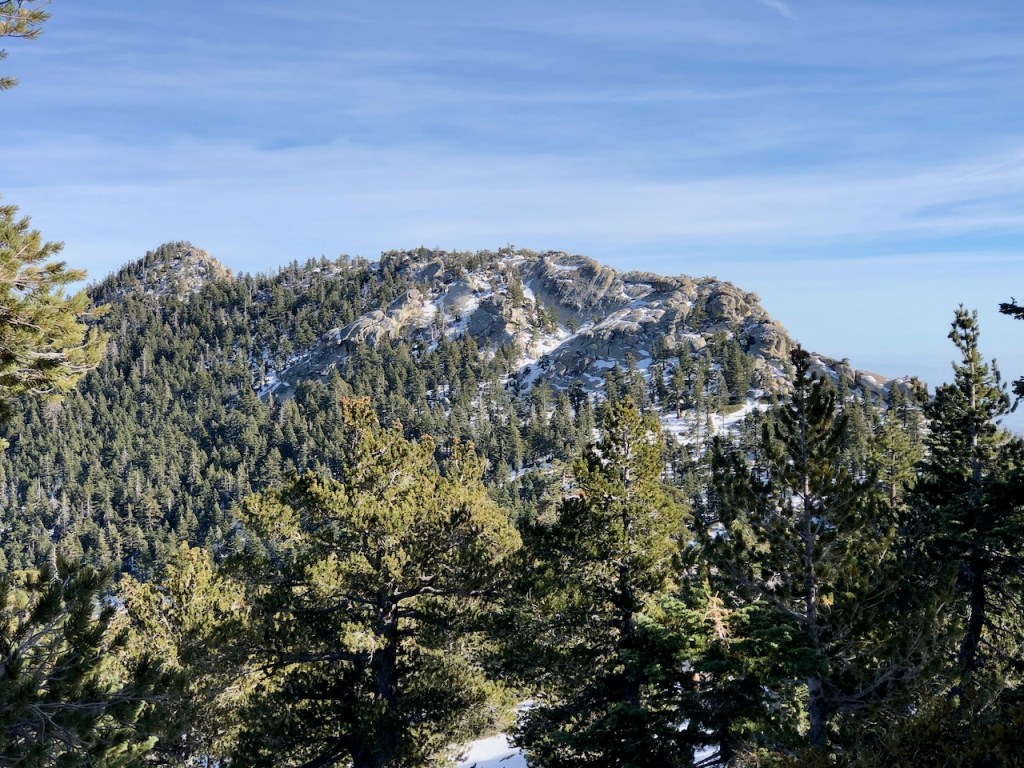
I hiked along the ridge line through a lightly forested area, where the landscape opened up a bit.
I was no longer making steep switchbacks, but gradually gaining in altitude, now at over 8000 feet.
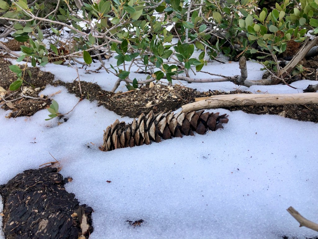
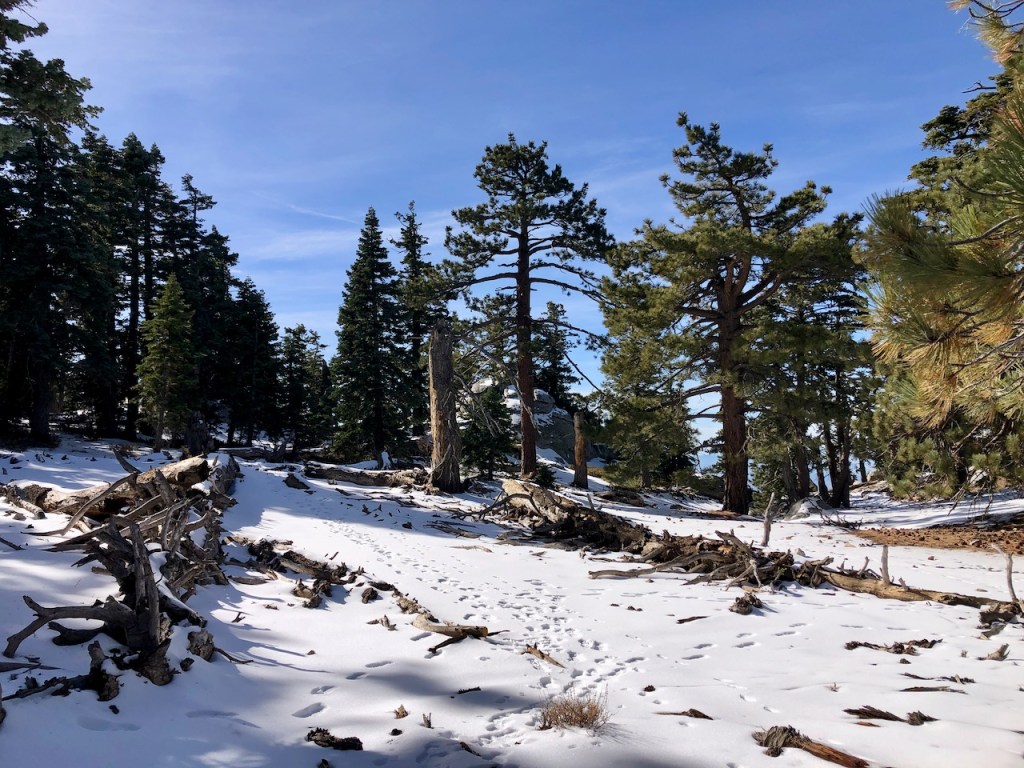
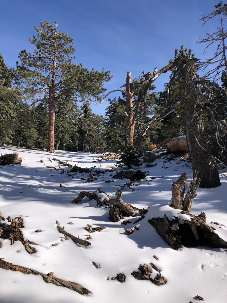
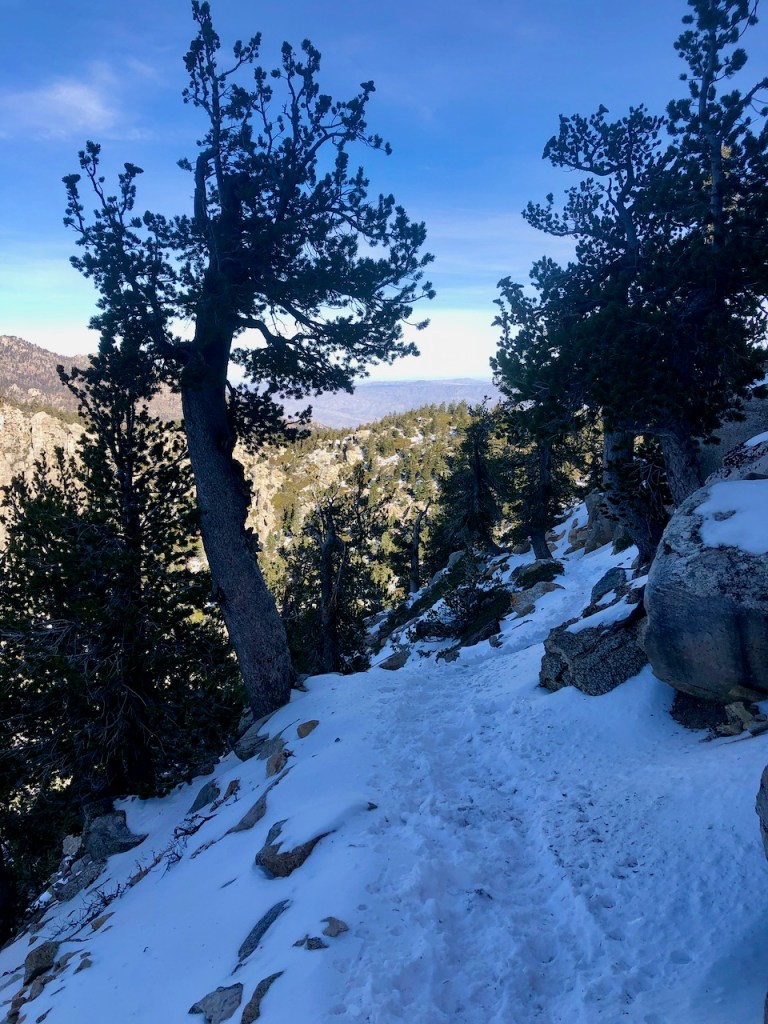
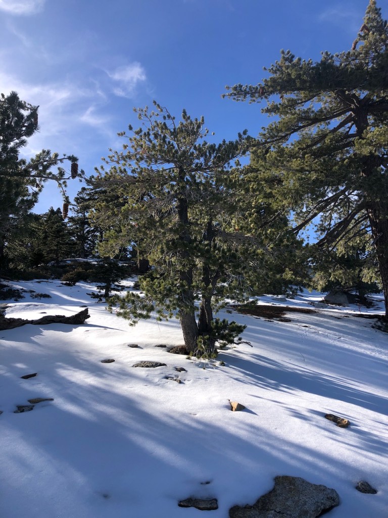
Fresh Snow
Wow, was it ever beautiful up there. Fresh snow had fallen, and it was about 2-3 inches deep. It was glistening, soft, and like powder.

Leveling Out
The trail leveled somewhat from this point forward, and I only had about 700 feet or so of gain left to reach Tahquitz Peak, having already gained about 2000 feet.
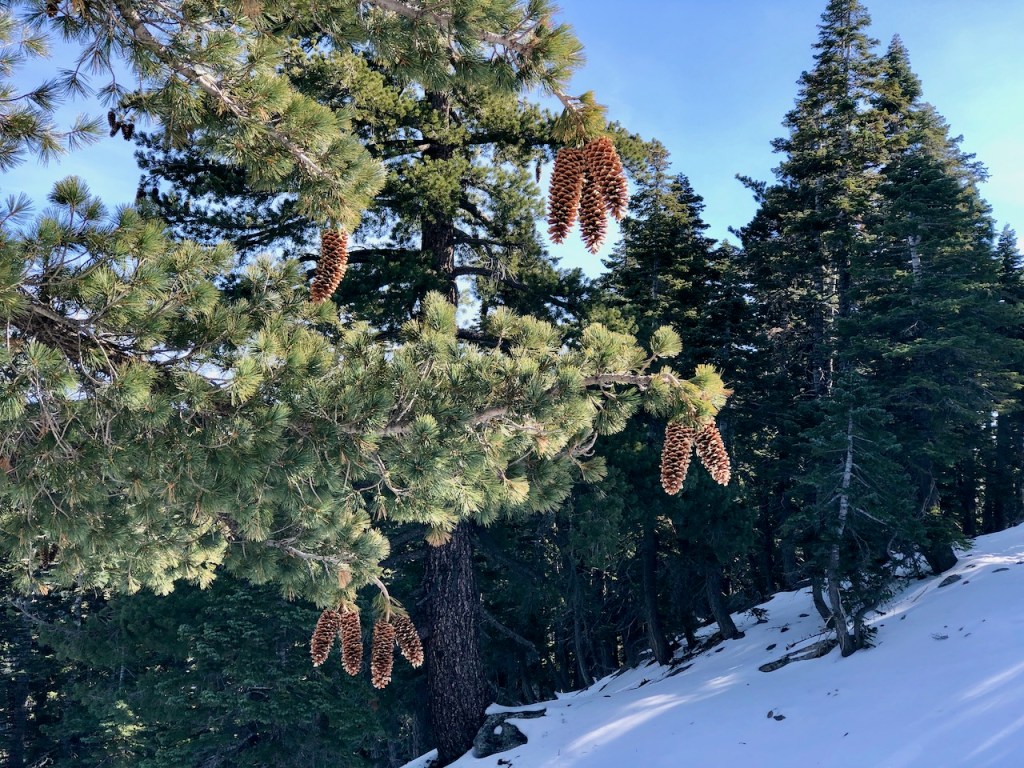
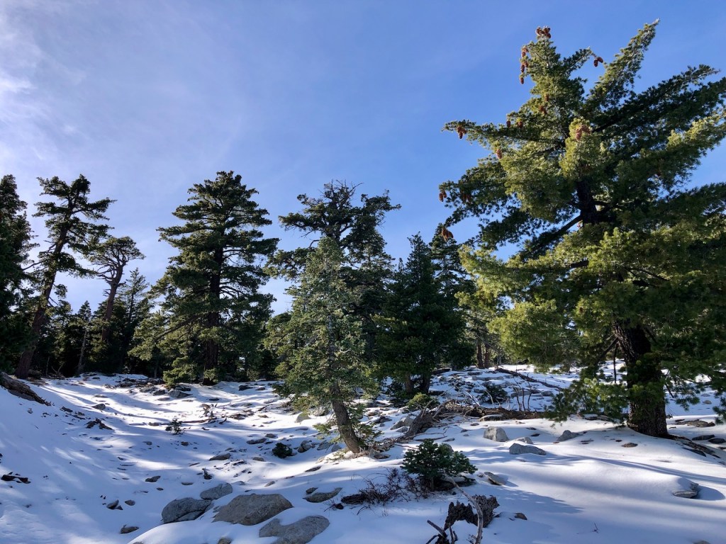
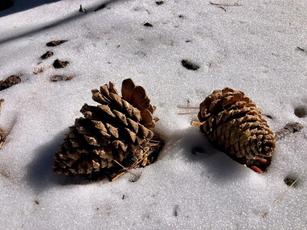
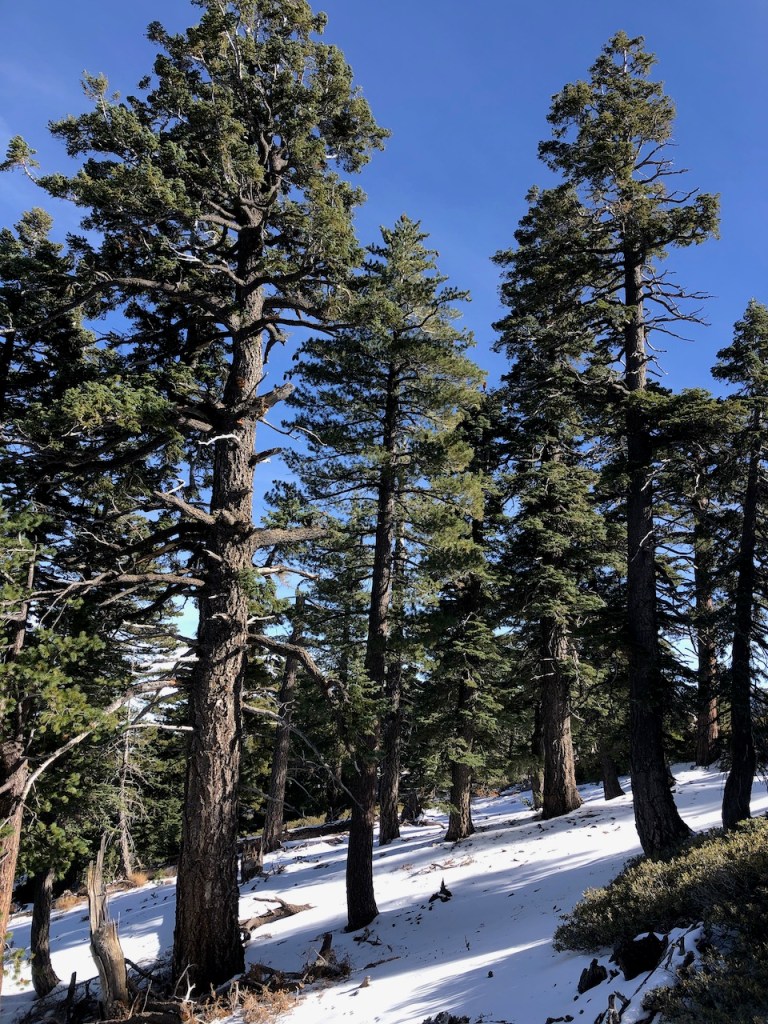
The pines surrounded by snow, with their large cones, made for a true alpine wonderland.
I was now at a more usual pace of 3 mph, and taking off extra layers. In the sunshine, I started hiking in just two layers, a tank and long sleeve shirt.
The air felt so nice up here, and I was feeling great. I had a ton of energy, and was growing ever more energized by my beautiful surroundings.
I took plenty of pictures, but not too many, so as not to slow down too much. I had to keep my goal in mind, of making it to Tahquitz Peak.
Staying Charged
It was chilly and I focused on keeping my phone warm, and charged. Phones lose power rapidly if they get cold. I wrapped it in a warm hat, when I was not using it. I ended up putting my down jacket back on, and phone in the pocket. Inner pockets of a jacket are my first choice for stowing my phone when hiking in chilly weather.

Trekking through the snowy forest on that ridge, I had not felt so free, in a long time.
Hiking on top of a mountain is a beautiful thing, and wintertime hiking adds another layer to that. I could now see why winter hiking is so popular. I had not done much of this type of thing yet. This was not an extreme type of winter hike by any means, like the Baldy Bowl, but it was just perfect for me.
I had lost some momentum on that slow ascent, for the first two hours, so I still wondered if I would make it to Tahquitz, and back well before dark, when it really would get cold.
I hiked on, making a right at the next fork in the road, heading toward Tahquitz Peak. I passed another group of two people, and then another as well. It was nice to keep seeing other hikers, and know someone is up there too. I was not looking for a crowd though.
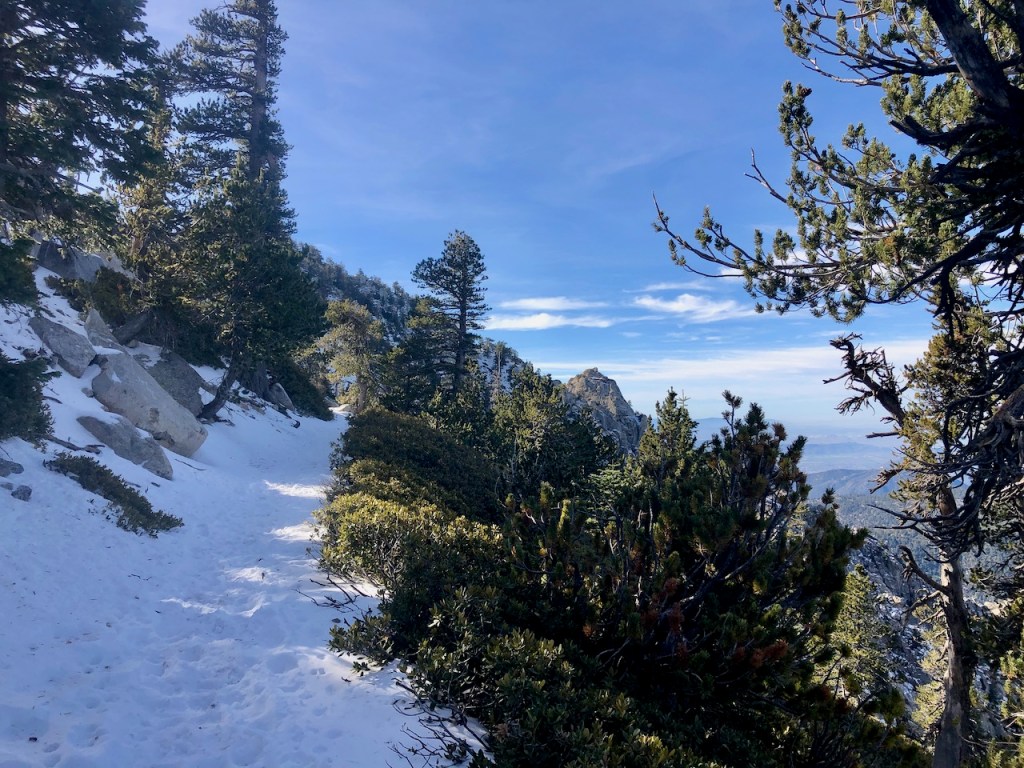
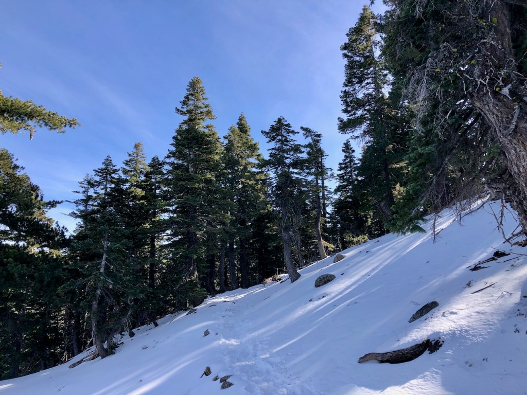
Hiking along the ridge it started to get steep, off to the right.
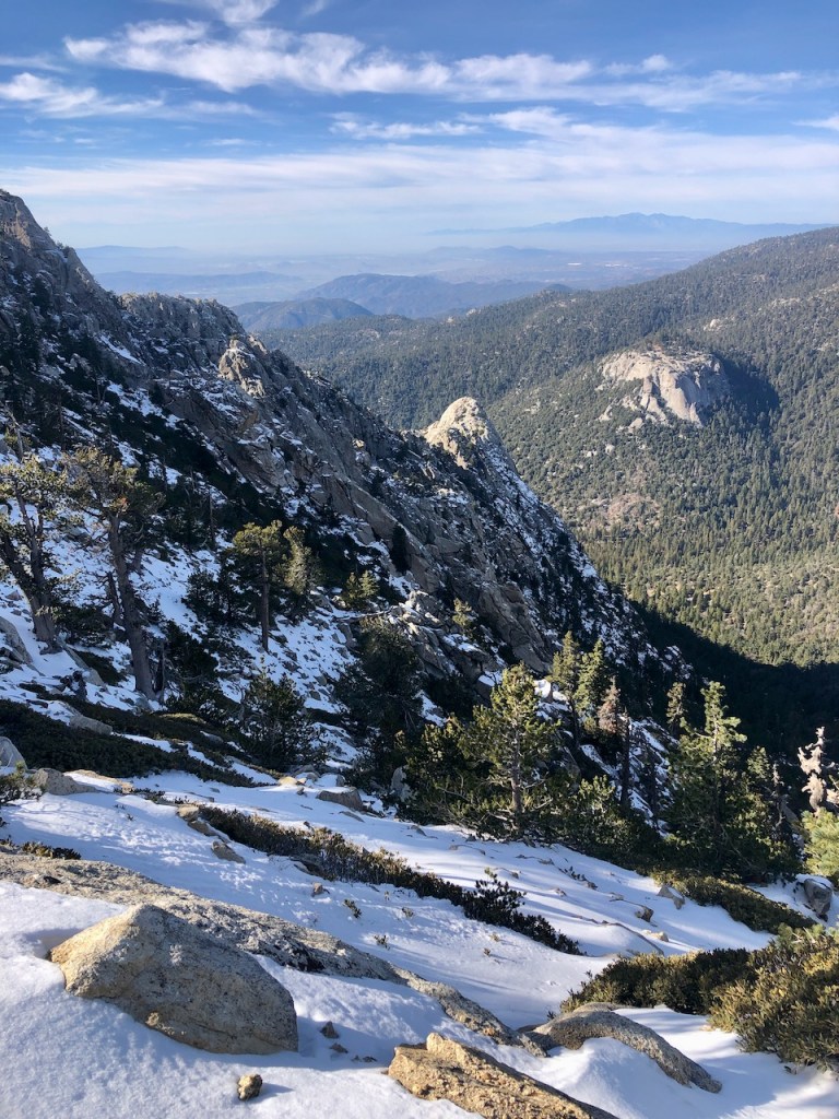
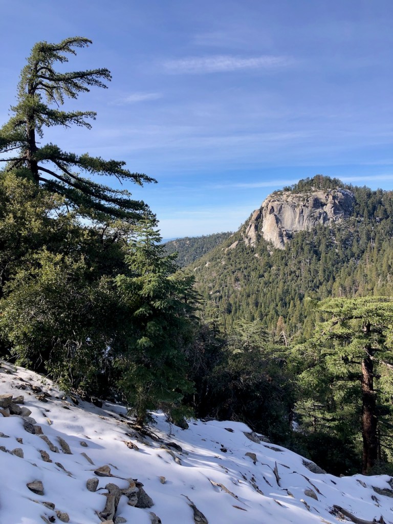
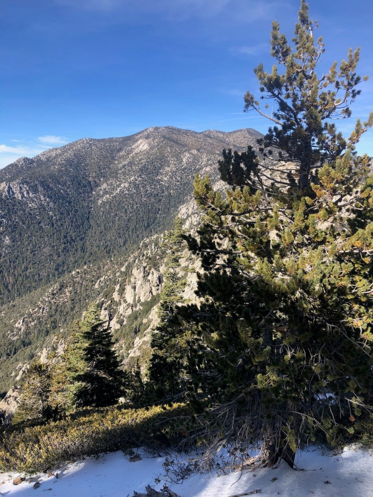
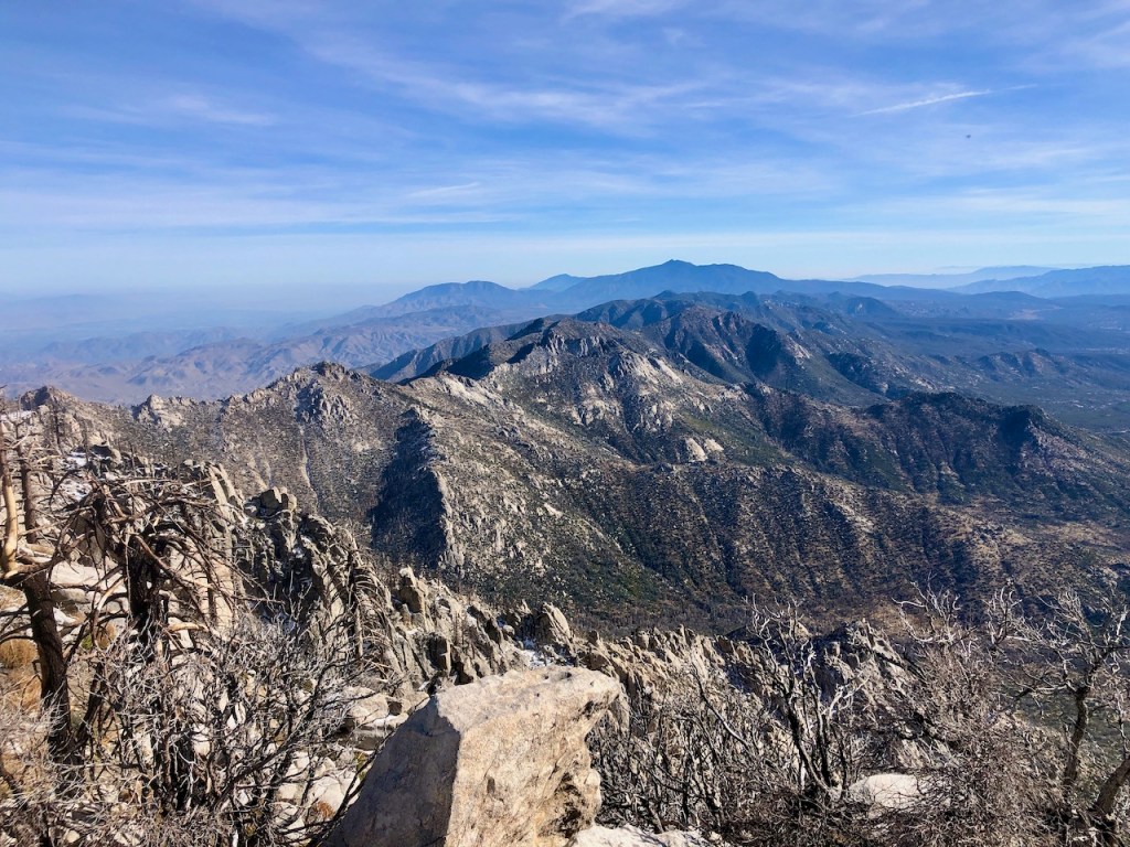
Finally I could see what gave the Devils Slide its namesake, an absolutely treacherous looking slope with an extreme 30-40 percent grade. No doubt a slip over this edge, especially with ice covering it, and you would be a goner. It was over a thousand feet down, and potentially more.
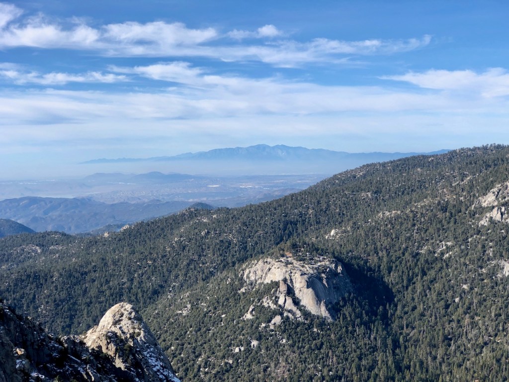
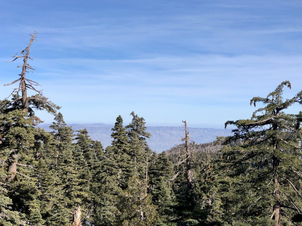
The views up here were spectacular to say the least. Far off in the distance were Santiago and Modjeska Peak, collectively referred to as Saddleback Mountain.
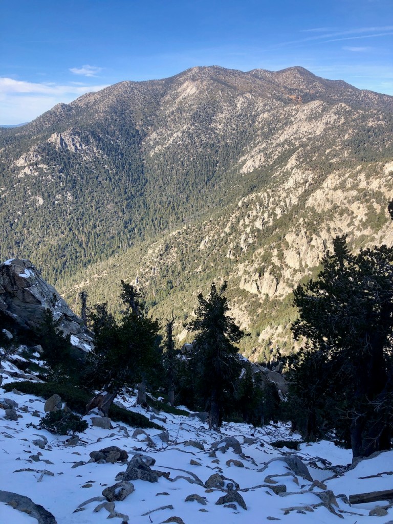
Off to my right was San Jacinto Peak, which I have climbed to from both the Devils Slide trail, and from the opposite side, via the Palm Springs tramway.
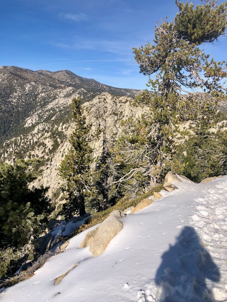
I would not test my luck as I edged my way along this cliff. I stayed to the left as much as possible, on the singletrack trail taking care with my footsteps.

I used my trekking poles to continually push away from the edge. The snow was soft, not icy, and the conditions were close to ideal for a snow hike. Still I stayed on guard.
Glancing upward, I was on the lookout for the peak with it’s fire tower. I could tell I was getting close.
As I hiked along the cliff amongst the pines, I recalled thinking it is safer time to hike in snow is at the beginning of the season, when there are just a few inches.
So here I was, doing just that. Later in the season, all bets are off. At that point, after successive snowfalls, mountaineering gear, and training would be mandatory. I was glad to be doing a snow hike now, rather than later.
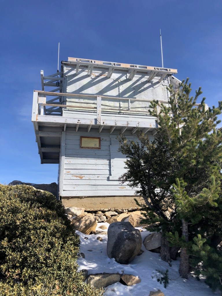
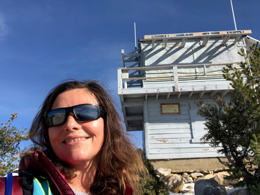
My goal was to make it to the old 1937 fire lookout atop Tahquitz Peak, the longest operating of all the historic fire lookouts, which are still standing.
The peak itself is named after the mysterious Cahuilla legend of Tahquitz, and you can read about it here.
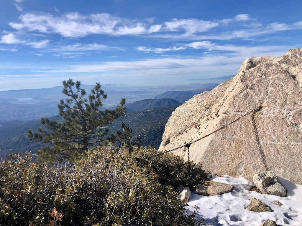
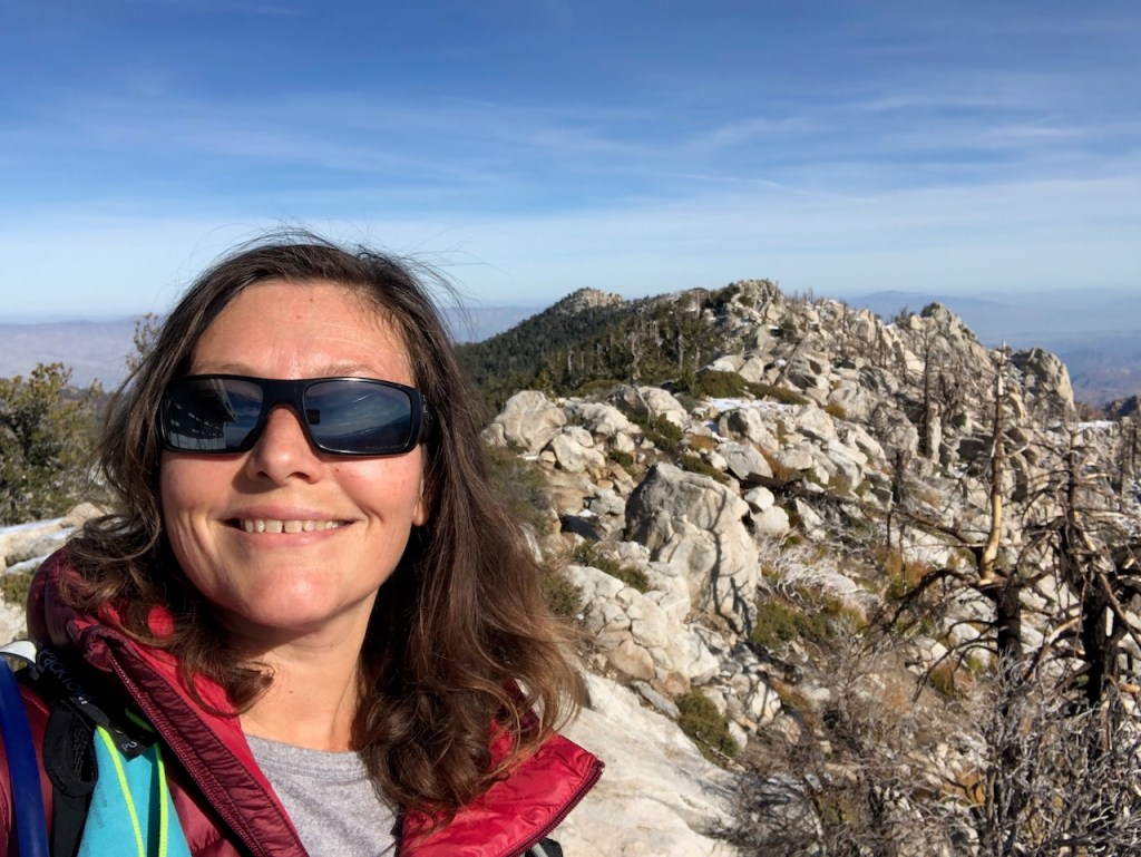
As I rounded the corner, passing the South Ridge Trail, I could see the entire expanse of the inland empire, including Diamond Valley lake and Lake Matthews.
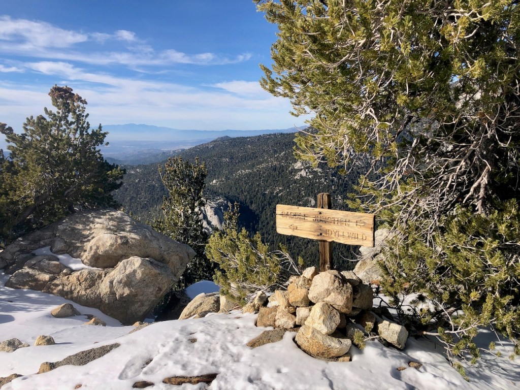
South Ridge Trail
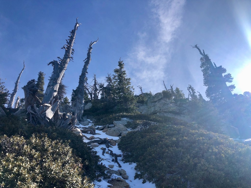
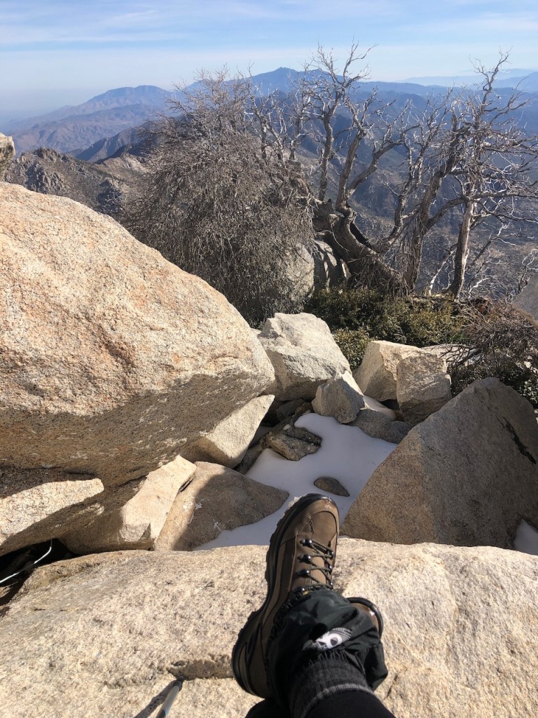
The South Ridge Trail is an alternate route to Tahquitz Peak. Just as I rounded this corner, past the sign, I spotted the fire tower up ahead and the peak, strewn with large boulders, laden in snow.
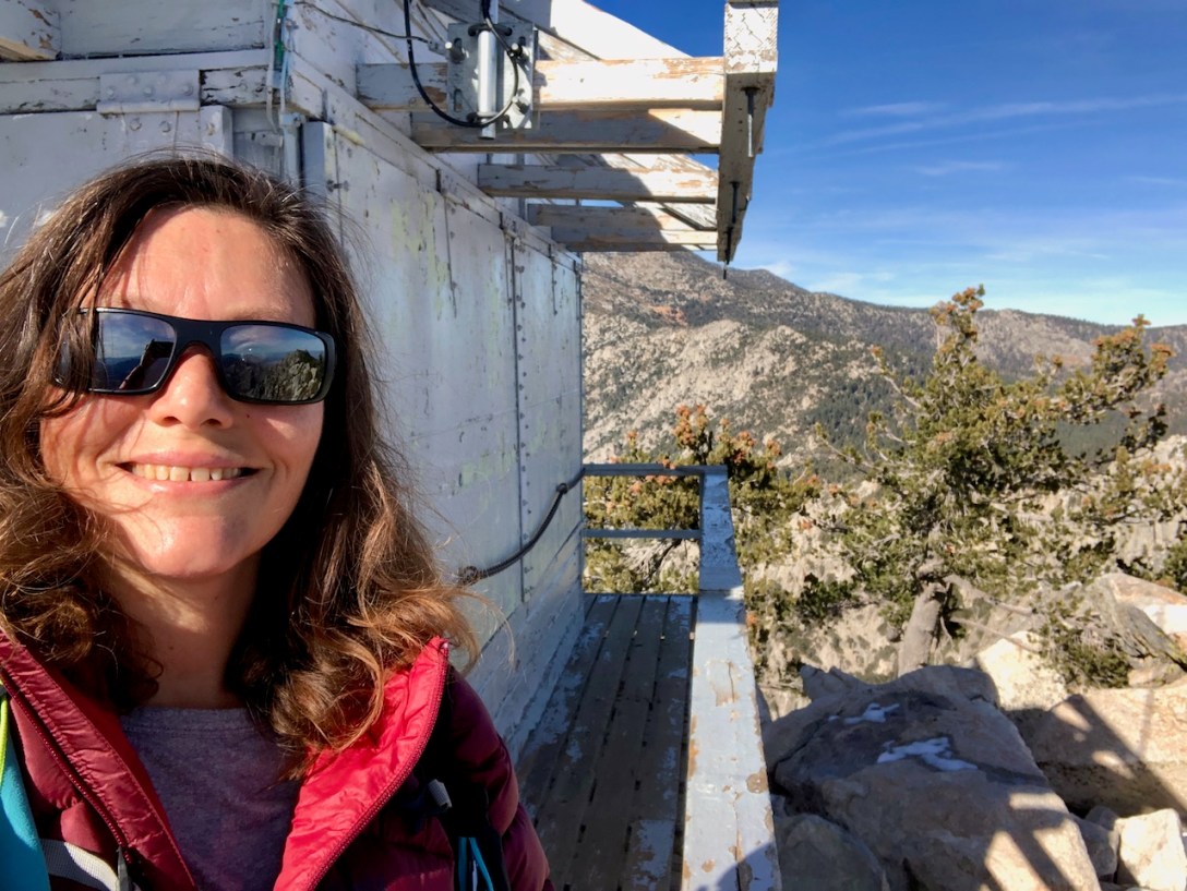
Tahquitz Peak
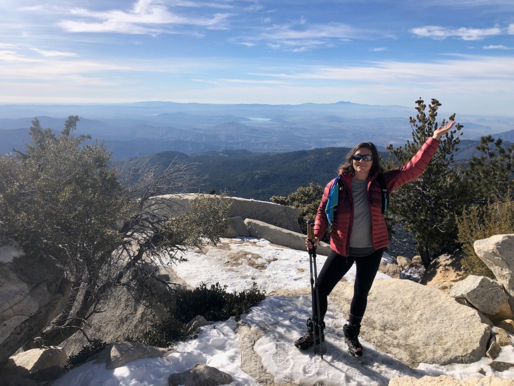
I had finally made it to Tahquitz Peak (Elevation 8,846 ft) after so much planning, and so much uncertainty, of whether I would make it here or not. It was truly a leap of faith, after the slow start this morning.
It had taken me just over an hour to hike those additional 3 miles to the tower, after leaving my hiking buddy. I was excited to explore the old fire tower, so I proceeded to climb the stairs to the top. The view was amazing from up there.

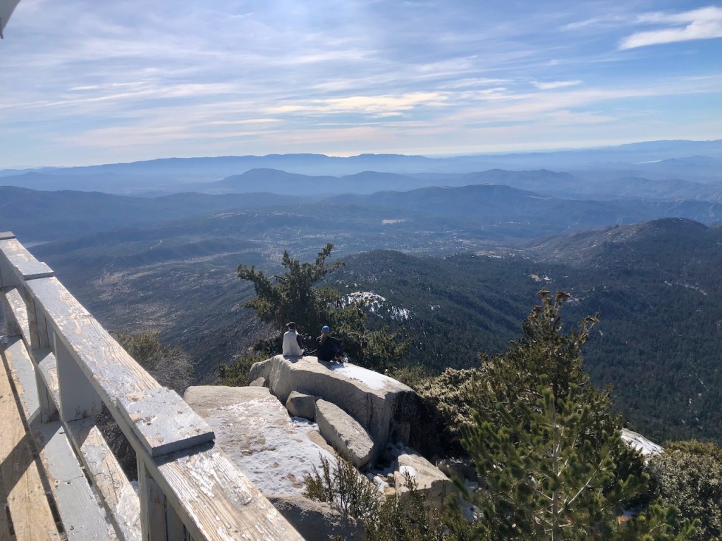
As I gazed out over the expanse of the Cleveland National Forest, realizing I had made excellent time getting here. I was so grateful to complete my goal of making it here. I could have stayed up here enjoying all this, and ate some snacks atop the fire tower. But I knew I better leave sooner than later, to at least try to meet back up with my hiking buddy, along with making it the trailhead by dusk.
I walked all around the tower for a few minutes, enjoying the views, and examining the details of it. This is a fire tower that has taken a beating over the years, being high on a ridge, exposed to the full brunt of winter storms.
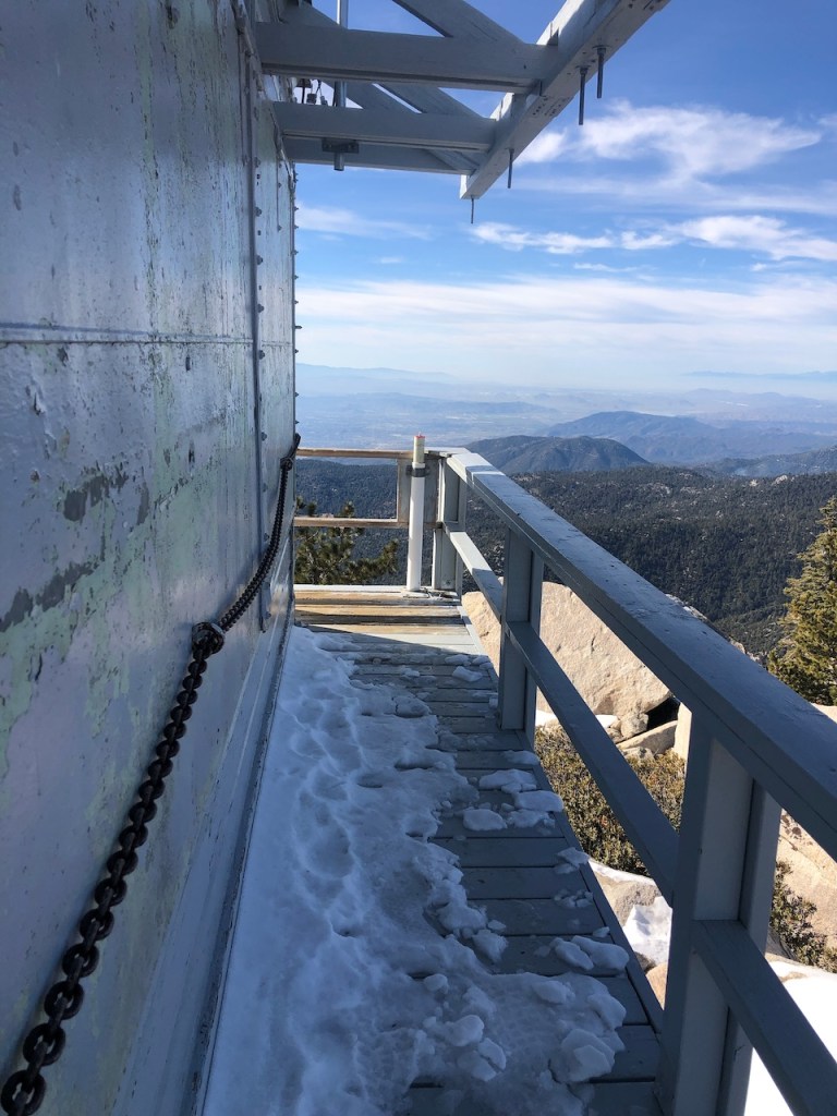
The wood was weathered, the paint was peeling, but it was in good condition, based on its age. It was officially closed for the season, surrounded by thick chains, and boarded up on all sides. Snow was beginning to pile up on the walkway, so I was careful to watch my step. I imagine it can get slippery up here.
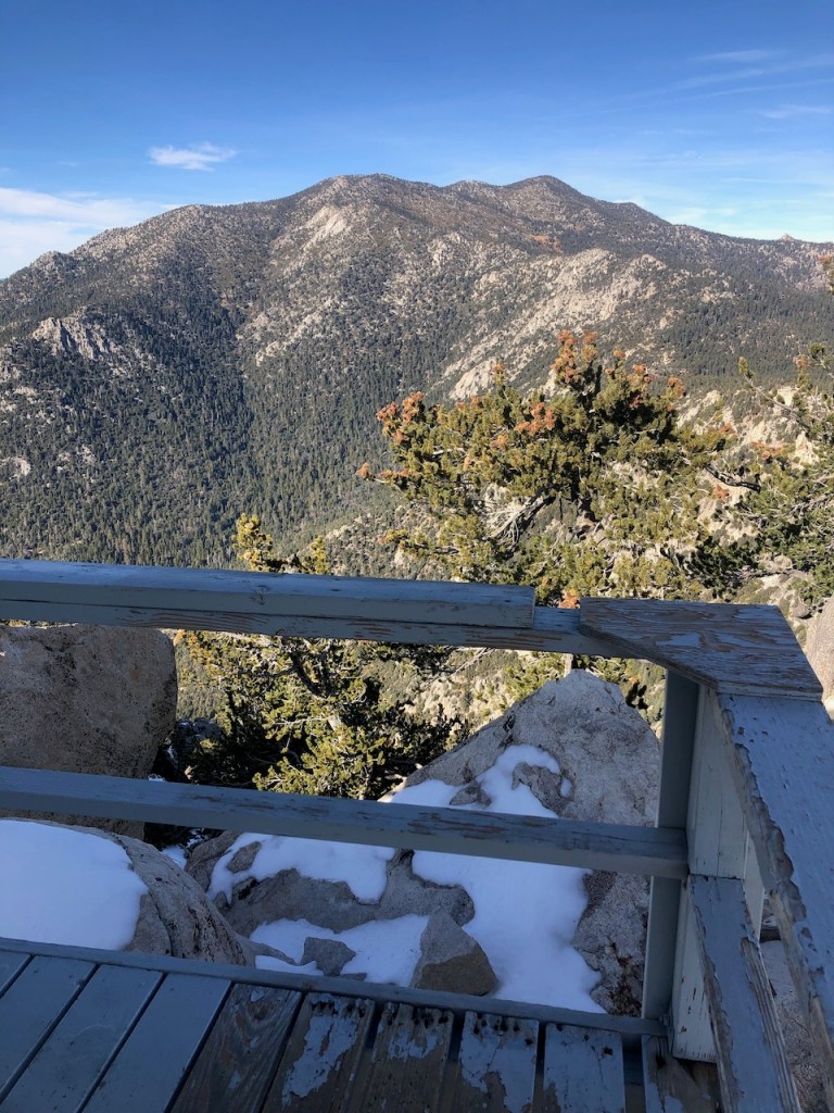
From the viewing deck, I had a clear view of beautiful Mount San Jacinto, a peak I intend to climb again, but next time via Marion Mountain.
I could see all the way from the desert, to the coastal foothills. South of the peak was a rocky, boulder flanked ridge line, and several other named peaks, I have not yet climbed. The 360 views were a definite treat, as they always are at the peak.
Two other ladies had made it to the peak alongside me, with Yaktrax on, which are probably adequate for the early season. There was a large flat rock, and they were having lunch gazing out towards the inland empire.
After exploring the fire lookout, taking plenty of photos, soaking in the epic views of Mount San Jacinto, and wilderness around me, it was time to make tracks, so I bid Tahquitz Peak adieu. I had a feeling with my fast pace, I might make it to Saddle Junction as my hiking buddy was arriving there.
The Way Back
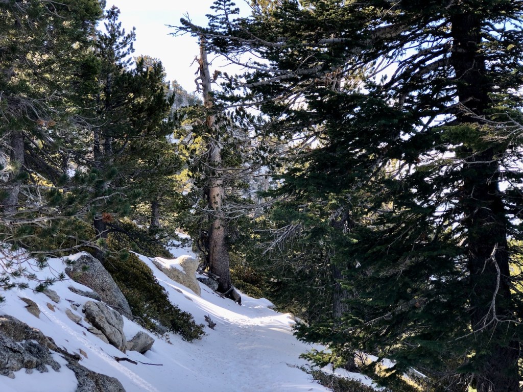
On the way back along the narrow snow covered trail running along the steep cliff, considered the most sketchy part of the Devil’s Slide trail, I simply took my time.
Once I reached the turnoff for the peak, and made a left, I took off through the pine forest, jogging along through the snow in my microspikes.
With no steep drop offs, I was feeling more confident about jogging along, and my Kahtoola microspikes worked fine.
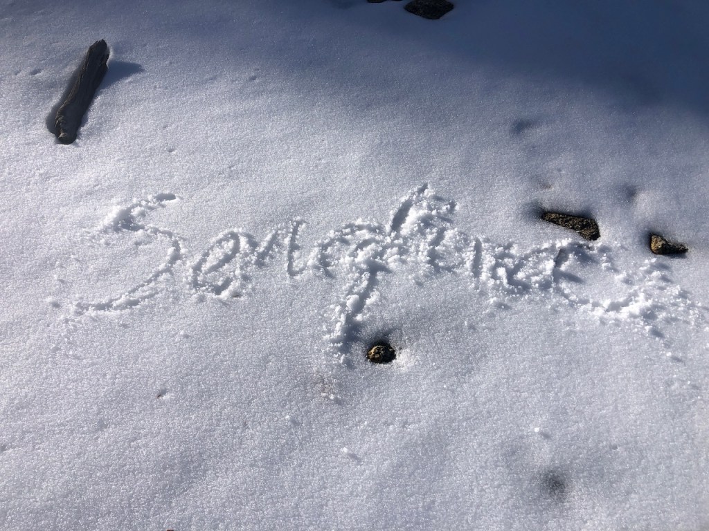
Seizing the opportunity, I wrote some graffiti in the fresh snow, but stopped short of making snow angels, realizing I needed to keep moving.
Jogging in Snow
I had been jogging less than 30 minutes, when I ran into my hiking buddy again. She had made it about a 1/4 mile beyond Saddle Junction, and decided to continue on, while searching for me.
Heading Back
We were glad to head back when we did. The views were so beautiful along the trail, and we headed back toward the saddle.
All Downhill From Here
So we hiked on back together. Going downhill was much easier for us both. I knew we now had enough time to make it back down to our cars before it got dark at 5pm.
Back by Dark
Being November, there was not much light. It was about 2:30 pm when we met up just beyond the saddle, and by 4:30 pm we were back at the trailhead, just in time.

We talked along the way about grabbing a hot cocoa somewhere. But after all was said and done, she had to get home, and I too had a nice dinner waiting for me. How could I pass that up? So it was a raincheck for hot cocoa.

Sometimes you may not go as far as you think you will, but you might as well enjoy the journey, wherever it takes you.
Conclusion
Tahquitz Peak was 10 miles roundtrip, and my hiking buddy had hiked about 7 miles of it, which was no small feat. We were two women, hiking in the wilderness, and I was glad we made it back safely, in time to see a beautiful sunset on the drive home.

Exploring the Wilderness
The San Jacinto Mountain Wilderness, and Idyllwild are a beautiful pristine area. It is not an area I frequent as much as I would like, but I was grateful to get up there at least one time this season.
Some Helpful Links
The Devils Slide Trail to Tahquitz Peak
Day Use Digital Recreation Passes
I hope you enjoyed reading this, and it is helpful in knowing what to expect, should you decide to visit here.
About me
I’m Serafina! I’m a writer and California girl who loves to go exploring. Hope you will get outside today, breathe some fresh air, and be happy!
Follow my Journey…
Be sure to Like and Subscribe to My Youtube Channel where I post videos!
Disclaimer: The work on this blog is my opinion and my opinion alone and I am not responsible for the outcome if someone were to apply these thoughts to their own life. All text and photography copyright 2023 by Serafina, all rights reserved. Information and opinions provided are kept current to the best of the author’s ability. All readers’ usage of the ideas and opinions presented in the blog, are at their own risk. Be aware of the possible dangers of hiking, surfing, walking, cooking, and other activities, which may take place indoors or outdoors. By reading this, you agree not to hold the author or publisher of the content on this web site responsible for any injuries or inconveniences that may result from reading the blog, or partaking in any activity mentioned in the blog. Read the blog, and use its ideas, if you so desire, at your own risk.
