
Mount San Gorgonio sits within the San Bernardino National Forest. This wilderness area is one of the most popular hiking destinations in Southern California. It’s a beautiful scenic area for enjoying the outdoors. The area is also popular for camping, fishing, rock climbing, off-roading, and winter sports.
Old Greyback
Mount San Gorgonio, also known as Old Greyback, rises to 11,503 feet, as the tallest peak in Southern California. It towers over the other tall peaks in the area, such as Mount San Bernardino, Mount Baldy, and Mount San Jacinto.
Solo Hiking
I would be hiking solo today. It’s how I challenge myself, and only go as far as my body allows. I have an intuitive halfway point where I will usually turn around. I was not hiking to keep up with anyone, only myself. I was ready for another challenge, and it was time to hike up Mount San Gorgonio once more.
A Fall Hike
Fall is here and I love hiking during this season of the year in the wilderness. The weather is cooler, and perfect for hikes. Sometimes hiking during this season requires warm clothing, and rain gear. I had all the 10 Essentials for this hike, and my pack was weighing in at about 15 pounds.
Hydration
I decided I would bring 5 liters of water at the start to save time filtering along the way. That was not really necessary, since the springs were flowing on the way up the trail. I regretted the extra weight later on.
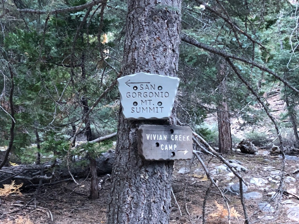
Vivian Creek Trail
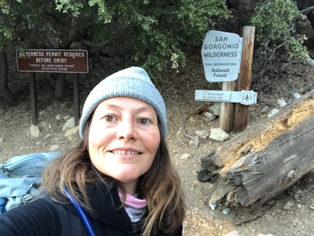
I would be taking the Vivian Creek Trail, just east of Forest Falls. Entering the San Gorgonio Wilderness requires a permit to hike, and it can be reserved online here at sgwa.org. There are permits available for day hikes, and overnight stays. You can book a permit for either the Cucamonga Wilderness, which includes Ontario Peak, or the San Gorgonio Wilderness here, along with checking the trail conditions, and a water report.
Backcountry Campgrounds
There are several free campgrounds along the trail including Vivian Creek, High Creek, and Halfway Camp, which is not quite halfway up the mountain. I will refer to this campside as Third Way Camp. It is free to camp at any of these sites with a permit, along with camping near the peak at “summit camp.”
Hiking in November
It was early November, and the rocky wilderness landscape here would soon be blanketed in snow. Summer and fall are the best time of year for hiking at altitude in my opinion. The weather is perfect, the air is crisp, and the trails are less overgrown.
Alpine Hiking
Most of my local mountain hikes above 8000 feet have been in October and November. I was excited to hike to one more high peak this season, before winter conditions set in. I am not a stranger to snow, having grown up in a place with frigid winters.
Mountaineering
I am also a novice mountaineer, and rock climber. I have some basic gear and have some knowledge of how to use it (Ex. ice axe, microspikes, and crampons). But I have not put in enough time using my gear yet to consider myself experienced enough to hike up this mountain during winter conditions solo.
An Alpine Start
I arrived at the trailhead around 5:30 am, and started doing last minute preparations. I was all packed up, and heading down the trail around 6am. The hike began rather uneventfully. I had noticed one lone hiker leave 15 minutes before me. It was still pitch black for the first 15 minutes of my hike. It was first light as I passed a series of forest service cabins along a rutted, rocky fire road.
Mill Creek
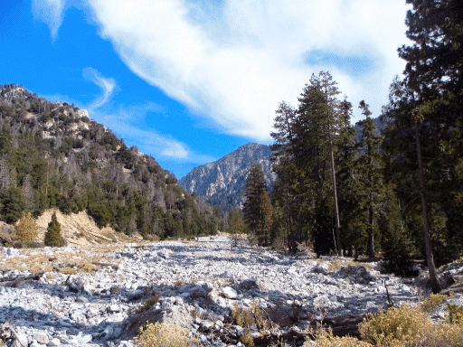
The trail seemed well marked along the way, and it was obvious where I was headed for the most part. As I approached the wide river crossing, at Mill Creek. I checked my alltrails app, as it was hard to see the path across the mostly dry riverbed. You could tell looking at it, that this was no place you would want to be after a rapid snowmelt, and that flash floods are common here. If it was not at all obvious, there was even a sign warning of crossing this creek bed and flash floods being common here.
Forest Falls
The atmospheric river last year did not spare the small enclave of Forest Falls. Just about every year I hear about the residents here having to evacuate, or lose their homes. If it’s not rockslides, it’s mudslides you need to worry about, in burn areas like this. The steep cliffs rising above this small mountain enclave lend themselves to disastrous weather hazards. Rocks tumble on down with heavy force and velocity, and yet people still make their homes here. Talk about living in the danger zone. Nobody said the wilderness was safe.
A River Crossing
As I crossed the mostly dry river bed, in the faint light of morning I spotted signs pointing the way up the mountain on the other side. Hence I have no photos of it. I also crossed it in the dark. On the other side were large signs pointing the way, which was helpful.
An Upward Climb
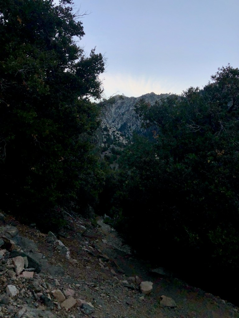
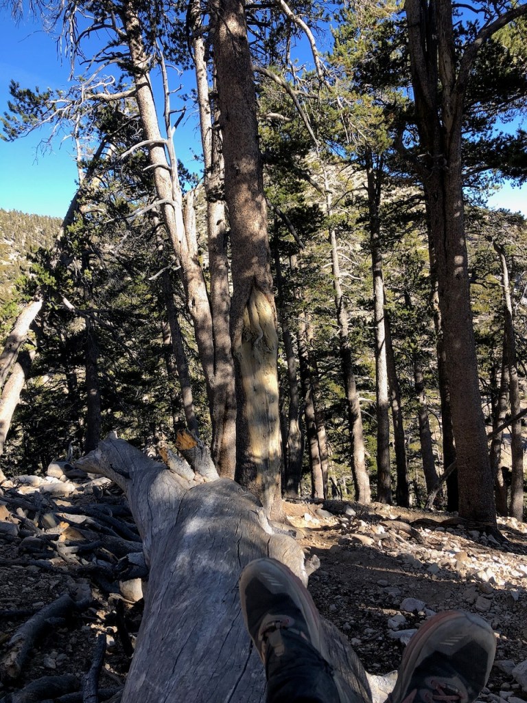
I continued up the trail in the faint morning light, through an oak studded forest, with downed trees everywhere. The hillside was steep, and it was slow going, heading up the slope. It would take as long going up today, as going down due to the pitch. It was very rocky indeed, as I had heard in trail reports.
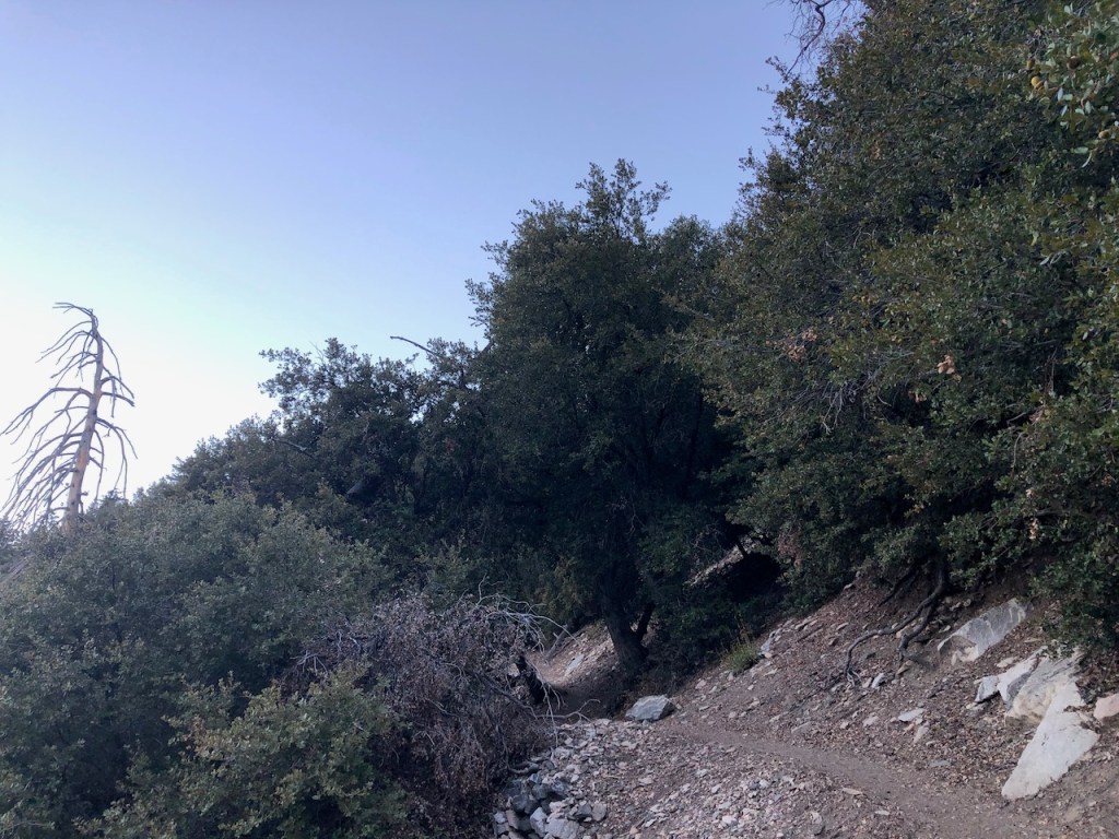
Switchbacks
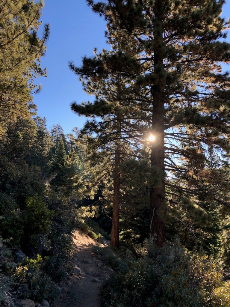
The trail never got less steep. After coming up the first two switchbacks I stopped for a moment to enjoy the sunrise. My slow and steady wins the race mindset took over. I try to use as little effort as possible hiking, and just steadily climb. It’s both a rhythm, and can be compared to a march. I sometimes repeat a military style march in my head, when the going gets tough on a trail, or in life. I just repeat one, two, three, four, and count my steps, so eventually I will get there. Slow and steady wins the race. So many things in life have been like this.
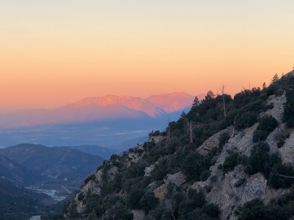
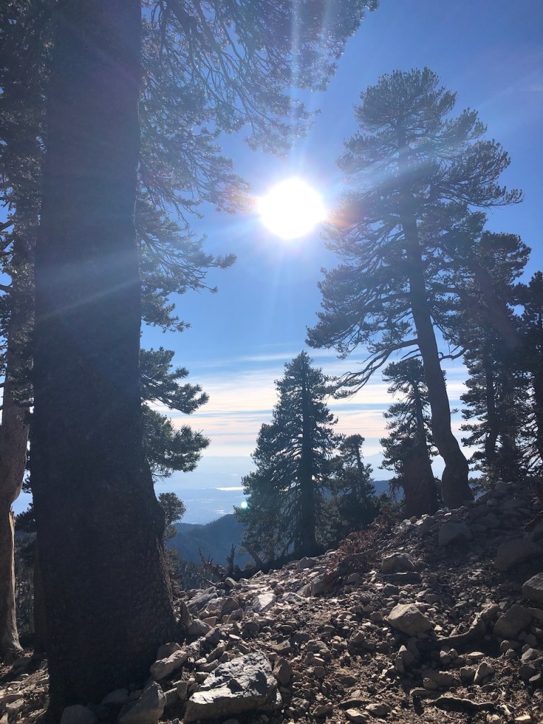
Sunrise
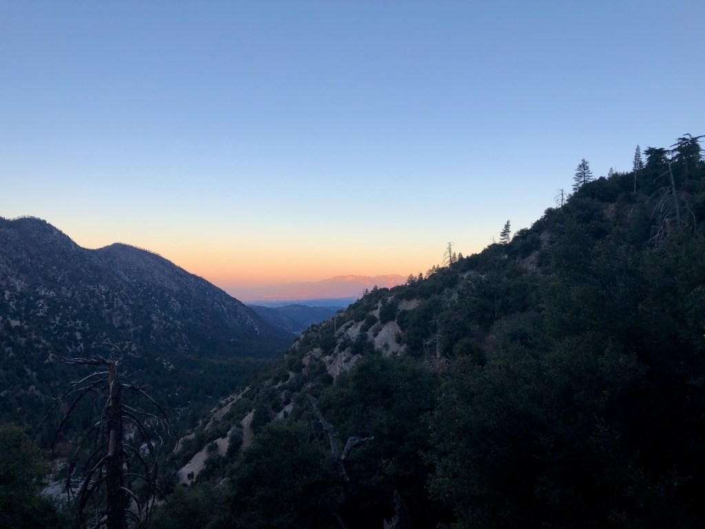
As I came to the end of one long switchback, I was greeted with Mount Baldy, aglow in the distance, in shades of pink and orange.
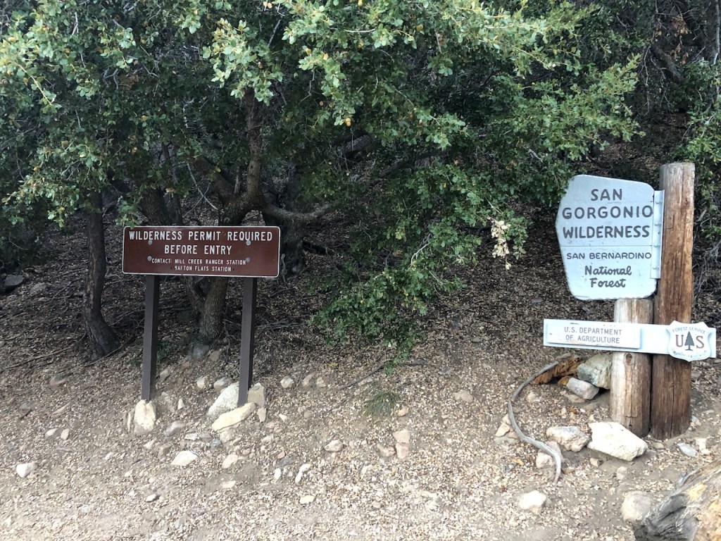
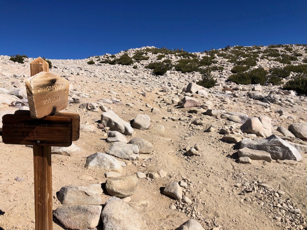
The sun had risen, as I passed the San Gorgonio sign, where wilderness permits are required prior to entry.
The trails seemed well marked, and it was easy to see where you were supposed to go. Unlike some wilderness areas, there was just one main trail to stick with.
Vivian Creek
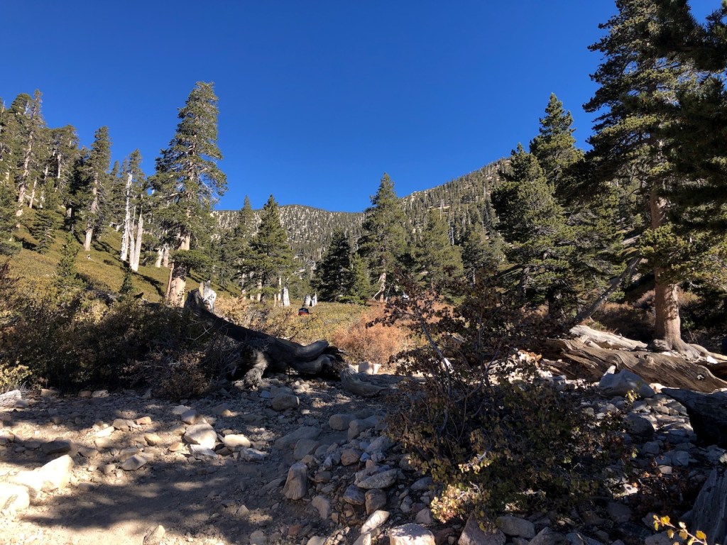
I climbed steadily higher through the rugged forest. There were dozens of downed trees everywhere. I made it my first milestone, Vivian Creek campground. I could see no tents, so I reasoned the camping area was well away from the trail, off to the right.
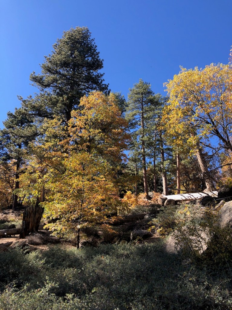
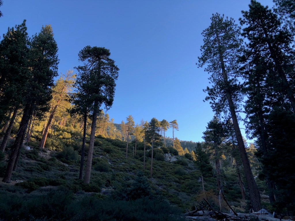
As the sun rose it dusted the tree tops in a golden light so beautifully.
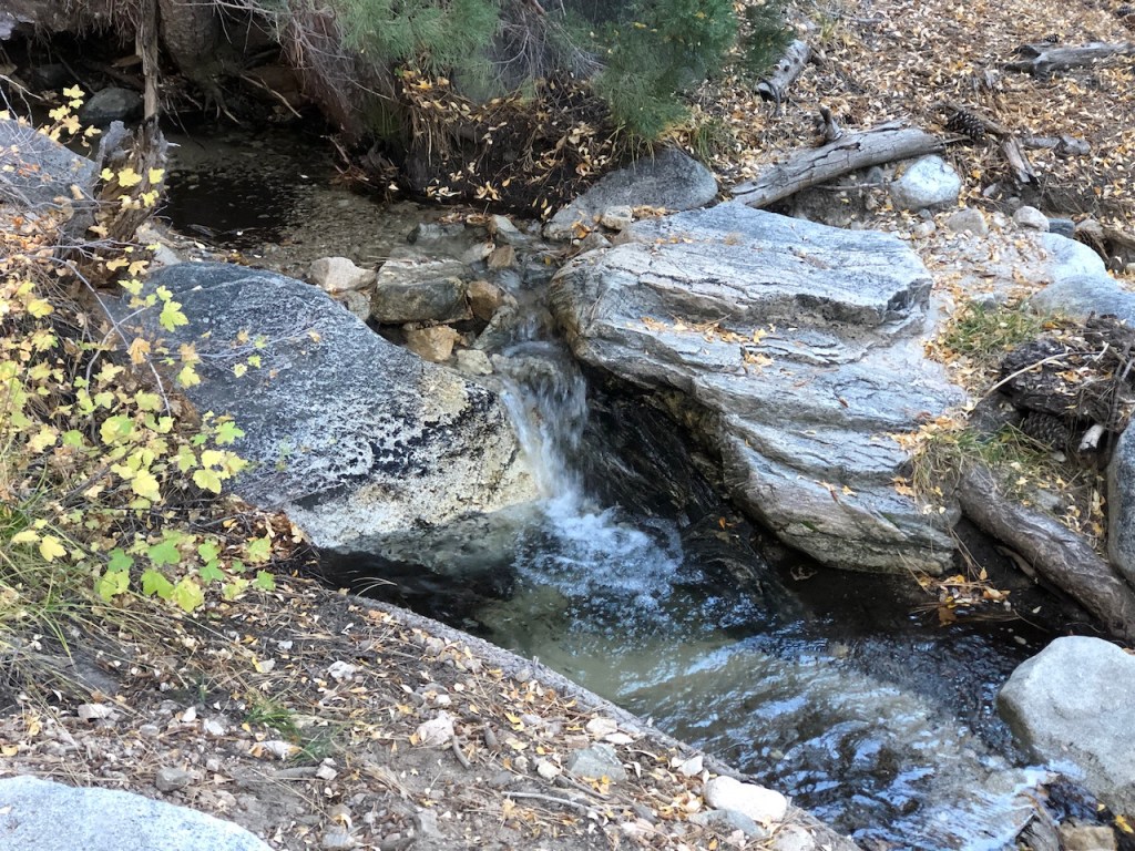
Water Sources
Streams were flowing, and there were fall colors everywhere, as I passed the campground. I crossed the creek easily on a large log. There were countless small waterfalls cascading down the mountainside alongside the trail. Streams continued to criss-cross the trail for the next mile or so, and water was plentiful. It was so tranquil, and peaceful here in the forest.
What to Wear
It was still very cool, in the low 40’s, and chilly. I was glad to have layers on, and a down jacket. I was taking no chances, and had brought warm clothes. I stopped for a moment to put my jacket back on too. The temps kept flucuating in this shady area of the trail.
Not Alone Out Here
During the first hour of my hike, several hikers passed by on their descent. They likely climbed the mountain yesterday, camped out, and were on the way back to their cars. Aside from a handful of other hikers, it felt remote, and isolated here. Another solo woman hiker passed me wearing a down jacket, well prepared it would seem. One more group which passed me, in thin layers. I questioned whether I brought too many layers. All that extra stuff weighs you down.
Window of Opportunity
There is a small window of time for hiking a mountain, in a particular set of clothing. It changes so rapidly. The mornings are frigid. The daytime is warm, and even shorts could suffice for a few hours of the day. I guess it all depends on how well you know this mountain, your clothing choices.
Wildlife
Soon I approached a thorn bush covered meadow area. It made me think of bears for some reason. I heard Vivian Creek Trail has lots of bears. This seemed like a place they might want to wander around in for some reason. All my senses were on alert, as I was listening for sounds in the bushes, and my nostrils were also on the lookout for characteristic smelly bear smells.
Indicators
Another key indicator of wildlife is crushed grass or brush, where they may have lay, or down trees shredded to bits by a bear in search of insects. I was unafraid, but still had no desire to see large wildlife like bears. I am content to birdwatch, watch the chipmunks scurry, and see the occasional deer.
What I enjoy most about the woods is the peace and tranquility, the fresh air, and it always feels like home.
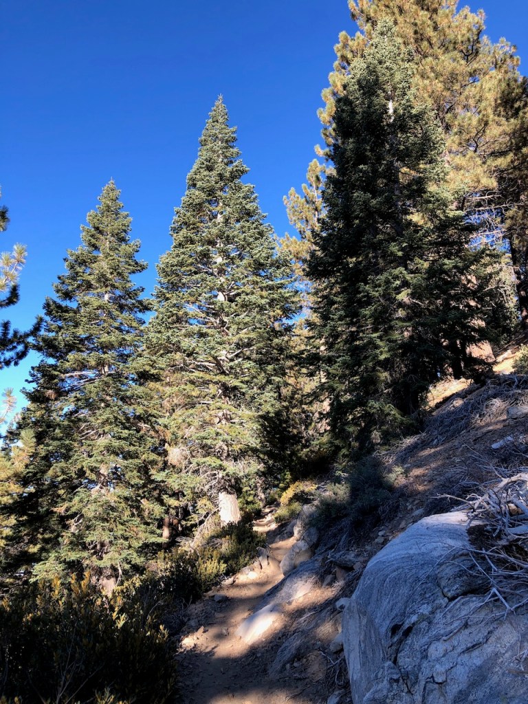
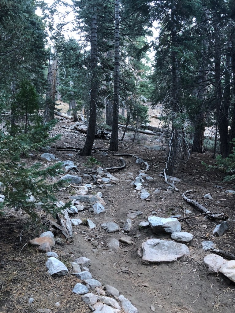
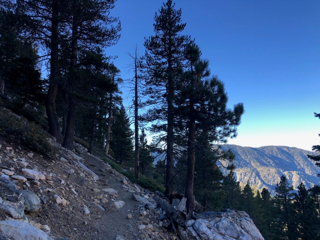
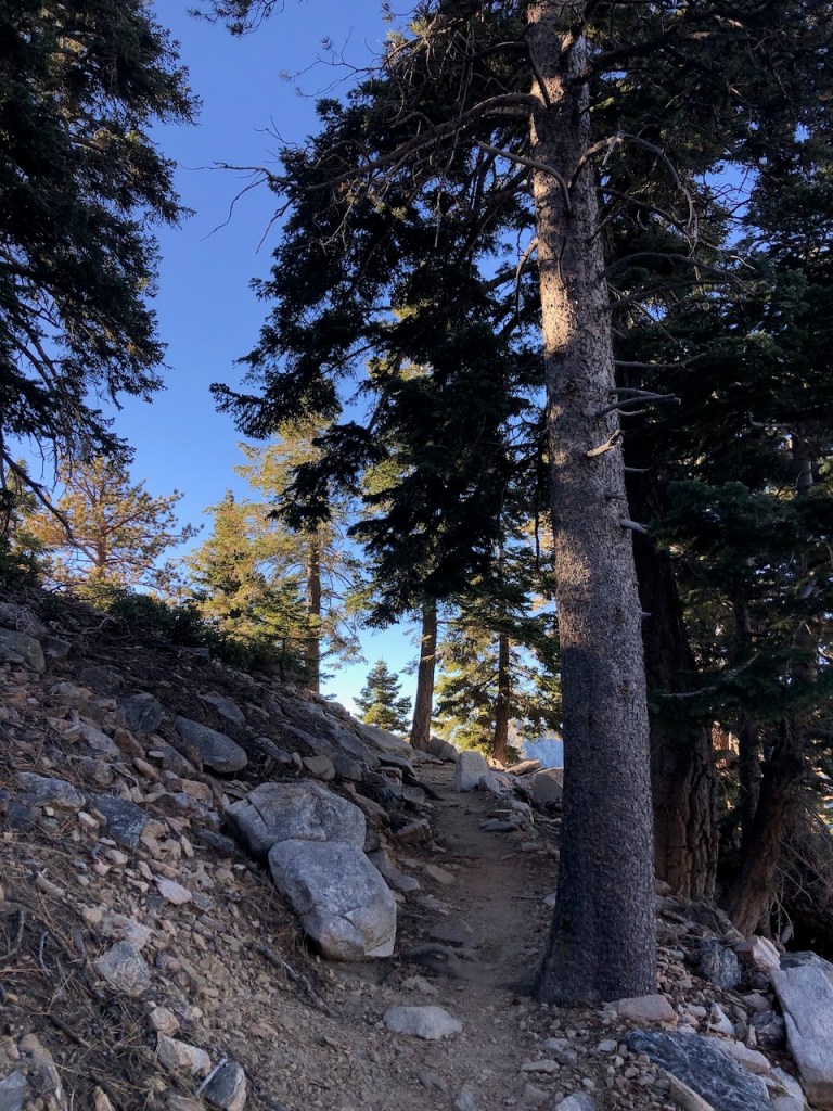
The climb continued steadily. The trail was narrow, rocky, and had plenty of scrambles. The climb itself was unrelenting. I kept checking alltrails, to be sure I was on track but each time sure enough I was on track.
I finally passed Halfway Camp, which is the next campground, about four miles up the trail. It was not halfway by any means, but a third of the way.
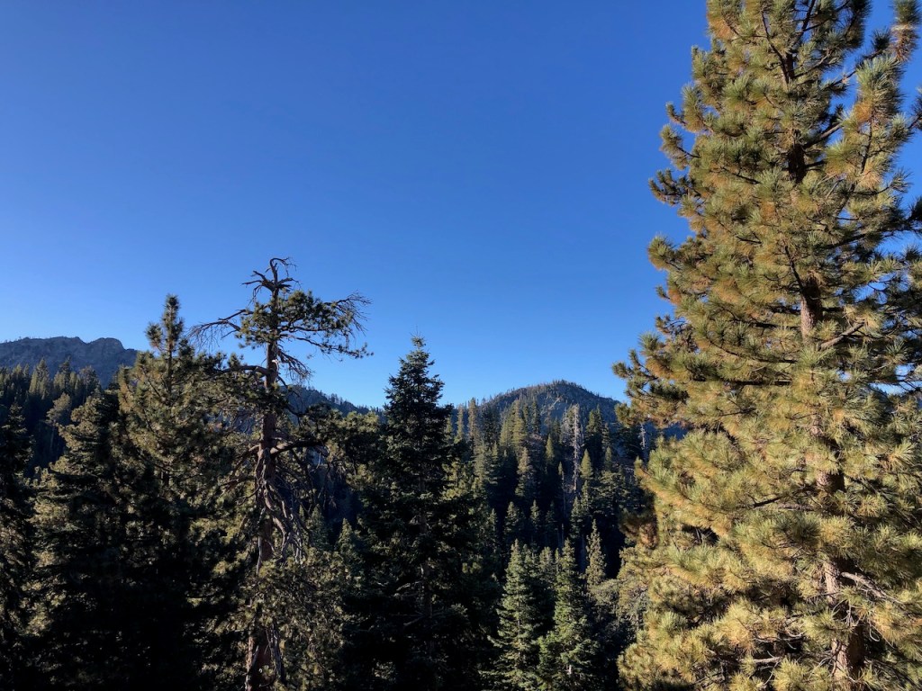
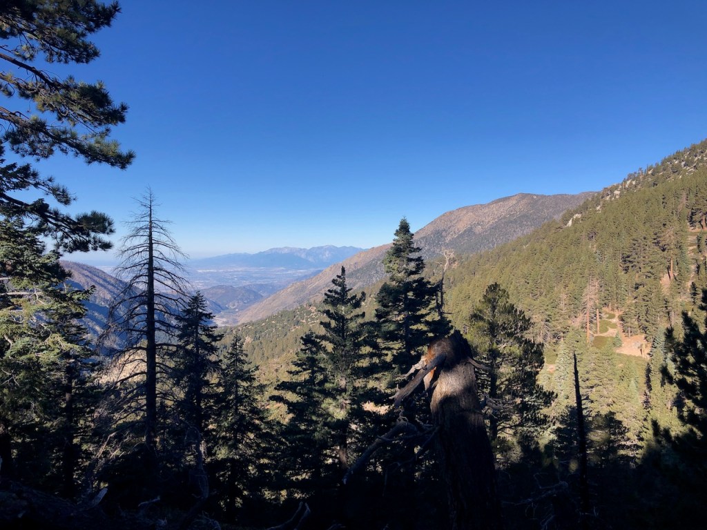
By 9am I had climbed almost 3000 feet, and was starting to take in some amazing views of Mount Gallena, and Little San Gorgonio to the south of me.
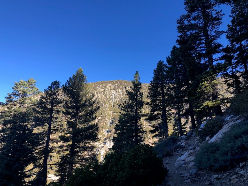
To the west was Dobbs Peak, towering above.
I was feeling very motivated, and pretty good about my climb at this point. All that would soon change. It was still early and I reasoned if I kept a good pace I could get to the peak by 11, maybe.
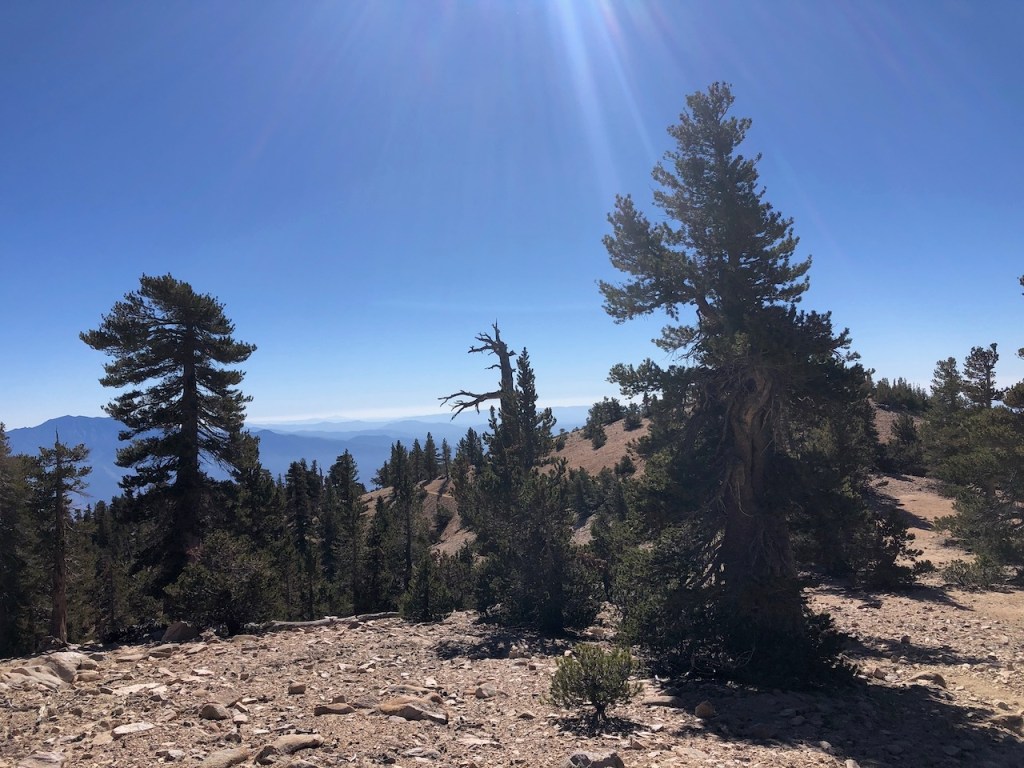
The steep mountain ridges above Forest Falls, would soon be dwarfed by Mount San Jacinto off in the distance. As I climbed, there was a bit more exposure, yet it was still very shady, and forested all along the way.
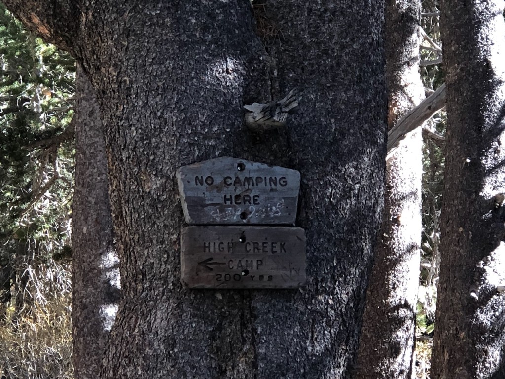
I reached my next milestone, High Creek Camp, the last campground, before Summit Camp, and the peak.

I began to pass through an open area, as I approached the camping area at High Creek which. I was now about 6 miles up the mountain.
High Creek Camp is a great place to fill up on water for the climb ahead. It was very sunny here, and filled with campers. The campsites are all just off the trail. This would be the campsite I would choose, if I was backpacking here in the future.
More Switchbacks
I crossed the creek once again, and was greeted with even more switchbacks. It never got any easier, as I climbed higher on a loose granite encrusted trail. I had to take care with my footing, so I did not roll an ankle on the many loose stones. Again, slow and steady wins the race was my mantra.
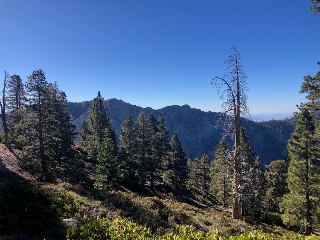
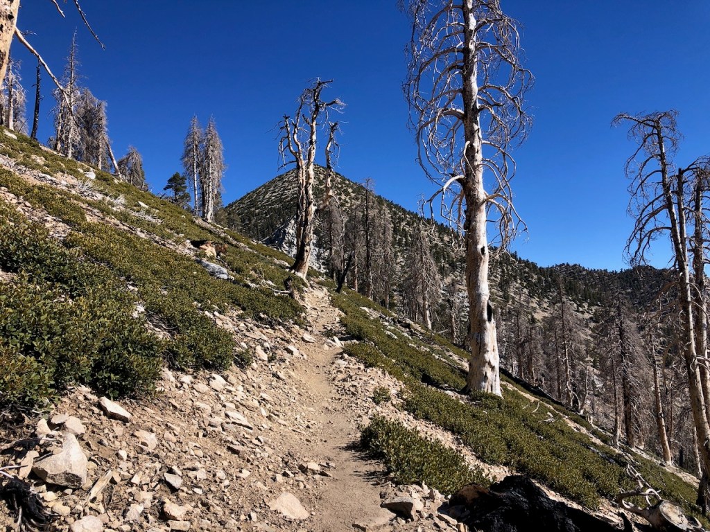
By about 9:30 I had passed a beautiful waterfall off to my right, down deep in a gorge. Once on the ridge, I could spot a rock formation called Dragon’s Tooth, through the charred trees.
On The Ridge
Eventually I reached a ridge, after about an hour more of climbing. I had begun to have a slight headache, and was not sure if it was something to be concerned with or not. So I disregarded it as much as I could, with my eyes fixed on the peak. But this headache would do a number on me.
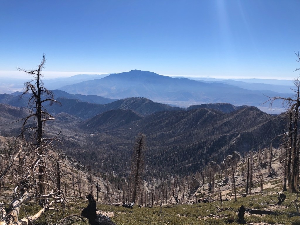
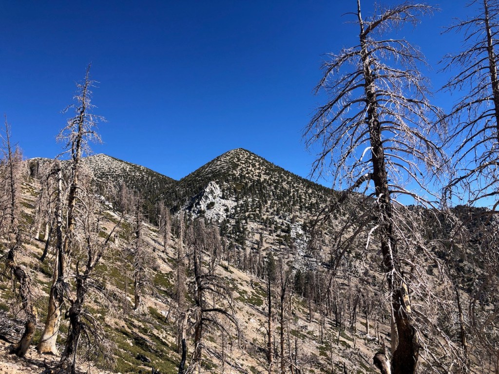
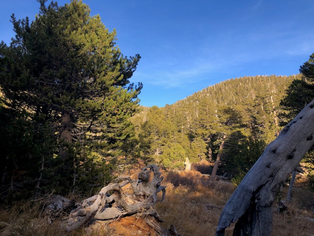
I gazed out over a moonscape, a huge swath of standing deadfall trees, with Mount San Jacinto in the distance. This area had recently burned, and the trees stood like skeletons.
I had now climbed about 3800 feet in about 7.5 miles. I was utterly exhausted. Another lone hiker passed me at this point. I had been passed by three groups. I knew I was not at my best. How I felt was on par with my first Whitney attempt, when I turned back. But it was still so early, and there was not a cloud in the sky. I wanted to keep going, so I did.

The further I climbed, the more I knew my decision was not a great one. I was not feeling better, but only worse. But the views kept stoking my enthusiasm to keep going.
I was so fatigued when I had reached the 8.5 mile mark, around 11am, so I decided to lay on a large flat rock under the trees, to decide if I could make it there at all.
I resumed my hike again but was moving very slowly at this point, and was not sure anymore if I was going to the peak or not. It felt so far away. It was as if I had already climbed a mountain, and I had one more to go. I took a ten minute rest, and continued on to the ridge. This hike is a true test of your endurance for sure.

I could glimpse the peak clearly through the pines, and deadfall, mere statues from the past, no longer alive in life, only in spirit. I had almost 2000 feet of climbing left to go.
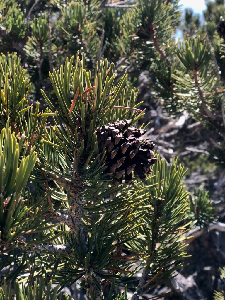
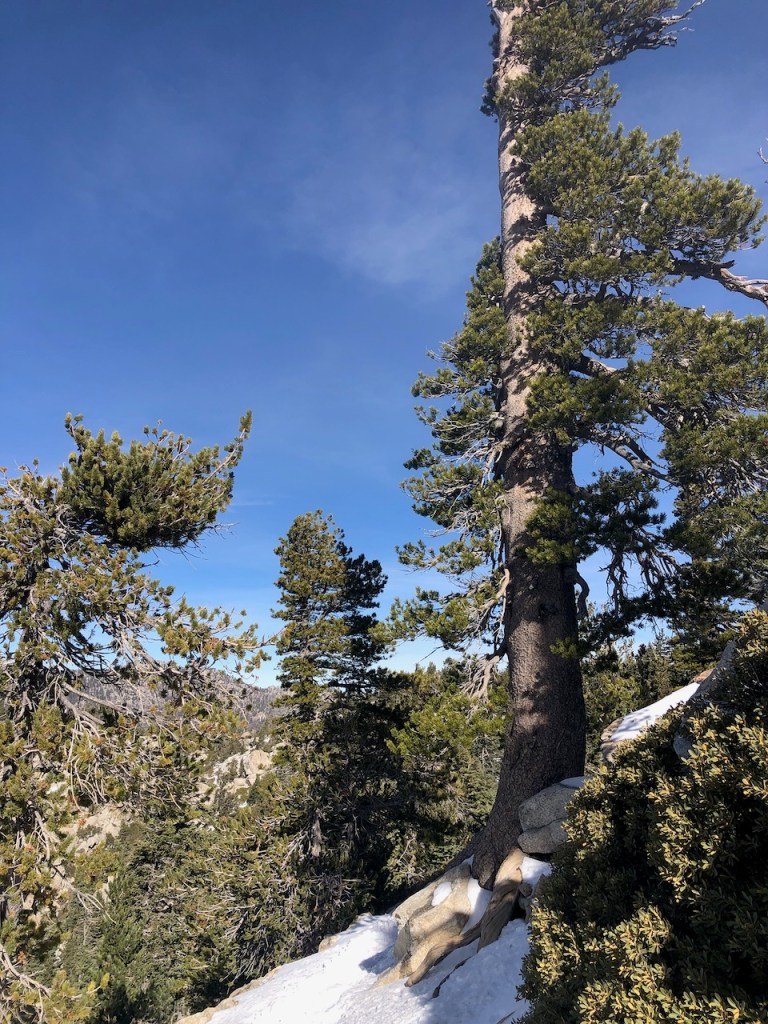
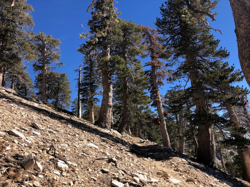
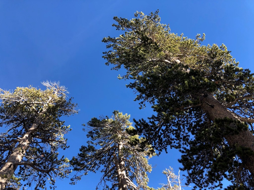
I was out of the thick cover of trees, and now surrounded by the usual windswept dwarf pines you see starting at around 9000 feet.
I trudged on, gaining in elevation ever so slowly. It was a mind over matter thing at this point. My legs could make it, but the rest of me was going haywire. My headache was making me feel dizzy too, which I did not like. Altitude does not usually affect me too badly, so this was not good news.

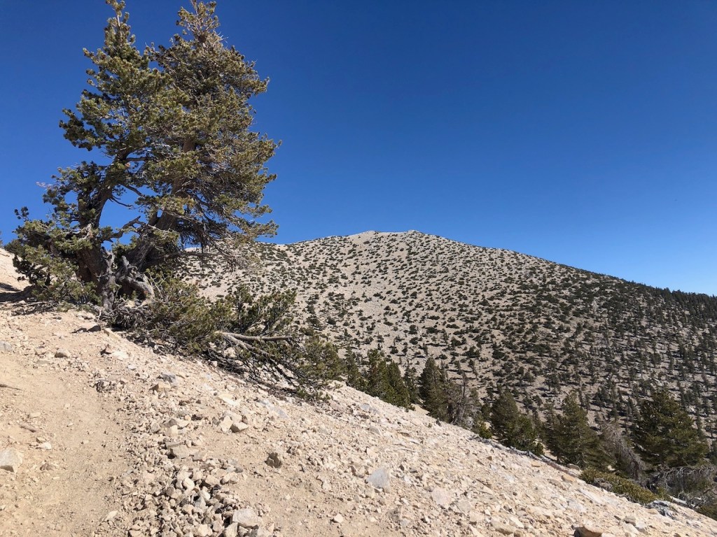
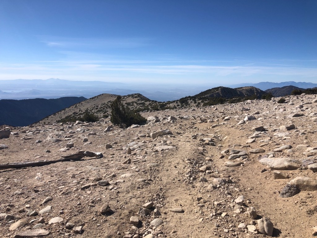
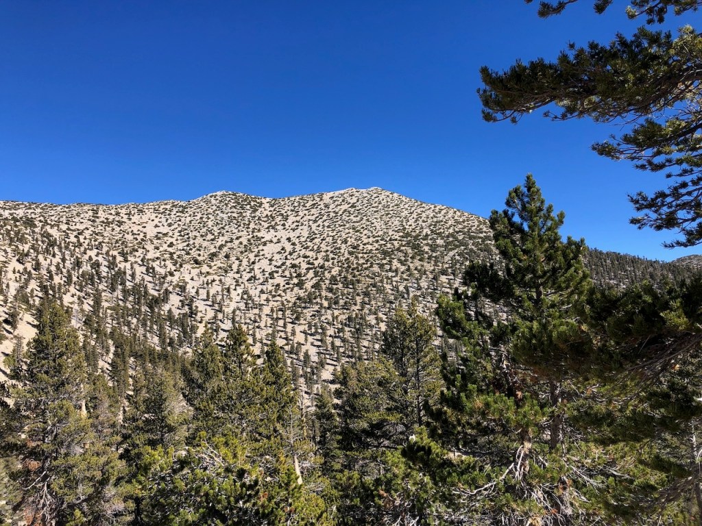
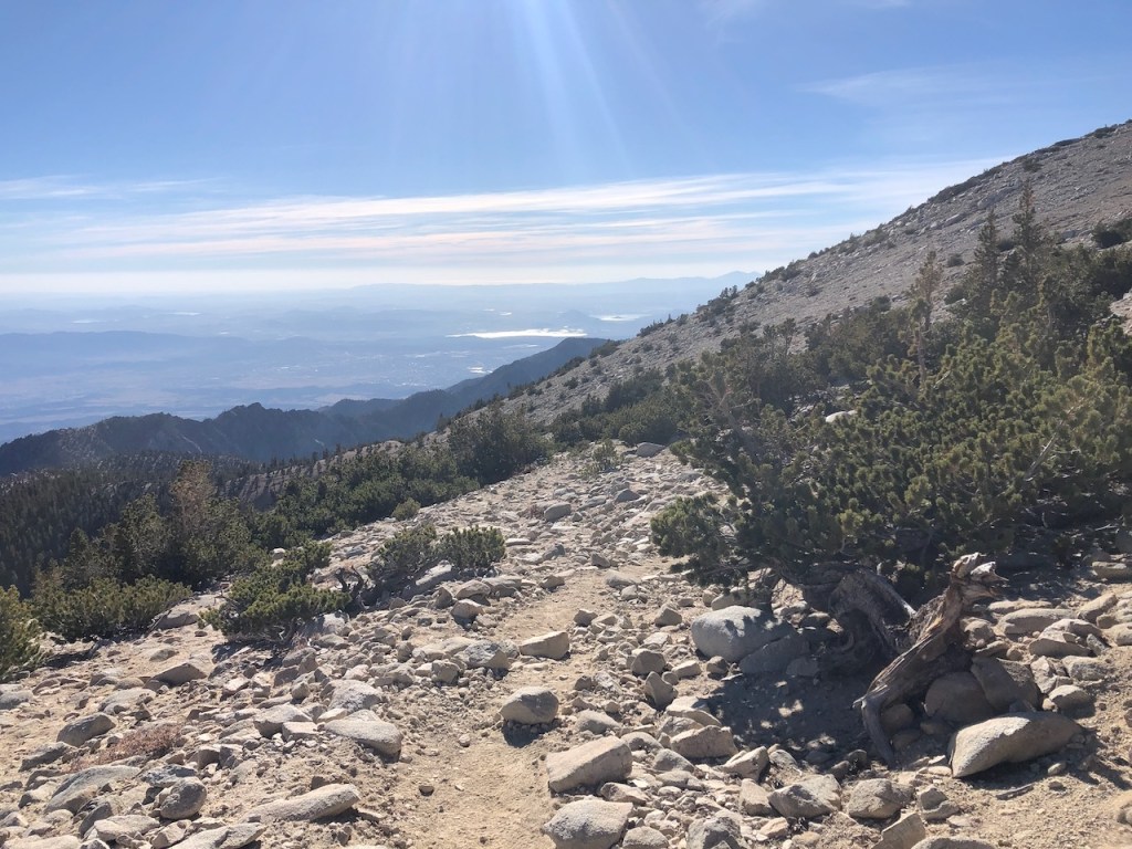
About 11:30, I had officially entered the alpine zone, and reached a mostly barren rocky ridge , having hiked almost 10 miles.

Extra Miles
I actually had a little over 2 miles to the summit of Old Greyback, but had no idea how far it really was. All trails was completely wrong, with its mileage. This hike was probably going to be over 22+ miles, based on how far I had hiked on my watch, and how much further I had to go. I record my hikes on my apple watch, and alltrails is always very off. I have compared apple to google maps in terms of distances. Sorry alltrails, I cannot rely on you for mileage. Also the Forest Service uses air miles to record distance, lol.
So Close Yet So Far Away
I was so close to the summit. Usually when I get to this point I get some kind of second wind. Not this time. I was not sure I made the right choice continuing. I knew the hike would be maybe 18-19 miles. But I had not guessed 22+ miles though. Those last few miles make a huge difference at this altitude, and the timing of all this was going to mean I would finish in the dark.
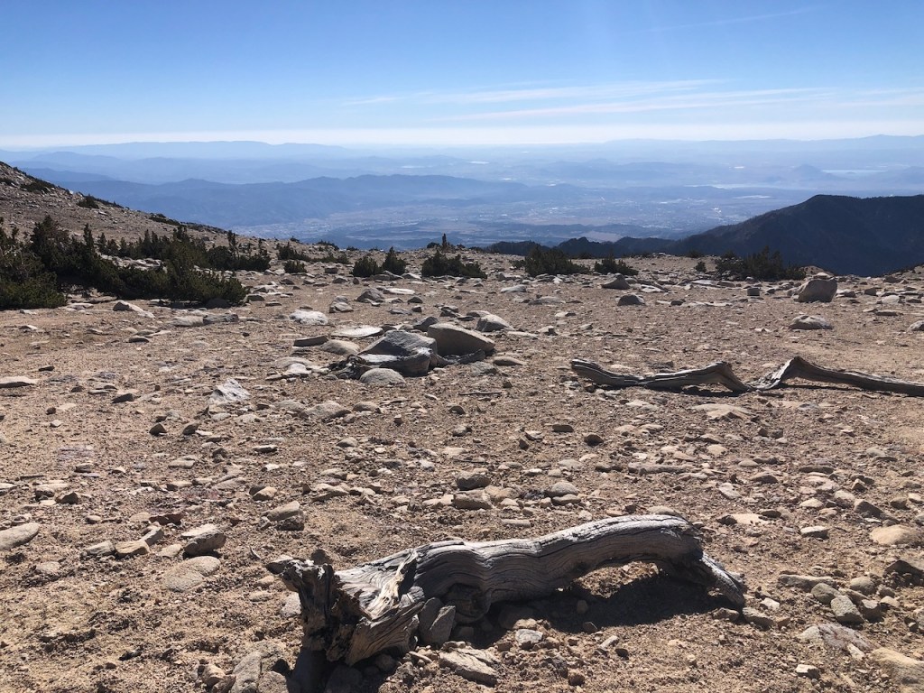
The Moonscape
Alpine hiking is like passing between worlds. You hike from a place brimming with life, to one practically devoid of it. I was stopping every ten seconds for a bit. I would hike ten steps, and stop to catch my breath. I would hike further, and stop again. The headache was doing a number on me, the pain was what was raising my heart rate, and making this so much harder than it could have been. By 12 noon, after hiking at a snail’s pace, I was edging closer, but still had about a mile and half left to go.
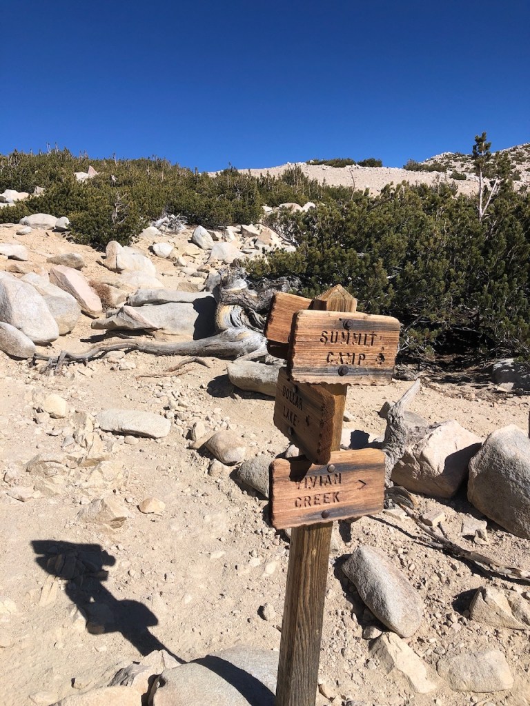
The Saddle
It was almost 1pm, when I finally reached the turnoff for Mount San Gorgonio. I was now less than a mile from the peak. I ditched my pack in a bush, and marked where it was with a cairn, and a makeshift arrow. That’s how tired I was. I just needed to get there at this point. People ditch packs for the last mile to Mount Whitney, so it was reasonable. It was a 15 lb pack with 3 liters of water left of the 5.5 liters I started with. With a lighter pack, I would have been there much sooner.
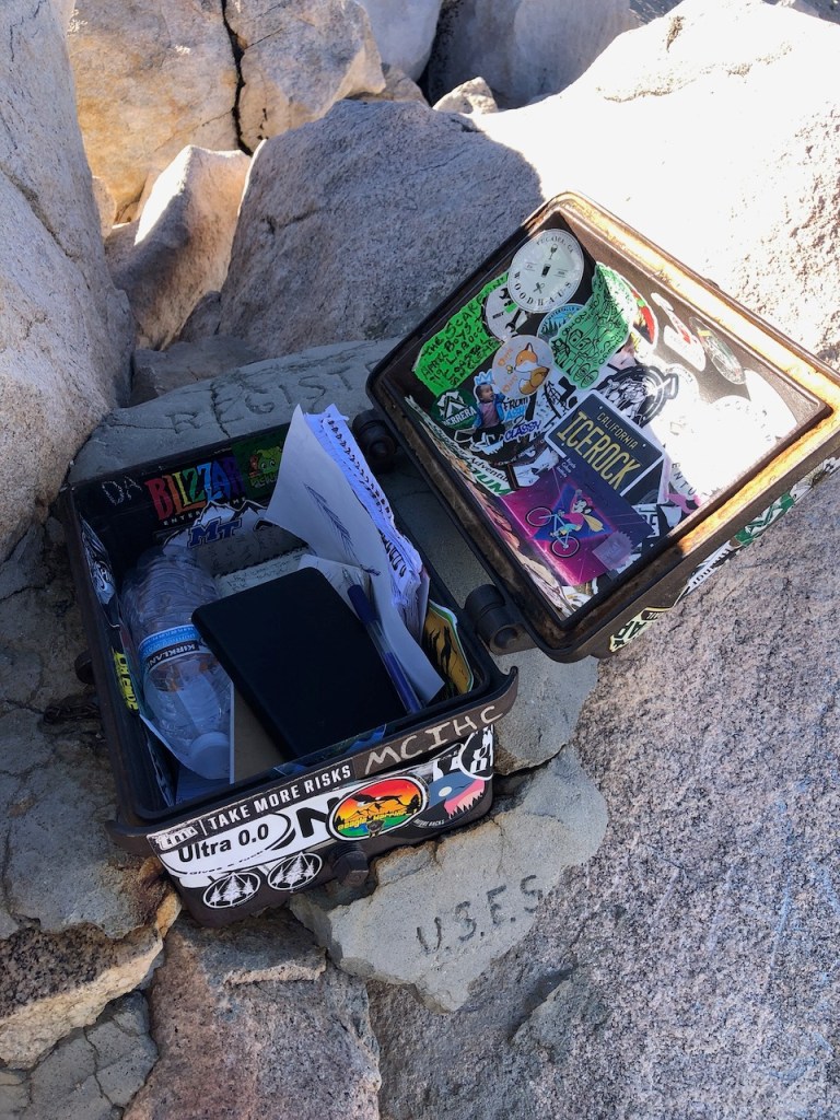
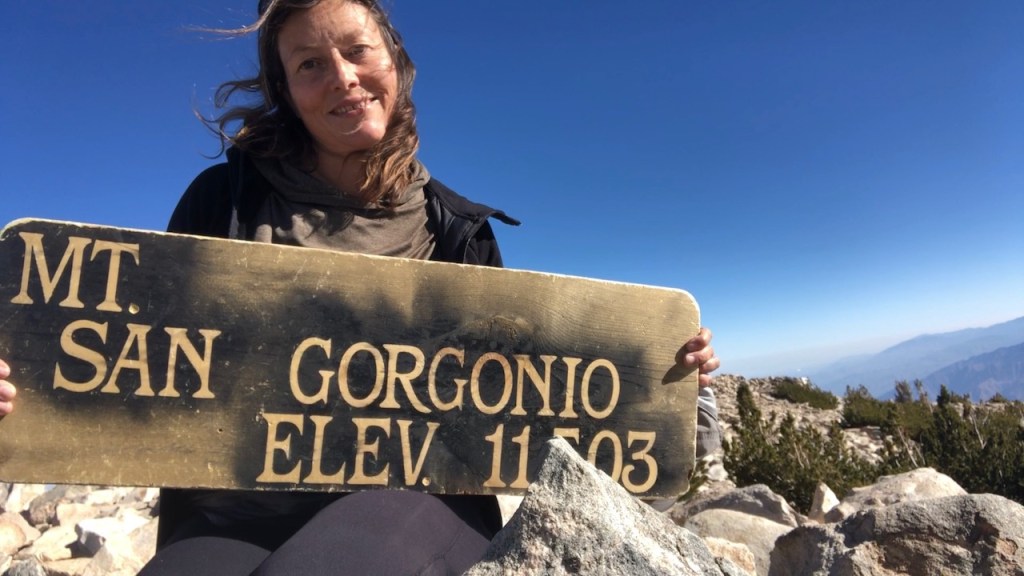
The Register
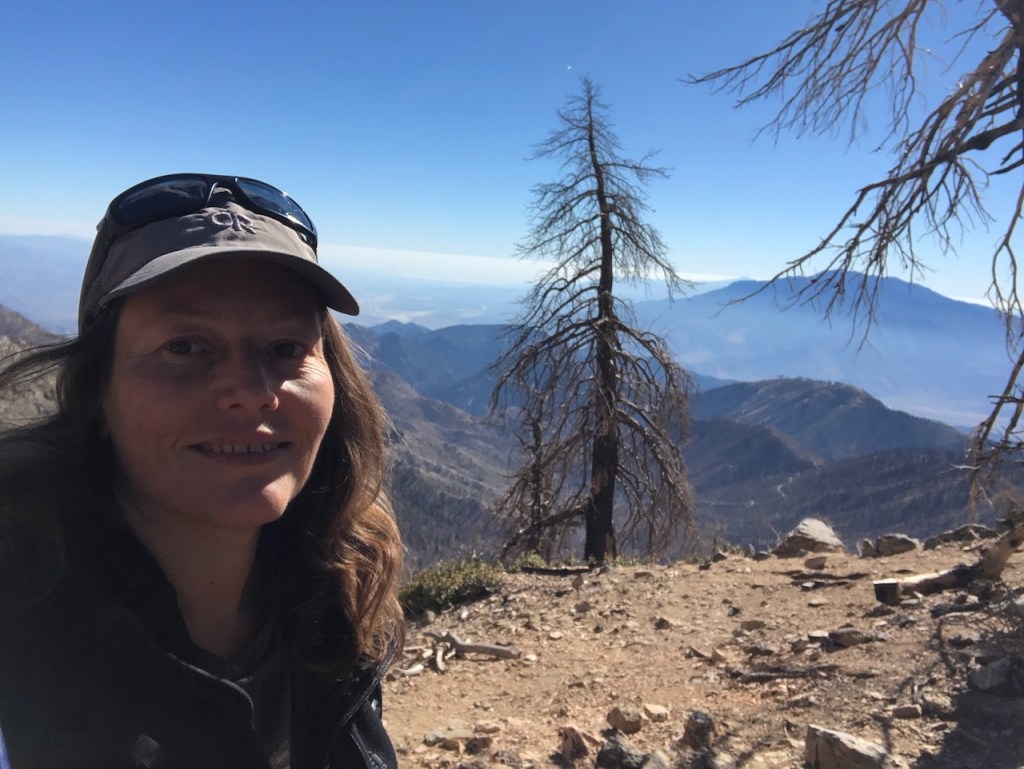
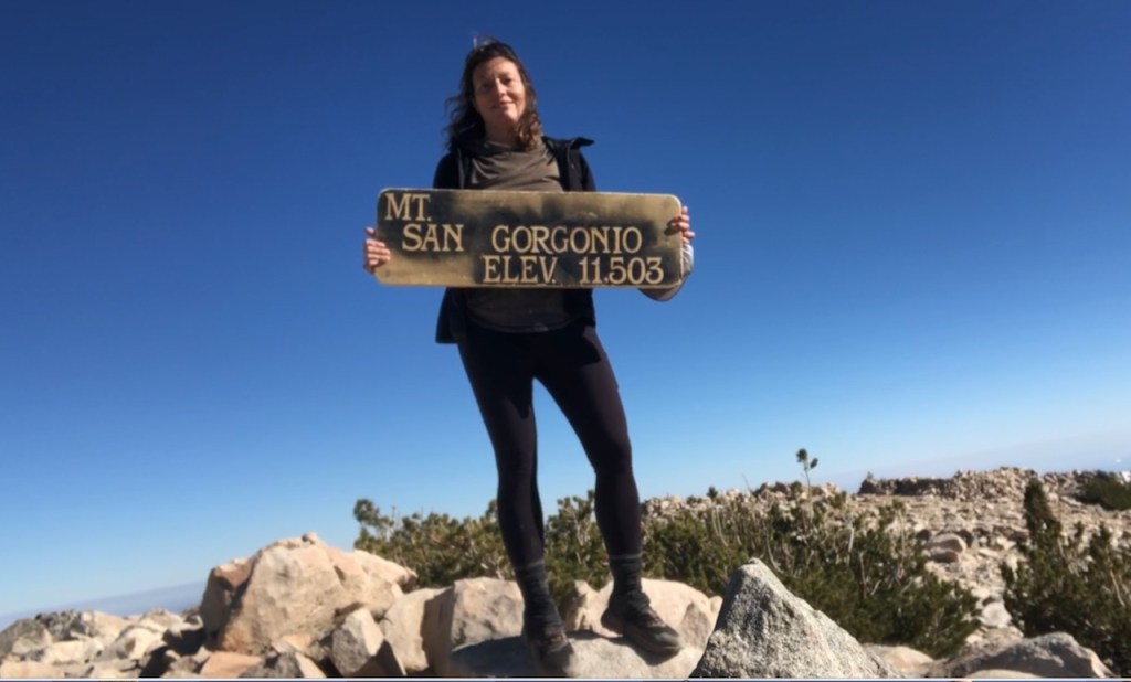
It was 1:20pm when I reached the peak of Mount San Gorgonio. The peak was empty. One group had just left, and two groups had passed me on my way up. The last mile had taken me over an hour. I never felt so relieved to open this box, and sign this register.
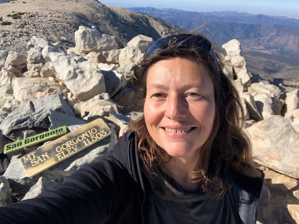
Mount San Gorgonio 11,503
This was my second summit of San G. I felt good about myself, persevering through pain, and mental battles, to get there. I had just two thoughts in my head. One was how grateful I was to make it, and the other was right back to how I was feeling physically. I questioned myself the entire way here. This summit was much more of a battle fought than any before. It was both mental and physical. Going through pain and trials in life makes you stronger. This summit was not handed to me, I had to fight to get here.
Faith Not Fear
As an added bonus I had the summit to myself. I would have never expected to be standing on the tallest mountain in Southern California all alone. Yet, I have had the summit to myself many times before. When I first climbed Mount Baden Powell, and the first time I climbed Mount Baldy, also solo. The saying that “you can do anything you put your mind to,” is somewhat true. You can do anything you put your mind to, unless your body fails. I don’t think I made it here on sheer will alone. I was in hiking shape though. I felt I was also carried and supported along the way by unseen forces. Talking to God, and asking for his guidance is a big part of my wilderness adventures. I overcome fear, through faith. I trust that ultimately he has got this. My life is in his hands.
Resilience
My next thought was that I needed to get going, and leave this place I fought so hard to get to. There was no time to rest up here. I knew I was also experiencing some sort of altitude related consequence. My heart rate was higher than usual, and my headache would not get better up here. So I needed to descend, before I rested, and so I did. Overcoming obstacles makes you more resilient. I guess that is what this climb had to be about for me today. I did not turn back when the going got tough. I just kept going.
I’m not sure how, but I jogged down this steep stretch of loose granite. I retrieved my pack, and steadily descended. I needed to make up time, and so I let gravity take over.
After I had descended about 1000 feet, I knew I needed a rest, so I laid down on a large log. It was now 2:30pm, and I decided I needed at least ten minutes of rest here to recuperate somewhat. I would stretch out, eat something, relax my hurting head, and neck muscles.
As I lay there on the log looking up at the canopy, listening to the birds, a lone jogger in shorts stopped by me, and checked if I was ok. I had spoken to him just before the summit before. He asked good questions, and I answered all of them with flying colors. I was perfectly coherent, but just had a splitting headache. I had a Garmin, and I had a headlamp to get me through. He wished me well and jogged off. It feels great when fellow hikers check to see how you are doing. Kindness goes a long way.
I still had so much hope I would get through this, and down the mountain safely. I made myself get moving, since I knew that daylight was not on my side. It would be dark soon, and I had ten more miles to go, give or take. It was now almost 3pm, and it would most certainly be dark when I made it back, though I did not know how long I would be hiking in the dark yet. I was still so hopeful though.
The next few hours were a blur. By 4:30 pm, I was back at the initial point I had thought to turn around, at about 3500 feet up, and 8 miles.

The sun was now fading. I had traveled down the mountain at 2 mph at first, but my pace steadily slowed, hovering around 1.5 mph.
2 Hours in the Dark
I watched the trees turn golden one more time. The steep loose granite would not help one bit. I would not be able to pick up the pace significantly. So I would be forced to hike in the dark for a solid 2 hours. My headache did not cease, and I would have to hike all the way back like this. I hoped the loss of altitude would improve the situation.
Improvements
By around 6000 feet, I started to feel slightly better, but was still in so much pain, and feeling beyond exhausted. I felt like I was walking in a daze, just praying, holding tight to my airhorn, fighting off fears of wildlife in the bushes at every sound I heard. Was it a bear, or a lion? It was just me out there, alone in the wilderness at night. Sheltering in a tent alone is somewhat more comforting than just hiking alone at night. Could wildlife sense I was hurt, and in pain? Animals have sense we will never understand. I shook my trekking pole in the air at every sound, and just kept praying all the way to the car.
In Search of Vivian
Reaching the Vivian Creek campground milestone again felt like it took an eternity. I hoped to run into someone, see a headlamp, or a lit up tent. But I saw nothing for two hours. I continued scampering down the trail, in pitch black, in a daze, still in pain, waving my trekking pole around in the air at every sound. I was also fighting feelings of failure, and defeat. I climbed the mountain, but failed to get back in time, jeopardizing my own safety. I never plan to hike in the dark alone, and if I do, it’s not for long.
Alone
Those last two hours of my hike I felt more alone than I ever have out in the wilderness. I was not in as good of spirits as I usually am when I hike. I was in survival mode. I had a desperate feeling, and only one thing on my mind, which was my safety. All I wanted was to be back in my car, not wandering in the woods, during the time carnivores go hunt. Had I backpacked, I would have been in my tent, falling asleep. Lessons learned.
Regrets
I kept regretting not making this an overnight trip. I wanted to challenge myself, and I also wanted to avoid sleeping in the freezing cold. I don’t sleep at all is the problem with that, and I stay up. I like to avoid freezing in a tent all night if I can, because of being a cold sleeper. I still remember my Mount Whitney turnaround attempt after just 3 hours sleep.
Mileages
The hike up took about 8 hours, and the hike down took just over 5 hours. Had I felt better, with a lighter pack, I am sure this would have been around 10-11 hours, as originally planned.
Lessons Learned
I learned some lessons about how to be your best when climbing a mountain on this trip. I made a few choices, which caused me to feel worse than I had to feel. I vowed to never again repeat them, and take mountain hiking more seriously in the future. But at least half of the hike was like a chore. Usually I enjoy every minute of my hikes.
The Drive Home
Now I just needed to get home, and survive a 1 hour drive, in the state I was in, making my way back to Orange County. I made it back somehow, driving 65 mph the whole way. Driving post hike is tricky. I had nodded off a few times, and slept in my car in places I did not intend. But I made it back this time.
Recharged
I was almost home, but starved, and too tired to cook. So I went through the Del Taco Drive thru. I ordered a Strawberry Shake and fries. Leave it to a strenuous and stressful experience to bring on fast food cravings. I usually prefer real food, not fried junk food. I felt I needed a shake at that moment. It was really good and my sugar depleted brain thanked me for it instantaneously.
Reflections
This trip up San Gorgonio my body kinda went haywire. My heart rate kept going up, making me dizzy, and I had a worsening headache. I kept going because I believed I could make it in spite of how I felt physically. Have you ever experienced a time like this where you said to yourself, its mind over matter, and just to finish what you started?
Faith
I knew anything was possible with God, and so I prayed, and had faith. Took breaks as needed, and took 10 minutes here or there to stretch out. I got grateful, thinking about how small my struggles are, and my own determination took over. I kept going, knowing that my feet may fail, but his love endures forever, that of Jesus Christ
Mileages
Wilderness mileages posted on signs and on the alltrails app are nearly always deceiving. Actual mileage is so much more. For instance, I would go on to record my mileage on my apple watch, as a total of 11.5 miles to the peak. All trails said it would be just 17.5 roundtrip. So which one is more accurate? It was very deceiving, and I had not planned on practically 23 miles. I guessed more like 19-20. The extra few miles meant I would be hiking on a dark trail, all alone, for two extra hours, traversing steep loose granite, which was slow going. The extra few miles cost me. That was an extra two hours of hiking that I had not planned on.
Self Care
Sleep, nutrition, hydration, and also gear, play a huge role in the success of a hike. You can be the fittest person in the world, and make grave errors. I had too heavy of a pack, and too little sleep on this day hike. I was not that in shape, so I would have been better off carrying less. Full rain gear could have been swapped for a light poncho. Six liters of water could have been filled up as I climbed, at the numerous flowing mountain springs. My Garmin In-Reach was a good choice, but my first aid kit was missing a few things. I did not need as much clothing as I had brought.
Halfway
I was halfway up the mountain when I started to remember that I climb better with a lighter load (trail running bag). In retrospect I think I drank too much water, and didn’t take enough electrolytes. I should have had more energy gummies with me, not just the Nuun tablets. I had eaten a few Bolt gummies too. I got a bad migraine, and think I needed more electrolytes, with less water. I should have brought the dried mangos in my trunk, not the beef jerky.
Decisions
Wrong decisions can happen to anyone, and it was not completely clear what caused me to get that headache on my hike, having hiked up high peaks before without issues. I had two glasses of wine the night before. Could that have been it? Alcohol interferes with heart rate, and blood pressure, even 24 hours later. I decided that was the wrench in my wheels, and it would be better to just give it up for health reasons. Alcohol and fitness don’t mix. I would rather feel my best when I am hiking, and climbing mountains. Lessons learned, the hard way.
Will it be another year until I see this place again? Time flies, and fall is leaving too soon.
Well, I did it, and I guess I am all the better for it. Until next time Mount San Gorgonio.
Just be sure to come prepared and follow Leave No Trace principles to keep the wilderness pristine for future hikers.
Like and Subscribe to my Channel!
I hope you enjoyed reading this, and it is helpful in knowing what to expect, should you decide to visit here.
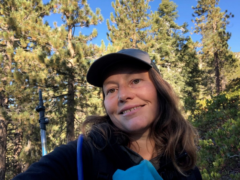
About me
I’m Serafina! I’m a writer and California girl who loves to go exploring. Hope you will get outside today, breathe some fresh air, and be happy!
Follow my Journey…
Be sure to Like and Subscribe to My Youtube Channel where I post videos!
Disclaimer: The work on this blog is my opinion and my opinion alone and I am not responsible for the outcome if someone were to apply these thoughts to their own life. All text and photography copyright 2023 by Serafina, all rights reserved. Information and opinions provided are kept current to the best of the author’s ability. All readers’ usage of the ideas and opinions presented in the blog, are at their own risk. Be aware of the possible dangers of hiking, surfing, walking, cooking, and other activities, which may take place indoors or outdoors. By reading this, you agree not to hold the author or publisher of the content on this web site responsible for any injuries or inconveniences that may result from reading the blog, or partaking in any activity mentioned in the blog. Read the blog, and use its ideas, if you so desire, at your own risk.
