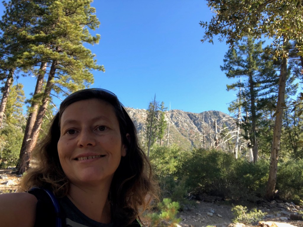
I set out to hike the Mount Hawkins Loop on a beautiful fall day. October is by far the best month of the year for hiking to peaks above 7000 feet, since the weather is just about perfect.
A Fall Hike
October is a small window for hiking to peaks close to 9000 feet, or more. I had been wanting to do the Mount Hawkins Loop hike for some time. Part of the draw was hiking to two peaks in a day, Mount Hawkins, and South Mount Hawkins. But I came to find there were two more peaks in the mix, being Middle Hawkins, and the even lesser known peak Mount Sadie Hawkins.
Who is Nellie Hawkins?
Who was this person named Hawkins, which these peaks were named after? I didn’t know much about the history of the peaks. They are situated within the Sheep Mountain Wilderness, near Windy Gap, and Crystal Lake. I had been to neighboring areas before such as Dawson Gap, where I hiked to Throop Peak, and Burnham Mountain. After a bit of research I found the mountains were named after Nellie Hawkins, a waitress at a restaurant called the Squirrel Inn which once was in operation, along the north fork of the San Gabriel River.
Hiking from Crystal Lake
I had not yet hiked from the Crystal Lake trailhead yet, even though it is a popular one. I was excited to check out this area, and explore the San Gabriels. Part of the adventure is not knowing what to expect, when you’re exploring a new place. I know that hiking up to Mount Islip is a popular hike, but Mount Hawkins, and the Four Hawkins for that matter, get little press. With the highway being closed all the way to Windy Gap, I knew there would be far less people on the trail than usual.
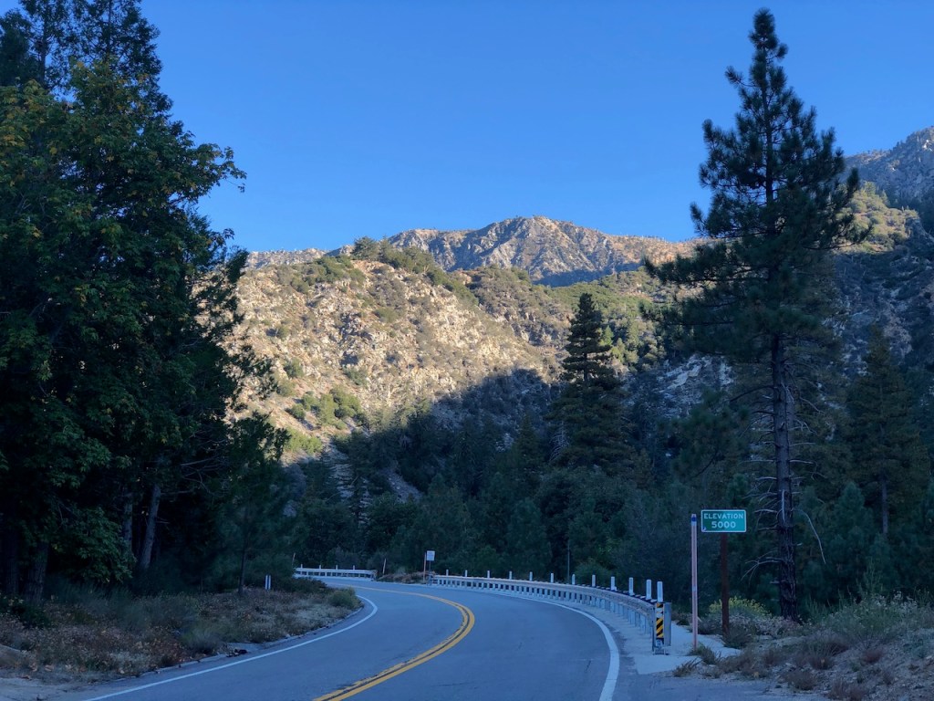
The Drive
I drove up Highway 39, which was narrow, and winding. As I climbed higher through the canyon I began to pass many road bikers, also climbing the narrow strip of highway. I knew the adventure had already begun, just getting to the trailhead. This was no ordinary highway. It runs through a rugged area of the wilderness, with a large reservoir directly in the center of it all. I was heading into the heart of the San Gabriels. This winding road had me on my toes, and for about 40 minutes I headed steadily along, passing a large dam, and several trailheads, making my way to Crystal Lake Campground.
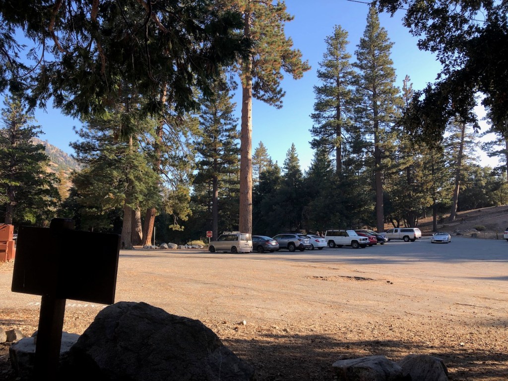
The Trailhead
I made it into Crystal Lake Recreation Area, making a right. I drove in towards the campground, and found my way to the trailhead. It seemed kind of crowded here, and I can see why, with all the scenic beauty of this area. I made a note to come back here soon and camp. The parking lot was filling fast when I arrived around 9am.

The Campground
The Crystal Lake Campground is actually only $12 per night, which is a real bargain. The gate is open from 6am to 10pm daily, which must be factored in, when deciding when to hike here. Also be sure to check for road closures here if you go. Highway 2 was still closed, due to several landslides, brought on by a stream of atmospheric rivers hitting the LA mountains, last January.
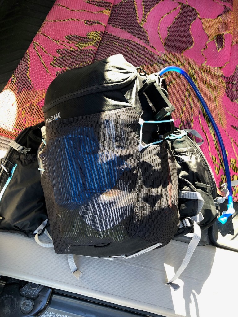
Being Prepared
I gathered my essentials, and decided bringing my medium size hydration bag would suffice. This would be a 6 hr hike, and I was bringing 3 liters of water along.

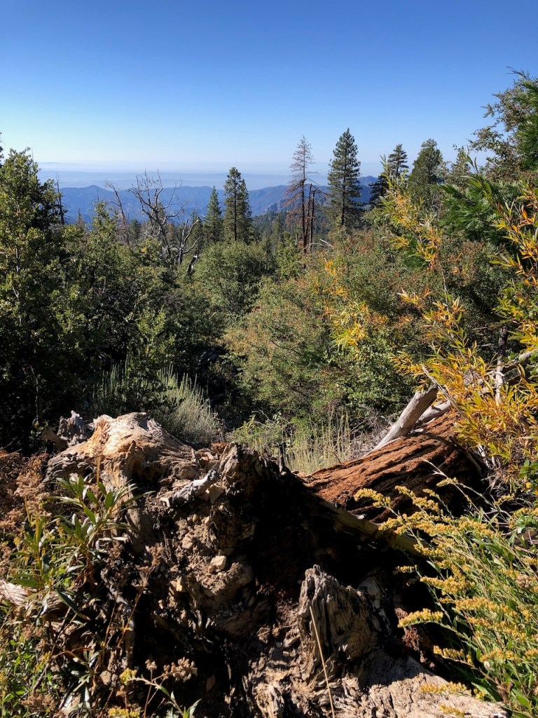
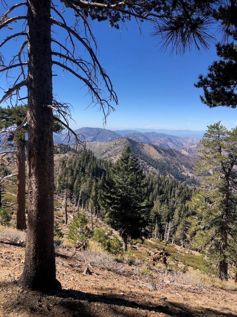
An Oak Forest
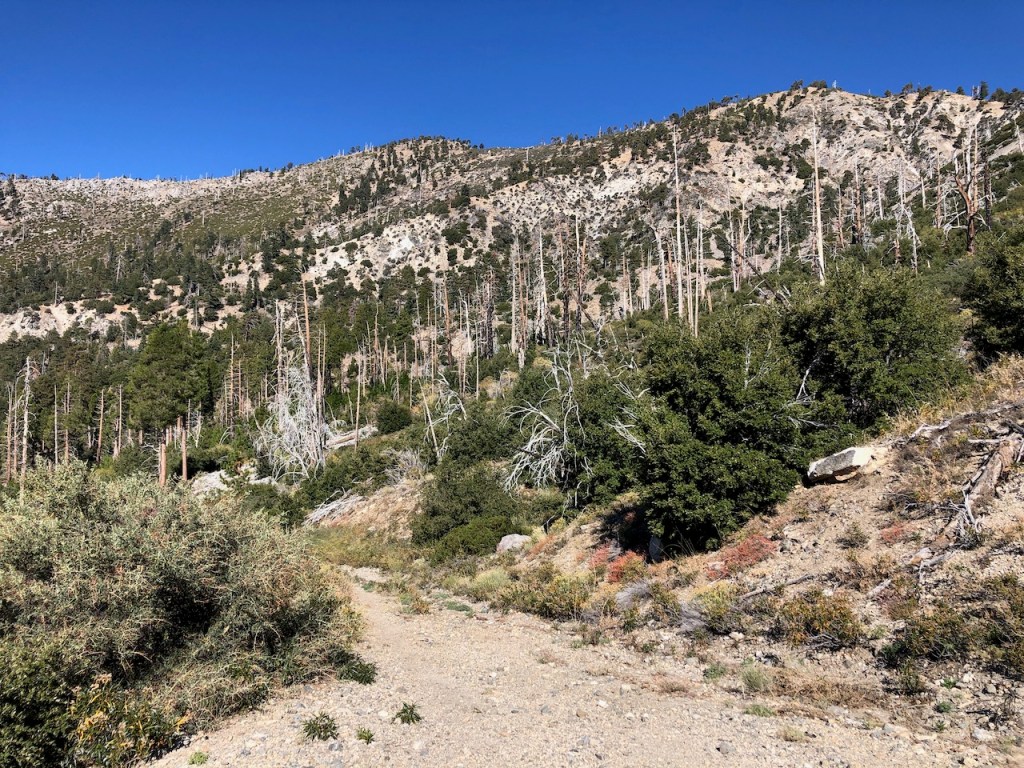
The hike started off uneventfully, and I was feeling pretty good at the start, but noticed I needed to acclimate a bit. I was not very high up in altitude at this point, but in spite of that, I still needed to take my time. I made a few stops to acclimate for the first two miles. The trail steadily climbed through a shaded oak and pine forest at first.
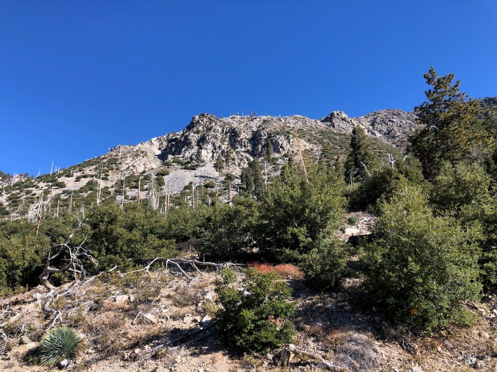
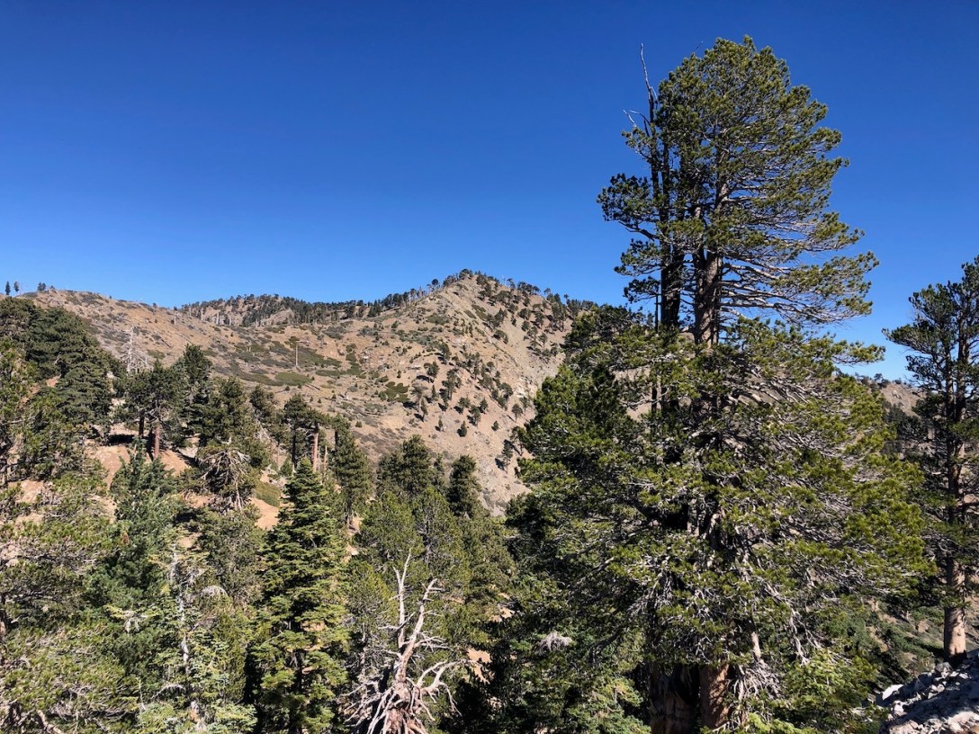
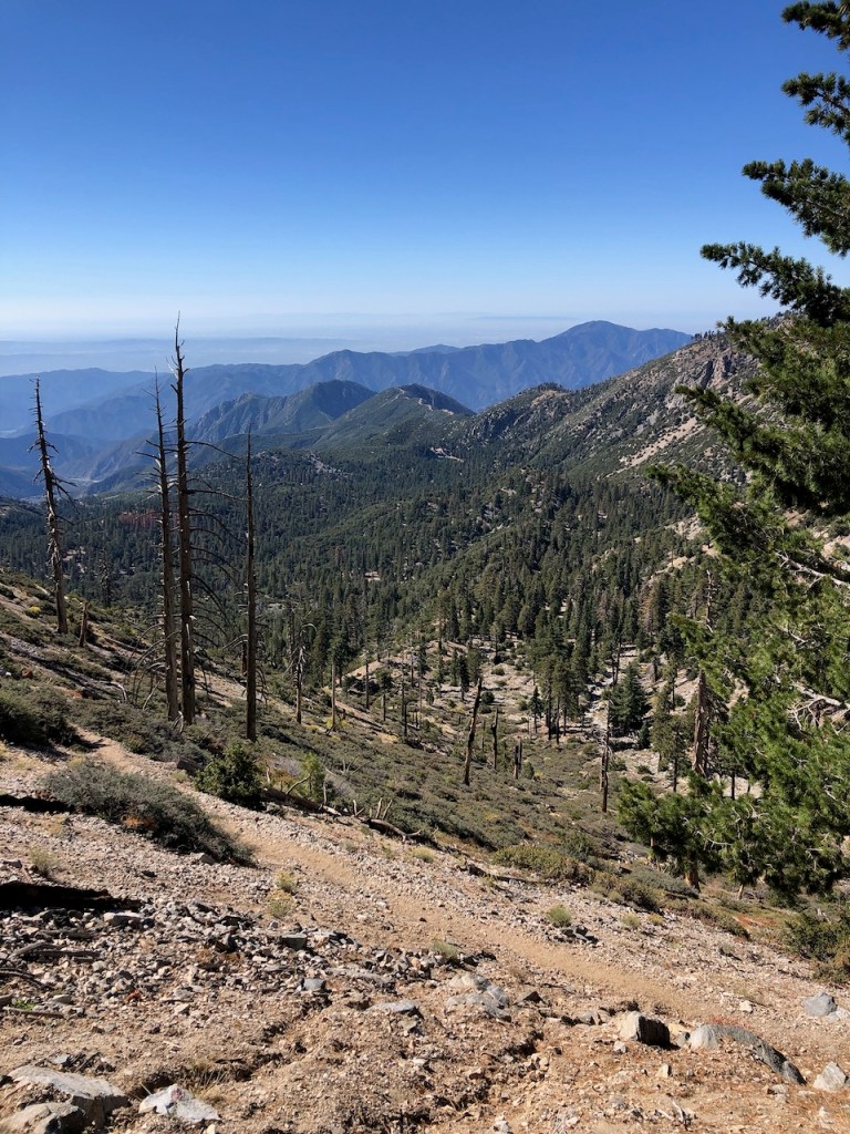
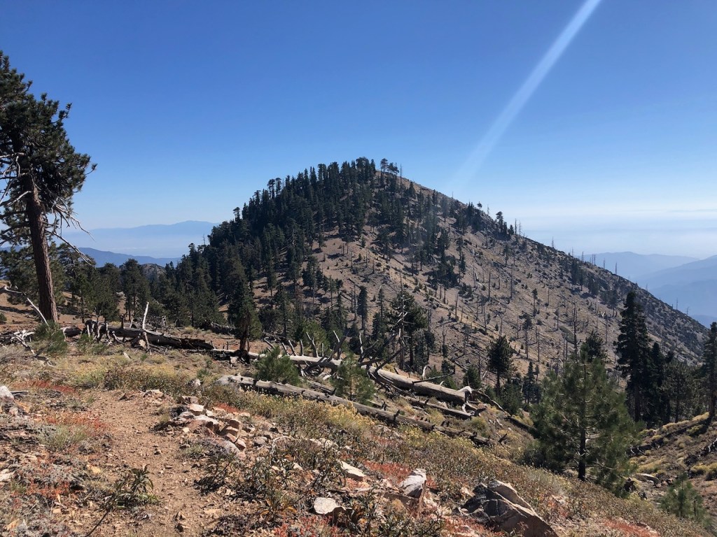
Eventually I could see the mostly barren granite topped ridge line in the distance, above the treeline.
History and Mystery
There is a certain level of mystery about a place, before you actually go there yourself. I had read all I could about the history of this place before I drove up here today, but there are always still more surprises in store. Everything was new to me, though maybe not to people who frequent this place, and I was looking forward to making my own discoveries.

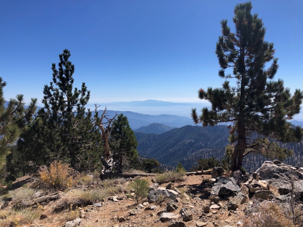
An Alpine Bowl
It felt like I was hiking within a giant bowl or amphitheater, with Crystal Lake Campground in the center. The views got better, as I continued hiking steadily up the trail, gaining several hundred feet over the next hour.
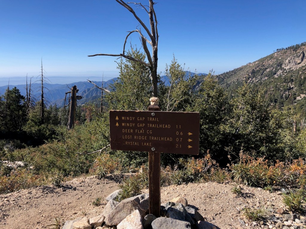
Decisions
I eventually reached some signage, and a fork in the road, where several trails meet. To my left was a trail leading up to Mt Islip via Big Cienega Trail, and to my right was the trail to Windy Gap, which is the one I would be taking. There was a third trail to the far right, which was Mt Hawkins Rd. That was the way I would have to come back, if I was to hike to the Mount Hawkins Loop.
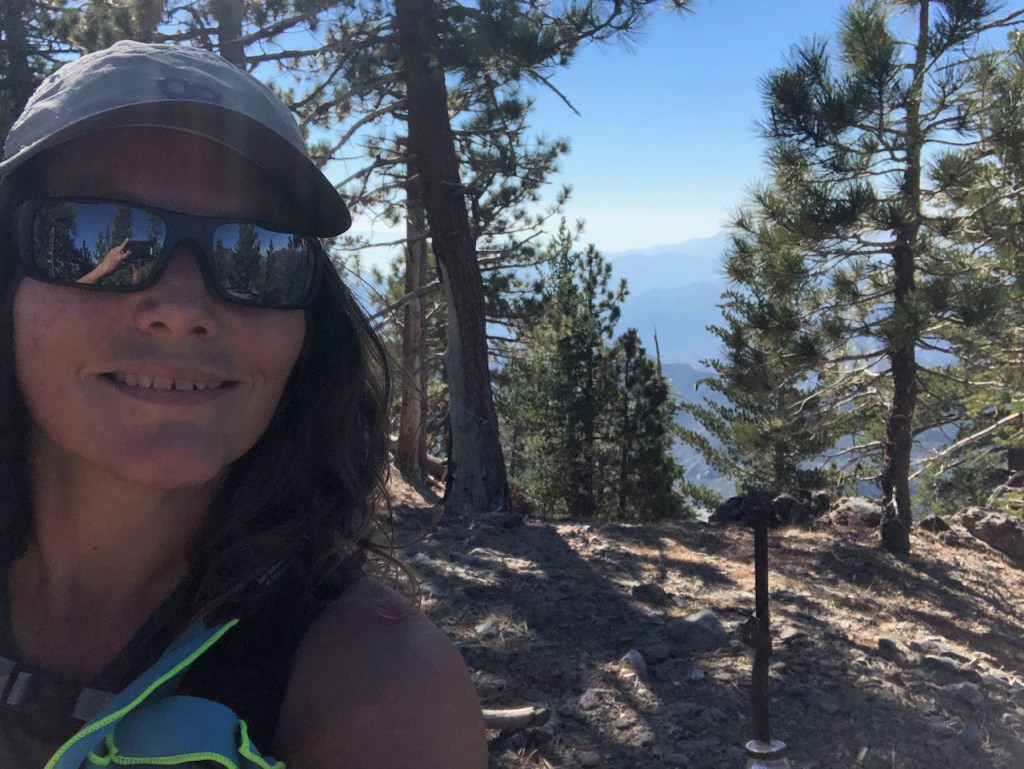
Solo Hiking By Choice
I enjoy hiking alone, and testing my own levels of endurance, challenging myself to individual goals I set for myself each time. But sometimes you need help, out in the wilderness. Even if you have hiked solo for years, you can have a bad day, twist an ankle, or get injured. Having friends around to help can be a huge blessing. A group of three older men hiking together, had stopped to rest here. One of them first offered me candy and then to join me, both of which I declined.
An Epic Hike
But today I was on a much anticipated longer loop hike, and part of why I enjoy hiking is overcoming challenges, going on epic hikes. Becoming mentally strong is a lifelong process. Hiking combines mental and physical toughness. At the same time, it is essentially one front in front of the other.
Away From It All
I love the simplicity of hiking. You do need some basic gear, and essentials. What you carry with you can be simple or complex. My best days have been when I have my trail running hydration bag, and just a few things. Less is more, but sometimes you need to be a little more prepared than usual if you are venturing farther into the wilderness alone, away from civilization. This would be one of those occasions, and I had my Garmin In-Reach along with me as well.
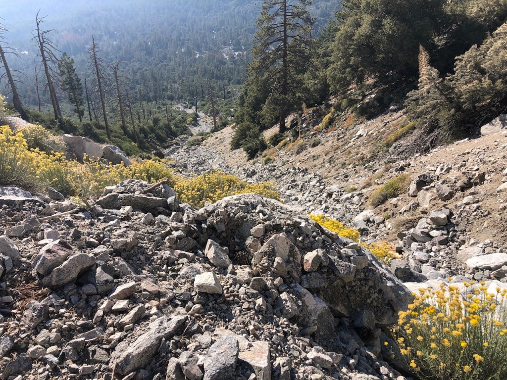
Washouts
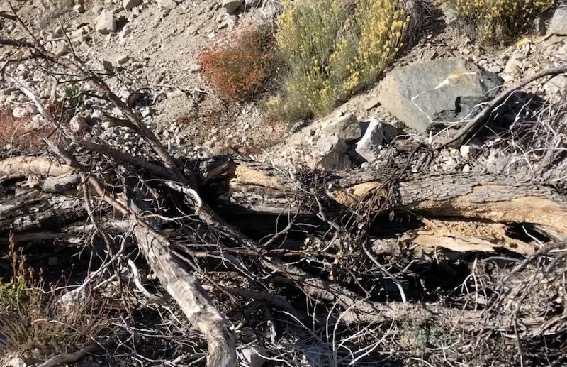
After making a right onto the trail toward Mount Hawkins I noticed almost immediately that the trail had some damage. As I crossed a wash, and a big gully created by a previous rockfall, I encountered several large downed trees. They were tossed here and there like matchsticks. I maneuvered around the obstacles before me, and returned to the trail.
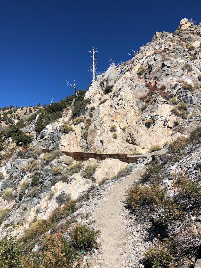
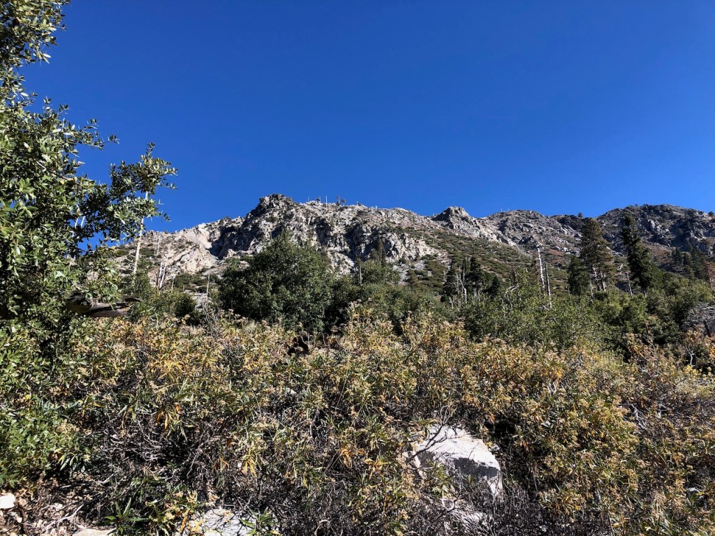
Cliffside
I climbed higher taking in more of the beautiful scenery. The trail clung closely to the cliffside. There was evidence of erosion control measures along the way. The area is prone to rock falls, and I watched my step, so I would not roll an ankle on a loose rock. There was a steep drop off to my left along this section.
Switchbacks
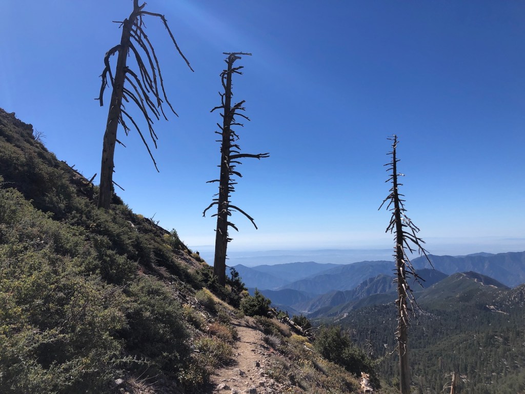
The steep switchbacks kept on climbing higher. There were a handful of standing deadfall trees, and not much shade along the way. At one point the trail had narrowed to less than three feet wide.

The Saddle
I continued up the switchbacks, and finally spotted Islip Saddle in the distance, which sits along with Highway 2, currently closed for repairs, due to a big landslide.
Mount Islip
It was not long before I spotted Mount Islip too. I climbed the last stretch of switchback, reaching the saddle, near Windy Gap.
As I made my way there, I heard a few voices down below in the distance, which may have been the group I encountered earlier.
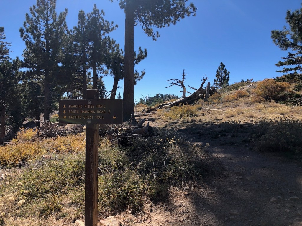
The Ridge
A small group was smiling and taking photos with their golden retriever there on the saddle. From here, the trails along the ridge line seemed well marked. There were signs leading up to Mount Islip to my left, Windy Gap was straight ahead, and the PCT led to the right.

Signage
Since Mount Hawkins was not marked on any of the signs, I consulted alltrails. But I knew it was off to my right, along the PCT. I have spent a lot of time looking at maps. Even without alltrails, I had a good idea of what peaks were this way or that way. I recommend doing the same, before you take a hike in the wilderness.
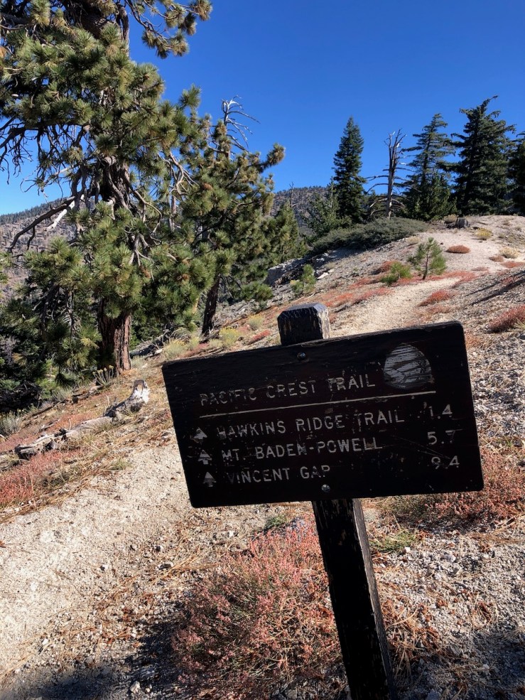
The PCT
I always get kinda excited anytime I hike another section of the PCT, even if it’s a small one. I was fortunate to get a chance to hike part of PCT Section A, earlier this year. I still have about 20 miles left of it, which could easily be checked off my list with just a 2 day overnight trip.

25 Miles Left To Go…
The only plausible way to do that last section would be to drive there, and hitch my way back to the part I left off, leaving my car at Scissors Crossing. I had been debating for some time, when to go about that. Maybe over Thanksgiving I will attempt it. The second option would be to go with a group, leaving a car on each side. The last option is talking a friend into giving me a ride at the beginning, leaving my car at the end.

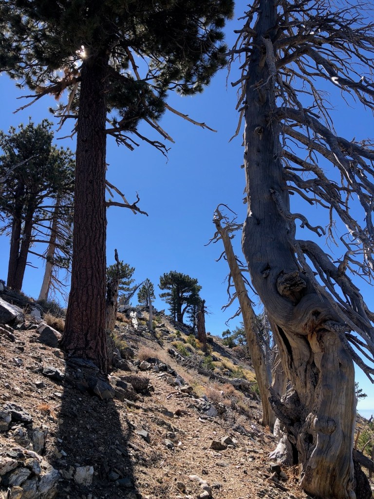
Another knobby pine, like something out of a Dr. Seuss novel, and that you might find hiking above 8000 feet.
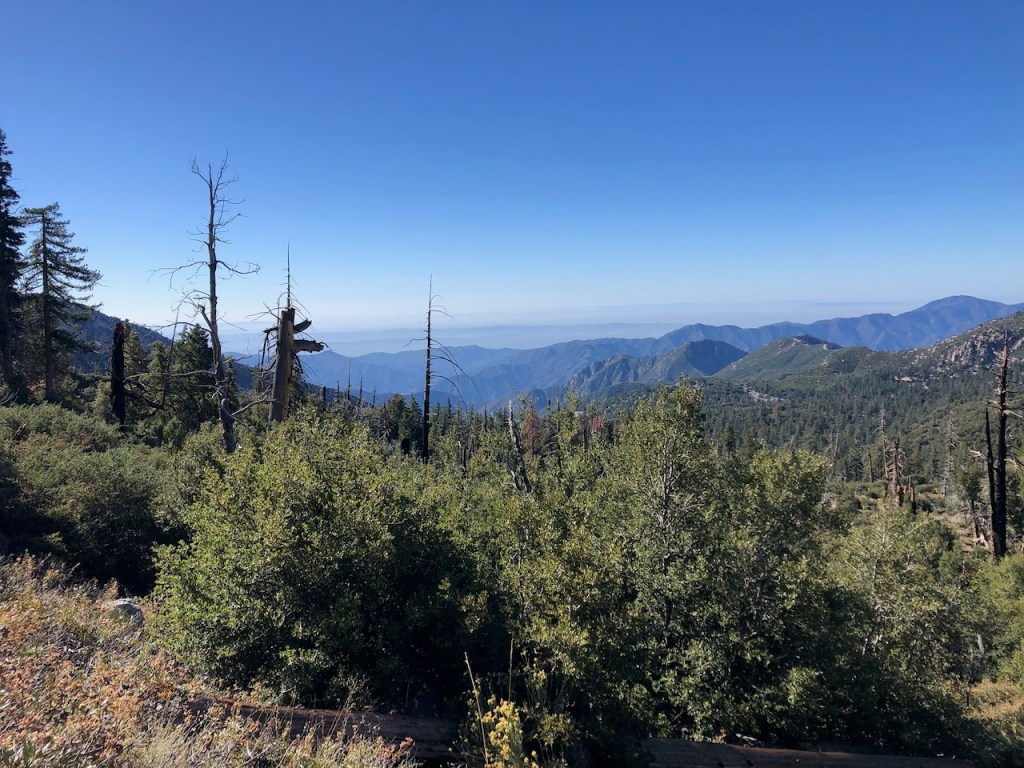
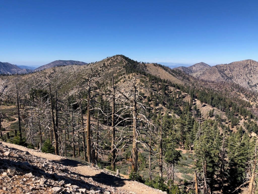
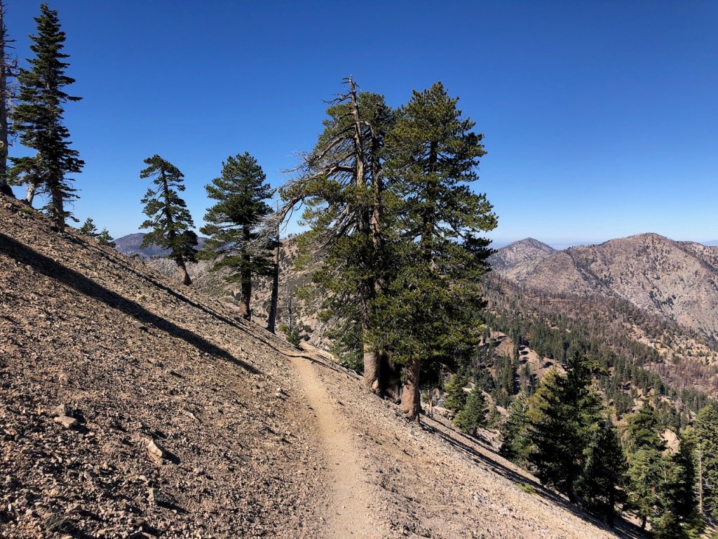
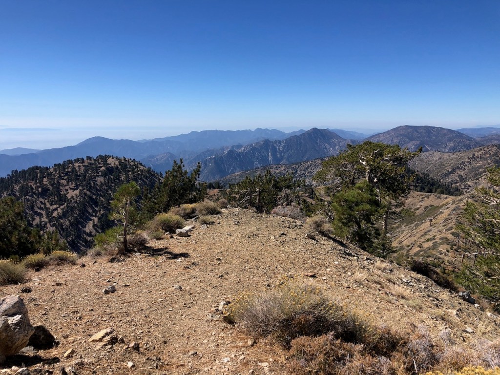
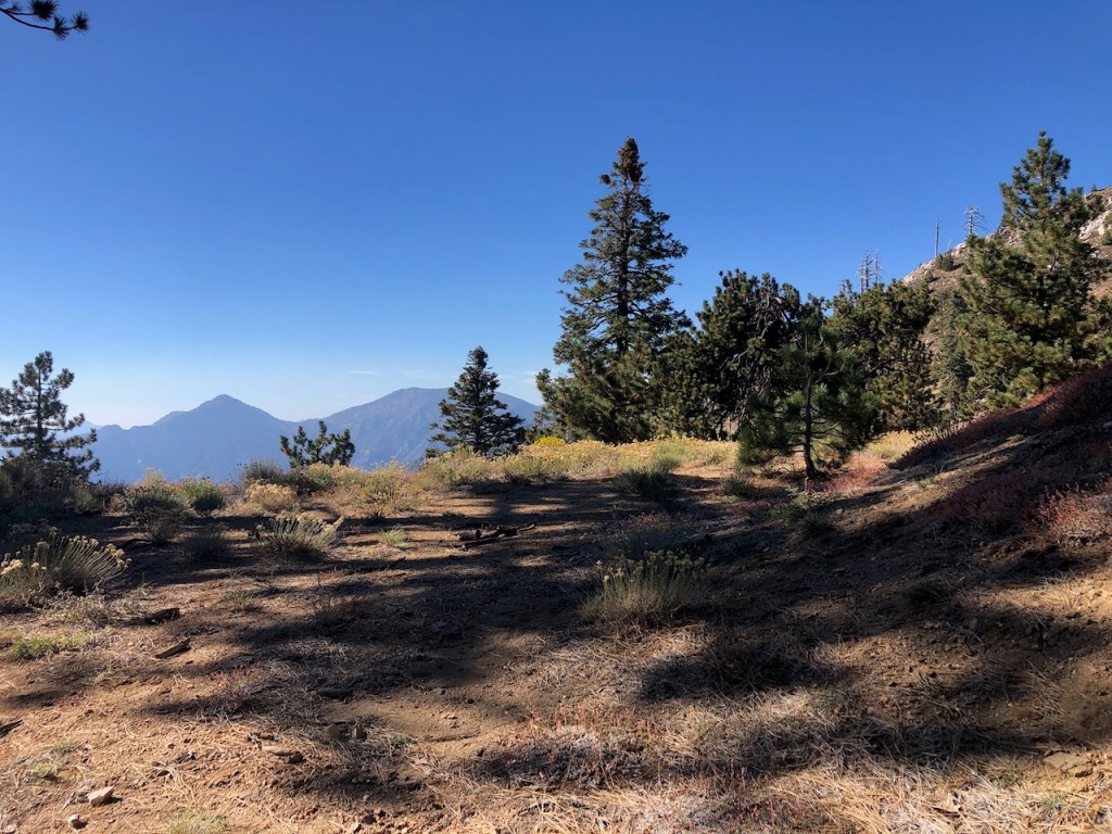
The Alpine Zone
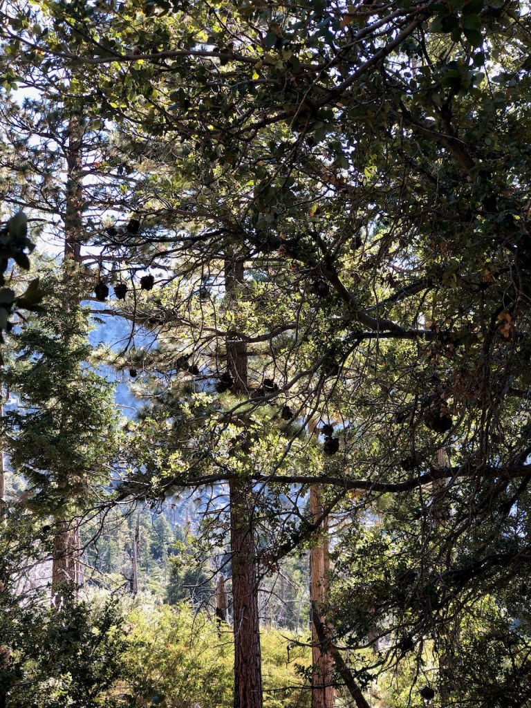
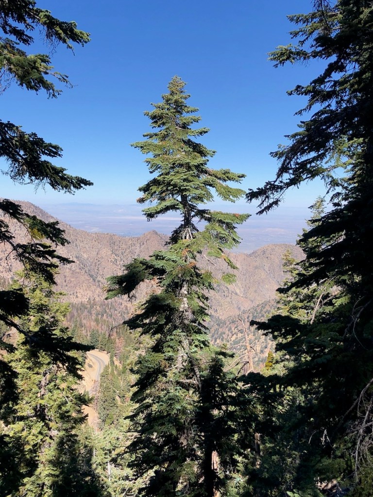
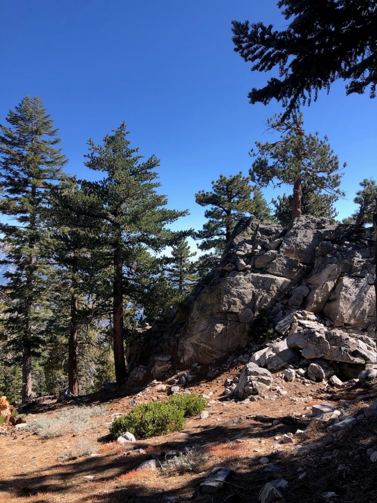
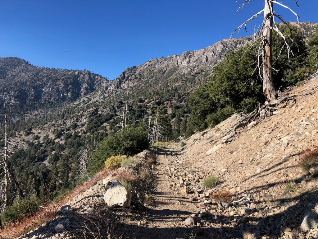
I hiked on, heading east from the saddle, along the PCT. The trail was well shaded, and was maintained. It was a rocky landscape, with lots of evergreens, mostly pines, and cedars.

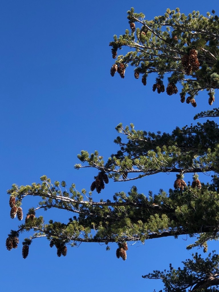
I walked through the beautiful alpine forest of pines, and cedars, noticing the large pine cones of the Ponderosa Pine.
I was enjoying all this beauty so much. I would love to have a cabin someday in the mountains, where the picturesque scenes I enjoy so much are just outside the my door.

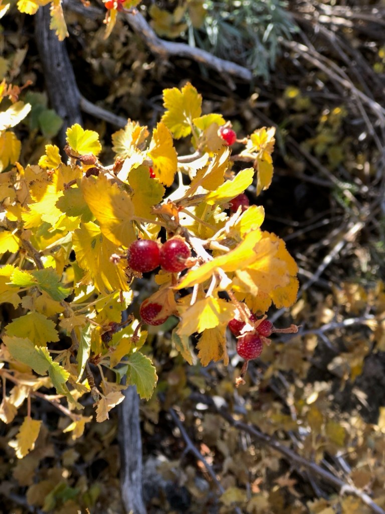
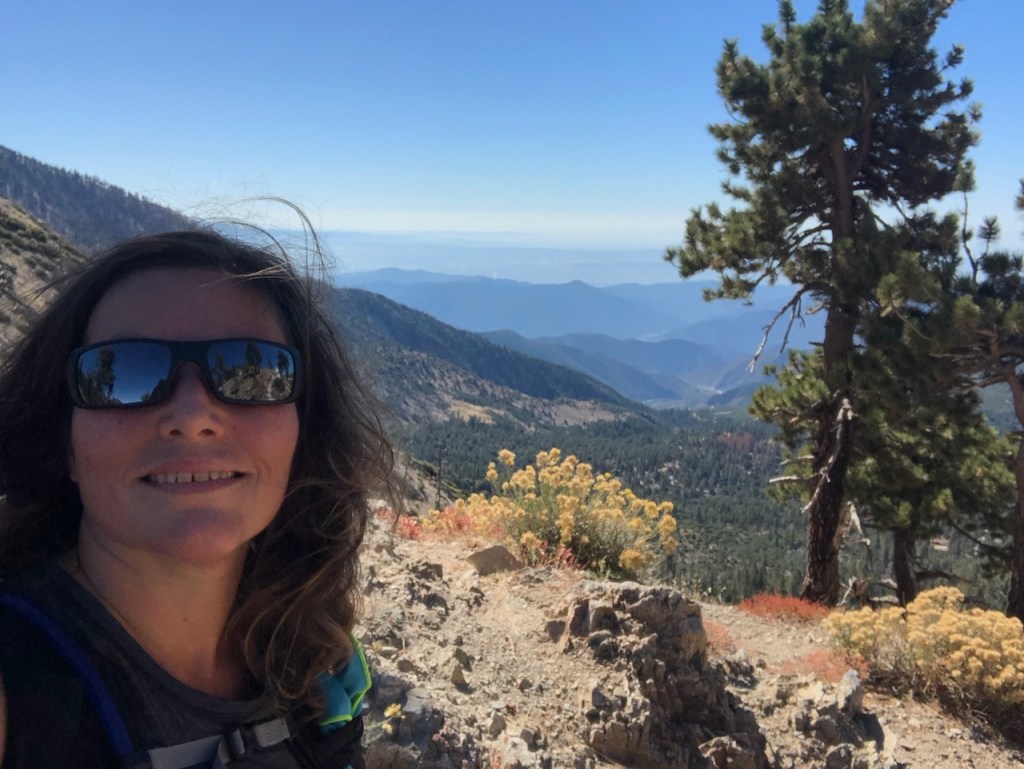
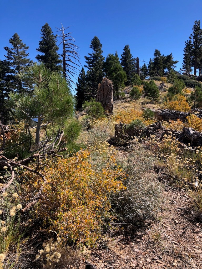
Wildflowers
I noticed flowering bushes along the ridge, with bright yellow flowers, and tons of butterflies. Summer was long past, everywhere in socal. But high up in the mountains, flowers were still in bloom even late into October. Winter would arrive soon, and the window for these types of alpine climbs was drawing to a close. Lingering snow and ice well into July, caused a delay in hiking at altitude.

Chasing Peaks
I was grateful to be back in these mountains once again. So far, I had summited several nearby peaks such as Mt Baden Powell, Mt Burham, and Throop Peak. Now I was on my way to hiking up the Four Hawkins. Since I have a goal of hiking to 100 peaks, but it’s funny that I have actually lost count of them all. I will have to go back through my photos, and figure it all out sometime soon.

The Impassable is Passable
Eventually the trail became overgrown with my least favorite plant that grows at high elevation, thorn bushes.
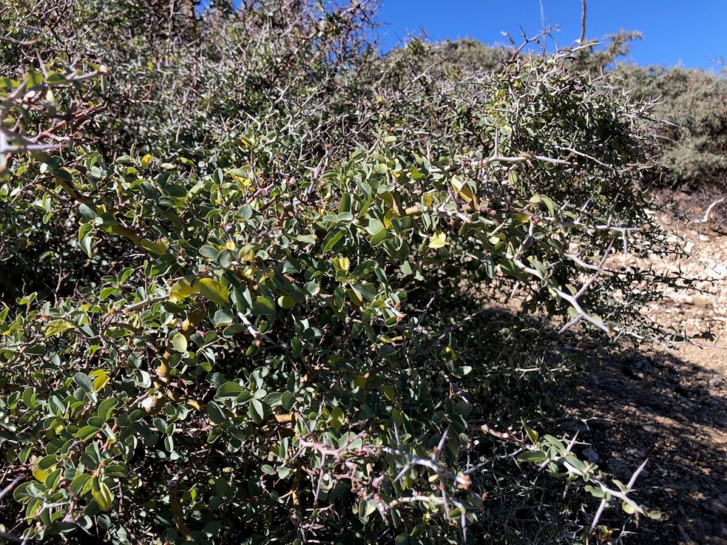
At times the trail seemed practically impassable, but I made it through mostly unscathed this time.
Alone for the Most Part
Eventually I met the turnoff for South Mount Hawkins, just after two older ladies hiked on past me, and not long after that, a lanky long haired guy, wearing a pair of pink yoga pants passed by. They say hike your own hike. All were hiking in the opposite direction on the PCT towards Windy Gap in the opposite direction. These three would be the last hikers I would see all day, and I would be all alone out there the next few hours.
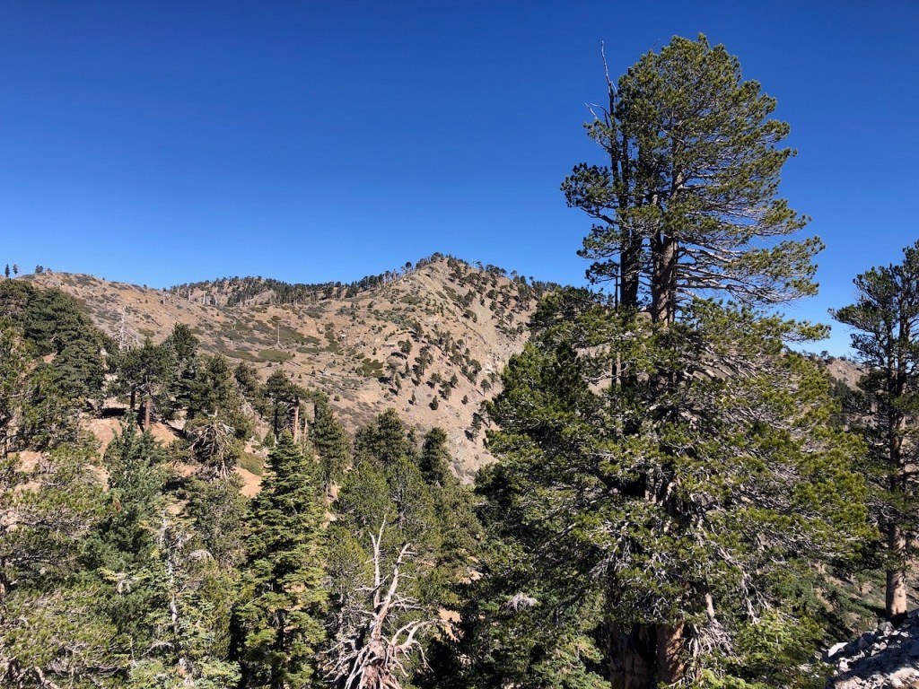
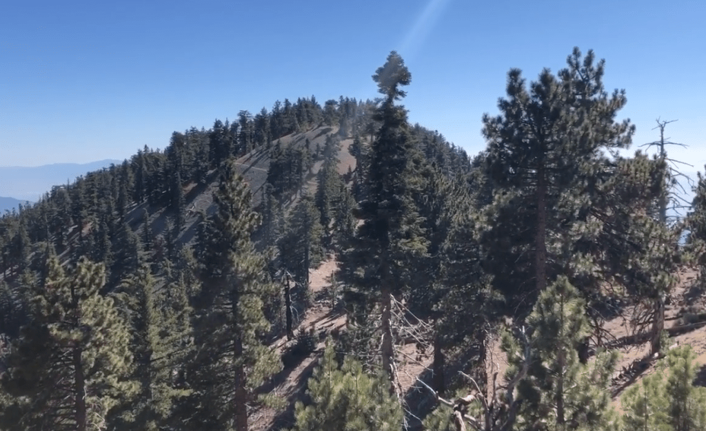
Off in the distance was Mount Hawkins, and I continued my steady climb along the ridge.
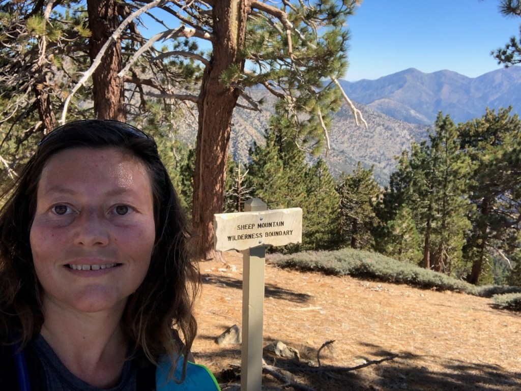
Sheep Mountain WIlderness
Eventually I noticed a sign off to my right reading Sheep Mountain Wilderness. I came to find this 41,833 acre wilderness area was created in 1984 with The California Wilderness Act. It spans two counties, Los Angeles and San Bernardino County. Some other notable hikes here are Iron Mountain, and the Bridge to Nowhere.
I knew Mount Hawkins had to be close by, and this gray sign was seemed to be an indicator of sorts. I had my alltrails+ app to guide me, and confirmed this was indeed the turn-off for Mount Hawkins.
There was a very slight trail, leading to the summit of Mount Hawkins. I only had a bit less than a hundred feet of climbing to go. Mount Hawkins was in my sights.
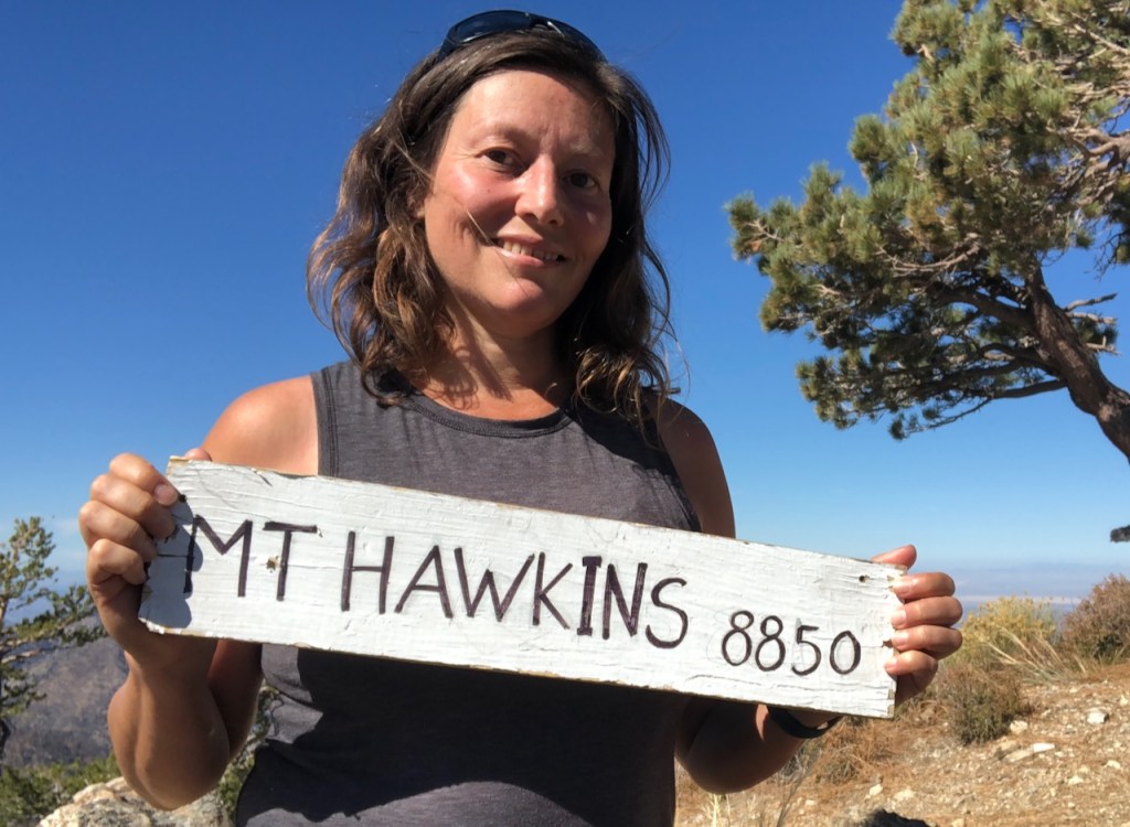
Mount Hawkins
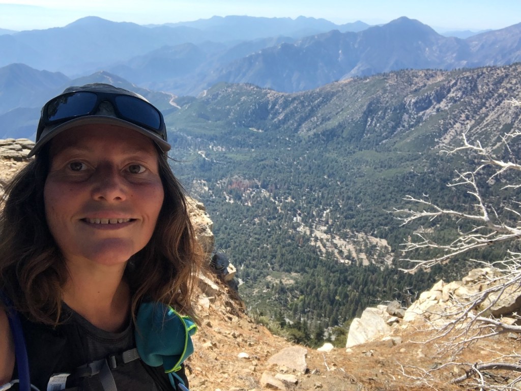
I made it to the summit of Mount Hawkins (Elevation 8783)! It had taken me about 3.5 hours to get here to the peak, with 3500 feet of gain, over about 6 miles. This was the highest point of my entire hike today. According to alltrails, it would have been 4.6 miles. Since alltrails is never right, I was almost certain this 12.6 mile hike would end up being at least 14 miles.

The Climb
When I am in average shape, I handle 3500-4000 feet of climbing just fine. If I go above that, I tend to feel the effects of my climb for at least a week. I was feeling pretty good at this point. The rest of the trail seemed to be mostly downhill. But it would have plenty more uphill, if I was to bag the other three peaks.
Taking a Breather
I spent about 15 minutes on the summit, in the sunshine, enjoying the views. Nothing about Mount Hawkins was disappointing, and turning back now, going back the way I came, would have made for a great hike in itself. I considered that option for a moment. But sometimes when you’re all in on something, you’re just all in.
Along the Ridge
I continued back to the turnoff for South Mount Hawkins, and made a left. I continued jogging down to the South Mount Hawkins Trail. In this photo on the left is Middle Hawkins, my next stop.
This trail was well marked, and was along a rollercoaster-like ridge. After a steep descent I was at the foot of Middle Hawkins.
I began to climb steadily upward in the hot midday sun. The rock was loose and slippery on this trail.
Middle Hawkins
Once atop Middle Hawkins (Elevation 8508 ft), there was no peak sign to be found. I thought this peak was really pretty, and it had a nice rock outcropping to sit upon, to enjoy the view for a moment. If you were going to do just two peaks in a day, then Middle Hawkins, and Mount Hawkins would be the two I might pick. But read on to hear about the other two peaks I would explore, because wait…there’s more.

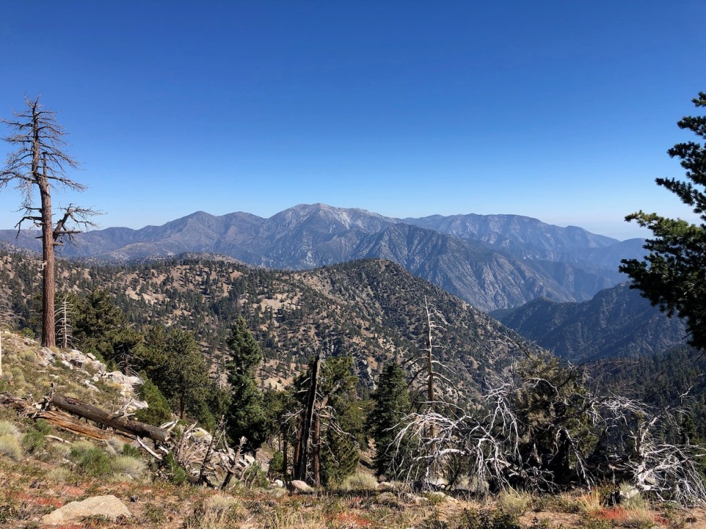
I stared down toward Highway 39 below. It was a winding 40 minute drive to get here today. The highway was barely recognizable from way up high on this ridge.
Glitching
Alltrails kept glitching in this area a lot. It kept needing to be closed, and re-loaded for some reason. There was no trail continuing on from Middle Hawkins, without backtracking, so I made my own. I passed a beautiful rock formation, as I descended Middle Hawkins, off to my right. It was comparable to Castle Rock in Big Bear.
A Slippery Slope
I continued down a slippery slope-side. I was on the lookout for wildlife, and snakes, as I walked through heaps of pine needles. I was either off trail, or the trail was lost under all the pine needles.

Tinder Dry
This ridge looked like pure tinder, and I tried not to think about it too much. Since September to October is fire season here, I was not here at a great time of year but during the driest season. But since this year was a bit wetter and cooler than usual, it was not as tinder dry as it could be. Also, there were no Santa Ana winds blowing. Whew…
Pine Tree Lane
On I went down the hillside, in search of the trail, and Mount Sadie Hawkins. I passed by more interesting rock formations, and eventually met up with the trail again, which was laden in pine needles.
Another Hawkins
Mount Sadie Hawkins was now in my sights. As I approached it, edging closer, I was not even sure I had enough time to add in this peak, since it was getting late. I had a birthday dinner to get to. There are so many peaks to climb and so little time.

Off Trail
There was no actual trail to this peak either, so I did my best to cut switchbacks up the steep slope laden with even more deep piles of slippery pine needles. The sun shone right in my face during this climb, and it was the warmest part of the day. But I was undeterred. I wanted to see this peak for myself, after hiking so far, for so long.
Sadie Hawkins
Here I was, standing atop Mount Sadie Hawkins (Elevation 8048 ft), a mountain I never knew existed, until just this week. Again, there was no peak sign, or usgs marker to be found. The view was somewhat obscured by trees. Some peak are just that way. You never know until you go.
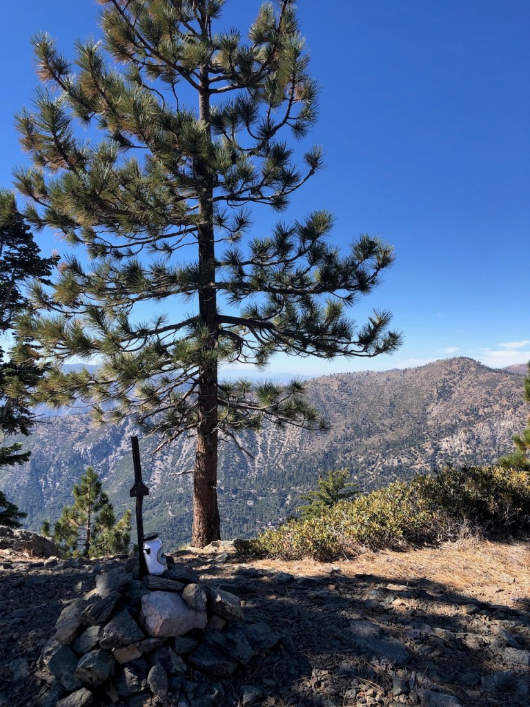
An Iron Marker
There were some great views here, and even an iron marker, with a hiker box made out of a jar. I have seen these types of peak markers at numerous peaks, such as Wright Mountain near Mount Baldy. This one was more like a small rusty fence post though. Sometimes, that is all there is, and a pile of rocks. The views from this peak was stunning, though not as sweeping as that of the two previous peaks.

I continued down the back side of Sadie Hawkins, towards the last peak of the day, South Mount Hawkins. There was a somewhat dense forest here, and through it, I set my sights on my last peak of the day.
Bushwacking
I chose the best path possible down Sadie Hawkins, in search of the trail. Alltrails was insanely helpful during all this, when it was not glitching every 5 minutes, and needing to be re-loaded. I had to shut down the app, and find the map again in my saved maps each time. It was such a pain. But somehow I kept getting it to work again. I crossed through many more heaps of pine needles, navigating between fallen trees, large burls, and clusters of big shrubs.
Mountain Meadows
With not a soul around, I crossed a grassy mountain meadow filled with shrubs, which also was very dusty. South Mount Hawkins was now clearly in my sights. The plants in this section looked ragged, brown, and withered, typical of late fall. It was October, and most of the greenery had faded to yellow here. I had hiked over 10 miles at this point, and was starting to feel a bit tired.
I came to where Hawkins Road meets the trail to South Mount Hawkins.

Follow the Signs
I proceeded up the steep narrow singletrack to the peak, rather than take the fire road. According to the sign, I was just two miles from the PCT, should I choose to hike back the way I came. Actually, it was more like 3 miles were you to backtrack from here.
vIt was dusty, rocky, and narrow on the singletrack leading to Mount Hawkins, but the views down into the valley were spectacular.

Again, I had an excellent view of the corridor I was driving up, just a few hours ago. There is no road quite like Highway 38, which resembles an octopus from the trail above.
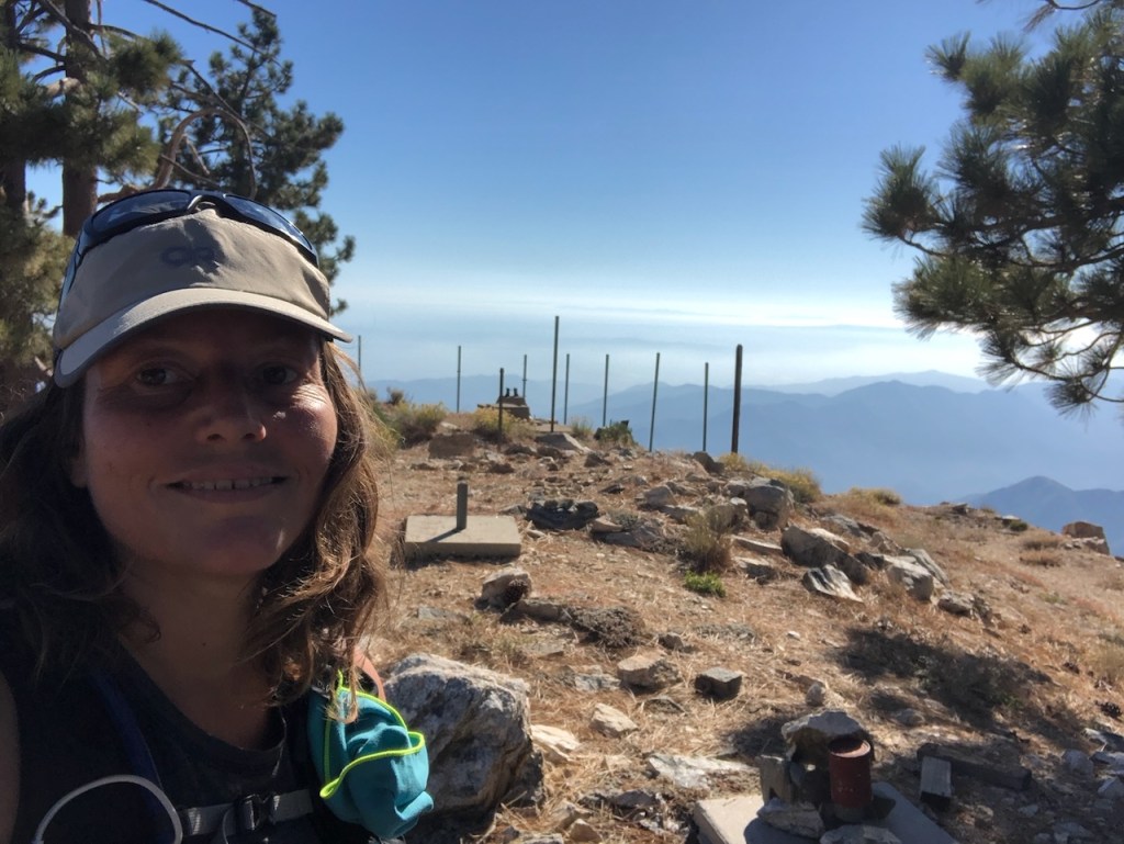
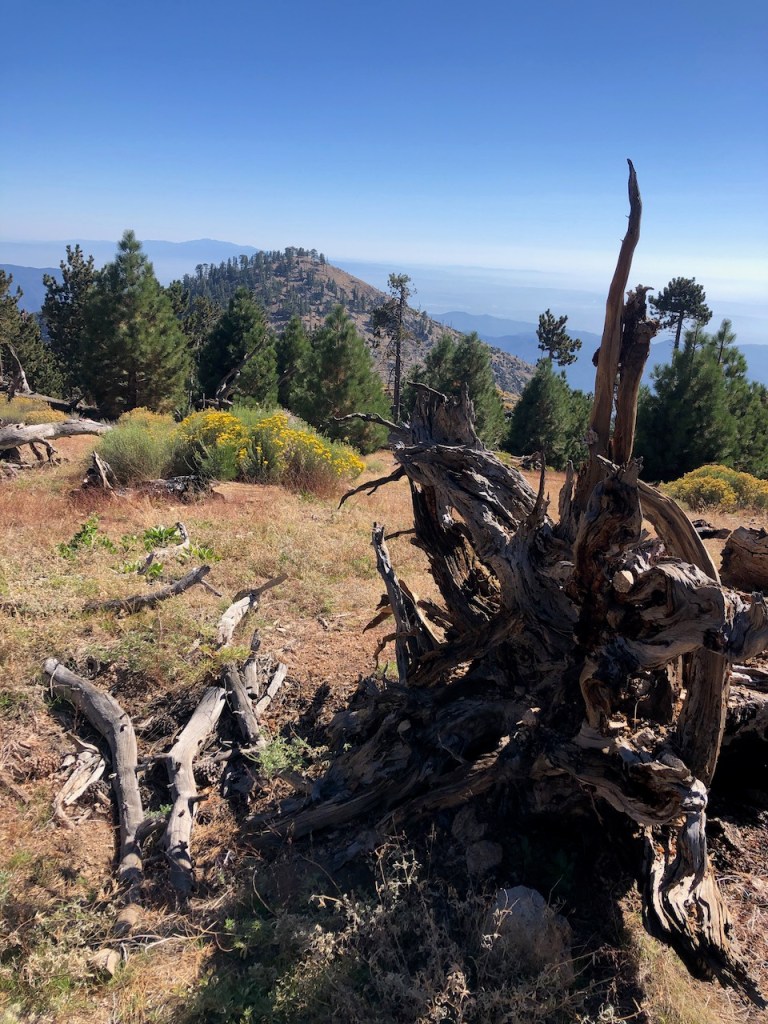
South Mount Hawkins
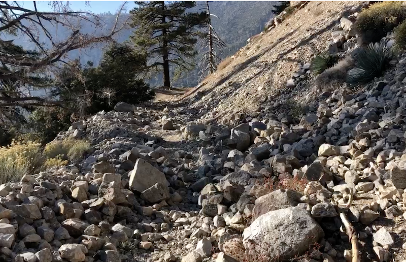
I finally made it to my last peak of the day, South Mount Hawkins (Elevation 7773 ft). This was my second time hiking to four peaks in a day. The ridgetop here was barren, with just a concrete slab, and the remnants of what once stood here, an old fire lookout tower. Again, there was no peak marker or sign atop South Mount Hawkins. I had officially checked off another peak from the Sierra Club’s Hundred Peaks List. After a brief rest, I headed on back only to realize I left my hat, 5 minutes later. I ran back up to snatch it, before heading back down the same narrow trail I came up on, to connect with the much wider South Mount Hawkins Road which I would hike back to Crystal Lake Campground.
Hawkins Road
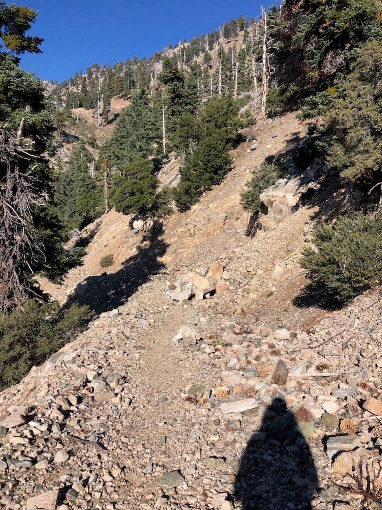
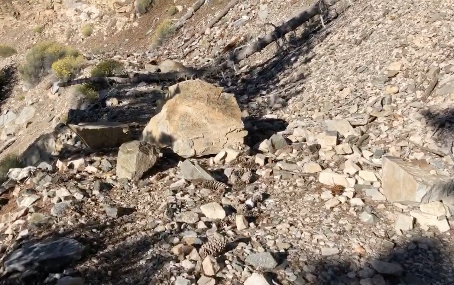
I headed back down the steep trail, veering to the left, on to Hawkins Road. At first, it seemed like a typical fire road, similar to Baldy Road, which I have hiked up many times. That road is great for trail-running. But it quickly grew rockier and more treacherous. There were huge rock falls, and several ravines, one after the other, which had to be crossed. It was hard to tell if they were newly formed, or had accumulated over time. Either way, Hawkins Road did not feel like a safe place to be hiking by a long shot. A tall cliff with rocks which could fall at any moment hovered above me. Nothing about this place felt safe.
An Obstacle Course
I did my best to jog down the road despite all the rocks strewn here and there, since I was running out of my allotted time. The hike had taken longer than anticipated, and I wanted to make it back in time for my dinner plans. Sometimes long hikes and dinner plans don’t play well together. The rutted, sometimes borderline impassable fire road continued for about 2 miles or so. Eventually I made it back to the turnoff, where I would veer left back down toward Crystal Lake Campground.
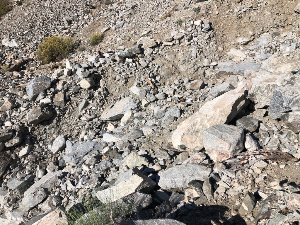
Rockfalls
Yes, this was the tail. I was so relieved to have passed through that rocky section of trail. I felt slightly put off that not one person on alltrails mentioned how treacherous it all was. The steep cliff sides lent themselves to rock falls. There was no way this road could ever remain clear, given the sheer rocky cliffs hovering above. I was grateful not to fall victim to a large falling rock or boulder, since it seemed more probable than usual on that stretch, than typical on most of my hikes.

Hiking is Not Safe
Would I recommend hiking on Hawkins Rd.? I definitely would not. Would I go back again? No. I felt safer on Mount Whitney. But I had a few takeaways. Hiking is not safe, and I was glad I overcame my fears, crossing several rock filled ravines. I explored a new area, without much to go on, and I was happy with how I handled it. When in doubt, keep going, back to your car, which I did. Option B would have been to climb almost 2000 feet again, and hike back in the dark.
Just in Time
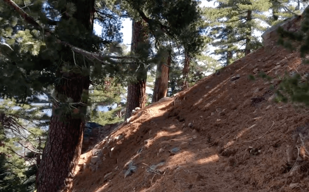
I proceed downhill on the woodsy, brush filled trail for about a mile or so to Crystal Lake Campground. I jogged as fast as I could, even where it was rocky and narrow. I felt relieved as I passed through the shady oaks, an indicator I was back where I started. I would make it back just in time for a celebratory dinner with family and friends. Birthday hike 2023 accomplished. I wanted to do an epic solo hike in the wilderness, and I got one!
Leave No Trace
Just be sure to come prepared and follow Leave No Trace principles to keep the wilderness pristine for future hikers.
Like and Subscribe to my Channel!
I hope you enjoyed reading this, and it is helpful in knowing what to expect, should you decide to visit here.
About me
I’m Serafina! I’m a writer and California girl who loves to go exploring. Hope you will get outside today, breathe some fresh air, and be happy!
Follow my Journey…
Be sure to Like and Subscribe to My Youtube Channel where I post videos!
Disclaimer: The work on this blog is my opinion and my opinion alone and I am not responsible for the outcome if someone were to apply these thoughts to their own life. All text and photography copyright 2023 by Serafina, all rights reserved. Information and opinions provided are kept current to the best of the author’s ability. All readers’ usage of the ideas and opinions presented in the blog, are at their own risk. Be aware of the possible dangers of hiking, surfing, walking, cooking, and other activities, which may take place indoors or outdoors. By reading this, you agree not to hold the author or publisher of the content on this web site responsible for any injuries or inconveniences that may result from reading the blog, or partaking in any activity mentioned in the blog. Read the blog, and use its ideas, if you so desire, at your own risk.
