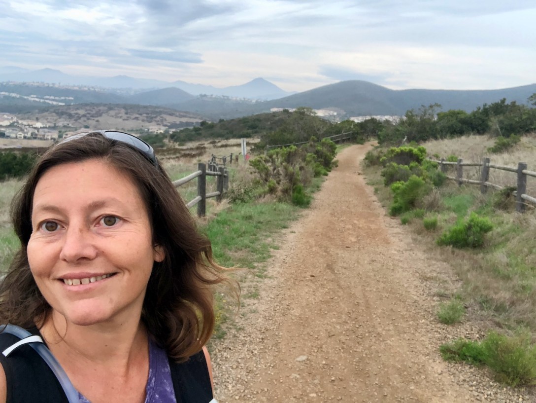
I recently visited the 2,352 acre Black Mountain Open Space Preserve, one of the gems of San Diego County. I decided I would hike the Black Mountain via Miner’s Ridge trail. It earned its name, since the mountain has a history as an old mining area. I could not help but feel somewhat nostalgic, walking in the footsteps of miner’s of the past. There are lots of reasons I wanted to hike up Black Mountain, in part since I have a goal to hike to 100 peaks. There are so many reasons I love peakbagging, and you can read more about that here.

It was getting close to sunset, on a cool overcast fall day when I arrived at the parking area.
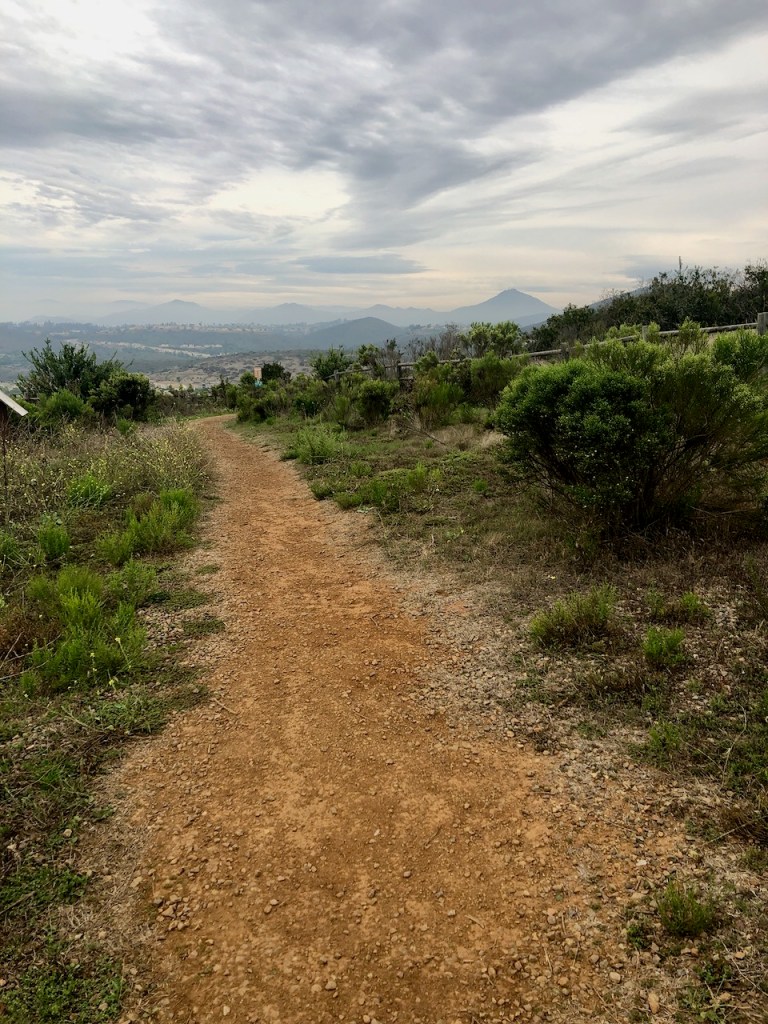
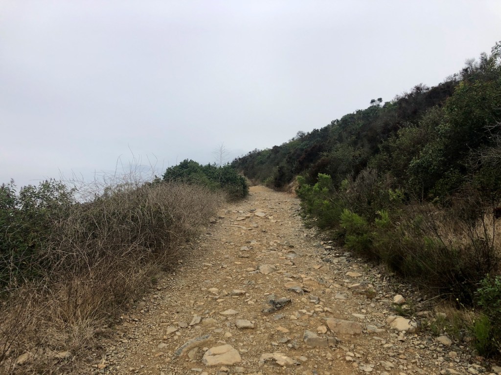
I headed off to the left of the trailhead, and began my hike up Black Mountain via Miner’s Ridge. The trail started out flat, and wide, with nothing technical about it.
Native Plants
It’s been a wet year in California, and our summer was not as hot, or dry as it could have been. New shoots from fallen grass seed had sprung. The hills here were still quite green, even though it was late fall.

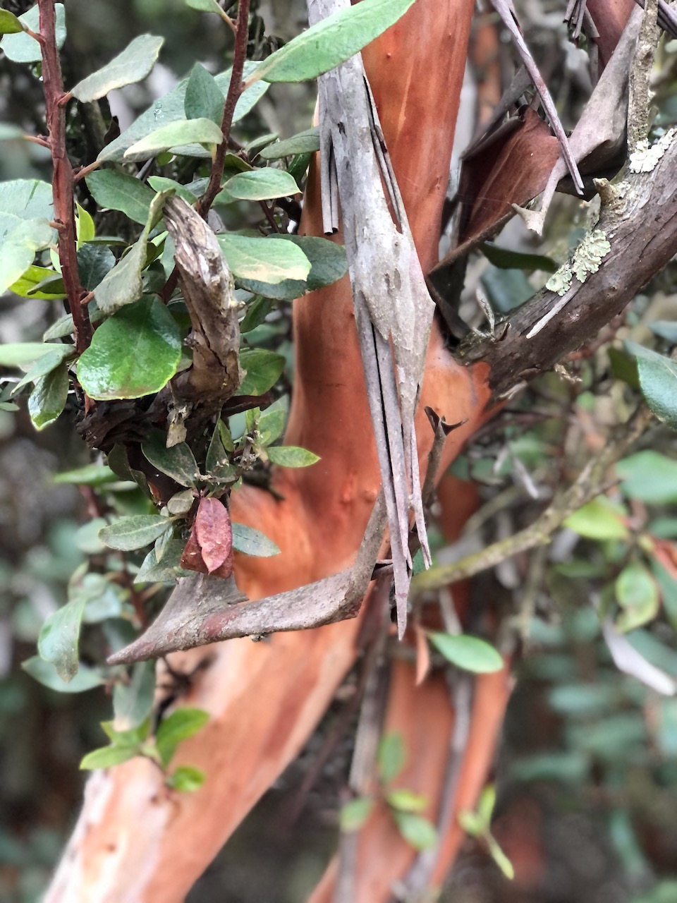
Plenty of native plants and shrubs, were still green, and flowering.
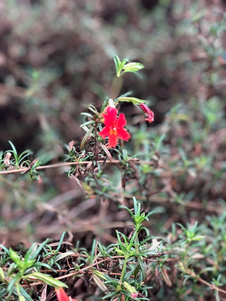
There were even a few wildflowers in such as Red Monkeyflower, in bloom late in the season.
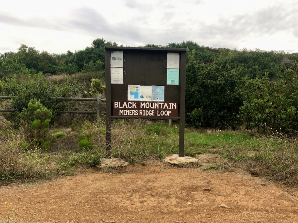
Miner’s Ridge
There were so many trails to choose from in this open space, such as Nighthawk Trail, and the trail from Hilltop Community Park. It was tough to choose which one, not having hiked here before. I chose a shorter trail, since it was close to dark, and I did not want to find myself on an unfamiliar trail in the dark, all alone. This open space preserve is a place you can really get in some miles. The path seemed well traveled and maintained setting off. There were just a few people out and about near the parking area, but it was not crowded.
Singletracks
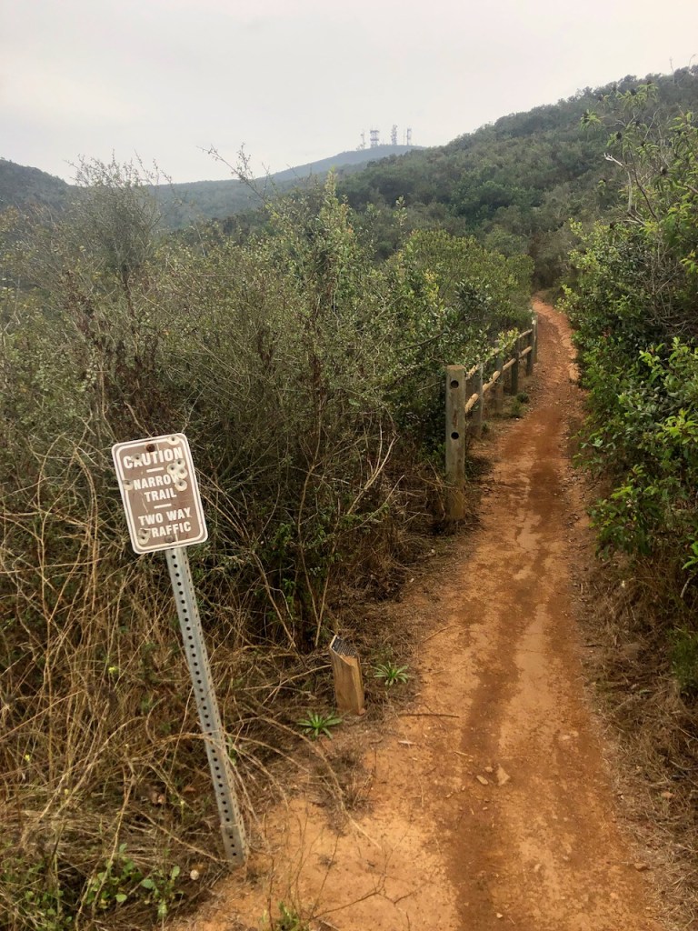
As I continued down the trail, it began to steepen, and became more rugged, along with being a narrow singletrack. Mountain bikers began to pass me, and I would encounter several groups of them as I climbed. The trail I chose is apparently a popular downhill mountain biking path. It looked fun and challenging. But I was not here to bike, but to hike, so I had to take care, listening for the sounds of spokes, as cyclists don’t always have a bell on their bikes.
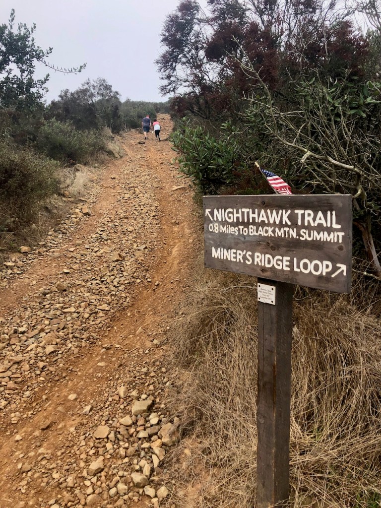
Nighthawk Trail
I came to Nighthawk Trail, which meets up with Miners Ridge Trail, and made a right up a steep rugged incline. It was at this point I noticed two groups of hikers, one heading up the ridge, and one descending down Nighthawk. This section would prove to be the buttkicker of the hike. I was definitely getting in my climbing, and my cardio now.
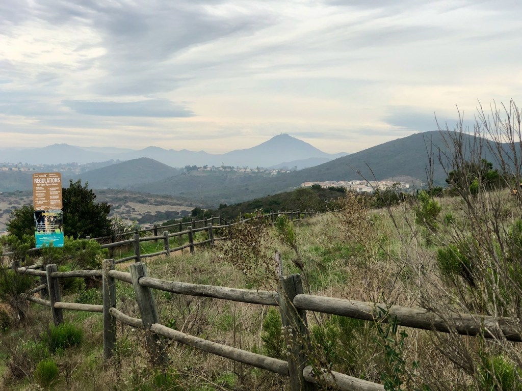
The Fire Road
At the top of Nighthawk, the trail widened into a fire road, which would lead me on up to the summit of Black Mountain. Along the way I passed by several benches, to sit and take it all in.
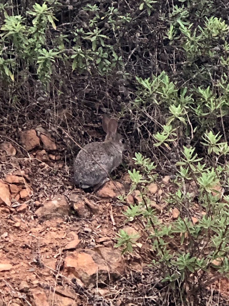
The scenery grew ever more breathtaking the higher I climbed. I happened to spot a few critters too.

I glanced down toward several trails below, and could see hikers, heading further along Miner’s Ridge Trail, and along Nighthawk Trail, both of which were wide fire roads.
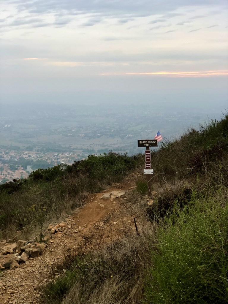
Black Widow
I passed a super steep looking trail called Black Widow, to my left, which I guessed was mostly for daredevils to fly down on bikes.
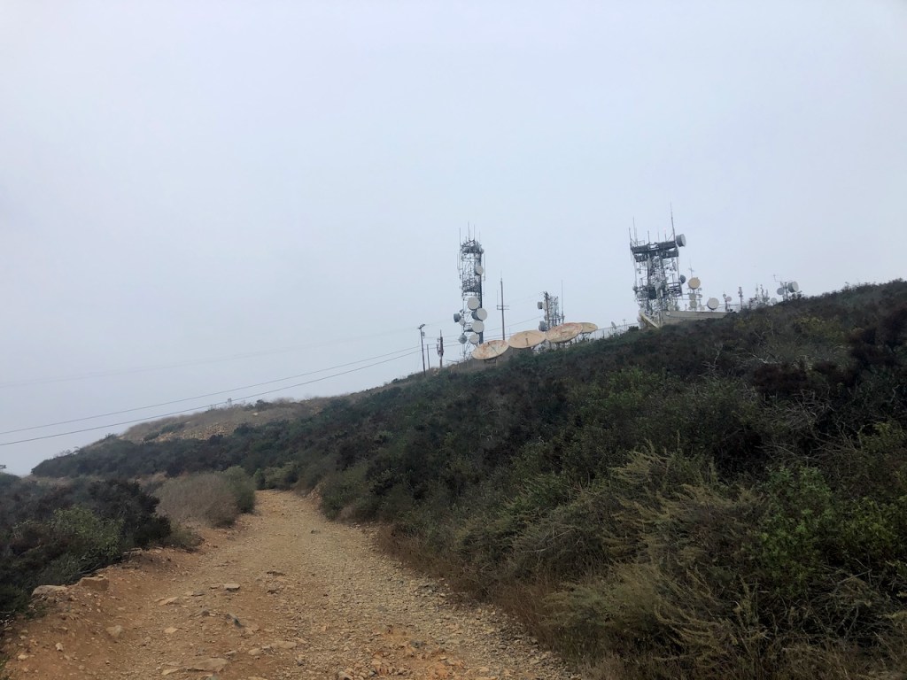
The Cell Towers
Before reaching the summit, rather than continue encircling the cell towers on the fire road, I took a short steep shortcut trail that I noticed. This got me to the peak much quicker.

Black Mountain Elevation 1558
I was now standing on Black Mountain. The sun was setting quicker than anticipated. There were benches to sit and enjoy it, but I instead chose to enjoy my Friday night, back in the safety of my car. As a solo female hiker, I try to play it safe. I don’t hike in the dark much at all, and if I do, I only will do so in familiar places. I easily found the peak marker, on the south facing side. It was easy to spot the flags waving, on the sign of Black Mountain.
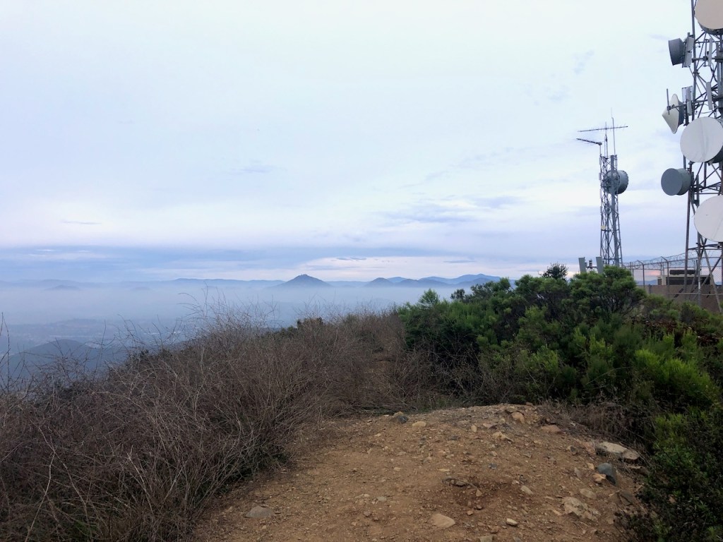
The peak was flocked with cell towers, and humming machinery, characteristic of many of San Diego’s peaks, such as Mount Woodson.
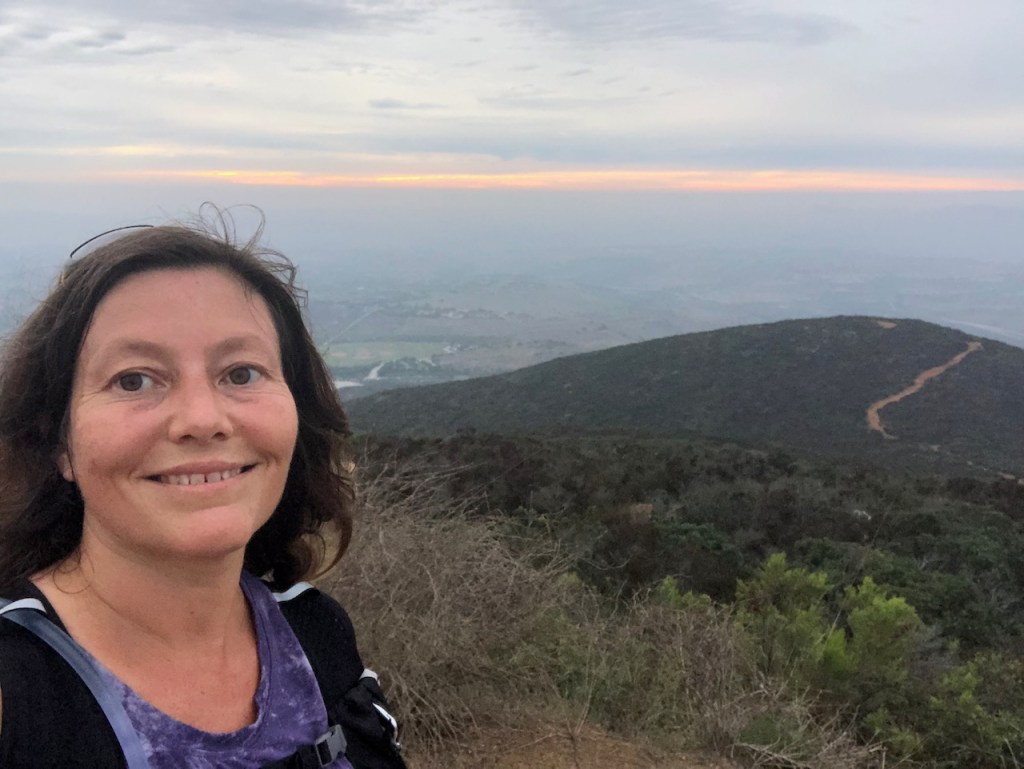
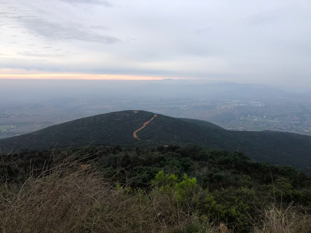
Sunset on the Ridge
After summiting Black Mountain (Elevation 1558 ft), I hiked down the super steep ridgeline, to the Secondary Summit (Elevation 1380 ft), on the Glider Point Trail, before cutting back over to Miner’s Ridge. I guess that makes this hike a two peak day!

Another Peak Climbed
Peak-baggers take note, since this was a relatively easy two peak day. I was only on trail for about an hour and a half, before I was back at my car. I jogged down the mountain to save some time, and make it back by sunset. As always, this peak sort of made my day, and my week. It was a fun accomplishment, and a great workout to boot.
The Open Space
This vast 2,352 acre open space begins at the northern end at Lusardi Creek, near Rancho Santa Fe, and extends south to Carmel Mountain Road on its south boundary. Its vast wilderness area is sandwiched between the suburban communities of Rancho Penasquitos, and Carmel Mountain Ranch. There are so many more trails to choose from here, which is why this is one of the more popular hiking areas in San Diego County, along with Iron Mountain, Los Penasquitos Canyon Preserve, Lake Hodges, and Mission Trails Regional Park.
The History of Black Mountain
This mountain had history, and some mystery attached to it, since it was home to the Black Mountain Mine, also referred to as the As-Au Mine. They mined arsenic along with Molybdenite, until the 1920’s here. This was before arsenic was revealed to be a carcinogen to humans. At the time it was sprayed on farm fields, to combat bow-weevils. Anywhere there were mines, you know there is pollution associated with them. It is a dirty business, and cleanup can take decades.
Contaminated
The mountain was also contaminated, until a recent cleanup in 2017, and re-opening. Mining is a dirty business, and causes pollution, which can be harmful to humans. That is something to keep in mind, if exploring old mines, or mining areas is your thing.
From the County of San Diego Website:
“During January 2017, the City of San Diego closed the Miner’s Ridge Loop Trail in Black Mountain Open Space Park out of an abundance of caution after preliminary readings of higher than normal arsenic was detected at Black Mountain Mine and adjacent to Miner’s Loop trail. After closing the trail, the City contracted Ninyo and Moore and staff from the University of San Diego to conduct a thorough study of the mine site and surrounding trails. A final report was provided to the City in May 2018.” The report concluded that while the impacted trails pose no imminent danger to the public, three sections of trails within the Black Mountain Open Space Park did register higher than normal naturally occurring arsenic readings and a recommendation was made to remediate those areas as a precautionary measure. The City completed remediation of the three sections of trails in late Spring 2018 and all Black Mountain Open Space Park trails are open for use. The Black Mountain Mine site will remain closed and will not be accessible to the public.
A capital project has been initiated by the City to permanently secure the Black Mountain Mine site and additional studies and analysis are ongoing. For questions related to the report, please visit the Parks and Recreation Department “Ask Parks” website.
I hope you enjoyed reading this, and it is helpful in knowing what to expect, should you decide to visit here.
About me
I’m Serafina! I’m a writer and California girl who loves to go exploring. Hope you will get outside today, breathe some fresh air, and be happy!
Follow my Journey…
Be sure to Like and Subscribe to My Youtube Channel where I post videos!
Disclaimer: The work on this blog is my opinion and my opinion alone and I am not responsible for the outcome if someone were to apply these thoughts to their own life. All text and photography copyright 2023 by Serafina, all rights reserved. Information and opinions provided are kept current to the best of the author’s ability. All readers’ usage of the ideas and opinions presented in the blog, are at their own risk. Be aware of the possible dangers of hiking, surfing, walking, cooking, and other activities, which may take place indoors or outdoors. By reading this, you agree not to hold the author or publisher of the content on this web site responsible for any injuries or inconveniences that may result from reading the blog, or partaking in any activity mentioned in the blog. Read the blog, and use its ideas, if you so desire, at your own risk.
