
I had not taken a vacation specifically in Sequoia National Park before this trip, although I had come here to begin the High Sierra Trail a year prior, hiking all the way to Mount Whitney. I was staying at Lodgepole campground for 3 nights by the Kaweah River.
On this trip I was on a mission to explore all the best trails of the park. Late season snow was lingering on the high peaks above 9000 feet, but the Lakes Trail was all but a mystery to me.
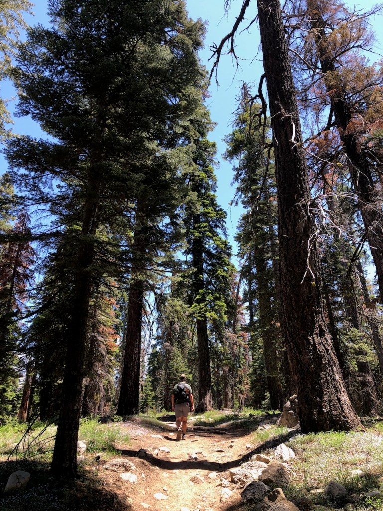
We hiked from the Wolverton trailhead about 6 miles roundtrip on this particular day.
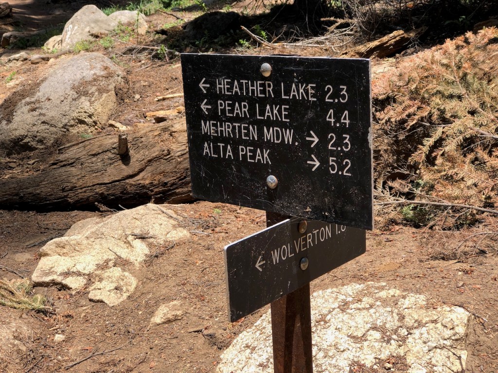
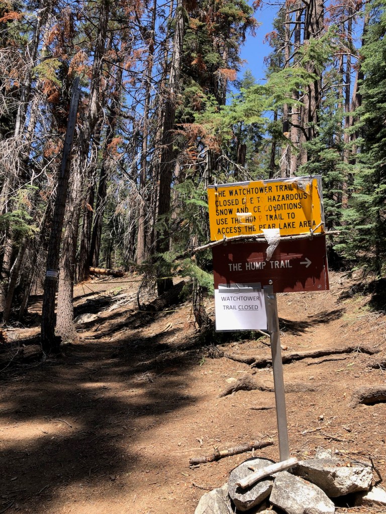
We did not know the Watchtower was closed, and planned on it as our final stop. That was until running into a ranger who let us know the situation with the trail closure. Heather Lake was our new destination.
After crossing a few creeks we continued on the Hump Trail toward Heather Lake.
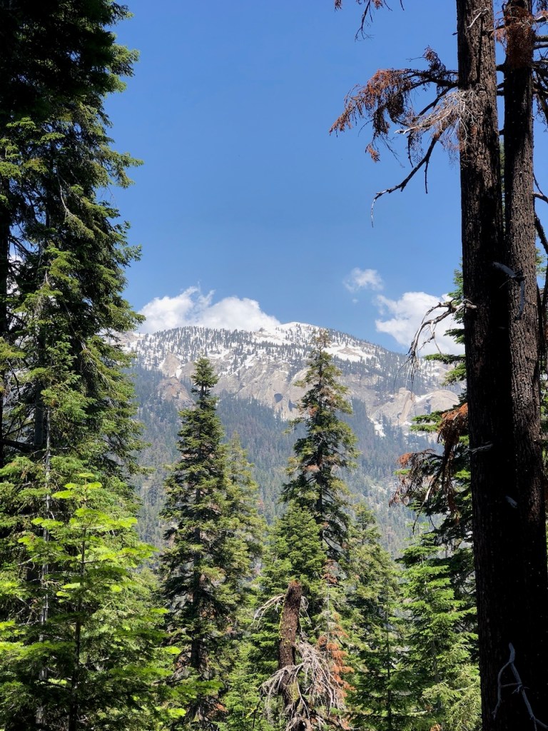
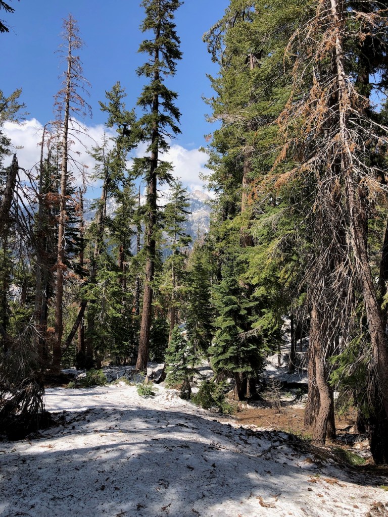
I could see Mount Silliman in the distance, and eventually Panther Peak.

There were yellow triangles on the trees marking the trail along the way. The trees were absolutely huge, and there were plenty of old growth pines along this stretch, not to mention a few sequoias.
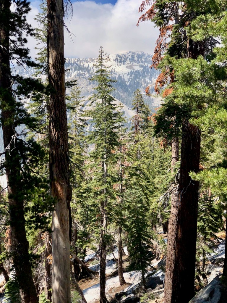
I could not tell if a storm was moving in out in the distance, as Mount Silliman began to be surrounded.

After climbing higher hoping the snow was just in patches, the reality set in. Be were above 9000 feet and this snow was planning on hanging around.
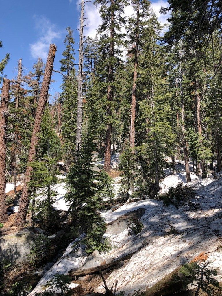
The choice was whether or not to cross a snow bridge over a creek in nothing but shorts, and trail runners. This was after about 3000 feet of climbing.
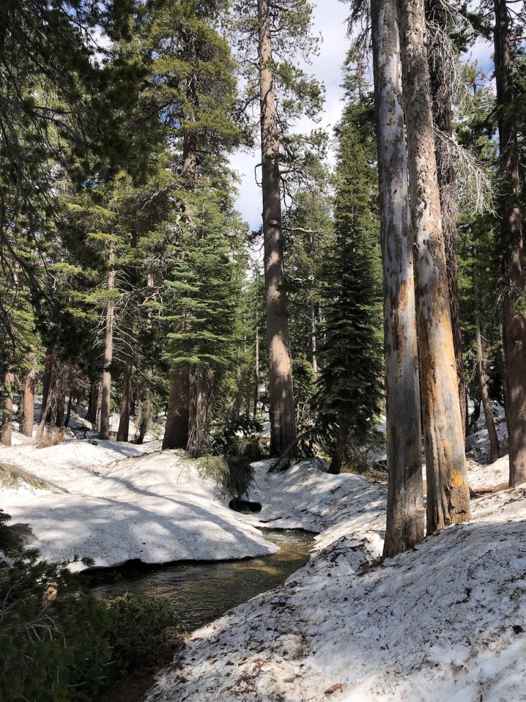
We walked around in the snow a bit, exploring our options, but realizing were were ill equipped for it.
After some deliberation and discussions with passing hikers, we decided it was best to head back.

Before heading back down, we climbed a bit higher up on the ridge off trail a bit, and stood on top of a large boulder to admire Panther Peak, which was directly across the valley from us. It was not the awe inspiring view we came for, but was all new nonetheless. I tried to guess how Panther Peak got it’s name?
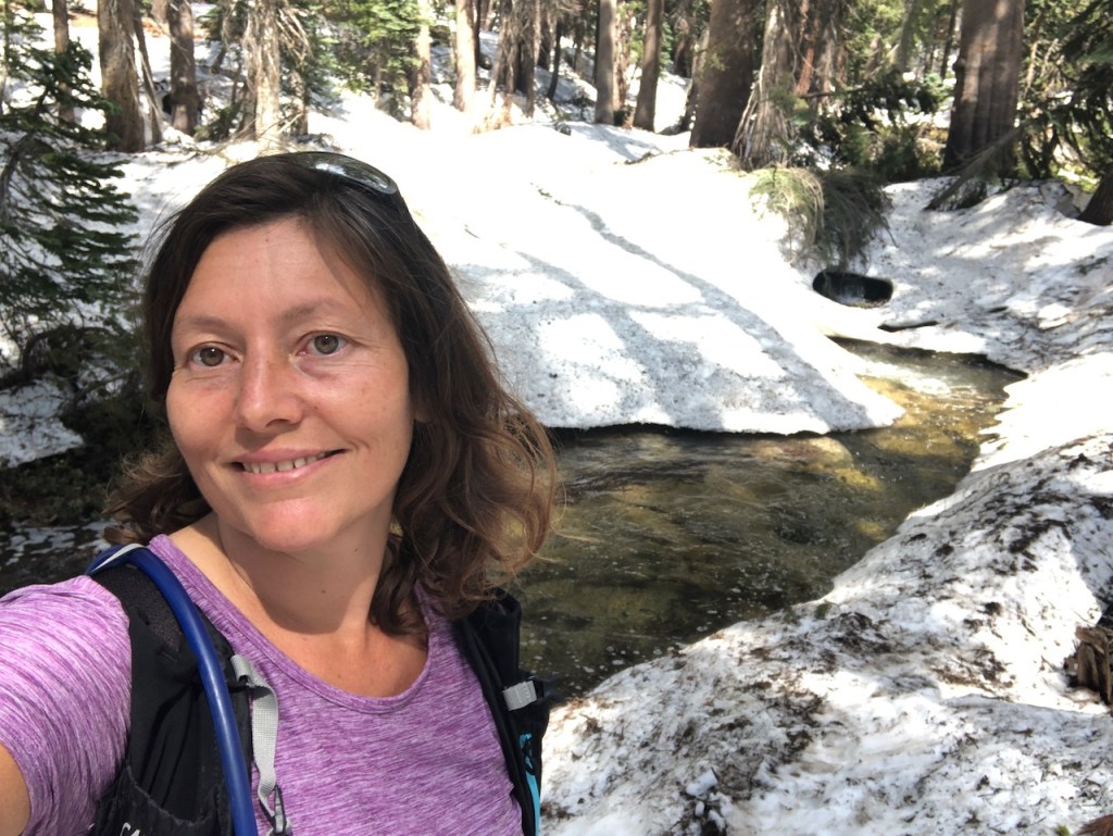
It was so pretty here with all the snow. Lacking mountaineering gear we played it safe, and turned around from here, after hearing of soaked hikers who turned around in the slush shortly afterward.

About the Trail
The Lakes Trail is a mostly wooded trail, which takes you into the subalpine zone, and towards the high peaks of Sequoia National Park. is one of the most popular hiking trails in the park. It offers stunning views of the surrounding landscape, including impressive giant sequoia trees and high-elevation lakes such as Heather Lake, and Pear Lake. It is also a popular route to reach Alta Peak, and to access the High Sierra Trail.
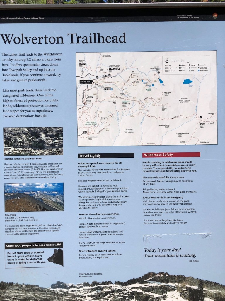
The Trailhead
The trail begins at Wolverton Trailhead, and is a moderate to strenuous hike, passing through dense forests of giant sequoias and conifers, along with subalpine meadows.
The Watchtower
One of the main draws of this trail is The Watchtower, a rock formation, and towering pinnacle of granite hovering over 2000 feet above the Kaweah River below. It is made entirely of granite rock, and named for its significance as a lookout, hovering high above its gorge, with its sheer cliffs descending sharply down to Tokopah Falls below. The Watchtower was constructed in the 1930’a to resemble a medieval tower atop a granite outcropping. The hike is just 6.5 miles roundtrip, but don’t let the mileage fool you. The trail was created by blasting out the rock, and drops off sharply in areas. It also includes about 2100 feet of gain, so is no cakewalk.
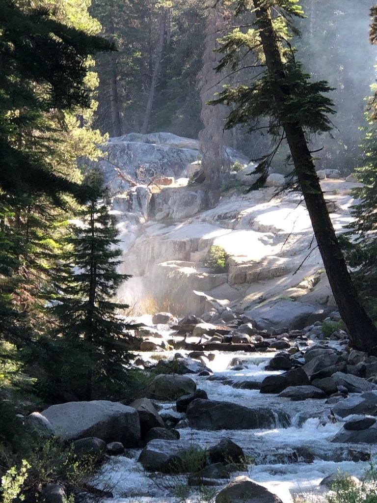
Another popular destination is Heather Lake which clocks in at 9.5 miles roundtrip. This is a beautiful mountain lake surrounded by picturesque granite walls. With its calm waters and relatively undisturbed surroundings, Heather Lake offers mirror-like reflections of its surroundings. This makes it popular with photographers and nature lovers alike.
High mountain lakes such as this can remain frozen during high snow year such as 2023 well into August, so plan accordingly. Traveling here when the trail is still covered in snow requires crampons, an ice axe, and mountaineering experience. The Wolverton trailhead begins at 7200 feet and climbs another 3200 feet to about 9500 feet at Pear Lake.
If you love long treks, you may want to continue all the way to Pear Lake, and the Pear Lake Ranger Station. This is a popular backpacking spot, and sometimes utilized as an entry point to the High Sierra Trail, along with being a base for backcountry trips to the surrounding peaks. Aster Lake is a lesser known lake you can visit as well, if you choose to hike even further on from Pear Lake. You will need a permit to backpack in the wilderness, and you can reserve them online.
Backpacking Permits
For backpacking information, contact the Sequoia and Kings Canyon Wilderness Office: Phone (559) 565-3766, Fax (559) 565-4239, E-mail SEKI_Wilderness_Office@nps.gov
You can also stop by the ranger station at the Giant Forest Museum. Permits are available by reservation, and by quota, which releases permits the week of the hike. So walk up permits are available the same day. If you arrive early, you have a good chance to obtain one, same day.
Terrain
Sequoia National Park has a unique and rugged beauty characterized by its granite rock formations, towering cliffs, castle-like crags, and glaciated valleys. There are unique limestone caves, including Crystal Cave, adding further uniqueness to the park’s terrain.
Scenery
It is located in the southern Sierra Nevada mountain range in California. It is filled with towering high mountain peaks, deep gorges, canyons, waterfalls, and of course the famous giant sequoia groves. The lower elevation stretches of the park have lush grassy and picturesque meadows that come alive with vibrant wildflowers during the spring and summer months. Several waterfalls dot the area, such as Grizzly Falls, Roaring River Falls, Mist Falls, and Tokopah Falls.
Crowd Factor
The crowds vary significantly depending on the time of year, holidays, weekends, and popular attractions within the park. The peak season is June through August. General Sherman Tree and Moro Rock trails to hike. The Lakes Trail is one of the least crowded by far.
Seasons
From April to May and in Fall from September to October crowds tend to dissipate. When the wildflowers are in bloom and the meadows are green, expect the crowds. Winter has much colder temperatures and can have heavy snow. Snowshoeing and cross-country skiing is a pastime during those times, so long as your vehicle is equipped to handle the icy mountain roads. The park has shuttle services, though they were not in operation in July of 2023 due to a strike.
Current Conditions
It’s always best to check the parks website for up-to-date information on visitor guidelines, road conditions. I also recommend stopping by the Giant Forest Museum, to see what trails are open along with their conditions, since this information is not posted on their website.
Wildlife
There are a variety of animals inhabiting Sequoia National Park. You may encounter black bears, deer, chipmunks, coyotes, squirrels, marmots, foxes, bobcats, and mountain lions here. In addition there are opportunities to spot birds of prey, and even bald eagles. When I visited in July the butterflies were abundant, and dancing amongst the wildflowers.
Rating
This hike is moderate to strenuous depending on how far you choose to travel. The trail is steep, can be slippery, and somewhat technical in areas. Scrambles over down trees were numerous.
Gear
For Heather Lake in summer conditions, you will need gear you typically take on a day hike. That includes water, snacks, a backpack, sturdy shoes, proper attire, shade, and possibly bug repellant. Trekking poles are recommended for stability on the rocky sections. When snow is present, mountaineering gear and experience is recommended.
Nearby Hikes
There are lots of interesting other trails in Sequoia Park. The Tokopah Falls Trail takes you to a beautiful and roaring waterfall The famous Congress Grove and General Sherman sequoia tree are hundreds of years old. People come for the trees, lakes, and also for the High Sierra Trail, which begins at Crescent Meadow. The Giant Forest museum is a great resource of information on the history of Sequoia National Park, and its giant trees.
Hazards
Be alert to the sound of falling rocks, and steer clear of rockfalls. Rockslides, deadfall, wildfire, and falling are some of the hazards of hiking along this trail.
Overall
Overall this is a beautifully maintained trail, that you’re not soon to forget. All the effort pays off with the beautiful views from the Watchtower, and the lakes.
Challenges
Hiking at higher elevations can come with challenges, such as rapidly changing weather conditions, altitude-related effects, and potentially strenuous terrain. It’s important to be prepared with proper hiking gear, clothing, and provisions, and to be aware of any regulations or guidelines set by the park authorities.
Considerations
The trail is high altitude, and is a wilderness area. There are numerous water sources in early spring and summer to filter water along the way. It is still best to come prepared to spend a night outside, in a worst case scenario, and bring a Garmin In-Reach or similar for navigation, weather, and communications, in the event you are injured.
Get the Bear Facts
Store food away from bears in bear lockers from dusk until dawn. Use hard sided bear canisters otherwise, or bear proof coolers. Never keep food in cars overnight. All your scented items must be kept in bear proof lockers, coolers, or canisters too.
Hike Safely and be Prepared
Bring what you feel is necessary to survive, including water and food. Protect yourself from the elements with proper clothing, and sturdy footwear. Always bring your own first aid, and be prepared for emergencies. Always hike with a friend or bring an Garmin In-reach for emergencies. Never hike without paper maps or extra batteries for your navigation. Download maps before you go. Always plan for the worst and hope for the best.
Pets?
Sorry but pets are not permitted on any trails within Sequoia and Kings Canyon National Parks, unless they are service animals. They are permitted in picnic areas, campgrounds, on leashes no less than 6 feet in length. Don’t leave Fido alone or unattended. Wildlife in the area could have an altercation with your pet.
Trail Stats
Length – Up to 11 miles
Gain or Loss – Up to 4500 feet
Leave No Trace
Just be sure to come prepared and follow Leave No Trace principles to keep the wilderness pristine for future hikers.
Like and Subscribe to my Channel!
I hope you enjoyed reading this, and it is helpful in knowing what to expect, should you decide to visit here.
About me
I’m Serafina! I’m a writer and California girl who loves to go exploring. Hope you will get outside today, breathe some fresh air, and be happy!
Follow my Journey…
Be sure to Like and Subscribe to My Youtube Channel where I post videos!
Disclaimer: The work on this blog is my opinion and my opinion alone and I am not responsible for the outcome if someone were to apply these thoughts to their own life. All text and photography copyright 2023 by Serafina, all rights reserved. Information and opinions provided are kept current to the best of the author’s ability. All readers’ usage of the ideas and opinions presented in the blog, are at their own risk. Be aware of the possible dangers of hiking, surfing, walking, cooking, and other activities, which may take place indoors or outdoors. By reading this, you agree not to hold the author or publisher of the content on this web site responsible for any injuries or inconveniences that may result from reading the blog, or partaking in any activity mentioned in the blog. Read the blog, and use its ideas, if you so desire, at your own risk.
