Driving Rim of the World Highway and Peak Bagging in Big Bear
I drove up the scenic and winding Highway 33, and the Rim of the World Scenic Byway, on my way to Bertha Peak with a friend. It was early June, and the snow had finally started to melt off above 7000 feet.

Along the drive, the clouds began to finally clear. There were tons of Lupines, and the invasive, yet fragrant yellow blooms of Scotch Broom.

Escaping June Gloom
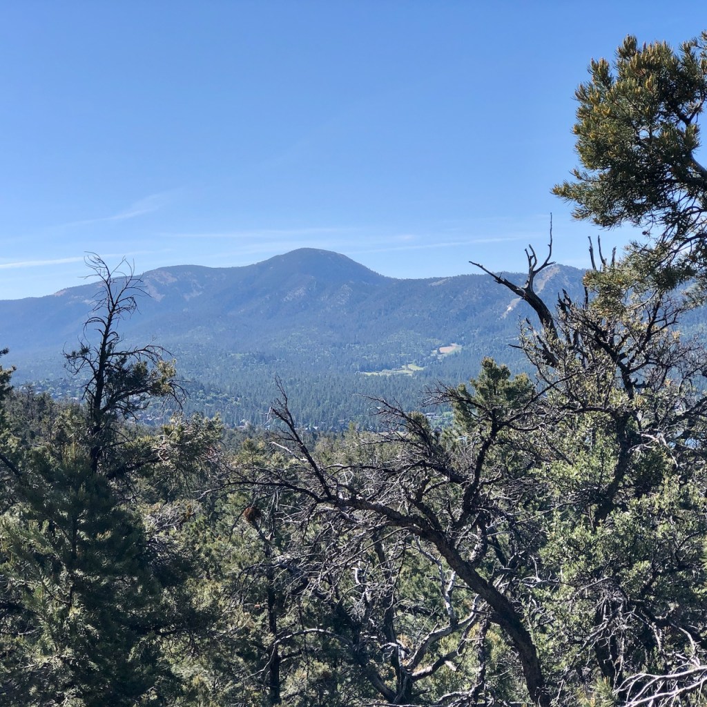
I was ready to escape the June gloom spread out in a thick fluffy layer across the southland. I love alpine landscapes as you will find up here, high above Los Angeles. The sun was out, above the treeline, and all I could see behind me was a sea of clouds, with the snow capped peaks of the Angeles Forest in the distance.
Mountain Towns
Along the way I passed through some small towns and enclaves. There are very few stores and amenities in this area. First I passed Rim Forest, and Sky Forest, before reaching Arrowbear Lake, and Running Springs. After passing Lakeview Point, the last section of highway on the way to the lake, runs along a steep cliffside, prone to avalanches, with towering peaks up above it, such as Butler Peak, and Crafts Peak, to the left.
Little Green Valley
Off to my right I passed by Snow Mountain, a snow tubing area, and Keller Peak. The Little Green Valley trailhead, is also located right by here.I recommend that one, for a short, scenic hike through the alpine forest. The one caveat is the trailhead only has room for four cars.
Recovering from Snow
The snow melted much later this year, since there was so much of it. The towns in this region are still recovering from early 2023’s epic snowfall, brought on by a freight train of atmospheric rivers, which did plenty of damage to homes, and cabins. People in this area were cut-off from services, some lost power, and the snow storm sadly ended up claiming lives.
Hazards of Mountain Life
Mountain areas have far more hazards to contend with than the beach areas in places like Orange County, where I live. Rockslides, avalanches, heavy snowstorms, and floods from melting snow, can make living, and traveling here a challenge. There are few ways in and out of the area, and the forest is also prone to wildfires, so you can easily get trapped up here. In spite of all this, myself and so many others are drawn to Big Bear. The mountains are calling, and we must go.
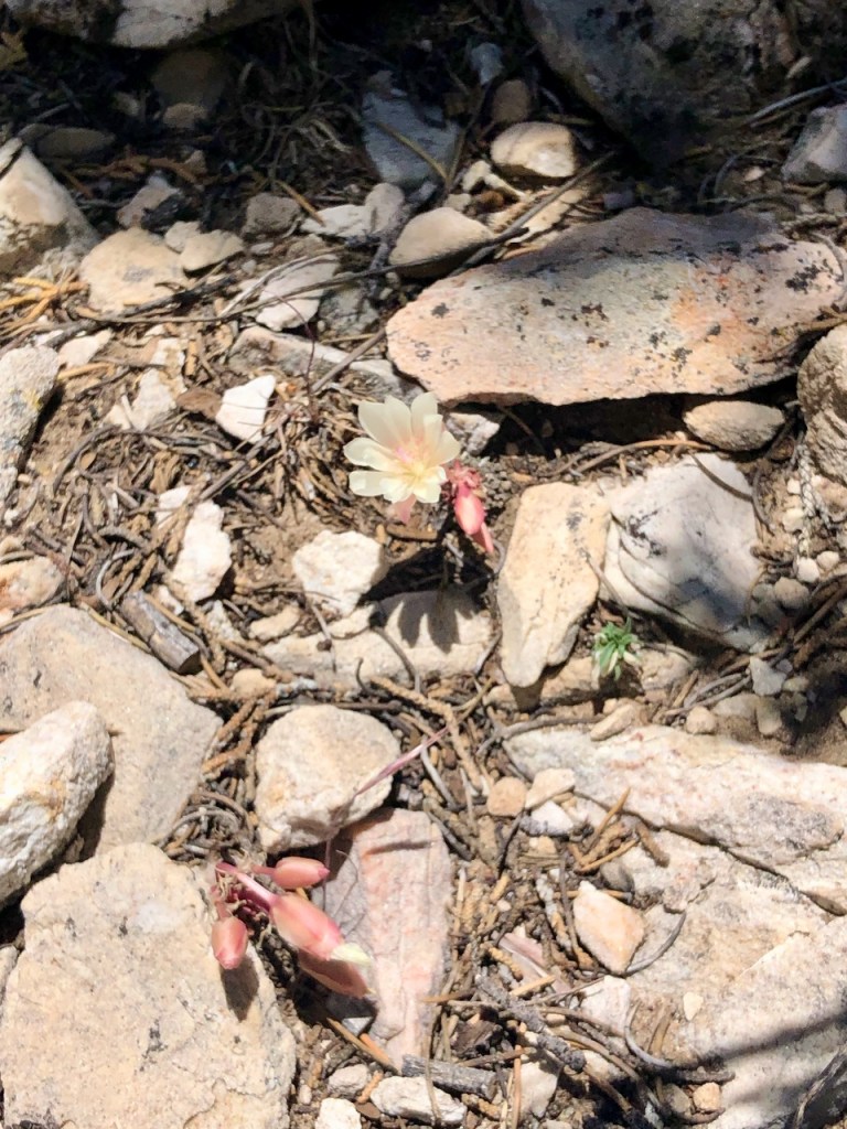
Mountain Springtime
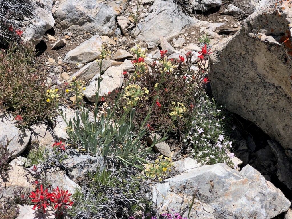
The wildflowers were just beginning to look vibrant here, in early June. The sun was out, and that was a welcome change from the June gloom happening on much of the coast. It was a perfect excuse to make the long drive up here.
Best Seasons to Visit
I have hiked in Big Bear a few times before, and each time, there was something more to see. I have hiked here in spring, summer, fall, and winter. Each season has so many different hikes to enjoy. In winter I hiked to the popular Castle Rock, when it was covered in snow. In late summer and fall I visited Pine Knot Trail, and Town Trail, which are right beside downtown Big Bear Lake. The north side of the lake was where I was headed today.

Mount San Gorgonio
In the distance, hovering above the north side of the lake, was snow-covered Mount San Gorgonio, the tallest peak in Southern California. To this day, this is still one of the most difficult, yet rewarding hikes I have done.
You can read about my hike up Mount San Gorgonio here.
Big Bear Lake
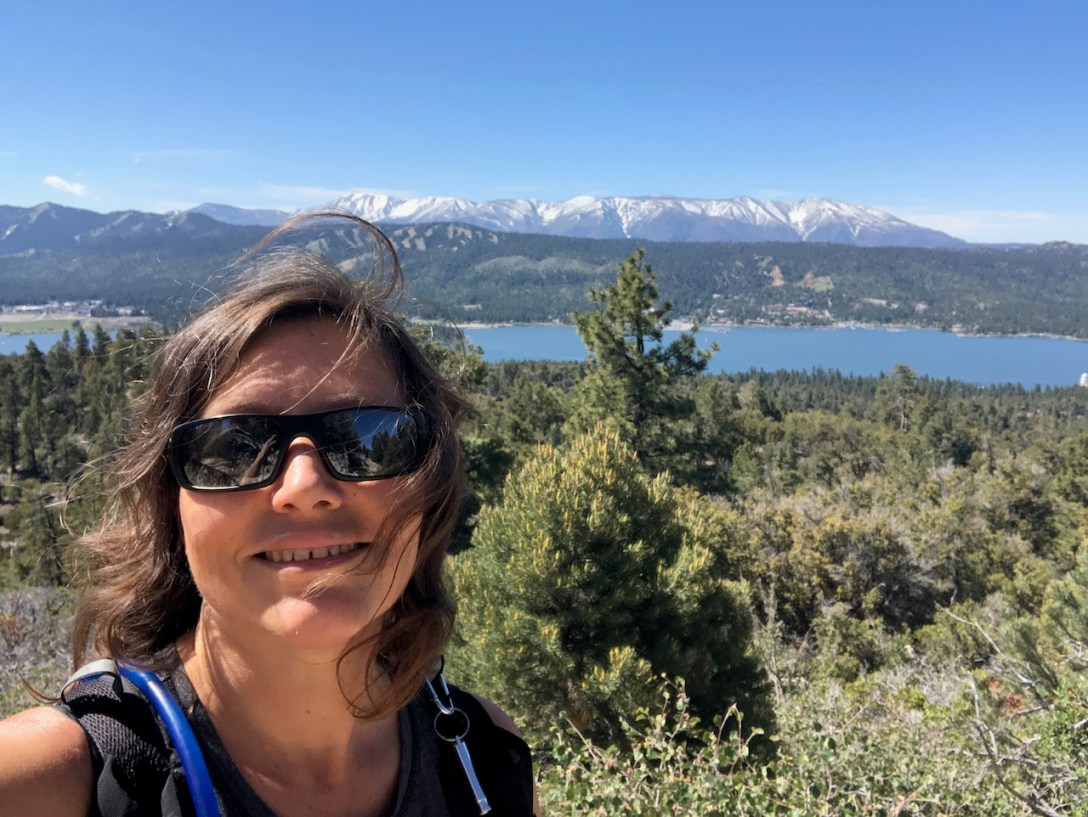
Eventually I arrived at the shores of peaceful Big Bear lake. Spring was just beginning to unfold up in the mountains. I stayed to the left, at the fork in the road, staying to the north side of the lake. I could not help but stop to admire the lakeside for a moment. I would stop a few more times on the way to the trailhead. All my stops ended up adding about 30 minutes to my travel time, but I was living in the moment, so I did not feel I had to rush. I’m not here everyday, and the whole area is filled with pristine nature.

Big Bear Lake History
The lake was formed by damming up what was a small marshy lake, with rocks. Eventually the dam and reservoir were built which we see today, suitable for boating, and fishing. From 1912-1916 the dam was constructed, and Big Bear Lake was born. Since that time, the area has been a popular vacation destination for locals, and visitors to California alike.
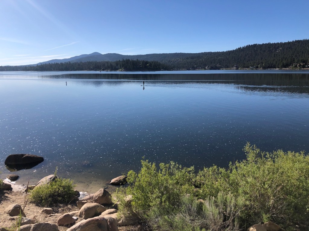
As I drove along the shoreline, I noticed many fishermen. I stopped at another picnicking area, and observed a paddleboarder blissfully paddling across the glass-like lake, in morning. Off in the distance a speed boat was about to deliver a few wakes to this paddler. Hopefully they were wide awake and did not lose balance, falling into the still frigid waters.

Intense Sunshine
It felt like early summer, in the low 50’s, but it warmer, since I was at altitude. You will notice the rays of the run are more intense at high elevation. You can sunburn quicker, and will feel warmer, than you think you would. So next time you see a photo of backpackers in shorts, traversing snow, with towering Sierra peaks around them, you will know why.

Forest Service Cabins
Along the shoreline drive are tons of quaint old forest service cabins. The northside of the lake is a bit warmer than it would be to the south, since the hot desert valley is just on the other side of it.

Grays Peak
I passed the Grays Peak Trailhead, which is another popular peak in the area to hike up to. The hike to Bertha Peak begins on the north side of the lake. I parked at the Cougar Crest Parking area near the Big Bear Discovery Center. I would be taking the Cougar Crest Trail, about 3 miles on to the famed PCT, which I would only hike along for a .25 mile, before the last .75 mile or so, on to Bertha Peak. The hike is just under 8 miles.
The Trailhead
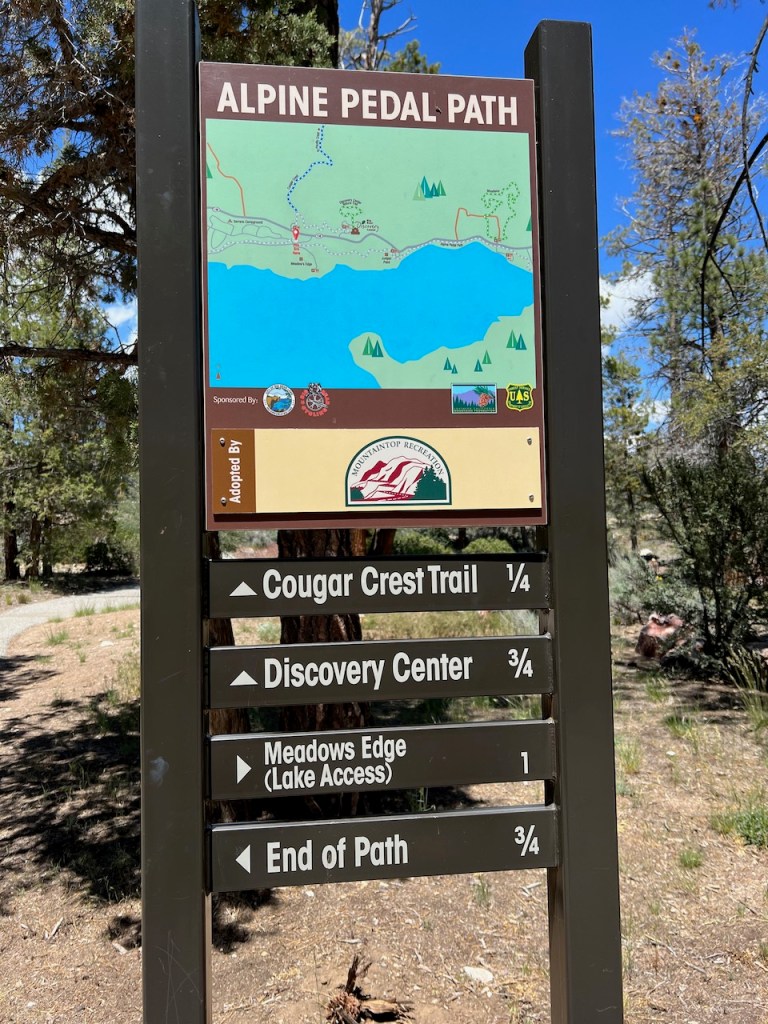
The trailhead has pit toilets, and porta potties. Nearby are Serrano Campground, the Alpine Pedal Path, and also a lakeside trail, running from Juniper Point, on to the Cougar Crest Trailhead. So there are other options for exploring here.
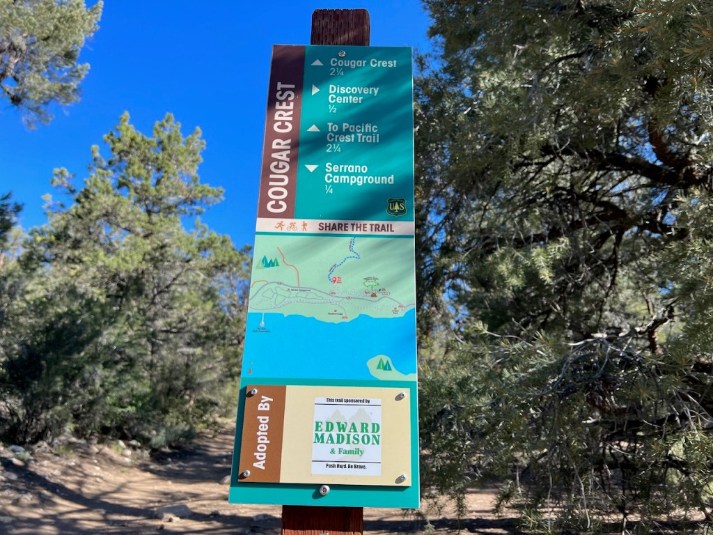
As I proceeded onward up the trail, I stayed to the left for the Cougar Crest Trail at the fork, at this sign.
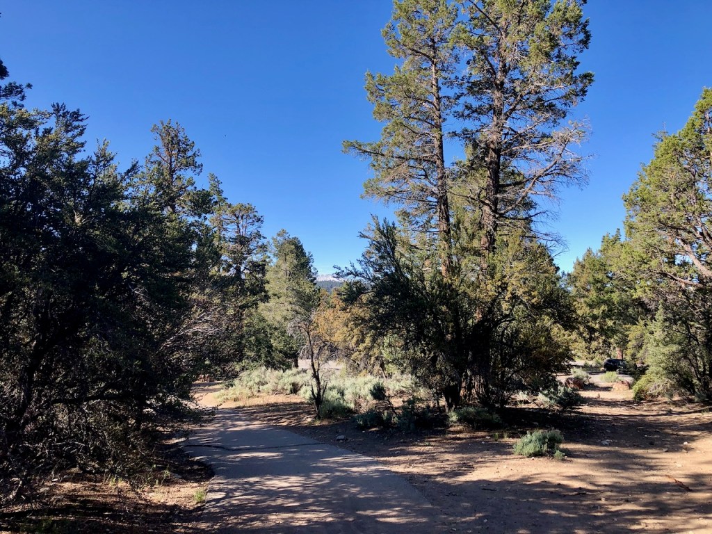
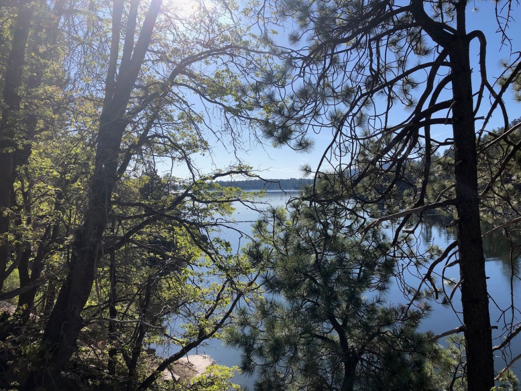
For the next few miles, there was very little incline, and it was very gradual. The scenery was just dense forest.
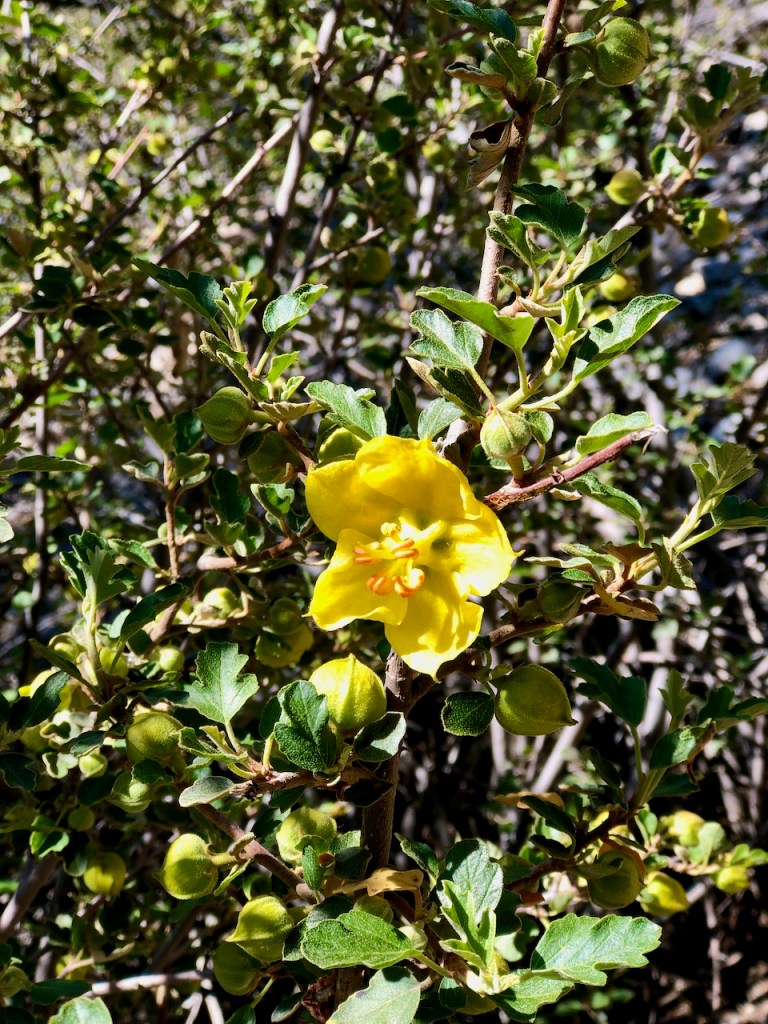
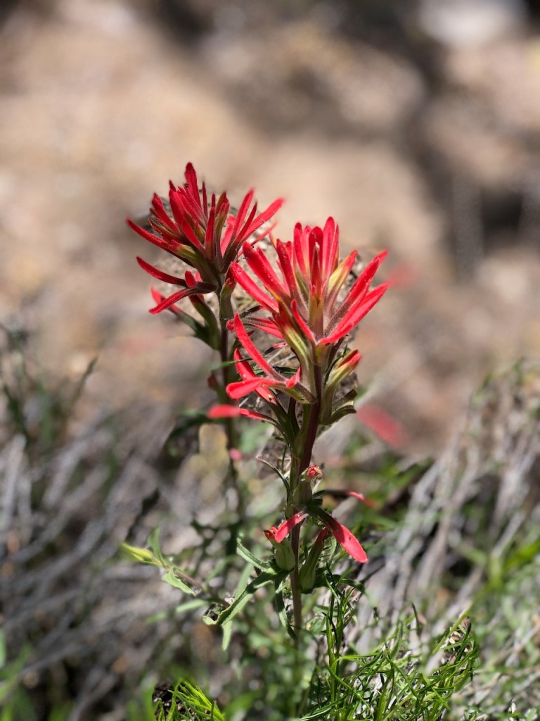
There were lots of wildflowers in bloom. The first ones I noticed growing were bright yellow Flannel Bush.
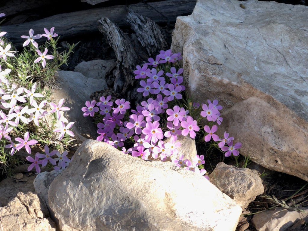
Then I spotted some delicate pink Big Bear Valley Phlox.
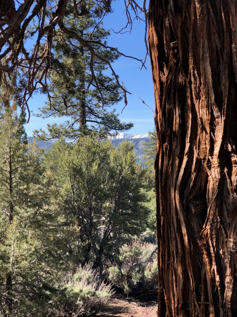
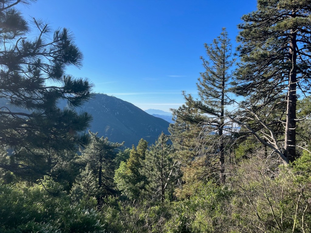
There were beautiful cedars, pines, and junipers, growing all around in the forest here. I had a glimpse of snowy distant peaks, where traveling in snow is still possible late in the 2023 season, if crampons, helmets, and axes are your thing.
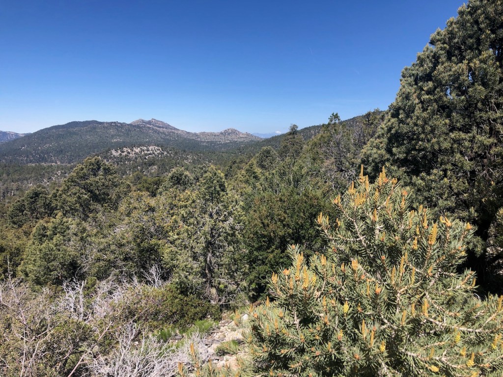
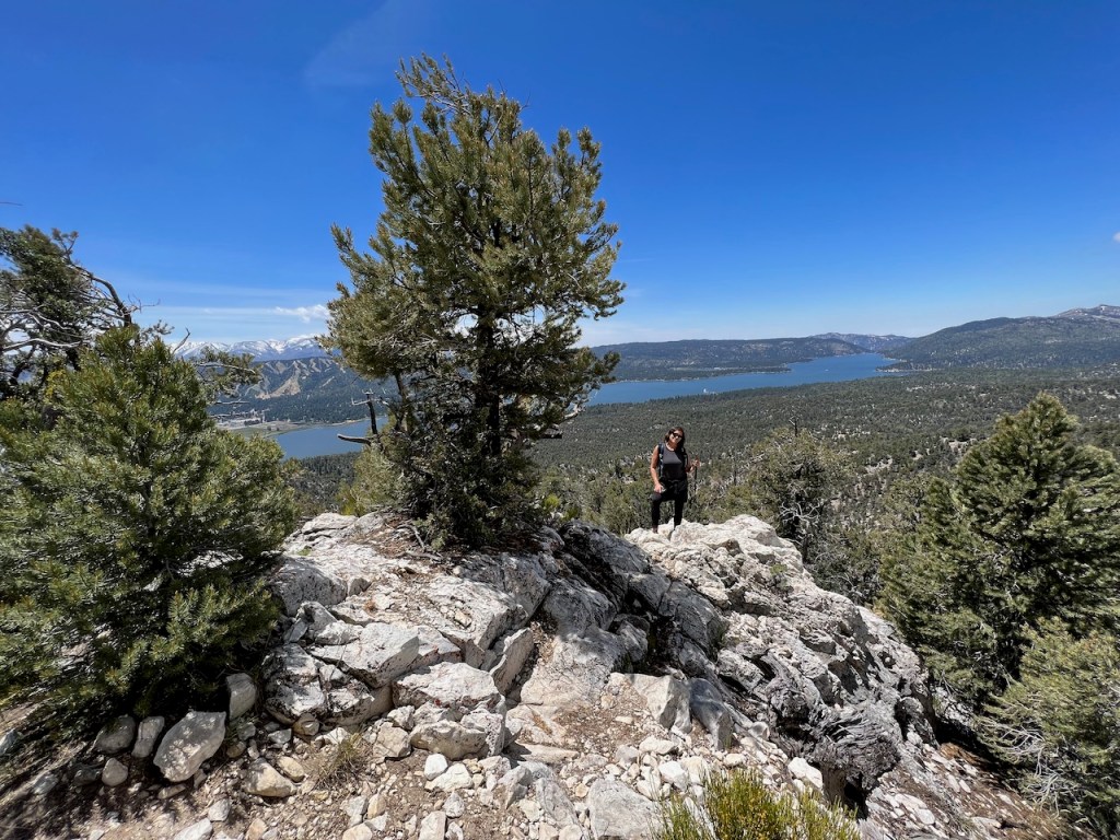
Around this point I began to enjoy more scenic views of the mountains surrounding Bertha Peak such as Sugarloaf Mountain, which sits just to the left of Snow Summit, on the south side of the lake.
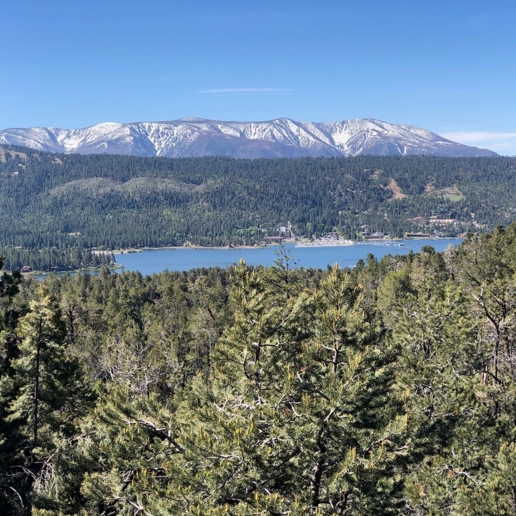
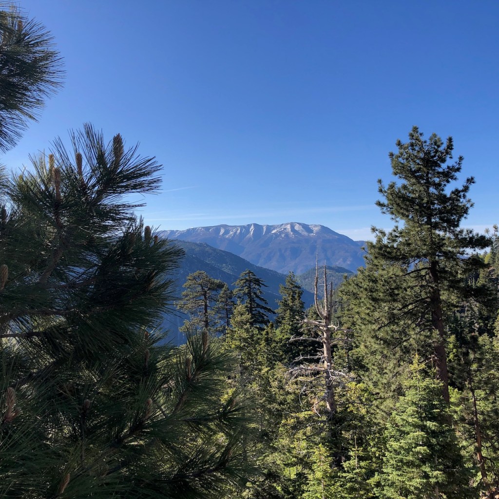
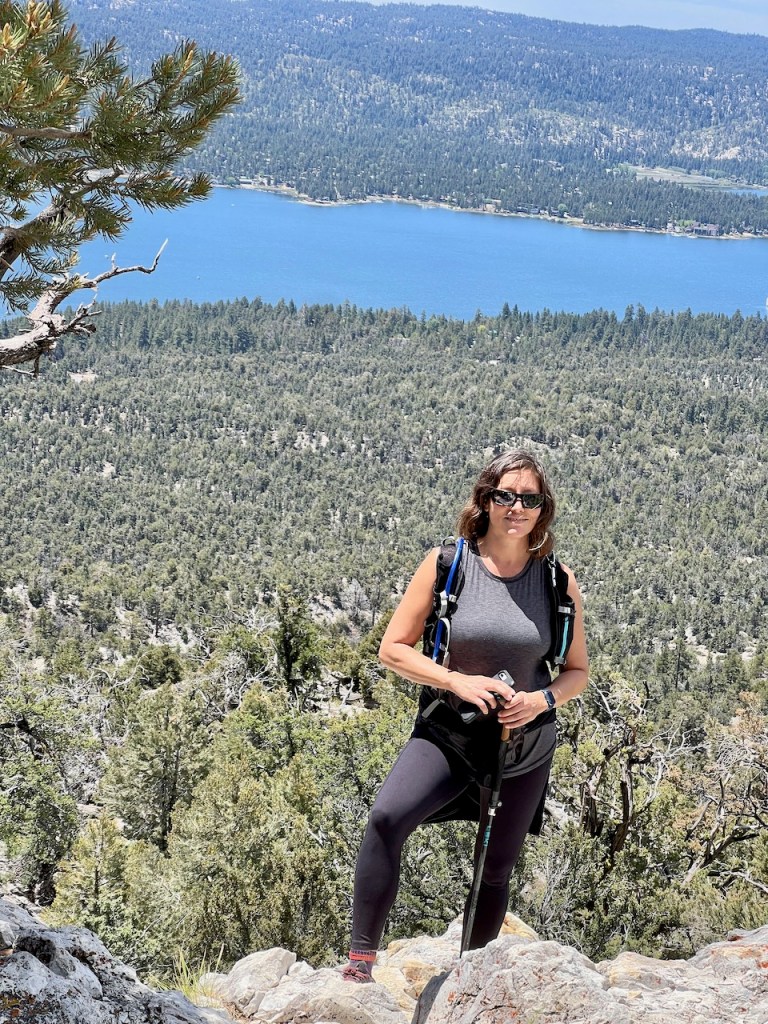
As I climbed higher, I began to be treated to the most amazing view of Mount San Gorgonio, standing tall above Big Bear Lake. I had a clear view of the entire San Bernardino Mountain range, from Grinnell Mountain on the left, all the way to San Bernardino Peak on the right. The time I backpacked into the San Gorgonio Wilderness on the South Fork Trail, and did Four Peaks in a Day, is still one of my best memories.
As I climbed higher I could spot Gray’s Peak, and Delamar Mountain to my right. I may head to one of these surrounding peaks soon, while the weather here is pleasant. It is the perfect season for hiking in Big Bear right now.
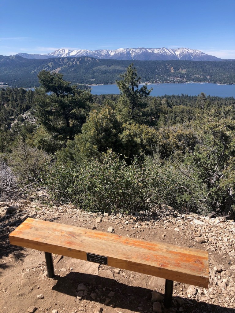
I came to a series of benches, with small plaques, at this point, and was about 2.5 miles in.
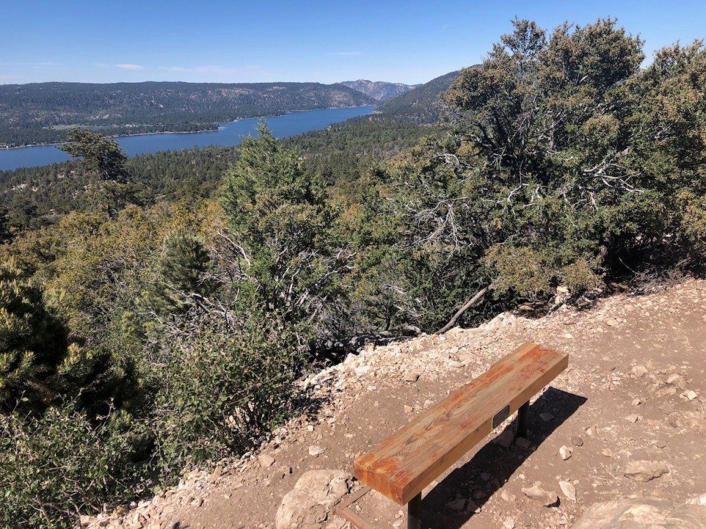
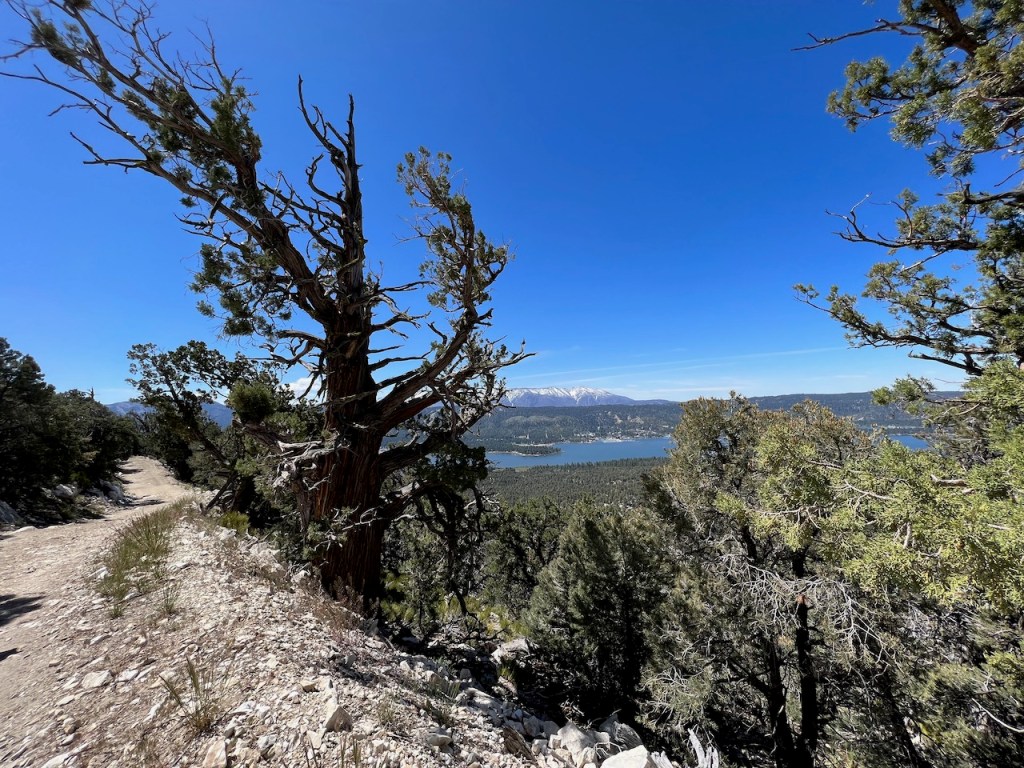
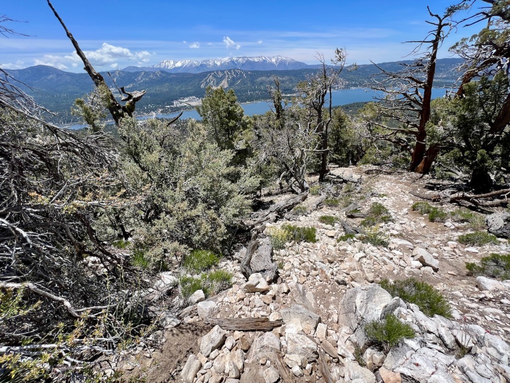
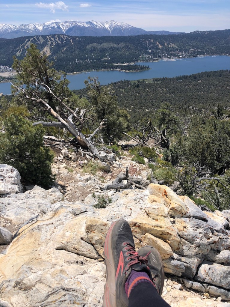
I could almost see almost the entirety of Big Bear Lake from here.
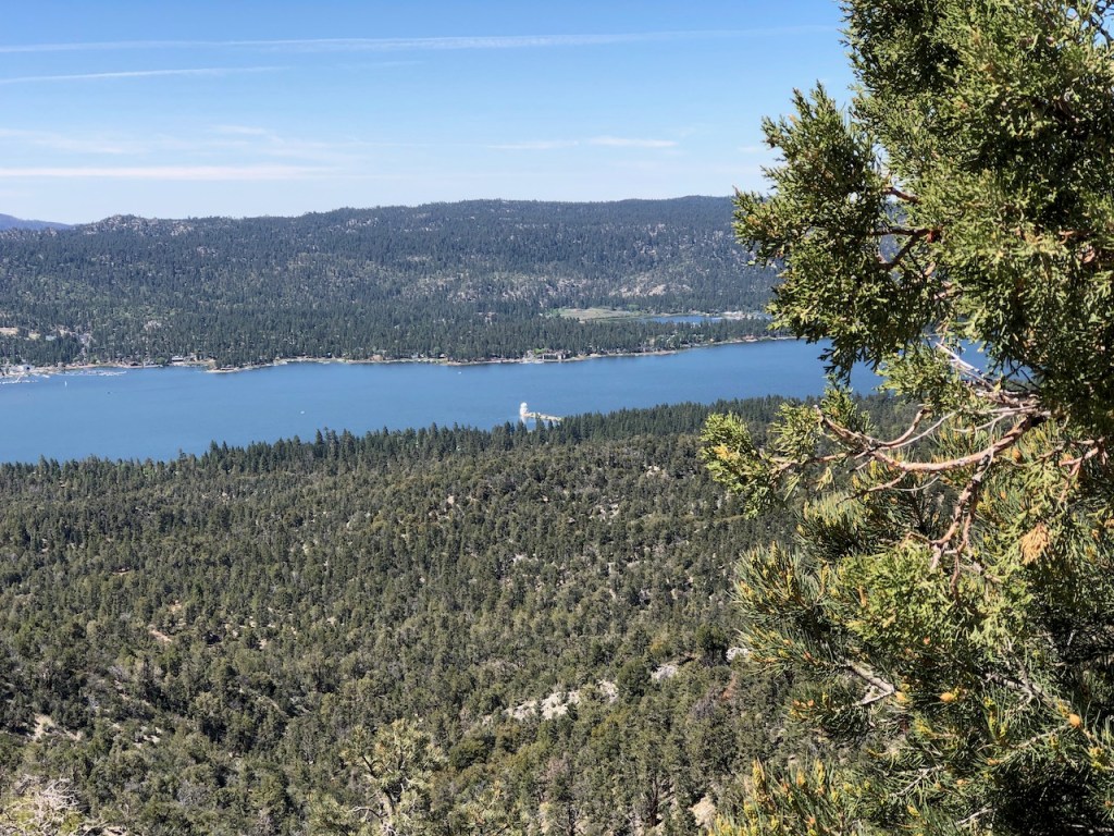
I could also make out a small peninsula jutting out into the lake, with it’s solar observatory down below, along with the marina down on the south side of the lake. The observatory is home to the Solis telescope, and it offers free tours on the first Thursday of the month, starting in June.

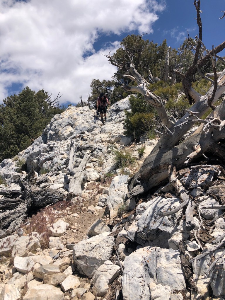
The trail narrowed into a single-track trail, and became very rocky around this point in the hike. There were a series of steps, which can be challenging for some hikers. I can easily get overly excited about the cardio aspect of doing stairs, but was still trying to be careful with my footing.

The gain was still very steady all along the Cougar Crest Trail, and at no point, did I really feel a need to take a break, even though there would be even more benches along the way.
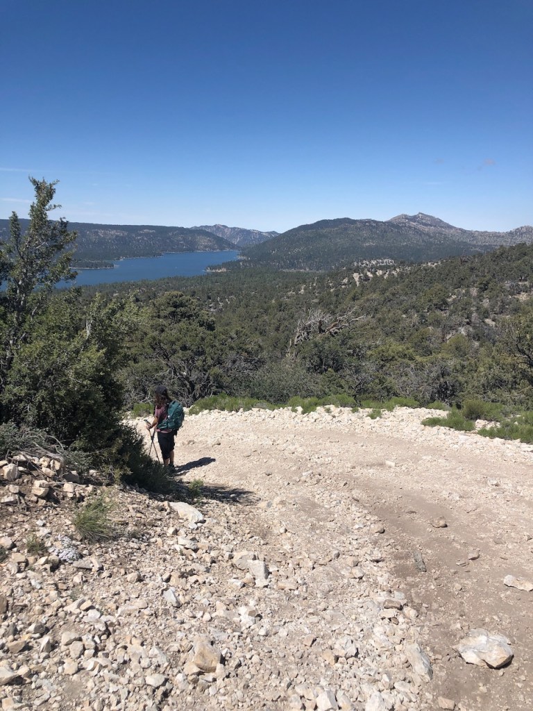
The switchbacks continued, and eventually the trail wrapped about the backside of the ridge, heading up to Bertha Peak.
I could spot even more mountain peaks, off to my left, such as the aptly named White Mountain, and South Peak, which sits to the right of Grays Peak.

PCT Hikers
As we climbed the ridge, I passed a gentleman hiking the PCT, heading into Big Bear, who was getting off trail for a re-supply. He described flip flopping several times on his PCT hike, and it would appear, that was since he aimed to avoid hiking in the snow. He mentioned having just hiked all the way from Kennedy meadows, and how he was heading to Inspiration Point, as his final stop, on what would be an almost 700 mile trek. Not everyone does the whole PCT in its entirety. About 3 miles up the trail, I reached the PCT, and continued onward.
Bertha Peak Trail
About a .25 mile later, I left the PCT, and followed the sign for Bertha Peak. This would be the steepest part of the whole hike.
The fireroad to the peak was at about a 30% grade, most of the way up. So the last .75 miles is the butt-kicker part of this hike.
If you’re not looking for a workout, and feeling more leisurely, you may or may not enjoy this section. You can see the peak is not far, but is high up the steep fire road. The best is yet to come, since once at Bertha Peak, you get the 360 degree views you were aiming for.
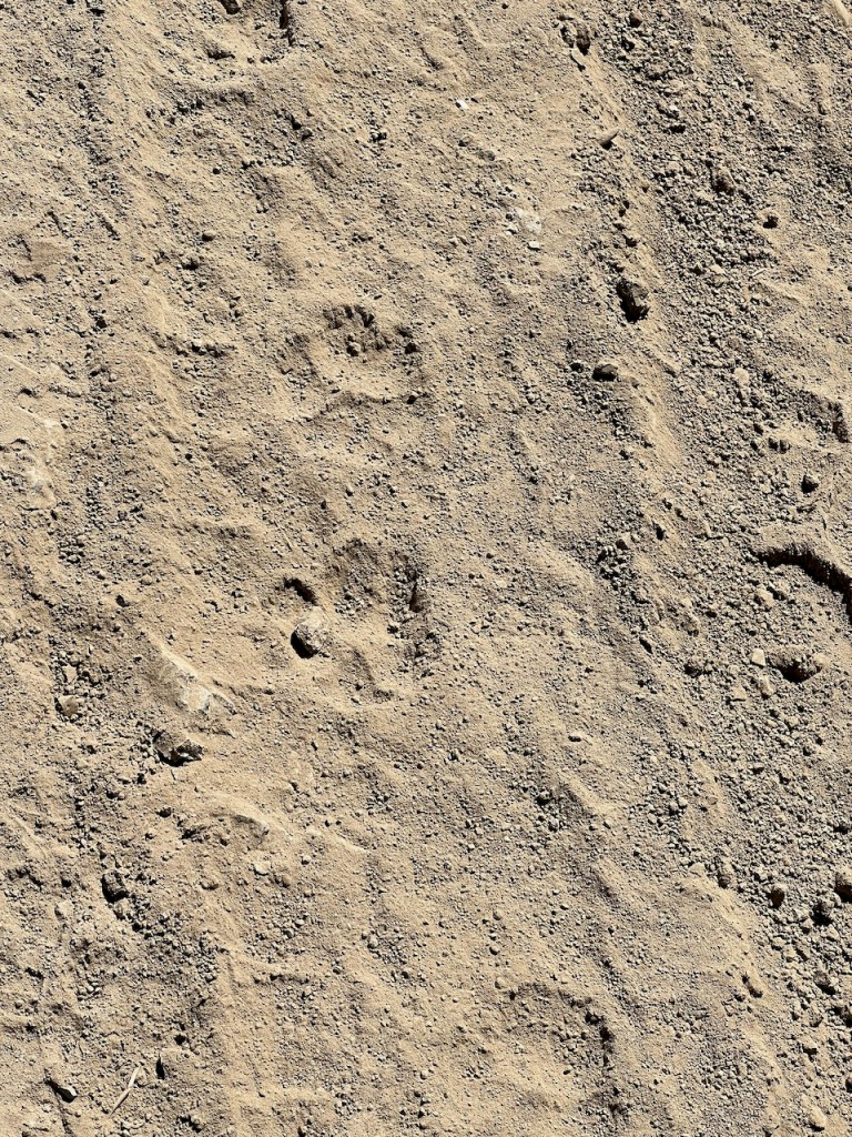
On the last stretch, I noticed these tracks on the way up the Cougar Crest Trail, which was aptly named. I brought a pocket size Sabre Air Horn for this reason, to scare off critters.

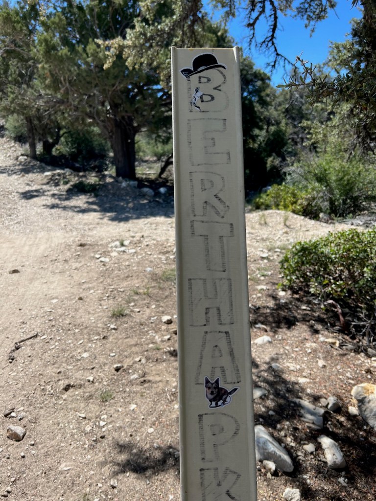
Some peaks are covered in trees, some are barren moonscapes, and Bertha Peak has a tower on it, surrounded by a chain link fence.

There was no USGS marker anywhere to speak of, and the peak marker was firmly planted in the ground, behind a fence. There was no sign for Bertha Peak, so I actually thought ahead, and made my own.
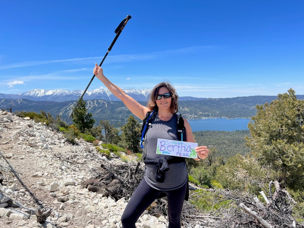
Bertha Peak Elevation 8199
We made it to Bertha Peak! It is one of the highest peaks in Big Bear. I have this goal to hike to 50 peaks, but I have lost count of how many I climbed. I am guessing not 50. I love challenging myself, and that is why I created the Women to the Peak 5 Peak Challenge, where women can hike to any 5 peaks to achieve their goal. But every challenge starts with the first step, the first mile, and the first peak. You can do this!
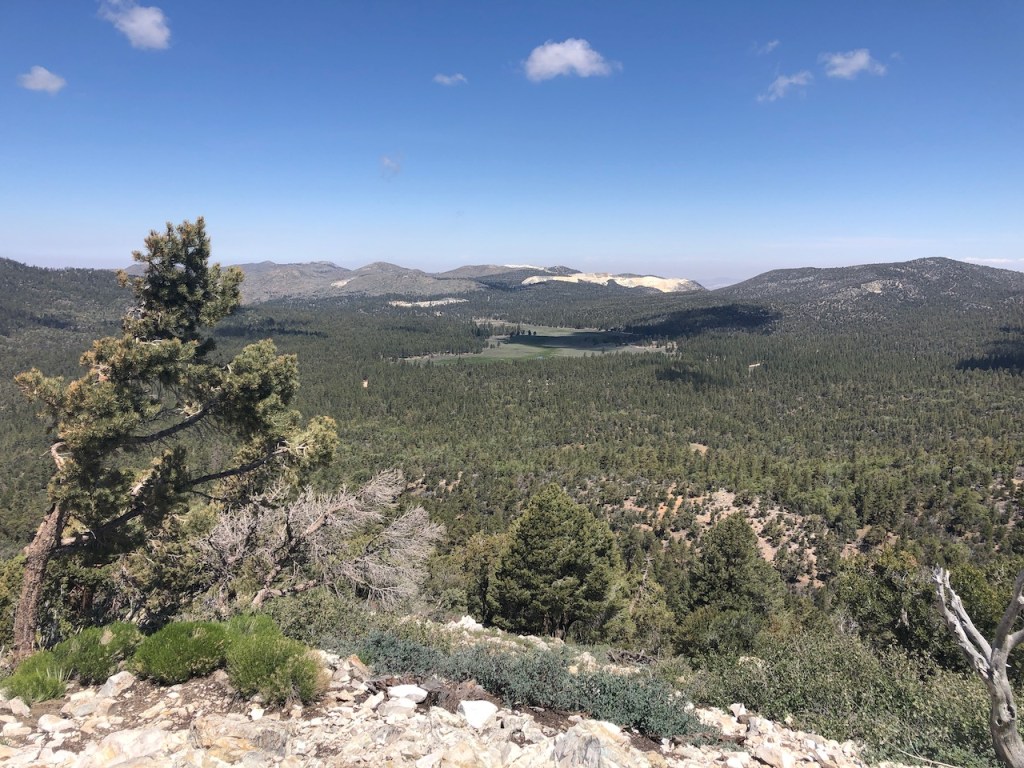
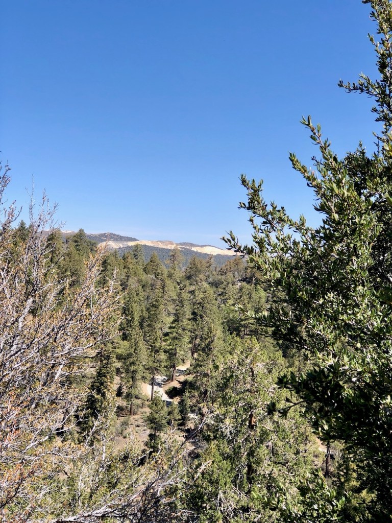
I could now see an excellent view of the green meadows of Holcomb Valley, an area known for its history relics, the site of an old ghost town. In the present day there is camping at a working ranch, a fishing area, and a shooting range there. The whole Big Bear area was booming in the gold rush, and there are lots of relics of the past here, along the trails, sitting in arrested decay. You can see everything from old stamp mills, to old cabins, to the remnants of mines around Big Bear Lake.
Holcolmb Valley Pinnacles
Off the right in the distance were the Holcolmb Valley Pinnacles, which has over 500 named climbing routes, such as the Incinerator Wall. The area can be reached by driving up Van Dusen Canyon or from Baldwin Lake, onto the John Bull Trail, and forest service road 3N16, before parking by Wilbur’s Tombstone. There are plenty of campgrounds in this area, most of which are first come first served, such as Holcolmb Valley Campground.
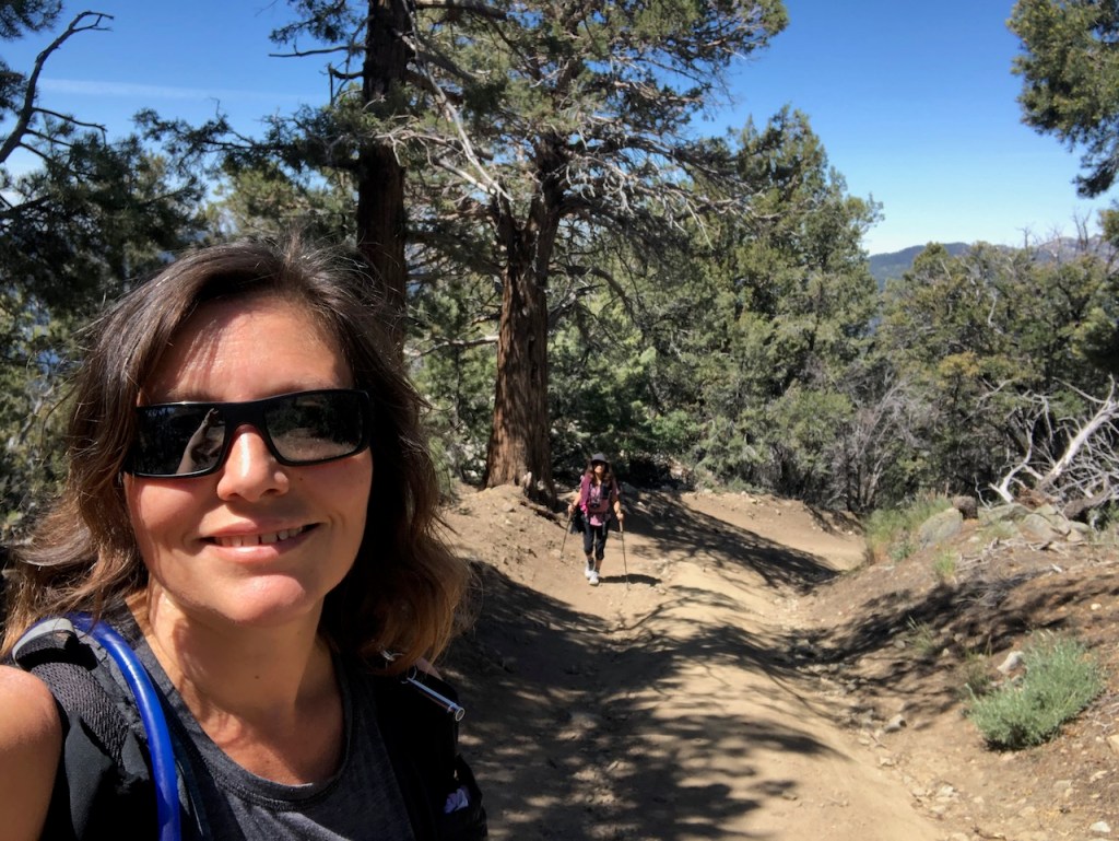
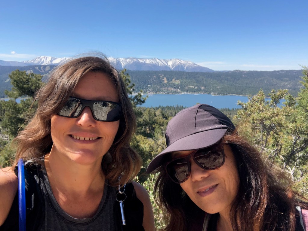
There were some nice sized rocks here, so my friend, and I took a break at the summit for lunch.
Running Cougar Trail
I noticed a trail leading from the summit down to the Alpine Pedal Path. We decided to give the Running Cougar Trail a shot.
Heading down Running Cougar, first off, it was very scenic, and the single-track trail was surrounded by beautiful wildflowers.
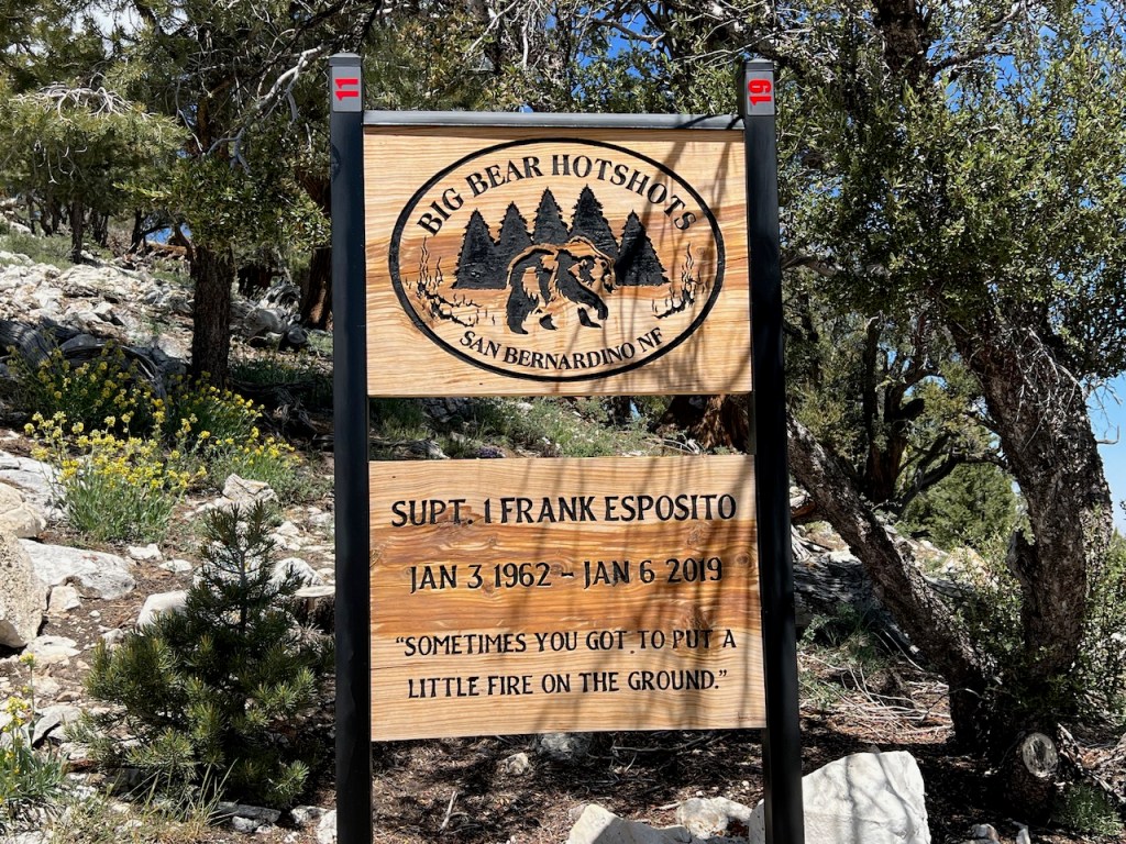
Firefighters Memorial
Right away, we came to a Firefighters Memorial, remembering a wildland firefighter, who was a member of the Big Bear Hot Shots crew, who passed away tragically, in the line of duty.
There appeared to be a trail along the ridge, which was noted on alltrails, but it sort of disappeared at the point where the ridge trail meets Running Cougar Trail. It seemed few people travel this way.
So we proceeded down the trail, only to realize it was amazingly steep, and rocky.
We took our time heading down. Tripping and falling were a real threat, with all the uneven, jagged, and loose rock, not to mention steep incline.
We did get to pass through some of the most interesting scenery of the whole hike though. There were lots of rocks, and boulders, intermingling with moss covered junipers, pines, and cedars here. All in all, Running Cougar trail, I rate as hard and strenuous, not moderate by any means.

Eventually the trail leveled out, down below, and we continued toward the lake, in search of the Alpine Pedal Path.
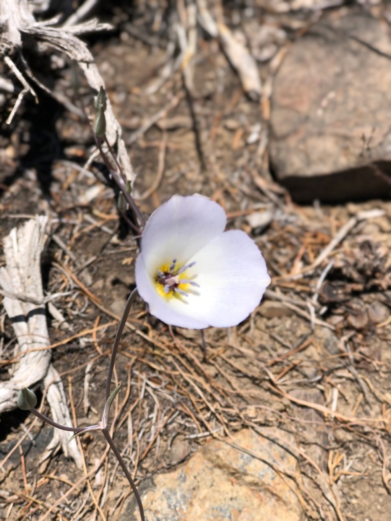
There were many beautiful wildflowers in bloom here such as this Mariposa Lily, and many others.
We passed by a green meadow, and were nearing the lake once again.
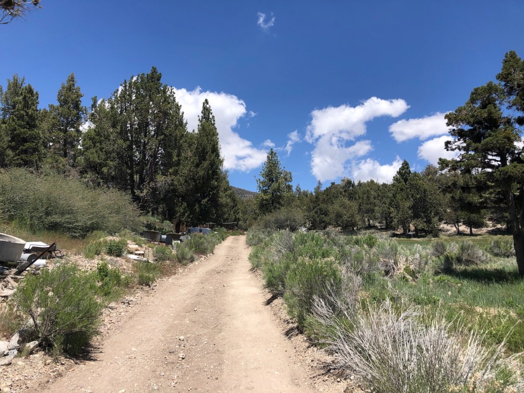
The trail turned into a paved road, and we passed a “boneyard,” where the forest service stores old signs, and refuse, such as old sections of wooden fence.
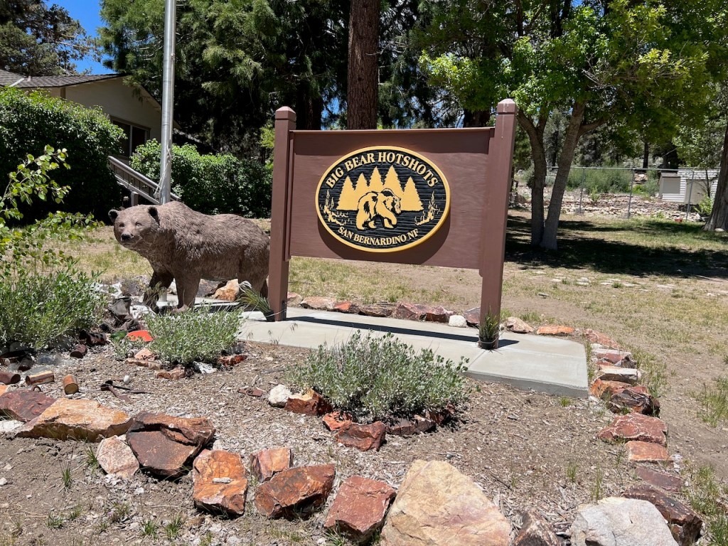
Eventually the road passed some buildings, houses, and what appeared to be the headquarters for the Big Bear Hot Shots crew. The road was off limits to traffic, but not hikers. I could see why Running Cougar Trail was not more utilized. Had I approached this from the road, I might have felt like I was trespassing. But no signs stated anywhere the drive or trail that it barred access to hikers.
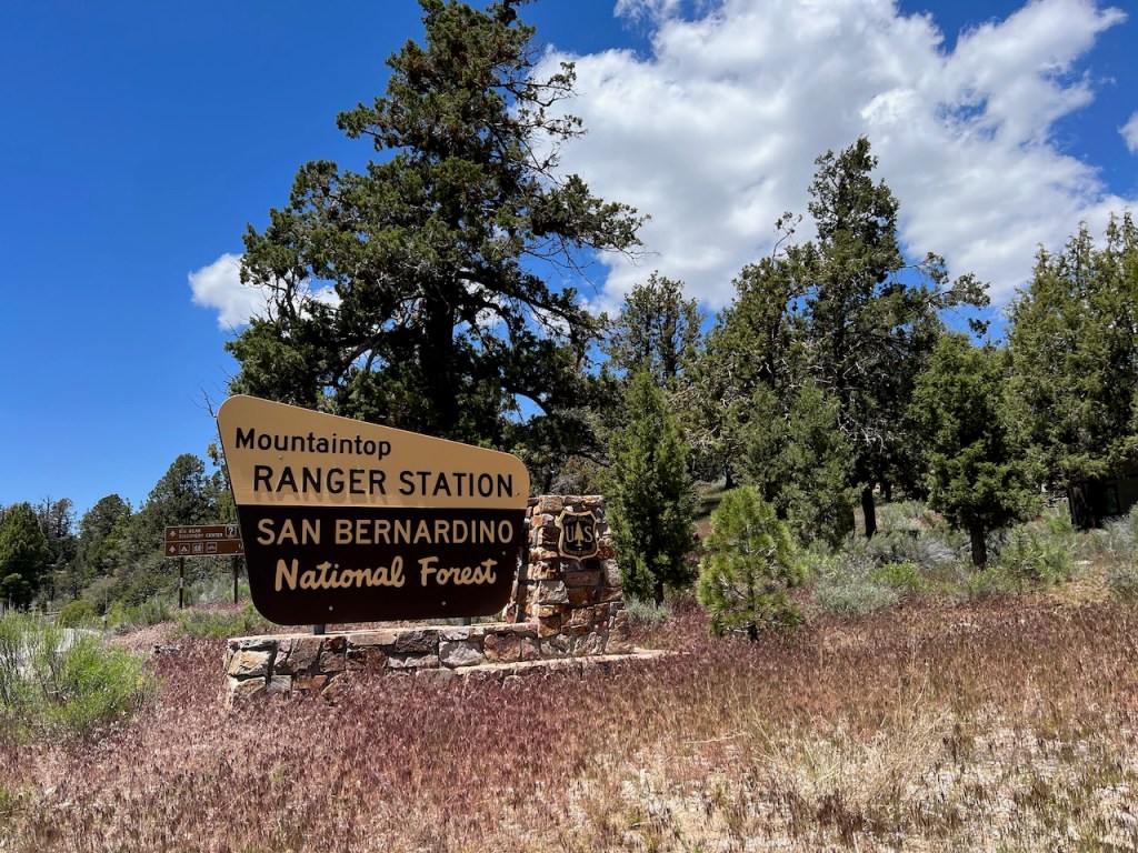
We crossed the road right by this sign for Mountaintop Ranger Station, and walked down the road to Juniper Point.

Alpine Pedal Path
Off to our left was the Alpine Pedal Path, where I could see people cycling along. We noticed there was an unnamed trail along the lakeside, that was for hiking, not biking, so we chose that one. The road less paved is always going to be my first choice.
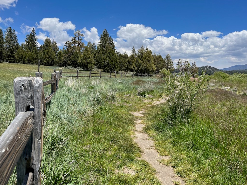
The Lakeside Trail
This green pasture-like trail was so refreshing, and pleasant. We walked through grassy fields, crossing over small streams feeding into the lake. Boards had been placed over them to serve as bridges.

There were more grassy meadows, and wildflowers. There were some beautiful picnic areas here, and another small parking area.
Back to the Trailhead
Eventually we made our way through a forest of tall Ponderosa Pines, and wound our way back to Cougar Crest Trailhead. Hiking to Bertha Peak and back in a loop, instead of out, and back, shortened the hike considerably.
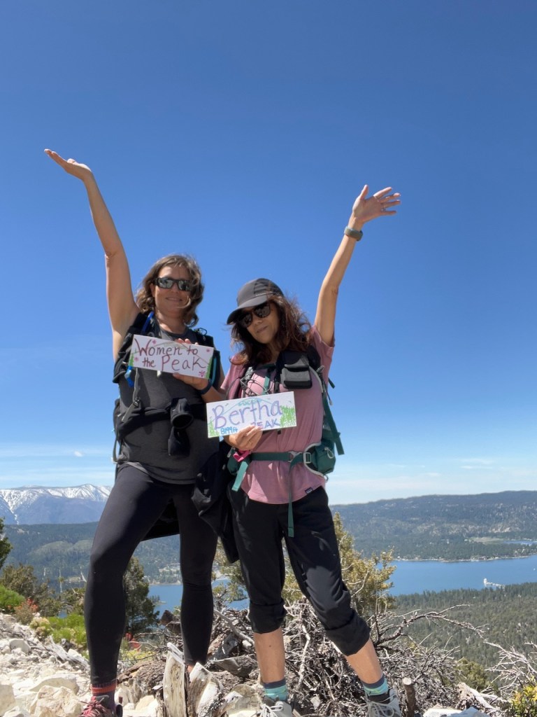
Women to the Peak
We bagged Bertha Peak on our inaugural hike for my hiking group, Women to the Peak. I founded this hiking group, because I wanted to share what hiking has done for me. This group is for Socal area women looking for peak bagging partners. My life has changed in every way since I started hiking. I have undergone a 360 degree change in my health, through regularly getting outside, and being on the trail. I hope you may join us, and get peak bagging! Level for most planned hikes is for women who have previous hiking experience of hiking 5+ miles and up at least 1000 feet of gain, or advanced beginner level +. But I will occasionally lead local beginner level slower pace hikes, of up to 3 miles on mostly flat terrain. Nobody gets left behind. Our group is based in Orange County, and I will be planning a hike once a month.
Stats
We ended up only hiking 7.4 miles total, when we had planned for about 8 miles roundtrip. The total gain on this hike was about 1453 feet. Adding up the mileage of the other two trails, we had added some gain to the hike.
Conclusion
The hike to Bertha Peak is an advanced beginner to intermediate one, based . If I was to hike Running Cougar again, it would only be up. I would hike the Lakeside Trail, just about any day. It would be perfect for any level of hiker, since it was short, and flat.
I hope you enjoyed reading this, and it is helpful in knowing what to expect, should you decide to visit here.
About me
I’m Serafina! I’m a writer and California girl who loves to go exploring. Hope you will get outside today, breathe some fresh air, and be happy!
Follow my Journey…
Be sure to Like and Subscribe to My Youtube Channel where I post videos!
Disclaimer: The work on this blog is my opinion and my opinion alone and I am not responsible for the outcome if someone were to apply these thoughts to their own life. All text and photography copyright 2023 by Serafina, all rights reserved. Information and opinions provided are kept current to the best of the author’s ability. All readers’ usage of the ideas and opinions presented in the blog, are at their own risk. Be aware of the possible dangers of hiking, surfing, walking, cooking, and other activities, which may take place indoors or outdoors. By reading this, you agree not to hold the author or publisher of the content on this web site responsible for any injuries or inconveniences that may result from reading the blog, or partaking in any activity mentioned in the blog. Read the blog, and use its ideas, if you so desire, at your own risk.
