
My First Ever Thru-Hike
The TCT was my first ever thru-hike, which I completed solo in April of 2021. I had known about thru-hiking for years, on long trails such as the Pacific Crest Trail (PCT), the Appalachian Trail (AT), and several other beautiful long trails throughout the US. But I did not know until more recently about short thru-hikes, such as the TCT, and the HST. So I set about planning a solo 3 day backpacking adventure on Catalina Island, starting at the southern terminus in Avalon, ending at Parsons Landing, on the other side of the island. Maybe I was not yet PCT material, but how would I ever be, if I did not start somewhere right?

Planning a Thru-Hike
Heading into the wilderness of Catalina solo was not as difficult as it sounds. I did a bit of careful planning, studying maps, and reading about other peoples experiences in advance. Whether it’s freak storms, animal encounters, or things that go bump in the night, plans can change. I wanted to be ready for whatever was in store.
In this Guide
- Reservations
- Transportation
- Gear
- Water Sources
- The Terrain
- Beaches
- Exposure
- Campgrounds
- Hot Showers
- Firewood
- Food Options
- Calories
- Safety
- Hazards
- Itineraries
- Cell Service
- Maps
Reservations
Get to know the map of where the campgrounds are on Catalina. You have a choice of just five different places to stay, and camp, while hiking the Catalina Trail. You are not permitted to camp in the backcountry, outside these designated areas.
Catalina Island Company
The first step is to book your site for each night, at the Catalina Island Company here. One thing to note, is it a little tough to find spots at Parsons Landing. The trick is for your nights to all line up. Hermit Gulch, and Two Harbors had the most sites when I booked. You are permitted to stay multiple nights at any of the campgrounds, based on availability.
Campground Options
- Hermit Gulch
- Blackjack
- Little Harbor
- Two Harbors
- Parsons Landing
Transportation
The next step is to book your ferry as early as possible, from San Pedro on the Catalina Express here. This is the departure point of choice, if you want to take the ferry to one side, and then return on the other, back to the same place you left your car. You could also get a ride to the ferry, and return via a different spot, it’s up to you to decide what works. The parking at the ferry terminal was $20 per day, subject to change. There are other ferries, but none of which go to both Avalon, and Two Harbors.
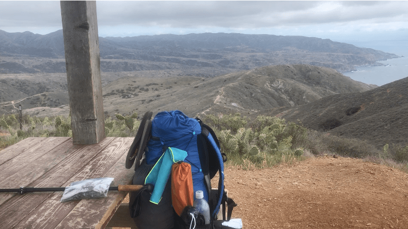
Gear
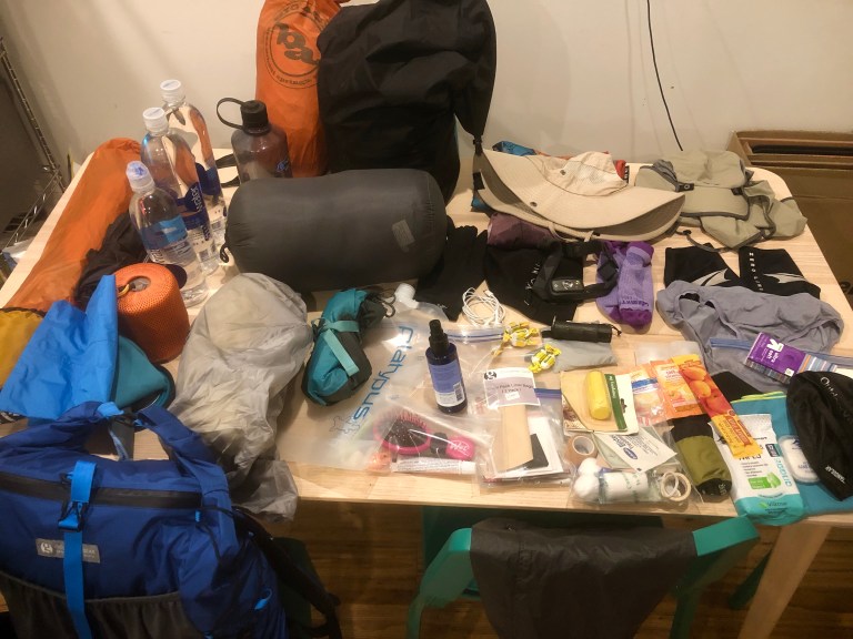
The main pieces of gear you will need are a good backpacking tent, a sleeping bag, a sleeping pad, and a backpack. In addition to these essentials you will need food, cookware, clothing, and safety gear, according to your personal preferences. You will want to have all the 10 Essentials of Hiking, and then some. That said, try to pack as light as possible, only bringing what is essential to you, since it will make the trek all the more enjoyable, with less weight on your back. Luxury items are typically heavy items. You can check out my TCT Gear list on lighterpack here.
Water Sources
Fortunately drinking water is abundant on Catalina, and available at all the spigots in each campground. There is no potable water, creeks, or streams in between. So you will have a few long water carries, of 10+ miles. So I recommend planning to have a 4 liter water capacity. Depending on how hot it is, and how thirsty you are, you may even need 6 liters. I brought 4 smart water bottles, since they are light, and sturdy. Many people opt for hydration bladders. It’s really up to your personal preferences.

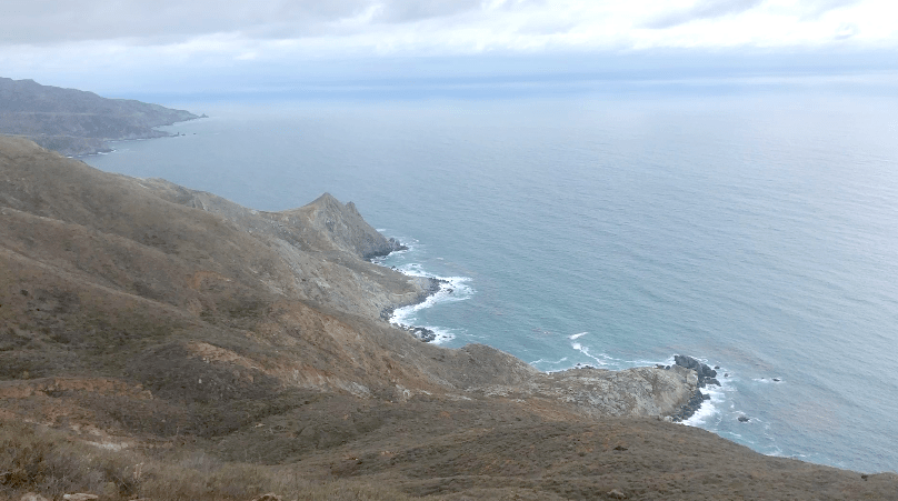
The Terrain
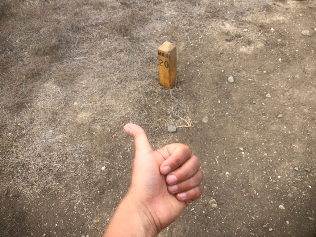
The Catalina Trail is part sandy narrow single-track, and part fire road. Most of it is fairly level, but it is not flat. This is a hike with some teeth. The first mile or so from Hermit Gulch has steady gain from the start. The trail felt like a rollercoaster, as in what goes up, must come down, before it goes back up again. You can expect to complete about 7500 feet of gain in however many days you take to complete the trail. This is the equivalent gain of hiking Big Iron. That said, you are probably not hiking 7500 feet in one day, so taking your time is encouraged if this cumulative gain scares you.
Steep Inclines
There is only one steep section I remember, and that was heading downhill from the ridge into Parsons Landing. That section had a 40% grade, so be forewarned on that. Butt sliding is an option there. Better yet, pack in a piece of cardboard, and make a sled.
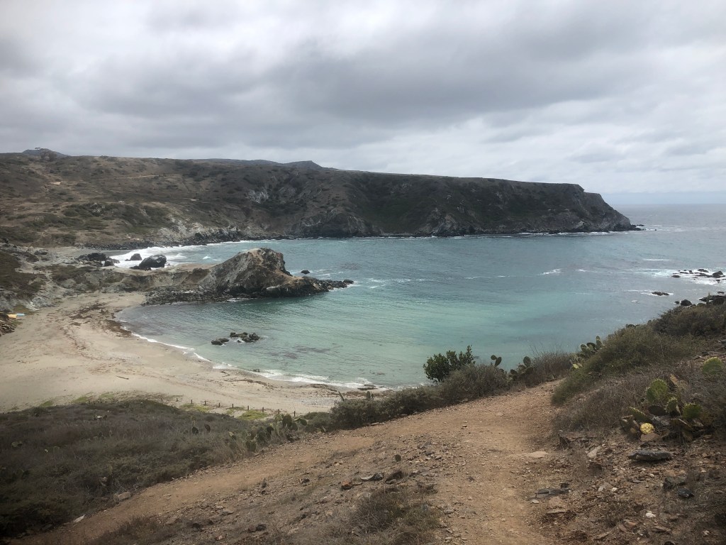
Beaches
The trail bypasses several sandy beautiful beaches, which may be worth staying longer at, such as Little Harbor. You may want to pack a swimsuit, depending on the season. The water warms up in late August, to about 70 degrees, and stays warm into September. The rest of the year, expect the waters to be chilly. Summertime is a busy time of year here, with all the beach tourism, so it tends to book faster than when I hiked here in spring.
Sun Exposure
This is a beach bum paradise, and if sunbathing is your thing, you will love this trail. Since there is very little shade to speak of on the trail, there are shade structures throughout the trail, every mile or so, to provide a much needed break from the sun, in areas where it is very exposed otherwise. I enjoyed having a picnic lunch at these structures, and stretching out under the pergolas.

Campgrounds
There are five campgrounds throughout the island:
- Hermit Gulch
- Blackjack
- Little Harbor
- Two Harbors
- Parsons Landing
I stayed at just two of these, and you may wonder how. Well I began at Hermit Gulch, and the terminus on Day 1, before hiking to Blackjack, where I stayed for the first night. My second night was at Two Harbors, after a 14 mile hike on Day 2, bypassing Little Harbor. For my third day I trekked the 11 mile loop to Parsons Landing, and back to Two Harbors, in time for the 4:30 pm ferry back home on Day 3 of my hike on the TCT.
Hermit Gulch
This campground in Avalon is tucked into Avalon Canyon about two miles from downtown, at the terminus of the Trans-Catalina Trail. It has 40 tent sites, 7 tent cabins, a spigot with potable water, coin operated hot showers, restrooms, picnic tables, BBQs but does not allow fires, along with having an on-site ranger.
Blackjack Campground
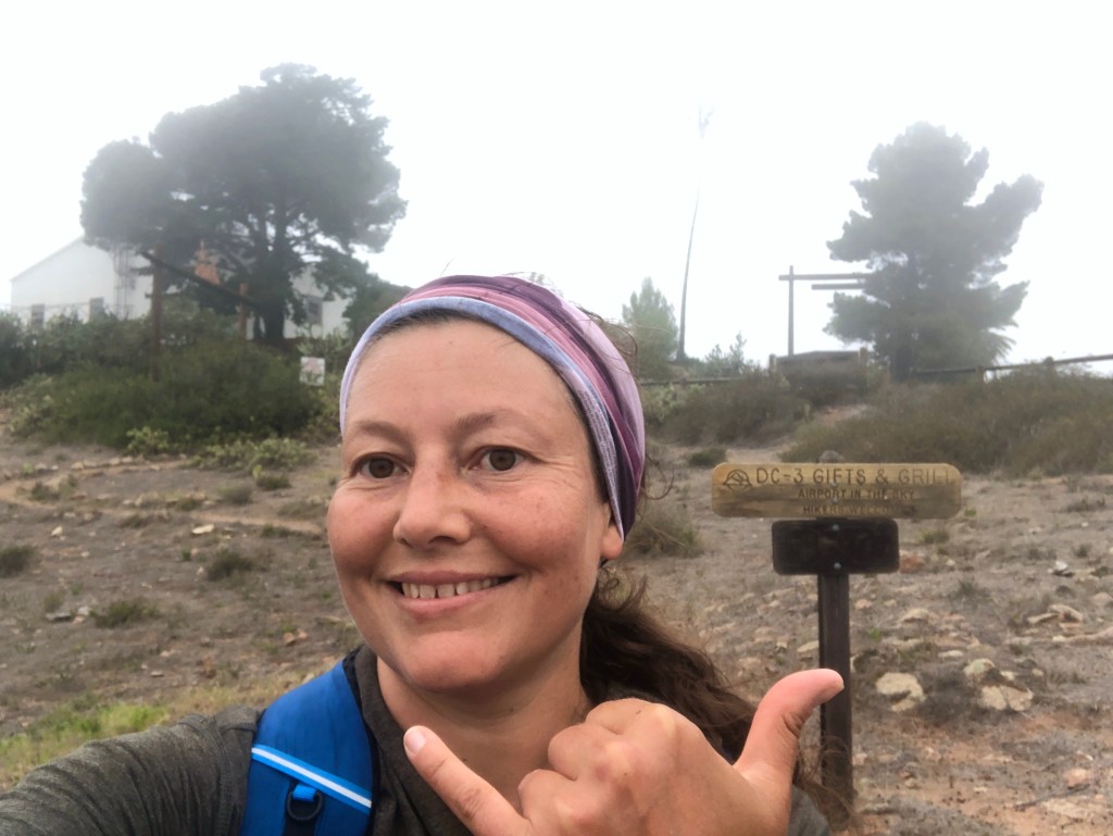
This backcountry campground has just 10 sites, a potable water spigot, a cold outdoor shower, pit toilets, and no campfires are allowed. It is located 11.5 miles from Avalon, and 2 miles from the Airport-in-the-Sky.
Little Harbor
This campground overlooks the beaches on the more rugged windward side of the island. It was rated as one of the “Best Campgrounds in the West” by Sunset magazine, so it tends to fill up with all this press it’s getting. It has 26 sites, a potable water spigot, cold showers, porta potties, a few shade structures, a ranger on site, and fires are allowed in the fire rings.
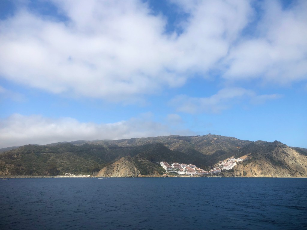
Two Harbors
This campground is a half mile walk from Two Harbors village along an ocean-view bluff. It has 47 tent sites, beach access, a potable water spigot, cold outdoor showers, porta potties, picnic tables, fire pits, BBQs, and sunshades. It also has a few tent cabins with propane stoves, lanterns, fire pits, and picnic tables.
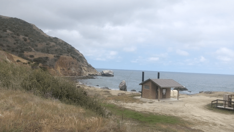
Parsons Landing
This beachfront campground has storage lockers, which you must pickup the key for in advance, at the ferry dock in Two Harbors, when the ferry office is open. In these lockers, you can retrieve both water, and firewood, that was purchased in advance. There are 8 campsites, along with beach access, pit toilets, but alas no running water, though fires are permitted in fire rings. The lack of running water sets Parsons Landing apart from other campgrounds on Catalina Island, along with it being the terminus for the end of the TCT.
Hot Showers
Coin-op hot showers and restrooms are located in Hermit Gulch Campground. There are also some in the town of Two Harbors, by the Harbor Restaurant, and the ferry dock. None of the other campgrounds have hot showers.
Firewood
Firewood is available for advance purchase from Visitor Services, for use at Little Harbor, Two Harbors, or Parsons Landing. It will be waiting at your site when you arrive which is highly convienent, for Little Harbor, or Two harbors. Parsons Landing has a different policy, which forces you to pickup a locker key from the ferry terminal before they close at 4:30pm daily, in order to get your firewood, if staying there.
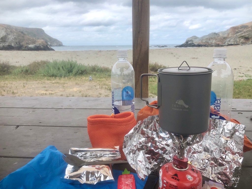
Food Options
You will want to bring food based on how you like to eat, and how you plan to the cook your food. Some people use the no cook method, and others prefer to just bring pre-made items, such as a bag of granola, with no cooking required. Some eat breakfast, lunch and dinner. Others eat snacks all day, and cook one big meal. I enjoyed meals from Good to Go, and Backpackers Pantry on this trip. I brought tons of energy bars, and high carb snacks. I stopped to buy a few snacks at the Avalon Vons store on the way to the trailhead. Bringing extra food is always a good rule of thumb. Also, don’t forget electrolytes, to help keep you hydrated. I love Nuun tablets. There are just a few restaurants in Two Harbors, and numerous ones in Avalon, along with the popular Airport in the Sky Cafe, just past Blackjack Campground.
Popular Trail Foods
- Ramen Noodles
- Just Add Water Backpacker Meals
- Pre-cooked Rice Meals
- Mashed Potatoes
- Oatmeal
- Freeze Dried Snacks
- Dried Fruit
- Trail Mix
- Jerky
- Peanut Butter
- Tortillas
- Cheese
Calories
There is no rule about calories when hiking, though some people say you should adjust what you eat to the calories you burn. I eat regularly and when I am hungry. I ate something about every hour or two on this trek. I always take electrolytes, no matter what, or how much I eat. I personally lean towards eating more carbs for energy, but to each their own.
Safety
Your own personal safety is your responsibility, but I do recommend bringing a Garmin In-Reach device, just in case you become injured, and need assistance. There is no cell service throughout most of the backcountry of Catalina, so I would not count on it. Backup paper maps, and a backup charger with enough power to charge your phone a few times is recommended. I would not want to be out on this trail, without a downloaded map. In spite of that, I did briefly get turned around, and off trail once, while on the TCT, just passed Haypress Reservoir, which cost me some time.
Hazards
Aside from the usual hazards present while hiking, such as slipping, falling, exposure, and bad weather, there are unique kinds of wildlife hazards to be aware of here. In addition to mountain lions, and rattlesnakes, Catalina has a lot of Bison. These beasts are not something you want to approach. They are aggressive, and approaching them has resulted in injuries, and deaths in the past. I had a very close call with Bison on my trip, and it is no laughing matter. If there is any reason I would not hike this trail again, it would be Bison. They really scared me.
Itineraries
Most people take 4-5 days to hike the Catalina Trail.
Sample Itinerary
Day 1 – Hermit Gulch
Day 2 – Blackjack
Day 3 – Little Harbor
Day 4 – Two Harbors
Day 5 – Parsons Landing
Hike Your Own Hike
I went a bit faster than this, since I was more short on time. I hiked 11.5 miles on Day 1, to Blackjack, 14 miles Day 2, to Two Harbors, 11 miles to Parsons Landing, and back to Two Harbors, on Day 3, before returning home that night, to a warm bed.
How you decide to plan your itinerary is up to you. Each night’s stay has a cost, so I saved on camping fees, taking less time. If there were a site I would have stayed multiple nights it would have been either Hermit Gulch by Avalon, Little Harbor with its beautiful beach, or Two Harbors, so I could have done some additional hiking along Cat Harbor, which has its own separate trail, to the south of it.
Cell Service
There was spotty cell service on Catalina Island, and only a few places I was able to get a signal. I would not count on having it anywhere but Avalon, and Two Harbors for the trip, planning accordingly. A Garmin In-Reach will allow communicating with family, in absence of a signal. Be sure to read a tutorial on how to set it up in advance, as you must do so prior to getting on trail, in order for it to work.
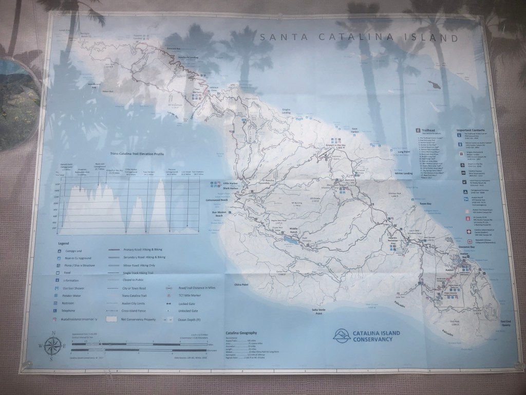
Maps
There are several maps people like to use. I used alltrails+ maps of the Trans Catalina Trail on my hike on the TCT, along with a printed backup map. There are maps you can purchase in advance of the TCT, for reference.
No One Plans to Fail
Many fail to plan, but nobody plans to fail. I hope this short guide helps you plan your Trans Catalina Trail thru-hike a bit better, and helps your know what to expect. For a more a indepth personal account of what it was like on the trail and the scenery, be sure to check out my trail diary about hiking the TCT back in 2021.
Read About My Hike on the TCT
Trail Diary: Day 1 of Hiking the Trans Catalina Trail (TCT) 37.5 Miles in 3 Days
Trail Diary: Day 2 on the Trans Catalina Trail – Blackjack to Two Harbors 15.7 miles
Trail Diary: The Trans Catalina Trail – 12 Mile Loop from Two Harbors to Parsons Landing Day 3
I hope you enjoyed reading this, and it is helpful in knowing what to expect, should you decide to visit here.
About me
I’m Serafina! I’m a writer and California girl who loves to go exploring. Hope you will get outside today, breathe some fresh air, and be happy!
Follow my Journey…
Be sure to Like and Subscribe to My Youtube Channel where I post videos!
Disclaimer: The work on this blog is my opinion and my opinion alone and I am not responsible for the outcome if someone were to apply these thoughts to their own life. All text and photography copyright 2023 by Serafina, all rights reserved. Information and opinions provided are kept current to the best of the author’s ability. All readers’ usage of the ideas and opinions presented in the blog, are at their own risk. Be aware of the possible dangers of hiking, surfing, walking, cooking, and other activities, which may take place indoors or outdoors. By reading this, you agree not to hold the author or publisher of the content on this web site responsible for any injuries or inconveniences that may result from reading the blog, or partaking in any activity mentioned in the blog. Read the blog, and use its ideas, if you so desire, at your own risk.
