
I have thought and wondered about hiking the PCT for many years. Living in Southern California, not far from the trail, I had hiked on short sections of it, out and back. I had not yet backpacked or thru hiked an entire section before, though I had hiked a short section of the JMT.
Section A starts in Campo, CA and is 107.1 miles long, ending in Warner Springs, CA. The prospect of hiking 100 miles was exciting to me. I knew the time to do it was in spring, after the nights warmed above freezing, and preferably after the winter time rains ended.
This winter and spring were a little different weatherwise. The rains never stopped, and there was a long line of incessant atmospheric rivers hitting California, one after another. The creeks and rivers were overflowing. It was a waterfall chasers paradise out there in the wilderness. There was even a super bloom happening. It was a lot to take in.
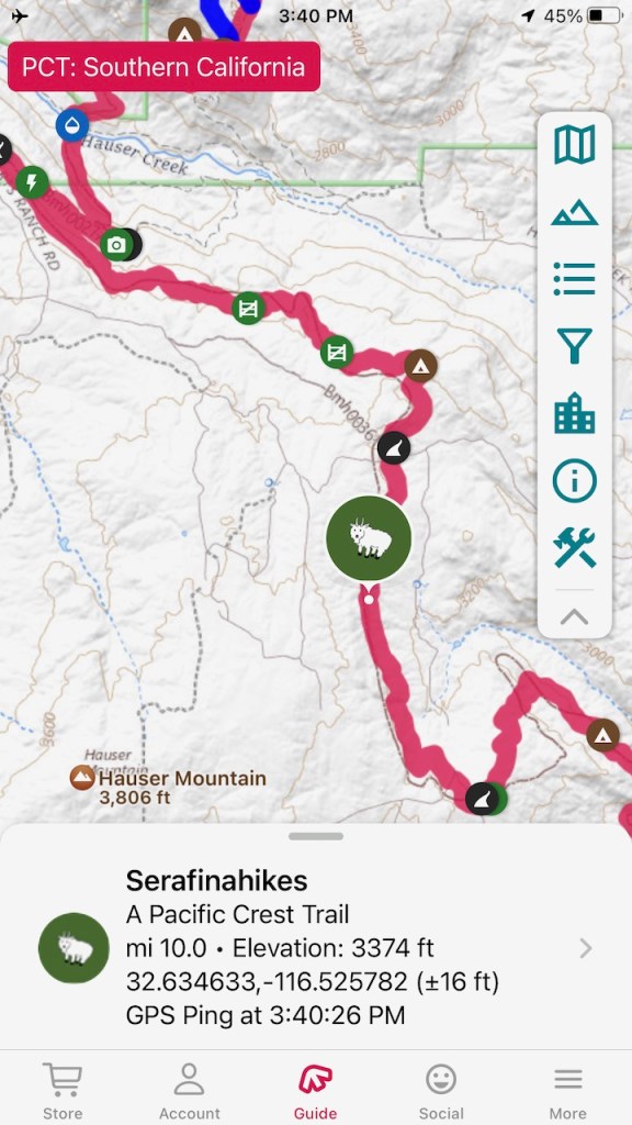
I decided the time was right, and I was going to hike the PCT. The only issue was I needed a permit for the part through the Cleveland National Forest, which is hard to obtain. So I decided to start with the section where I could hike without a permit, which is the desert section. I hiked from Ranchita, CA at Scissors Crossing, on to just shy of Warner Springs at Barrel Springs. At the time, I thought I was in Warner Springs.
Oh well I said. Will have to go back and hike those last few miles, to complete my goal. Then there was the longer 77 miles from Campo to Scissors Crossing. I lucked out and scored a Cleveland National Forest PCT permit for the most southern part of PCT Section A.
Day 1
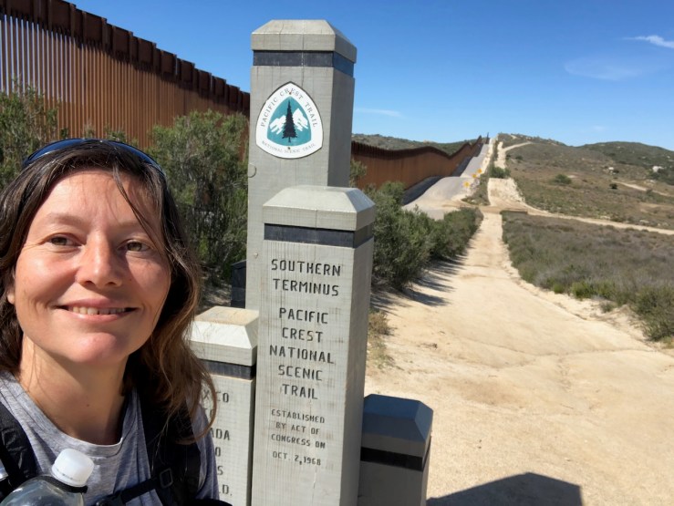
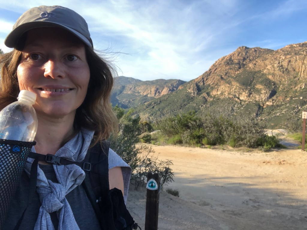
It was Easter weekend, April 8th, when I set out from the terminus, with the help of my boyfriend. He drove me there, a full two hours from my house, before driving another 2.5 hours back to his home.

There were a handful of hikers there at the terminus. A young guy, and a group of two women.
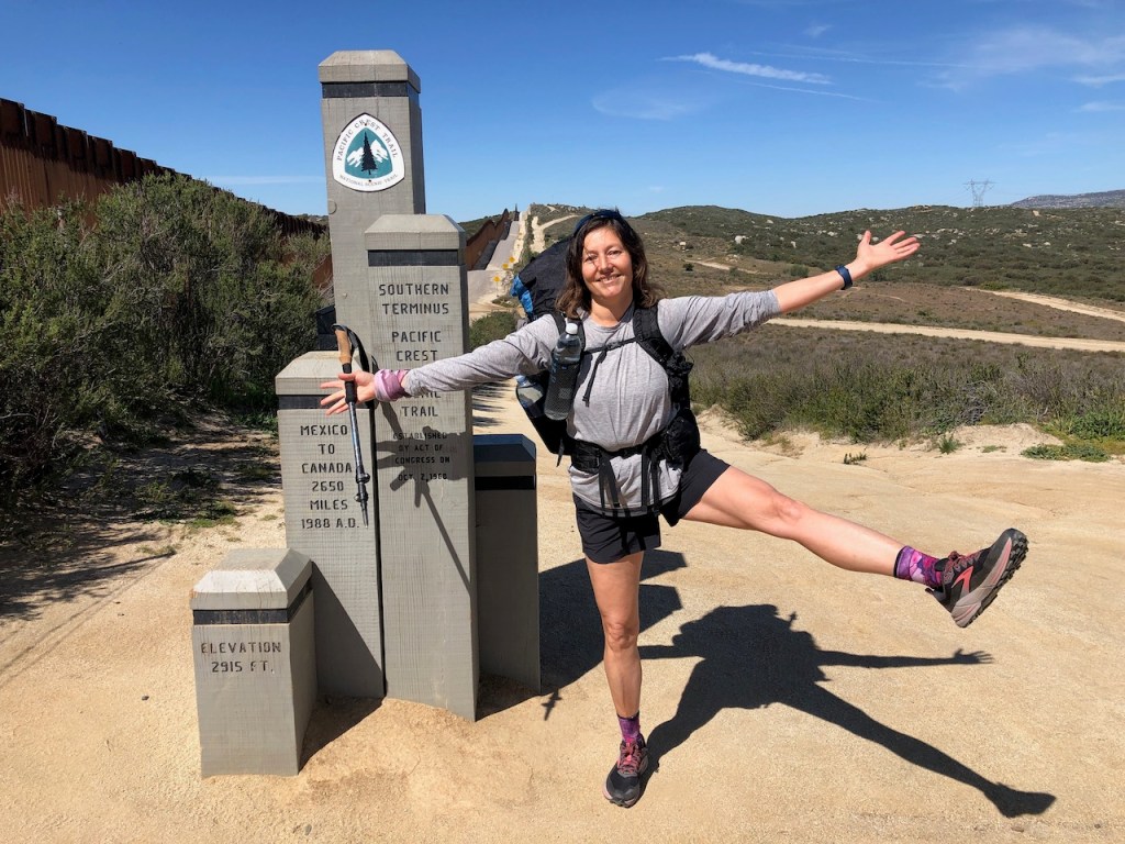
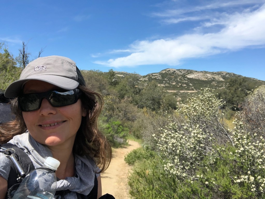
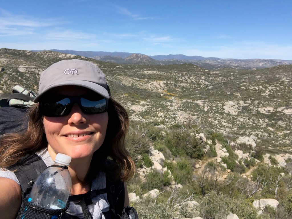
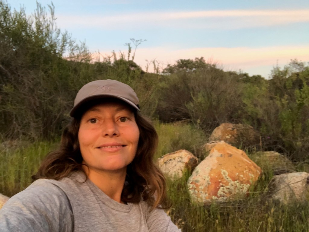
Me being silly, doing a fun pose, pretending to be a thru hiker. I suppose I will be, for a few days.
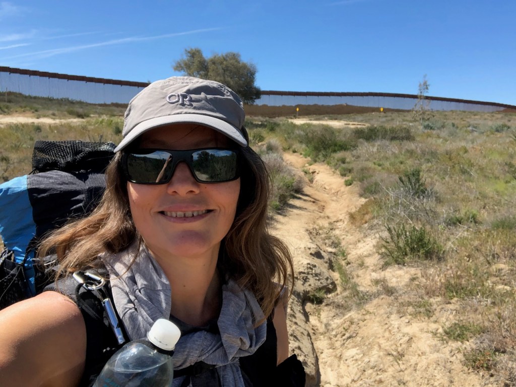
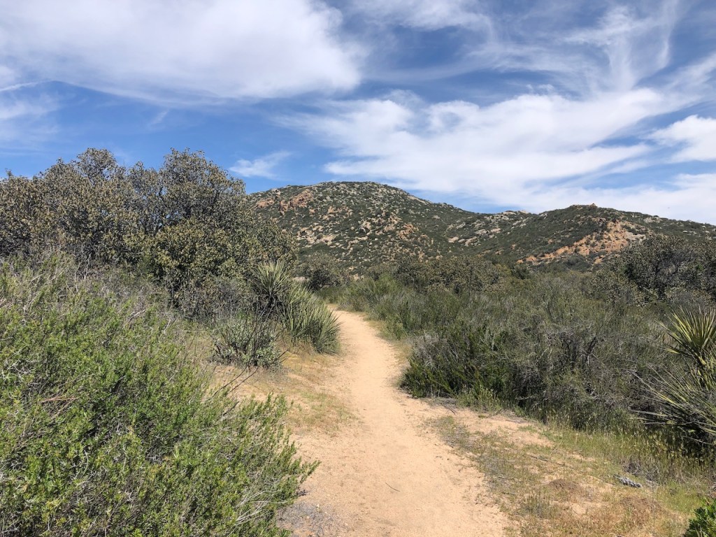
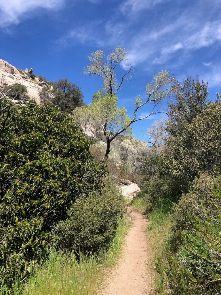
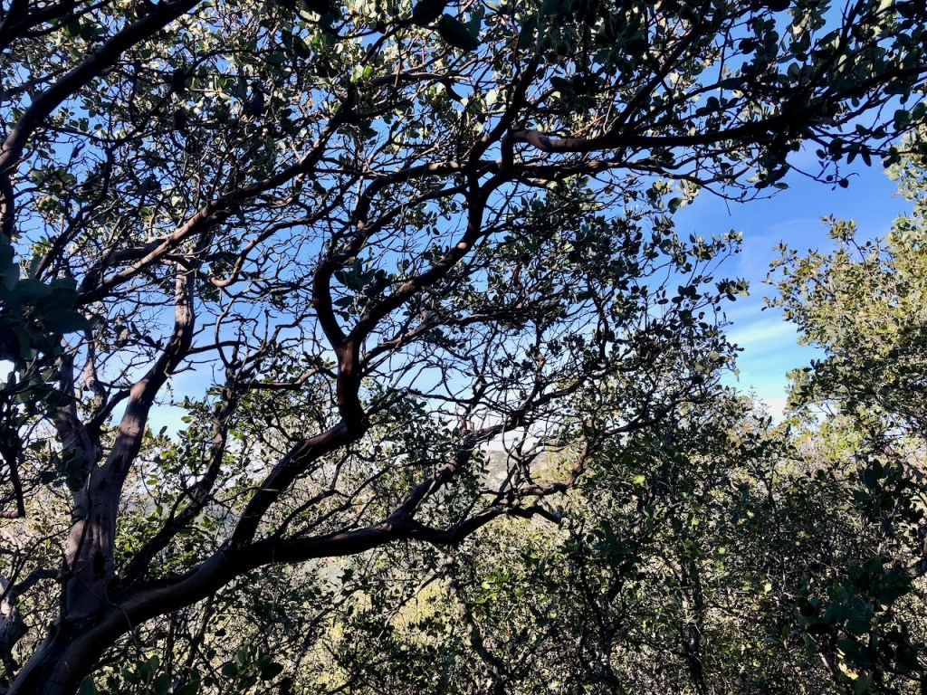
Day 1 of my hike took me further and further away from the border wall, through oaks, and amongst boulders, through the foothills.

We had spotted some hunters on the way there, and I could hear gunshots in the distance. There was plenty of BLM land there allowing hunting apparently.
I would pass the people I met at the terminus, about a mile down the trail, as they seemed stalled at a map board. I briefly ran into them once more, further down the trail.

I passed many large boulders and lots of brush the first few miles. Behind me was the southern border of the United States, with it’s famous seemingly impenetrable wall, hugging the ridgeline. There was some sort of ranch to my right, which appeared to host visitors.

I kept gazing back at the ominous border wall. I did not get close to it, or touch it when there. I respected the border wall and what it aims to protect us from. Many thru hikers will reach through it as a tradition. Not sure why.
Eventually, after 3 miles, I heard the sound of a train horn. I passed over the first and only set of railroad tracks of my journey.
As I climbed higher, and moved ever farther from the border, and it officially sunk in that I was finally hiking the famous long trail, the PCT from the actual terminus. It was a really cool feeling.
All I needed to focus on was one foot in front of another. I felt I started to get a rhythm going. I was counting in my mind a military march. My dream was now a reality.
On my mind were all the others hiking the PCT, all the way to Canada. I contemplated how long it would take to get there, depending on the miles one put in everyday. I reasoned that you might need to hike at least 12 miles a day on average to get there in a reasonable amount of time.
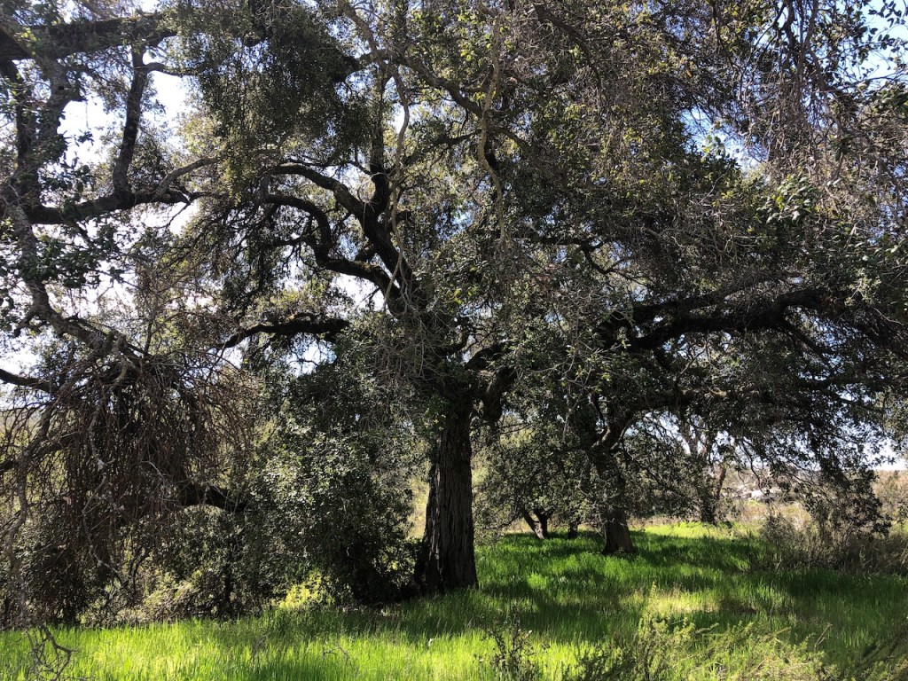
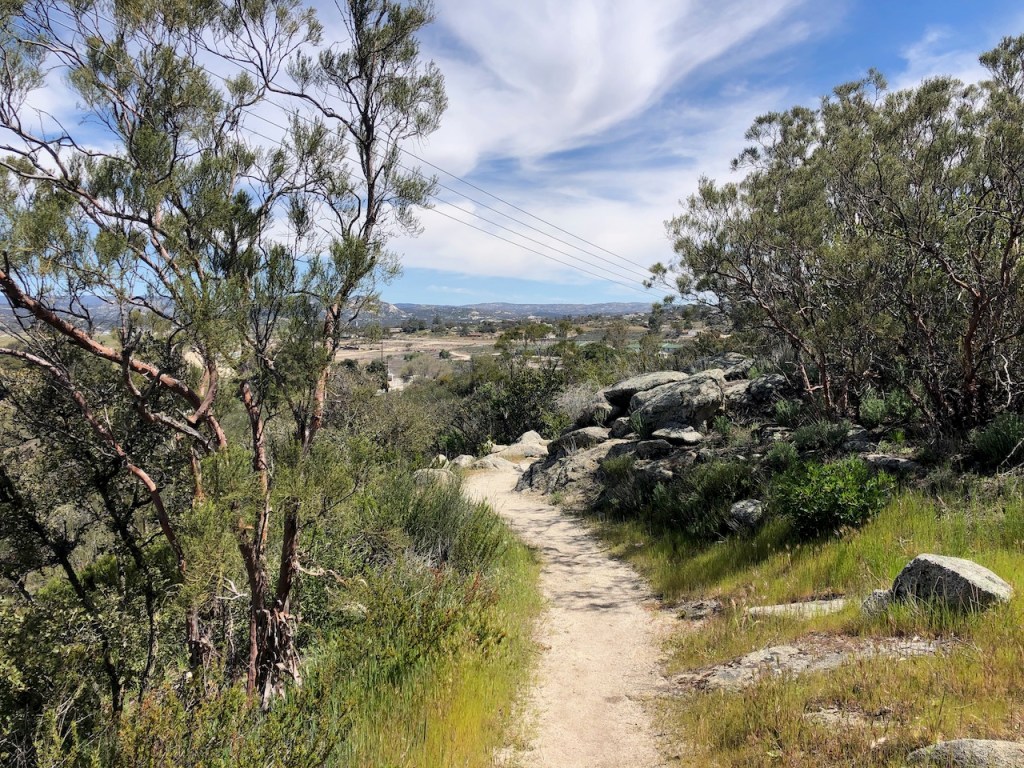
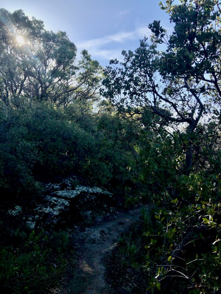
There would be lots of oak forests I would pass through along this section of the trail.
A young guy in a red hoodie, who chatted me up about my Z-Packs bag at the terminus, happened to pass me by. As he passed he asked me what I was doing with my phone, and if I was looking at the Far Out app. I replied “something else.” I was glad I did not get stuck in a conversation.
I was here to listen to nature, not the world. I really just wanted to be alone, with God, nature sounds, and my thoughts for a few days.
It was back to listening to the sounds of nature again. Birds were chirping, and butterflies were everywhere.
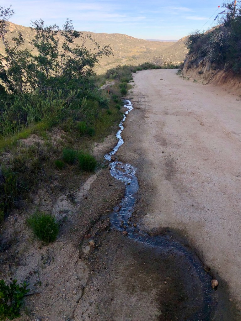
The Creek Crossing
I came to my first official creek crossing, one that would require me to remove my shoes to cross, unless I wanted wet shoes, which is my last resort. One thing about me is I absolutely don’t like having cold or wet shoes and feet when hiking.
The Crossing Guard
There was a solo woman hiker there, eating lunch by the creek. She almost immediately began to give me much unsolicited advice on how to cross the creek. This was annoying. So as I debated my best option for crossing, she dished out lots more ideas for helping me across this stream, for the entire 5 minutes. it took me to switch into my Teva river sandals. That was interesting.
A 5 Foot Wide Creek
If one is solo backpacking in the wilderness, they probably don’t need help crossing a small creek. I was perfectly capable of figuring out how to cross a 5 foot creek. I took off my shoes and crossed it, wading on through. This crossing was very tame, and nothing of concern. I just don’t like wet feet.
After crossing, I asked how she was doing, and her answer was to ask me how I was, cleverly answering a question with a question. Interesting. I wondered what kinds of characters I might meet along this trail. Anything was possible.
5 miles In
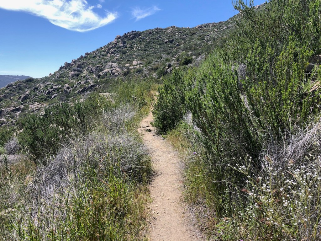
As I walked off down the trail, my feet dried off. Eventually I paused at a large rock which was warmed by the sun, for a footwear switcheroo. The trail began to climb higher after passing the 5 mile mark, through some dense and fairly scratchy brush. The trail was difficult, uneven, and rocky. It began to get baking hot, around 12:30, as I made my way up a series of switchbacks toward a plateau, a flatter stretch of trail. This part was easy. I would soon take a deep dive into Hauser Canyon.
Pacing Myself
I had heard lots about Hauser Canyon, and the thing that stuck in my mind the most was that you never want to try to hike out of Hauser in the late afternoon. I knew I had no chance with such a late start of making it to Lake Morena at the pace I was going at. I started off at 2.75 miles per hour. I was down to the standard 2 miles per hour. I knew Hauser Canyon was likely my camp spot, if not sooner. I was pretty good on water, since I started with 4 liters that morning, and was feeling confident.
The Trail Levels Off
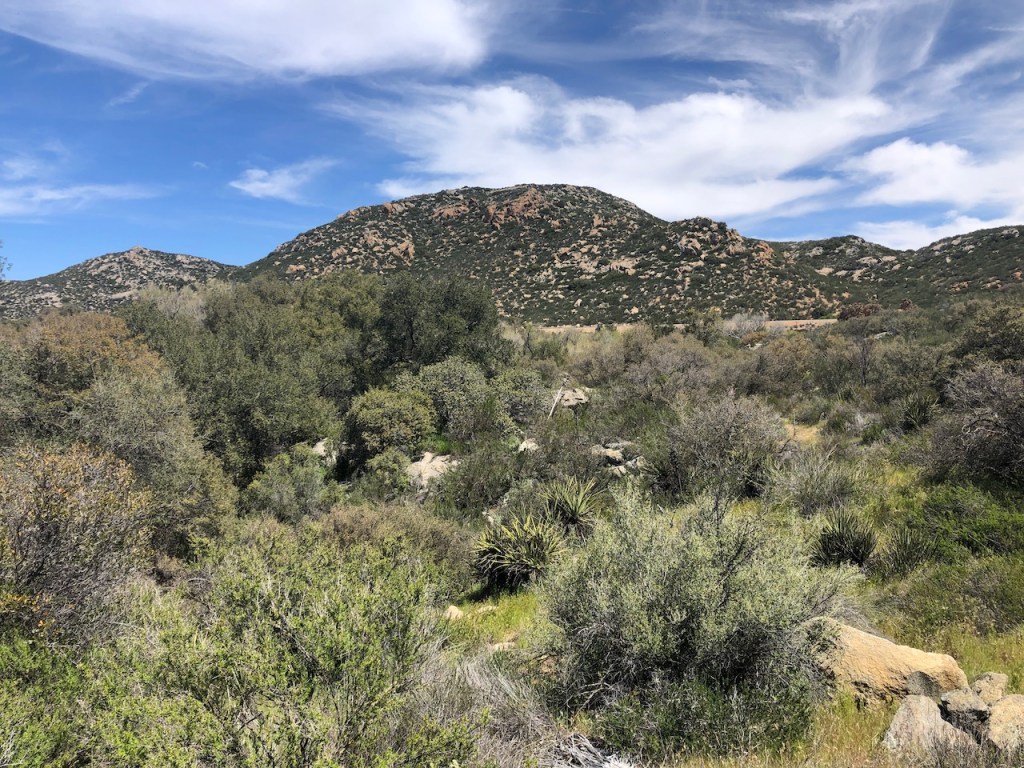
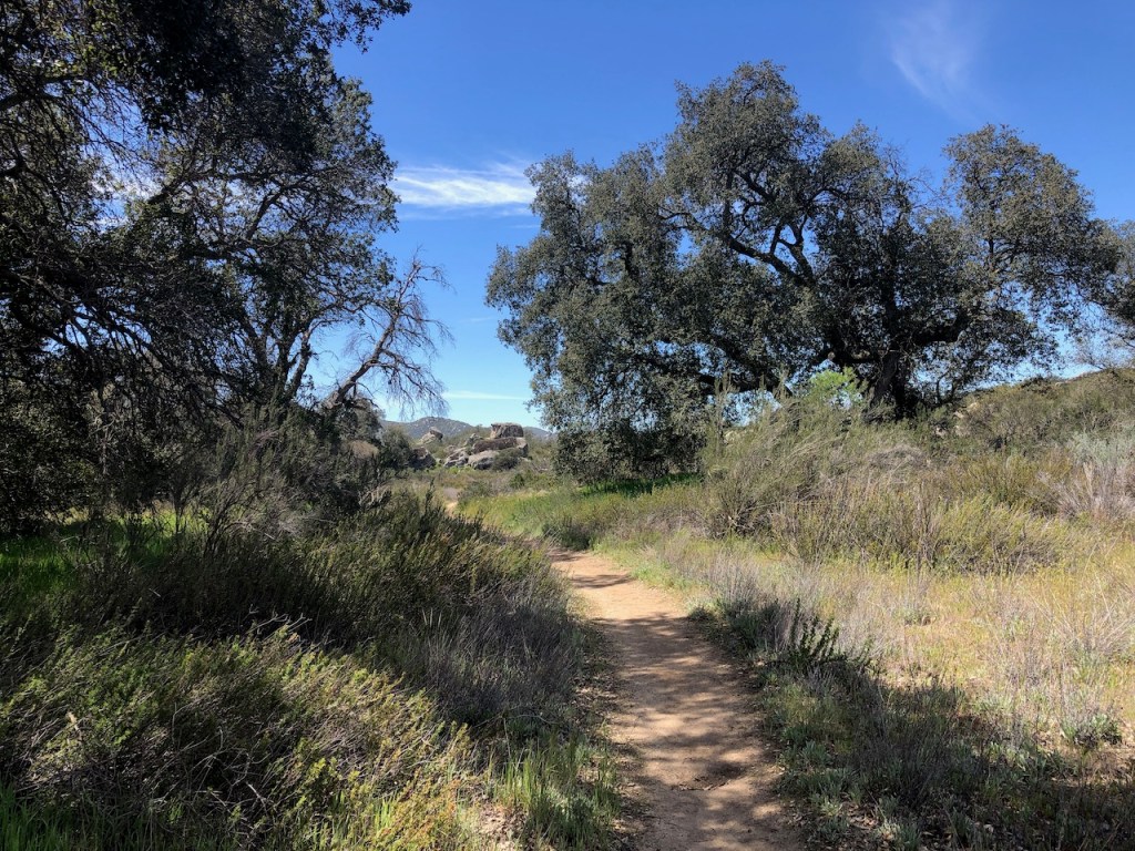
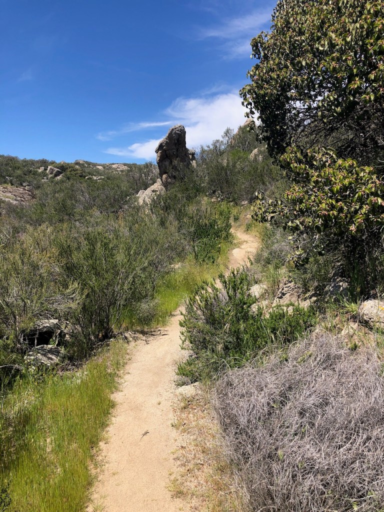
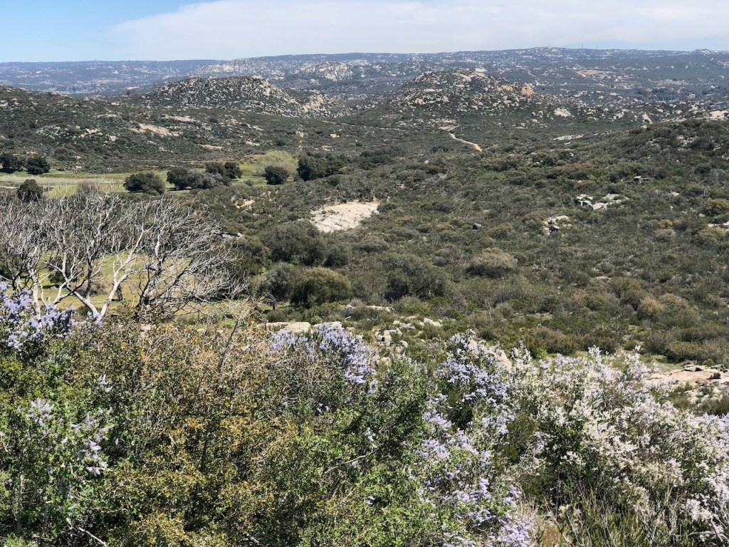
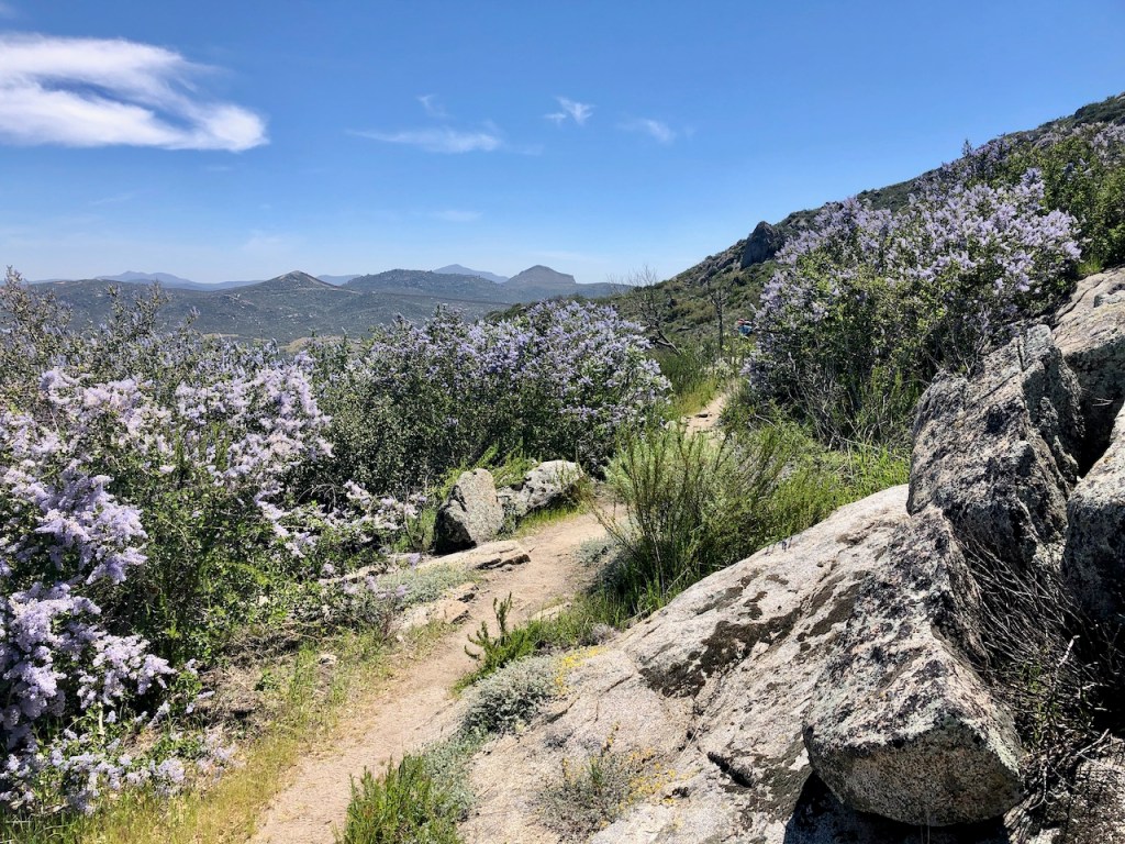
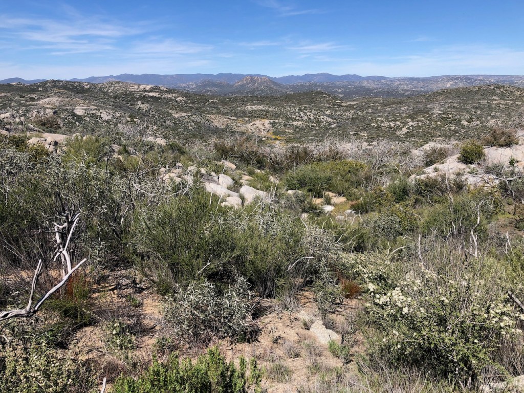
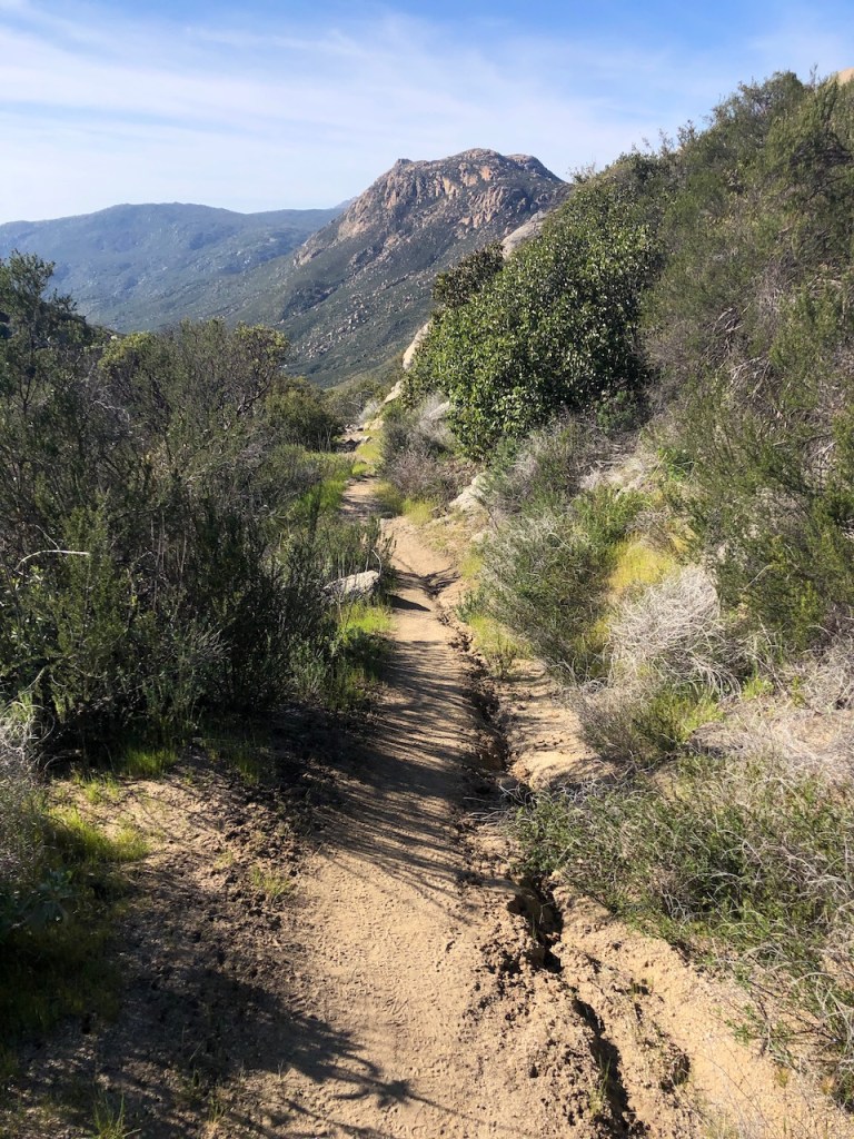
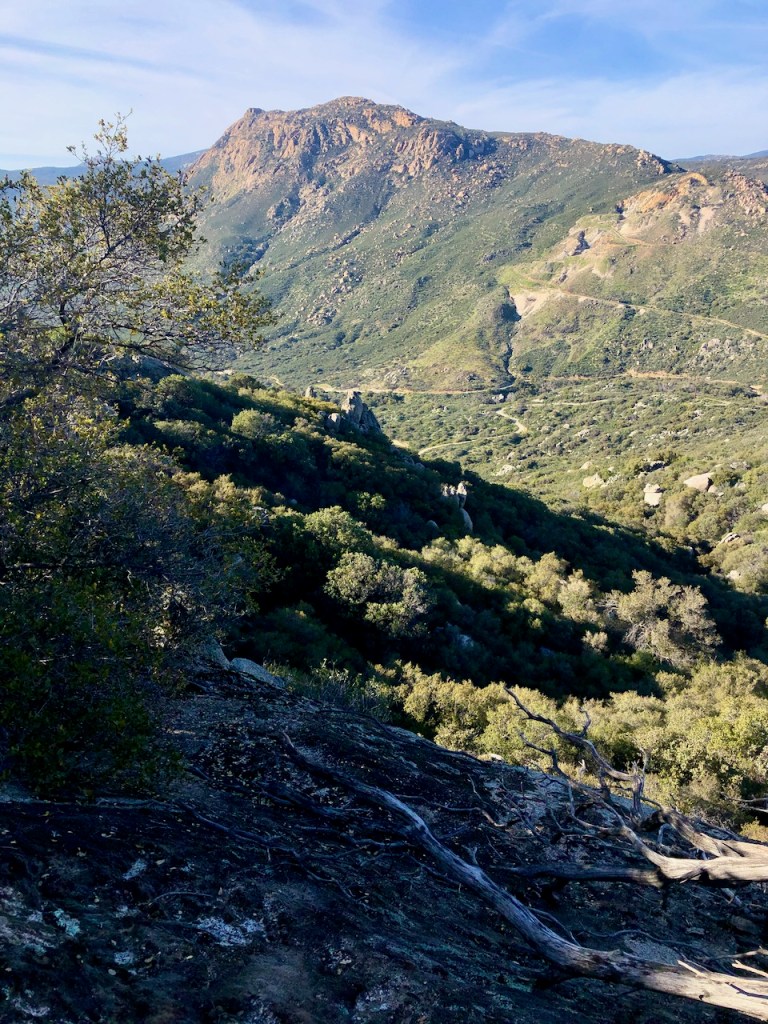
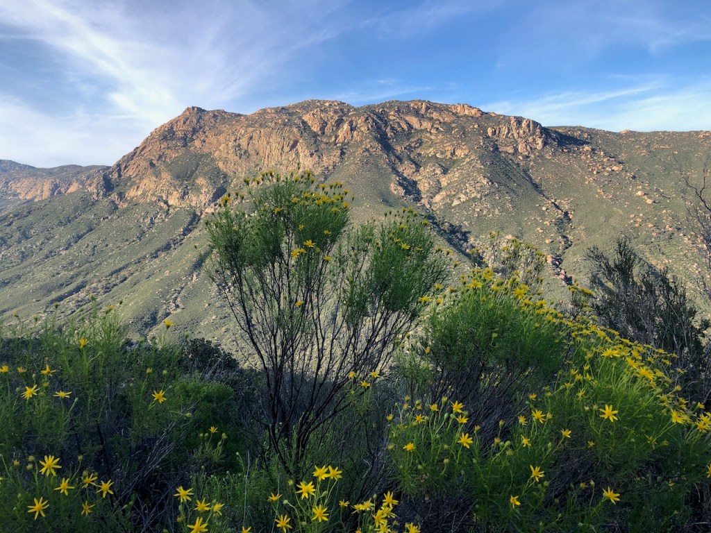
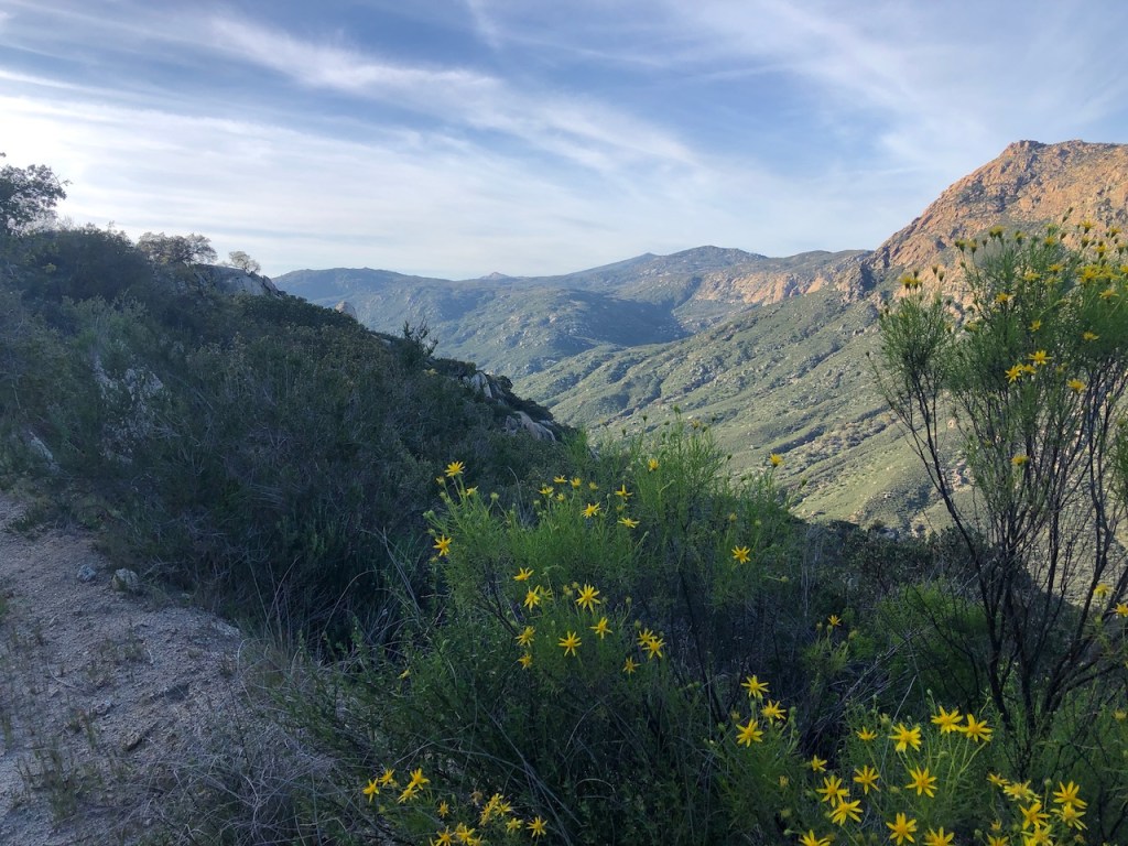
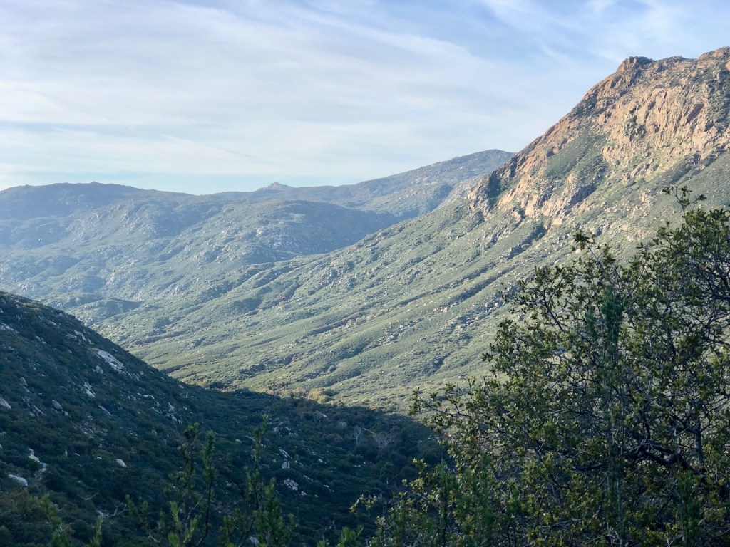
I hiked on and made my way along a scenic plateau section, around 7-8 miles in, which was dotted with interesting rock formations reminiscent of stonehenge. There was fragrant blooming lilac bushes all around.
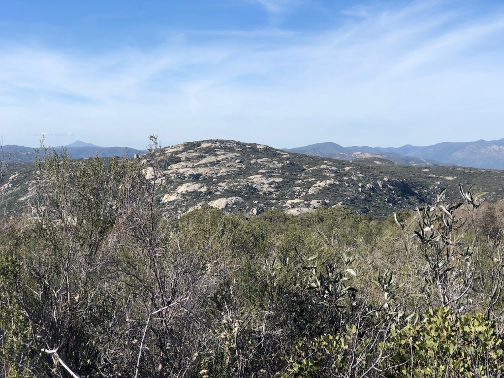
There were ghostly skeletons of burned manzanita trees, once charred black, but now faded to an ashen gray.
There were lakes, and grassy fields in the valley in the distance.

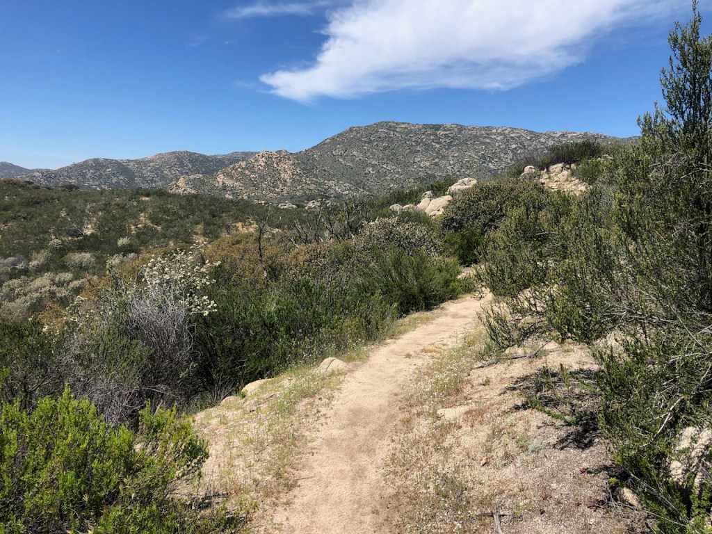
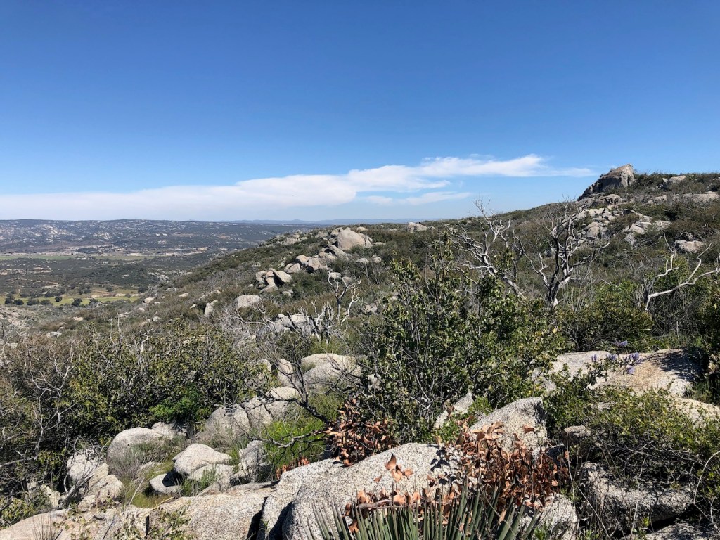
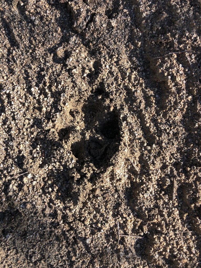
I inched my way further from the border, towards the high peaks of the Cleveland National Forest. I happened to notice paw prints in the dried up mud.
I passed a couple camped on a scenic ridge, relaxing next to a large boulder, somewhere around Mile 8 or 9. They asked if I cared to share their shade. I politely declined, since I was on the move. I needed to make miles.
Trail Names
I started to think about “trail names,” that thru-hikers give each other, and started imagining names for the hikers who I already passed. I thought of some good, and not so good ones. Then I tried to think of one for myself, but kept coming up empty handed. You can’t give yourself a trail name, it’s against the rules.
Determined
I was not about to stop, since I was determined to make it at least to Hauser Canyon.
In my mind, I thought if I made good time, and could stay just past Hauser. But that was wishful thinking.
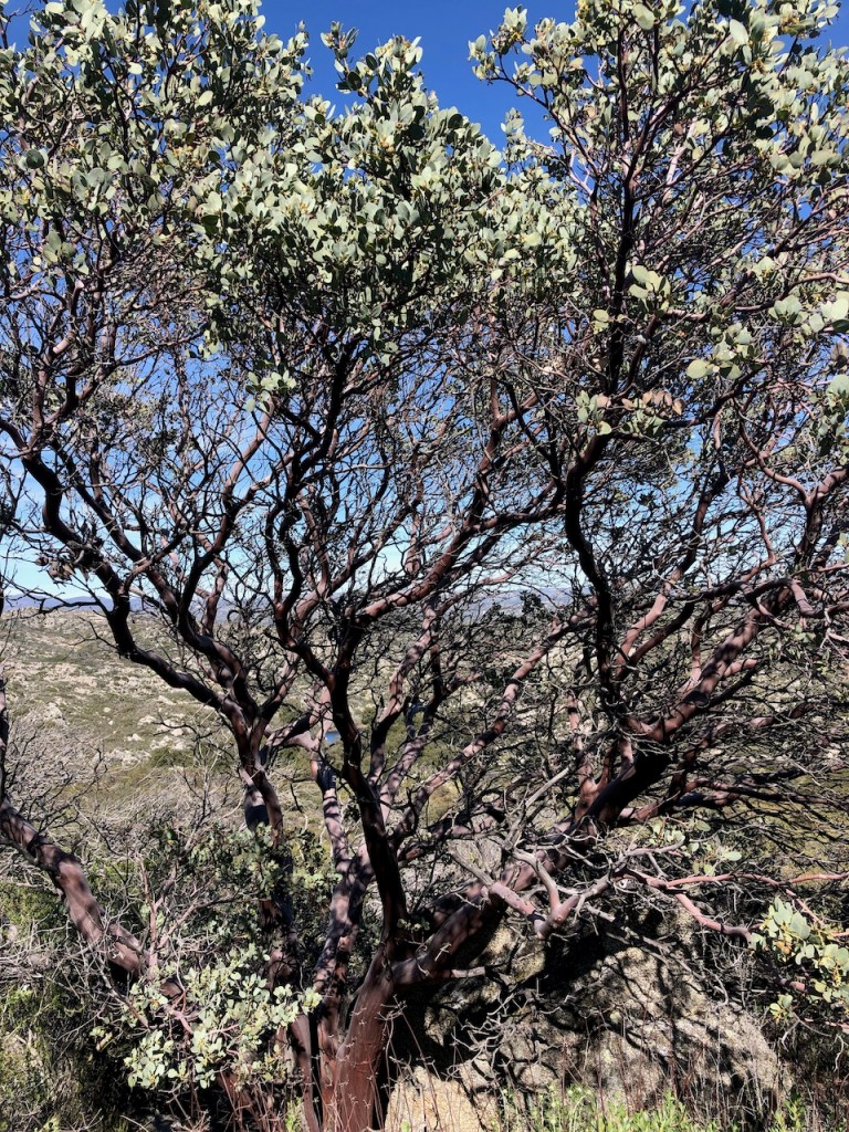
The Manzanita trees along this stretch were nothing short of amazing, with unusually thick trunks. Some appeared to be at least 50 years old.
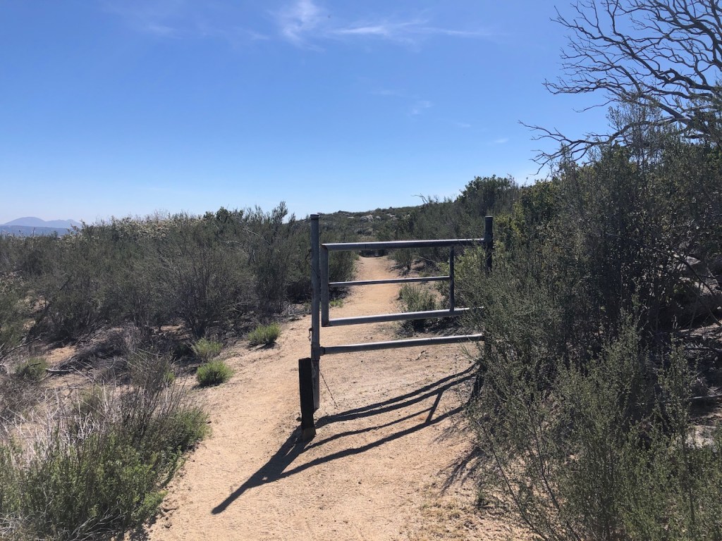
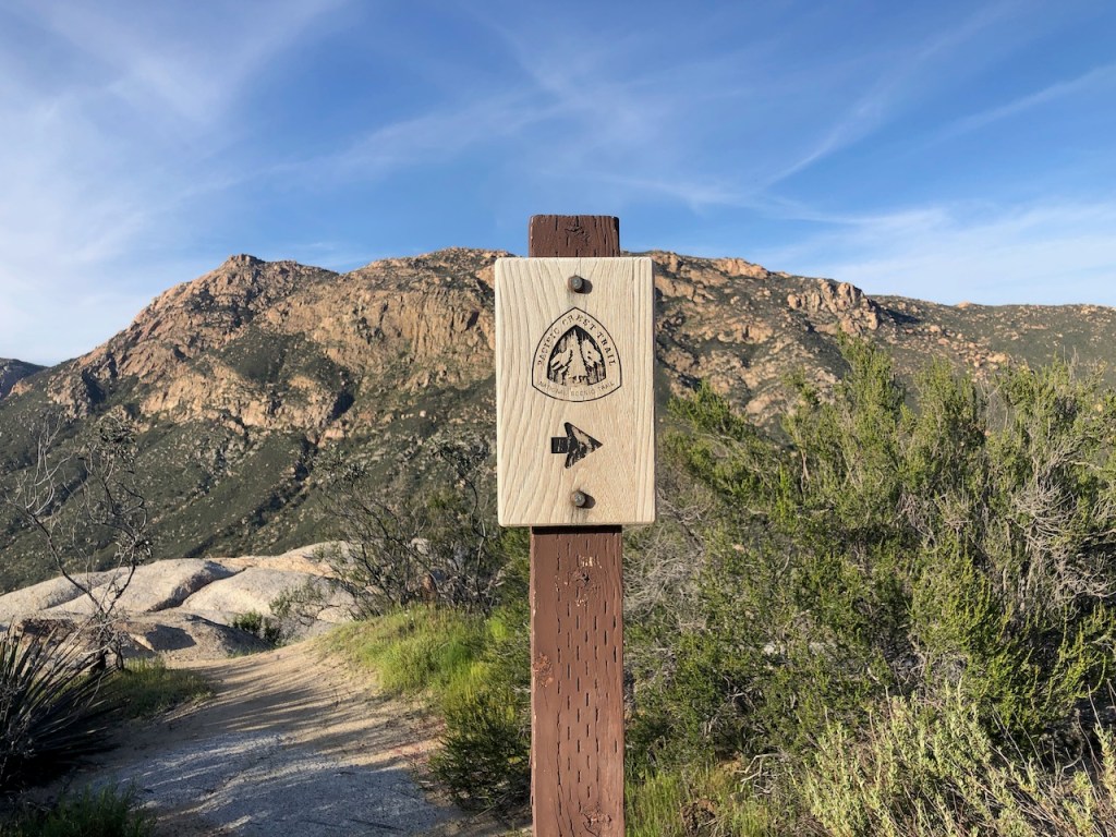
I passed through several of these cattle gates along the way. These are marked on the Far Out app, along with the mile marker you have reached.
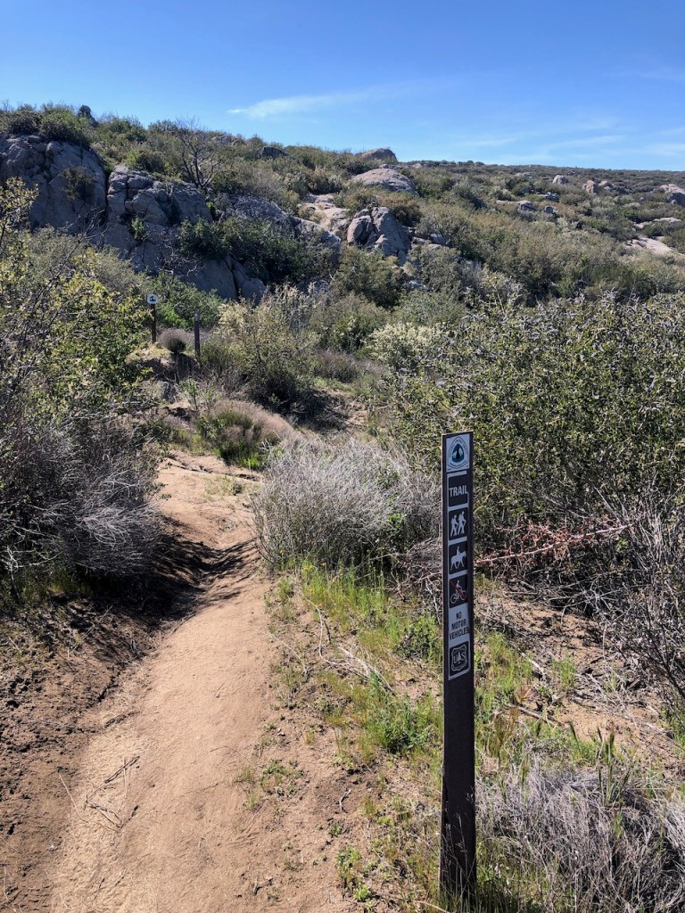
The trails were a bit easier along this section, not as rocky, and I started to pick up speed.
I was now about 2 miles from Hauser Creek and about to descend the canyon, when I came across a large group camped off to the right of the trail. One gentleman not much younger than myself, decided to be friendly and strike up a conversation, asking me if I planned to camp there with them?
Keep on Keeping On
I declined, stating I was seeing how far I could co, and that I planned on heading to the creek. It seemed like a friendly group of people though. I would not see them all again for the rest of the trek.
Chance Meetings
There would be just a few people I ran into more than once. That is just the way it goes when you’re hiking on the PCT. You go at your pace, unless you’re hiking as some sort of family unit, or group, in which case you’re moving as fast as your slowest member, etc.
Hauser Canyon
I started a swift descent down into the scenic and beautiful Hauser Canyon. I gazed over at what is the Morena Butte. It would prove to be a less than a swift hike downward into the canyon, since this trail became very challenging once again. There were lots of rocks and uneven pathways to maneuver on.
Red Rocks
These reddish colored rocks glowed red in the evening sun. I imagined how warm it would be right now were I climbing up the other side of the canyon.
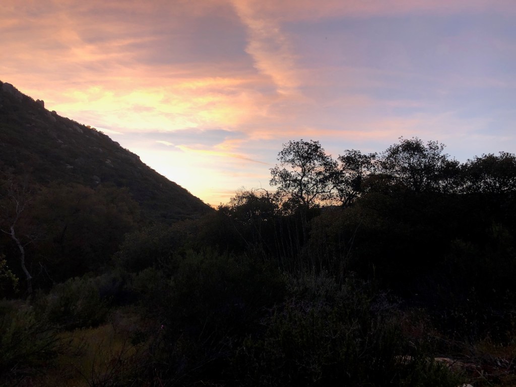
Almost Sunset
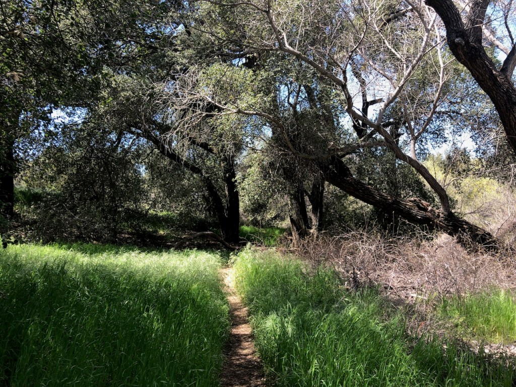
The light was fading as it was around 6:30pm, when I realized I was making it no further than Hauser Canyon today. The trail ventures through an oak forest, as it moves steadily downward.
Surefooted
I slowed down a lot here, since I had to be careful with my footing. The greatest challenge of a trail like this is not the miles, it’s not getting injured, twisting an ankle, smashing a knee on a rock, or stumbling, and hitting your head.
The Biggest Hurdle
It just takes one stumble, to trip, and tumble down a cliffside. So that is the true challenge of a backpacking trip, of not getting hurt. So I took my time here, heading down the canyon.
On the Road
I came to a fireroad, and realized the trail would travel along it a ways.
Now I needed to be vigilant, and aware of approaching vehicles. For the next half mile, I saw not a soul, before a border patrol vehicle passed. He ended up coming back again, about ten minutes later, and questioned how I was doing.
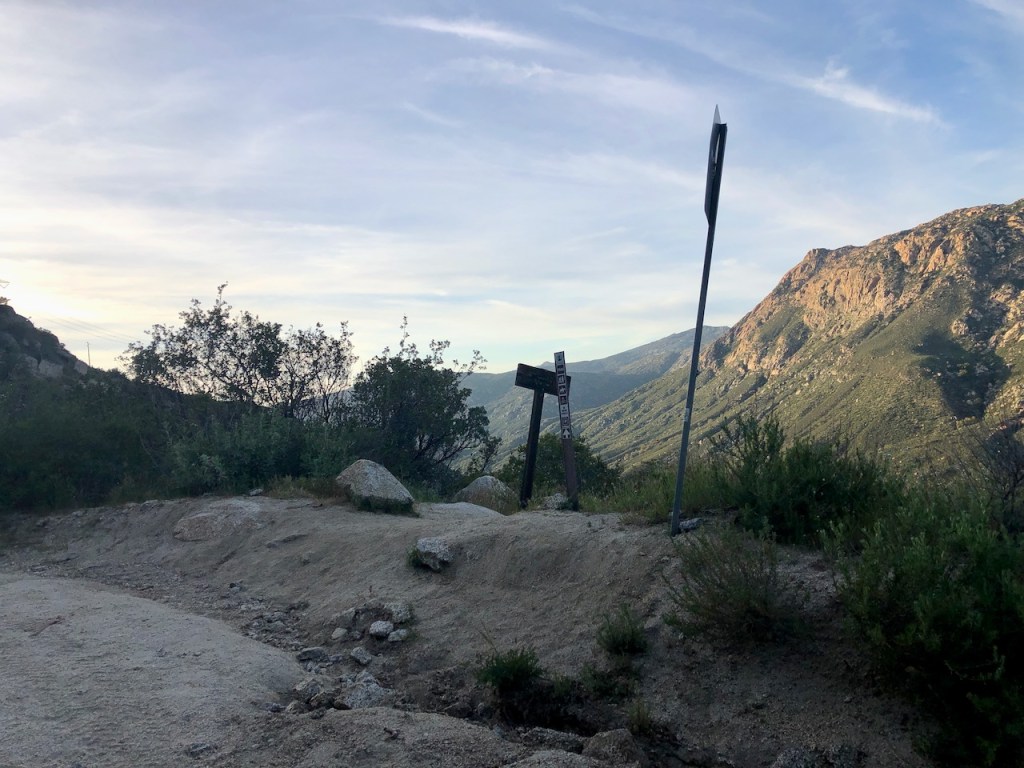
I’m still not sure if it was the border patrol agent, the distractingly beautiful scenery, the sun being right in my eyes, or just being dazed and confused, which caused me to miss a sharp left turn to the canyon.
Looking at my map, I could see a trail off in the distance, and obvious long switchbacks. I guessed I to continue to hike to that trail, along the length of the fire road, and take it down to the creek, but I was mistaken.

I passed this gate, and did not realize, that I had gone too far. I would hike back to my missed left turn off the fire road. I swore to check the Far Out app more often from this point forward, as I did not need more miles.
I continued further down the road than needed, and my error cost me hiking an extra 1.5 miles.
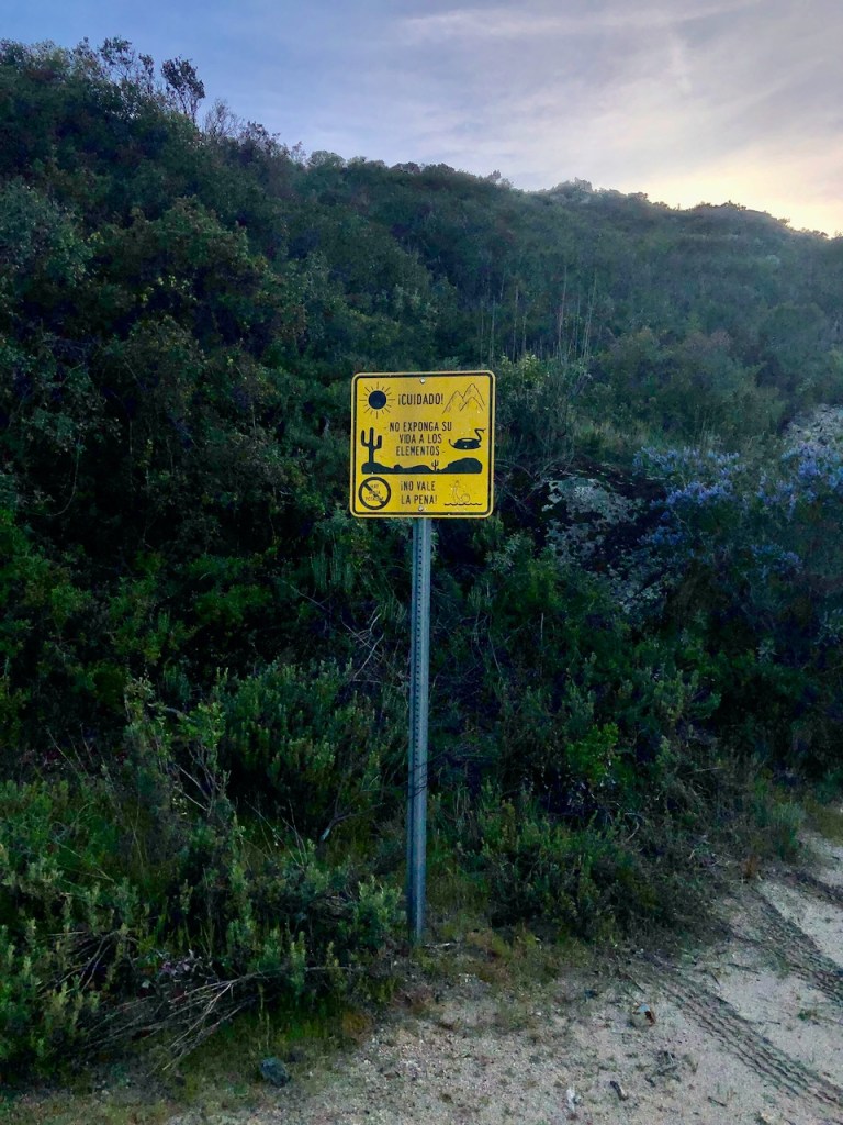
I wondered why only this sign was in Spanish, and who it was geared towards. Not Americans is my guess.
This was the sign I missed. This is the one that mattered.
I hiked double time uphill back to the turnoff, and then down one of the worst sections of the trail yet further into the canyon towards the creek.
The Last Half Mile
It was rocky, uneven, flooded, muddy, and challenging. Again, I tried to not stumble, which was tough, as I was wobbly, and a bit dazed from hiking all day.
A 17 Mile Day
My hike had morphed from 15.5 miles, to about 17 miles, according to my watch when all was said and done at the end of the day.
Late to Camp
Note to self, was to not do these late camp set ups. The first issue is all the easy camp spots are taken. I really had to hunt for one, but when I found it, it turned out to be just right.
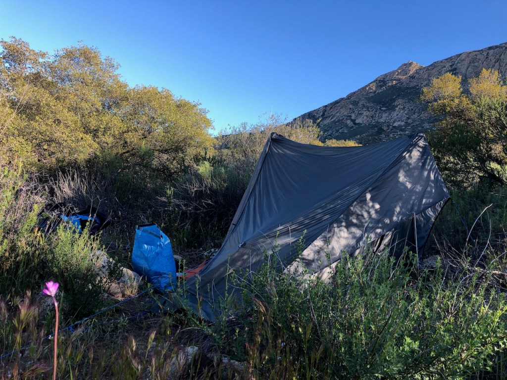
A Perfect Campsite
I ended up about a 10th of a mile from the creek, down the road, in what looked to be a campsite, though not used as much as the others. It was fairly flat, had wildflowers, was secluded, and was also quiet. The last thing I wanted was to hear chattering all night. Hauser was the busiest camp site I had backpacked to yet.
The Fading Light
The second issue is of course light, or lack of it. A headlamp only attracts bugs, especially by the creek. So I was left to eat in the dark. The meal I had, I did not soak long enough, and in addition, it was not that good. The Massaman Curry with potatoes and rice was missing something. I regretted not portioning it into two servings, since I could only eat half of it.
Neglecting the Guylines
Then I neglected to tighten the guylines enough, so my tent was sagging. My sleeping bag got soaking wet on top as did the tent. I slept horribly, getting dripped on, and was up most of the night. This was my third night using my Gossamer Gear The One tent. I got better with the guylines on subsequent nights. The stars were beautiful though. You live and you learn, when you backpack. A bad experience, or less than stellar one makes you stronger. I vowed to do it better next time.
Next Time…
Next time, I vowed I would camp at least an hour before sunset to give time to set up and eat with actual light. I would do a better job staking the tent. It was a new tent, and I was still getting used to how it worked. Now I pretty much understand how to set up a Gossamer Gear One tent. In spite of my best efforts, I came to find this tent always sags here or there, due to the design, so it’s really a question of deciding where you want it to sag or not.
I woke up Easter morning surrounded by wildflowers, sunshine, and beauty.
Read about Day 2 of my hike here.
I hope you enjoyed reading this, and it is helpful in knowing what to expect, should you decide to take a hike on the PCT.
About me
I’m Serafina! I’m a writer and California girl who loves to go exploring. Hope you will get outside today, breathe some fresh air, and be happy!
Follow my Journey…
Be sure to Like and Subscribe to My Youtube Channel where I post videos!
Disclaimer: The work on this blog is my opinion and my opinion alone and I am not responsible for the outcome if someone were to apply these thoughts to their own life. All text and photography copyright 2023 by Serafina, all rights reserved. Information and opinions provided are kept current to the best of the author’s ability. All readers’ usage of the ideas and opinions presented in the blog, are at their own risk. Be aware of the possible dangers of hiking, surfing, walking, cooking, and other activities, which may take place indoors or outdoors. By reading this, you agree not to hold the author or publisher of the content on this web site responsible for any injuries or inconveniences that may result from reading the blog, or partaking in any activity mentioned in the blog. Read the blog, and use its ideas, if you so desire, at your own risk.
