3-26-23
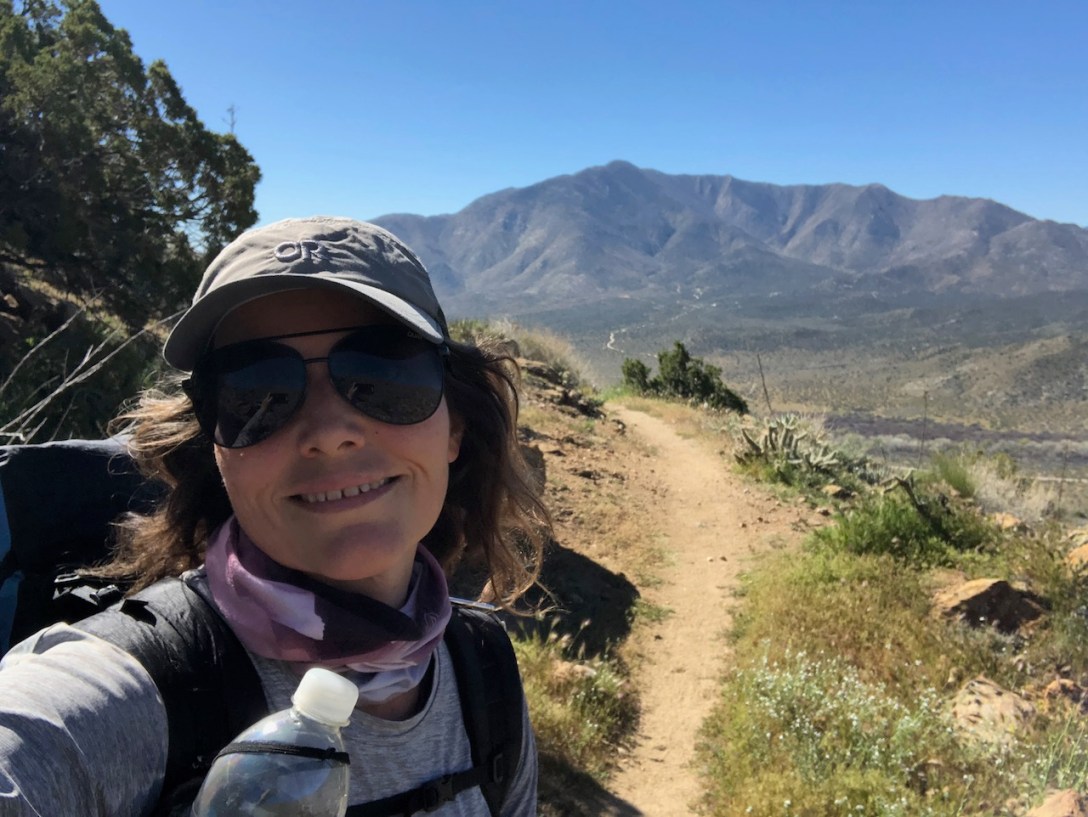
I set off on the 35 mile section of the PCT from Scissors Crossing near Julian in Ranchita, off Hwy 79. I had some fears hiking in an unfamiliar place all alone, but also had faith it would be ok.
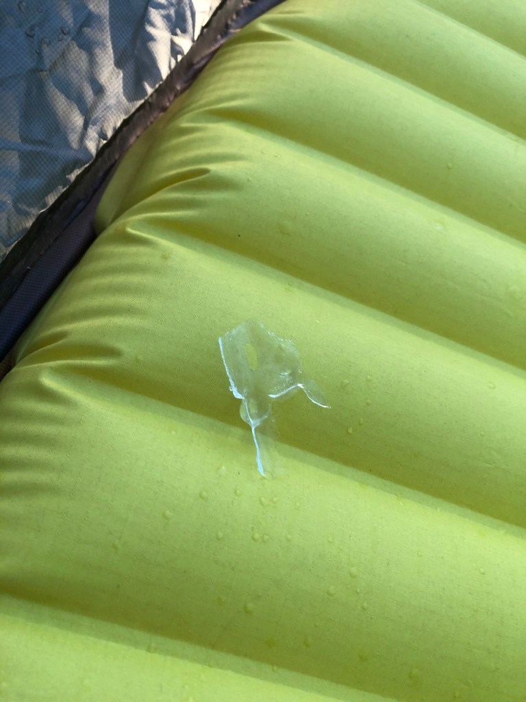
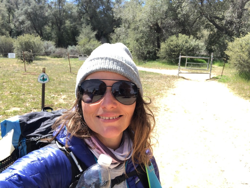
I had brought with me all the essentials, and was attempting to not overpack on this trip. I was going ultralight, with a brand new Gossamer Gear The One Tent. So this was a shakedown hike for my new tent. What better place than the PCT?
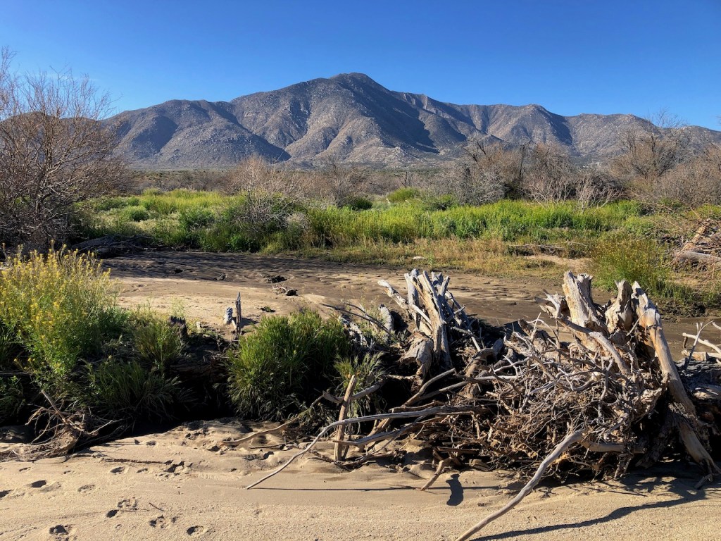
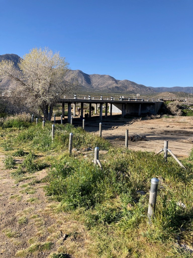
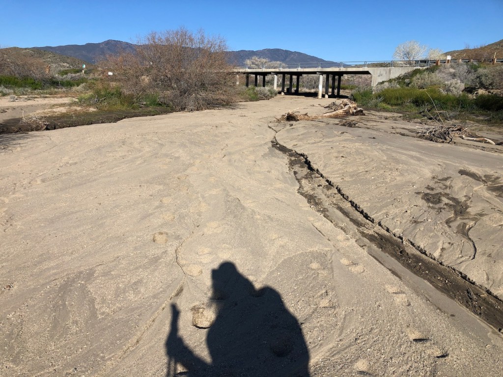
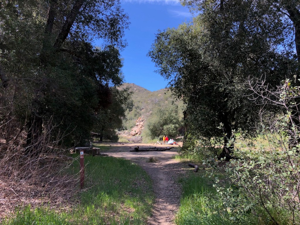
I started off by passing under the bridge at Scissors Crossing, and walking along the wash. There were people under the bridge, with water for filling up, and other supplies for hikers. I guesses these were trail angels, people helping thru hikers out on trail, with no expectations.
After passing under the bridge, I went to the left, but missed the single track trail for the PCT.
I noticed right away and backtracked to the PCT, which was on my right.
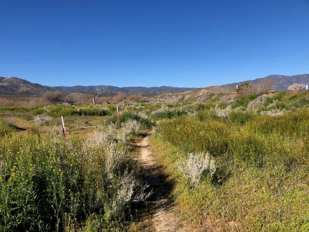
I followed it for a minute or two, and crossed the road.
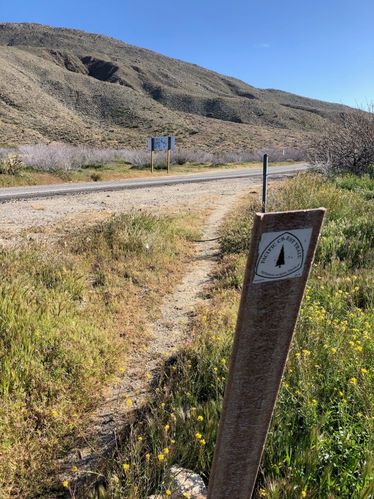
There were signs pointing the way. I was actually on the Pacific Crest Trail, backpacking, for the first time. I had backpacked part of the John Muir Trail before, which the PCT follows through the Sierras.
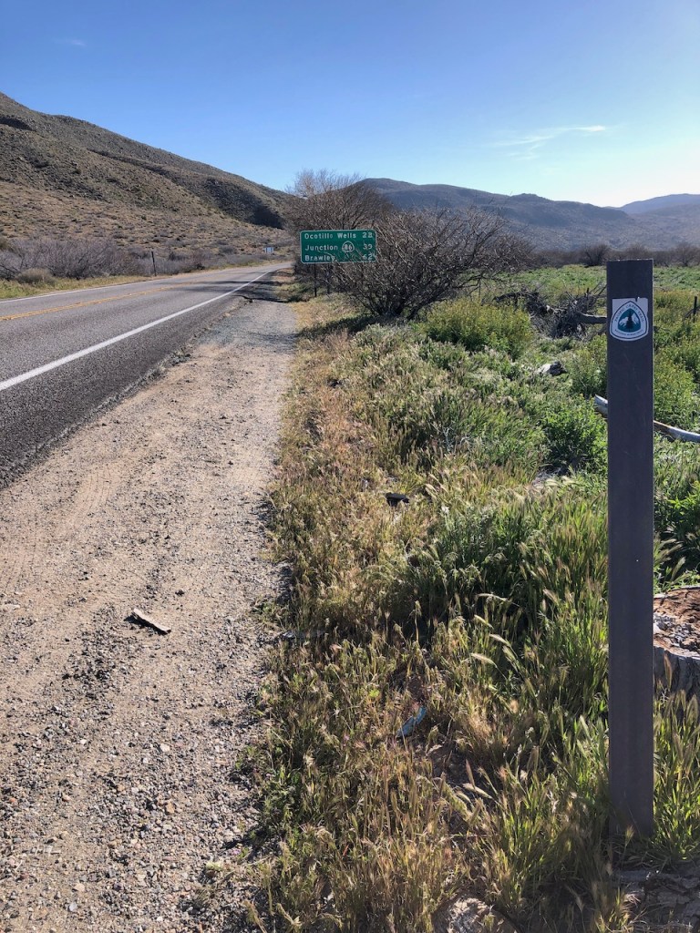
The road signs pointed toward Ocotillo Wells, and its famous salt flats.
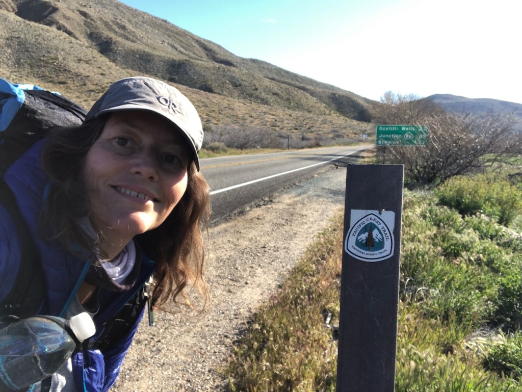
This was a pretty cool moment, to be once more hiking on the PCT. But this time, I was actually backpacking, around the same time that thru hikers pass through.
My PCT Section A Plan
I had considered starting at the border. The problem was no permits were available, and in order to comply with the permit system, I would have had to hike all the way from Campo into Lake Morena in one day, and stay at the campground there, not the backcountry. That would have been very optimistic.
So since I did not want a chance it, I decided to just hike a section that requires no permits, and get to experience backpacking on the PCT. It had been on my mind a long time, and the perfect season was now.
Permits
I would continue to check back for permits on recreation.gov for the Cleveland National Forest section of the PCT, which would enable starting in Campo, and camping in the backcountry.
This is was not just the beginning of the trail, but a new chapter in my life. Hiking and backpacking is a way to take time away from the world to contemplate how to move forward in life.
I was not actually alone though, and would call on Jesus to be my guide on this adventure.
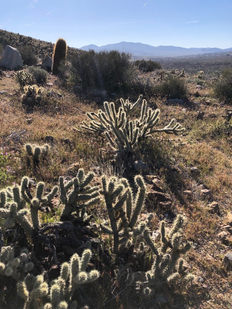
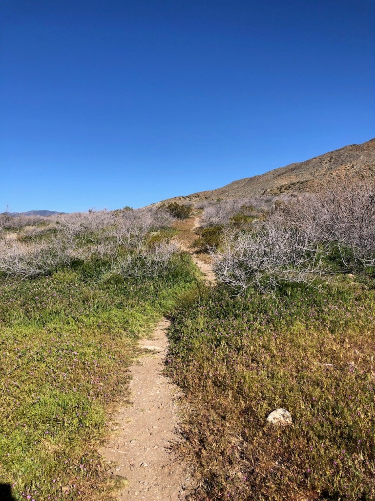
I hiked on through a beautiful cactus garden.
I looked back at the bridge and Scissors Crossing in the distance. No going back now.
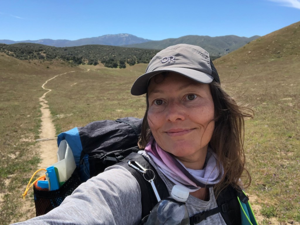
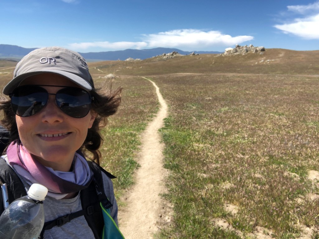
I was feeling confident, and my pace out of the gate, heading uphill, was fast, around 3 miles per hour. As the day would wear on, I would slow down, but right now, I wanted to make some miles.
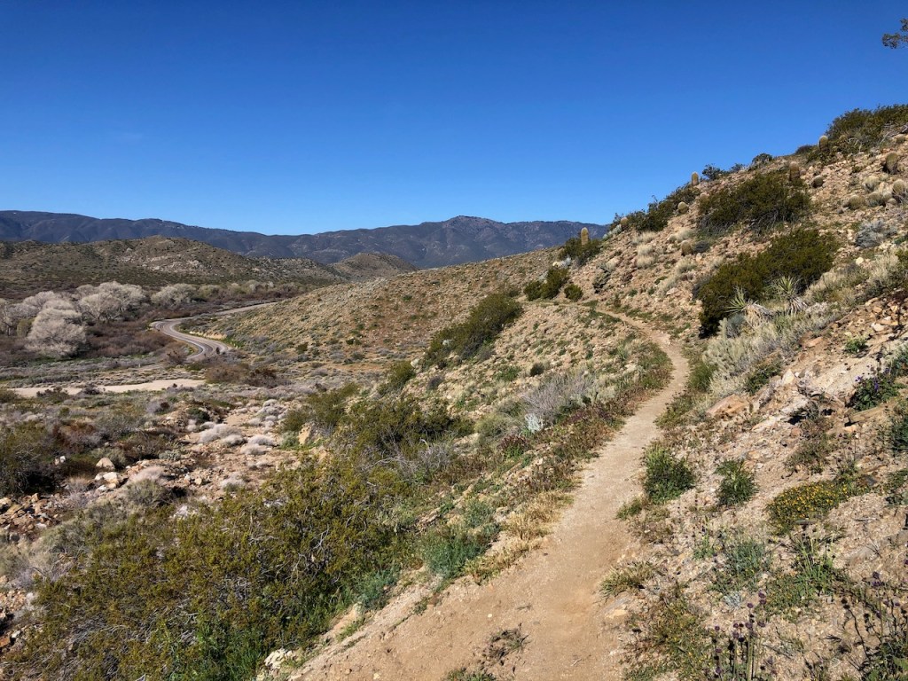
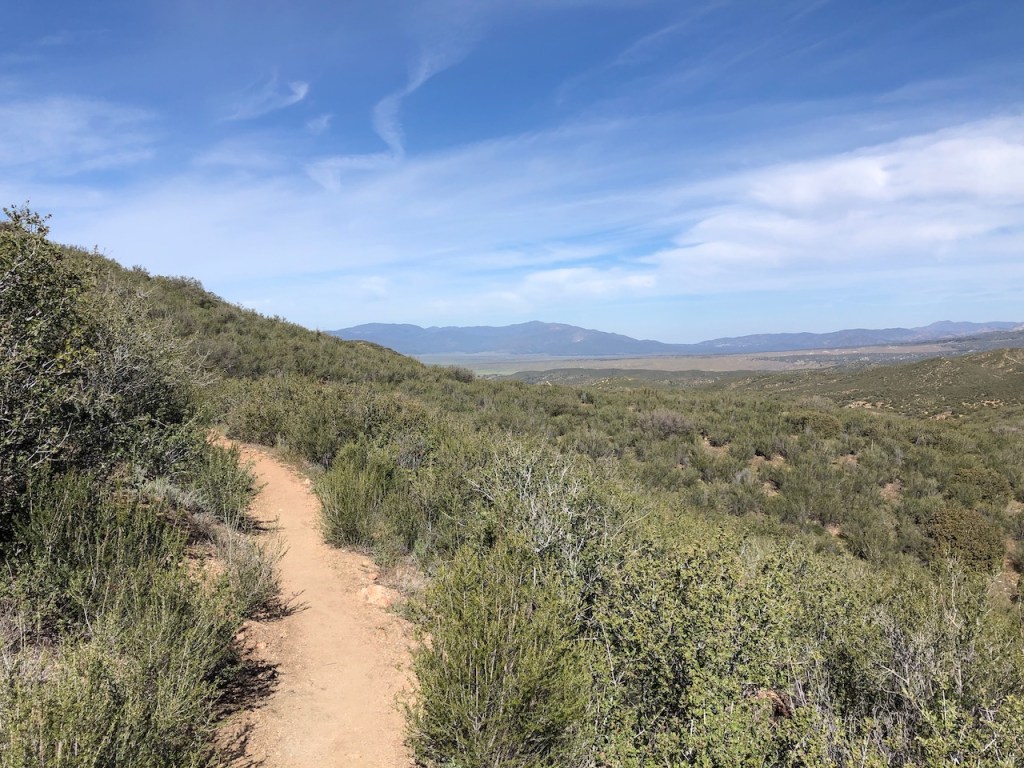
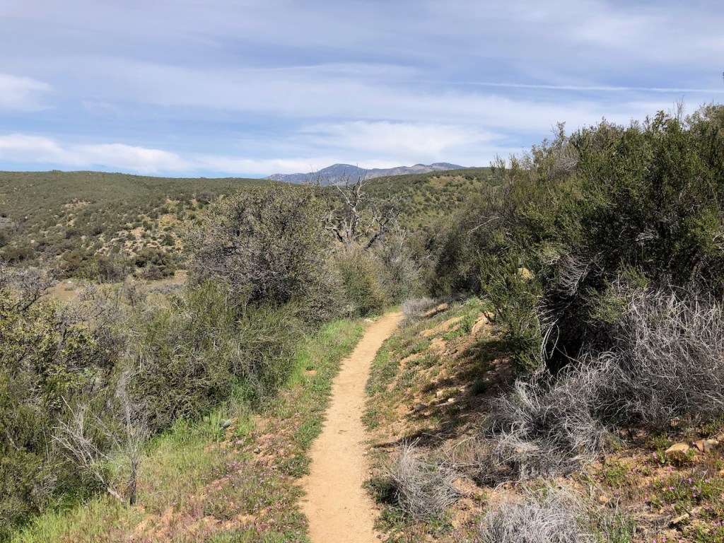
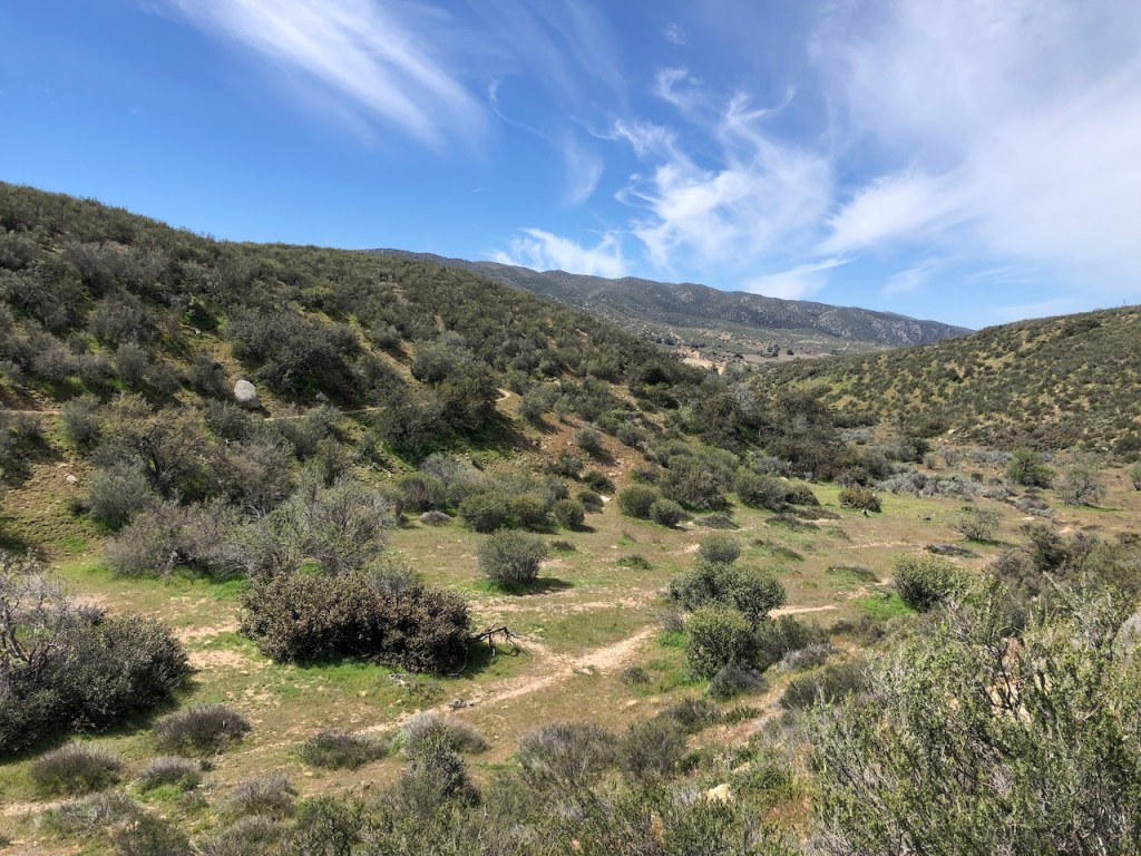
The narrow trail hugs the ridges, and slowly climbs, past Grapevine Mountain on the right.

This would be Grapevine Mountain, and the hike up to this peak is apparently unmarked, even though alltrails lists a path to the summit. I’ve been to that party before. I recently hiked up a nearby desert peak with no trail, decorated in similar fashion to this terrain, cholla, cactus, and yucca. I got stuck many times, and was not ready to repeat that scenario. Best of luck to whomever attempts Grapevine Mountain.
This section was jam packed with cactus, all along the first few miles.
It was early in the day, and cool out, in the 50’s. I could not have asked for better desert hiking weather. That was why there was no hesitation, to start the desert section, and head back for the remaining sections from Campo to Scissors at a later date.

I hardly ever wear headphones backpacking or hiking in nature, though I may wear them to drown out loud people in more crowded settings.
I was just enjoying listening to the sounds of nature all morning, although I could still hear cars passing in the distance.
I was on the lookout for snakes, early in the season, and tried to keep an eye on where I was headed. Baby rattlesnakes don’t even use their rattles yet.

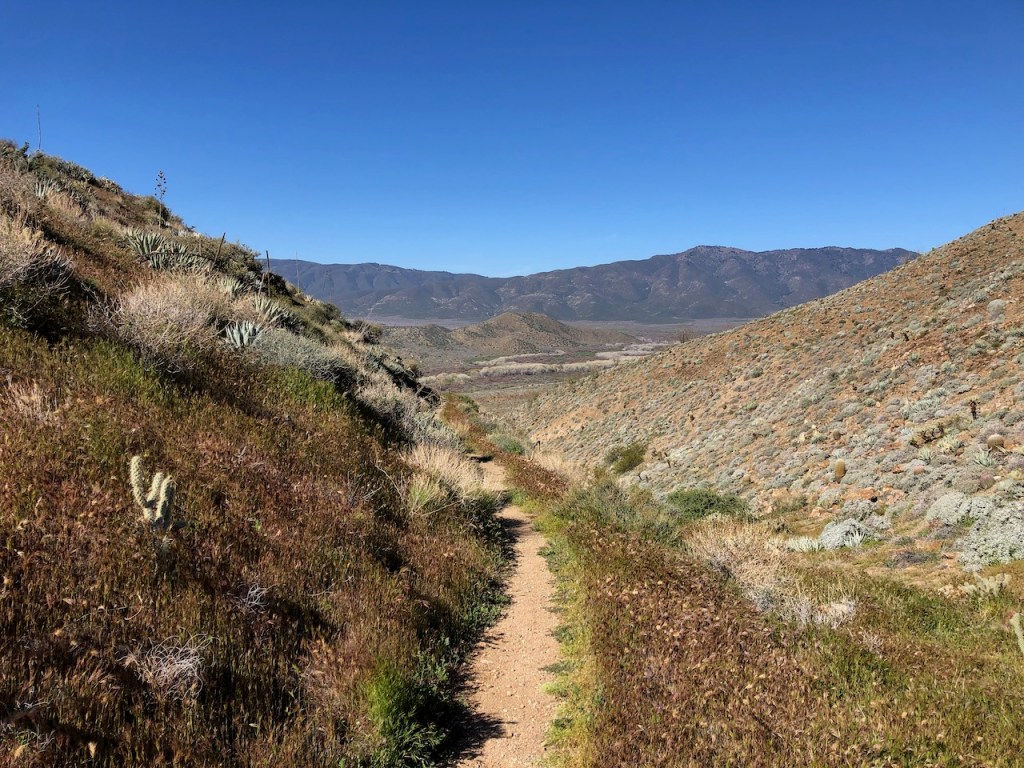
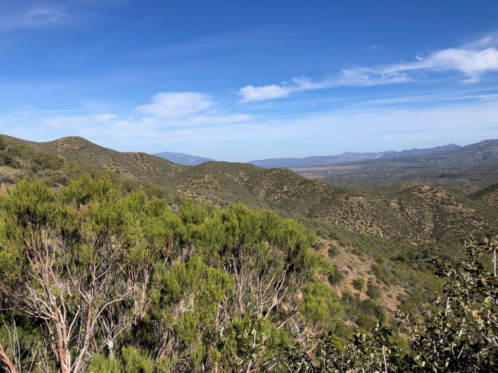
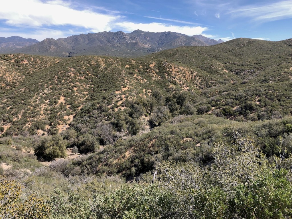
To my left was the Laguna Mountain Wilderness, and several 5000 to 6000 foot peaks. I would not being going that high up on this section, but only to 4500 feet.
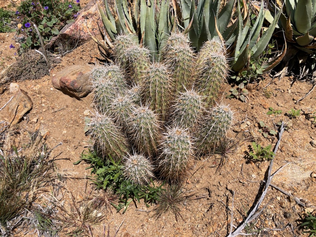
This was a cactus I don’t see everyday, called Engleman’s Hedghog Cactus. Don’t ask me why its called that. It will start to bloom vibrant fuschia blooms very soon.
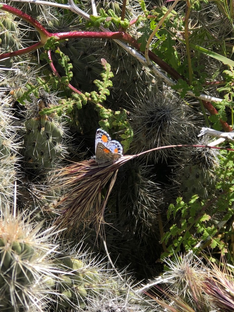
This is an Acmon Blue Butterfly. I don’t see them much in Orange County, but out here on the PCT, they were abundant.
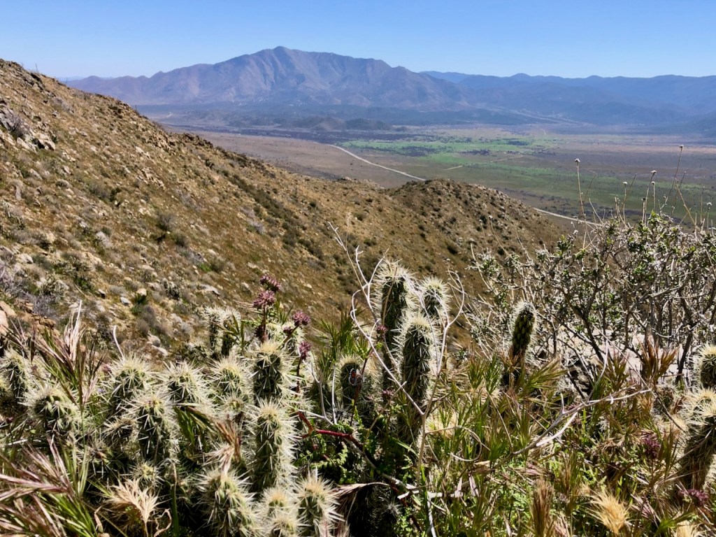
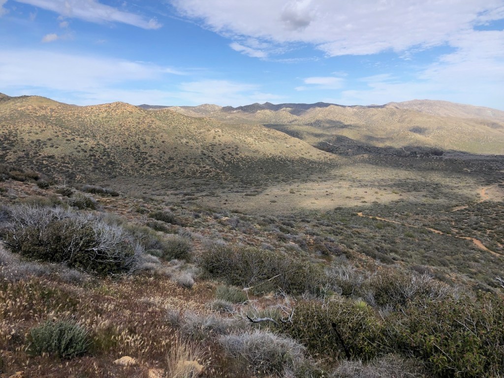
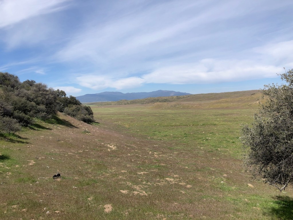
Looking back on fields of green, thanks to the atmospheric rivers we have been experiencing.
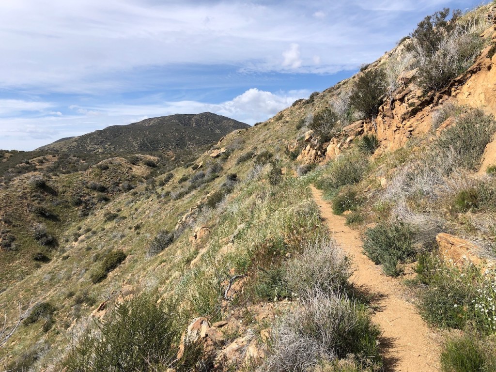
It was a steady climb most of the way, with some occasional bushwacking.
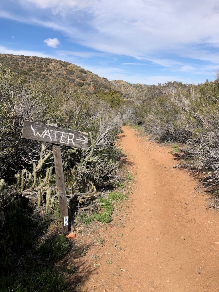
About 14.5 miles later, I reached the first water source. There are no natural sources on this stretch so someone must bring water here for the PCT hikers. I am not certain who that is, but my guess is the PCTA has something to do with it. There is what appears to be a jeep trail leading up here, so maybe that is how it all gets here. It’s still a long way, even for a jeep, on such a rugged road.
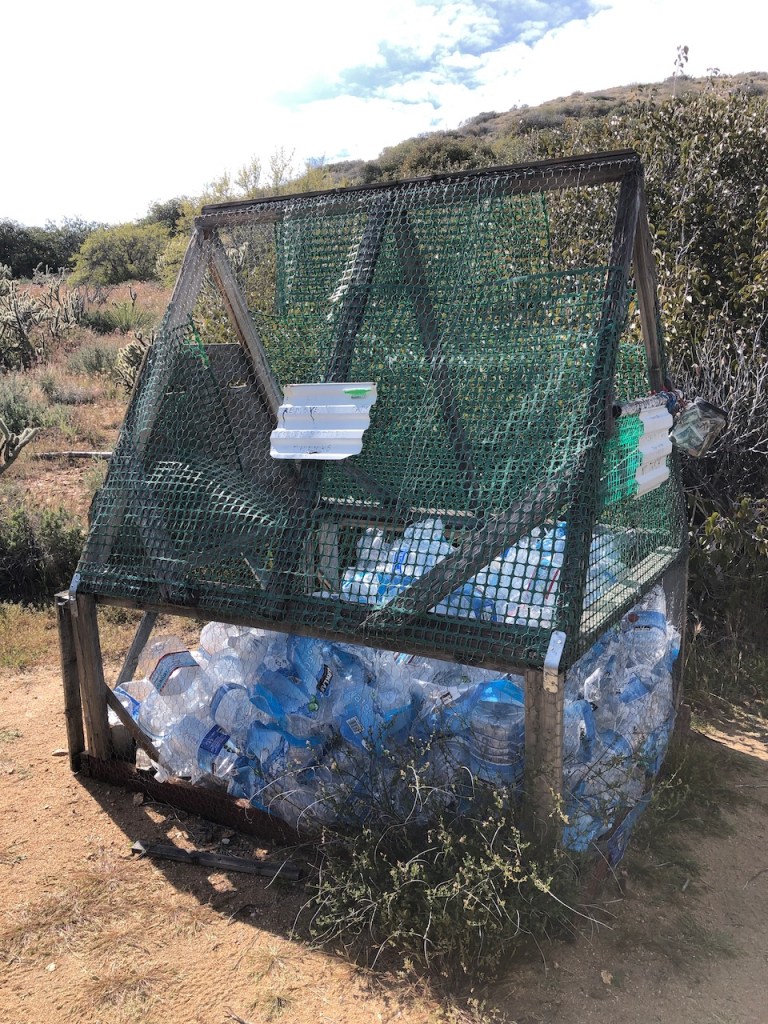
If your a fast hiker, or not needing the water, just take only what you need. There is a spring at Montezuma Road. However that is another 10 miles.
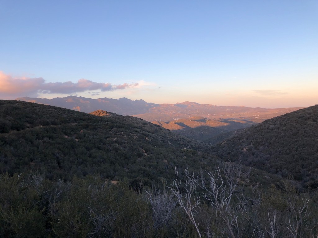
The clouds were dancing along the foothills, as I finished the last stretch. I kept passing on campsites, and then would come to one that I thought was going work, to find it taken, so I kept pressing on. The Far Out app lists them, so you know what to expect.
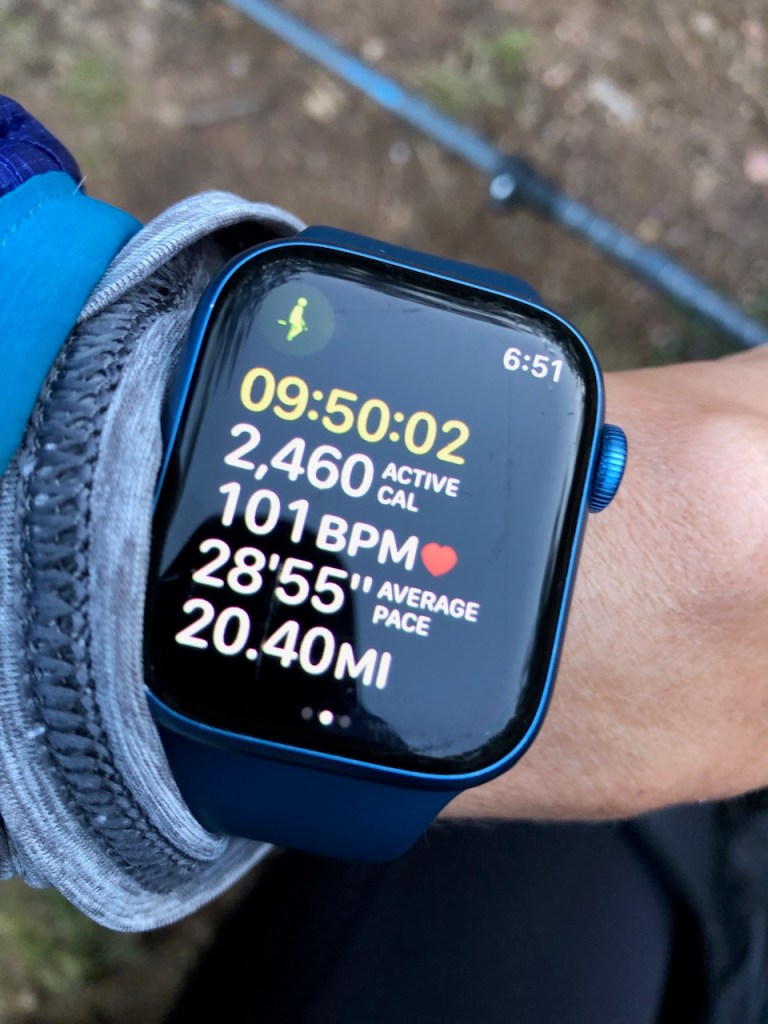
I was glad to be approaching 20 miles, since that was a new milestone for me, backpacking that is, and uphill no less.
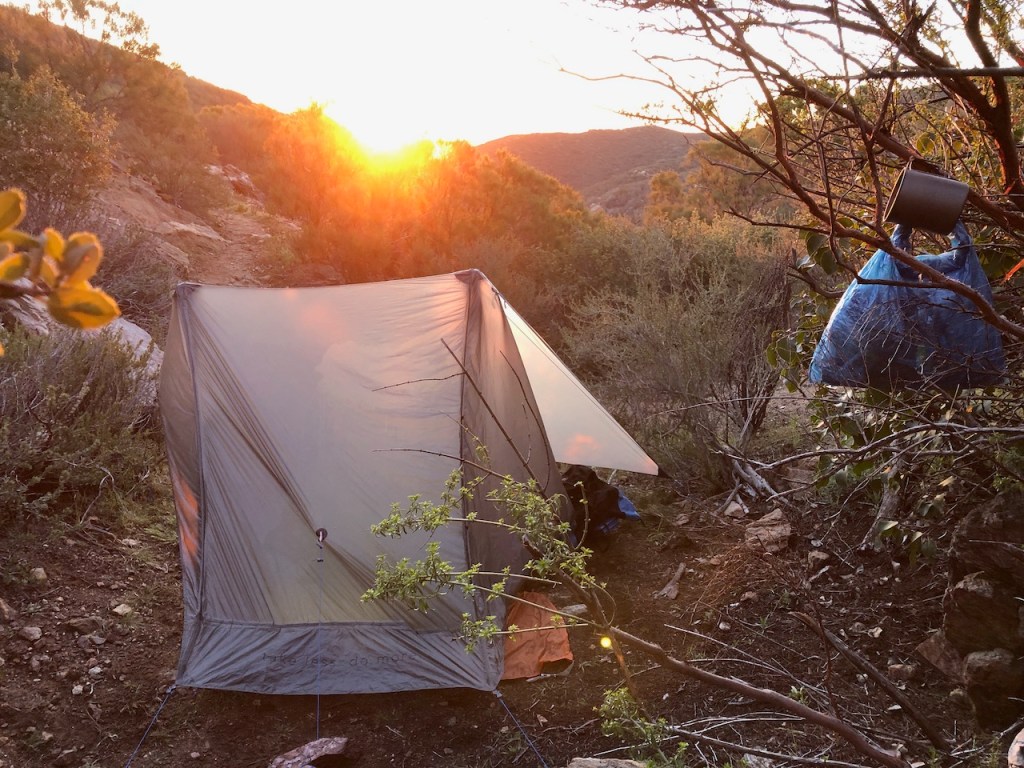
I finally found a suitable campsite, tucked away, snuggly between some brush, just off the trail. It was large enough for a one person tent, which was what I had.
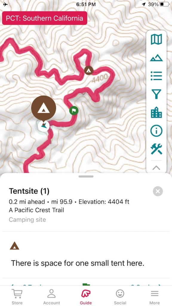
I was at mile 95.9, and had started at mile 77. The additional mile added was going to the water source, and back, which added a mile, for a total of 20.4 miles.
I barely got set up before it was dark out, but was successful. So I hung my food bag on a high branch, and hoped for the best in terms of rodents. I was sure to put anything smelly in there, such as toothpaste.
I was still in awe of the miles I made. I guess if you can hike 20 miles in a day, anything is possible right? I didn’t even start that early, but at 8:45 am. The sun was starting to set later now, in late March, and I was ready to crash out.
A Chilly Night
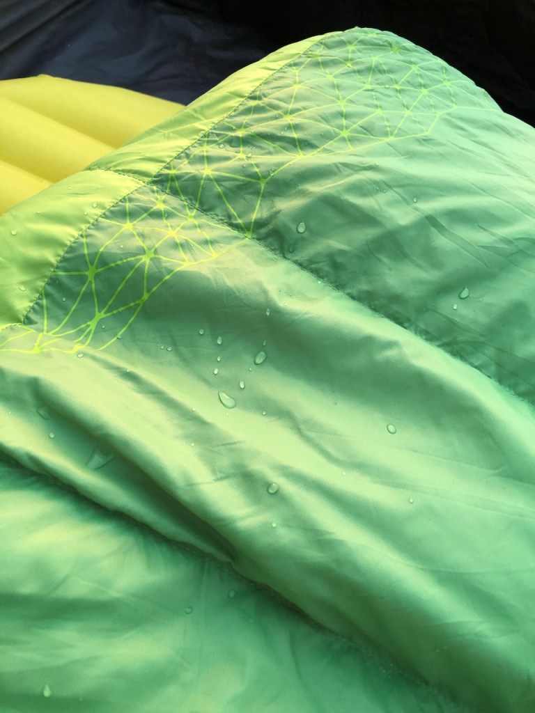
The temperature dropped so fast after sunset. The temperatures would drop below freezing that night. I was on a ridge at 4500 feet. Even the desert can be chilly. I slept in all my clothes, including my puffy jacket, wool socks, rain pants, a buff, and a hat on my head, in a zero degree sleeping bag.
Staying Warm
All that and it still took awhile to get warm. You live and you learn. That’s the thing about backpacking, you challenge yourself, not just to make miles, but to plan everything, for your own survival out in the wilderness. It’s a really cool skill to have.
Staying Charged
It was not just keeping my body warm I had to worry about. I had all my electronics and water filter in the sleeping bag with me too, which made it a bit uncomfortable at times. You can never let lithium batteries get cold, or they run out of charge. I was successful, and my phone stayed charged, as did my backup batteries. I had brought two of them. A water filter like a sawyer will freeze, and become unusable, which is why I put it in my sleeping bag.
Day 2
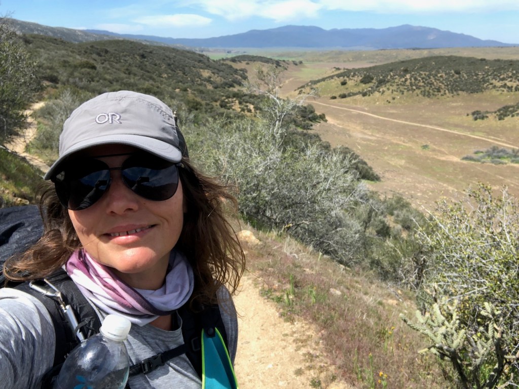
It was a beautiful chilly morning, and time to hike on to Warner Springs. I had about 14 miles to go. It would be a mostly downward trek toward Montezuma Road today, where I would get another chance to fill up on water.

There was ice on my tent, and lots of condensation dripping on my sleeping bag in the morning.
I did not know I would ever be able to sleep outside like this, since I sleep cold, but I managed somehow.
I packed up, had some breakfast, and coffee. I was once again ready to make tracks.
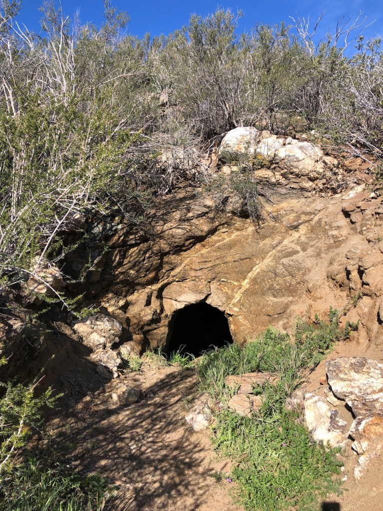
My first milestone was this cool little cave. I had heard about it, and people say you could shelter inside, were there to be a storm up on the ridge. That’s good to know.
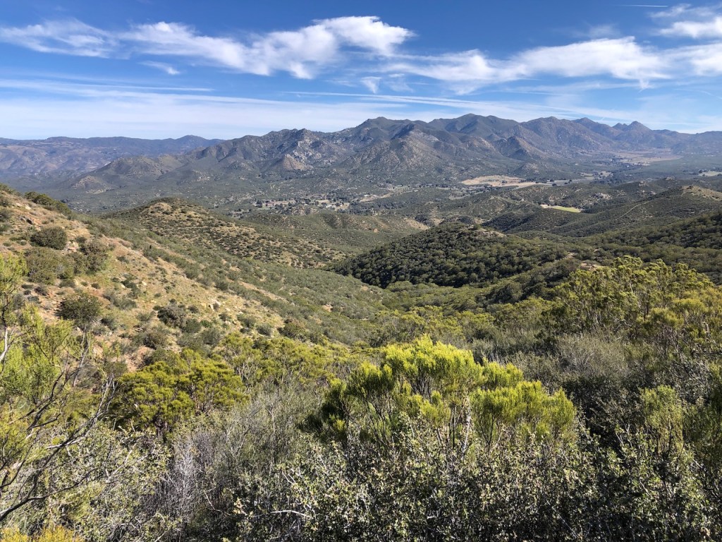
As I hiked on I could see a valley in the distance, which I guessed was Warner Springs, but could be where the Mountain Valley Retreat is located, a frequent stop of thru hikers, looking to recuperate from the strain on their bodies, with the therapies offered there.
The miles were pretty easy for the first half of the day. It was still relatively cool out. I was going downhill after all at a gradual rate.
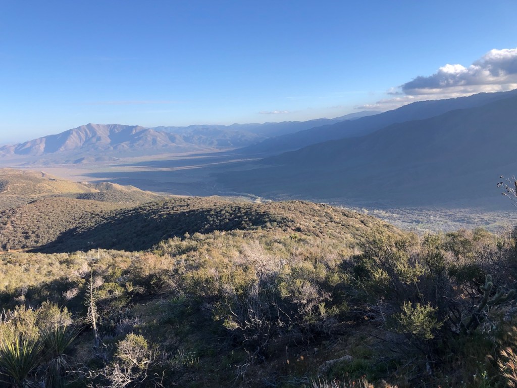
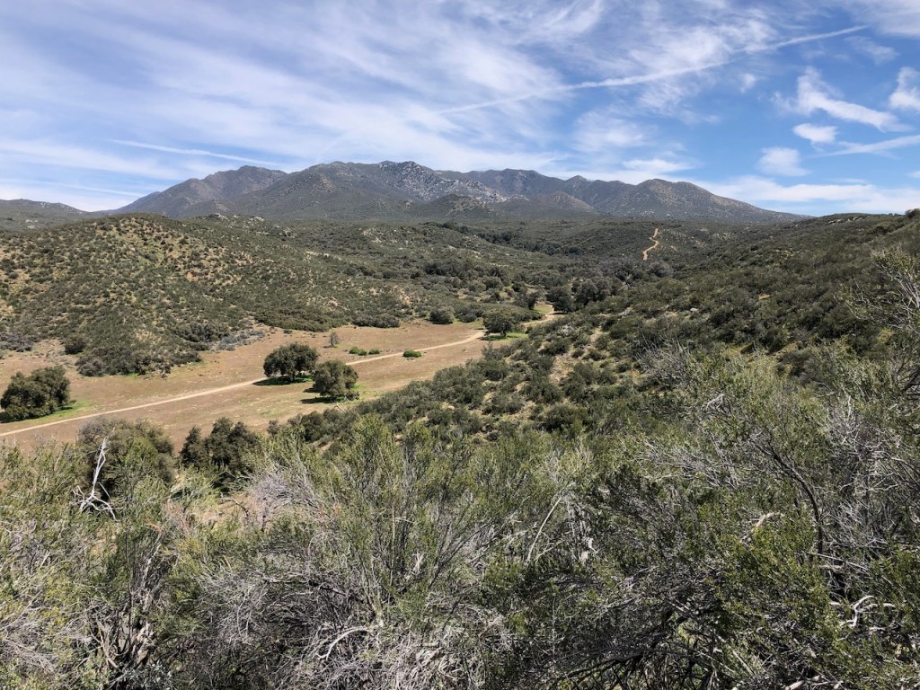
Off in the distance I could see the foothills of the San Jacinto Wilderness.

I would pass several cattle gates all along the way on the PCT. Sometimes they have little trails beside them, so going through the gate is not even necessary.

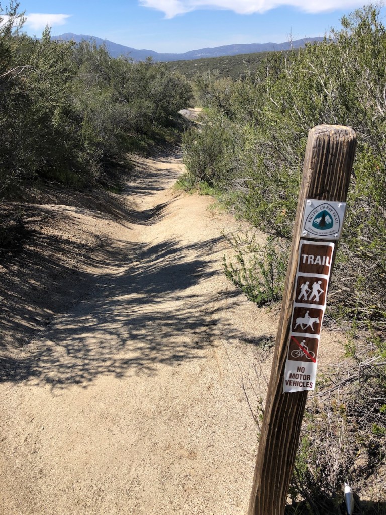
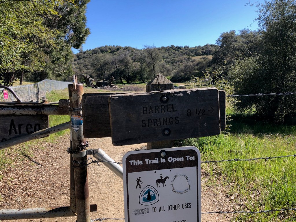
This was an unusual sign, different from the rest.
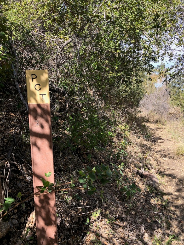
All the PCT signs are a little different, in the choice of signpost, and the colors.

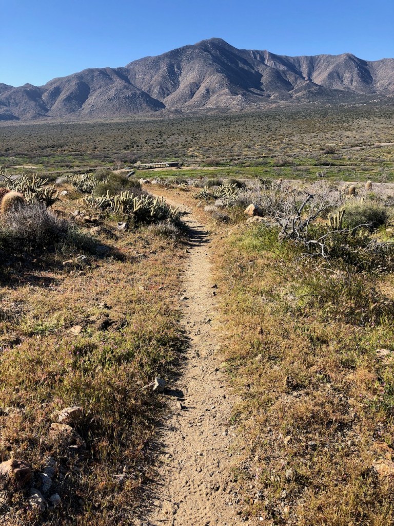
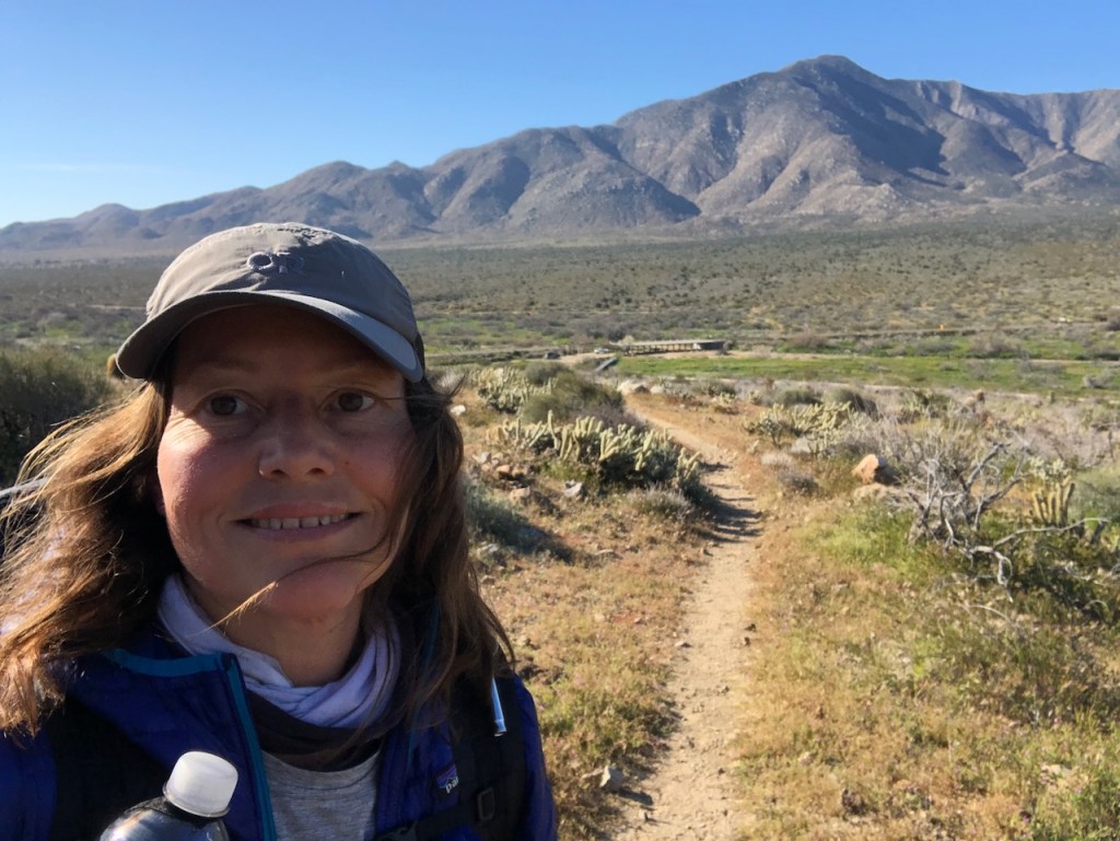
I was on the valley floor, heading over towards Montezuma Road.

There were several people camped out at Montezuma Valley Road. Technically this is not allowed, but who was checking really. Good a camp site as any. I personally prefer to be a bit further from the road.
I had successfully closed one chapter and began another. I was now on the way to Eagle Rock.
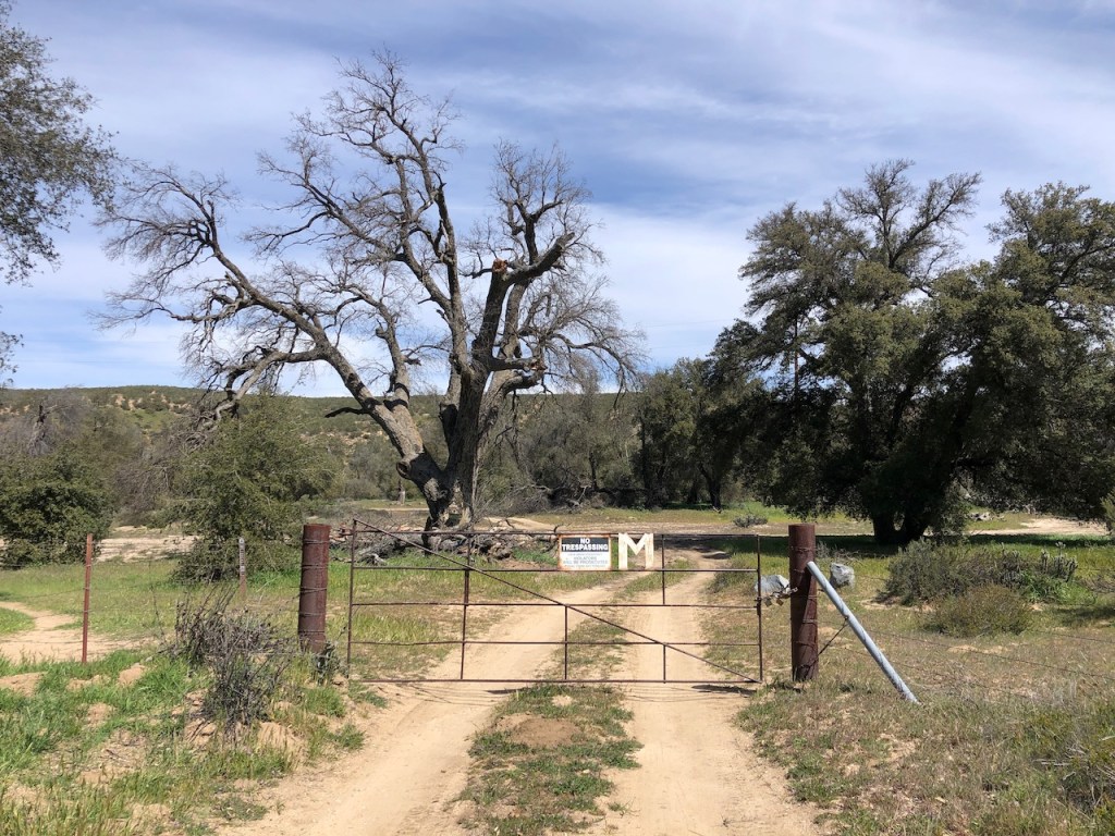
I passed through the Montezuma Road gate, marked with a letter “M.”
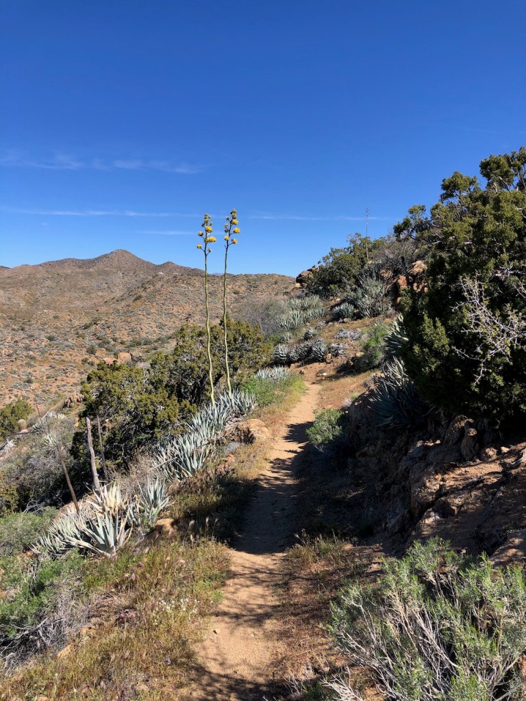
I traveled onward down a narrow trail toward places unknown. Part of the joy of hiking the PCT is in the discovery, and not knowing where you are headed next.
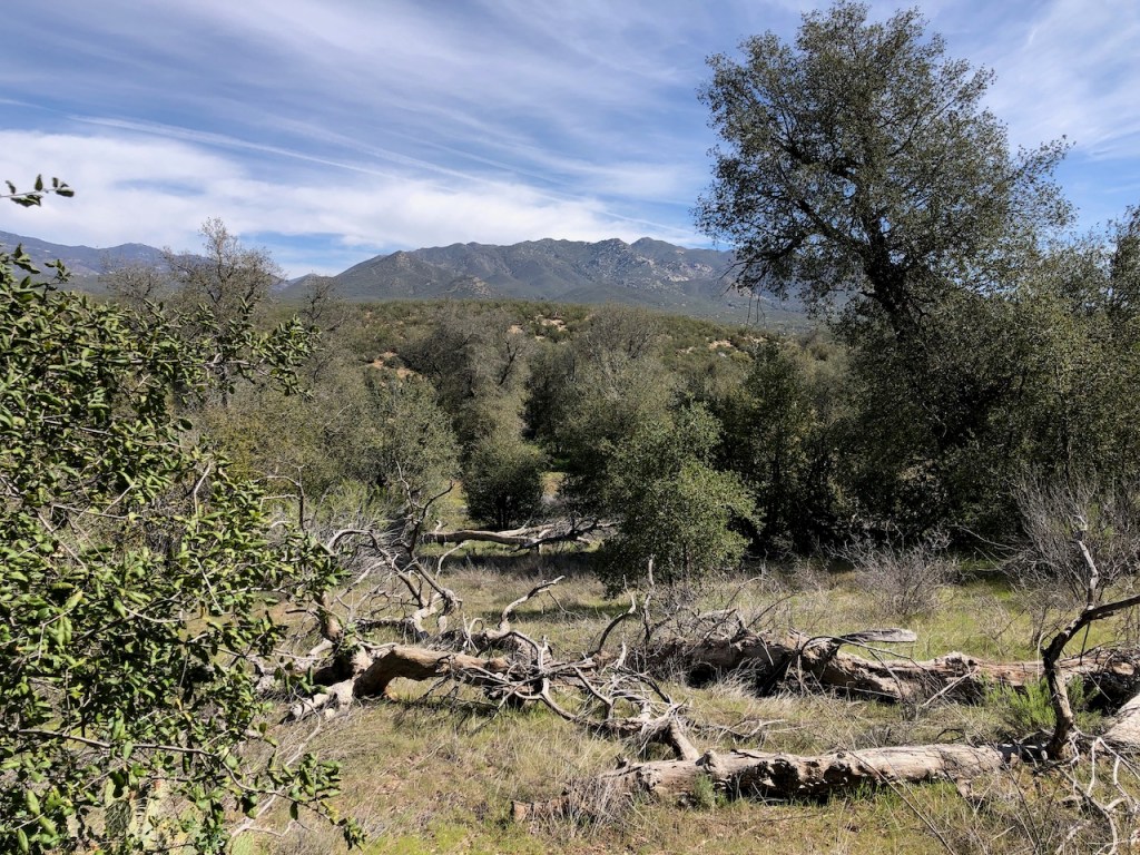
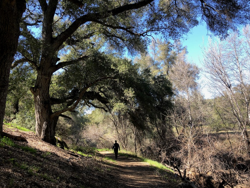
There was a grove of oaks deep in the canyon, where there is more water, and less wind. The ridges are more covered in low growing tree and shrubs.
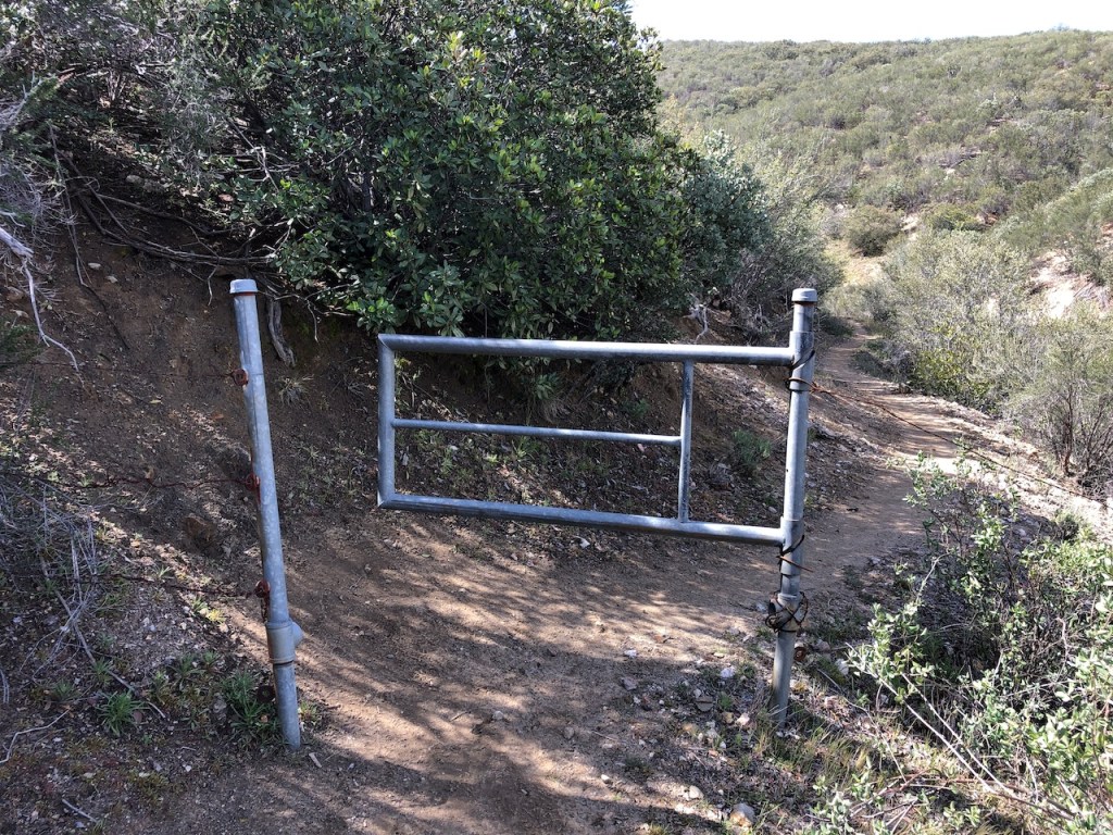
These gates are a common sight all along the PCT.

There were many different signposts for the PCT, and this one happened to be yellow.
Heading toward Montezuma Valley Road, I was amongst the Oak trees again.
Walking on in, I spotted one tent, and a couple by the spring. This was where I would filter, and fill up my water bottles once again, for the trek into Warner Springs.

I was still chilly for some reason, and was wearing mu puffy jacket all morning, It had been quite windy, and there was a bit of a chill in the air still.

I crossed the road and passed through the Montezuma Valley gate, marked with an M.

It started to get warm finally, and I removed my jacket.
I started to climb higher a bit, but the gain would be negligible and not more than 200 feet.
It seemed to be all downhill from here, heading into a beautiful valley after a short climb.
There were mountains everywhere, and this section of the PCT was rather serene.
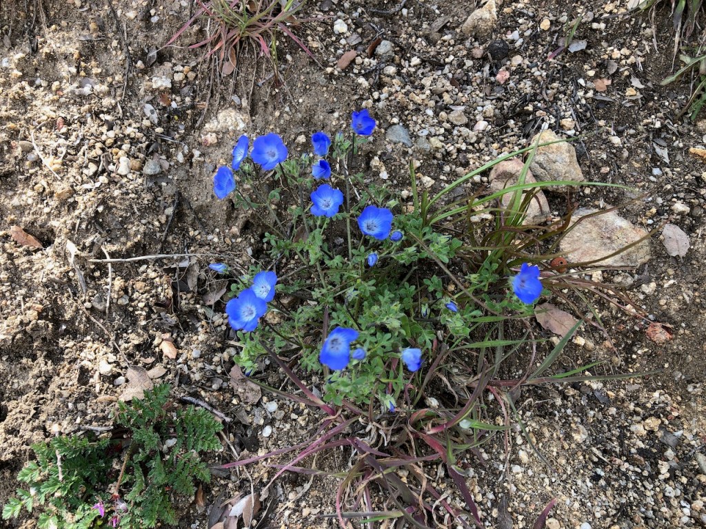
I happened to spot several cluster of bright blue wildflowers, called Baby Blue Eyes.
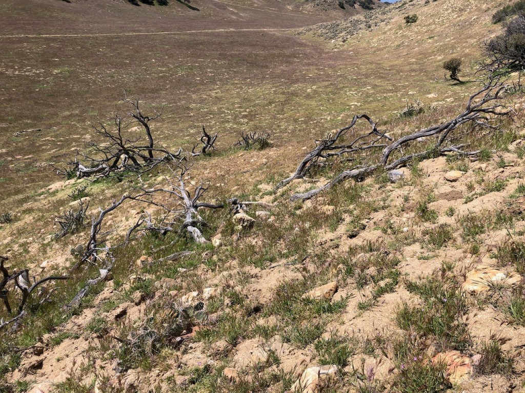
I climbed yet again, over a small hillside, and noticed tons of gnarled looking deadwood everywhere.
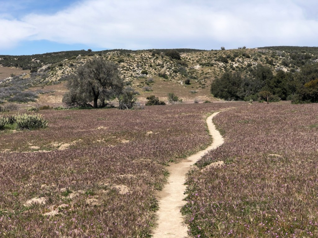
The purple grasses were swaying in the breeze, and looked like waves on a purple sea.

It was on to Eagle Rock, with another PCT sign letting me know I was on the right track.

There were cows in the pasture, which began frollicking and running when I approached them.
I had about 5 miles to go at this point of my journey, leaving the mountain wilderness of the PCT behind.

Small rolling hills, dotted with oak trees, were set amongst a purple grasses waving in the breeze.
I made my way into another oak grove down a scant singletrack. I knew it was about to be time for the rattlesnakes to emerge. But generally anytime up until late March, could not be a better for this section of the PCT.
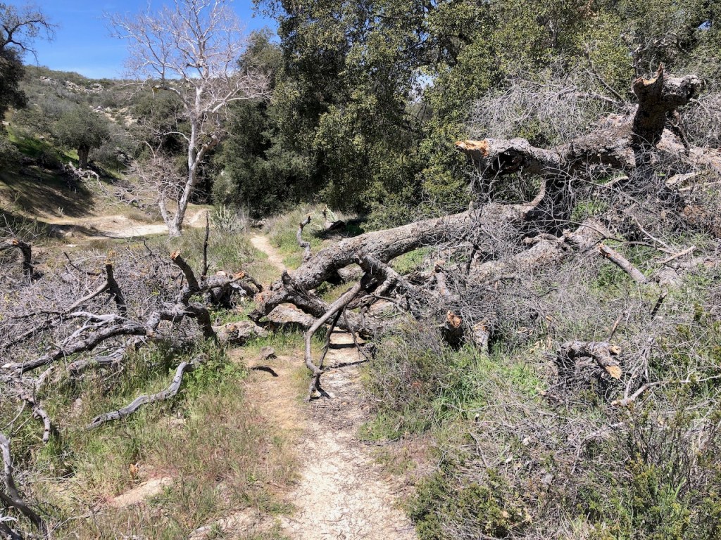
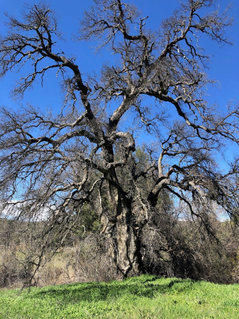
There was a downed oak across the trail, and many more deadfall around, that looked like they might fall at any time. Standing dead trees are a real threat to hikers, so I always try to be vigilant, whenever passing by them.
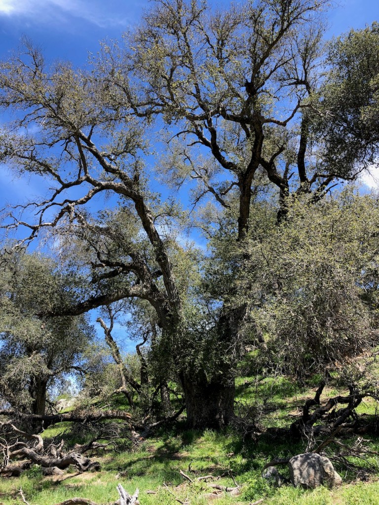
The Live Oaks of course win the prize. There were so many ancient looking ones along this stretch, with some close to two hundred years old, or maybe more.
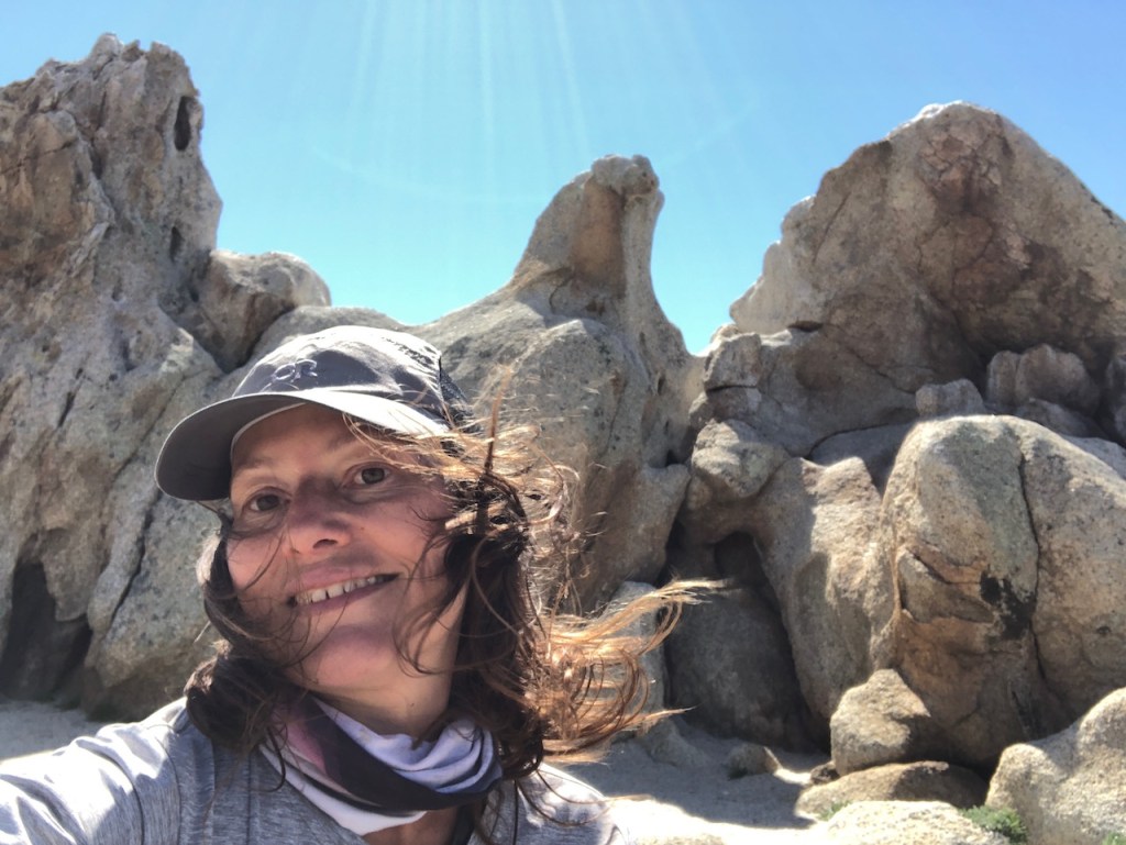
Eagle Rock was finally in my sights. I was exhausted, and ready for a break, at the famous rock.
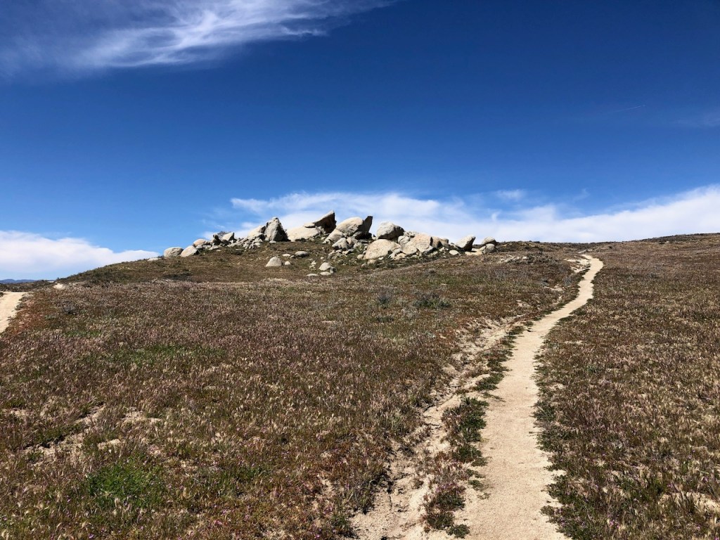
Another backpacker had passed me along the way, but he had stalled at the rock, likely in awe of this amazing formation. There were more people there, from what I could tell, off in the distance.
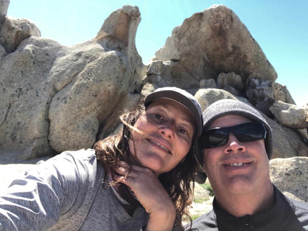
One more surprise awaited me here, and it was not just the rock. My boyfriend took my suggestion to meet me at Eagle Rock, since he was picking me up in Warner Springs, so why not see Eagle Rock too? Well he surprised me here. Best surprise ever!
Seeing Eagle Rock for the first time reminded me of my freedom, to live in a beautiful country like ours, come and go as a I please as a free woman, and in this case solo female backpacker. Freedom is a cool thing!
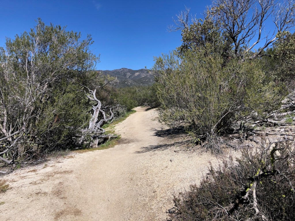
It was pretty much smooth sailing from here, heading back to the car. The trail was wide and flat. Those days of rocky uneven terrain were now over.
I passed yet another PCT marker, edging my way to the end of Section A of the PCT. My feet were tired, and I was definitely doing the “hiker hobble,” a bit.
I trodded through another scenic oak grove enroute to Highway 79.
My boyfriend was up ahead, and moving faster than I was at this point.
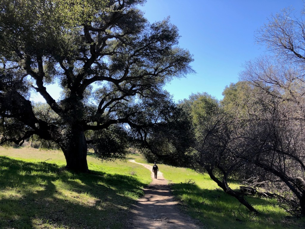
I think the oaks on this section, were some of the largest, most beautiful, and dynamic, of all I had seen thus far. The PCT had saved the best for last.
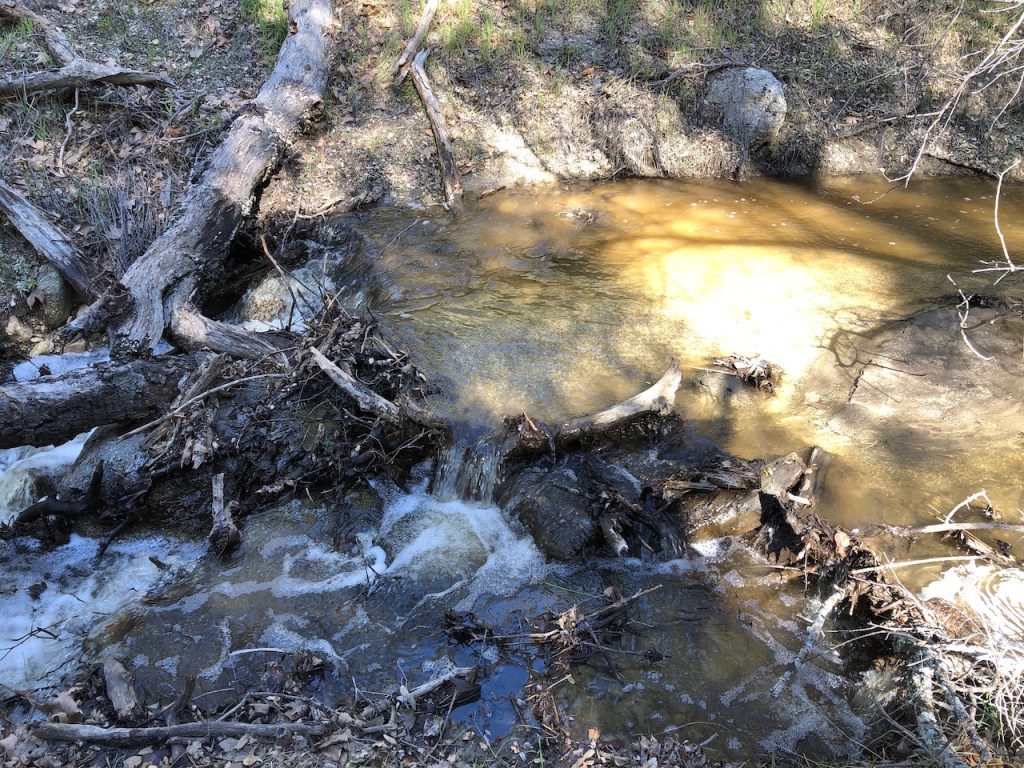
I walked along a stream, and could swear it glimmered like gold. There was gold in dem hills after all.

Re-Supply Time
If your a thru hiker this is your cue to get a cold beverage, and your re-supple box. From what I have heard, Warner Springs is a popular spot to send your box of food along to, as well as to stop to recuperate a bit.
PCT thru-hikers will depart Warner Springs, and set out to tackle Section B. It heads through the Beauty Mountain Wilderness, before reaching the Paradise Valley Cafe, and on to Mount San Jacinto (Elevation 10,788).

Warner Springs is a beautiful place. It is my second time visiting the PCT in this area. On my last trip here I hiked about 10 miles of Section B, heading nobo.

Part of me wants to keep going. The other part is excited to get home to my warm bed, and the people I love.
Until next time PCT. The good news is I got a permit for April 8th, and would be able to finish Section A, beginning at the official terminus at Campo.
You can read about the rest of my 3 day backpacking trip along Section A of the PCT, here.
I hiked from Campo at the Southern Terminus of the PCT to Storm Canyon in the Mount Laguna area, for a total of 49 miles, plus an extra 1.5 miles of taking a wrong turn on the way to Hauser Canyon.
I hope you enjoyed reading this, and it is helpful in knowing what to expect, should you decide to visit here.
About me
I’m Serafina! I’m a writer and California girl who loves to go exploring. Hope you will get outside today, breathe some fresh air, and be happy!
Follow my Journey…
Be sure to Like and Subscribe to My Youtube Channel where I post videos!
Disclaimer: The work on this blog is my opinion and my opinion alone and I am not responsible for the outcome if someone were to apply these thoughts to their own life. All text and photography copyright 2023 by Serafina, all rights reserved. Information and opinions provided are kept current to the best of the author’s ability. All readers’ usage of the ideas and opinions presented in the blog, are at their own risk. Be aware of the possible dangers of hiking, surfing, walking, cooking, and other activities, which may take place indoors or outdoors. By reading this, you agree not to hold the author or publisher of the content on this web site responsible for any injuries or inconveniences that may result from reading the blog, or partaking in any activity mentioned in the blog. Read the blog, and use its ideas, if you so desire, at your own risk.
