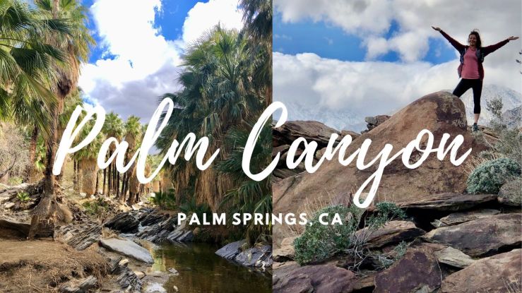
It was late February when I visited Palm Canyon.

It is located within a rocky gorge, within the Indian Canyons area of the 32,000 acre Agua Caliente Indian Reservation.
It is just south of the city of Palm Springs, along South Palm Canyon Drive.
A Walk Through History
Indian Canyons is located within an area rich in history.
You will pass a few interesting old buildings on the drive in.

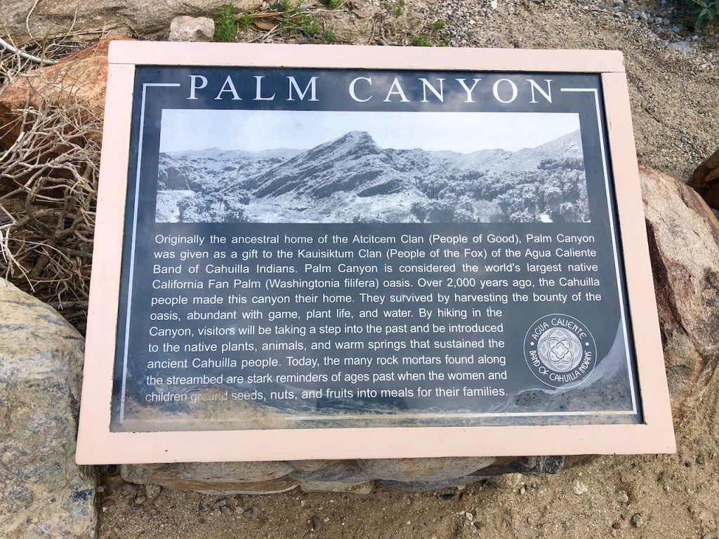
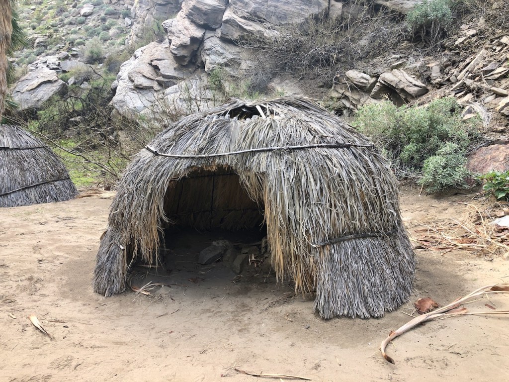
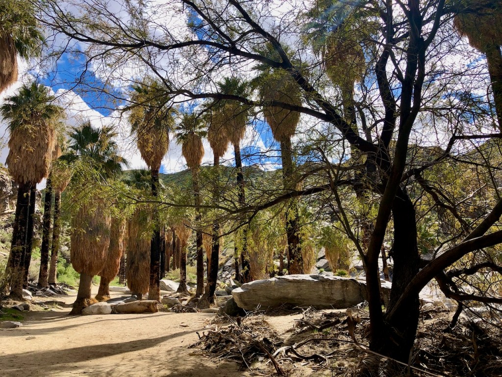
Along Palm Canyon, you can walk through the site of an Indian settlement, complete round domed huts, representative of the homes the people lived in here.
You may even spot other points of interest here such as morteros, or grinding rocks, and petroglyphs, while walking along the flowing Palm Canyon Creek.
The Santa Rosa Mountain Wilderness
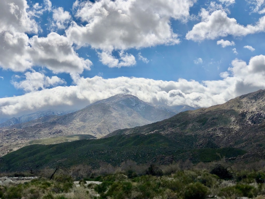
The setting is the Santa Rosa and San Jacinto Mountains Wilderness.

Many towering mountain peaks lie to the west of Indian Canyons, with the lower peaks of the Coachella Valley to the south, and the 4,000 to 5,000 foot peaks of Joshua Tree National Park, off to the north.

Everywhere you look is natural beauty and pristine wilderness.
Getting There
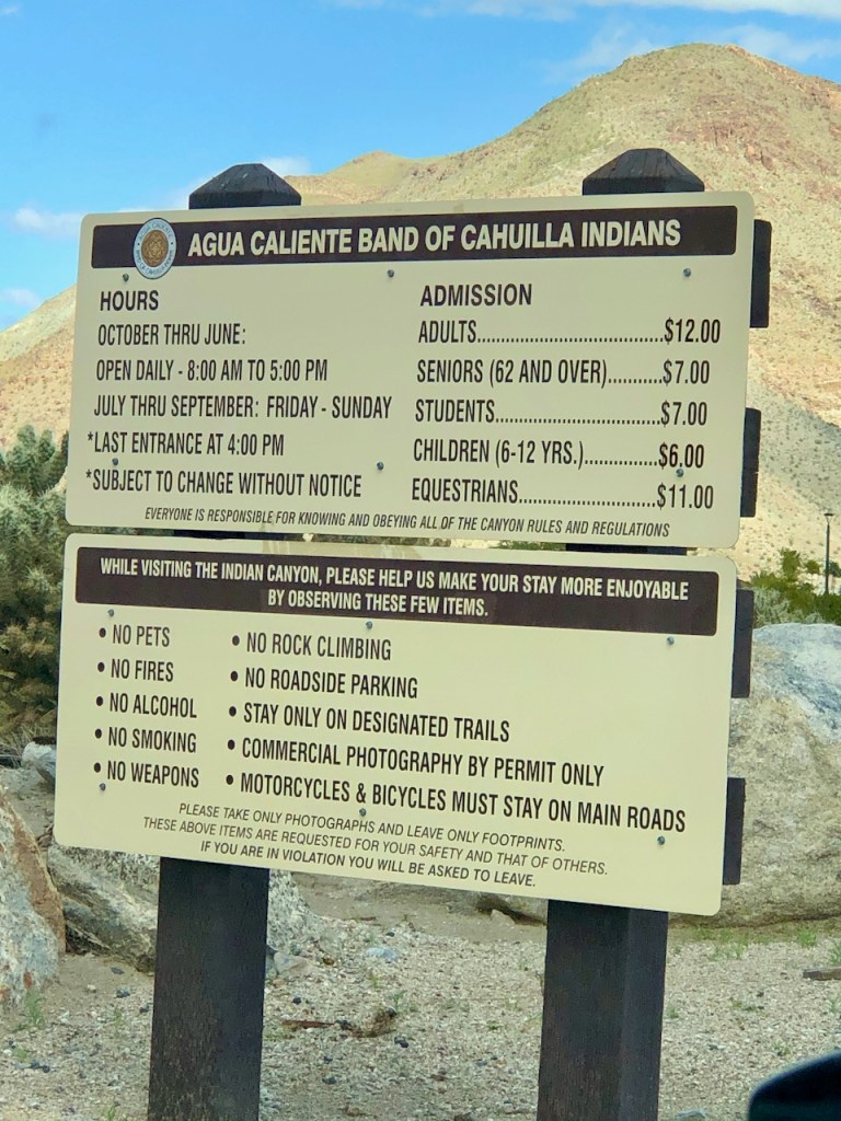
After following South Palm Canyon Drive, south of the downtown Palm Springs, you will eventually reach the entrance to Indian Canyon. There is an admission charge to visit, which was $12 per person, at the time I visited.
Many Trails to Choose From
After passing through the entrance gate, you will begin to notice signs for other trails in the area, such as the one mile loop on Andreas Canyon with its Palm Oasis, the 5.5 mile more strenuous climb to the Maynard Mine, along with Murray Canyon, and Corral Canyon.
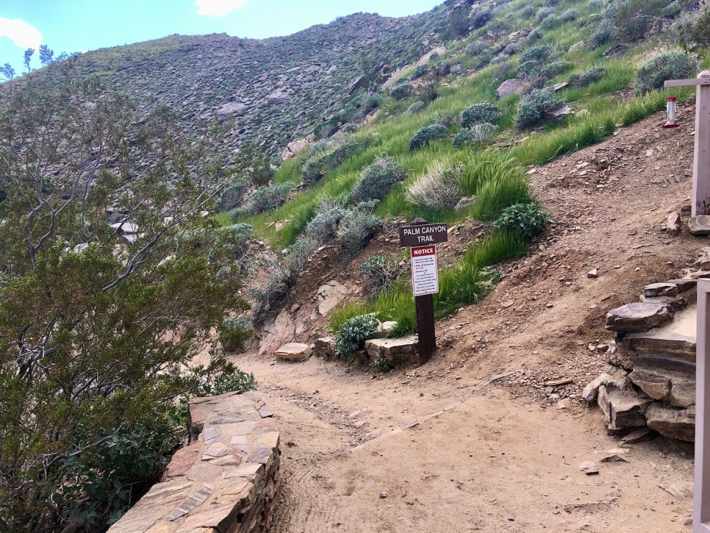
Finding The Trailhead
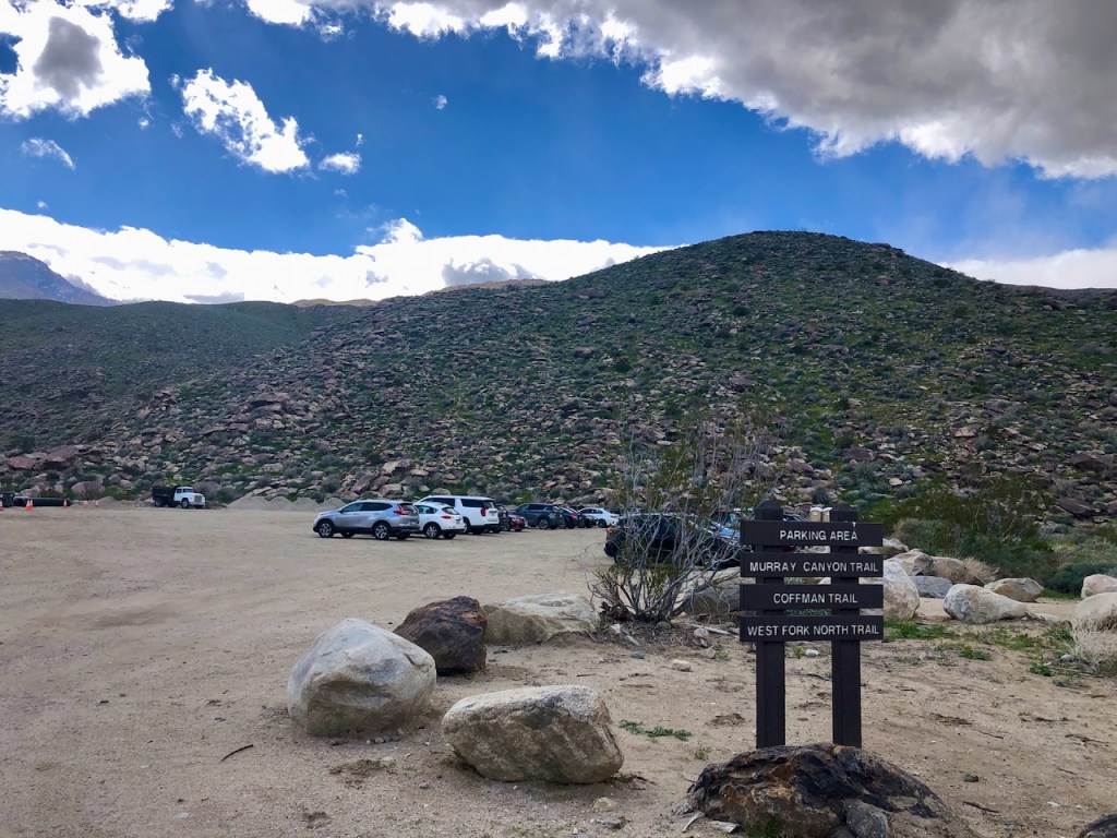
To reach Palm Canyon, the most popular and also easy hike at Indian Canyons, you will proceed all the way to the end of the road, where there are several parking lots and a trading post.
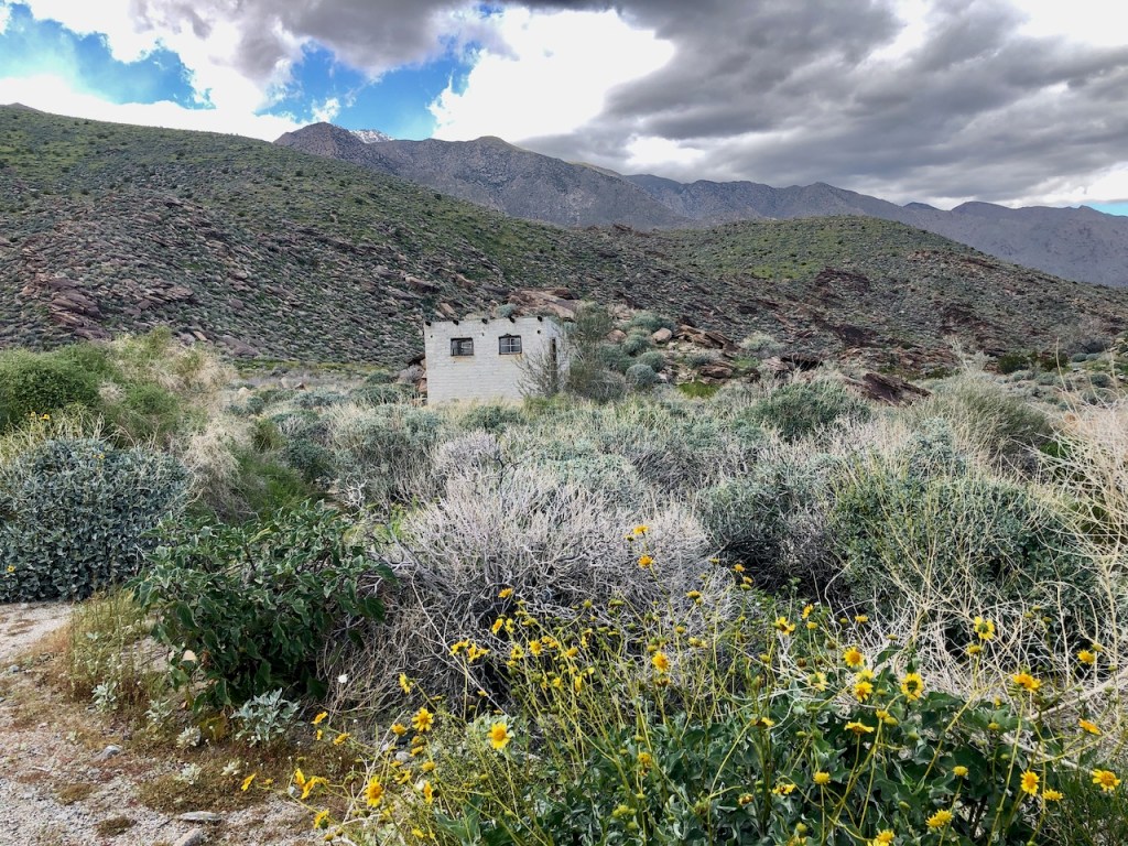
Along the way you will pass several trailheads, ruins of old buildings, a stream, and pass through a narrow rock opening, which allows only one car to pass at a time. This may be a lot of fun, or nerve wracking, depending on how large your vehicle is.
Parking
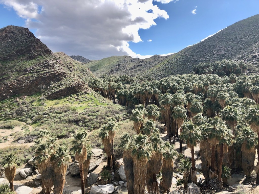
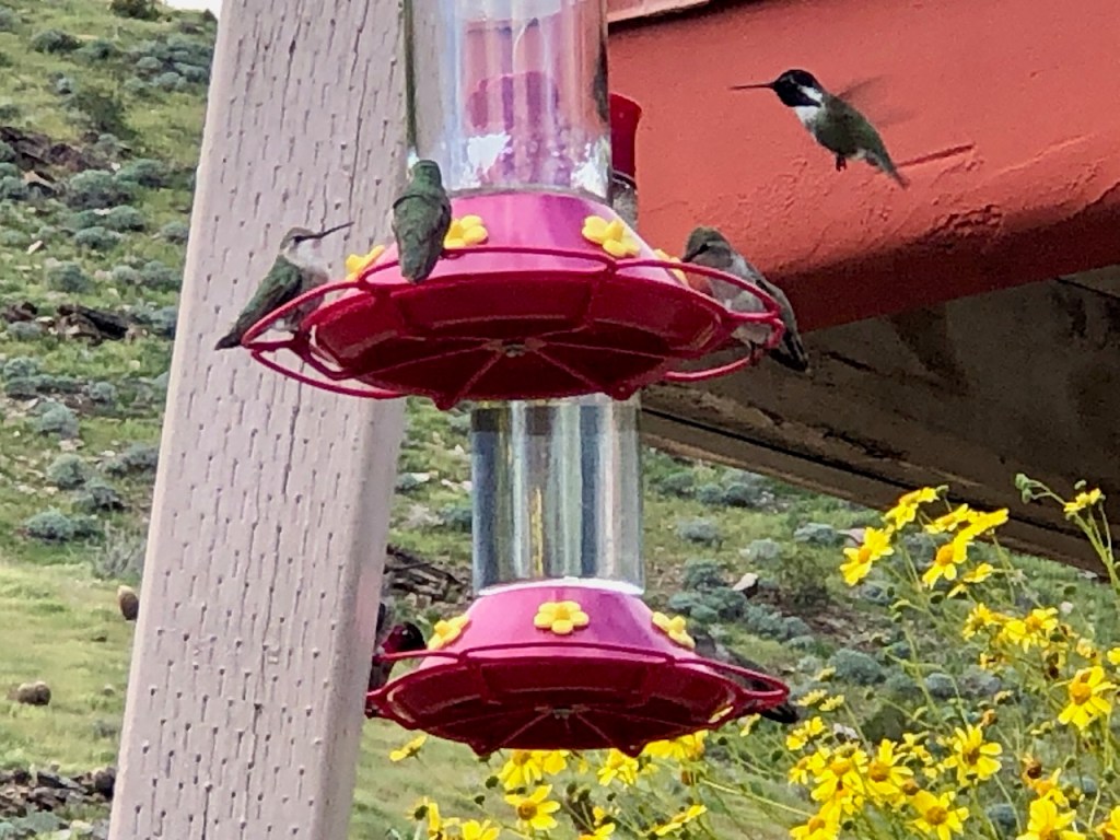
Once parked you have a beautiful view of the oasis, right from the parking area, next to the trading post. You can purchase lots of interesting art and even artifacts here. There are books on the history of the area, refreshments, pottery, jewelry, and other handicrafts, such as baskets. Some items are made by local artists, and members of the tribe, with ancestry dating back thousands of years.
There was a hummingbird feeder by the trading post, filled with emerald green colored desert hummingbirds.
Maps
At the entrance gate, you will be given a map of the most popular hikes. You could spend just an hour here in Palm Canyon, or an entire day exploring the longer trails, throughout Indian Canyons. There are hikes ranging from just one mile to as much as 9 miles, listed on the map.
Late Arrivals
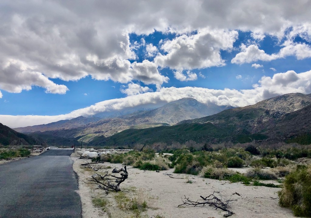
I arrived late in the day around 1:30pm. There was a slight breeze, and it was sunny, with lingering clouds.
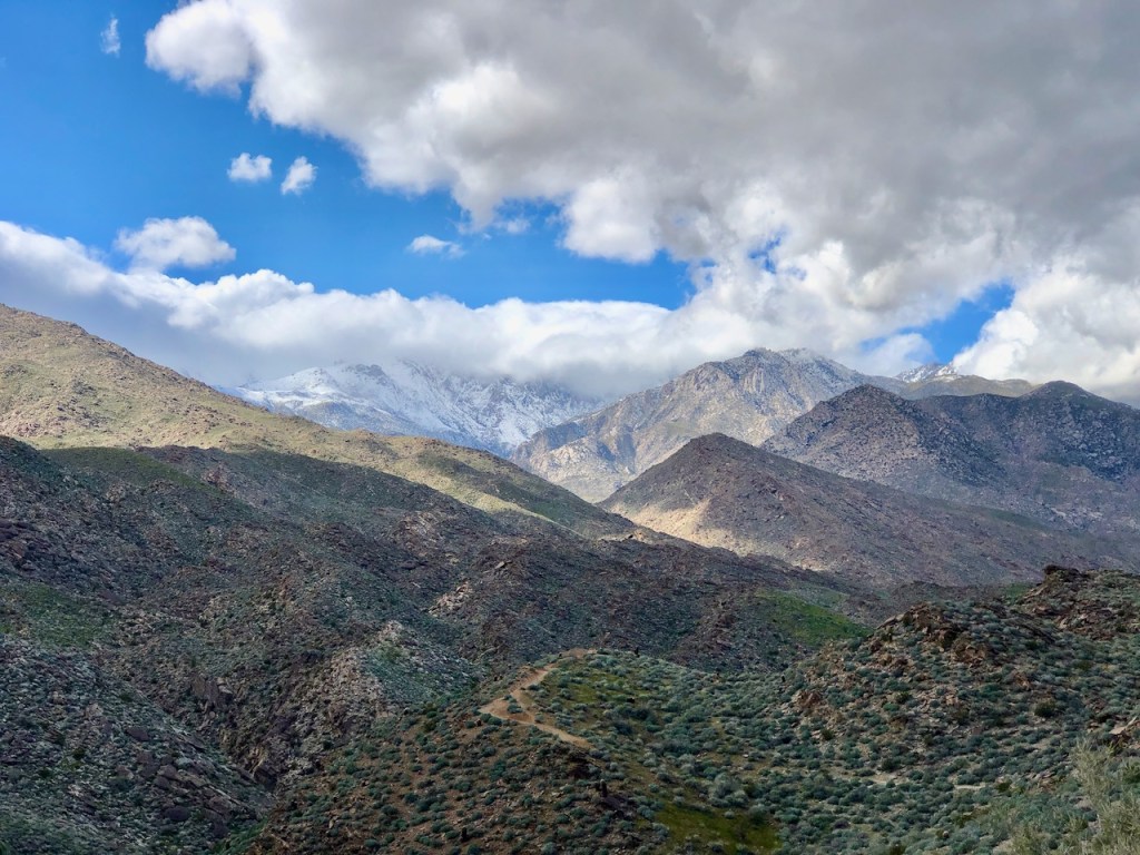
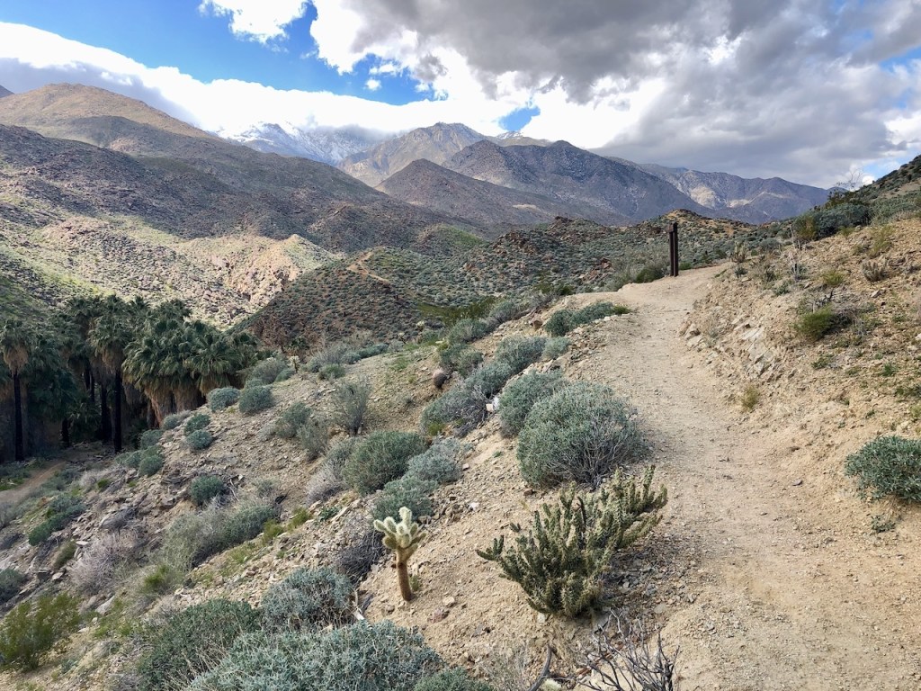
There was a recent rare snowfall on the lower elevations of the desert, after a cold spell. The weather, and wind, were still churning up something. It was hard to tell just what that was.
A 14 Mile Canyon
Palm Canyon itself is 14 miles long. But the Palm Canyon Oasis hike is just 2 miles.
I decided to start hiking up Palm Canyon on to the Vandeventer and Fern Canyon Loop, which was 6 miles total.

This route takes you a mile up Palm Canyon, before heading off up a ridge to the left. Continuing further on Palm Canyon, would have eventually brought me to an area called the Stone Pools, via Potrero Trail.

Desert Rainstorms
The desert needs rain, and usually only receives it in spring. It drizzled a bit, as I hiked down a few short steep switchbacks into Palm Canyon toward the oasis, with its flowing stream. There was no rain in the forecast, but lingering clouds around Mount San Jacinto and the Santa Rosas to my right.
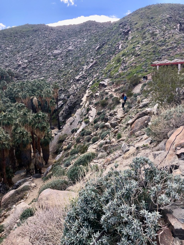
The Hike Begins
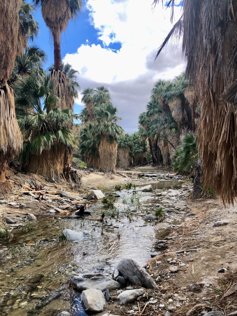
After reaching the creek, the trail heads to the right through Palm Canyon.
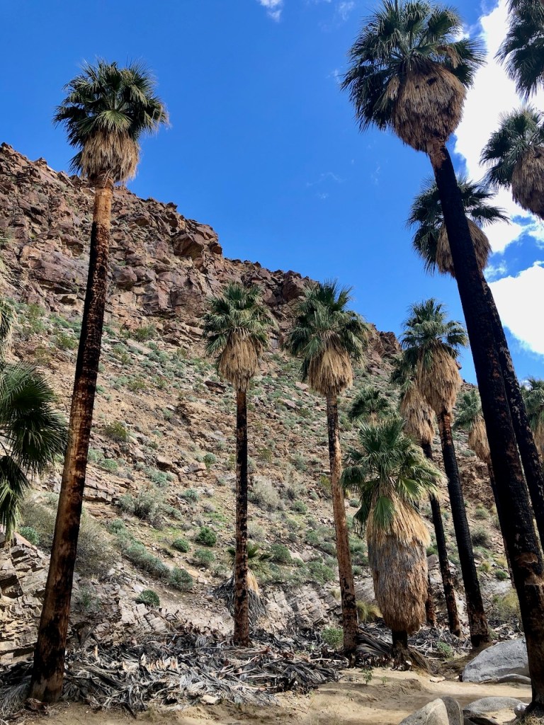
As I passed through the grove of Fan Palms, I noticed two thatched round dome huts off to the right, erected to represent the homes where the Cahuilla lived, when they inhabited this canyon.
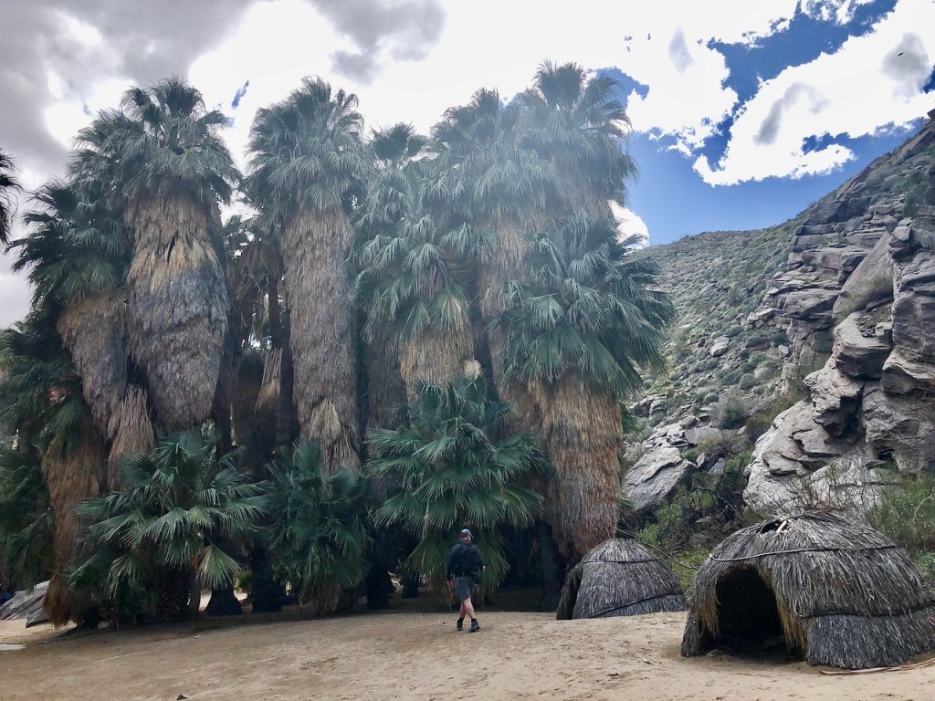
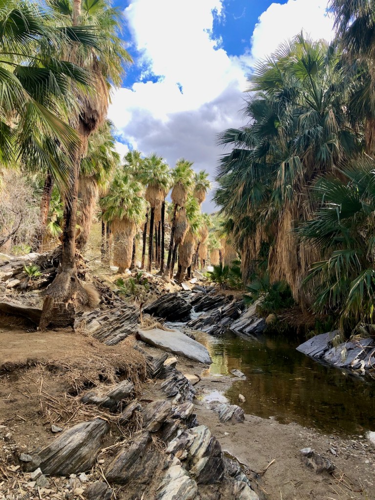
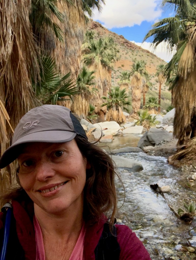
A Desert Oasis
This desert oasis amidst the Agua Caliente Indian Reservation was vital to the survival of the Cahuilla tribe residing here going back over 7000 years. You may be surprised anyone could survive in the desert, before air conditioning.

The Cahuilla
Not only did the Agua Caliente band of Cahuilla Indians survive here, they thrived here. Their remote location also likely played a part in avoiding conflicts with early settlers. The desert was not exactly prime real estate long ago for settlers, but it was for the Cahuila.
Life in the Desert
The desert is a harsh environment, and places like Palm Canyon, were an oasis, to stay cool, under shady palms, during hot spells. It has important and plentiful resources, such as water, along with an abundance of native palms. These are different palms, from the ones imported to adorn suburban neighborhoods back in the 1950’s.
Natural Materials
The fibers of these palm fronds were used to weave baskets, and mats. They were also used to build the walls of their round dome shaped huts they lived in.

A Creek Crossing
As I hiked on through the oasis, the trail follows Palm Canyon Creek. It is a mostly flat trail, with a few slight inclines. There is a creek crossing about halfway along.
Fire Resistance
I began to notice an abundance of dead palm fronds piled up all along the trail. The bark of the palm tree trunks were charred. I guessed they may burn the palm fronds onsite, when there are no visitors, and this might cause some of the palm trees to catch on fire. They are highly fire resistant and also drought tolerant.
Rock Pools and Waterfalls
I eventually reached some rock pools, and small waterfalls, about 3 /4 of the way to Vandeventer Trail. This was a popular spot, as the creek was flowing down the mountain from the right of the trail. Lots of people were enjoying the waterfalls here. The rock pools were useful for bathing, and washing during the rainy season for the tribes. These pools could have also served as storage vessels, when the creek was not flowing, in the dry season.
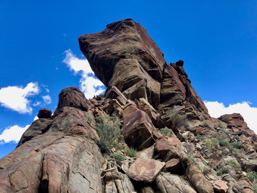
Interesting Rock Formations
Coyote Rock as I named it, is located about halfway along the trail.
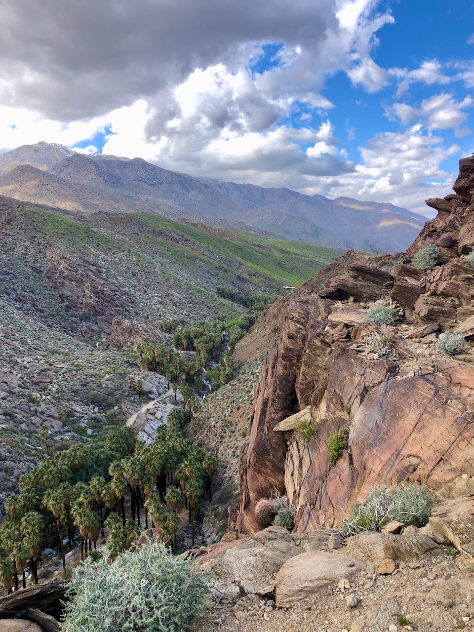
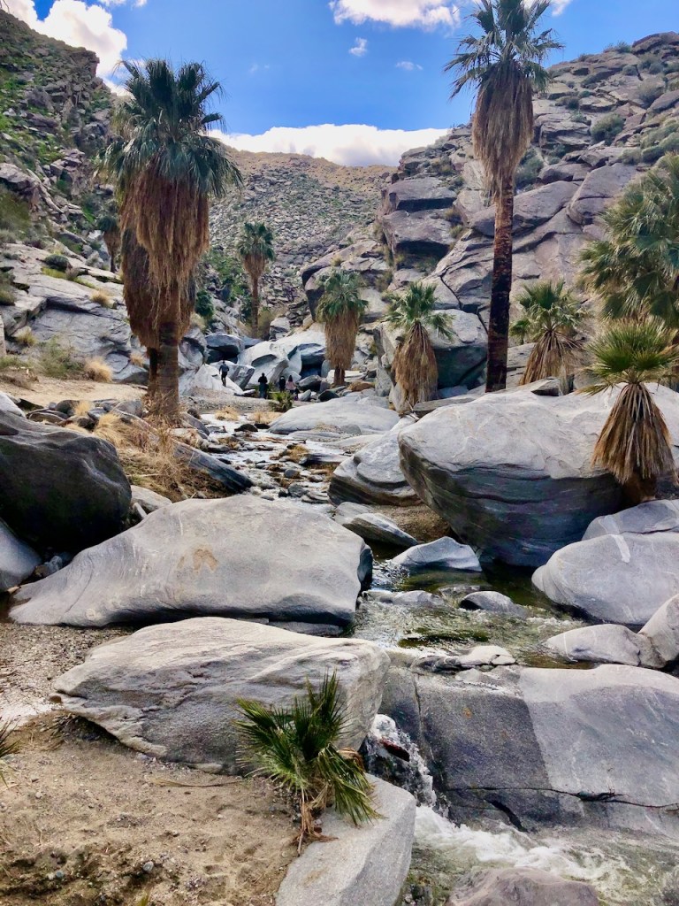
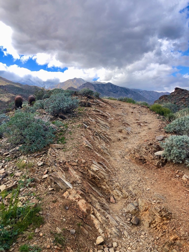
Heading Up the Gorge
About two miles up Palm Canyon was the sign for Vandeventer Trail, and Victor Loop. This is the turnoff, and I would make a left here.
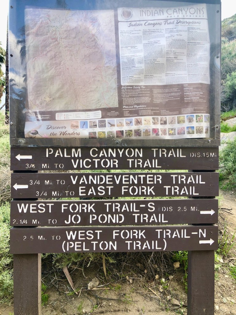
Potrero Trail
Further on up Palm Canyon, past this signpost, the trail continues on, and is re-named Potrero trail. This is the word for pasture in the Cahuilla (pronounced Kawia) language. The Trading Post to Stone Pools hike leads you to a series of stone pools, located just to the right of the trail, about 3 miles up Palm Canyon, for a total of 6 miles roundtrip.
Vandeventer Trail
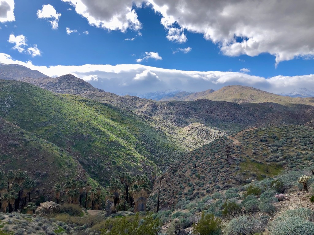
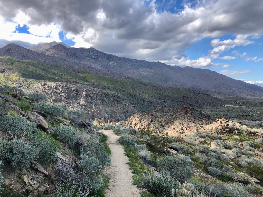
As I turned left, and proceeded up the gorge, the scenery was nothing short of breathtaking. I was so awestruck by the beauty of it all. I thought I was on Vandeventer Trail at this point, but there was another right I needed to make, a few feet later, which I missed.
Wrong Turn?
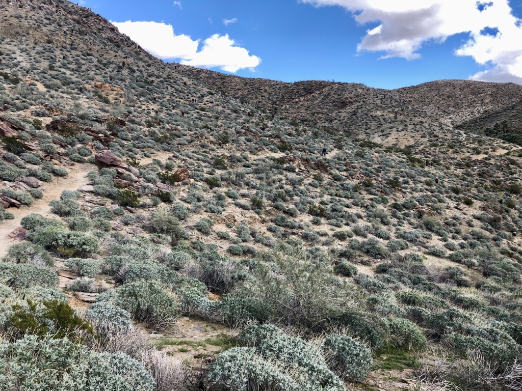
Since I was busy taking in the views, and photos, I somehow missed another sharp right I needed to take shortly afterward, for Vandeventer Trail. I was actually on Victor Trail. Failing to look closely at the map, I ended up realizing about halfway along Victor Trail that I had missed a turn. So rather than backtrack, I continued onward, on what would be the shorter, but very scenic Victor Loop, at just 2.7 miles.
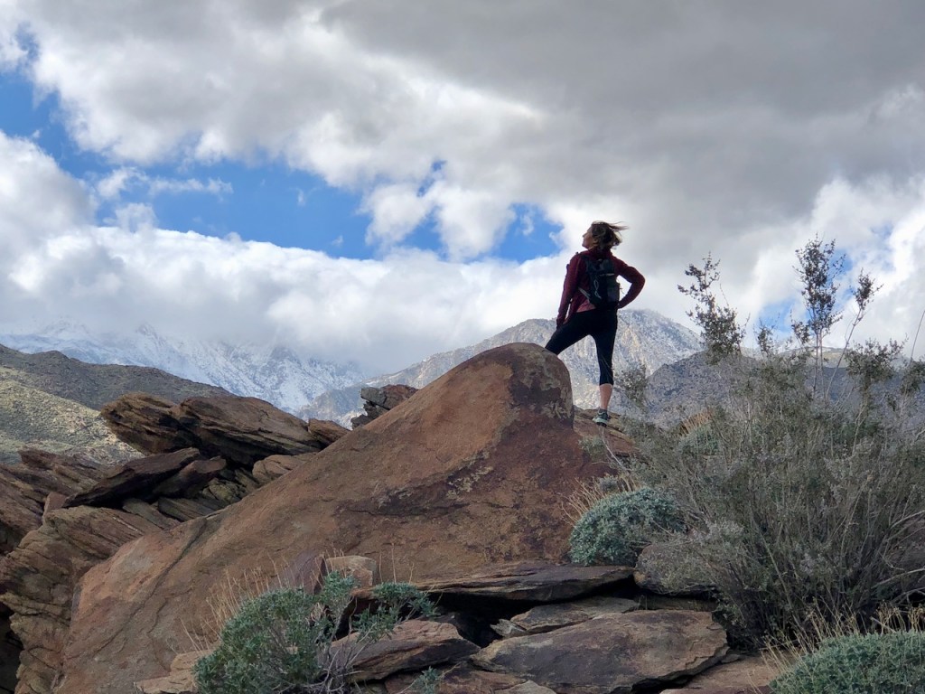
Desert Winds
The wind had really started to pick up, and was howling, with 30 mph gusts at this point. This is very common in the desert. Having a hat with a chin strap, or a buff is helpful, when this occurs. I did not have a buff today, so my hair would get very windblown. I had my cap on tight as possible, but ended up removing it, so it did not blow away.
A Chance of Rain
A storm seemed to be moving in. Being so close to the mountains, the weather can be unpredictable. Mountain ranges tend to create their own weather systems.
The Palm Canyon Gorge
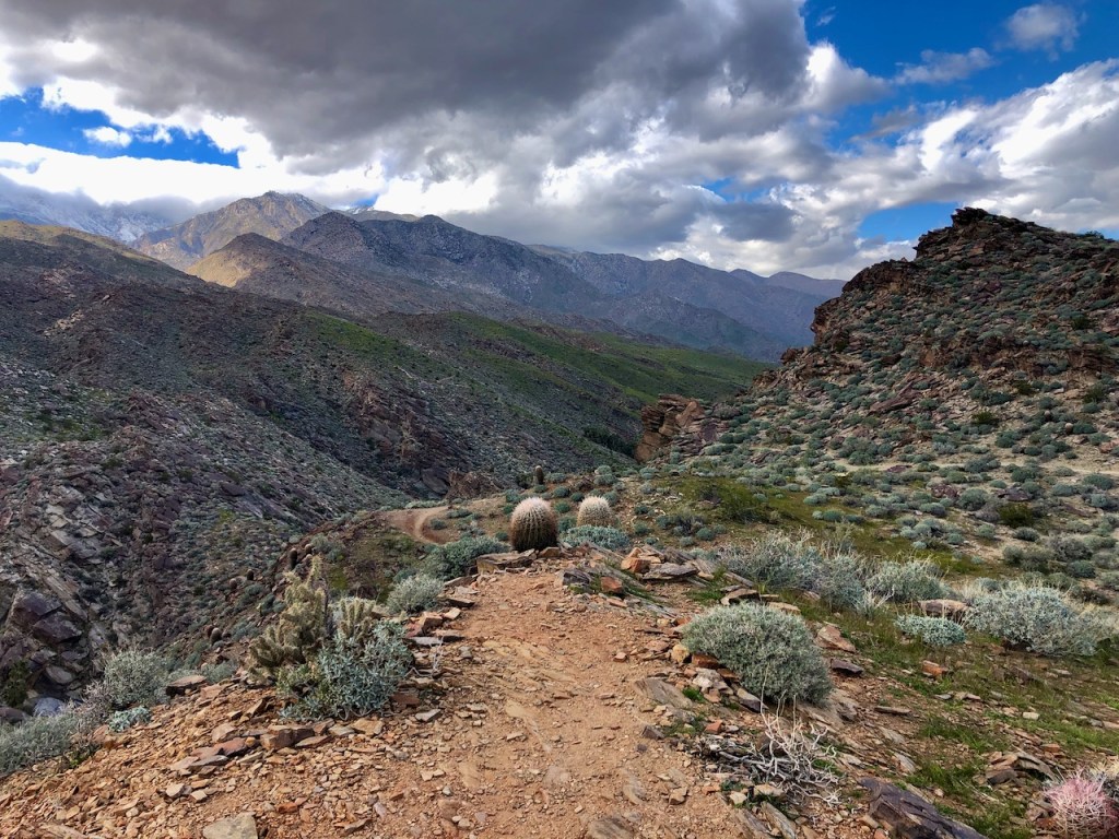
Along the gorge there were several scenic rock outcroppings, which would be perfect for photos, and picnics. Be forewarned, the gorge is steep, and drops off hundreds of feet. So think twice before taking that selfie on that large boulder.
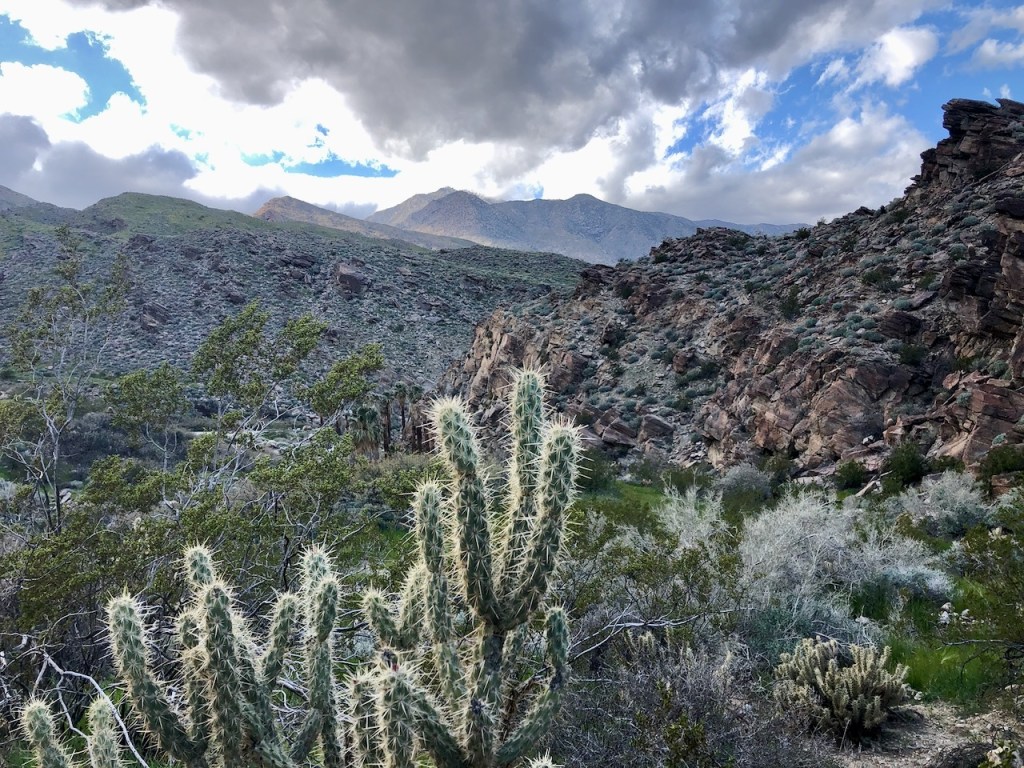
The Cactus Garden
On this ridge above the Palm Oasis, I was surrounded by a native cactus garden.
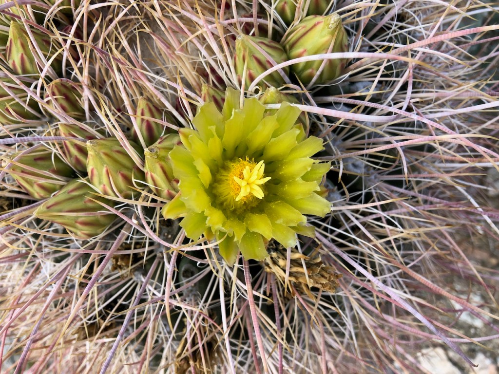
The bright yellow flowers of the barrel cactus were just coming into bloom, in late February. With their red and green spines, they were quite beautiful.

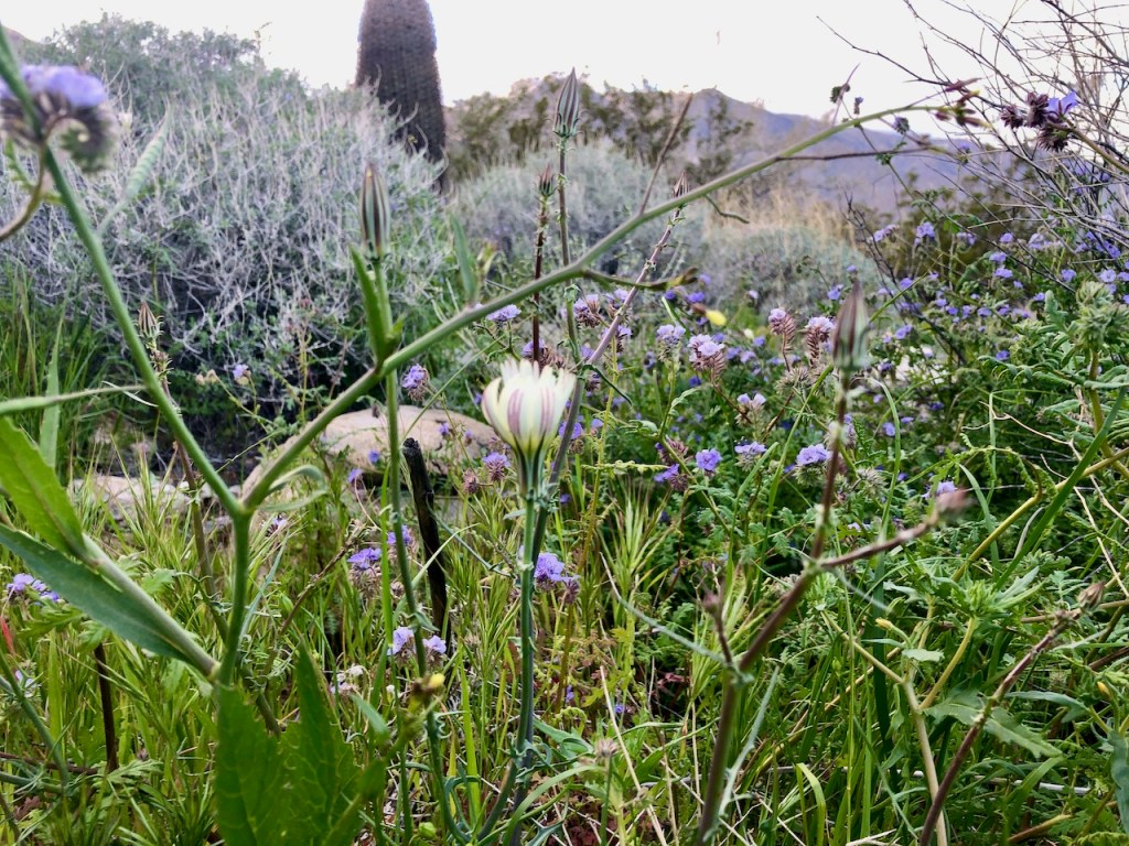
Wildflowers in the Desert
Desert flowers and plants bloom when it rains, more than during a particular season. Generally February to April is the best time to see the desert come to life, in full color.
Back in the Oasis
After hiking along the gorge, eventually the trail descends back down towards the oasis, linking up with Fern Canyon Trail.
Along the way I noticed lots of native grasses, and areas of lush greenery tucked away amidst the rocks.

I saw several wildflowers here, such as a yellow Ghost Flower, protected from the winds, behind the large boulders.
One Last Creek Crossing
Eventually I met back up with Palm Canyon Creek, and crossed it, before hiking back up toward the Trading Post, and parking lot.
One of My Favorite Desert Hikes
Hiking above the gorge on Victor Trail was well worth it. I was glad I made this detour. Sometimes the longest hike is not the most scenic. I could easily have missed this, simply since I tend to opt for longer, more challenging hikes. I would rate Victor Loop as one of my favorite desert hikes of all time.
About Victor Trail
According to the Indian Canyons website, “This trail is one of the most scenic trails in the Indian Canyons. It is best to access this trail by hiking a mile south on the Palm Canyon Trail. The Victor Trail will take the hiker out of the shade of the palm trees, up and onto the ridge that overlooks the canyon and return the hiker to the Trading Post making a three mile loop.”
It’s listed as 2.7 miles, with 365 feet of gain. So it’s somewhere in the ballpark of 2.7-3 miles total.
At a slow pace, you could expect to complete this hike in 1.5-2 hours, depending on stops.
More Trails of Indian Canyons
A two hour hike on the Murray Canyon to Seven Falls trail, is just 3.7 miles, and a great option for those looking for a bit of a challenge, with its Palm Oasis, and the added bonus of beautiful waterfalls.

The much longer Dry Wash Trail, East Fork Trail, and West Fork Trail all take you higher into the foothills of Indian Canyons, if you’re looking for more scenic mountain views. The parking area for these hikes is the same as for Palm Canyon, and you start your hike at its oasis.
Don’t Get Towed
Be sure to be done with your hike, by closing time, as they will tow any car left in the parking lot past 5pm.
What about Visiting Tahquitz Falls with the Same Admission?
The short answer is no. Both are located within the Agua Caliente Indian Reservation. But this hike requires separate admission fees. If you’re wanting to hike to Tahquitz Falls, it is located much closer to town, outside of Indian Canyons, and has a separate admission of $15 per person.
Best Time to Visit
Since the last hike of the day allowed is 1.5 hours before closing, it’s best to plan accordingly, since they will tow cars left in the lot after closing time. There is however a hike locals take, that is free of charge, which takes people above the falls, but not directly to it. You can park on the street to walk there.
You can check the hours for Tahquitz Falls here.
I even created this video of my trip to Palm Canyon, which you can watch here on my youtube channel.
Please like and subscribe to Serafina Hikes on youtube.
About me
I’m Serafina! I’m a writer and California girl who loves to go exploring. Hope you will get outside today, breathe some fresh air, and be happy!
Follow my Journey…
Be sure to Like and Subscribe to My Youtube Channel where I post videos!
Disclaimer: The work on this blog is my opinion and my opinion alone and I am not responsible for the outcome if someone were to apply these thoughts to their own life. All text and photography copyright 2023 by Serafina, all rights reserved. Information and opinions provided are kept current to the best of the author’s ability. All readers’ usage of the ideas and opinions presented in the blog, are at their own risk. Be aware of the possible dangers of hiking, surfing, walking, cooking, and other activities, which may take place indoors or outdoors. By reading this, you agree not to hold the author or publisher of the content on this web site responsible for any injuries or inconveniences that may result from reading the blog, or partaking in any activity mentioned in the blog. Read the blog, and use its ideas, if you so desire, at your own risk.
