
A Beach Wetland
Orange County has its share of beautiful beaches, and beach hikes. It also has several wetland hikes, such as the Back Bay, and San Joaquin Wildlife Sanctuary. Bolsa Chica is a little of both being a wetland, and a beach hike, perfect for a sunset stroll.
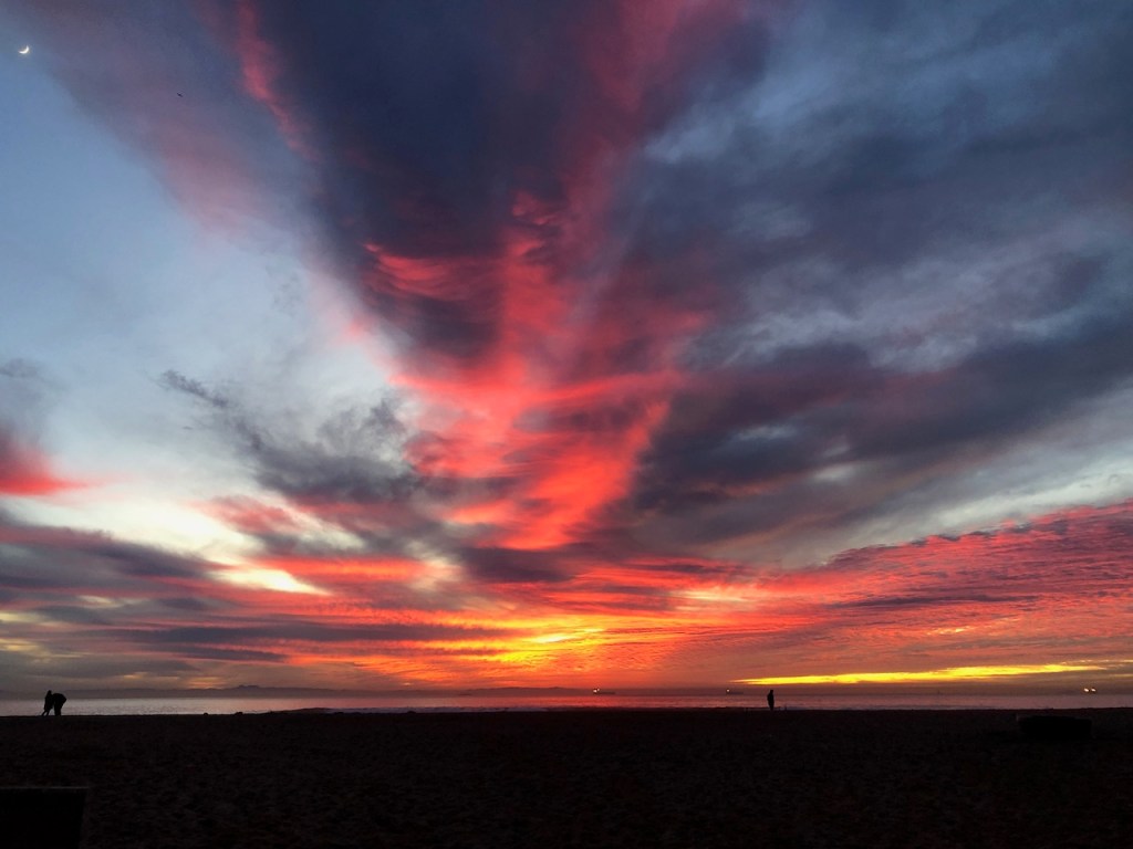
Hiking at Sunset
I began my hike at Bolsa Chica on a Monday afternoon, at dusk. It was late December, and the weather was mild. It was not too chilly, and there had been rain in the area. The air was clear, and crisp. It was a perfect winter evening for a hike at the beach.
The Nature Center
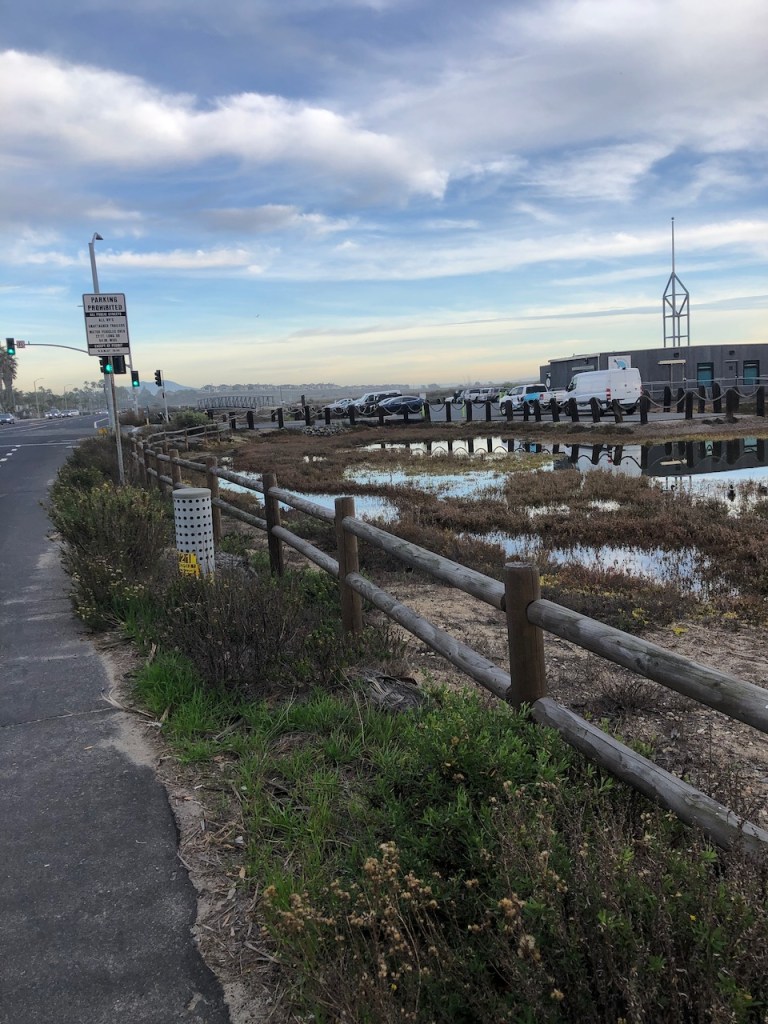
After parking at Bolsa Chica, I decided to cross the street at Warner, and PCH, making my way along the side of the road to the Nature Center and trailhead there. I would not recommend this option, since there is no sidewalk. We decided to do this, since the nature center lot was full, when we first checked.
The Trailhead
I started my hike through Bolsa Chica on Mesa Trail. I started hiking south along the lagoon on my right, which was filled with shorebirds.
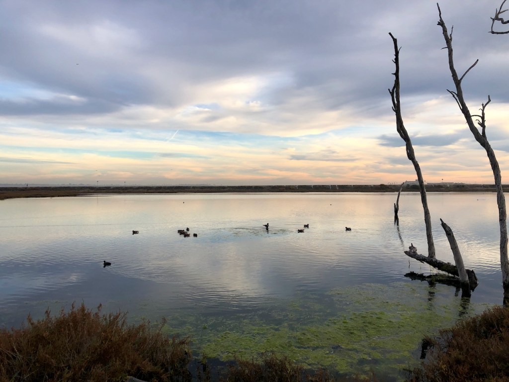
I came to the Mesa Overlook, and made a left along Pocket Loop Trail, which has a peaceful lagoon off to the right.
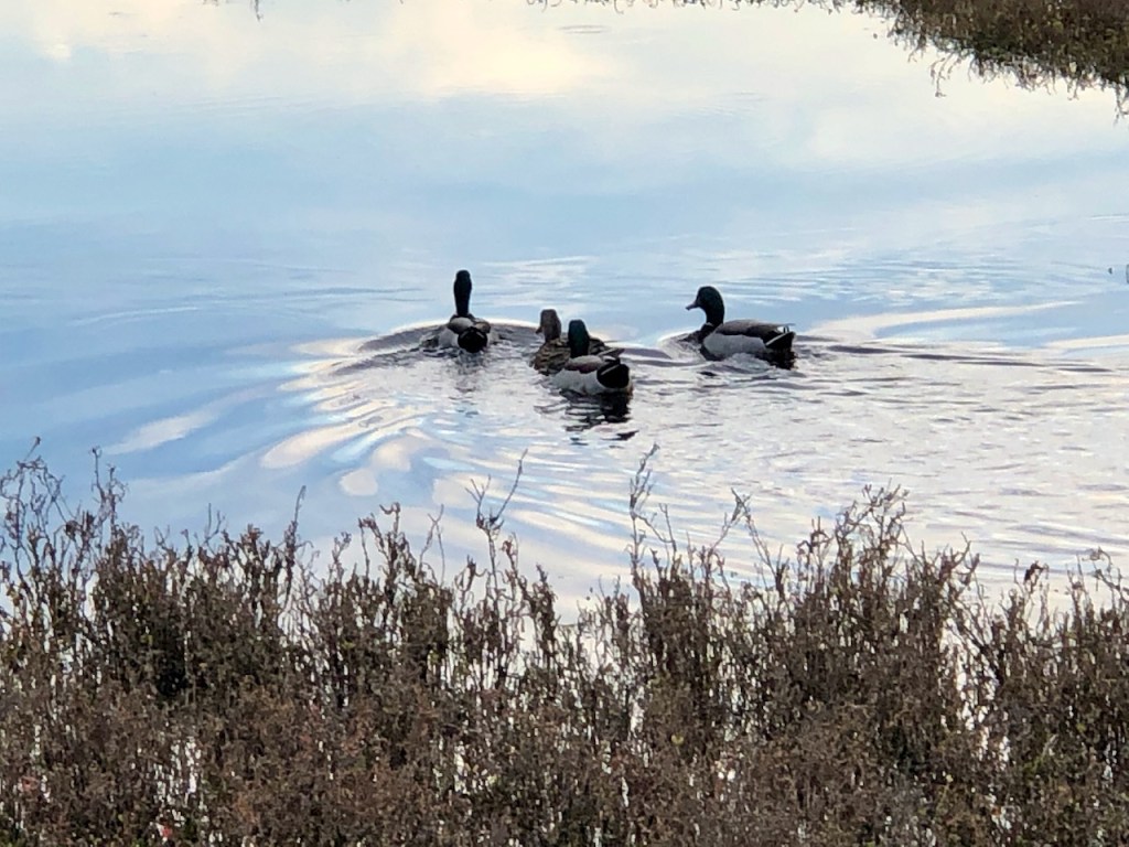
There were families of ducks swimming along here.
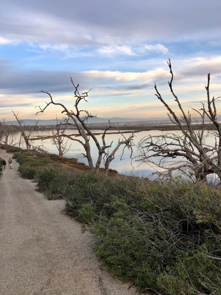
There were many tree skeletons along the bay, which had succumbed to the brackish water.

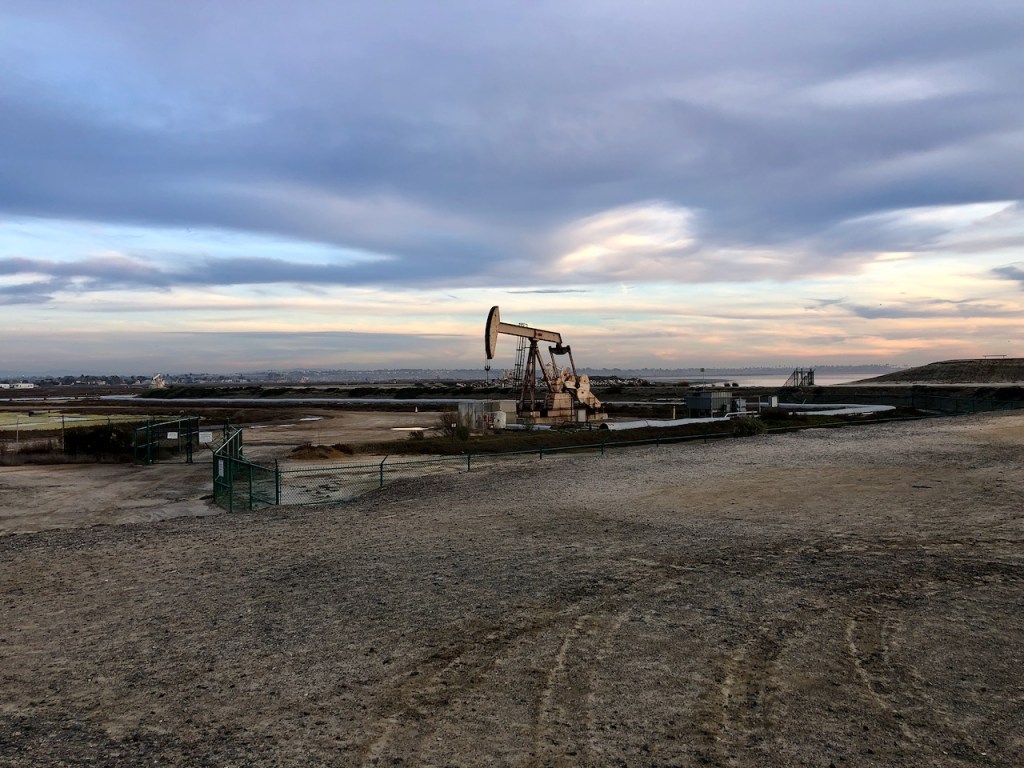
Oil Derricks
Off in the distance was Saddleback Mountain, along with several oil derricks, pumping up that black gold we all rely on for just about every aspect of our lives. Read more about my thoughts of our relationship with Big Oil here.
Inner Loop Trail
Next I made a right along the Inner Loop Trail, which is paved. It takes you past another oil derrick.

The sun was starting to set, and as I made my way towards PCH along the raised road, there were a series of overlooks, with benches. I passed those by since time to finish this hike was running short.

Closing Time
I was glad I had parked across at Bolsa Chica State Beach, since the wetlands were closing, and I did not want to get my vehicle locked in, or worse towed. I had underestimated the amount of daylight I had. It was getting dark so early, around 4:30 at this time of year.
Rabbit Island
I made another decision, to pass the Rabbit Island Overlook, and make a left on Inner Bay Loop, taking it to the other parking area on PCH, where there is a light. There is an entrance to Bolsa Chica there.
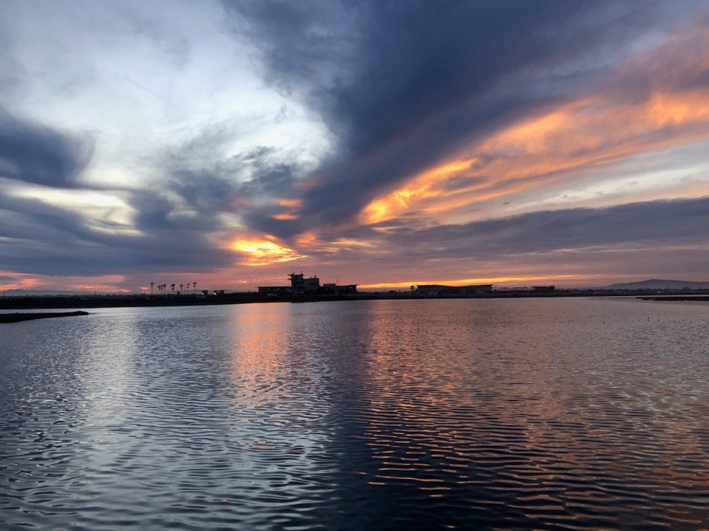
Herons at Sunset
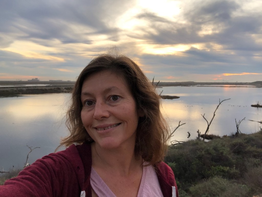
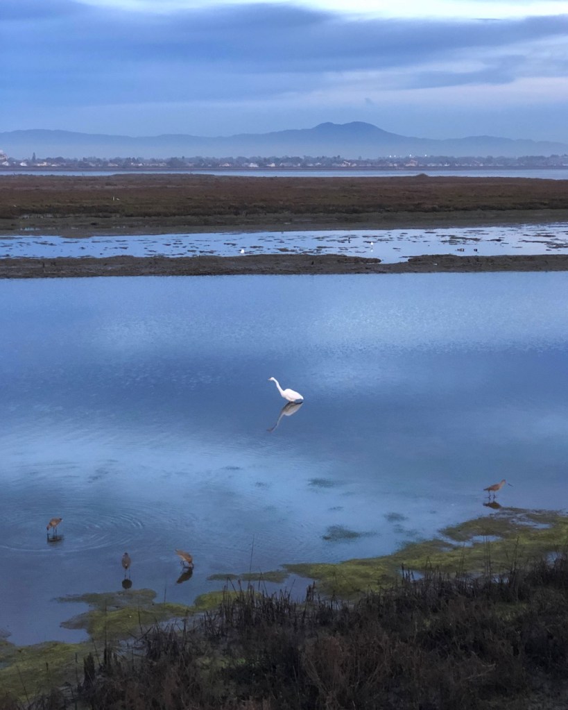
Along Inner Bay Loop I got to see some of the best views of the day over the wetlands, and watch the sunset. There wwe more beautiful white herons than I had ever seen before in one area. This truly was an important nesting area for shorebirds.
Crossing PCH?
I would come to find the light had no crosswalk, making crossing even at a red light a bit hazardous, so I went about it quickly. This is not something I would do again. It’s definitely worth it to come to Bolsa at sunrise, and park in the lots here. There is just not any completely safe way to walk over to Bolsa Chica via Warner and PCH.
Parking
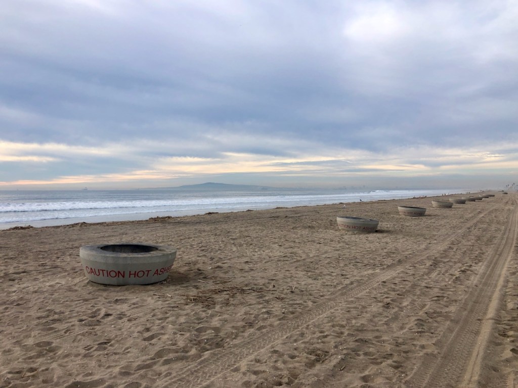
There are several options to park, and visit here. You can park for free at either of the two lots on PCH, and also at Warner, where the visitors center is. You can also park across the street at Bolsa Chica State Beach and walk over, which is what I did since I had a beach pass.
About the Marsh
Long ago Freeman Creek, a tributary of the Santa Ana River, flowed into what was a much more extensive marshland than seen today, post channelization of the river. The brackish water of this swampland supported a variety of different plants, and trees. Along with bobcats, rabbits, coyotes, and deer, long ago there were grizzly bears, even antelope here.
The Tongva Tribe
The Tongva tribe utilized the wetlands of Bolsa Chica until the 1800’s and colonization forced them off the land. They had resided here going back 9,000 years. They lived in shelters called wickiups, hunted, and gathered what they needed from the surrounding area.
The tribe also would travel via canoe throughout the wetlands, and across the ocean, to islands such as Catalina. There is little evidence of their settlement here, except for a couple of burial sites, deposits of shells which were used for trading, and about 150 mysterious Cog stones, similar to those found in South America.
Land Grants
In 1787, the land on which Bolsa Chica sits became part of a large land grant of over 300,000 acres, to a Spanish soldier, Manuel Perez Nieto. This land grant stretched from the San Gabriel River, all the way to the Santa Ana River, and into the foothills of the San Gabriels. The land would be later subdivided, and given to a man named Joaquin Ruiz. His wife Caterina named it Rancho La Bolsa Chica, or “The Little Purse,” in 1804.
Duck Hunting and a Gun Club
Later in 1895 Bolsa Chica would become a duck hunting preserve, and a gun club. Eventually a dam was installed, around 1900, which prevented salt water from flowing into the marsh. This changed the wetland permanently, though work is still underway to restore it.
Oil Wells
In the 1920’s oil was discovered here. Standard Oil developed the oil wells along the edge of Bolsa Chica. Later Signal Oil took over, and developed the raised roads, above the wetland. These also serve as the hiking trails crisscrossing the marsh today.
Autotopia
The Red Line would run though the area from 1904 until the 1950’s, when cars became the preferred method of transport, over trains. The rail line that once ran past here would be demolished.
World War II
Near the tide gates on the northern end of Bolsa Chica, are various military installations, placed here during World War II. It was a time when it was thought more defense was needed for the port of Long Beach.
A Nike Missile Site
There was an artillery battery, several buildings, fortification establishments, personnel and munitions storage, gun emplacements, a water tank and tower, a transformer vault, two underground tanks, electrical and water utility systems, and long range gun emplacements, all installed here. It was even going to be a Nike missile site, but the land was deemed unsuitable for such a use.
Tin Can Beach
In the 1950’s as people started to drive down PCH, and the beach area here came to be known as In Tin Can Beach. Squatters lived in the area in makeshift shacks and shanties constructed of cardboard, tarpaper, and scrap lumber. The beach was littered with their trash, and became a dump.
Bolsa Chica is Born
In 1961, the beach was cleaned up and Bolsa Chica State Beach was born. In 1972 the 310 acre Bolsa Chica Ecological Reserve was established. The Department of Fish and Game has been actively restoring this reserve ever since, including adding a tide gate to allow salt water to flow into the bay once more. In 1997 an additional 880 acres would be added to Bolsa Chica Ecological Reserve.
The Largest Saltwater Marsh
The 1,449 acre Bolsa Chica Ecological Reserve, is the largest saltwater marsh between Monterey Bay and the Tijuana River Estuary. It is open from sunrise to sunset daily. There is a nature center here, and 5 miles of trails to enjoy.
Noise Pollution
On a side note, this trail is not very quiet, and tranquil. Since the reserve is located right on Pacific Coast Highway, without any type of sound barrier, it can be very noisy here. The best way to enjoy this wetland without as much noise, is to come at sunrise, when there are less vehicles on PCH. The least vehicle traffic would be on a Sunday morning, at sunrise. You will have the added bonus of having the trail mostly to yourself if you go early. Expect the most road noise on a Saturday afternoon, or during rush hour traffic.
Learn more about the wetlands at Bolsa Chica Conservancy
About me
I’m Serafina! I’m a writer and California girl who loves to go exploring. Hope you will get outside today, breathe some fresh air, and be happy!
Follow my Journey…
Be sure to Like and Subscribe to My Youtube Channel where I post videos!
Disclaimer: The work on this blog is my opinion and my opinion alone and I am not responsible for the outcome if someone were to apply these thoughts to their own life. All text and photography copyright 2023 by Serafina, all rights reserved. Information and opinions provided are kept current to the best of the author’s ability. All readers’ usage of the ideas and opinions presented in the blog, are at their own risk. Be aware of the possible dangers of hiking, surfing, walking, cooking, and other activities, which may take place indoors or outdoors. By reading this, you agree not to hold the author or publisher of the content on this web site responsible for any injuries or inconveniences that may result from reading the blog, or partaking in any activity mentioned in the blog. Read the blog, and use its ideas, if you so desire, at your own risk.
