
Nine Mile Creek to Hamilton Lake 9 miles
We awoke at Nine Mile Creek at sunrise, having slept like logs, after being exhausted from Day 1’s full day long trek from Crescent Meadows. We had traveled 11.5 miles, far more than stated on the HST mileages. We knew every day would be more miles than originally anticipated.
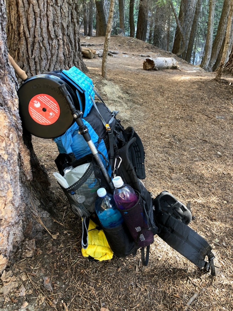
We filled up on water, and tried to get moving as early as possible, to hike during the cooler part of the day for a change. In spite of our attempt to get going early, we did not end up leaving camp until around 8:30am.
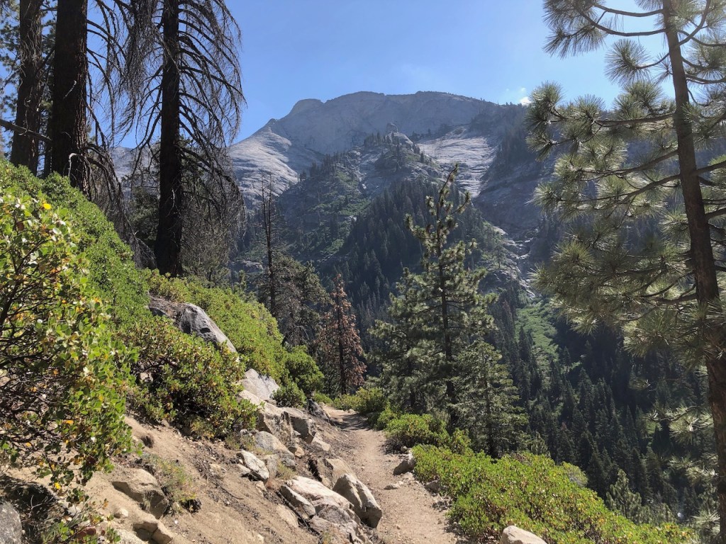
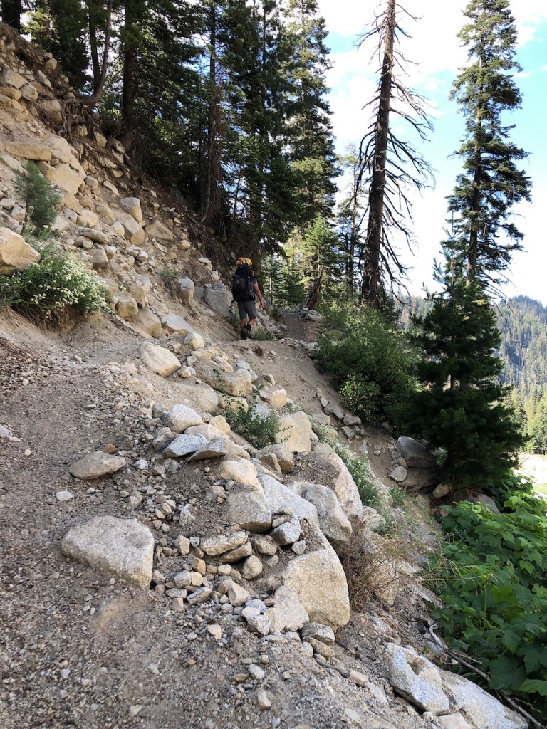
The sun was out, and there was not a cloud in the sky, as we edged closer to the Great Western Divide. The trail began to hug the cliffside, as it descended down towards Buck Creek.
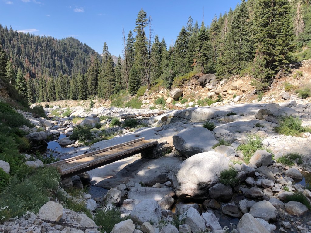
This was another excellent water source, about 12.5 miles along the High Sierra Trail. This gorge can flood, but fortunately the bridge was intact.
A series of switchbacks took us higher to Bearpaw Meadow and High Sierra Camp.
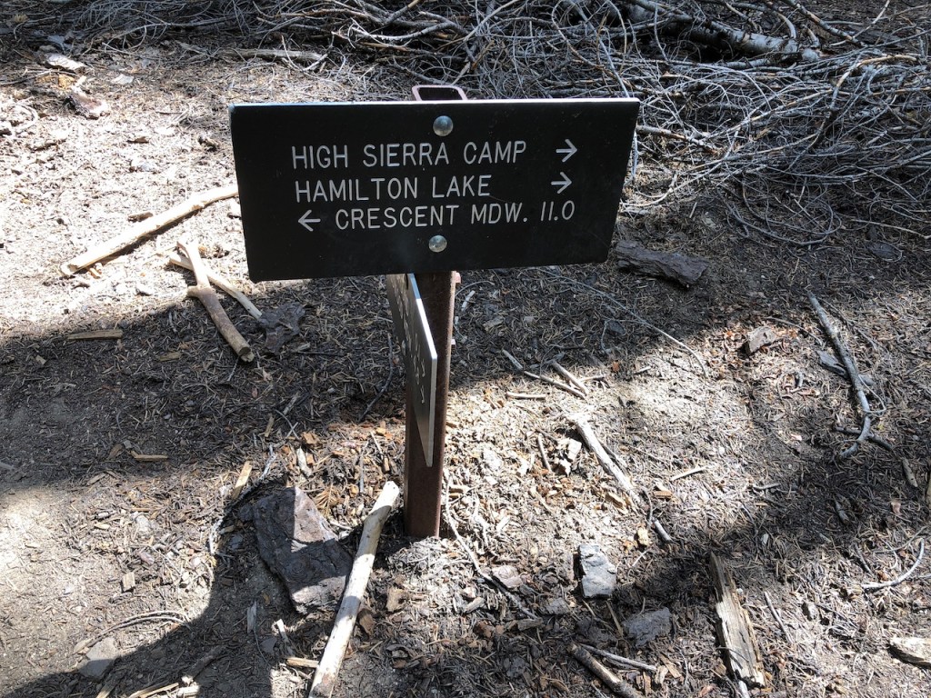
Bearpaw Meadow has several trails intersecting here. You could head south towards the North Fork of the Kaweah River and Redwood Grove in Mineral King or north towards Tamarack Lake.
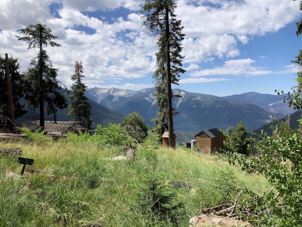
In summer of 2022, the High Sierra Camp was still being renovated, after a high snow year, resulted in damage to the buildings, and water pipes.

Gazing off into the vast wilderness, you feel so small, and isolated.
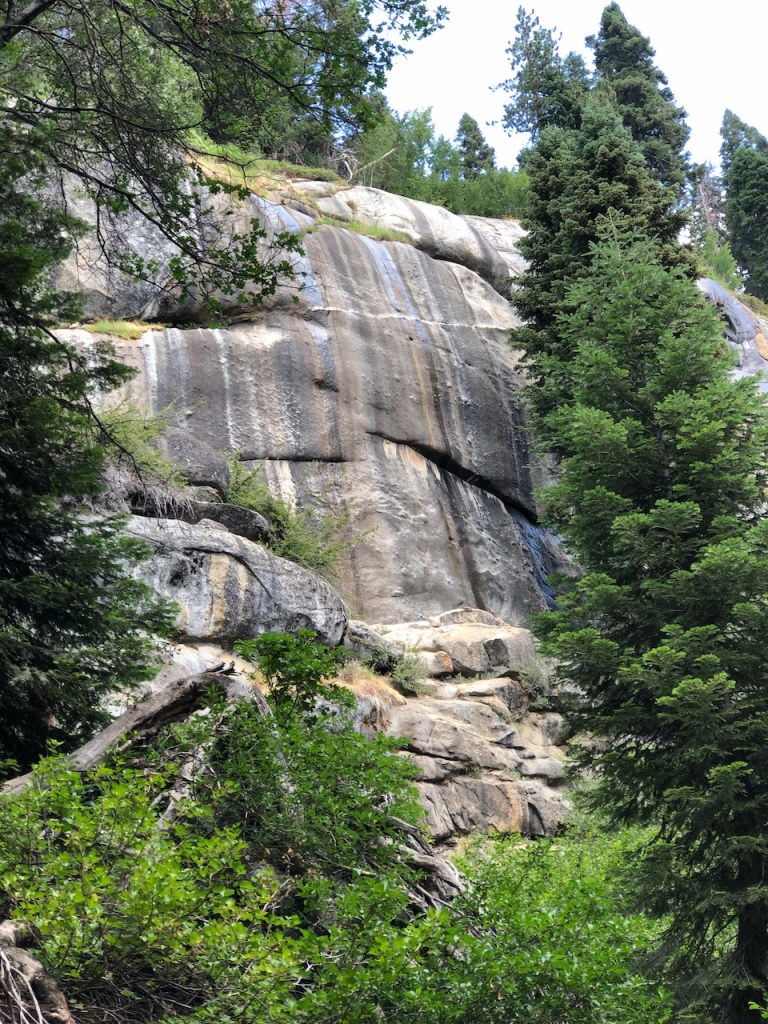
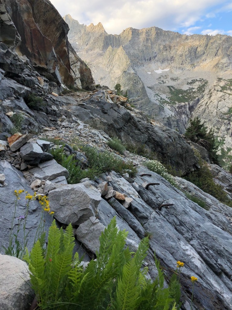
The granite was stained with black streaks, due to mineral deposits.
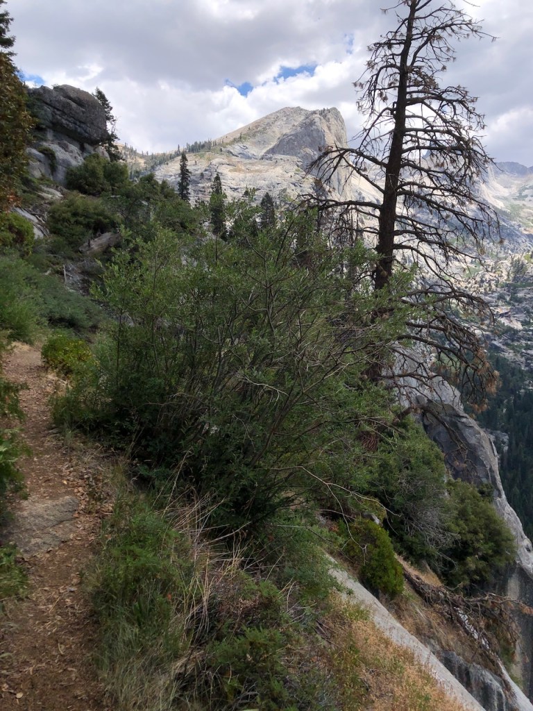
The trail became a bit treacherous, as one false step, could send you over the edge.

Amongst all the granite, small springs fed the lush greenery, filled with late summer wildflowers. It was after all early spring, on Sierra time. The snows typically melt away between Mid June to Early July.
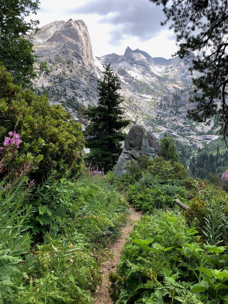
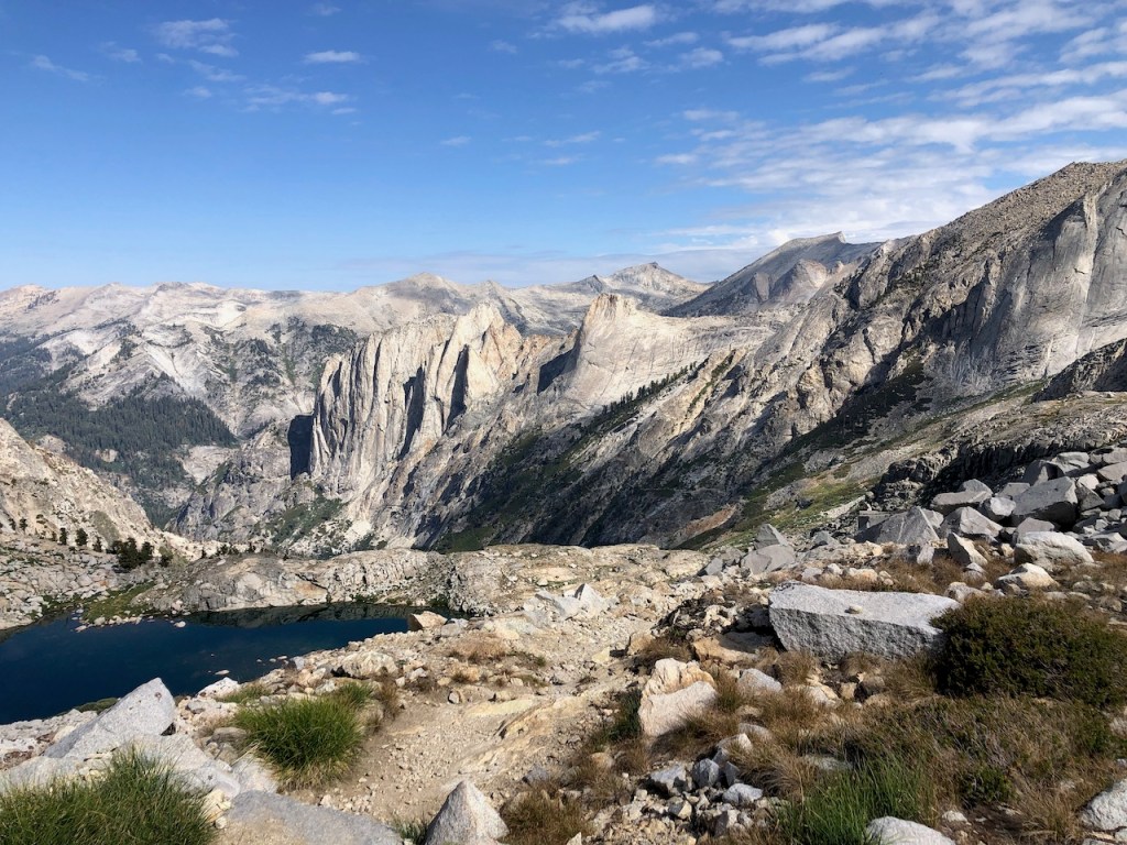
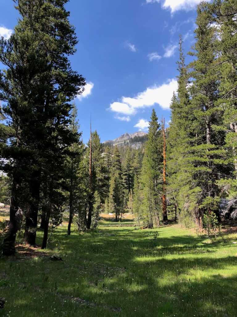
We were climbing higher into the alpine zone of Hamilton Lakes. As I hiked on I tried to spot where the trail was headed, and over what pass, but it was hard to make out.
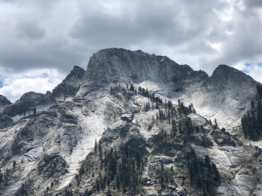
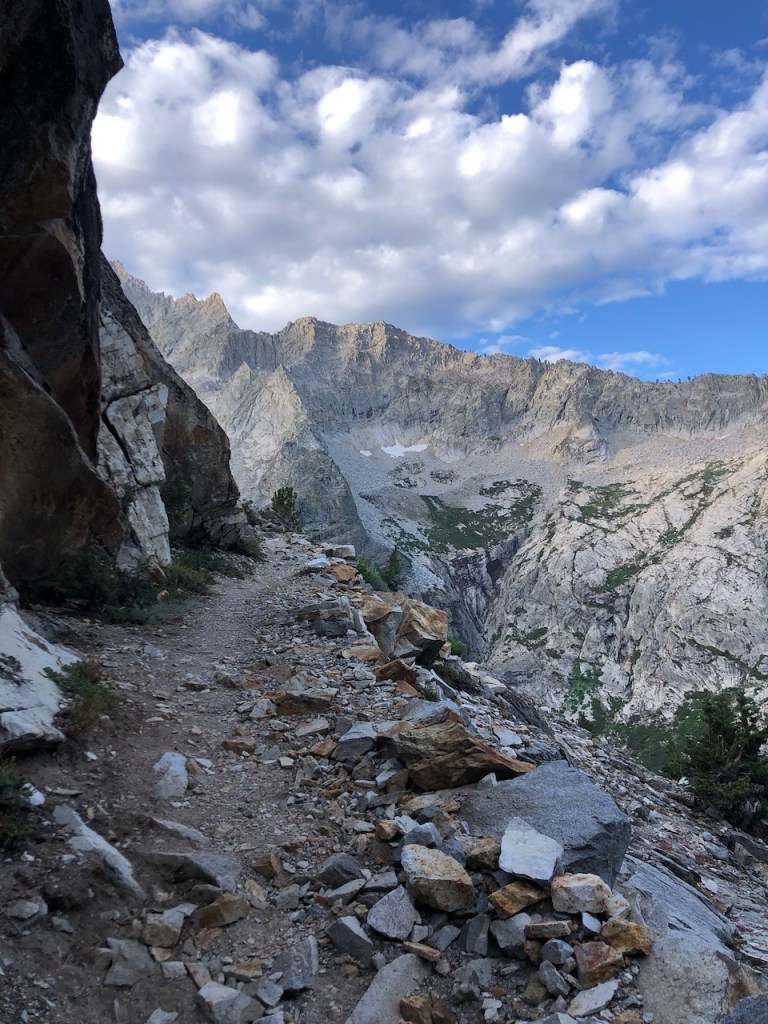
The granite domes were simply breathtaking. Ominous grey clouds occasionally passed by reminding us that there was a chance of rain, and hence lightening.
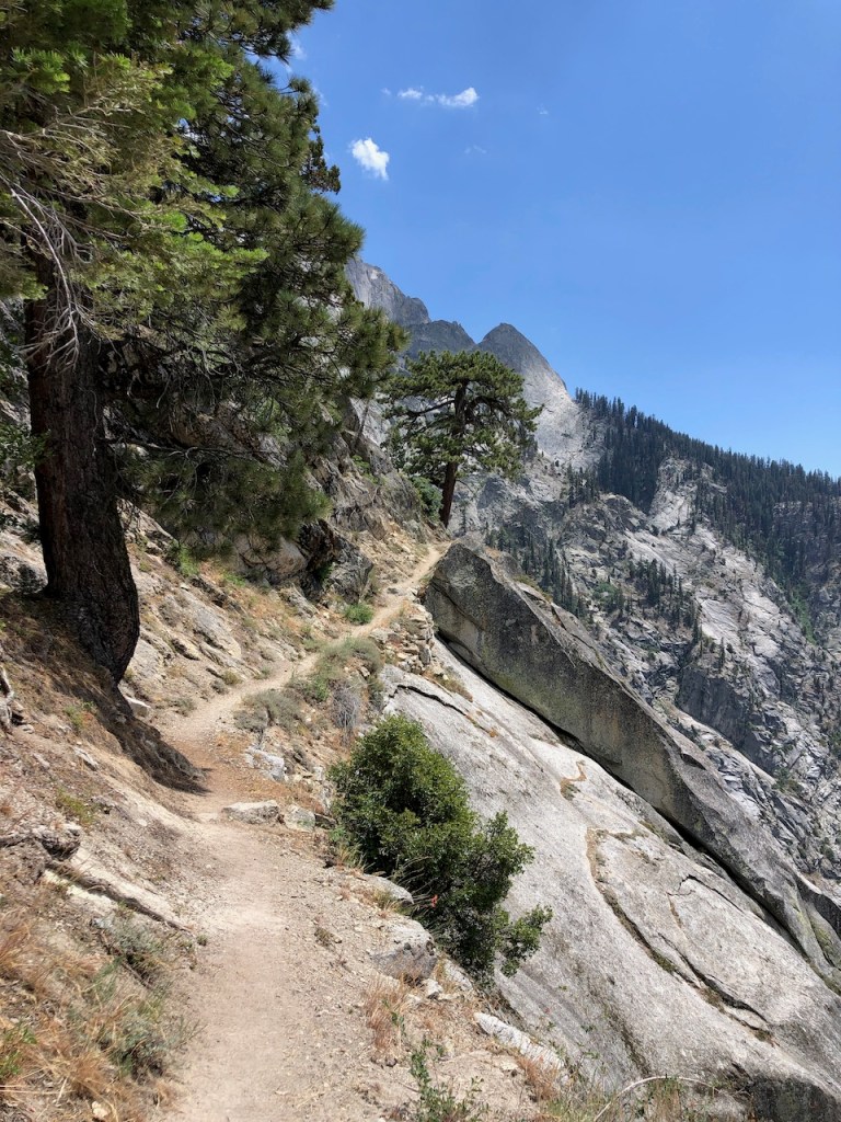
The trail became ever more narrow, and the trees were barely hanging on.

Finally the clouds had mostly passed, and by mid-day, I felt we were not getting rained on after all.
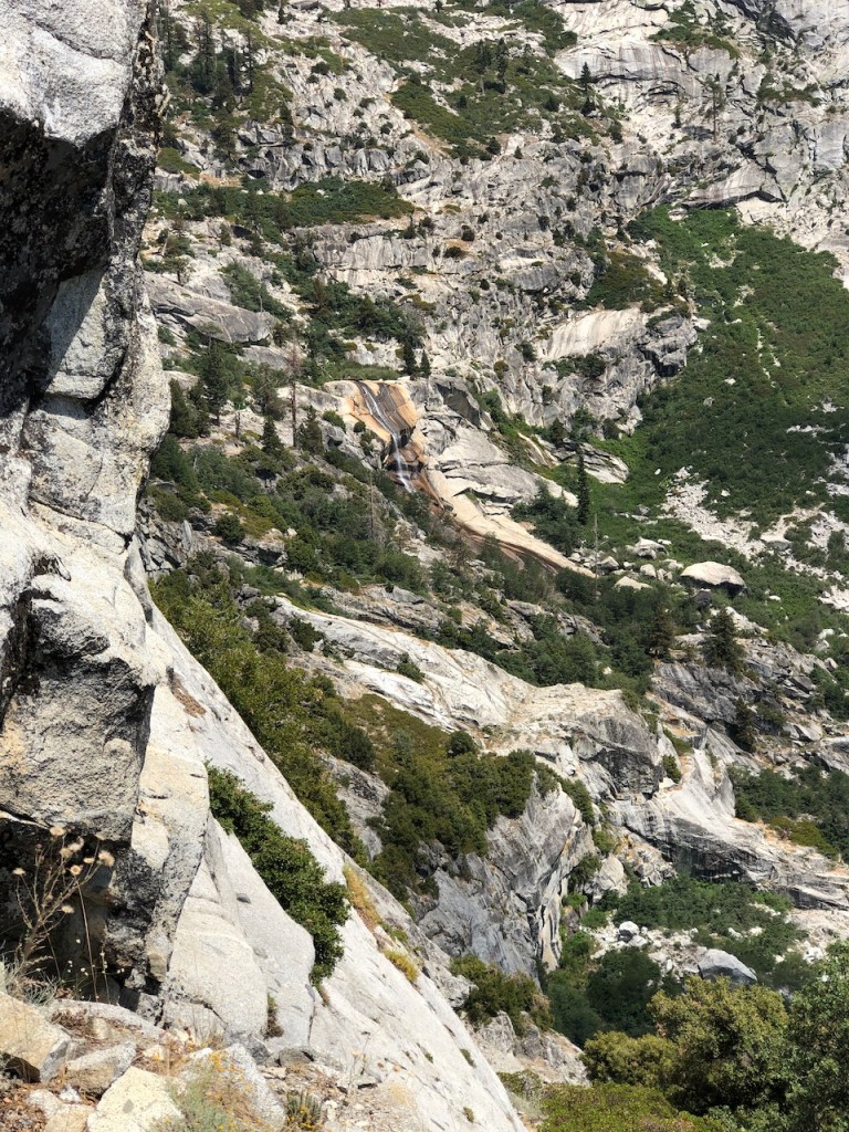
There ere several beautiful waterfalls, cascading down the gorge, into the North Fork of the Kaweah River.
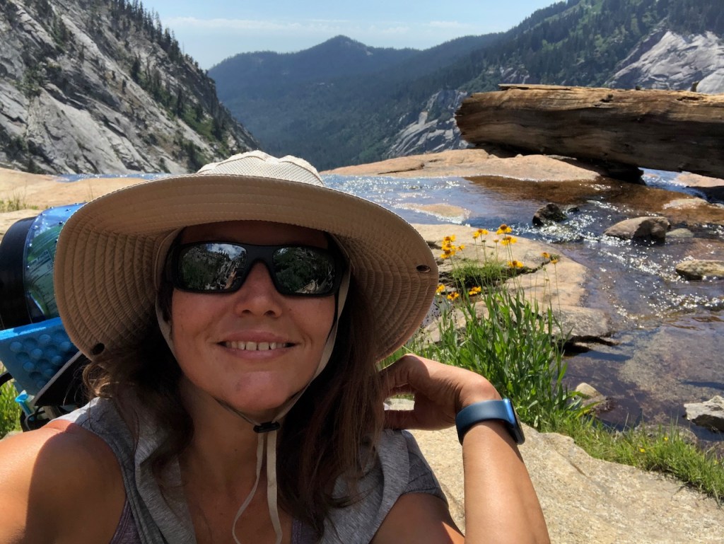
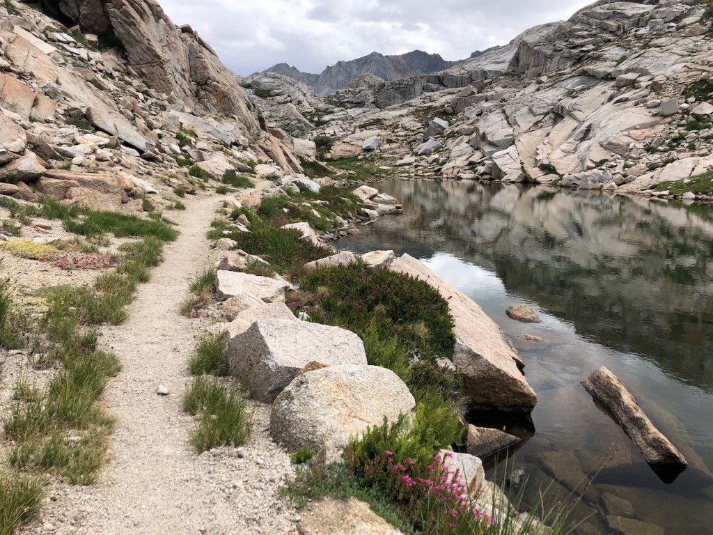
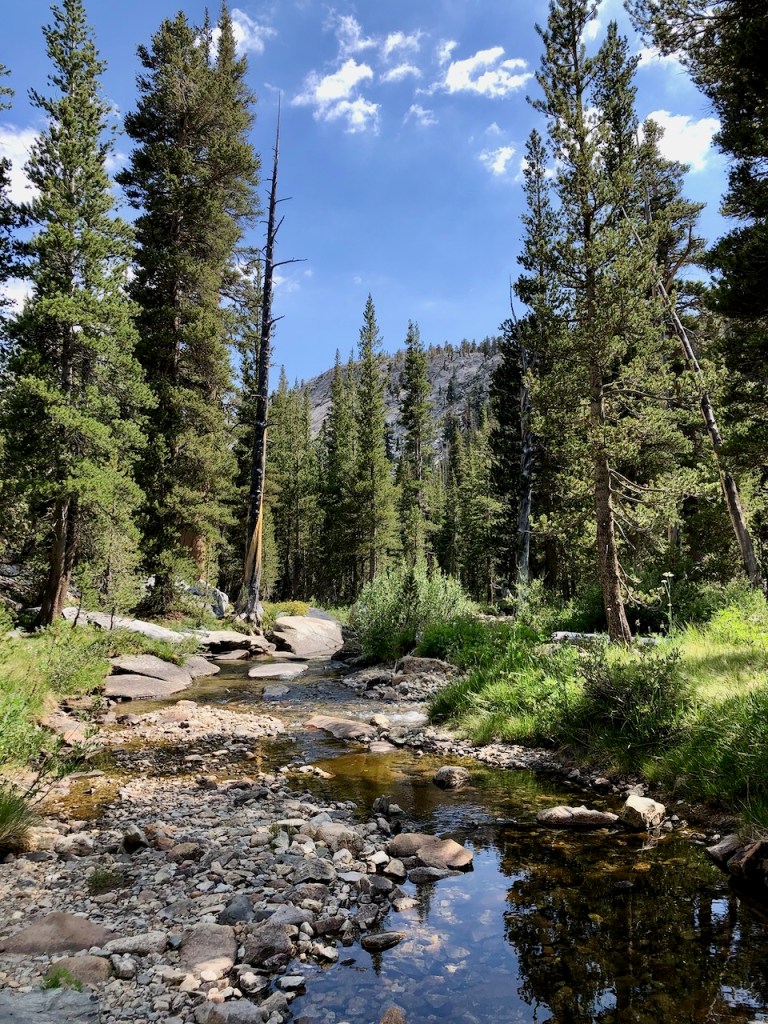
The trail crosses a wide creek, flowing over granite slabs, a tributary of the North Fork of the Kaweah River. I refilled water here at this beautiful creek, which was not flowing that much, so it was easy to cross.
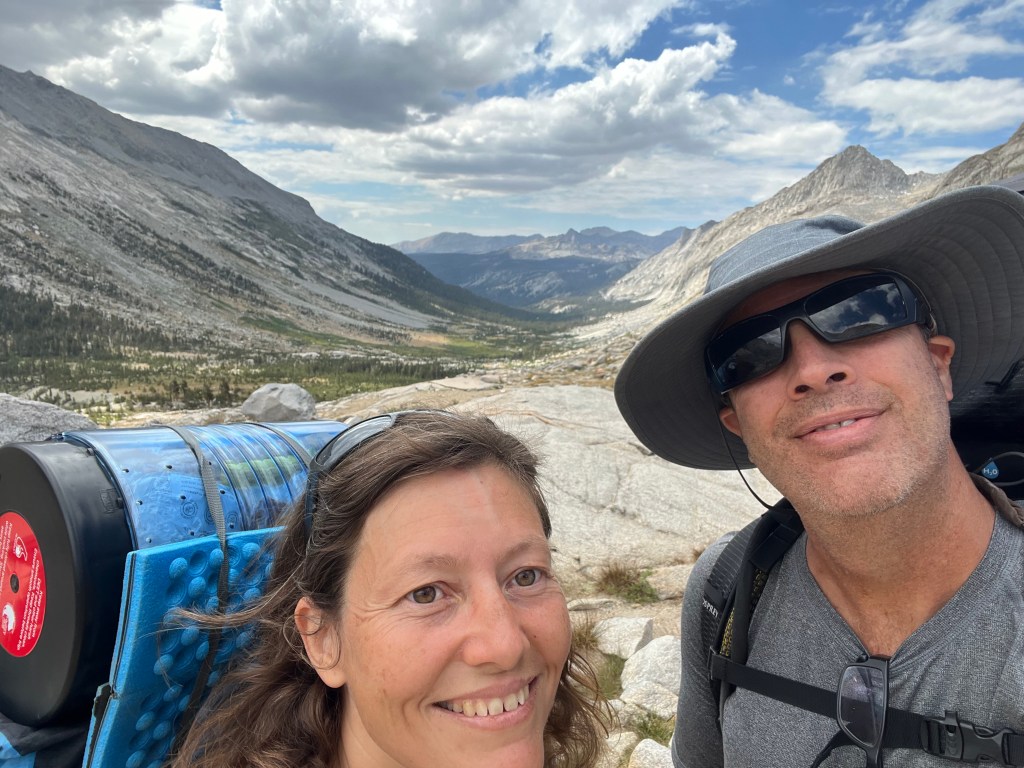
The best part of the day, is taking off your heavy pack, and just enjoying what is around you.
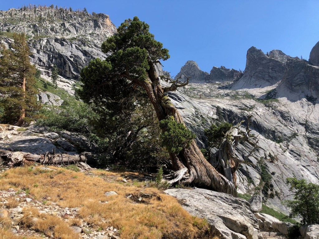
There were lots of windswept juniper growing around here. Where there is a will, there is a way.
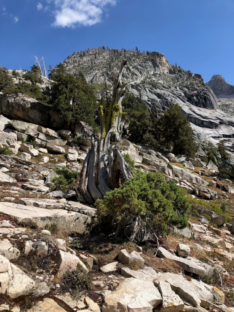
This once looked like it had succumbed to the elements, and was not covered in moss.

This was the same waterfall I had just seen in the distance on the other side of the gorge.

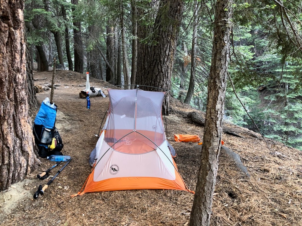
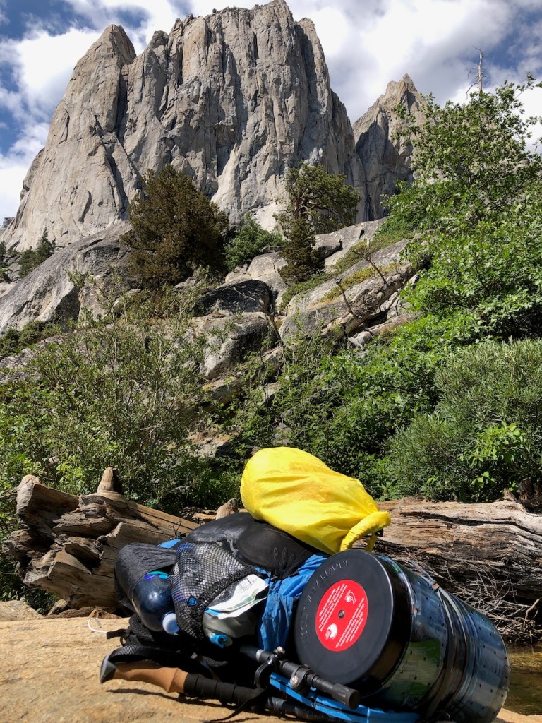
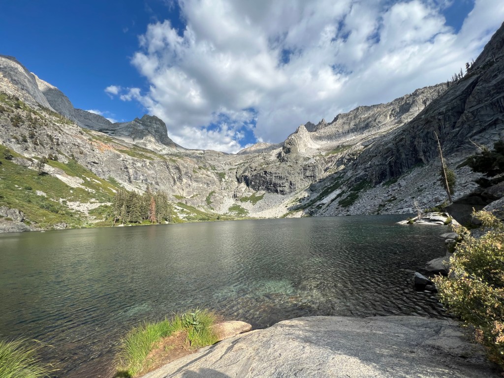
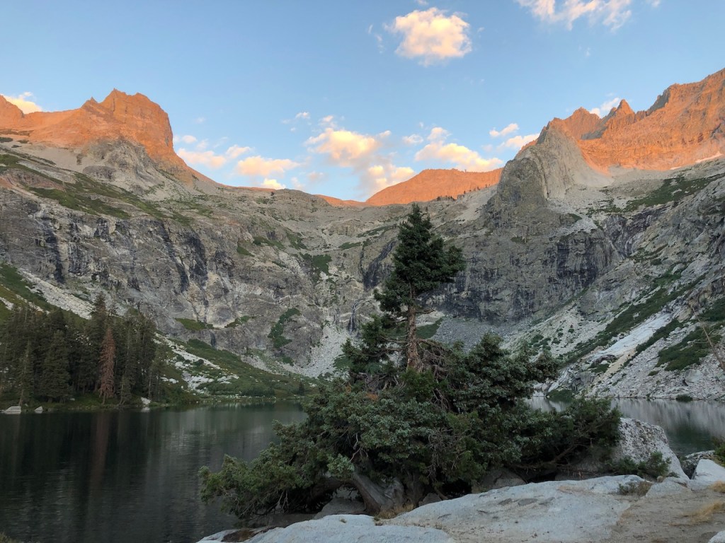
We made it to the smaller of the two Hamilton Lakes around 2pm, much earlier than we made it to our last campsite. We had hiked just 9 miles on Day 2.
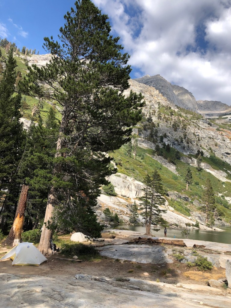
We decided would camp by the larger of the two lakes, which is the main lake, where you can swim, and fish. We would not continue on to Precipice Lake, as we originally reasoned we might. It was too pretty here to pass up. This would end up being our favorite campsite of the entire trip. Too bad there is a one night maximum.
We ran into a couple we had met on the Sequoia Shuttle heading to the trail. They were doing a bit of fly fishing, catching, and releasing the small trout, found in this lake. We would leapfrog Whitney and Ephraim the entire way to Whitney. It was nice occasionally meeting people, since the trail is practically empty. But the emptiness also adds to the draw for me. Alone in nature, well almost.
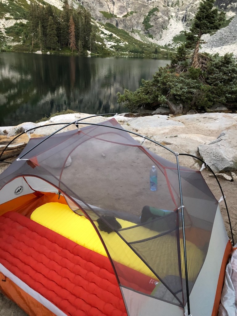
After a swim, sunning ourselves on the rocks, and relaxing all afternoon, it was time to get some sleep. No complaints about the spot we picked, to the right side of the lake. We had amazing views, and slept with the fly off, under the stars.
Day 3: Hamilton Lakes to Big Arroyo 10 miles
In morning I was greeted by that alpen glow. We gathered our stuff up as quickly as possible, for the big climb to Precipice Lake.
We made a point of leaving before dawn, since this climb would be tough, and we wanted to maximize our chances of success. Our goal was not only making it to Precipice Lake, 3 miles away, but over the Kaweah Gap, before possible thunderstorms rolled through.

Some of the climb was along sheer rocky cliffs, with steep drop offs.
We hiked steadily over several long switchbacks for about 2 hours, before reaching the a plateau.
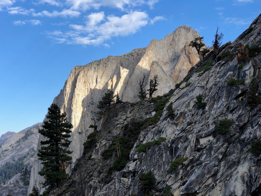
In the distance was an amazing view of the rock formation Valhalla, or Angels Wings.
Precipice Lake
There was one smaller lake here, just below Precipice Lake. There was a couple camped by it, and I can see why. What a view from up here.

Precipice Lake did not disappoint. I did not notice any campsites right by this lake. It is very rocky up here. We filtered water here for the journey to Big Arroyo. The water was much colder in Precipice Lake. Were it not that storms were approaching, I most definitely might have gone for a swim here.
After passing Precipice Lake, I got to hike on past the headwaters of the North Fork of the Kaweah River. The ranger mentioned when we picked up our permits, there was a great camping area, just past Precipice Lake, and the Kaweah Gap. This was what her was talking about.
It was lush and green up here, and I could see why it would make a great campsite.
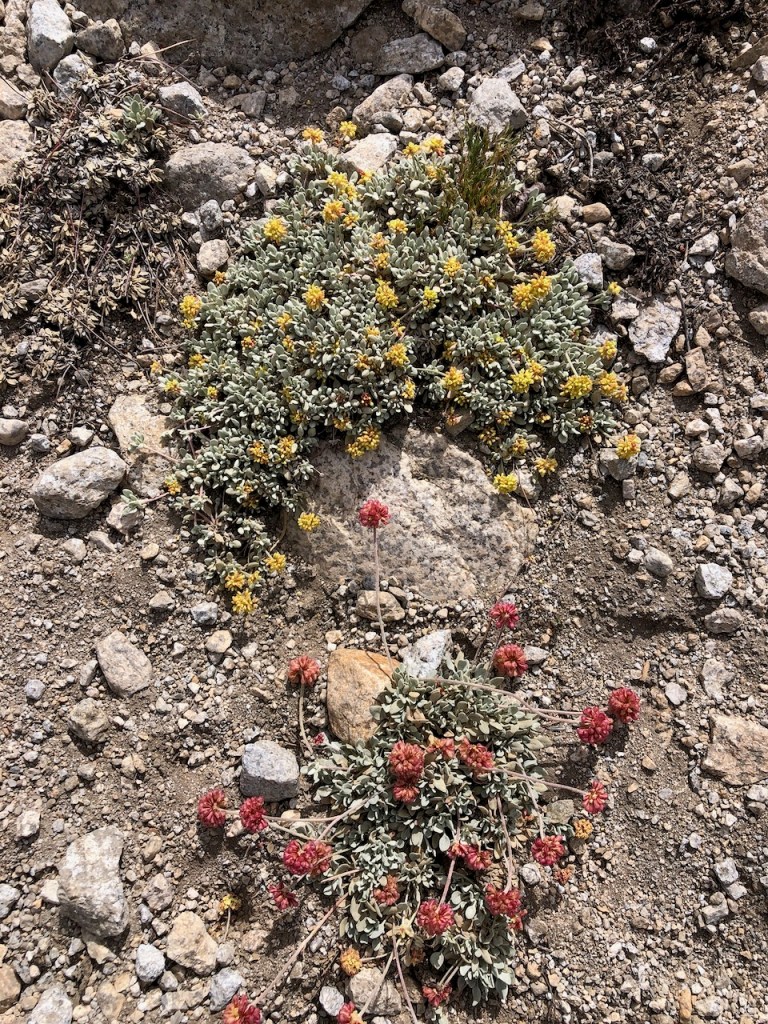
There were plenty of low growing ice plants, which only grow at altitude.
Kaweah Gap
After passing Boy Scout Peak, and summiting Mount George Stewart, we were at the Great Western Divide, the Kaweah Gap. We actually bagged a peak without any additional effort.
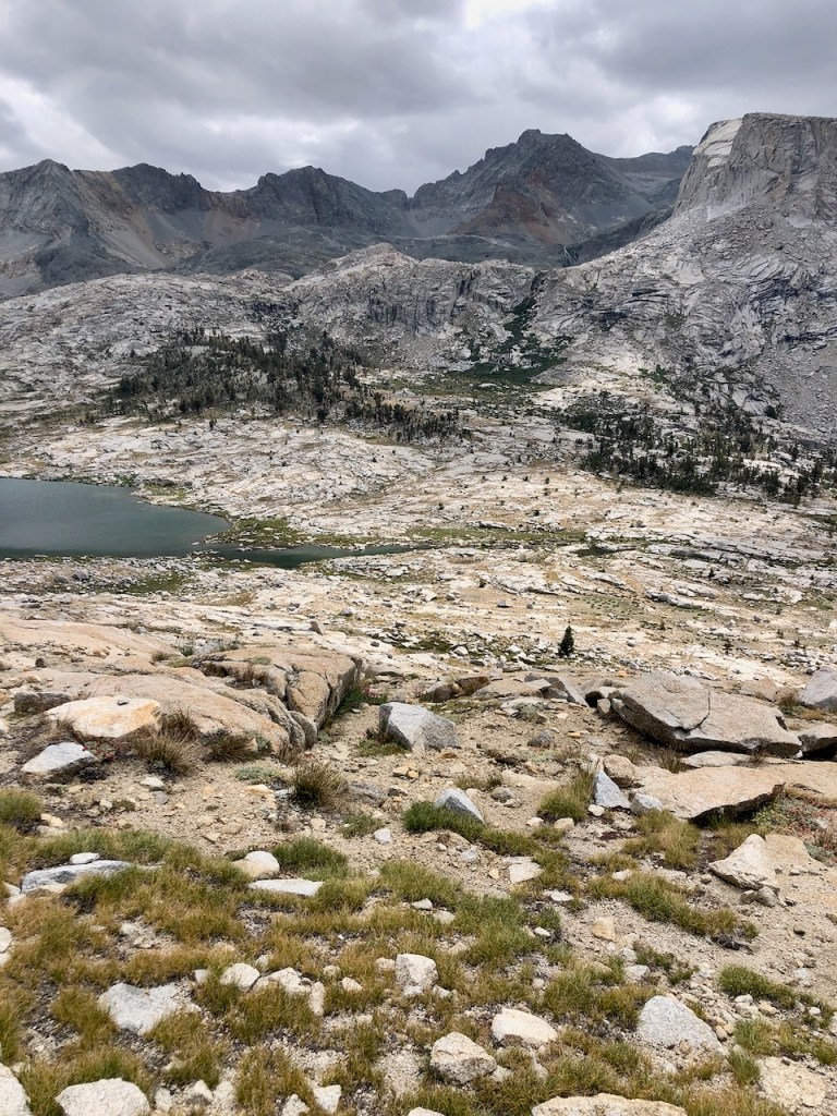
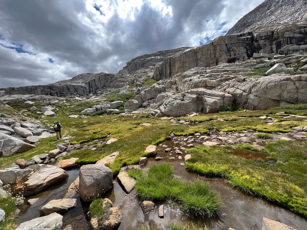
We entered into the Nine Lakes Basin, a u-shaped basin. It felt so isolated here, as we were now near the halfway point on our hike, and in the dead center of the Sierras. It felt as though we could not be further from civilization than we were.
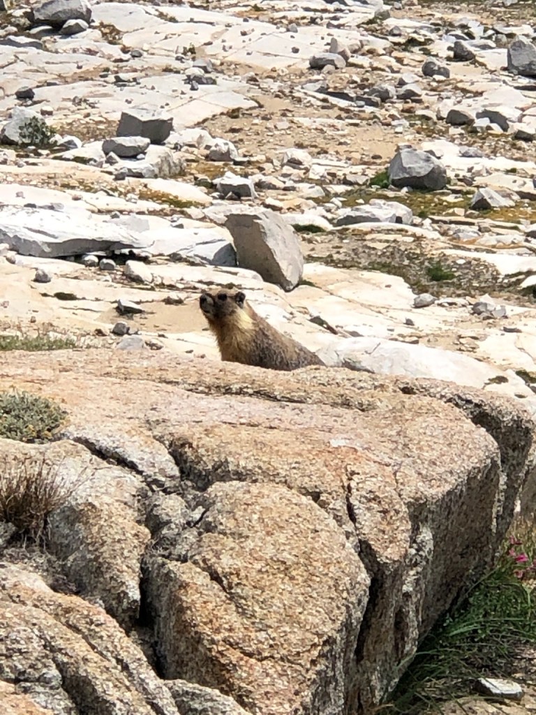
Marmots
As we trekked downward past Big Arroyo Lake, we ran into another gentleman here who had been camped out by the lakes here a few days, taking photographs. If you’re looking to get away from it all, this is it. Along this stretch I also saw my first and only marmot of the trip. I had always wanted to see one, but they had somehow alluded me, on previous trips to the Sierras.
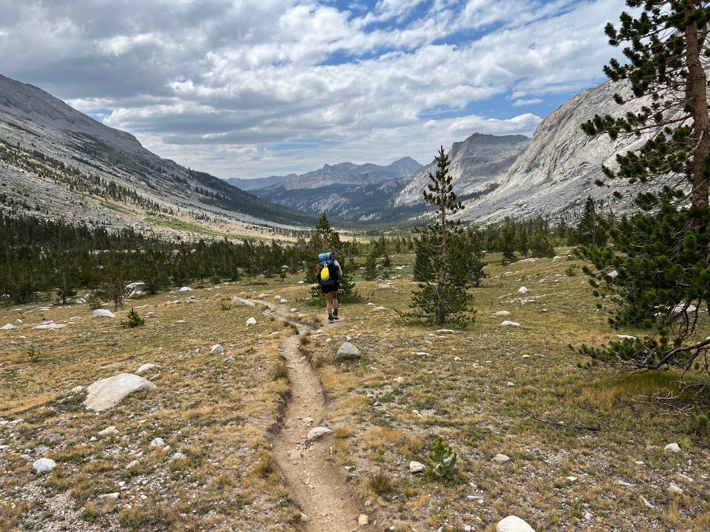
As we hiked on through the foxtail and lodgepole pines on to Big Arroyo, a storm was on the horizon. I just hoped to make it to camp beforehand.

Cactus Crag
Off to my left amongst the twisted and painted granite, was an obelisk like rock standing tall on the ridge. I dubbed it cactus rock, since it resembles…well a cactus. Were I a climber it might be called cactus crag, and be a popular climb. If you’re not hiking, or fishing, then you definitely should be climbing amongst all this granite.

Big Arroyo Creek
We hiked on, along Big Arroyo Creek, as we approached our campsite. We were not sure if we would hike all the way to Moraine Lake, or not. We passed two gentleman, and chatted a bit with them. We shared itineraries. They were heading on to Moraine Lake, from Hamilton Lake. They were moving much faster than us though.
Once at Big Arroyo, we decided to take a break by the cool trout filled spring. There were some mosquitos buzzing about here but we really didn’t care that much.
The alpine meadows here were so inviting, green, and lush. It felt like one of the the most pristine places I had been. Be it not for mosquitos, I could have stayed here many nights longer. Unlike Hamilton Lakes, there is no particular limit on most of the campsites along the High Sierra Trail. We decided to scout out a good campsite and call it a day, since it was around 4pm.

We built a nice campfire to keep the mosquitos away, and made another backpacker meal. It would be our one opportunity for fire-making, for the entire trip, since we were at both the right altitude to allow them, and there was also an abundance of dry branches lying around.

It would be just a ten miles for us today. We went to bed even earlier that on previous nights, mainly to avoid the mosquitos.
Read about Day 3 of the High Sierra Trail here.
I hope you enjoyed reading this, and it is helpful in knowing what to expect, should you decide to visit here.
About me
I’m Serafina! I’m a writer and California girl who loves to go exploring. Hope you will get outside today, breathe some fresh air, and be happy!
Follow my Journey…
Be sure to Like and Subscribe to My Youtube Channel where I post videos!
Disclaimer: The work on this blog is my opinion and my opinion alone and I am not responsible for the outcome if someone were to apply these thoughts to their own life. All text and photography copyright 2023 by Serafina, all rights reserved. Information and opinions provided are kept current to the best of the author’s ability. All readers’ usage of the ideas and opinions presented in the blog, are at their own risk. Be aware of the possible dangers of hiking, surfing, walking, cooking, and other activities, which may take place indoors or outdoors. By reading this, you agree not to hold the author or publisher of the content on this web site responsible for any injuries or inconveniences that may result from reading the blog, or partaking in any activity mentioned in the blog. Read the blog, and use its ideas, if you so desire, at your own risk.
