I was getting ready for a trip on the High Sierra Trail, which is 7 days long, traversing across the Great Western Divide from Sequoia Park all the way over Mount Whitney.
It would be an epic journey of a lifetime. I had planned to hike the John Muir Trail the year before, securing a much sought after permit, but wildfires changed my plans, after it was cancelled.
A Shakedown Hike
I felt somewhat unprepared for the High Sierra Trails. I needed to do a shakedown hike of epic proportions, to know I was truly ready.
So I though, why not backpack up to San Bernardino Peak, just a few peaks over from Mount San Gorgonio?
San G
I had backpacked here before, with two other women on Memorial Day weekend, a few years ago, summiting San G on day two. At the time, I was just learning how to challenge myself with backpacking, and had only climbed Mount Baden Powell, as my highest peak to date.
We had gone to Dry Lake on day one, camping about a half mile from Lodgepole Spring. We hikes 26 miles in two days, which at the time, was my biggest challenge completed.
Our First Backpacking Trip
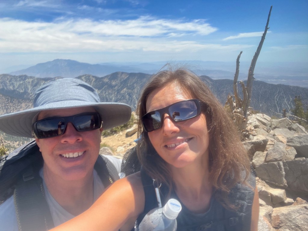
My backpacking partner was not experienced in hiking to high peaks at all, and this hike to San Bernardino Peak was his first actual overnight backpacking trip. In spite of all that, he felt he was ready. He had been to the Sierras, and grew up going to Yosemite, and the Sierras a lot. He loved mountains, and was ready to go, with a bunch of untested new gear. I had no idea how this little shakedown would go, for either of us.
The TCT
I had hiked the Trans Catalina trail solo, about a year and a half prior. My entire brain seemed to revolve around hikes, hiking gear, where I was hiking today, tomorrow, and in a few months from now. It was becoming a borderline obsession to research, and search again, wanting to know just everything there is to know about a place, before I go.
Learning from Mistakes
I had my share of mishaps hiking, and backpacking already. You live and you learn. You learn to be prepared, and research. Still things happen, and injuries happen. I was not going about this all willy-nilly, but taking it all very seriously.
Going Ultralight
I went all in on ultralight gear, once I knew about it. Nothing sucks more than hiking uphill in the beating sun at 2pm in the afternoon, than hiking uphill in the beating sun with 30 lbs strapped to your back. I was willing to pay more to save one pound, or even two. I wanted to go ultralight, but still, I was bringing extras. I would soon learn to leave that stuff home, with each successive backpacking trip that is.
I had some new gear for this trip, but most of it I had used before. It was my inaugural hike with my Zpacks Arc Air, which was now over a year old, and I guess a dinosaur, compared to the newer model, weighing an ounce less.

Permits
I picked up my backpacking permit online at the San Gorgonio Wilderness Association, beforehand, and printed it out. This is the permit I selected, with Limber Pine Bench. Problem is, I found out Forsee Creek was not in good condition late, and decided on South Fork. I was not sure if this mattered that much, if it’s not crowded out there.
Last time I hiked to Mount San Gorgonio, a ranger asked if we had permits, but did not check them. The permits are free, and there is no excuse not to have one. You must select your campground beforehand though. That is just so they know where to find you, if need be. You don’t need a permit for day hikes here though.
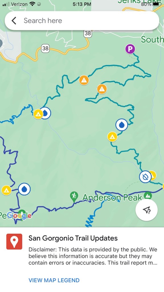
The Water Report
I checked the water report at the San Gorgonio Wilderness Association before choosing my route as well. It made sense to plan where I was going, based on the availability of water. From the report, the main spring seemed to be flowing south of Dry Lake, as did a spring at Limber Pine Bench, but the rest of the water sources seemed unreliable.
There seemed to be very limited water along the ridge, but with some flowing at the spring on South Fork., it helped affirm that South Fork was the best choice of trailhead, though further from Mount San Bernardino.
Weather and Trail Closures
I was sure to check the weather report at mountain-forecast.com, along with check for trail conditions and closures at the San Bernardino National Forest.
Forsee Creek
We originally reasoned we would go up Forsee, and down South Fork, then walk back to the car along the road in a loop. An out and back hike was much further, and about 24 miles to San Bernardino Peak, and back to South Fork.
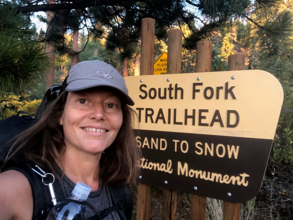
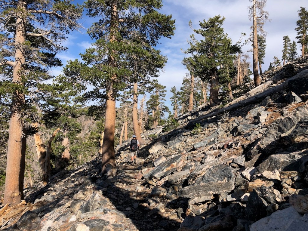
South Fork Trail
So here we were, at the South Fork Trailhead, just three days before we would leave for the High Sierra Trail, doing a shakedown hike.
We were starting late, and that was my fault. But I wanted to go ahead with the shakedown hike anyway, since we were running out of days to do this, before the Sierras. I wanted to have one day to recover before we headed up there.
We arrived just after 4pm, and had just a few hours of sunlight left. The parking lot was completely empty of cars, which was not what I was expecting.
This parking lot was jam packed on Memorial Day weekend.
The Sand to Snow Monument
We began hiking up the South Fork Trail. This trail is located within the 154,000 acre Sand to Snow Monument, which reaches from the Sonoran desert floor to over 10,000 feet high, to the unique sub-alpine forest of the San Gorgonio Wilderness. This wilderness is tucked away within the San Bernardino National Forest.
It’s a box, in a box, in another box. Where were we? Lots of places all at the same time.
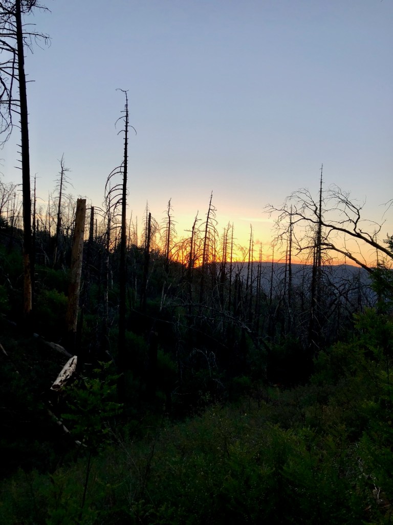
A Sunset Hike
We had no idea how far we would end up going, since it was sunset, and neither one of us had night hiked before. It was kind of an adventure. The cool temps are great for hiking uphill though, so we both embraced it, and hiked on.
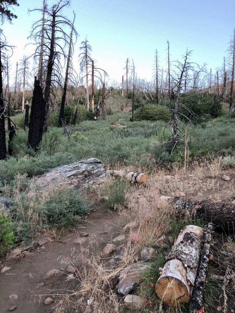
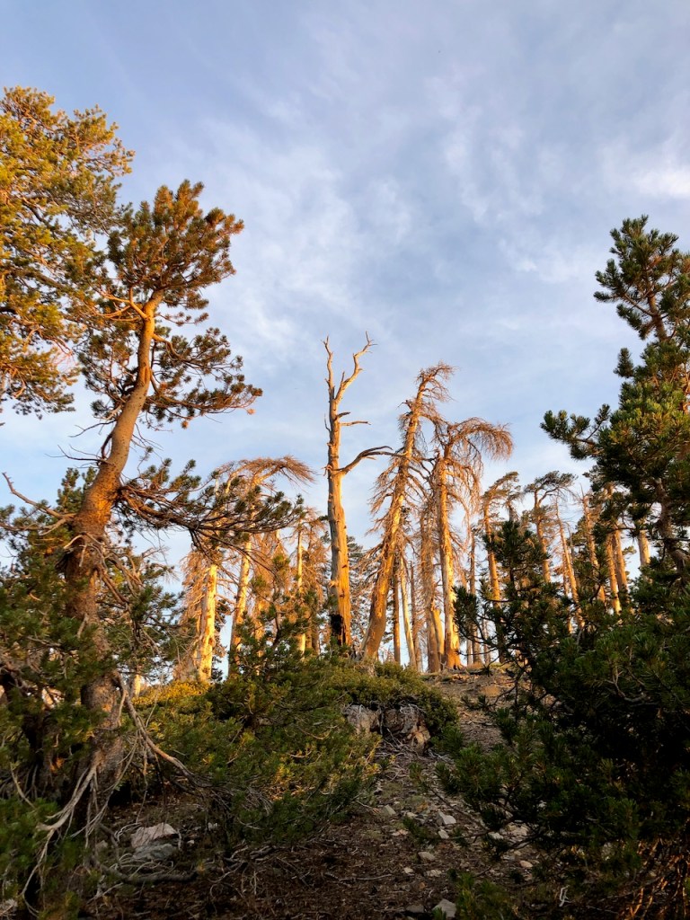
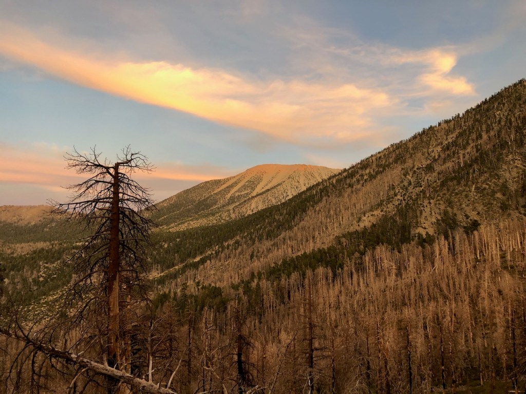
The single track dirt trail was surrounded by wildflowers, and strewn with freshly cut logs, left to the side by trail crews. The forest was charred from recent wildfires, but regenerating.
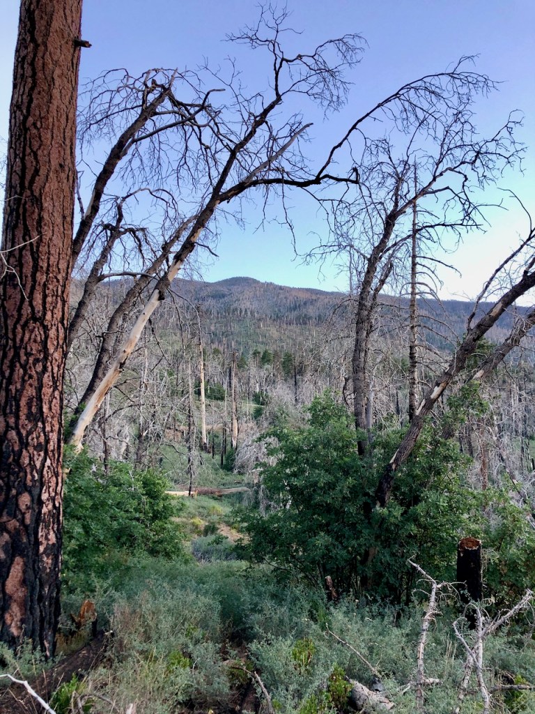
As I climbed higher, I was surrounded by an eerie ghost forest, with lots of fresh green growth. It was mostly low growing shrubs. Some of the trees were sprouting new growth from the base of their trunks.
Wildfires
The charred logs were a reminder this place is subject to rapidly changing conditions. It was not yet peak wildfire season, but was very close. Fires in July are not uncommon, so I knew I needed to pay attention, and proceed with caution.
Night Hiking
Sunset was beautiful, but I knew I would soon be hiking in the dark. I always wanted to night hike though. Having a partner with me gave me more courage to do so. Wild animals hunt at night, and tend to attack individuals, more than groups. So that was somewhat comforting.
But once it was pitch black, it got very eerie out there in the wilderness. It was so quiet all around us. There was literally nothing going on. I was listening all the time for bumps, thumps, and rustling in the bushes.
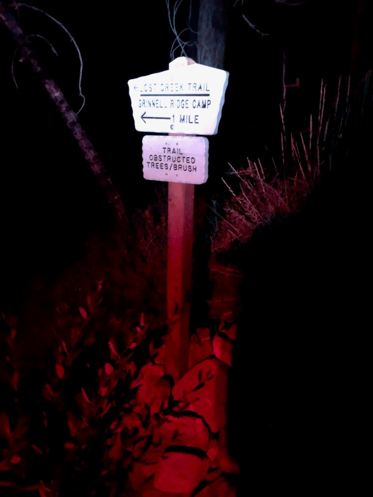
Lodgepole Spring
Shortly after the turnoff for Grinnell Ridge Camp and Lost Creek Trail, we made it to Lodgepole Spring, and filled up our water. My water filter pooped out on me, but we had two, so we were in business. This water stop took far longer than anticipated, and about 45 minutes since we had to share a filter for both of us.
This is why you do shakedown hikes in a nutshell. In the Sierras, this amateur hour stuff would not fly.
It was getting very late, and I was concerned with how slow we were going. Still be pressed on, in the dark, with headlamps. My headlamp decided to poop out on me, and fortunately, he had an extra one. We hiked onward, higher and higher, along several switchbacks, past Lodgepole Spring.

We had decided that we were going to San Bernardino Peak the next day.
I had been to Mount San Gorgonio before, and wanted to try something new, adding on to my peakbagging resume in the process. My partner had not ever hiked here before, and it seemed to be all the same to him, whatever peak we bagged, so San Bernardino Peak it would be.
On we hiked to Dollar Lake in the pitch black darkess, on the west side of Mount San Gorgonio.
Harry Potter Land
Along the way, I would see two owls, fluttering out of nowhere right in front of me, with their grayish white feathers flashing in the glow of my headlamp, just a mere few feet away.
They gave me a fright. I was now in Harry Potter land.
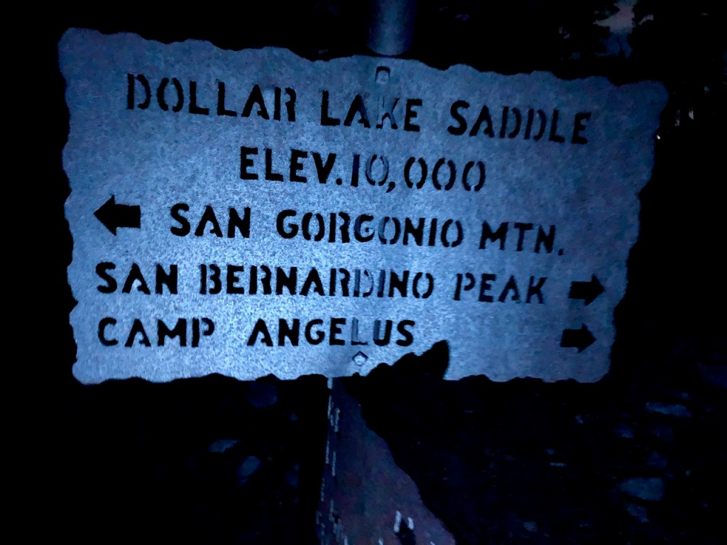
Dollar Lake
We closed in on Dollar Lake. Unfortunately, about halfway down the trail into the campground, we realized the area is completely filled with deadfall. This was something my research did not uncover. The wind was blowing that night a bit. So after about a half mile detour, we hiked back up to the main trail, another 200 feet.
It was onto the saddle, or any area without dead trees all around. We were exhausted at this point, and feeling a little desperate.
We had seen one headlamp out there in the darkness, off to the right, on the way to Dollar Lake, and wondered who it belonged to. Heading down into Dollar Lake, we saw one headlamp again, in the area of the campground. There were people out here, but who were they. They certainly did not park at South Fork Trailhead. That was slightly creepy, since humans can be scarier than wild animals.
We hiked into the night, and camped on the ridge, sometime around 1:30am.
The Ridge
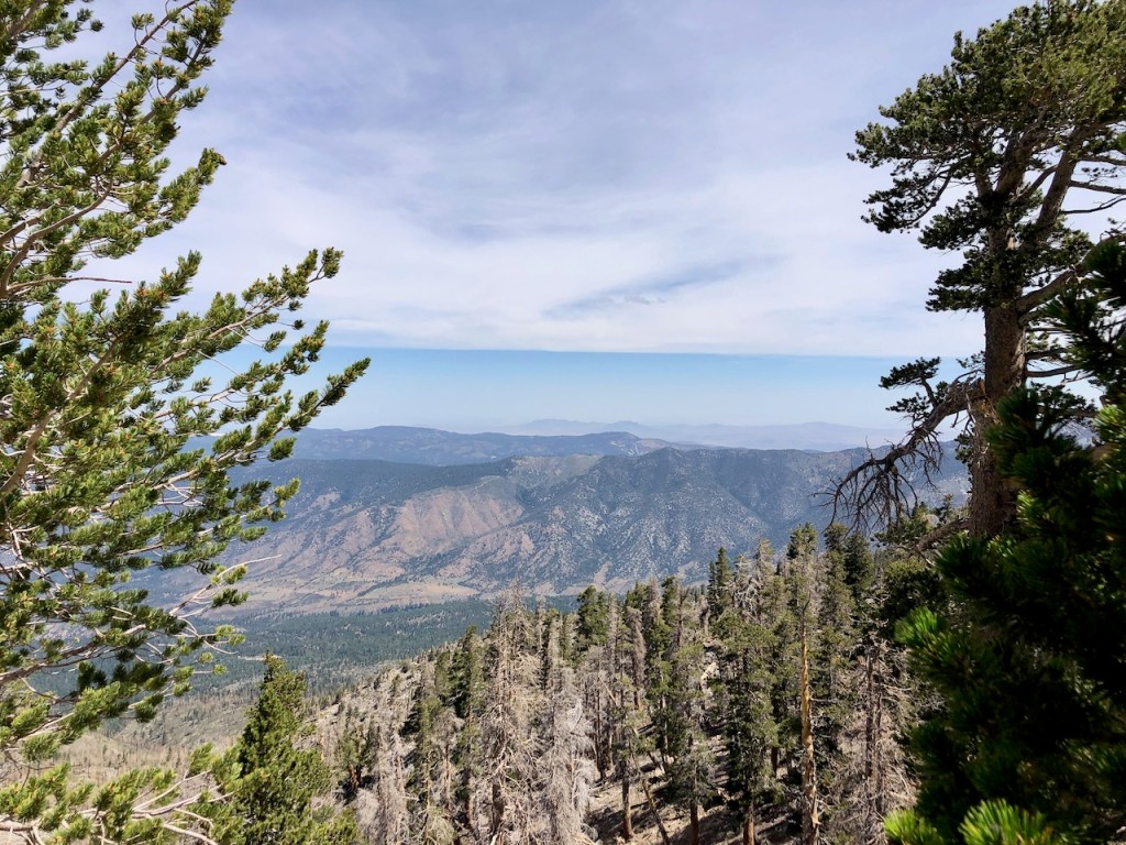
After making it to the ridge, and gazed out over society, glowing far off in the distance, I finally felt at peace. I had no desire to bo over there. Where I was, was exactly where I wanted to be, far off in the wilderness.
It’s amazing the power of light pollution, that it literally backlit the trees. It was somewhat comforting, after hiking in pitch black darkness for several hours, without a soul around, to see some light though. The world is still there. Check.
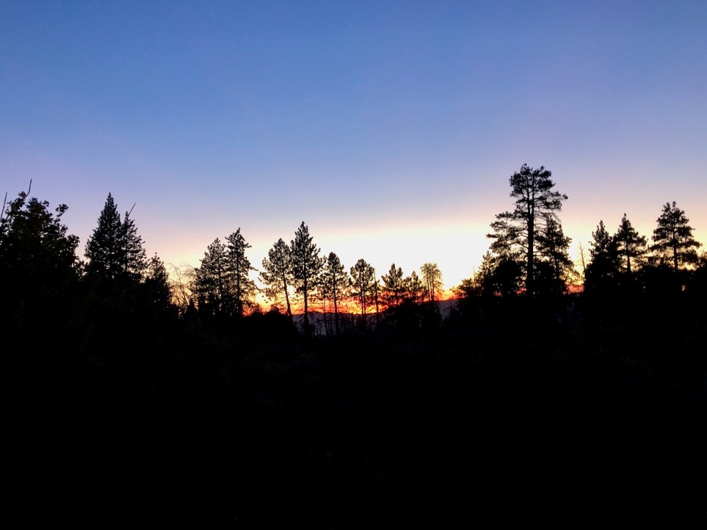
The Golden Hour
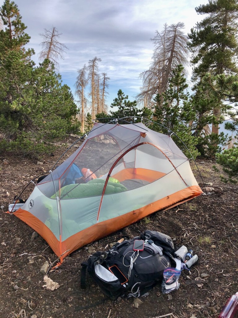
Morning was delightful, waking up with the golden glow washing over the pines, breathing the fresh dry air of the ridge line. There was no condensation whatsoever. We slept without the rainfly on, and that was a summertime treat.
We had truly found a patch of clearing surrounded by live trees, though the charred deadfall was not far off. It felt like a near miss. We almost camped amongst widow-makers.

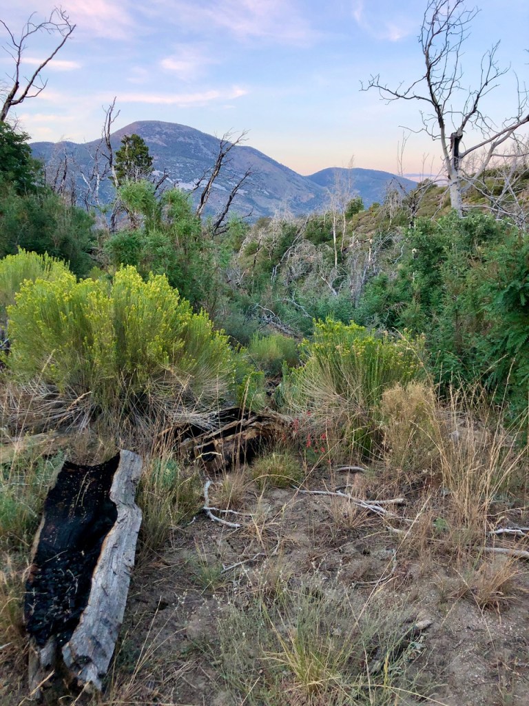
Red Rock Flat
I was slow to rise, in part since it was a blissful place to be, and second, since I was exhausted.
We had camped at Red Rock Flat, which was the next primitive campground after Dry Lake.
Fortunate for us, there was a clearing, just off the trail, where were could finally get a good nights rest after a 9 mile climb the night before.
A Perfect Campsite
As far as where the established campgrounds are, it all looks the same up here. It’s hard to determine what is a campsite, and what is not. Being flat is the main thing to look for. There were few rocks here, and since I was not using the rainfly, I merely staked the tent on all four sides, which is a much easier setup of course. Nobody was camping nearby us, and we had the campsite to ourselves.
Four Peaks in A Day
Today we would hike to four peaks: San Bernardino Peak, San Bernardino East, Anderson Peak, and Alto Diablo Peaks. We did not this at the start of the day, but had the idea, we would try. It all depended on time, and how we were doing on time.
We were getting a late start, after taking our time getting up, enjoying the morning there. It was about 9am by the time we got going. No alpine start for us today. It was on to San Bernardino Peak.

Leaving Camp Set Up
We decided to leave our tent set up at the saddle. It saved us weight, but of course we had some worries leaving it, along with my cookware there. There was nobody around, so I figured we should be good to leave it there for the day. The area was definitely not in demand, and there really is no time limit up here for camping.
I did the same thing last time I hiked to Mount San Gorgonio. We left our tents and gear set up, and hiked to the peak, packing up on the way back. I put on the rainfly just so it would not look like we were long gone.

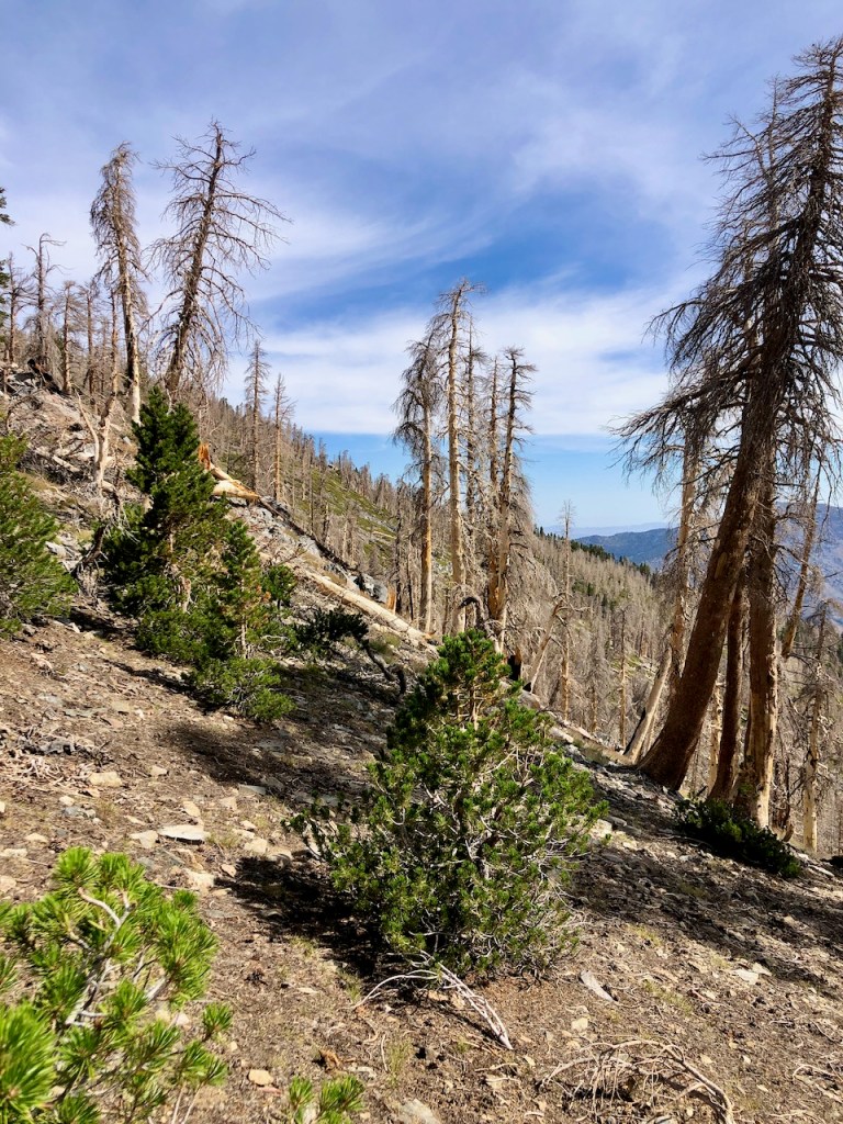
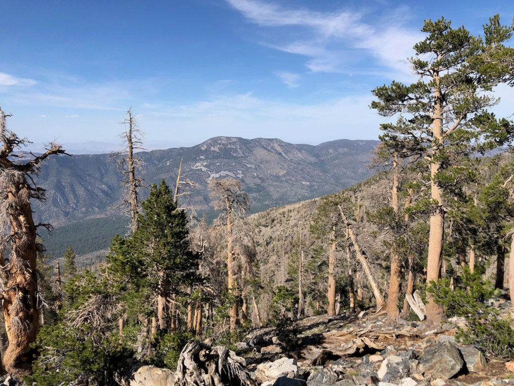
As we hiked on from Red Rock Flat, I noticed the deadfall along the ridge went on for a ways. I wondered if it would ever end.
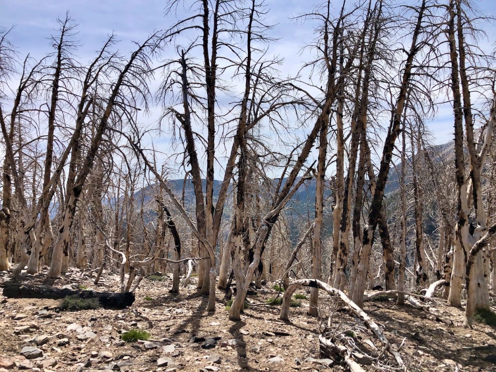
There was not much green growth along this first stretch, and the soil had an ashy quality about it. This area had burned just a year ago. Without much rain to wash this area clean, I was getting covered in it.

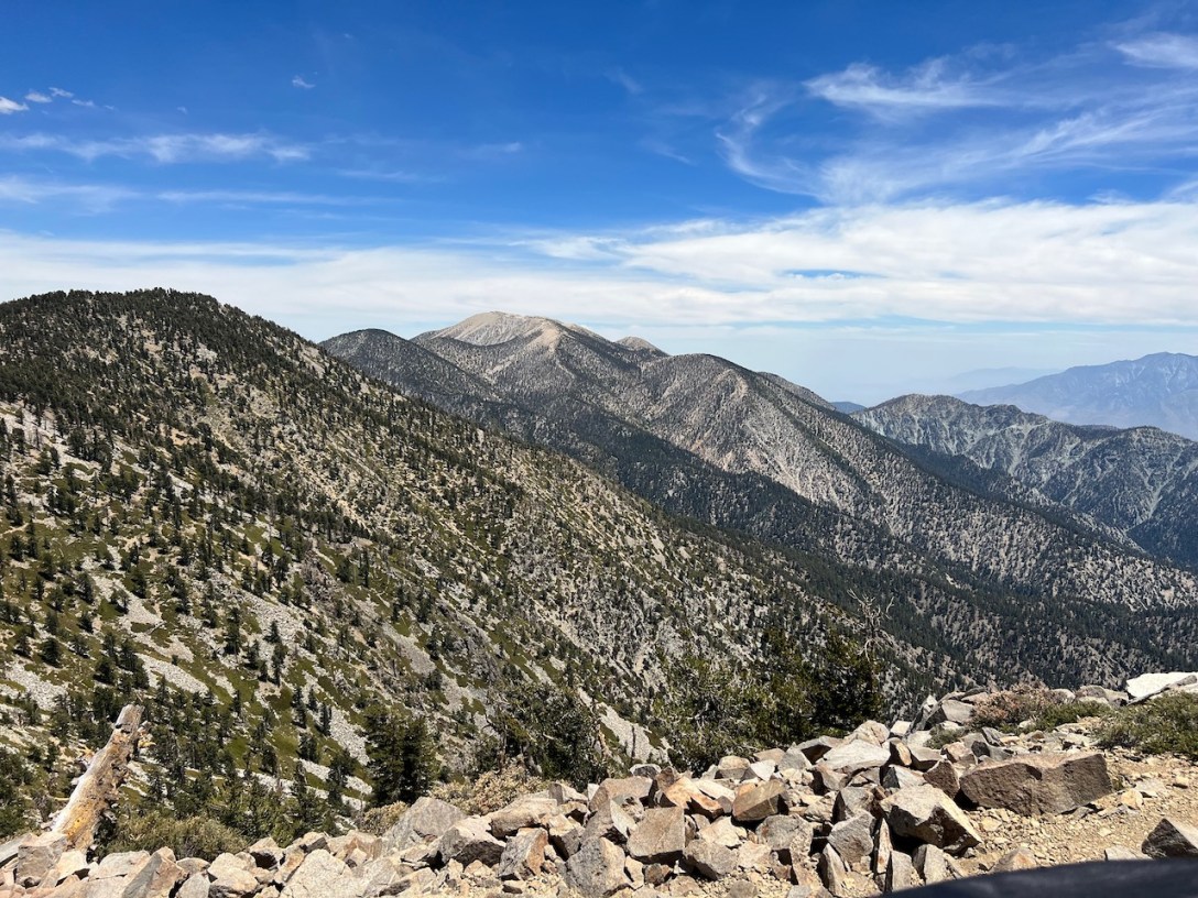
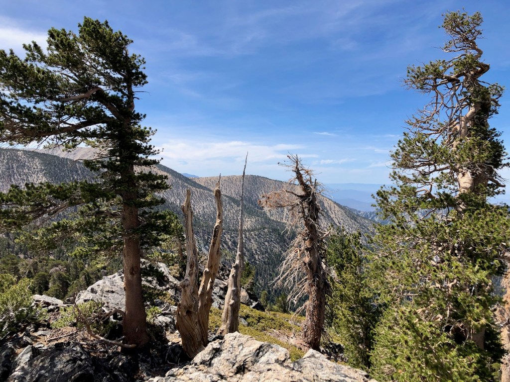
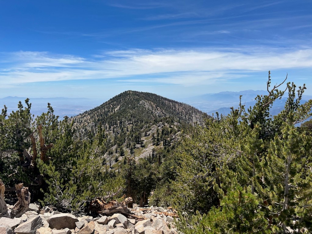
Eventually there were more live trees than dead around us, which was welcome. I had a clear view from here to the surrounding peaks, and clear skies to boot.
Alta Diablo
Our first peak had no sign, and that one was called Alta Diablo. We guessed this was it, due to the pitchfork-like tree at the peak. Anyway, we were in the vicinity for sure. It was tough to find it, since it’s not listed on alltrails. It was listed on the Mount San Gorgonio Water report page, and google maps. I had spotty wifi up here, so I kept checking google maps, to see if we were there or not.
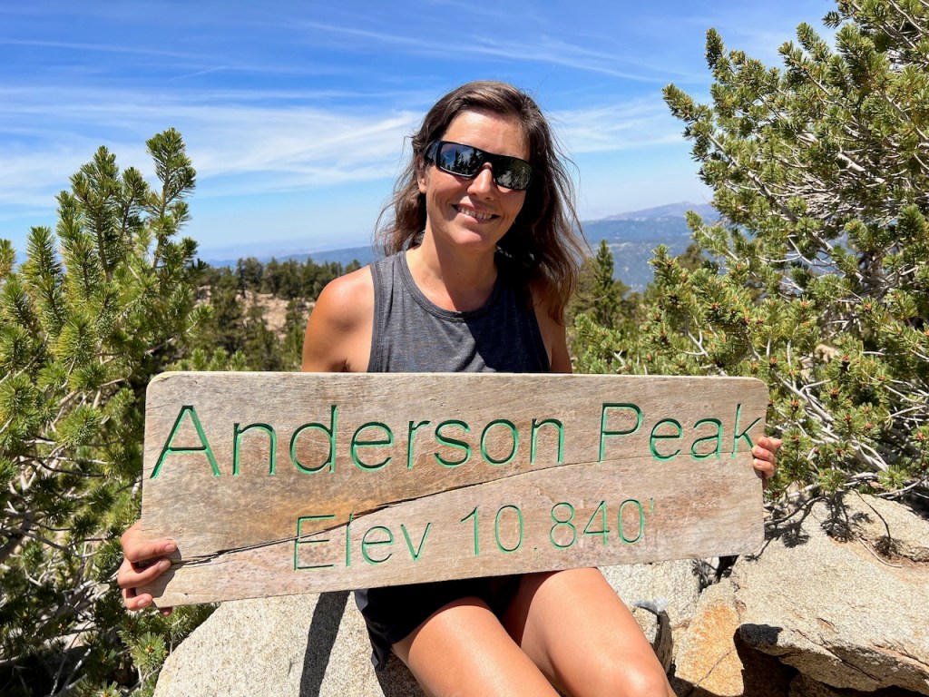
Andersen Peak (Elevation 10,840 feet)
We bypassed the scree and boulder field of Shields Peak. My partner was not ready for that. We hiked off trail up to Anderson Peak, which is actually the highest of the peaks we would hike today, at 10,840 feet. Fortunately it had its sign, somewhat intact, but sadly had a huge crack down the middle. There was not really a trail to the summit, which added to the challenge of finding it.
We hiked on, and ran into a few other hikers, the first we had spoken with, for the entire time. Then we ran into one solo hiker. All had come via Angeles Oaks. and the solo hiker mentioned something about a time capsule he placed on San G that he was going to retrieve. You meet all kinds of interesting people on trail, that’s for sure.
Trail Fork Springs
We passed the turnoff for Trail Fork Springs, on the way to San Bernardino Peak East. This is a different trail, we could have taken to reach this peak as a day hike, had we taken Forsee Creek. But since the trail was in major disrepair still from the fires, we had made a good choice.
We were now on the lookout for our third peak of a four peak day.
San Bernardino East Peak
This was peak number three, and we felt like we were on a roll today, with peakbagging that is. There was no sign, so we had to settle for just a selfie.
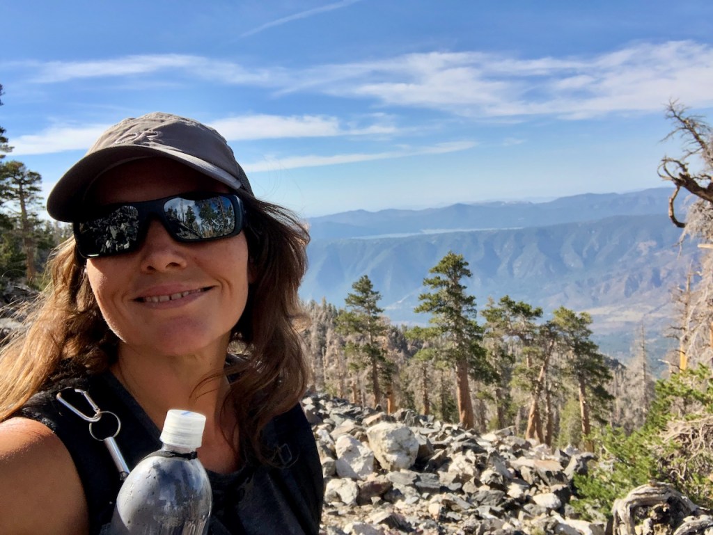
It was around 12 noon, and we now had San Bernardino Peak in our sights. It was starting to feel very warm out though.
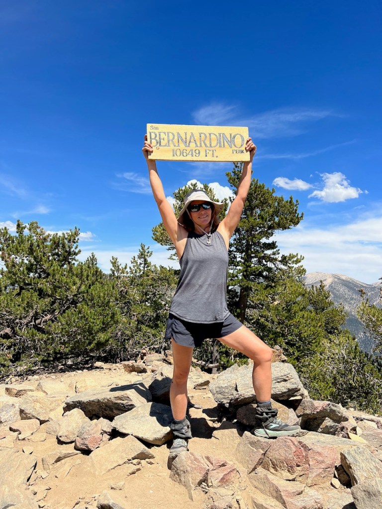
San Bernardino Peak
Finally we made it to San Bernardino Peak, a well earned peak, if I say so myself. It was only 5 miles to here from where we camped, but in addition, we had hiked to peaks along the way, adding a few more miles. So this took longer than anticipated. It was already around 2pm in the afternoon, and we had a ways to go, in the hot afternoon sun.
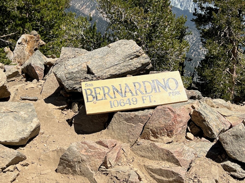
The peak sign was there, and after all this effort, I was glad about that, since people like to steal them, which I will never understand.
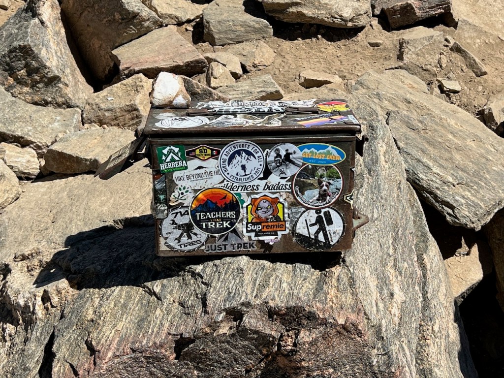
There was even a trail register box there. San Bernardino Peak checked all the boxes.
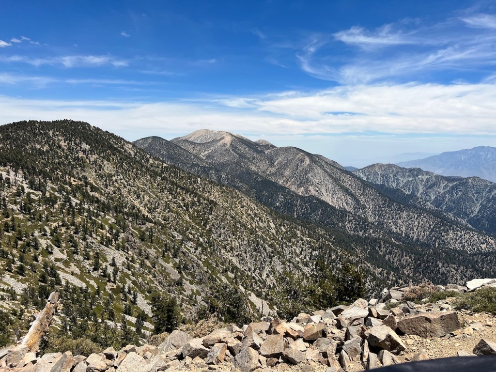
It had been a beautiful day hiking over several peaks, along the ridge line. I gazed back toward San G, which looks barren from afar. We still had a long ways to go, until we were back at our Red Rock Flat, where we would make dinner.
We were far from South Fork trailhead, and our car. The question was how much did we have left in the tank today.
We were both getting to to the point of exhaustion, and still had to get back to our site. Would we stay another night, or hike back afterward? Neither of us had an answer at this point. It wall depended on our energy levels, after we got some food in us.
Looking out towards Big Bear, everything seemed so much smaller, since it’s only around 8,500 feet at the ridge line there.
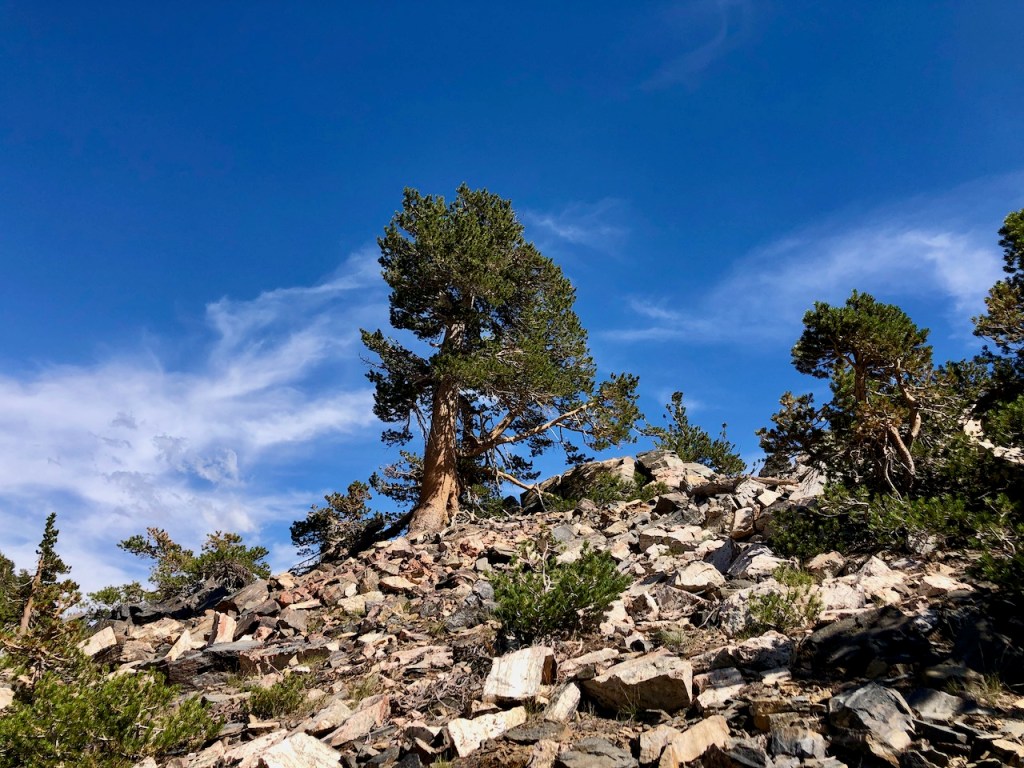
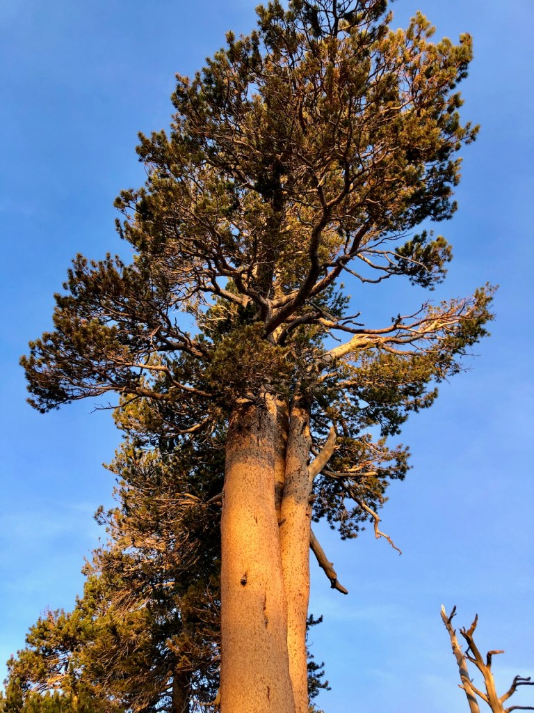
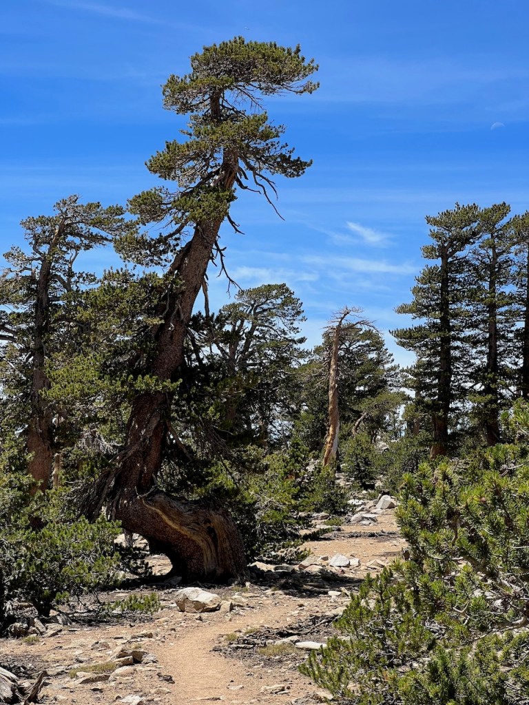
The trees here grow in places nobody would ever expect, in the most rocky soil, on ridges, with little moisture. I am always in awe of alpine trees like the Limber Pine.
Some sections of the trail were over large rocks like this section by Shields peak. We never did make it up there on this trip, since we were running out of time to complete this. We knew we needed to get home, so I would save that one for later. Five peaks would have been something though.
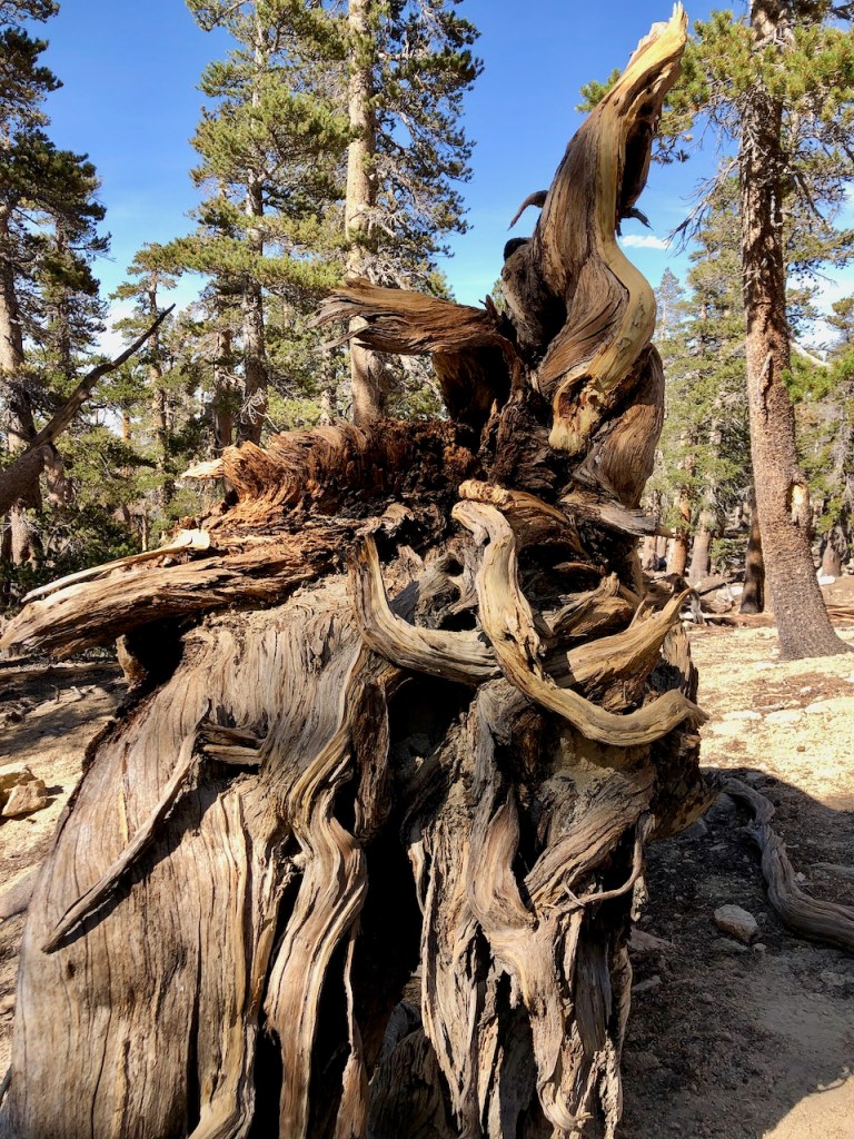
There were many chances to see burls, the intricate, twisting root structures of overturned trees.

But it was now time to finally say goodbye once to the alpine forest I love.
It’s pretty neat that this San Gorgonio Wilderness is right in my backyard, less than two hours drive from my home.
We made haste after arriving back at Red Rock Flat. We cooked up our backpacker dinners on our stove, and packed up everything. We didn’t really want to be in a hurry, but we had so much to do. We were leaving for the Sierras in just one more day after all.
We headed south to Lodgepole Spring. We would need one more water fill up to make it back. I had about a liter left, and it was only 4 miles to the spring, so we felt we were looking good.
Overall, it was an epic short backpacking trip, with an alpine sunset over San G, as an added bonus.
I felt myself literally flying downhill, as opposed to the slow climb, the night before. We made it back to the car by 10pm, back to South Fork, and were home to Orange County by midnight. We hiked 25 miles and considered this a very successful shakedown hike. We were ready for the Sierras!
This wilderness area has some of the most remote, scenic, and uncrowded trails. Though there are many peaks in this area, the one which draws the crowds is mainly the one to Mount San Gorgonio. You do need permits for backpacking in the wilderness here. You can find out more about the San Gorgonio Wilderness Association.
I hope you enjoyed reading this, and it is helpful in knowing what to expect, should you decide to visit here.
About me
I’m Serafina! I’m a writer and California girl who loves to go exploring. Hope you will get outside today, breathe some fresh air, and be happy!
Follow my Journey…
Be sure to Like and Subscribe to My Youtube Channel where I post videos!
Disclaimer: The work on this blog is my opinion and my opinion alone and I am not responsible for the outcome if someone were to apply these thoughts to their own life. All text and photography copyright 2022 by Serafina, all rights reserved. Information and opinions provided are kept current to the best of the author’s ability. All readers’ usage of the ideas and opinions presented in the blog, are at their own risk. Be aware of the possible dangers of hiking, surfing, walking, cooking, and other activities, which may take place indoors or outdoors. By reading this, you agree not to hold the author or publisher of the content on this web site responsible for any injuries or inconveniences that may result from reading the blog, or partaking in any activity mentioned in the blog. Read the blog, and use its ideas, if you so desire, at your own risk.
