A 10 mile Loop Hike Via Morgan Trail
Quick Facts
Located within the Cleveland National Forest
https://www.fs.usda.gov/cleveland/
Town/State Lake Elsinore, CA
County Riverside
Region Southern California
Address South Main Divide, Decker Canyon Rd, Lake Elsinore, CA 92530
GPS Coordinates 33.633599, -117.382071
Google Maps – Morgan Trailhead
Parking / Trailhead Parking lot at trailhead visible from road
Cost Free
Pass Required No
Restrooms No
Mileage 4.7 miles
Gain 971 ft
Time to Complete 2.5-3 hrs
Type of Hike Out and Back
Length 4.7 miles out and back, or a 10.2 mile loop
Water Sources None observed, seasonal creeks
Dogs Allowed No
Exposure to Sun Partial to Full
Best Season to Hike Winter from Dec-March
Hazards Wildlife, missing signs, no cell service, steep, and rocky
San Mateo Peak Via Morgan Trail
https://www.alltrails.com/explore/trail/us/california/san-mateo-peak-via-morgan-trail
Wander in the Wilderness
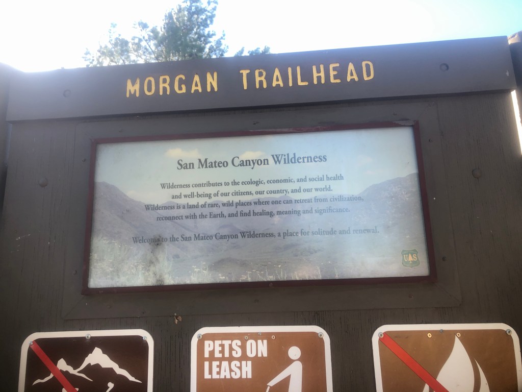
This trail is located within the San Mateo Canyon Wilderness and Cleveland National Forest. There is no charge to park at this trailhead.
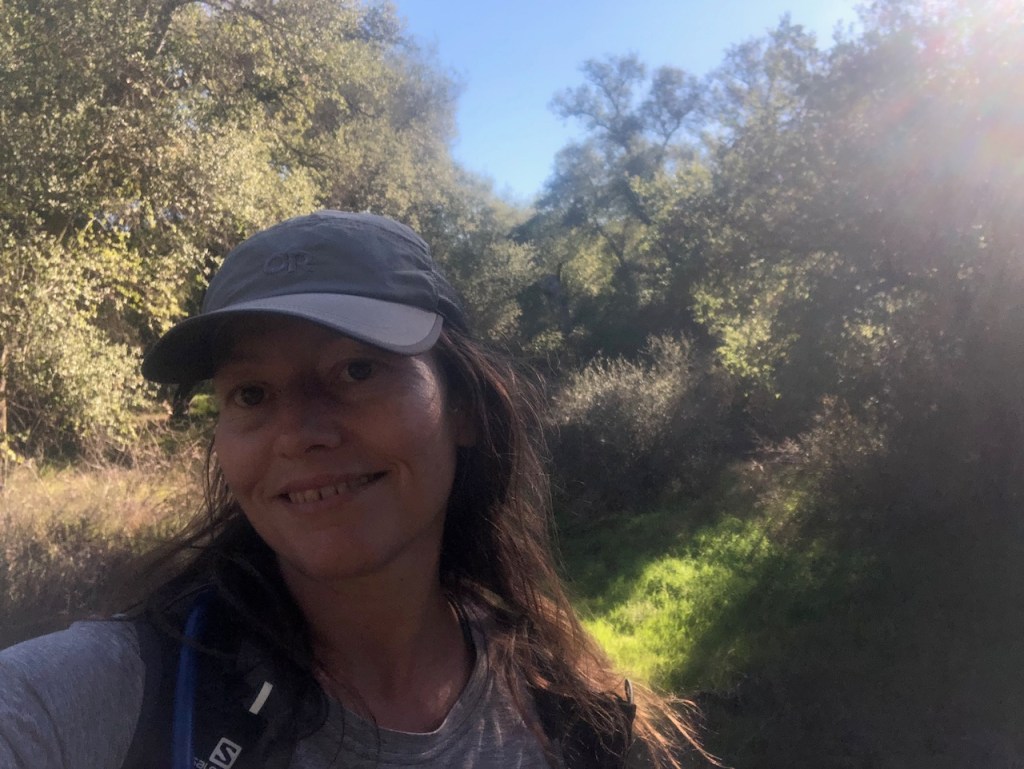
Today I would be hiking with a partner. Going with a friend or a group is always recommended, though in no way necessary to have a successful hike.

Note: The map was very tattered and of not much use.
Planning a Wilderness Hike
You won’t find San Mateo Peak marked on most maps. If you’re planning to hike to San Mateo Peak, most people take the out and back option, which is shorter at 4.7 miles.
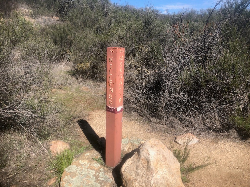
In order to not miss the trail, be sure to make a sharp left at the trailhead sign-in box, which is about a ¼ mile down the trail. The trail to San Mateo Peak is unmarked.

The Trek
We began the trek to San Mateo Peak down Morgan trail. Morgan Trail once upon a time crossed over the ridge down into Lake Elsinore, long before Ortega highway was built.

It was a sunny, clear and rather windy day. With the temperature set to climb to 80 degrees, we opted for an early start. Hiking mid-day increases the potential for heat stroke. You also need to drink more water. So starting early is a good rule of thumb.
An Early Start
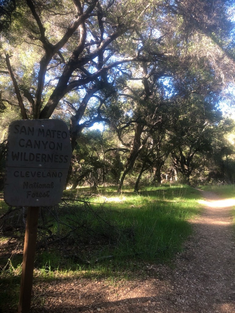
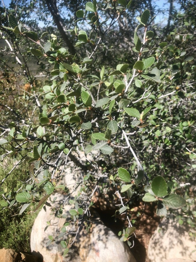
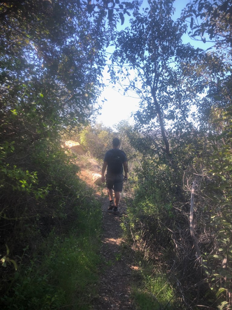
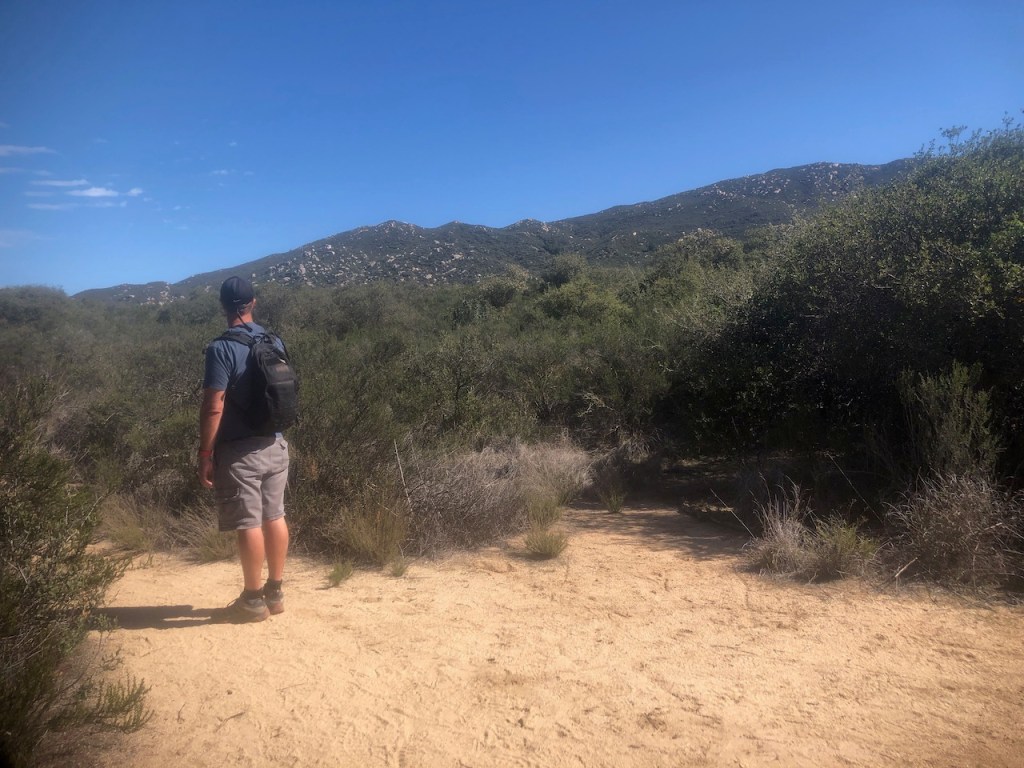
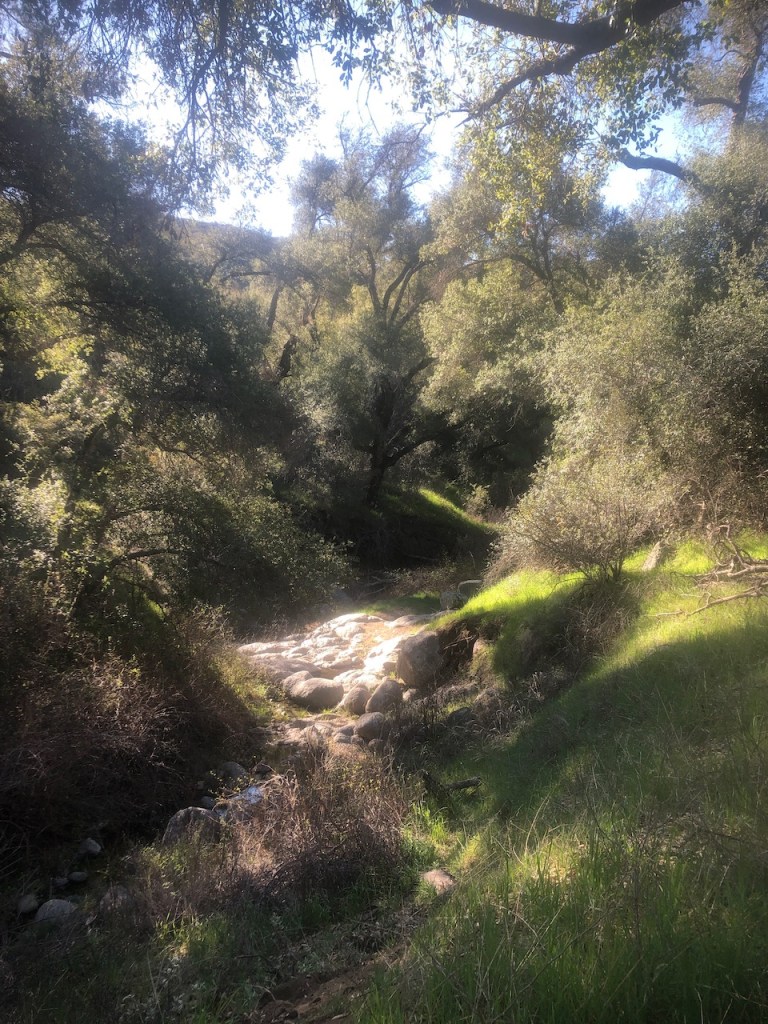
We proceeded from the parking area, just off Main Divide Rd around 8am. Morgan Trail begins in an enchanting forest of majestic Coastal Live Oak, and California Scrub Oak.

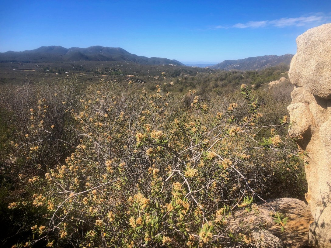
During springtime, it was very green, and filled with wildflowers, as we passed the San Mateo Canyon Wilderness sign.
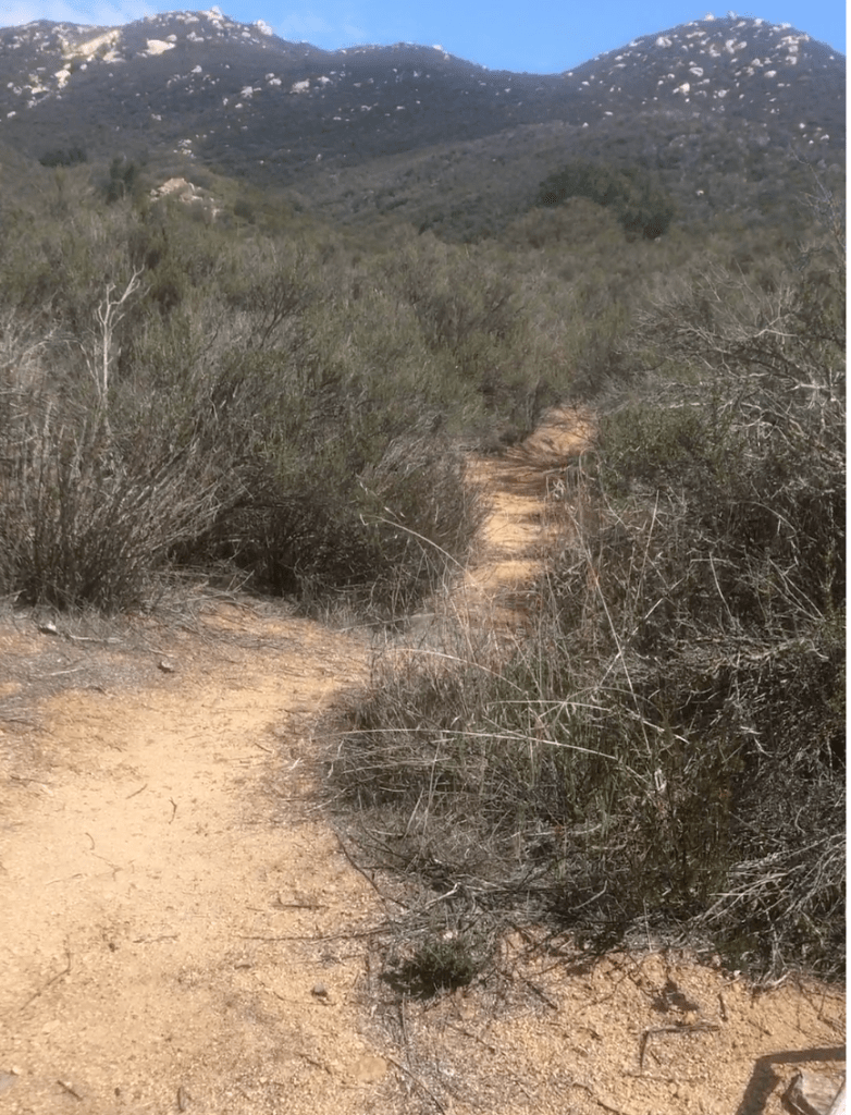
As we moved through a more exposed section, dotted in chaparral, and occasional scrub oaks, the potent smell of black sage wafted through the air.
The trail steadily descends towards Tenaya Falls, and Rancho Carillo. It’s a small equestrian community set right in the heart of the San Mateo Canyon Wilderness.
Escape the Crowds
We would pass just one other hiker along the way, dressed in neon colors, and jogging along. She stopped to ask us where we were going briefly, and proceeded to tell us where she had been.
She was a professed distance hiker, putting in fourteen miles that day, to the falls and back. That was much farther than I planned on going.
It’s always a good habit to check in with other hikers you pass along the way, especially if the trails are empty. You never know when you can help another hiker with some needed information.

Hike Your Own Hike
We initially planned to complete a 4.7 mile hike to the summit, out, and back. The original itinerary would take about 2.5 to 3 hours to complete. But we missed a turn, and ended up about a mile and a half off course.
So rather than backtracking, and finding the missed turn, upon consulting the map, we decided on an alternative approach from the west, up the backside of San Mateo Peak.
This hike had now doubled in size, and was now going to be a 10.2 mile loop hike.

A Rock Garden
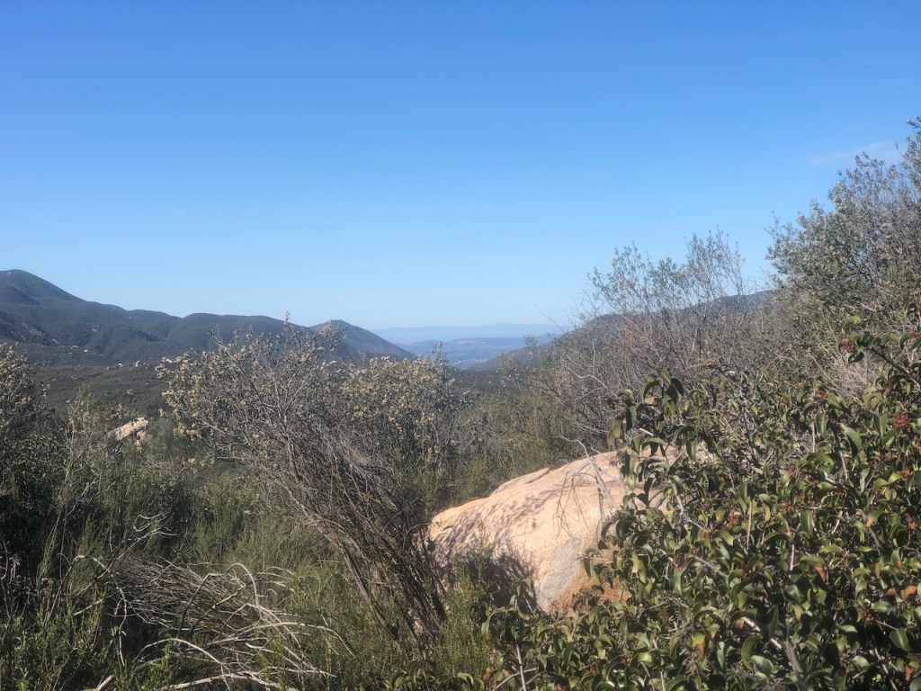
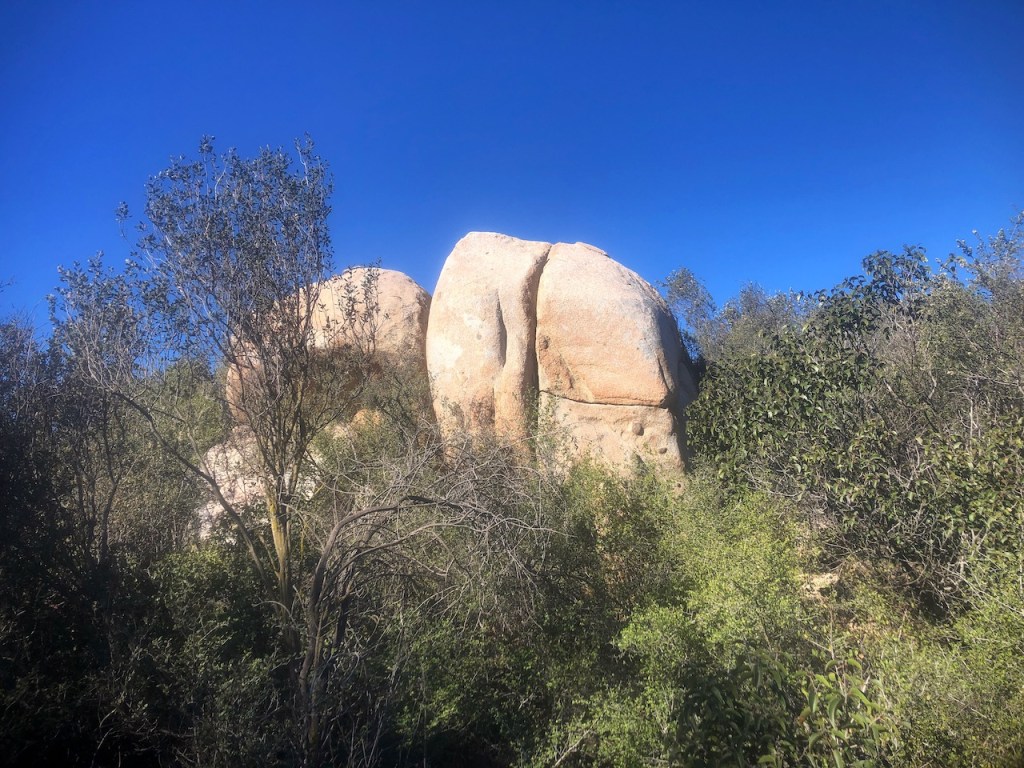
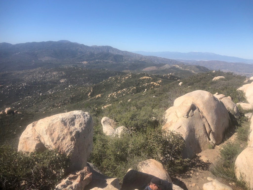
The San Mateo Canyon Wilderness is like a rock garden, with smooth batholithic boulders strewn about in every direction. The area kinda reminds you of Stonehenge.
My hiking partner mused that perhaps someone in ancient times placed these stones here deliberately. Jury is out on that one, but I suppose anything is possible.
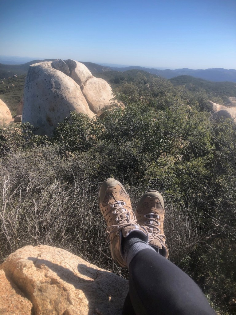
There were a handful of perfect picnic spots along the way. I sat atop a huge boulder, had a pro bar, and some fruit. I usually try to rest and eat lunch at the peak, or halfway mark when I take a full day hike.
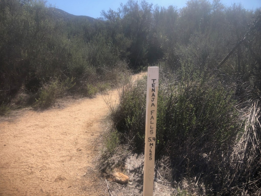
We eventually reached the Tenaya Falls trail cutoff. After making a left there, we would reach another sign, where we made yet another left.
Shortly afterward we made another left onto an unmarked single track trail.
There were no signs, and things started to feel a little spooky, and we were definitely isolated there. It’s that feeling that you’re on your own, and need to take care, since nobody will be coming to the rescue.
Tip: Having downloaded alltrails maps was essential for finding this single track trail.
I was on the lookout for my next left turn. With no signs, and a barely recognizable trail, a messy fallen over rock cairn was the only marker.
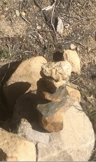
I felt compelled to repair it, to help out the next hiker who passes through. I continued down an overgrown leaf covered trail. One section was marked only by trampled grass, of the hikers who came before.
It seemed like the perfect spot to encounter a rattlesnake. It was early in the season, and I hoped not to run into any early birds.
Before the ridge line, we would endure a two mile uphill slog in the midday sun. I forgot my trekking poles and regretted it when I reached this section. My hiking partner and I agreed, we would be each other’s trekking poles.
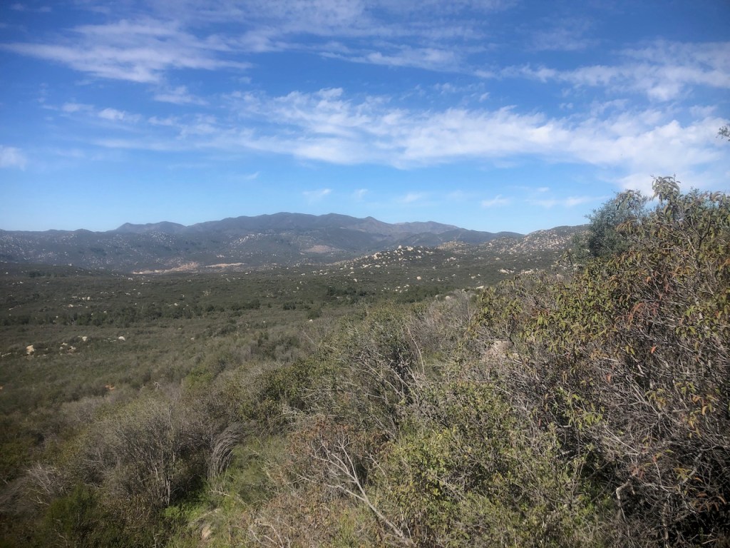
As we climbed higher towards the ridge, I spotted Sitton Peak and the radio towers of Saddleback Mountain.
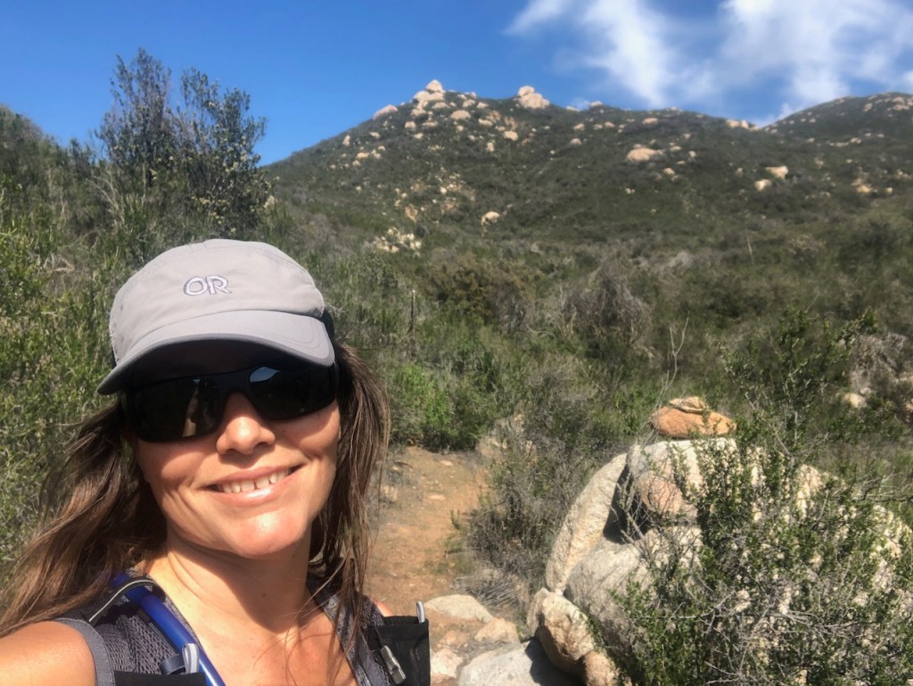
After a sweaty butt kicker of a climb up the west side of the mountain, San Mateo Peak was in our sights, with its undeniable rock pile.

At the Peak
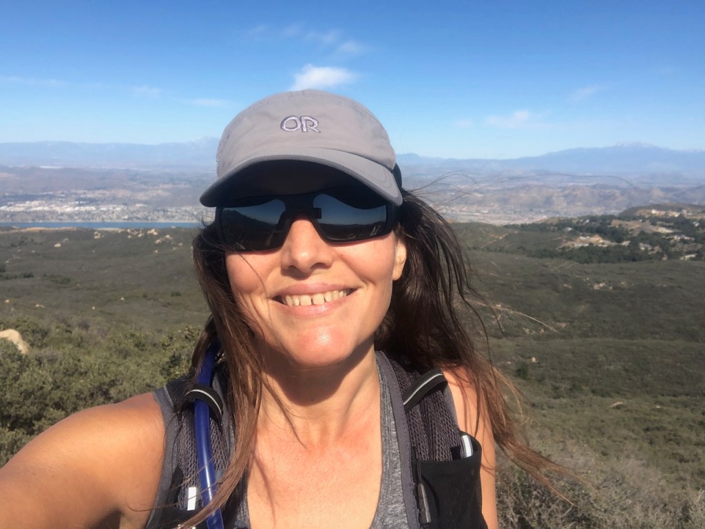
Finally we were there at the peak. We took turns climbing on top of the large boulder. There was nobody else in sight.

Snow covered Mount San Jacinto, Mount San Gorgonio, and Mount Baldy were in the distance. Lake Elsinore sparkled and glistened down below.

The peak marker was there, as was a hiker box, with a trail register. The idea is that you sign it to prove you were there.
Be Prepared for Anything
I love exploring, and I don’t always do too much research on a trail, before heading off. Part of the fun of wandering in the wilderness, be it the mountains, desert, or sea caves, is in the discovery.
Still there are things every hiker should do to be prepared, anywhere you go. The impromptu twists and turns you make, and sometimes wrong turns, make it all feel somewhat more authentic.
Just Don’t Fail to Plan
Sometimes it’s tough to plan for everything. There is no such thing as a perfect hike. When you go out and experience the great outdoors, it’s really what you make of it that matters, with the cards you’re dealt.
Weather can change in a heartbeat. Gear can break down, or be left at home. Improvising and adaptability are in my opinion some of the greatest skills you can attain in life.
We made a wrong turn early on in this hike, and were left with two choices, to improvise, or simply retrace our steps.
Why visit The Cleveland National Forest?
It is a beautiful and scenic trail set within the Cleveland National Forest, near Lake Elsinore, CA where you can enjoy a hefty dose of nature therapy, and solitude. It’s just a short drive from Orange County or Riverside. Parking is also free, and there is no admission price. I love things that are for fun and free.
Start Your Hike Early
Whenever your hiking anywhere that is sun exposed, or warm, starting early gives you time to enjoy your hike, without also enjoying heatstroke. I’m sure nobody would enjoy that. If weather is in the 60’s or cooler, it’s not as much a factor.
But if it’s in the 70’s, heat can magnify itself, and you might get baked, especially in a canyon. Similarly, If you make a wrong turn, or your gps goes kaput, your less likely to be stuck in the middle of nowhere in the dark, or lost if you have time to spare.
A Few Recommendations
The trail was very steep and vertical in areas. I would not recommend taking the longer loop past March, due to the overgrown nature of the trail. It’s always good to be mindful of rattlesnake season, which occurs from April until October in California. I also recommend bringing trekking poles.
History and Lore
The area has been inhabited going back over 10,000 years, according to historical artifacts. Several Indian Villages of the Luiseño, Kumeyaay and Cahuilla once sat in the wilderness here, along Ortega highway.
Petroglyphs dot the rock formations here, but you have to know where to look.
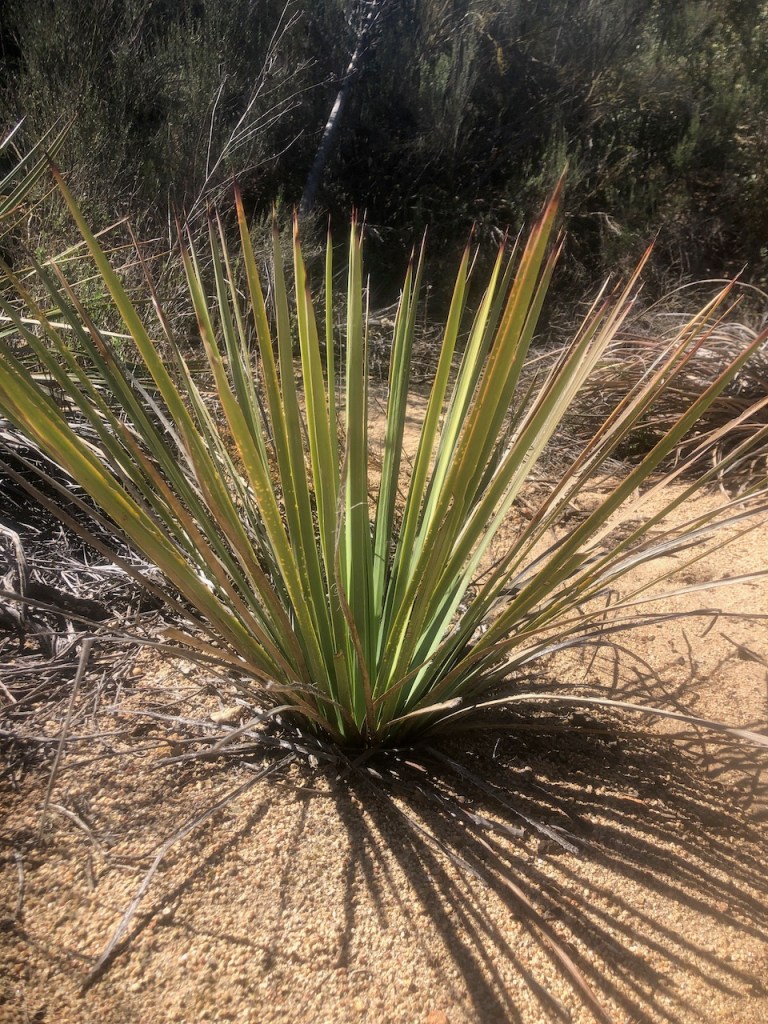
The tribes utilized drought tolerant native plants for food, and survival, such as Yucca plants.
The CCC
A writer, historian, and naturalist named Ken Croker, is famous in part since he located abandoned Civilian Conservation Corps trails within the San Mateo Wilderness. In the 1930’s the CCC constructed them, before they fell into disrepair.
Ken would restore these trails here with the help of the Sierra Club. Not only that, he went on to become one of the most notable resources in the history of the area, as author of the Santa Ana Mountains Trail Guide, which I own a copy of.
Mining and Steelhead
San Mateo Canyon was once active as a site for mining, grazing, hunting, and fishing. Fisherman’s Camp was popular back when steelhead still swam in the creeks up until about 1938. The eggs of Steelhead were once collected at the headwaters in neighboring Camp Pendleton.
Though miners never really struck it rich here, there are still the ruins of several mine shafts in the area. Clark trail has the somewhat secretive remains of one of these. Another mystery in the area is the lesser known Hot Spring Canyon, with its 70 foot waterfall, which flows only during big rains.
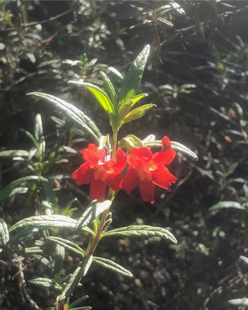
A Wildflower Hike
Along the trail are many beautiful flowers. You may spot the bright red blooms of the California Peony, Red Monkeyflower, California Centaury, Golden Yarrow, Blue Dicks, and Sugarbush. Native wild edibles such as Lords Candle (Yucca), Agave Americana (Century Plant), Toyon, White Sage, Lemonade Berry, and Manzanita, all can be found here. These same plants sustained the native tribes in going back thousands of years.
Be Your Own Naturalist
If you’re looking to find out more about the flora and fauna here, check out iNaturalist, or the UCI Natural History of Orange County.
Detailed Driving Directions
From South Orange County take Hwy 74 Ortega highway to Main Divide Rd and turn left, and the trailhead will be on the right.
From West and Orange County take the 91 freeway to the I-15 South and exit at Lake St in Lake Elsinore. Turn right, take Grand Ave, then make a right CA-74 W Ortega highway to S Main Divide Rd., and make a left there. Drive on it until you reach Morgan trailhead on your right.
From the North and Riverside take the I-15 South and exit Lake St in Lake Elsinore. Turn right, and take Grand Ave to take CA-74 W Ortega highway to S Main Divide Rd., and make a left there. Drive on it until you reach Morgan trailhead on your right.
From the South and San Diego take the 15 freeway north and take Take exit 69 toward Baxter Rd, then turn left onto Wildomar Trail, Turn right onto Grand Ave, and make a left on CA-74 W Ortega highway to S Main Divide Rd., and make a left there. Drive on it until you reach Morgan trailhead on your right.
From the East and Perris take Ca-74 to Main Divide Rd., turn left, and the parking area for Morgan trailhead will be on the right.
Wilderness Passes
Buy at a Forest Service Ranger Station
Buy at the Ortega Oaks Candy Store
Area Maps
San Mateo Canyon Wilderness Map
Cleveland National Forest Paper Maps for Purchase
Fun Fact: Canyoneers explore off the trail in less explored areas of the wilderness. They wear protective snake gaiters, along with carrying additional safety gear.
Tips for Wilderness Safety
- Come prepared for the terrain
- Check the weather in advance
- Look where you’re going
- Keep your headphones off, with ears, and eyes open
- Use your best judgment
- Tell a friend where your going
- Bring the 10 Essentials
- Don’t wander in the brush
- Stay on named and maintained trails
- Keep it wild and leave the wildlife alone
- Don’t rely on cellular data, download a map!
- Plan for emergencies
- Use your own best judgment
- Hike within your comfort zone
- Overdo it on the safety gear
- Trekking poles a must in steep terrain
Fire Danger
The Santa Anas have always experienced wildfire. Fires are both destructive and necessary for the health of the forest. Always pay attention to the weather when hiking in areas with a tendency to burn. It’s best to avoid hiking during red flag fire warnings, when the Santa Ana winds blow out of the northeast.
More Area Hikes
Sitton Peak (Elev 3225) – 10 miles 5-6 hrs 2037 ft gain
Chiquito Falls Loop 9.1 miles 4.5-5.5 hrs 1571 gains
Walker Canyon 9.2 miles 5-6 hrs 1761 gain
Ortega Falls 0.2 miles 30 min 39 ft gain
Fishermans Camp 4.3 miles 2-2.5 hrs 471 gain
Tenaya Falls 4.7 2.5-3.5 hrs 679 ft gain
More Things to Do
Camp at El Cariso, Blue Jay and Upper San Juan Campground.
Dining Options
Best Restaurants in Lake Elsinore
Jack’s Bar-B-Q Open Daily 10am-Midnight with Live Music Fri-Sun 7-10
Main Street Kitchen and Tap – Hours Vary, Opens at 11am
Annie’s Cafe – Open 7am-1:30pm
Michi Tacos – Open 10am-10pm, and Open late until 11pm on Friday and Saturdays
Nearby Campgrounds
El Cariso Campground https://www.fs.usda.gov/recarea/cleveland/recarea/?recid=47606
Blue Jay Campground https://www.fs.usda.gov/recarea/cleveland/recarea/?recid=47588
Upper San Juan Campground https://www.fs.usda.gov/recarea/cleveland/recarea/?recid=47666
Ortega Oaks http://www.ortegaoaks.com
Caspers Wilderness Park https://ocparks.com/caspers
Leave No Trace Principles
- Plan Ahead and Prepare
- Travel and Camp on Durable Surfaces
- Dispose of Waste Properly
- Leave What You Find
- Minimize Campfire Impacts
- Respect Wildlife
- Be Considerate of Other Visitors
Disclaimer:
The work on this blog, and my youtube channel, along with any associated social media accounts, is my opinion and my opinion alone. I am not responsible for the outcome if someone were to apply my thoughts or opinions presented to their own life. All text and photography copyright 2020-2022 by Serafina, all rights reserved. Information and opinions provided are kept current to the best of the author’s ability. All readers use of ideas and opinion presented in the blog, is at their own risk. Be aware of the possible dangers of hiking, surfing, walking, running and other physical activities, which may take place inside or outdoors. By reading this, you agree not to hold the author or publisher of the content on this web site responsible for any injuries or inconveniences that may result from reading the blog, or partaking in any activity mentioned in the blog. Read the blog, and use it’s ideas, if you so desire, at your own risk.
