Adventure Awaits
This challenging hike to Mount Baldy (aka Mount San Antonio) up the Devil’s Backbone, and down Ski Hut Trail, is one of the most strenuous, steep trails I have experienced in Southern California. It’s also one of the most popular peaks to bag, among experienced socal hikers.
Alpine Dreams and High Peaks
Hiking to the summit of Mount Baldy was on my mind for some time. It is one of the highest peaks within the Angeles Forest, at 10,005 feet in elevation. It stands out majestically, amidst neighboring peaks such as Mount Baden Powell, and Cucamonga Peak. The trail passes by a waterfall, San Antonio Falls. Then it proceeds up a fire road through the Baldy Bowl, with its aging vintage ski lift. Hikers on occasion will utilize it as a shortcut on the way back down during the summer months.
The Devil’s Backbone Trail
The most popular, longer, and least strenuous route up Mount Baldy takes you along “the Devil’s Backbone,” trail, which coincidentally is also a movie directed by Guillermo Del Toro. Is there a connection? The trail’s name is likely due to how it appears from a far, like a jagged backbone, or spine. The trail steeply drops off on either side.
A Calculated Risk
I suppose any place can be dangerous, but the trails around Mount Baldy, and its neighboring alpine peaks have claimed more lives than most other trails in the rest of Southern California. An experienced female mountaineer slipped and fell on this trail. Many other hikers have met untimely deaths here, mainly in winter, when it’s known to be icy. Fresh snow can hide the slick ice underneath. Even in summer time, without ice or snow, there have been many casualties. With no risk, there may be no reward in life, as the saying goes. The key is to do the hike safely, taking all necessary precautions.
Ski Hut Trail
Once you made it to the summit, on the way back to Manker flats, you have two choices. What comes up must come down. You could take the Ski Hut trail back to Manker Flats, passing by the famous vintage green forest service cabin of the same name. The Ski Hut trail is quite steep, with lots of loose rock, and some of it close to a 40% grade. Thats in summer. So many hikers will simply take the more gradual way they came, back down the Devil’s Backbone. The Ski Hut Trail, is steeper, but seems to have less sheer drop offs than the Backbone trail. So there is give and take with either decision. There is an enchanting woodland you will pass through, and an interesting boulder field, which adds variety to the hike. Just be sure to bring trekking poles.
Peakbagging
Mount Baldy is an honorary peak included within the Six Packs of Peaks Challenge, which has become a sort of right of passage, for socal hikers looking to prove themselves capable of tackling the most strenuous mountain trails around. It was created by Jeff Hester of Socalhiker, who also has a facebook page, where socal hikers can congregate to talk trails.
Bragging Rights
Hikers frequently brag about completing their six pack, myself included. I had completed five of these peaks so far 2021, hiking to San Gorgonio, San Jacinto, Sitton, Cucamonga Peak, and Mount Baden Powell. All that was left was to hike up Mount Baldy. I remember still not being sure, if I would make it to six. The general rule is you must complete six peaks in one year. The list changes every year a bit, so there are multiple options for where to go, and when depending on the year. Well I made it, and it was definitely no walk in the park.
The Most Popular Route
As you begin your hike up Baldy Road, on a paved fire road you will eventually pass by San Antonio Falls on your left, and if you’re lucky, it will be flowing. I recommend adding a trip to the falls, since it’s only about a quarter mile more in terms of distance. After the waterfall, the pavement ends, and then the adventure begins, is how the saying goes. As you continue on the trail up Baldy Road, you climb steadily towards “the Notch,” past the ski lifts and the Baldy Bowl.
The Notch
At the top of the ski lifts, is the trail crest or saddle. Here the trail splits off in several directions. There is a seasonal restaurant here. The famous ski lift of the Baldy bowl runs in summer time, to ferry exhausted hikers down to the parking area. Many hikers have taken this route down, after a long hard day of climbing. I would not call it the ride of shame, though some might call it woosing out.
The Ski Lift
At the top of the ski lifts, is the trail crest or saddle, referred to as The Notch. Here the trail splits off in several directions. Proceeding to the right would put you on the Three T’s Hike, towards Thunder Mountain. There is a seasonal restaurant at the Notch open in summertime. The ski lift runs in summer as well, to ferry exhausted hikers back down to the parking area.
Two Peaks in a Day
Staying to the left, takes you on the Backbone Trail, past Mount Harwood. This peak is almost as tall as Baldy, and covered in loose rock. It is another possible detour if you want to bag two peaks in one day. I was not able to find the peak marker here, or any type of sign to hold up to say you did it. Oh well.
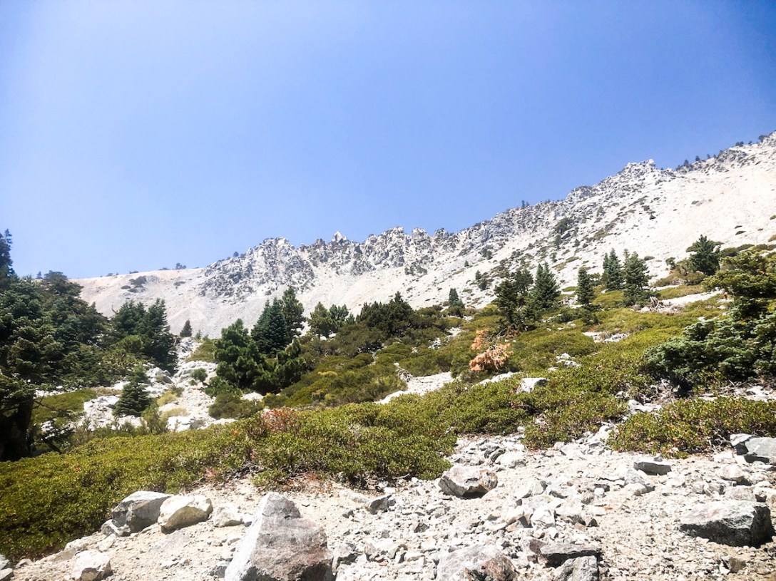
A Barren Rocky Wasteland With a View
The landscape becomes much more barren and rocky as you approach Mount Baldy. There are few trees, and no shade. There are however awesome views in all directions, from the desert valleys of the north, to Mount San Gorgonio to the east, and westward all the way to Catalina Island.
A Hike Long in the Making
I had been planning to hike Mt Baldy during the last week of May. But I was invited on a hastily planned hike up Mount San Gorgonio with two other women. So conquering Mount Baldy would have to wait.
Mount San Gorgonio
Mount San Gorgonio is the highest peak in all of Southern California. I camped 6 miles in, by Lodgepole spring, and Dry Lake. Water is a huge factor when planning a longer hike. I summited around 11 am the next day logging 24 miles in two days. It was one of the most unforgettable experiences of my life.
Back to Mount Baldy
It was late August, when I was finally ready to take on Mount Baldy. This peak had been on my list for a long time. It’s one of the most popular peaks you hear about, but I had held off on it. I knew it was not a particularly long hike, at 13 miles. Research all you want, but there will always be some surprises. No two peaks I have hiked to have been quite the same. After the experience of hiking here, and other mountains, I put it as my most challenging hike, next to Mount san Gorgonio. But the first peak I hiked to in the Angeles Forest was Mt Baden Powell. I recommend hiking up that one first, before taking on Baldy.
Mount Baden Powell
Mount Baden Powell was named after the founder of the Boy Scouts, Lord Baden Powell. It has a beautiful well maintained, and somewhat steep trail leading up to it. It being under the stewardship of the Boy Scouts, who keep it in tip top shape most of the time. At just 7 miles, it’s a very attainable peak, with some steep drop offs so I hesitate to call this one “family friendly.” It is far less strenuous a climb than Mount Baldy.
Mountaineering is not Hiking
Understanding mountain weather, and mountaineering, are an entirely different set of skills. I will not be covering all the intricacies of them here. It’s more than simply hiking, in the wintertime. Mount Baldy becomes a much more dangerous undertaking. In actuality most of the trails in the area can be steep, in any season. It does not take much for even the most experienced hiker to trip, slip, or fall over the side. I do recommend reading up on mountaineering, and taking a class, before attempting it. It’s more about climbing, and knowing how to use the proper gear, than putting one foot in front of the other.
Hiking is Not Safe
Hiking is not safe, and I repeat. Nobody ever said it was. Nothing I am saying is advice. You should always trust your own intuition, and rely on your own training, before any undertaking. Hiking is an adventure that, like driving, can be a lot of fun, but things can go south fast when the wrong combination of factors meet. It’s a dynamic situation, since not having the right gear, going at the wrong time, or not taking your own current level of fitness into account, can contribute to many different life threatening scenarios. Then factor in getting lost, gear failure, and unexpected weather events. The list goes on.
Hike Your Own Hike
Just because your friends say you can do it, or you hiked a mountain twenty years ago, does not mean you’re up for hiking one today. When it comes to hiking, you really need to work within your comfort zone, and use your intuition. If something does not feel right for you, just stop. There is nothing worse than continuing on, knowing you may be walking into trouble. There is no general consensus on what’s best for everyone. It’s always going to be an individual choice.
Not weighing risks versus benefits of a decision, is sometimes the culprit when a hiker makes an unsuccessful attempt at a mountain like Mount Baldy. There is a calculated risk with stepping outside into the wilderness for everyone, even the most experienced mountaineer.
Hiking Tips
- Bring the 10 Essentials
- Download Maps
- Check the Weather Report
- Share Your Itinerary
- Bring a Friend
- Overprepare
Quick Facts
| Trail Name | Mt Baldy Via the Backbone Trail and Manker Flats |
| Peak | 10,006 ft |
| Trail Length | 13 miles |
| Gain | 3943 feet |
| Parking | Free – on Baldy Rd. by Manker Flats trailhead |
| Restrooms | Pit toilet at trailhead |
| Dogs | Yes, leashed |
| Cell Service | No service to 1 bar |
| Location | Angeles Forest, 1-1.5 hrs drive from Orange County |
| Directions | Take Baldy Rd to trailhead past Mt Baldy Village |
Disclaimer: The work on this Serafina Hikes blog, and my youtube channel, along with any associated social media accounts, is my opinion and my opinion alone. I am not responsible for the outcome if someone were to apply my thoughts or opinions presented to their own life. All text and photography copyright 2020-2021 by Serafina, all rights reserved. Information and opinions provided are kept current to the best of the author’s ability. All readers use of ideas and opinion presented in the blog, is at their own risk. Be aware of the possible dangers of hiking, surfing, walking and other physical activities, which may take place outdoors. By reading this, you agree not to hold the author or publisher of the content on this web site responsible for any injuries or inconveniences that may result from reading the blog, or partaking in any activity mentioned in the blog. Read the blog, and use it’s ideas, if you so desire, at your own risk.
