I managed to score a permit in the Mount Whitney lottery for August 1st, back in spring. I had never even been to the Whitney Portal where the hike begins, but I had been to Lone Pine, the small town close by to it.
This is a hike people dream about their whole lives. I was somewhat unprepared for it, but not afraid to try. I would be returning from a month-long trip visiting my Mom, just a day prior to my permit date.
I did not read the instructions for picking up my permit right the first time. I thought I could pick it up at 4pm the day prior, but in actuality, I had to pick it up by 10am the the Sierra Interagency Center. There was a second option to have it emailed, had I contacted them 2 weeks prior. Such a complicated process. I had a permit, but could not pick it up.
I was exhausted and jet lagged the day I drove up to Whitney Portal from Orange County. I was beginning to think I would skip it, and just climb Whitney when my JMT permit comes up in September. But a girl I know decided to go online and get me a permit, for the next day, that came available. I guess I was going, but it was now later in the day. It was not a permit plan by any means. I needed to be back home the following day for an 8:30 am appointment, I could not cancel. What a complicated situation it was becoming. On top of that, it was set to climb to 107 degrees in Lone Pine, hovering in the 90’s at night.
I drove to Mount Whitney, leaving around 6pm from Orange County, around sunset. I had done something like this before, having driven to Death Valley, leaving in the evening, and car camping overnight. I had checked Mount Whitney’s weather, but not Lone Pine’s.
After pulling over several times to try to nap, I arrived at Whitney Portal around 1am, and would doze off about 1:30am, after listening to a bear ripping apart a vehicle, and honking its horn, not far off from where I was parked. Nice.
I set no alarm, since I knew I would wake up whenever my body decided. Starting at 2:30 or 3am was not going to be an option.

I woke up around 6:30 am to the sunrise in my car at Whitney Portal. The temperatures at night were really perfect.
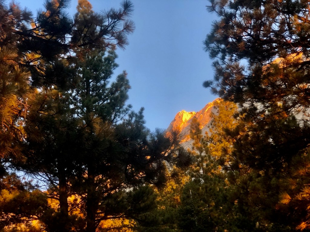
As I made my way out of my vehicle I was in awe, of the alpen glow all around me. All those worries from yesterday were gone. It was a new day, and a new trail. Whether I made it all the way, part way there, or anywhere, I would just accept it. I was in the wilderness again, and that was such a good feeling.
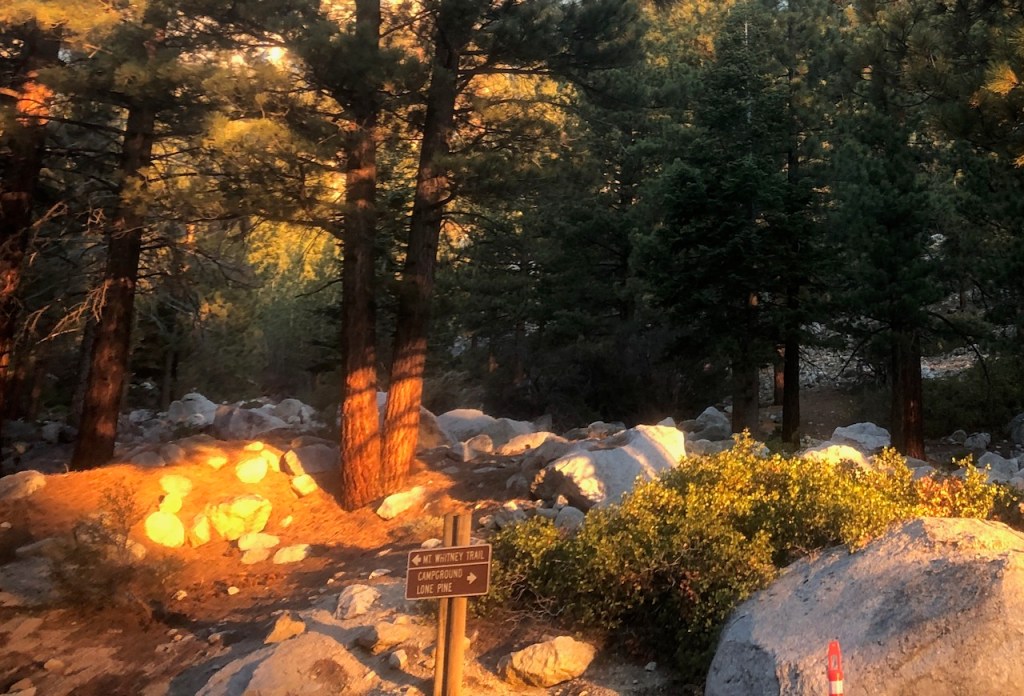
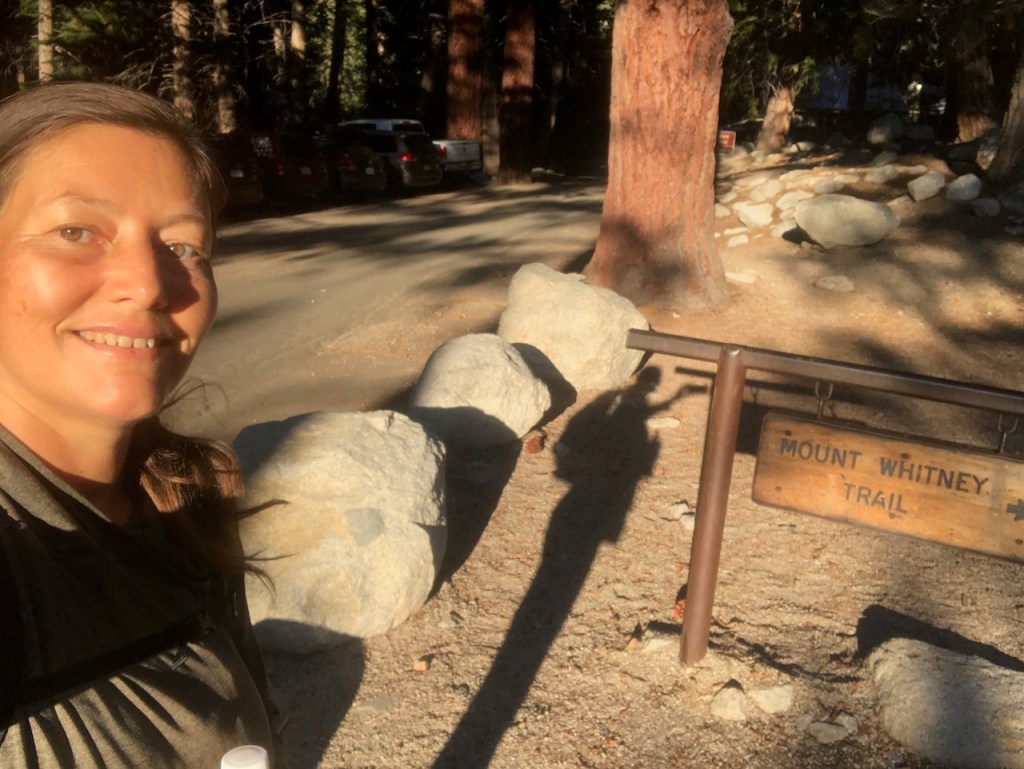
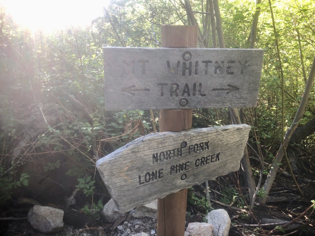
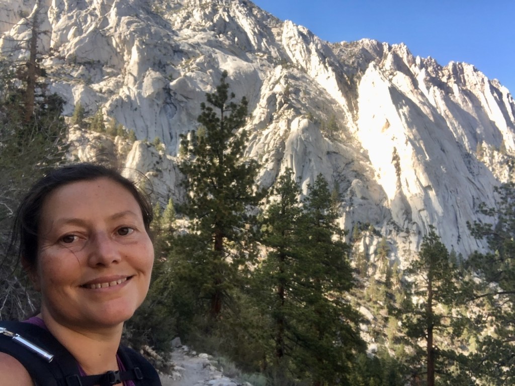
After sorting out my gear, I decided what I would bring, and made my way to the trailhead. I had no idea where it was, but looked for other hikers. I happened to be right by it, and began my hike to Mount Whitney.
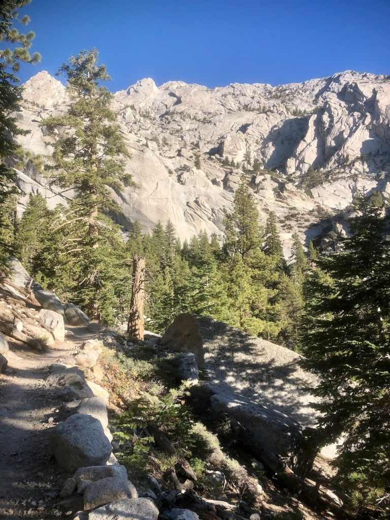
The golden glow faded, giving way to silvery granite cliffs rising up from the valley.

You start this climb well below the tree line, at around 8,325 feet. In the winter this area can be completely engulfed in snow, but in summer, there is none to speak of.
Staying Hydrated
The area seems fairly dry, and at this point, I have no idea the water situation, so I have brought a full 6 liters of water with me.
Early to Rise
I felt proud of myself already, having risen early, with little sleep, determined to get in a hike up Mount Whitney trail. This was all despite how exhausted I was, from a long, hot, and exhausting drive to the portal, the night before.
Switchbacks
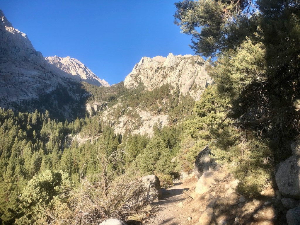
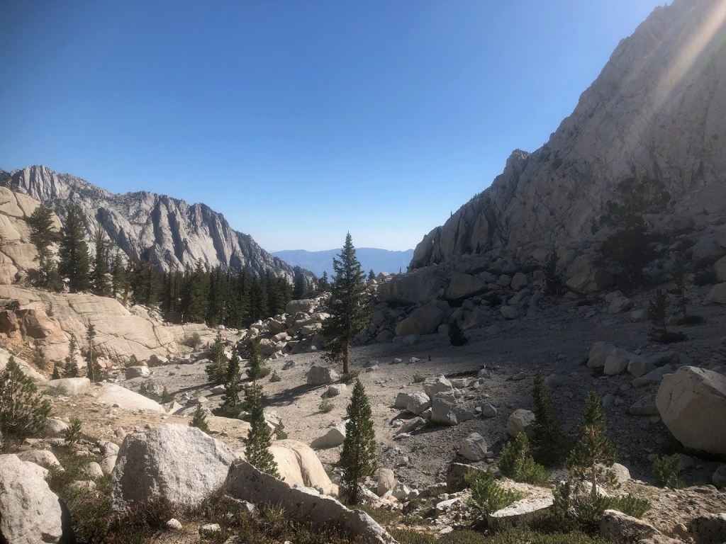
The trail to Mount Whitney begins on a series of switchbacks, along a V-shaped valley, formed by glaciers, long ago. These are nothing compared to the 99 switchbacks leading to Trail Crest, further along, down the trail.
A Chance of Lightning
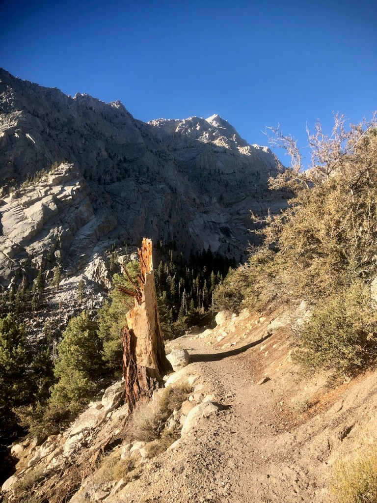
There are many hazards to be aware of here, such as tripping, slipping, and falling, stray boulders, earthquake driven rockslides, and the most dangerous of all, lightning.
You can see the sheer power of it, glancing at this tree, a mere mile from the portal.
Summit by 11am
They say you must summit Mount Whitney by 11am, to be on the safe side, and avoid afternoon storms. My late start made me feel a bit nervous about all this. I had an emergency Bivy to crawl into, should I need to seek shelter from rain, hail, or lightning, which are common daily occurrences here.
Evidently, lightning strikes close to the portal too. There are no guarantees, what you’re going to get weather wise, when you hike up Mount Whitney. I had cold weather gear, and rain gear, just in case.
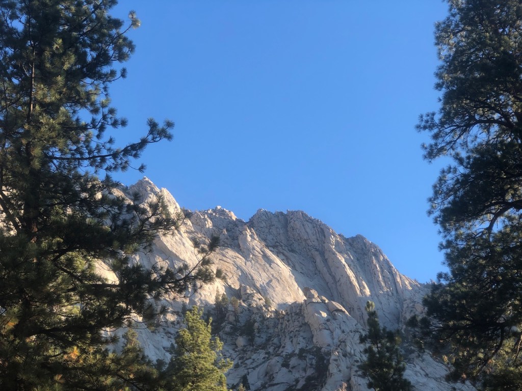
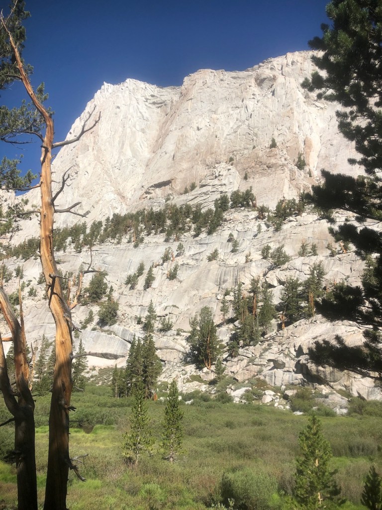
Mount Whitney is set amidst a practically impenetrable steep granite wall stretching from Mount Langley to the south, to Mount Tyndall to the north.

In the Forest
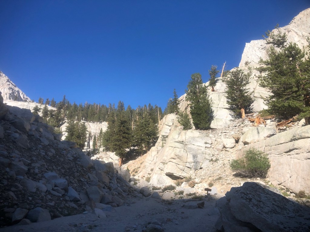
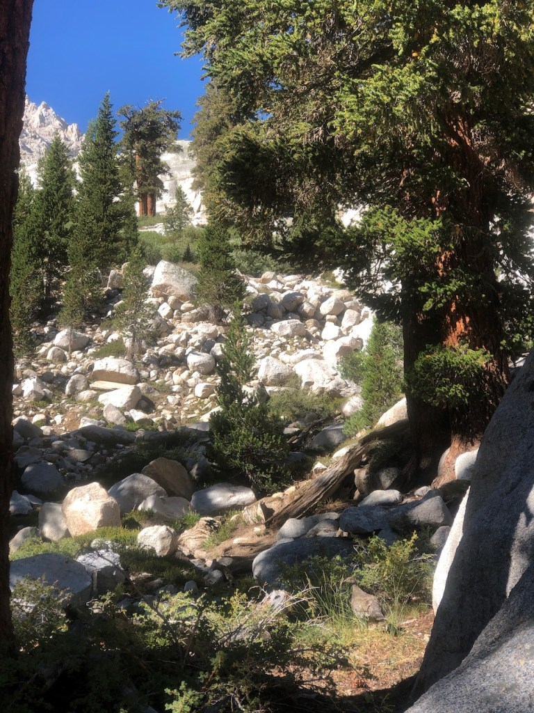
I climbed higher along the switchbacks as I prepared to rise above the treeline. Eventually I would enter the Whitney Zone, where it is mostly just rock, and boulders, with few signs of life. For now I was in the forested section of the trail, where there is plenty of shade.
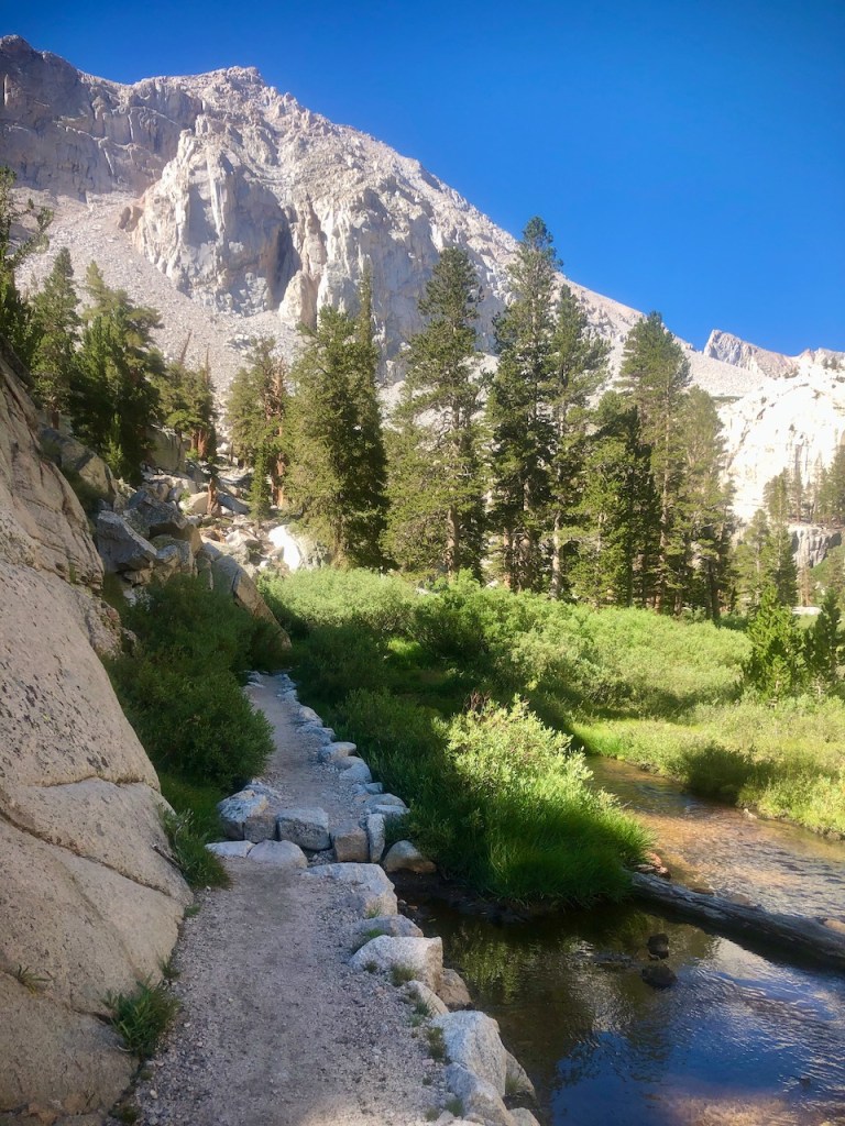
I came to my first milestone, which was Lone Pine Creek. It was flowing well, and I could have filled up water bottles here, but there was no need to, since I had 6 liters of water with me.

The small trickling waterfall would have made it simple to fill the cnoc bag I had, and use my Sawyer Squeeze to filter it, into smart water bottles, the hikers water bottle of choice. They are light, durable, and fit a sawyer squeeze.

So I simply crossed over Lone Pine Creek and went on my way.
The trail was lined with large rocks, making it easy to follow. There are no confusing side trails here, and most of the way, it’s easy to know what to do. There was nothing too steep thus far, or any scrambling of any kind. It was a flat packed, narrow trail. The gain was about 500 feet per mile.

The flowers growing here are unique to the area. There seemed to be a lot more flowers, around areas with water, in the shade. So there were small pockets of green lush growth, amidst the drier alpine forest.
I had only gone about 2 miles at this point, but it already felt great. I had no high expectations on how far I was going today. I knew I would push on until the time felt right to turnaround. I was taking into account a turnaround time, since I decided I wanted to be back to my car by 4pm, so I could make it home early in the evening by 9 or 10pm. That meant going up Whitney probably would not happen today, but that was ok. It was beautiful here, and I was just going to enjoy it.
I gazed back down towards Lone Pine and the Alabama Hills. I had heard about them before, by drove right past them, in the dark the night before. A 107 degree day probably would not be the best time for visiting them or hanging out in Lone Pine. I was escaping the heat for sure.
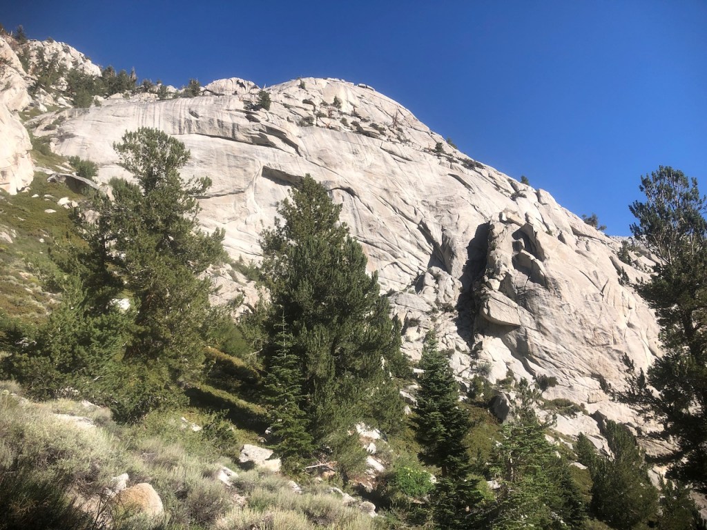
As I hiked along, gazing up at these granite crags, I wondered if anyone climbs up these cliff faces. They looked like technical but fun climbs. I knew there was a mountaineers route here too, but had no idea where it was.
About 2.5 miles up, it seemed to level off a bit, and I spotted a valley up ahead. I was getting close to Lone Pine Lake, which would be another milestone. I knew I could always turn back from there too, depending on how I was feeling.
I had no idea what peak I was seeing in the distance, and where Mount Whitney was. Eventually that would all become more clear.
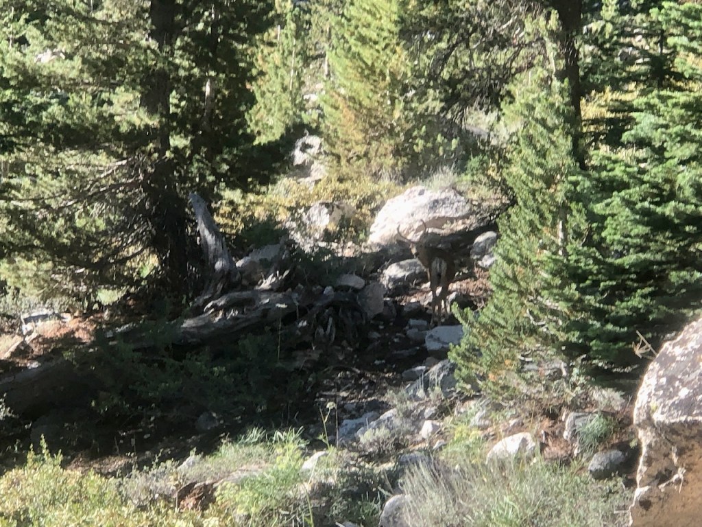
Then I spotted my first antlered buck of the day, who just stared back at me for a while. He had antlers, so I proceeded past him with caution.
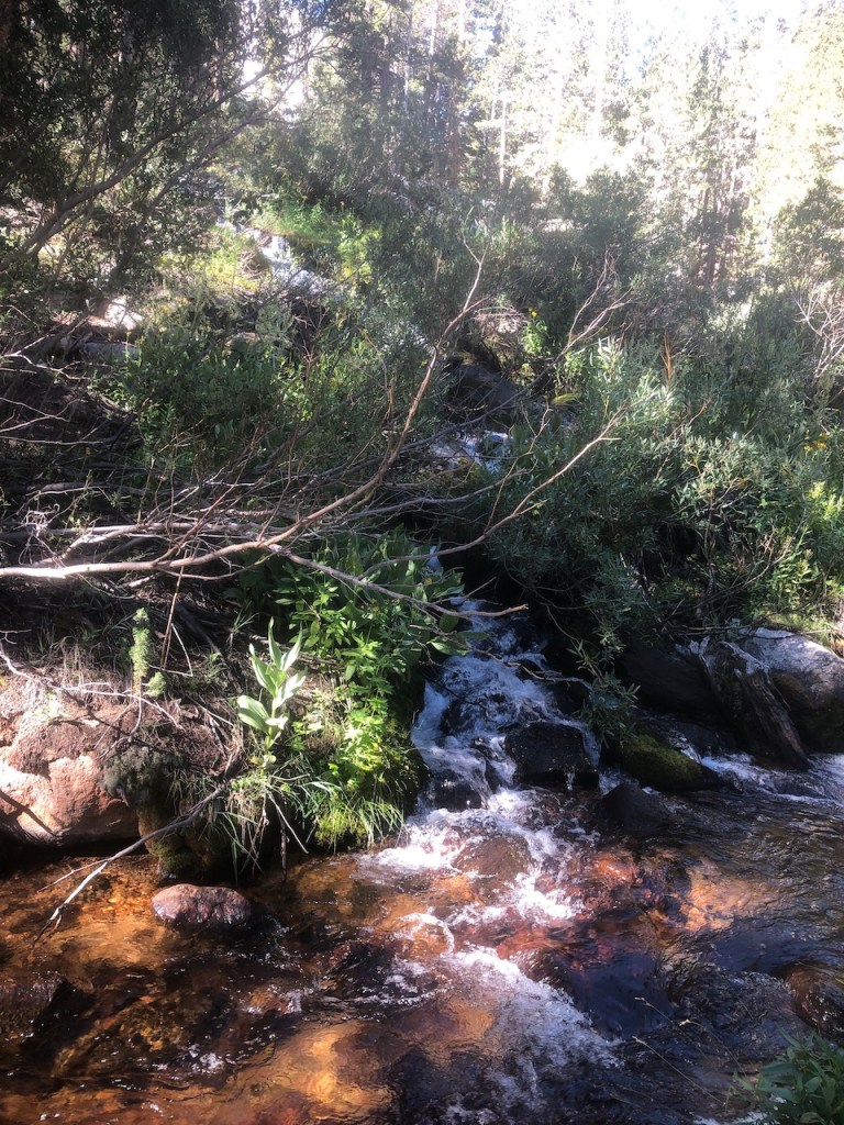
Then I came to another stream, which was flowing well. I started to realize that water was actually abundant right now along this valley. I could have easily brought less water, and filtered some here.

I found another small waterfall. It was beginning to feel so peaceful on this hike, with so much water flowing, wildlife, amazing views, and blue skies. I felt so blessed to be there.
Then I spotted a much larger flowing waterfall. This wilderness was worth it, all the driving, and the climbing. To think you need no permits to go as far as Lone Pine Lake, and the Whitney Zone. I was surprised there were not more people on this trail.
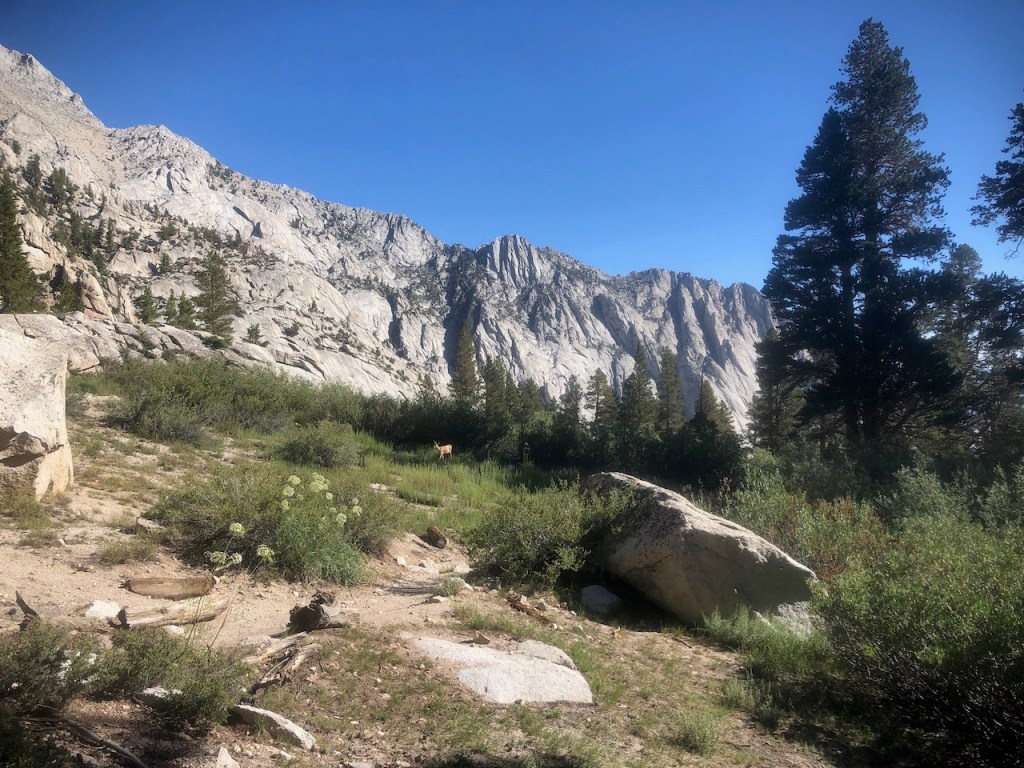
In the meadow I spotted yet another deer. If you must live in a forest, and are a deer, this is a nice choice of surroundings.
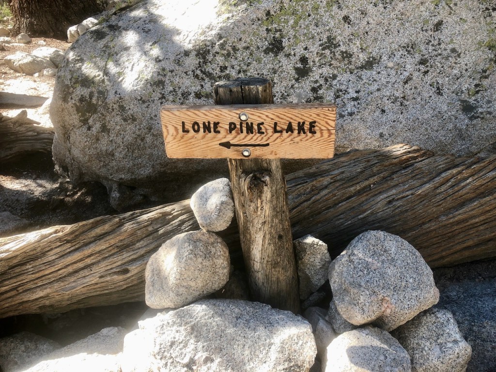
Finally I reached the turnoff for Lone Pine Lake. I was now 2.9 miles in. It was only a tenth of a mile more to the lake. So a hike to Lone Pine Lake is just 6 miles roundtrip.
There were a couple folks heading that way, who I passed by. I decided I would keep going, climbing higher, and try to get a closer look at Mount Whitney.
I was coming to the end of the shaded forest section, and I could tell it was going to warm up a bit, once there was no more shade.
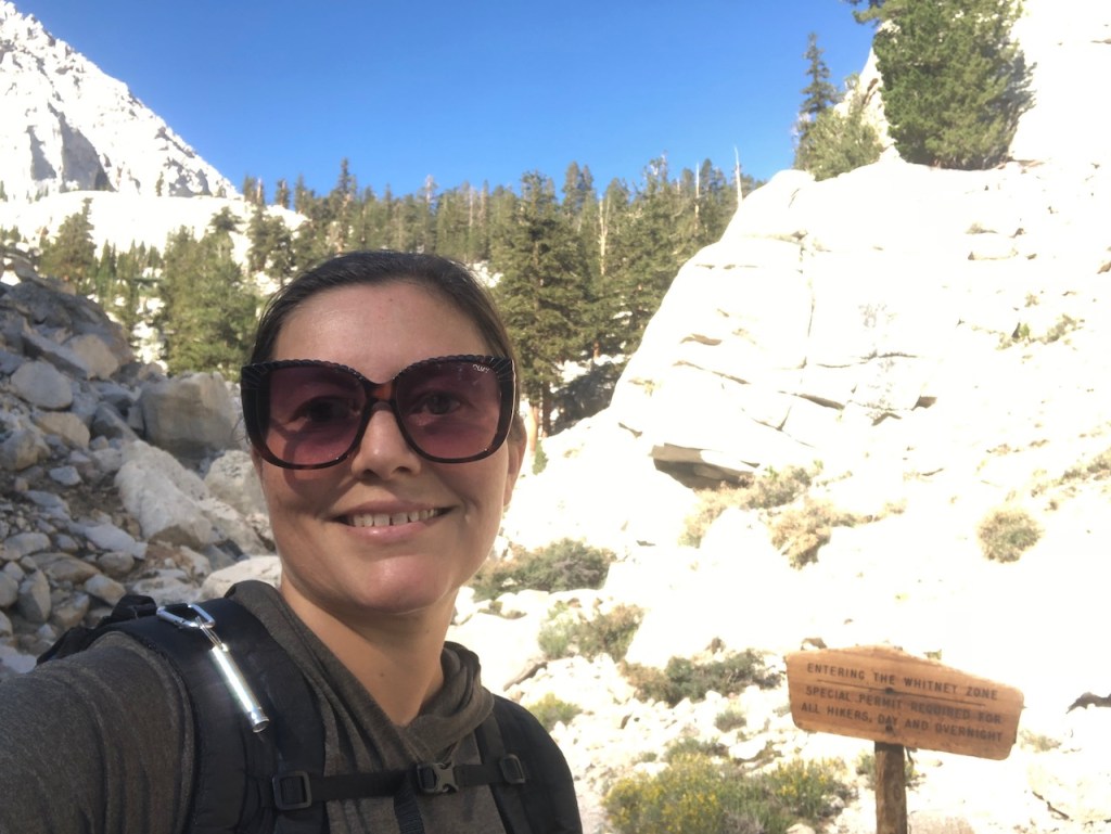
Entering the Whitney Zone was a cool feeling. I was now 3 miles in. This was what I had the permit for, so I could hike into this zone, and possibly to the summit of Mount Whitney.
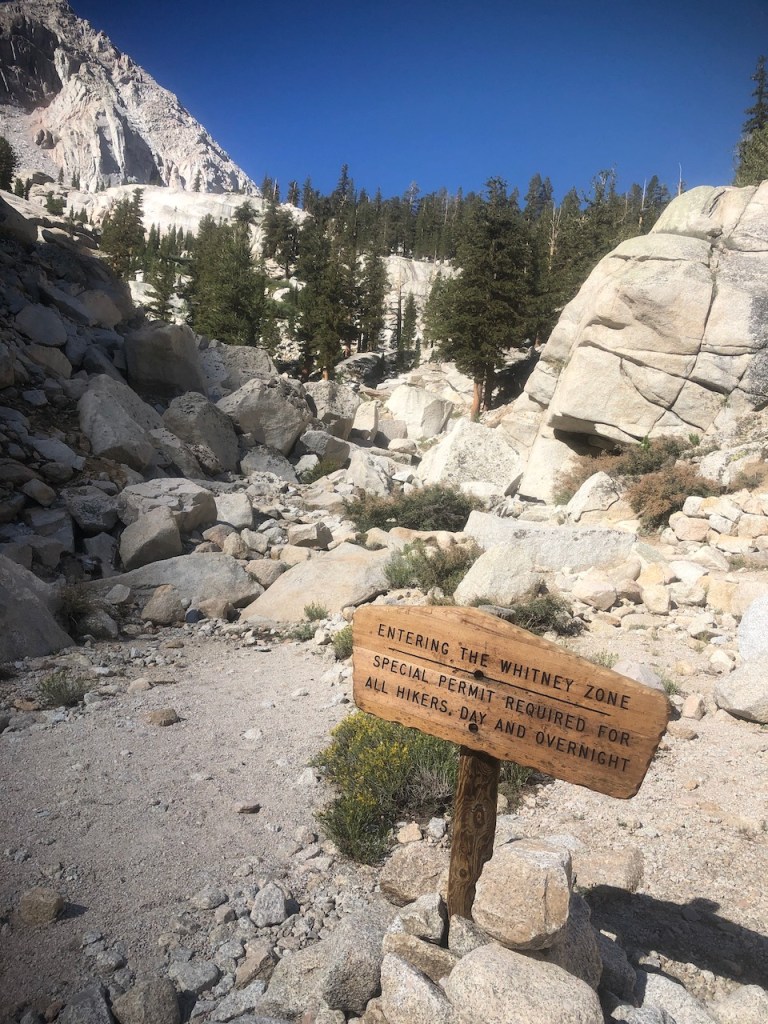
Though I had a permit, nobody would check it all day. Still, I was glad I had obtained one.

Was this Mount Whitney? I decided it was likely not.
I happened to spot a Sage Grouse grazing here under the shady pines. They are the largest native grouse in North America.
The Whitney Zone was another world. There are few trees, but still some patches of green, mostly near water sources.
The tree’s chose to grow in some of the most out of the way places, clinging to the rock, and to small patches of soil.
As I entered what I consider a proper meadow, there was water flowing everywhere. It was green and so lush in this section, as I approached Outpost Camp, which is the first allowable campsite, on the way to Mount Whitney, for those staying overnight.
I felt accomplished yet again, making it this far. I was about 3.5 miles in, and was feeling great, so I hiked on towards Outpost Camp.
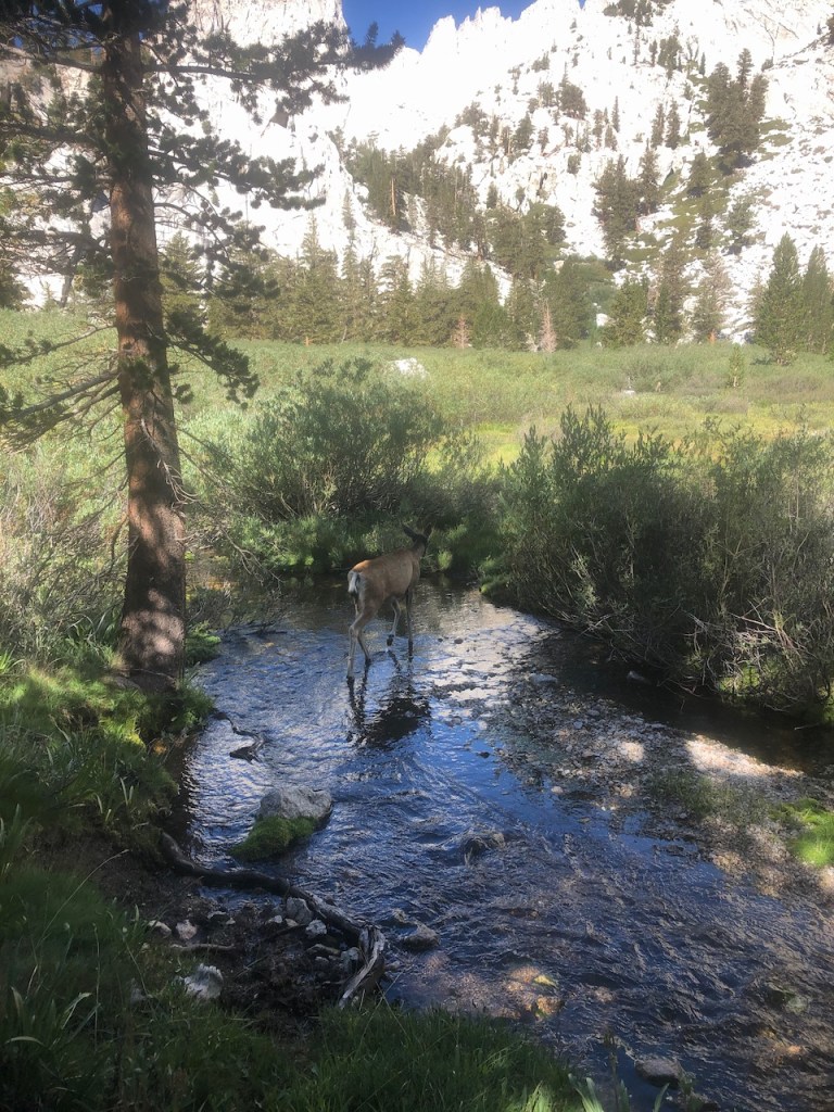
I happened to pass yet another deer, who crossed the trail just in front of me, and did not seem to be that concerned with me. Similar to places like Yosemite, the wildlife here, don’t seem that concerned with humans, since they are used to seeing them.

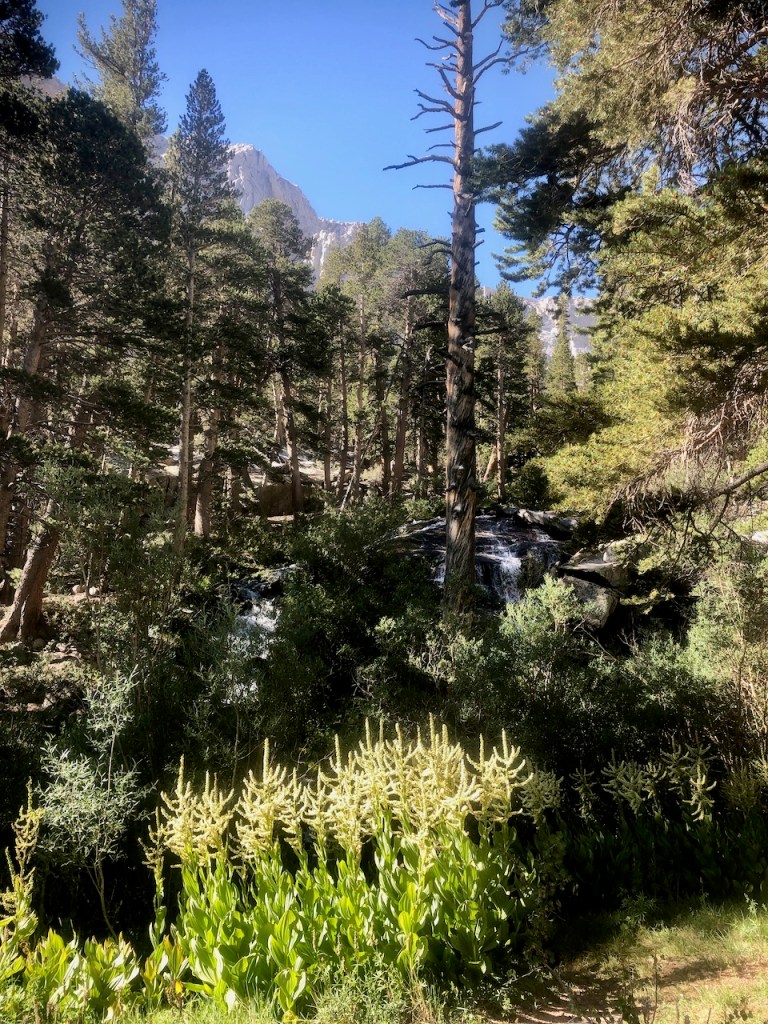
After crossing the meadow, off in the distance, was the most dynamic, and beautiful falls of the day. I was not in Yosemite, but I probably had not witnessed scenes like this, since visiting there years ago.
I passed by Outpost Camp, and ascended a series of switchbacks, before arriving at Mirror Lake. It was yet another milestone of my hike. I was now about 4.2 miles up the trail. I was not ready to turn around, just yet. I had hiked much further than this before and I wanted to make it to Mount Whitney.
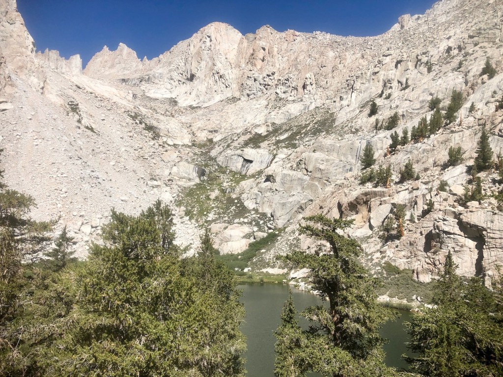
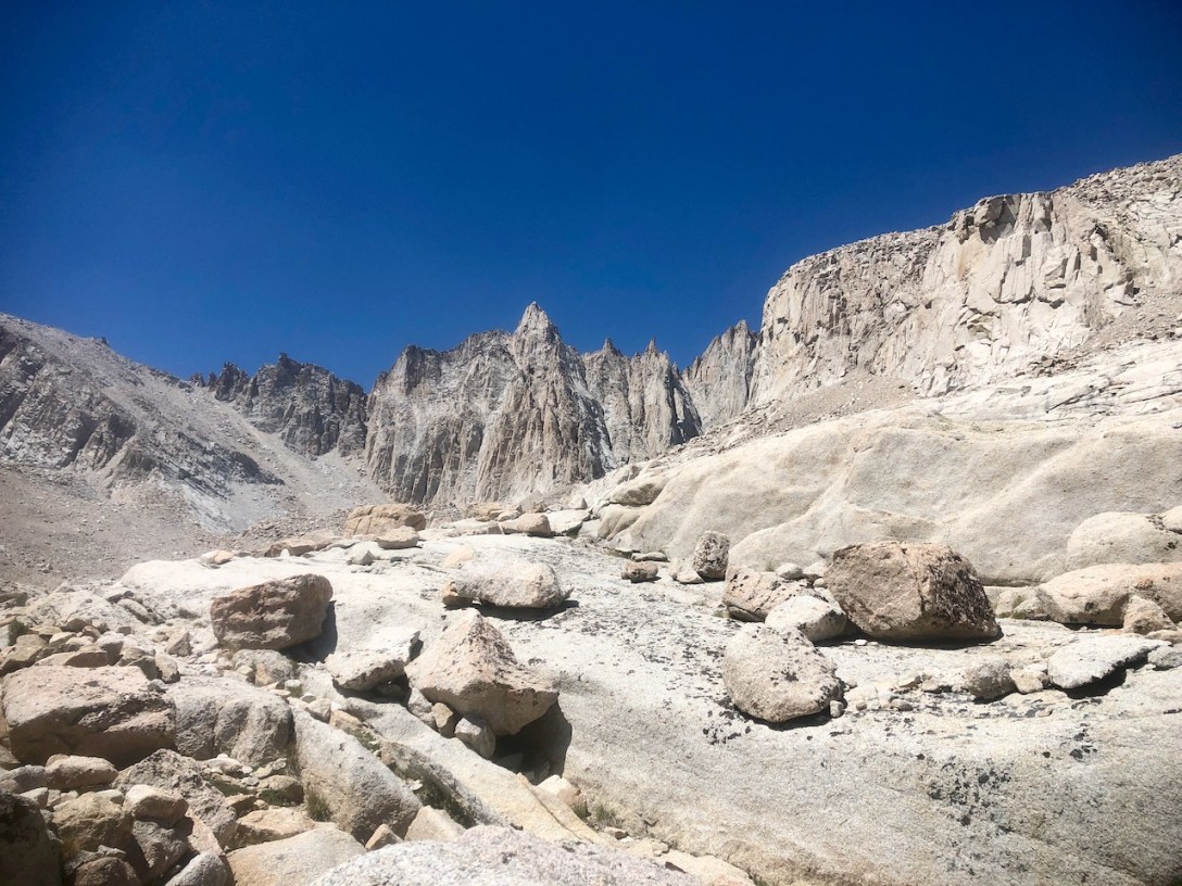
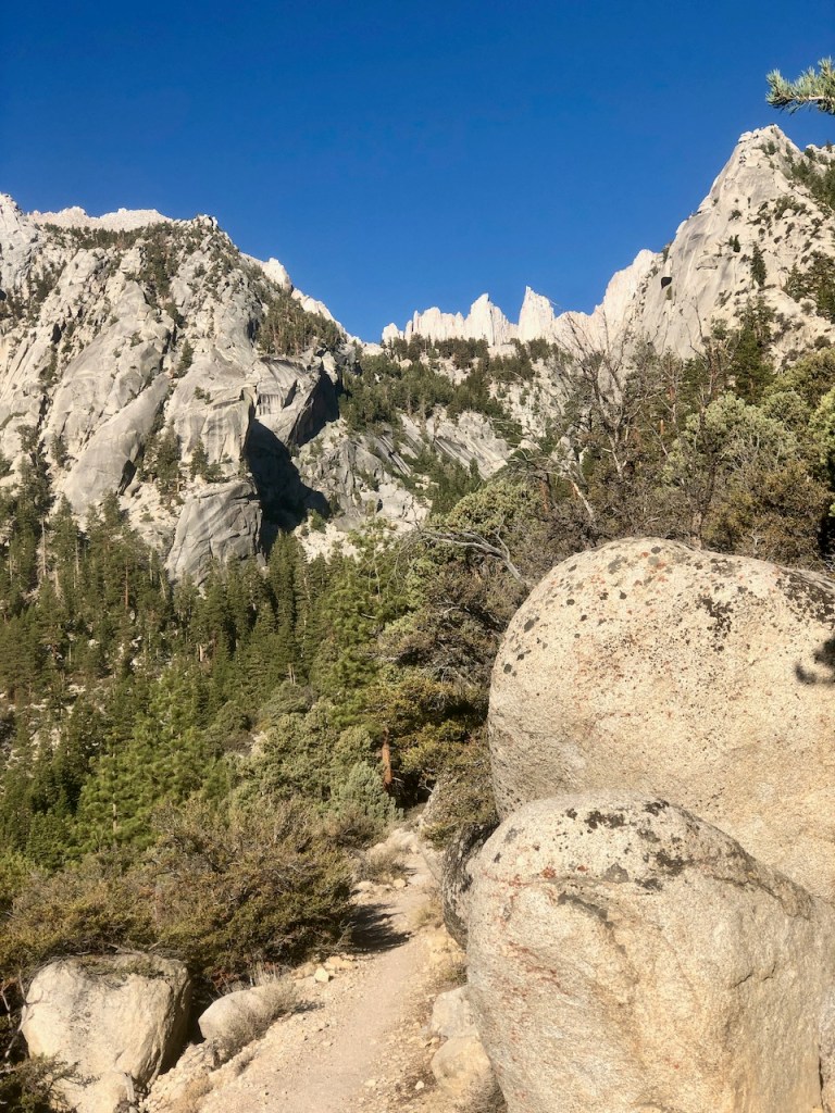
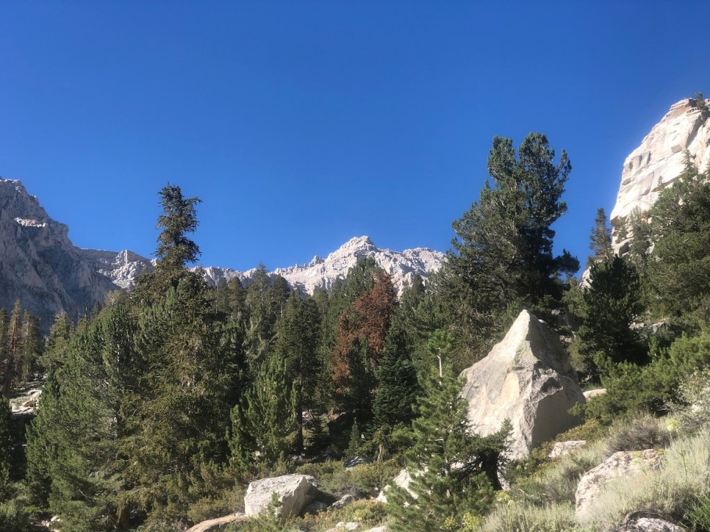
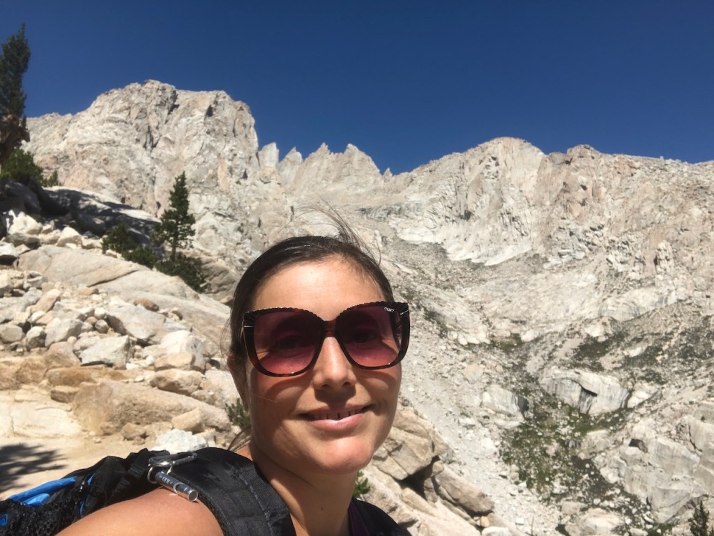
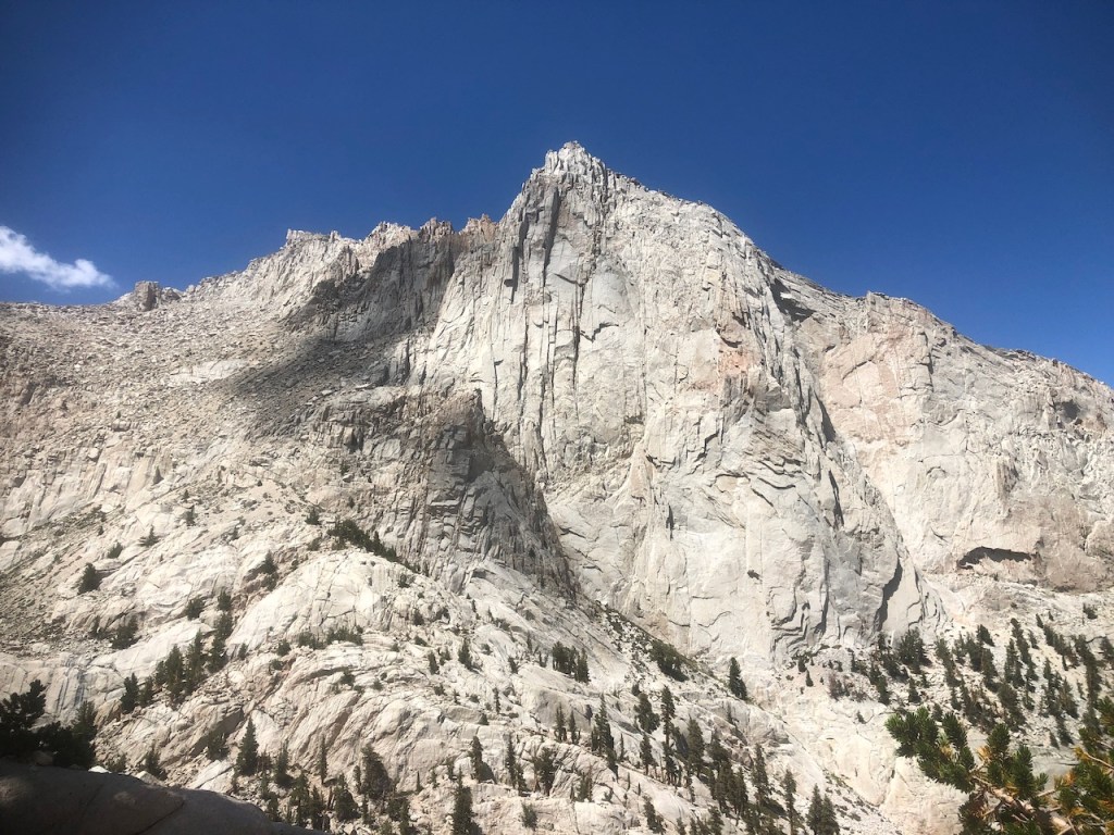
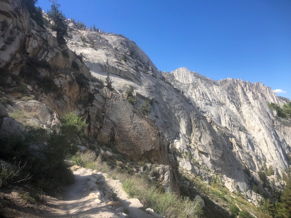
The climb up from Mirror Lake did get a little confusing, as you traverse over large slabs of granite. There were lots of cairns set up, which was helpful. It was like a beautiful amphitheater here, and I started to see pointed, spindly spires, in the distance. I knew I would soon see Mount Whitney.
I was starting to get warm now on this sunny day. Shade was no longer an option, amongst all this granite. At high altitude the sun can be harsh. I was definitely getting a tan today.
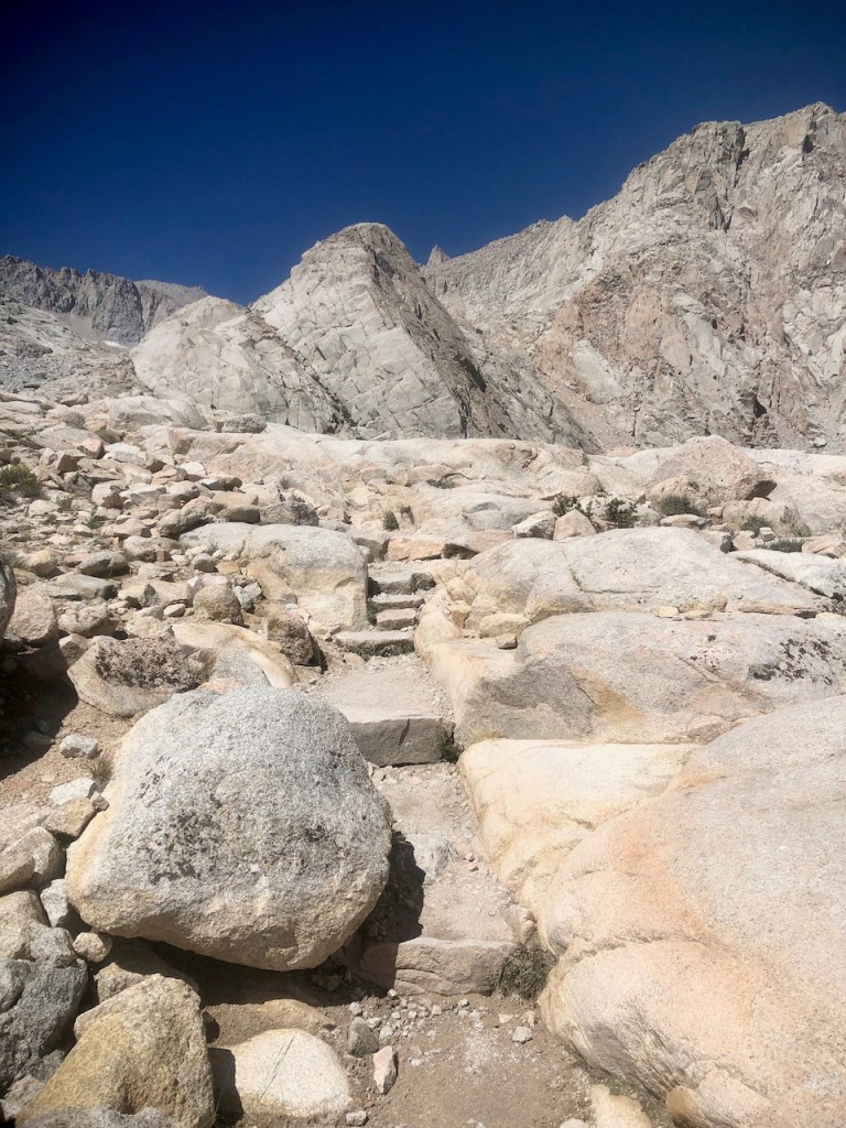
I turned the corner, to see the real stairway to heaven. Off in the distance, I could finally glimpse, just a sliver of Mount Whitney, the tallest peak in the lower 48.
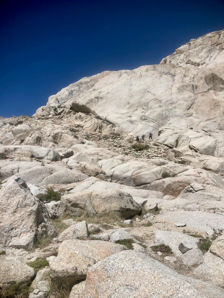
I happened to notice a group of climbers up ahead of me. There were some hikers and climbers here, but not nearly as many as I imagined.

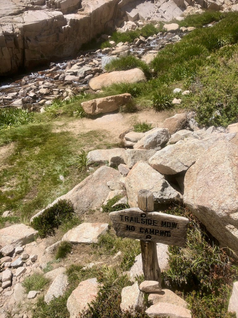
I stopped just before Trailside Meadows, with it’s gradual, cascading falls, and decided to stop for a moment to take it all in.
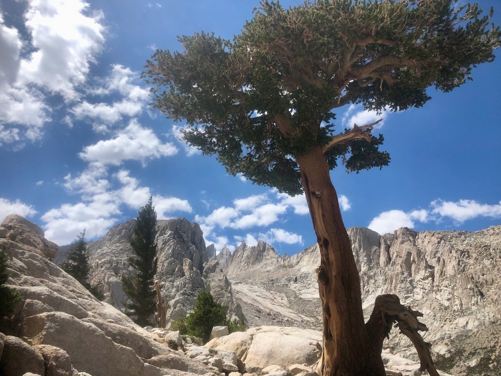
At this point, I was starting to fade a bit. I was about 5 miles in on my hike. I took a short break and had a snack, under a wayward tree, one of the last I would see, this high up on the trail.
Again, I filtered no water, since I had brought plenty.
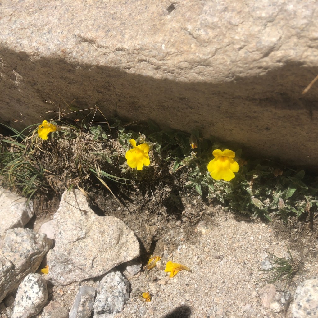
I had never seen these flowers before, but had to take note, of these rare beauties, growing about about 11,500 feet.
I passed over White Pine Creek, which flows into Lone Pine Creek at Trailside meadows, and kept on climbing.
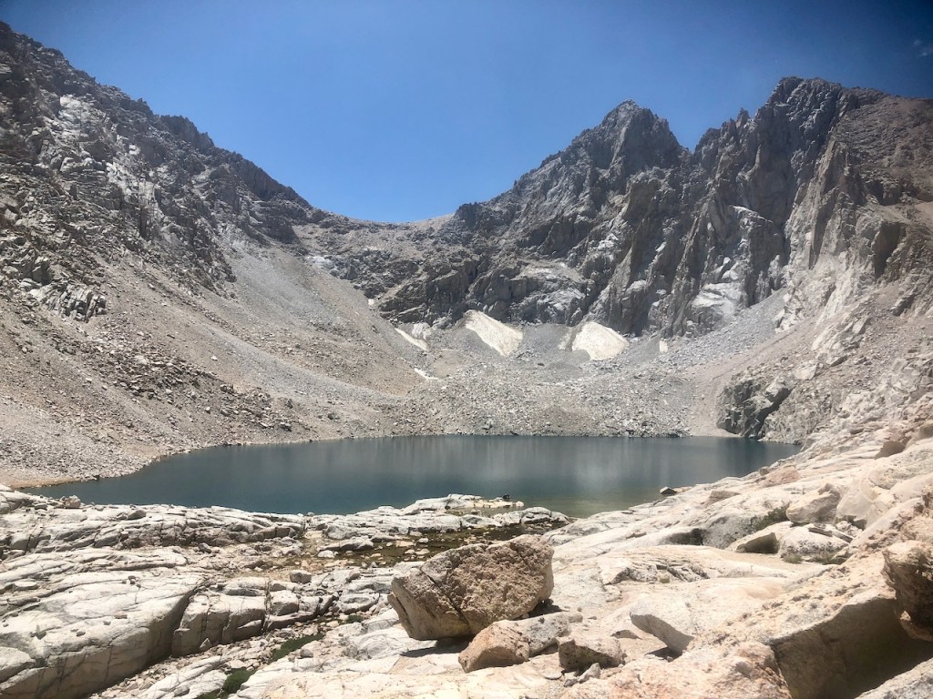
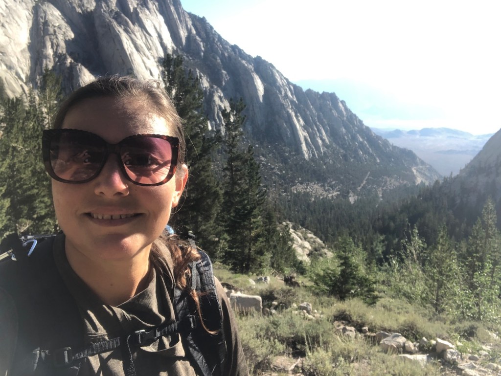
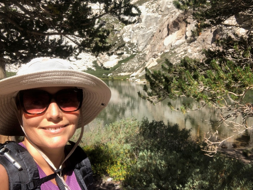
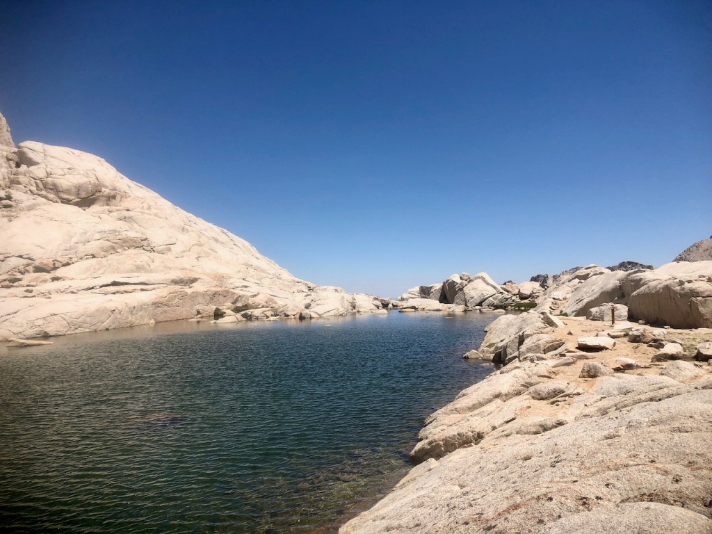
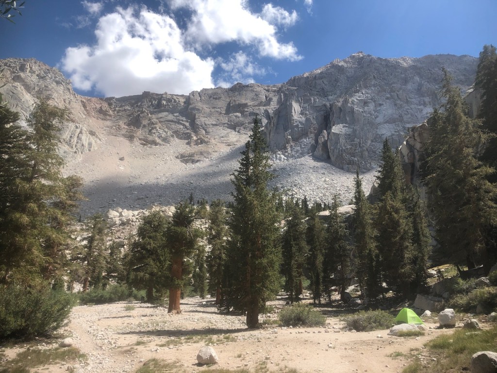
By the time I reached Consultation Lake, I had climbed about 2700 feet, and past three alpine lakes. Already, I felt like the hike was well worth, were I to just turn around right there, and head back to my car. I decided to press on, and climb higher on to Trail Camp.

Finally I could bee Mount Whitney, like some castle in the sky, hovering there above me. There is no way to see from this point, that as far as I had climbed, I had about double that to summit Mount Whitney.
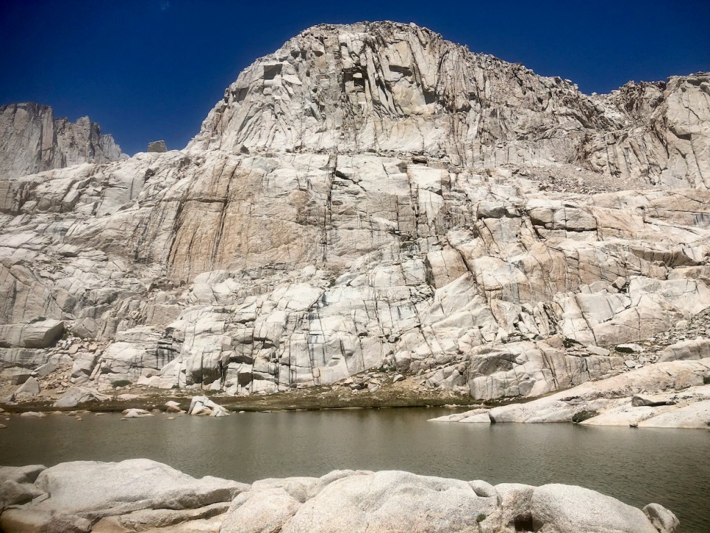
I finally reached Trail Camp, with its small lake. I had logged 7.5 miles on my recording of the hike. It would be another 7.5 back. I was exhausted, and knew it was debatable if I should continue any further.
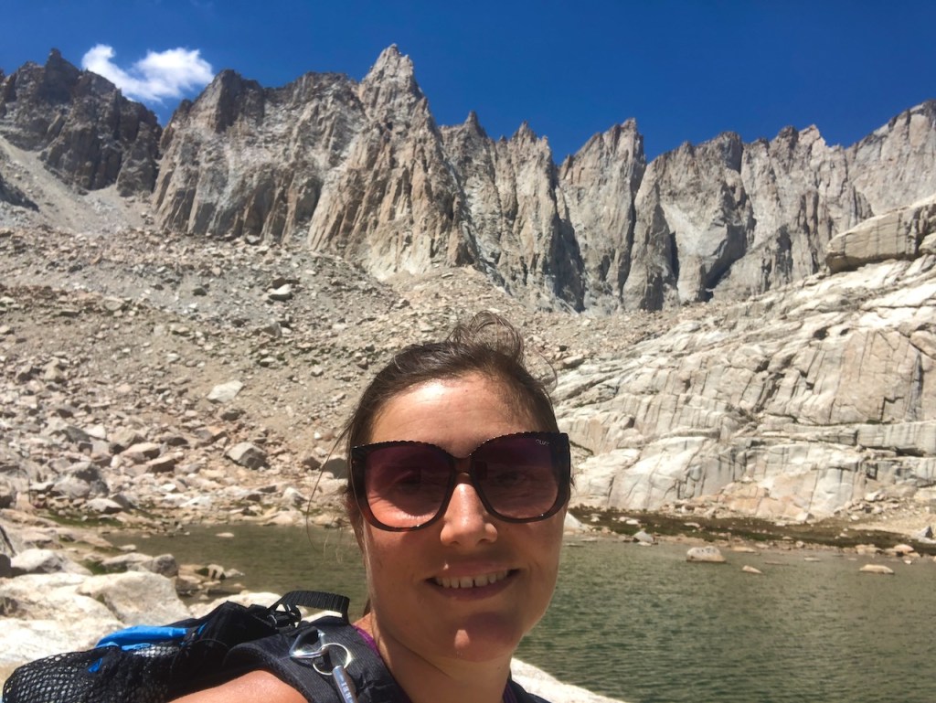
So I sat for a while, enjoying the view, and ate lunch in the Mount Whitney Amphitheatre. Were there not a trail to the summit, is this view alone, not worth the climb. I thought so, and realized hiking up there so late in the day could potentially result in me getting stuck in a lightning storm.
It was about 1pm. I knew it would take me about half the time to get back to the car. The climb is always slower. I hiked at about 1-1.5 miles per hour at times, heading up here, which is a slow pace. I did not have much sleep, and was feeling it. My concern was making it back to my car, and home, without passing out.
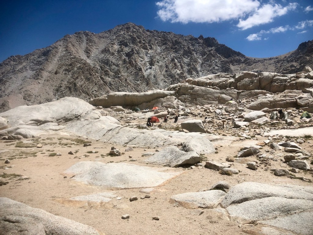
There were lots of people camping here at trail camp. I happened to chat with a couple of people about what I was planning to do. I met a girl just finishing her John Muir Trail adventure. She was in great spirits, and I talked with her about the experience. I knew I had a JMT permit for September. All there was to do now, was plan for that, and I could be right back here, in just over a month.
So ultimately, I placed myself on a downward trajectory for Whitney Portal.

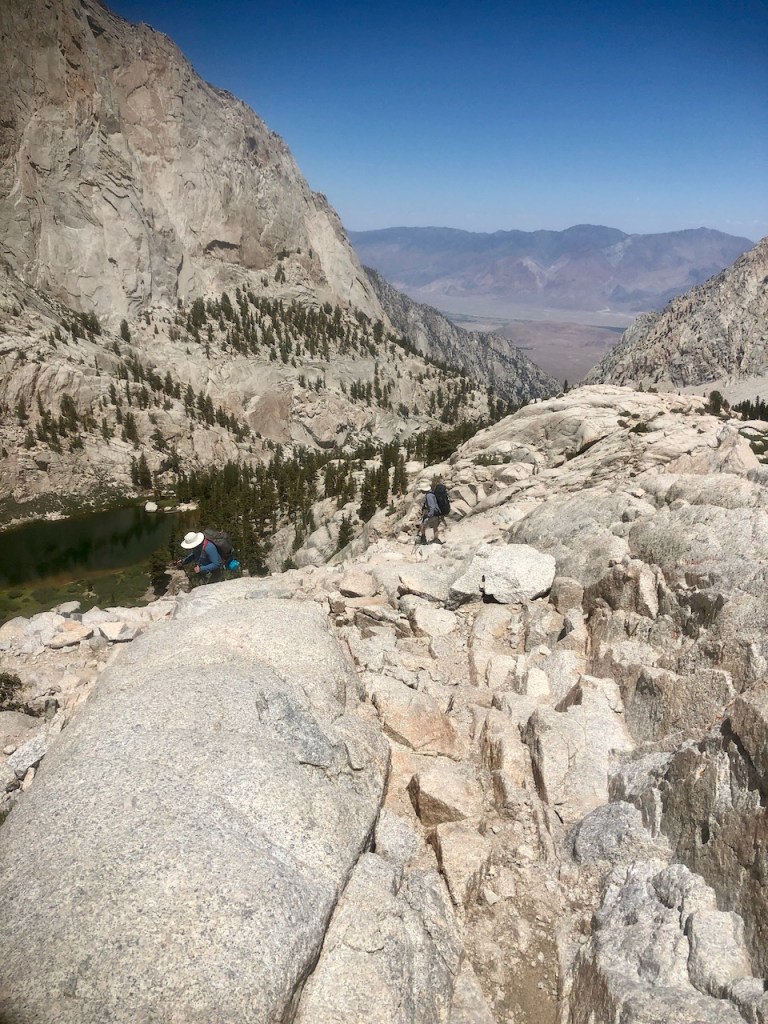
I breezed on by Mirror Lake, and through the confusing granite section. The stairs going down were particularly hard on my knees in reverse.
I bid farewell to Mount Whitney, and its granite spires.
The afternoon sun was casting interesting shadows on all the granite. There was no shortage of beautiful views.
I passed by Outpost Camp, noting one lone tent still set up. I felt like this was a good Sierra shakedown hike to get ready for hiking the JMT.
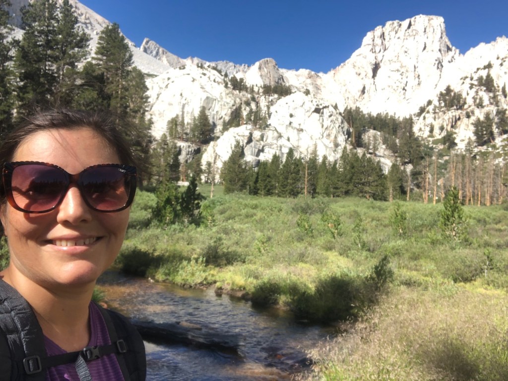
Part of what I loved about this hike, was I was doing it my way, on my terms, hiking at my pace, going solo.
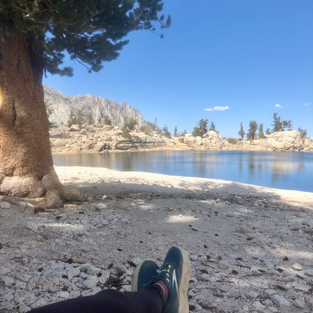
I decided on one more break at Lone Pine Lake. I knew people do swim here, but opted not to this time.

This is the bag I took with me on the hike. It was a shakedown hike for my new gear. This is the Zpacks Arc Air ultralight backpack, was going with me on the JMT. I loved this pack on a day hike, and think it will do nicely on a backpacking trip as well.
After Lone Pine Lake, I headed down the last few switchbacks back to the portal. I tripped on a tree root at one point, and fell over the edge. I was kind of wobbly, and exhausted. Not hiking further was a good choice. If I had an overnight permit, then maybe I would have, but I did not.
It was so long to the Sierras, until next time, whenever that would be. Would it be the JMT? I sure hoped so. I hoped I would be ready.
Whatever the future would hold, I had completed a full day long hike in the Sierras, hiking to 12,000 feet, and I was proud of that.
Whitney Portal
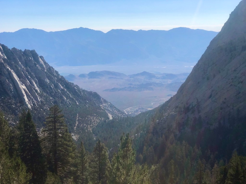
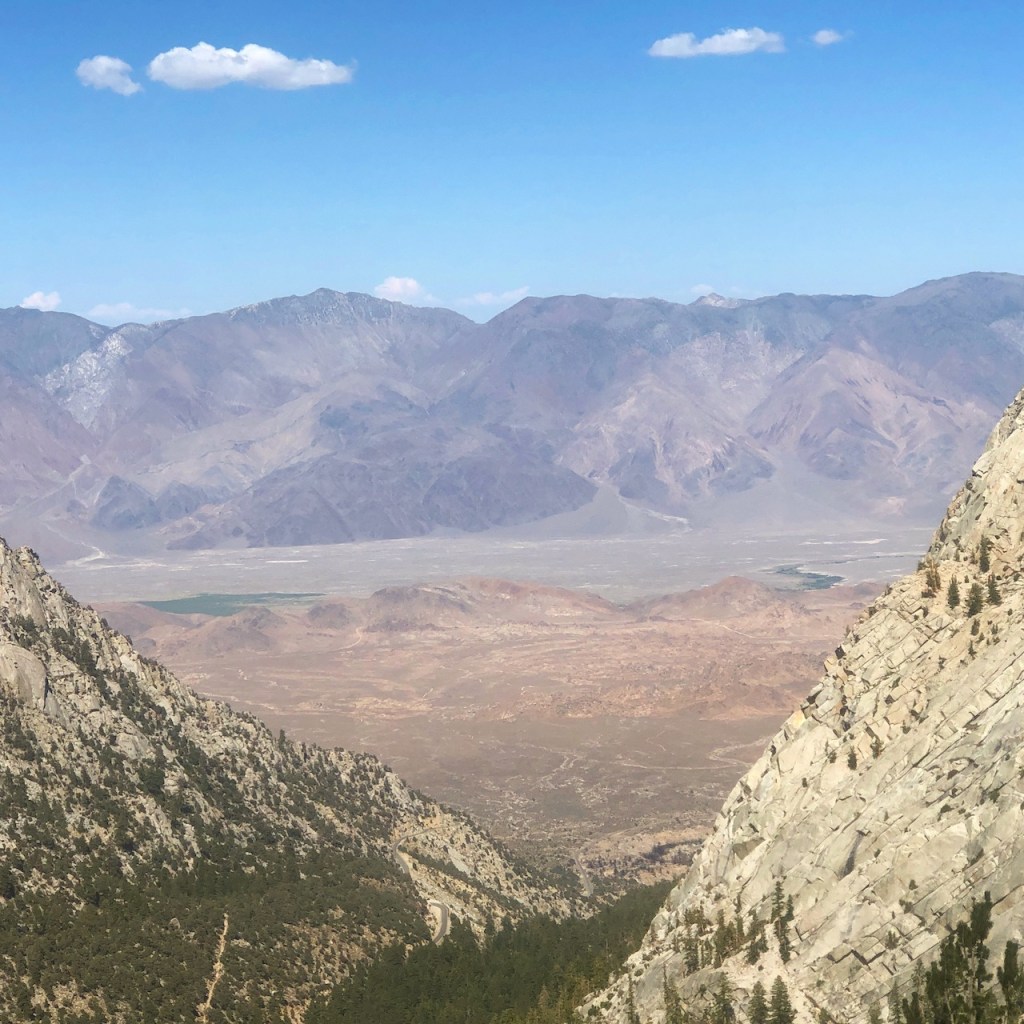
I made it back down the last stretch of trail to the portal, down several switchbacks. There was a unique and amazing view off in the distance, stretching from the granite cliffs of Whitney Portal, to the red sun baked foothills of the Owens Valley, to the purple mountain peaks of the Inyo Mountains. It was so beautiful here.
Phone Service
I managed to get phone service, around a mile or so from the portal, and sent a text to my daughter to let her know I was ok. There is no phone service at the portal though. I arrived back at my car at 4:30pm, had a quick bite to eat, and headed on home to Orange County.
I had hiked 15.6 miles in one day, according to my alltrails recording. According to alltrails it is just 12 miles to Trail Camp roundtrip. I am here to tell you that is inaccurate. I added about .25 mile to Lone Pine Lake, but the hike to Trail Camp and back is 15.35 miles.
I had driven about 9.5 hours round trip, and I was literally exhausted. I recommend staying the night in a hotel, or at Whitney Portal, should you do this hike, or go the entire way to the peak. Driving after a long hike like this is not advised. But that is up to you of course.
Whitney in a Day
Hiking Whitney in a day in no small undertaking. Even though I decided to play it safe, listen to my body, and head back when it seemed right, I had no regrets I did not make a push for the peak. I had a beautiful day hike in the wilderness. Mount Whitney would be there, and I knew that someday, I would be back here, once again.
You can read about my summit of Mount Whitney here. It was not via the JMT though, as I imagined it would be.
Hot Summer Nights
I could have literally died just driving out to Mount Whitney on that hot summer night.
When I left Orange County, with 107 degree temps in the Lone Pine area, for some reason I never considered the fact I might get sleepy on the late night drvie, and how I would handle that. I would never repeat the scenario that followed.
The long drive to a trailhead, when to take it, and when not two are things I will be taking into account on future trips to the Sierras, or anywhere I hike. It was in the 40s and 60s on Mount Whitney, when I headed out there on August 1st. But in Lone Pine, and for much of the drive to the Sierras from Orange County, it was very hot, and over 100 degrees. You drive through a desert, and that is something to take very seriously.
Sleep Monsters
I started to get sleepy driving out around 9:30 or 10pm while driving along Hwy 14.
I was somewhere between Mojave and where Hwy 14 intersects Hwy 395. So I pulled over on the side of the road to rest. Up ahead on maps, I could see there was Red Rock State Park. I reasoned I could camp there, with the windows down, and that a State Park was maybe safer than the side of the road.
It was brutally hot outside, near 95 degrees at night, and I was worried to run the car a/c while sleeping, risking possible carbon monoxide poisoning. So I cracked the window a tad, fearing for my safety. That plan did not work. I was too hot to sleep, and very uncomfortable there on the side of the road. I was far from home and wanted to make it there. But could I?
After a quick cat nap, I got a slight bit of energy to drive on further, driving right by Red Rock State Park. I was so tired at this point. I continued on to Hwy 395, but had to pull over again, about 45 minutes later, at a rest stop south of Lone Pine, called Coso Junction Rest Stop.
I was now about an hour away from Whitney Portal. It was around 11:00 pm. Again, I cracked the windows, and tried to sleep. It was impossible, since it was almost 95 degrees out, still. After 30 more minutes of trying to sleep, and using their restroom I forced myself to drive on.
This drive had become a very dangerous endeavor, on this hot summer night. Mount Whitney permit or not, this was really a terrible idea. I was endangering myself, not having a safe, cool place to sleep. My body just kind of shuts down when I am sleepy. With a thyroid condition, sleep can be a tough one for me, and fighting through it is not always an option, especially driving at night. I had basically screwed myself. I could fall asleep with windows open, in the baking heat, or drive on, possibly falling asleep at the wheel. Neither seemed like good options.
Leaving Coso Junction
I drove off from Coso Junction. I would pull over one more time, about 20 minutes later, off on the side of the road on HWY-395. I closed my eyes, with the a/c on this, but set an alarm to wake me in 15 minutes. I came to my senes, with barely anything left in me, and drove on towards Lone Pine, before making the turn on to the twisting road leading to Whitney Portal.
It was about 1am when I arrived. My plans to get there, sleep a few hours, and start at 3am, had faded. I don’t do well with lack of sleep. I have always needed a solid 7.5 hours. As I got older 5 or 6 would be doable. But when I nod off, there is nothing to stop that from happening. I was bobbing and weaving on that road. I easily could have fell asleep at the wheel.
The Drive Home
After climbing to trail camp and back, it was 4:30pm, and after a quick meal at my car, I hit the road. Little did I know, I would have another repeat of the night before, and again, struggle to stay awake on the way home. Around 8:30pm I ] pulled over in a shady area of Lancaster or Palmdale, at a gas station again to attempt to sleep. Rolling windows down in a shady neck of the woods was not an option. I left the A/C on this time, and set an alarm.
Road trips when it’s hot, they frankly are no good, and must be well planned.
Moral of the Story
I learned so many life lessons on this journey. I feel inclined to share them with you. Here is what I learned.
Don’t take road trips late at night, or long drives post long hikes, if it involves night driving, in the summer, when the temps are over 75 degrees at night.
Driving post a 15.6 mile hike is not a good idea, if it’s for more than an hour.
I was fine for a short while, but night driving when I am tired does not work.
If I was going to Mount Whitney again I would leave in the morning, for the drive, and stay overnight, leaving the next day. I would give myself 3 full days for this.
I would not chance driving in these hot temperatures without a hotel available along the way to cool off.
Driving late at night is a bad idea in any weather.
The drive was more dangerous than the hike.
I took on too much, and learned it is not worth endangering your life. Whitney in a day from Orange County is not really an option, unless you have two more days, one to get there, and one to get home.
I hope you enjoyed reading this, and it is helpful in knowing what to expect, should you decide to visit here.
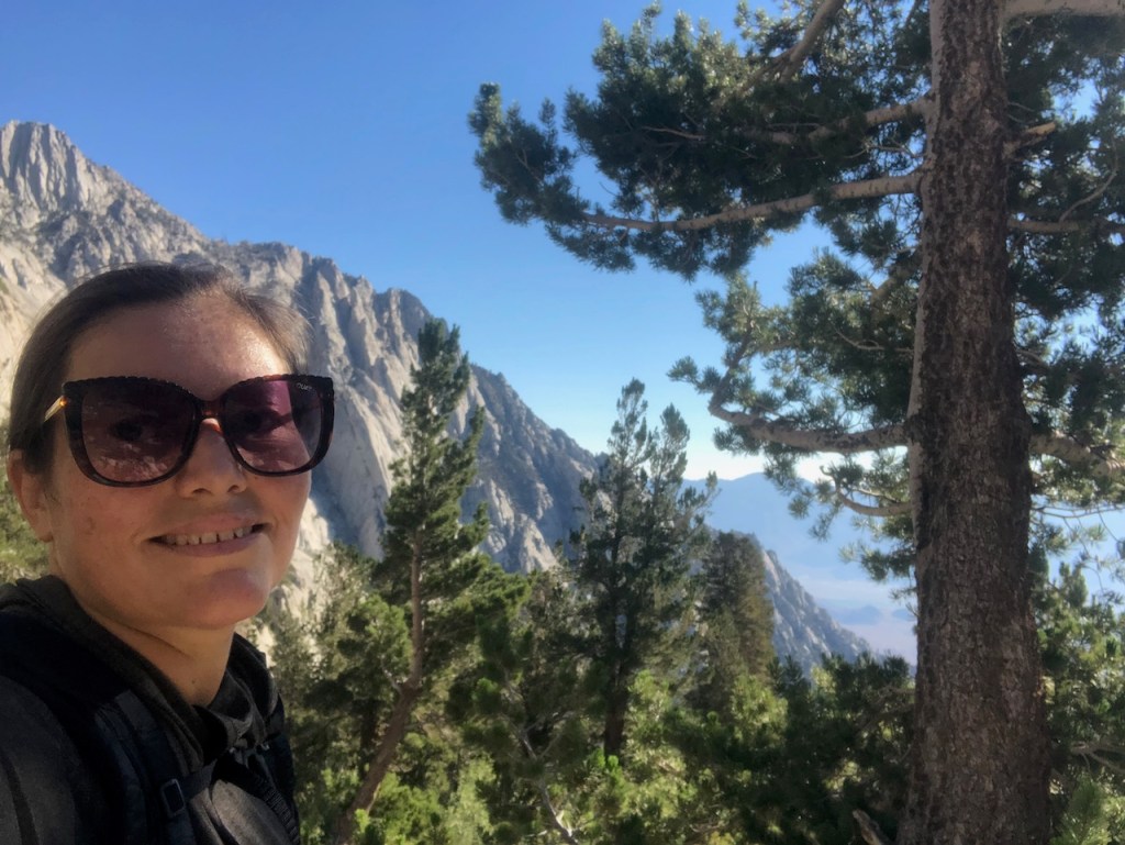
About me
I’m Serafina! I’m a writer and California girl who loves to go exploring. Hope you will get outside today, breathe some fresh air, and be happy!
Follow my Journey…
Be sure to Like and Subscribe to My Youtube Channel where I post videos!
Disclaimer: The work on this blog is my opinion and my opinion alone and I am not responsible for the outcome if someone were to apply these thoughts to their own life. All text and photography copyright 2021 by Serafina, all rights reserved. Information and opinions provided are kept current to the best of the author’s ability. All readers’ usage of the ideas and opinions presented in the blog, are at their own risk. Be aware of the possible dangers of hiking, surfing, walking, cooking, and other activities, which may take place indoors or outdoors. By reading this, you agree not to hold the author or publisher of the content on this web site responsible for any injuries or inconveniences that may result from reading the blog, or partaking in any activity mentioned in the blog. Read the blog, and use its ideas, if you so desire, at your own risk.
