
Sitton Peak is one of the high peaks located along Ortega Highway, a winding twisting 2-lane road, leading from San Juan Capistrano in Orange County, California toward Lake Elsinore in Riverside County.
Quick Facts
Elevation: 3225 feet
Trail Length: 10 Miles
Gain: 2083 feet
Parking: $3 day use or Forest Service Pass or National Parks Pass, parking lot is across the street from the trailhead.
Restrooms: Pit toilets at parking area
Cell Service: 1 – 2 bars for Verizon
Location: About 45 minutes from San Juan Capistrano, in Orange County. Located in Riverside County on Ortega Highway in Ortega Oaks, CA.
Directions
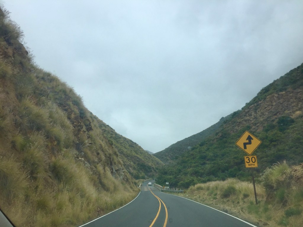
The road to the trailhead here, is a bit of a harrowing experience, since there is no shoulder in many areas. There are several overlooks, and pullouts though, which might tempt you to stop, for photos. This road has a history of dangerous and deadly collisions, when people try to pass at unsafe locations, so proceed with caution.
The trail is located within the Cleveland National Forest, and parking is just off Ortega Hwy CA-74 in the hamlet of Ortega Oaks near Lake Elsinore, CA.
Heading east on Ortega Highway, from San Juan Capistrano, you will proceed through a canyon. The road will have many twists and turns, along with steep drop offs. Eventually you pass through an Oak forest, and reach the Ortega Oaks Candy Store.
Take an immediate left into the Cleveland National Forest Parking area, where you must display a Forest Service Pass, in order to park. This is also the trailhead for several other hikes, like Chiquito Falls, which only runs in winter after a heavy rain.
At the Ortega Oaks Candy store, you can purchase a Wilderness pass, good for parking at all National Forest trailheads in California, and to park in the lot, across the street from the trailhead, to the right of the store.
The Climate
It tends to be much sunnier, and hotter inland of Orange County, in the area of Sitton Peak, by ten to 20 degrees, depending on the season. Its a very scenic drive, to Sitton Peak’s trailhead from San Juan Capistrano. You will pass several other trails, and Caspers Wilderness Park, along with the remnants of San Juan Hot Springs.
The Trailhead
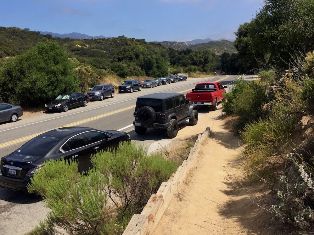
The hike begins by the Ortega Oaks Candy Store, to the right of it, on the south side of Ortega Highway. You may or may not see cars parked along the road. The way I understand it, you can park here for free, or in the lot across the street with a Wilderness Annual pass. The day rate is $3, but there is no pay machine, so you have to purchase the pass in advance, or at the store if its open.
I parked in the parking lot with my annual pass. There were pit toilet restrooms here, but the door did not lock, which was not very comforting. To access the trailhead I cautiously walked across Ortega highway.
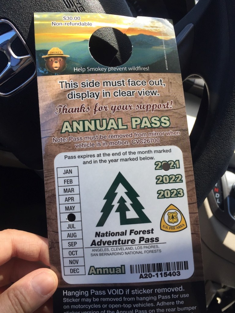
The candy store sells these passes, and they are about $40 for the year. You can also use a National Parks pass at Forest Service trailheads. You would need a hangtag for it to hang on the rearview mirror, as the passes will melt on the dashboard, if you were to just leave them there.
Maps
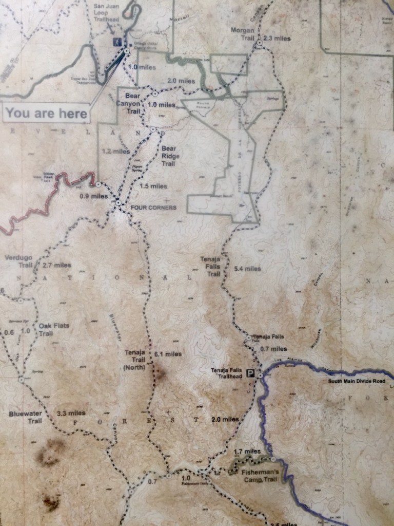
You will find a map here of the area by trailhead, adjacent the parking lot. If you have not downloaded a map in advance, you might at very least take a photo of it so you have a reference, in case you get lost. There are many side trails on this hike, and it gets confusing in some spots to know which trail goes to Sitton Peak.

Here is the Sitton Peak Loop alltrails map, you can download if you have Alltrails +.

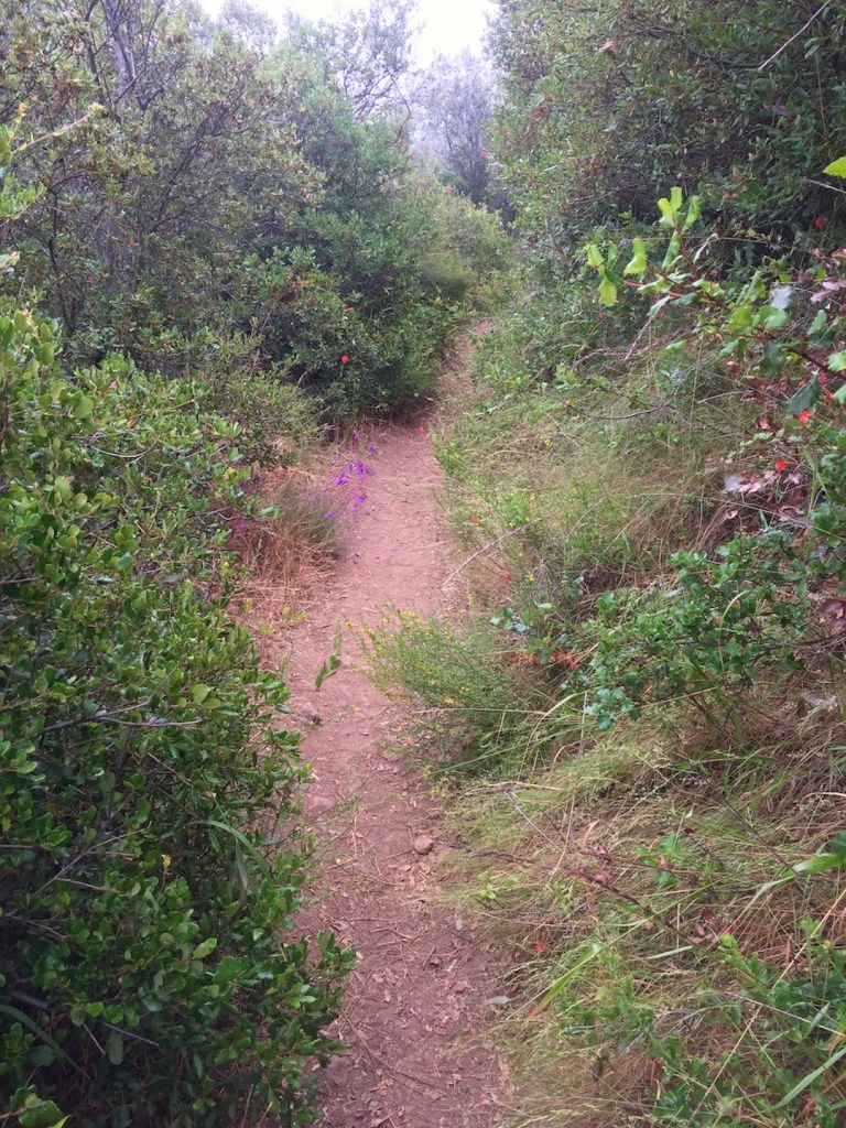
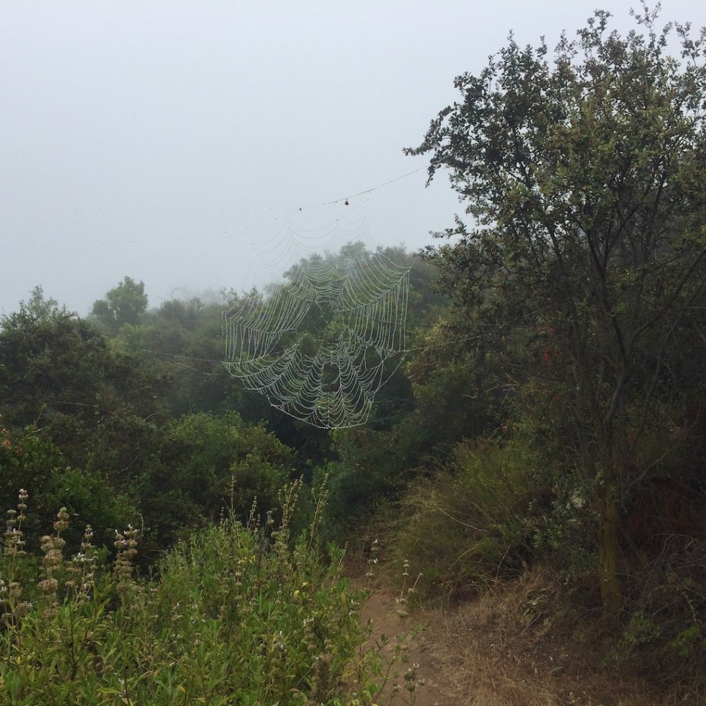
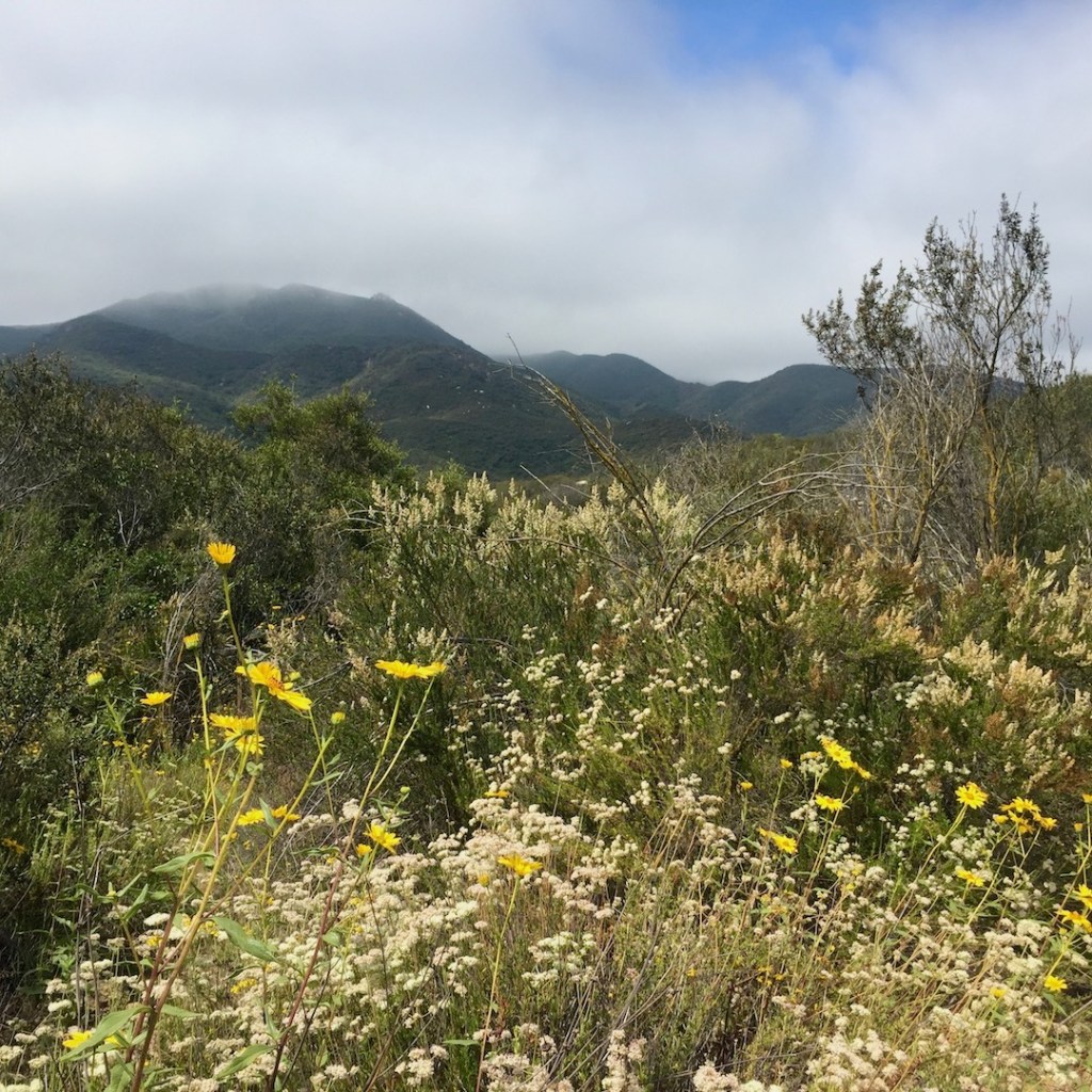
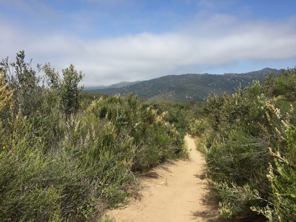
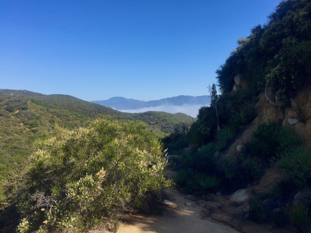
The trail at first is a narrow dirt single track. The sky was foggy and overcast on this particular morning, and perfect for hiking. It was fairly cool, in the mid 60’s, but set to reach 70 later in the day. I was passed by two trail runners early on, and for the rest of the climb, it was basically empty here on a Sunday morning.
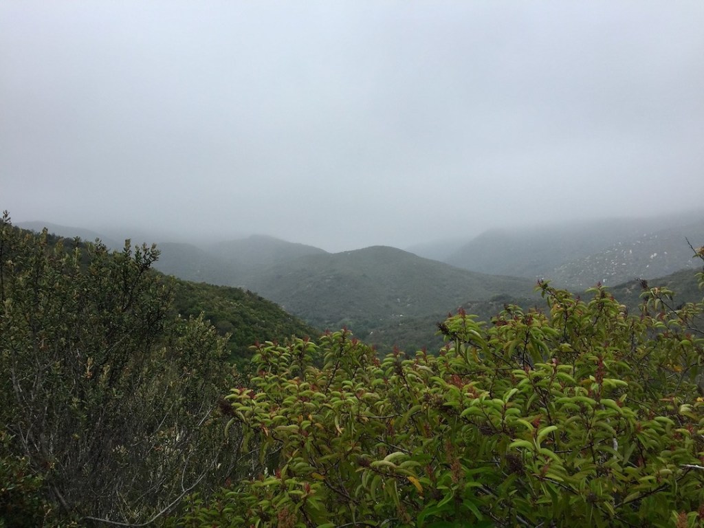
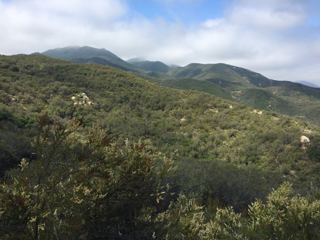
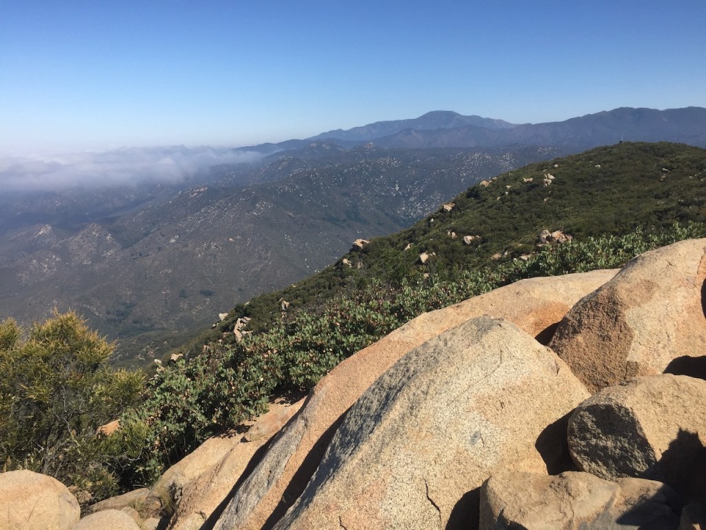
The mist of the marine layer seemed to lay like a blanket over the hills.
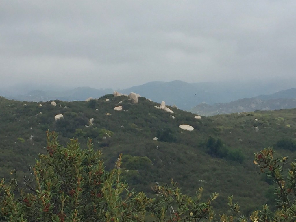
The large rocks tossed about the landscape here, are called batholiths. The ancient stone circles of Stonehenge came to mind.
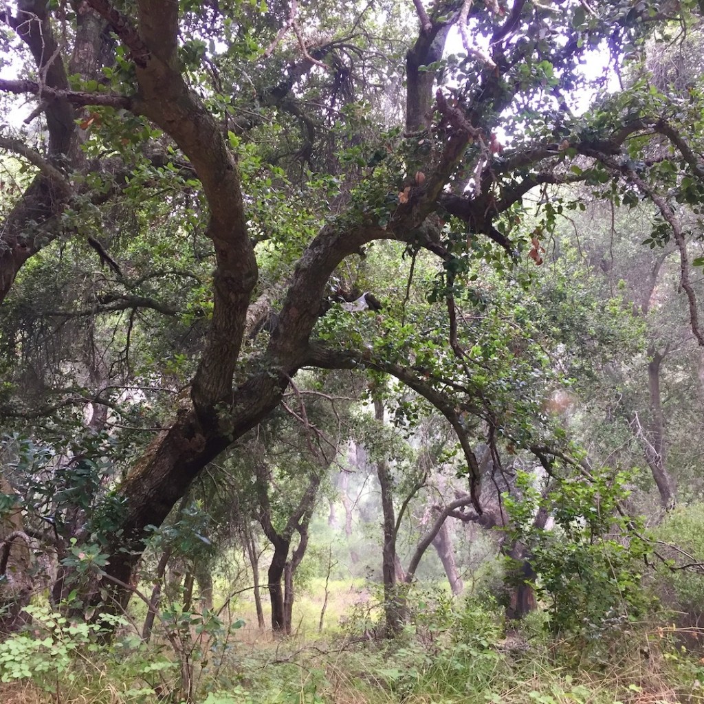
Eventually you enter an enchanted oak woodland.
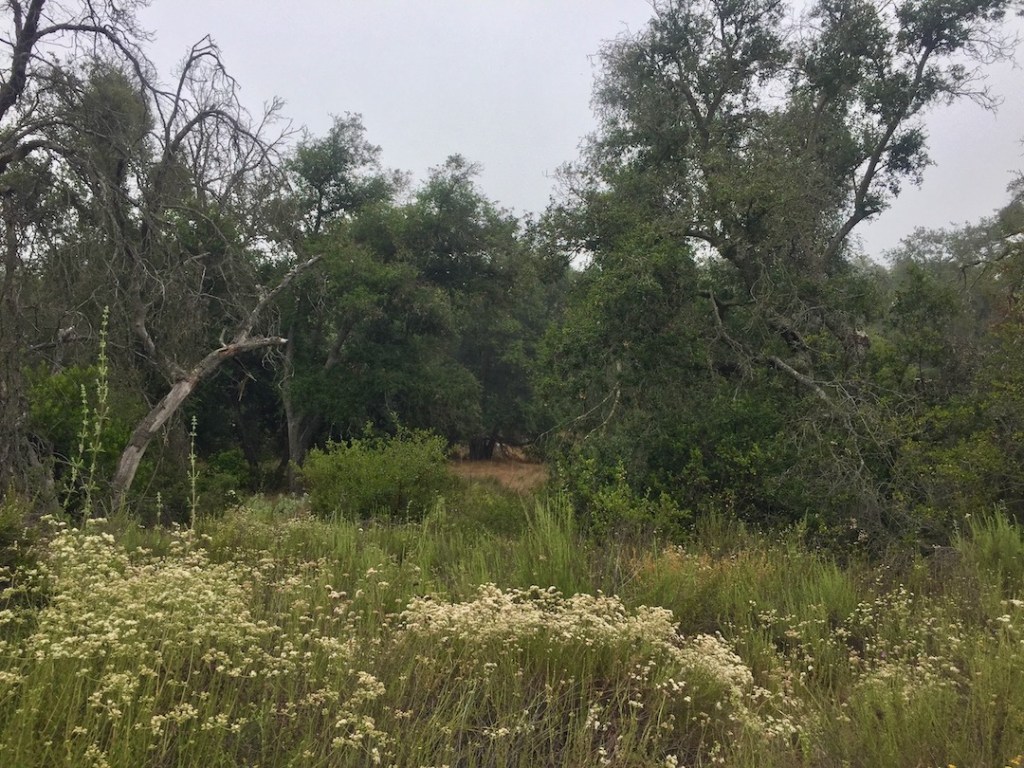
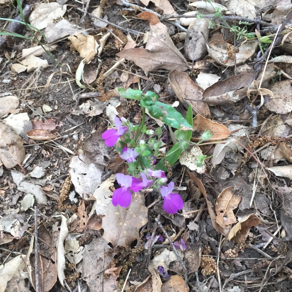
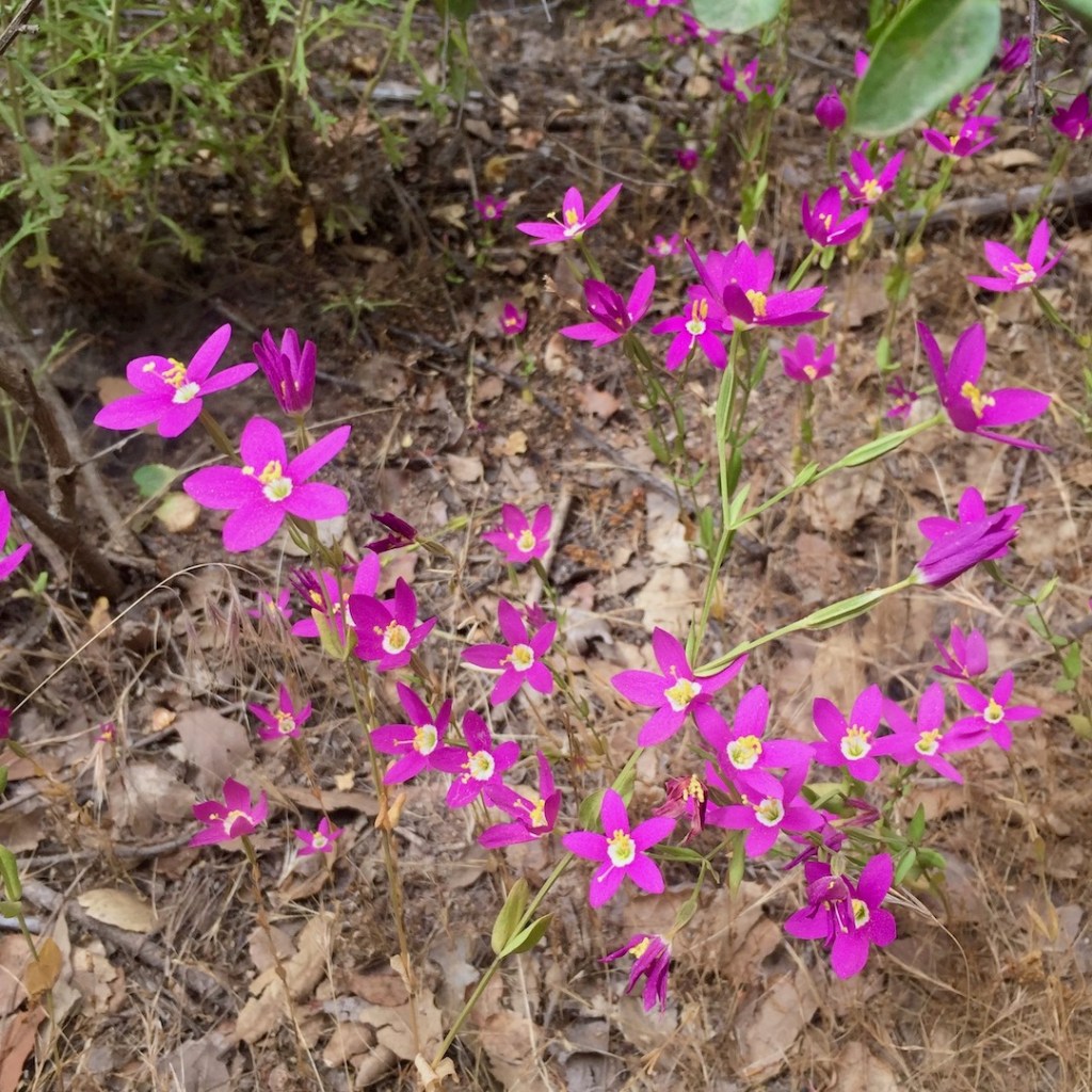
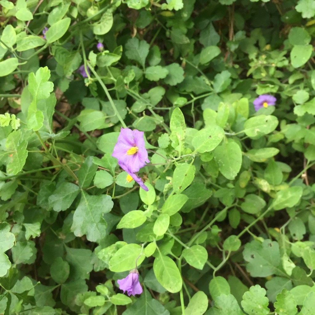
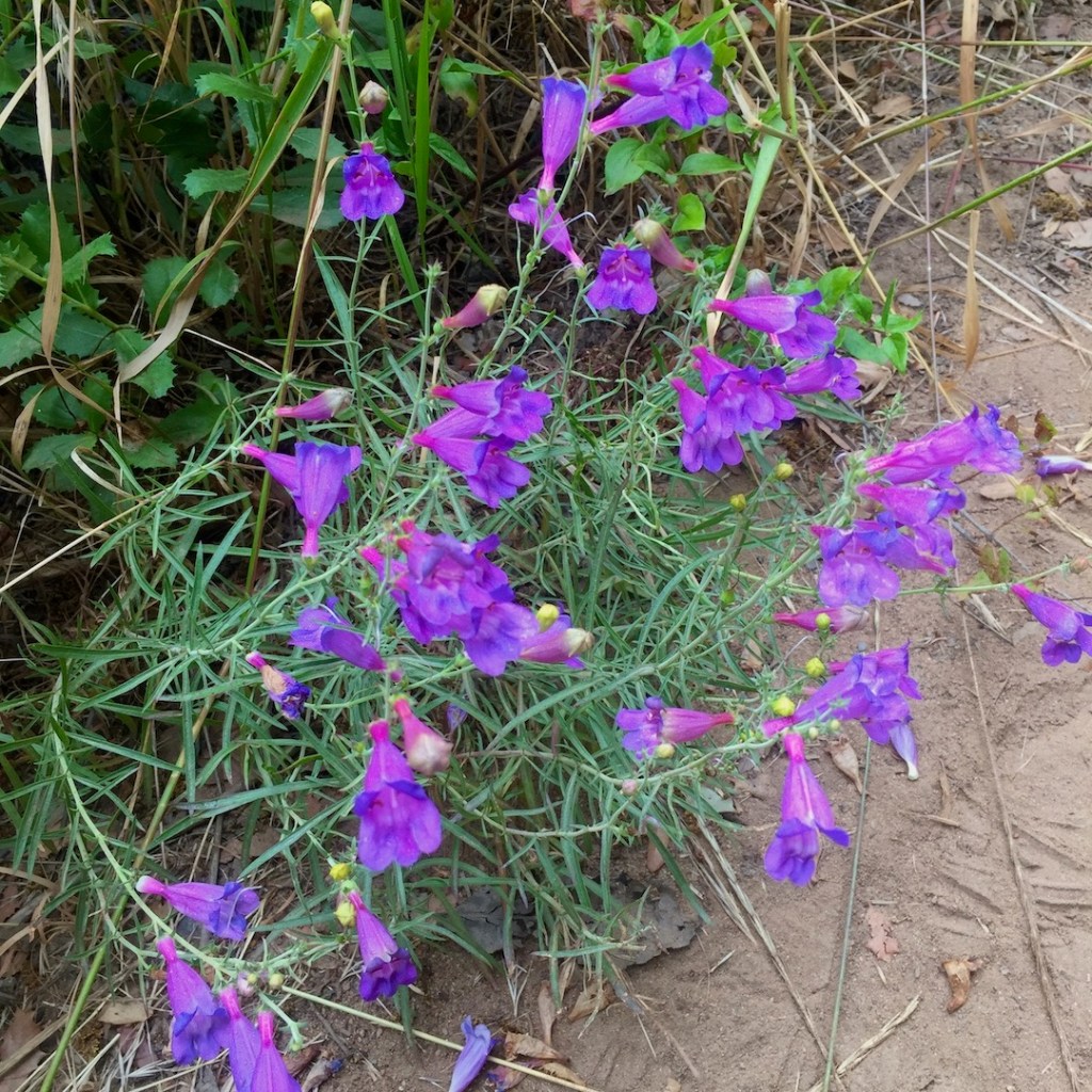
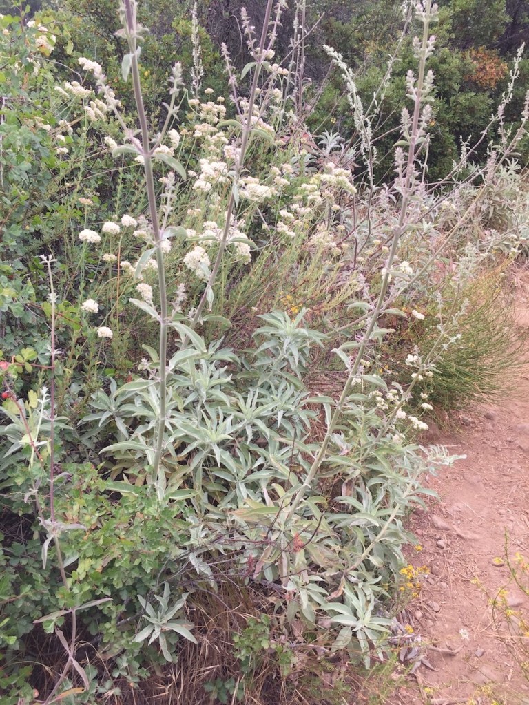
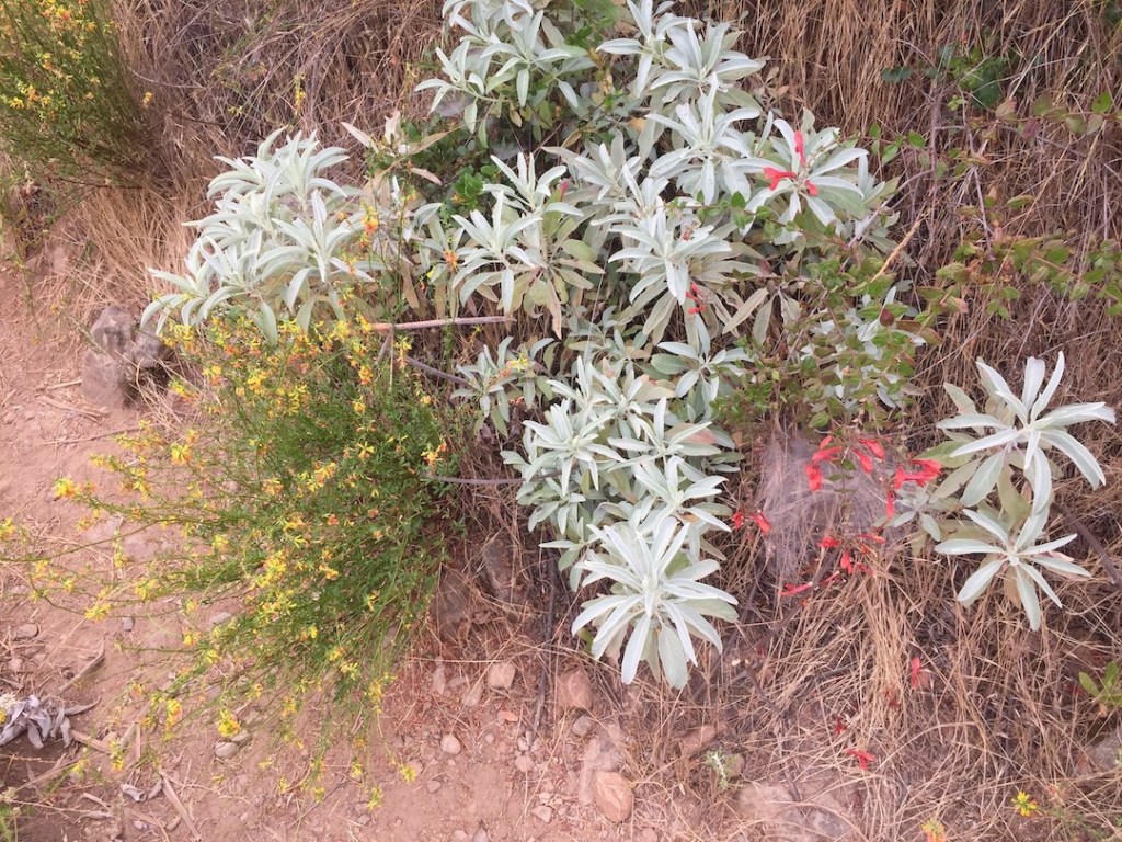
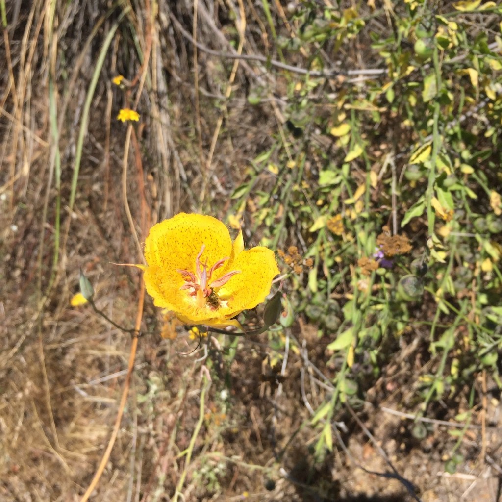
It was late spring, when I visited, and the flowers were all in bloom.
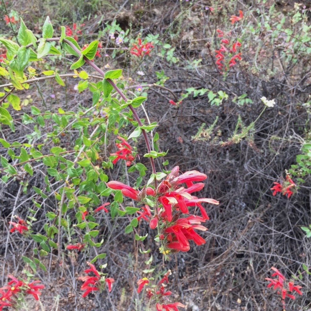
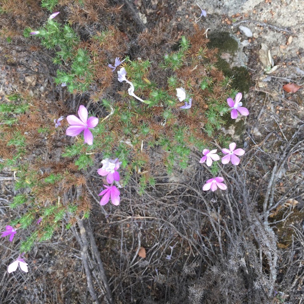
There were many in shades of red, purple, and violet.
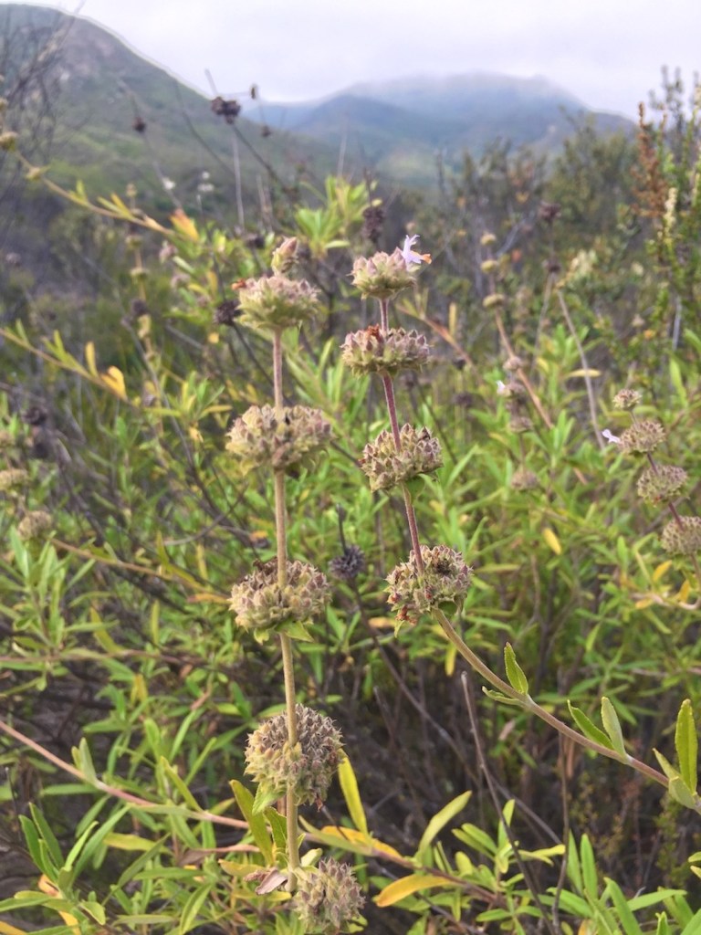
There was plenty of white sage, and also chia, otherwise known as salvia.
I was practically clearing the cobwebs, an honor only bestowed on the earliest of risers, the first hikers to make their way along a trail. What a perfect and intricate web you weave, spider.
The Bear Ridge trail, intersects Bear Canyon Trail, about 1.8 miles up. It’s a good turnaround spot. It’s as far as I got, my first time attempting this peak. It’s best to be prepared, and on that day, I felt I needed more water. I was right, and I am glad I went more prepared on my second attempt.
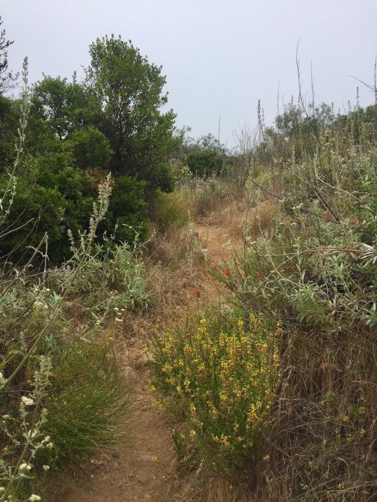
As I climbed higher along the ridge toward the first trail split, where bear valley trail branches off, the trail became overgrown. There were lots of small yellow blossoms of deerweed.
White Sage filled the air. A little brush tried to stop me, but I powered on through it.
Nothing bought in a store can quite compare to nature’s bouquet.
The white blooms, of chamise, and buckwheat, aligned the trail in abundance, intermingling with the buttercups.
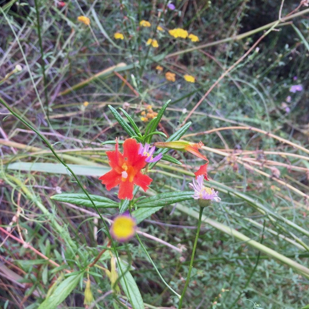
I spotted another favorite of mine, the red monkeyflower.
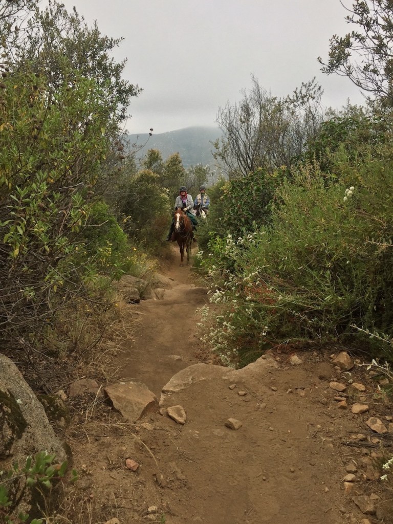
Finally some company, but not hikers, equestrians.
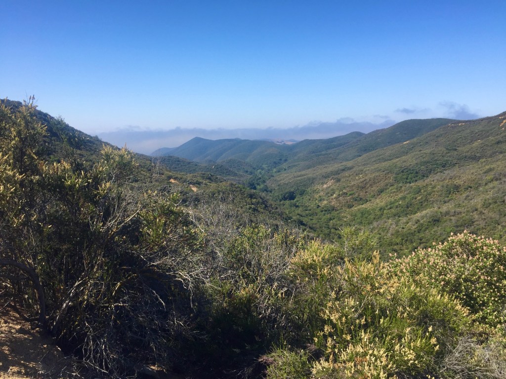
The clouds began to finally break, making way for blue sky, and the warmth of the day. So much for those cool hiking temps, it was time to say hello to sun.
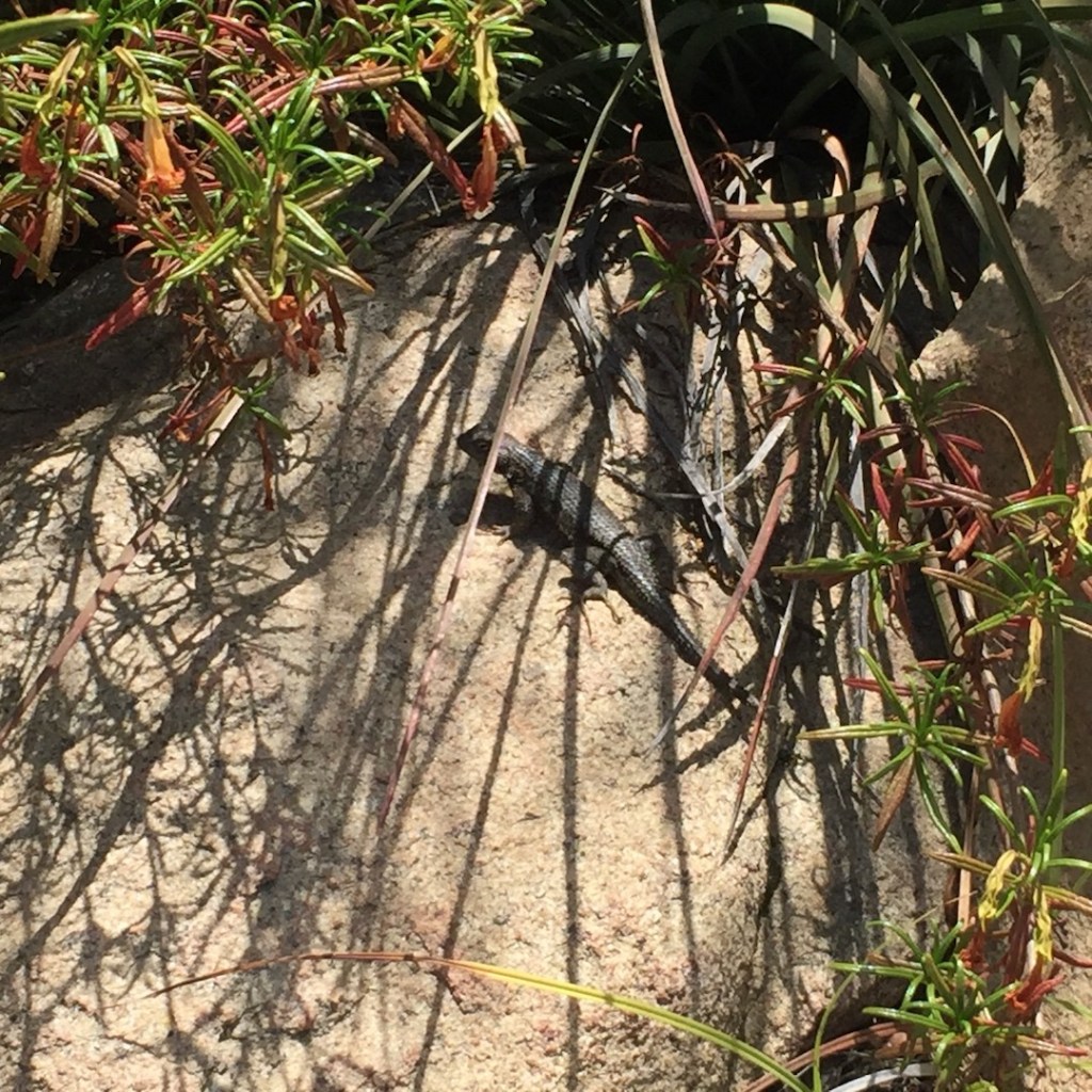
A lizard was enjoying the warmth on a rock. You will spot a lot of them here.
I was doing my best to overcome my fear of bees. It was a fear of the menacing kind who make chase, not the docile ones. They tend to come out and swarm as soon as it’s warm and sunny out around 10 or 11 am. They had started to be everywhere now.
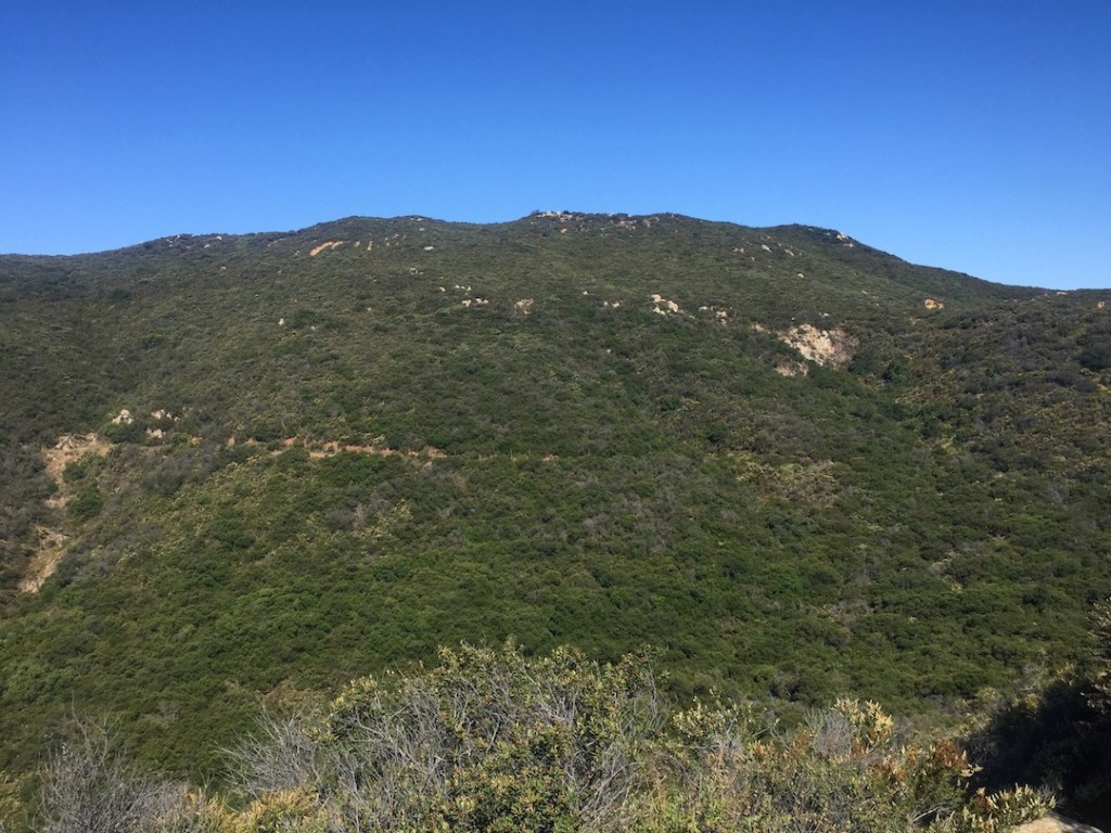
I passed the four corners, and took the appropriate trail. I was now more than halfway there. I could also see Sugarloaf Peak in the distance off to my left.

I kept a close watch on my map at this point. I kept thinking I saw the peak, only to find it was just another false summit. Many little side trails appeared here and there, leading to other lesser peaks unknown.
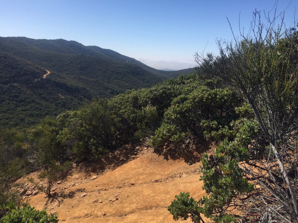
I began to descend again, and sighed. This meant even more climbing, and the heat of the day was sinking in. It was only getting warmer as high noon approached. I was feeling kind of exhausted at this point, since I was not in condition at this time. I had climbed about about 1500 feet in gain of the 2000 or so feet need to reach the summit.
There it was, Sitton Peak. It was hard to discern exactly where the summit was from this vantage point.
I descended a bit further, before climbing the last half mile to the summit. It was on a 40% grade for some of it. I had to put away my phone for most of the climb. I took my time since I had not brought trekking poles. At the time I did not even own a pair, and I immediately regretted that decision.
The two trail runners passed me again, when I was halfway to the summit, on their way back down. They were fast, and more in shape than I was at this time. I wondered in awe how they were able to run up a mountain?
I would later find, after I actually started trail running myself, that almost anyone who can run, can also run up a hill, with practice.
A half mile and almost an hour later, I had made it up that last steep climb.
Looking back at the steep climb, was such a relief. I was now just about there. I just had to find the official summit.
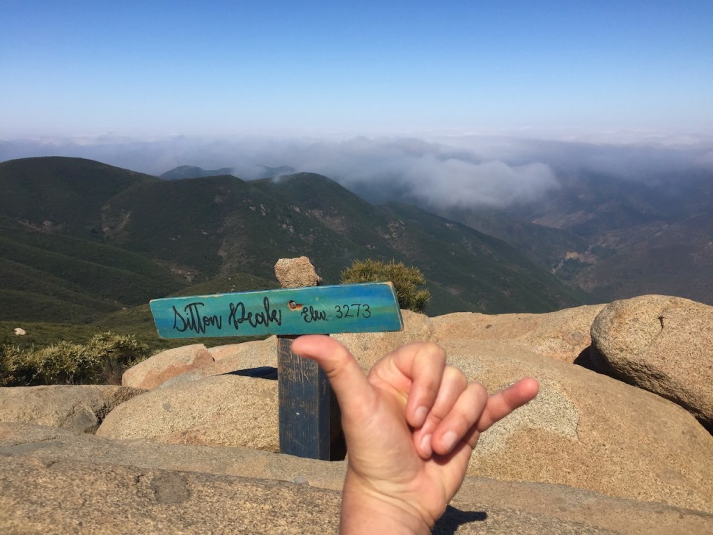
I did it!!! Sitton Peak complete.
I felt overwhelmed with emotion. It was Father’s Day. I was completing this hike in honor of my Dad who passed away, too soon. It was a reminder that sometimes you have more mountains to climb, but life is cut short. You just have to do it while you can. So here I was, and I did it.
I stopped for a bite to eat, and tried to thoroughly enjoy this spot, keeping in mind, the midday sun. After taking in the views, I said farewell to this peak, and began my descent back to my car.
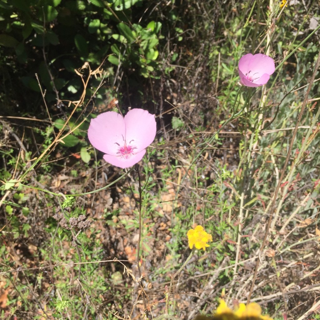
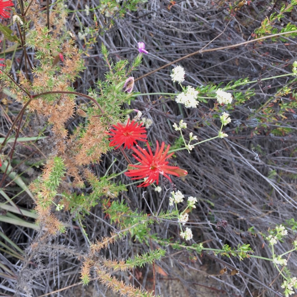
Along the way, I spotted some lovely rare beauties, you don’t see everyday.
The way back is certainly quicker than the way up. The parking lot was in sight.

I hope you enjoyed this hiking guide, and it helps you plan your future trip to Sitton Peak better, should you decide to go. Otherwise, see you on the next adventure!
Solo Hiking
This was not the first time I had hiked solo, but it was the first time I had hiked anywhere far from my house, on an unfamiliar trail alone. I thought I would just try hiking to one peak solo, and see how it went. That’s how it always begins. It was a great way to face fears, just being alone, and to contemplate life, during a time just about everyone was full of fear, during the_pandemic. I always loved nature, being outside, hiking, surfing, and yoga. So I was just doing more of what I loved, and out breathing fresh air. They say breathe is life.
Hiking in Spring 2021
This was a time, where people were starting to venture out of the house, trails were opening up, but most people were still hiking masks. During this time, nobody really knew anything. Far as anyone knew covid was a deadly thing that was everywhere. Now we know thats false. Eventually it would come out that wearing masks outside was not needed, which was a relief. I am glad I chose to get outside, get exercise, and explore the wilderness in this time. We should all always be free to just breathe air, and not live in fear. It’s a God given right. Today I answer to a higher authority, and will not give into the enemy, letting fear control my life.
About me
I’m Serafina! I’m a writer and California girl who loves to go exploring. Hope you will get outside today, breathe some fresh air, and be happy!
Follow me on my Journey!
Follow me on instagram @serafinabenjamin
Like and Subscribe to My Youtube Channel
Disclaimer: The work on this blog is my opinion and my opinion alone and I am not responsible for the outcome if someone were to apply these thoughts to their own life. All text and photography copyright 2021 by Serafina, all rights reserved. Information and opinions provided are kept current to the best of the author’s ability. All readers’ usage of the ideas and opinions presented in the blog, are at their own risk. Be aware of the possible dangers of hiking, surfing, walking, cooking, and other activities, which may take place indoors or outdoors. By reading this, you agree not to hold the author or publisher of the content on this web site responsible for any injuries or inconveniences that may result from reading the blog, or partaking in any activity mentioned in the blog. Read the blog, and use its ideas, if you so desire, at your own risk.
