
Hiking in the Angeles Forest
I love the Angeles National Forest, since it’s just over an hour from most parts of Orange County, and is an opportunity to truly get away from it all and experience the wilderness. There is every type of trails, some you can drive right up to with dedicated parking areas, some requiring merely parking on the shoulder of the road, and some along dirt roads requiring 4 wheel drive vehicles to get to.
Fire Danger and Other Hazards
This area is prone to fire, and some areas, have recently burned, so they are not as scenic as they once were, leaving behind a fire charred landscape. It’s best to know the trail conditions, terrain, and weather before you go. Mountain weather varies considerably, from the towns below at sea level. It’s usually cooler, but can also be windier. Freak storms can occur out of nowhere. It can even hail in the summertime. If anywhere will experience lightening, it is in the mountains. So there is more danger, along with all the beauty here.
Popular Trails
Some of the most popular places to hike in the area are Icehouse Canyon, Mount Baldy from Manker Flats, and Mt Baden Powell, from Vincent Gap. If you’re completing the “Six Pack fo Peaks Challenge,” those peaks are included in the list. But venture out to some of the other lesser known trailheads in the area, and you may just find it much more empty. I use the alltrails app a lot to read trail logs, and find new, interesting places to explore.
Destination Unknown
Today I drove along highway 2, from Wrightwood, towards Inspiration Point. I would meet a friend here, and our final destination was a bit up in the air. I originally thought we might hike up Wright Mountain on Acorn trail in Wrightwood. The trailhead was on a private road, and there was no clear indication of a parking area, anywhere close by. So we opted to hike there from Inspiration Point. I had never been there, but had passed by it enroute to Mount Baldy.
This would be my experience hiking the PCT from Inspiration point. We were in the midst of a heatwave. High altitude afforded us milder temps, in spite of it being still quite warm, in the upper 70’s even at the trailhead, at 6500 feet.
Hiking in Heatwaves
If you go hiking in a heatwave, know your limits, hike early, and bring shade (hat, sunglasses, umbrella). If your going to overdo it, then overdo it on water you carry.
Hiking to Wright Mountain via the PCT
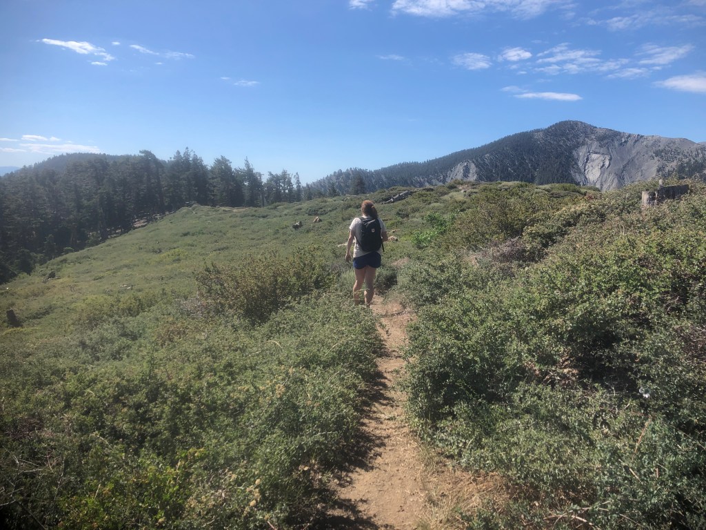
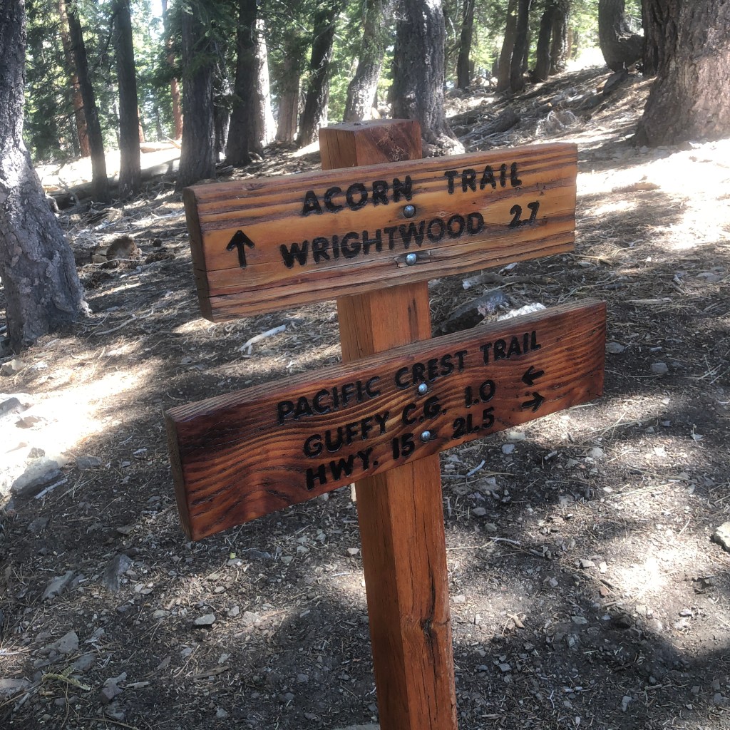
Today the mercury would rise to 90 degrees down in Wrightwood, below. This is the nearest town to where I would be hiking, at Inspiration Point. There are several ways to reach Wright Mountain. One way, is to head up the super steep Acorn trail. The second option is park at Inspiration Point, and hike on the PCT, all the way to Wright Mountain (elevation 8488).
Here is the alltrails map for just hiking to Guffy Camp. The map is inaccurate, as it is 8 miles roundtrip not 4.
We would hike a total of 15 miles to Wright Mountain and back.
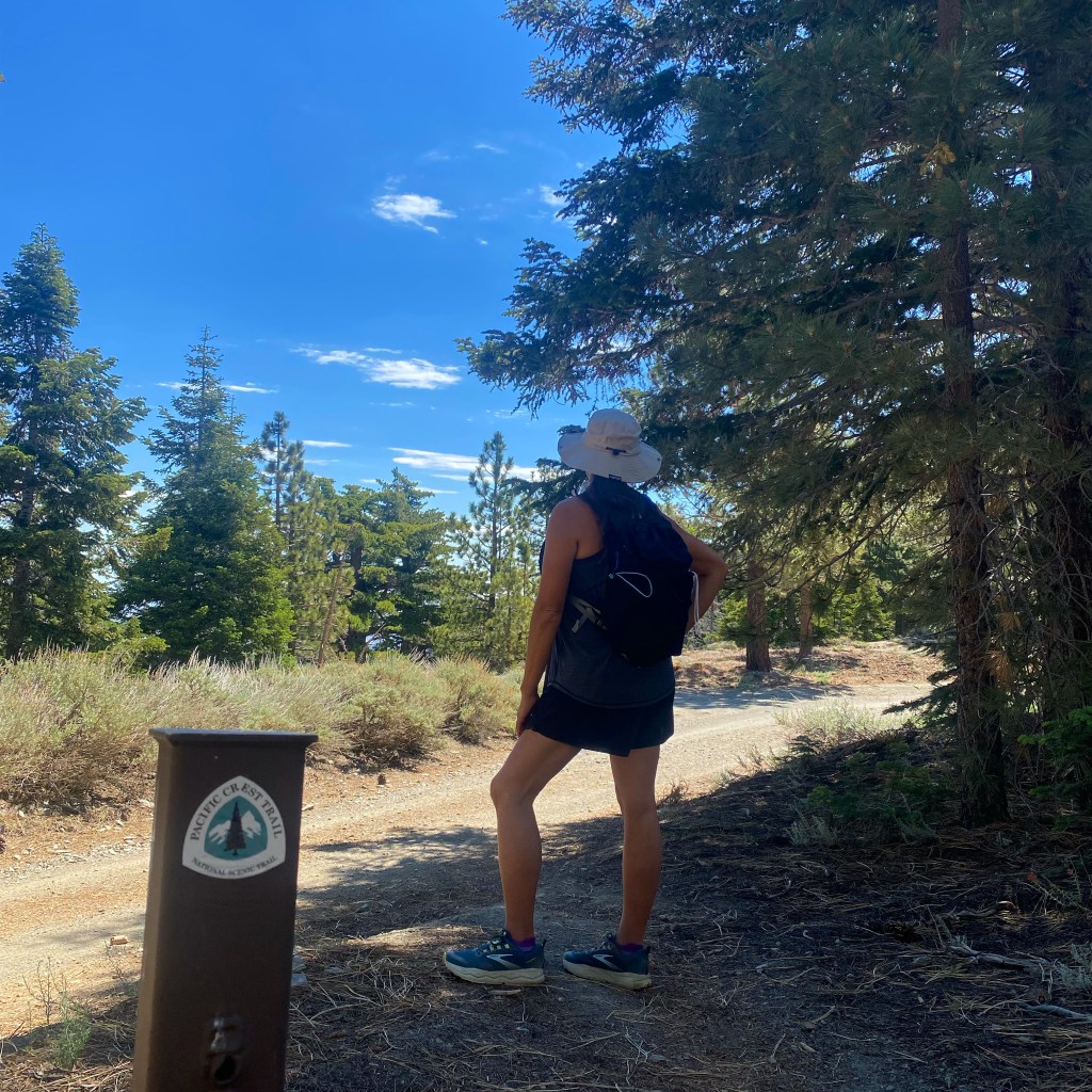
Don’t forget to stop and take a photo with the PCT marker. It is only the longest trail on the west coast, and somewhat world renowned.
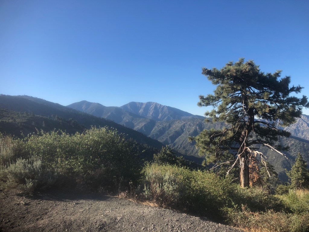
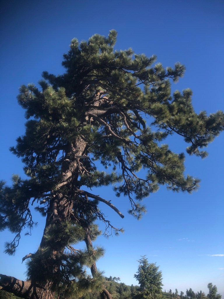
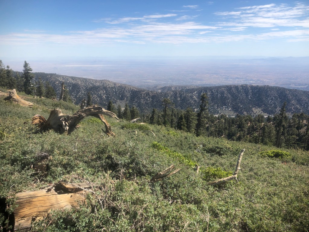
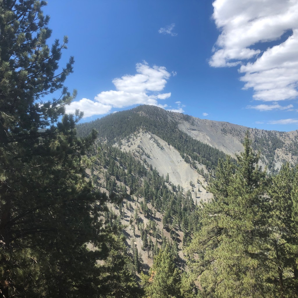
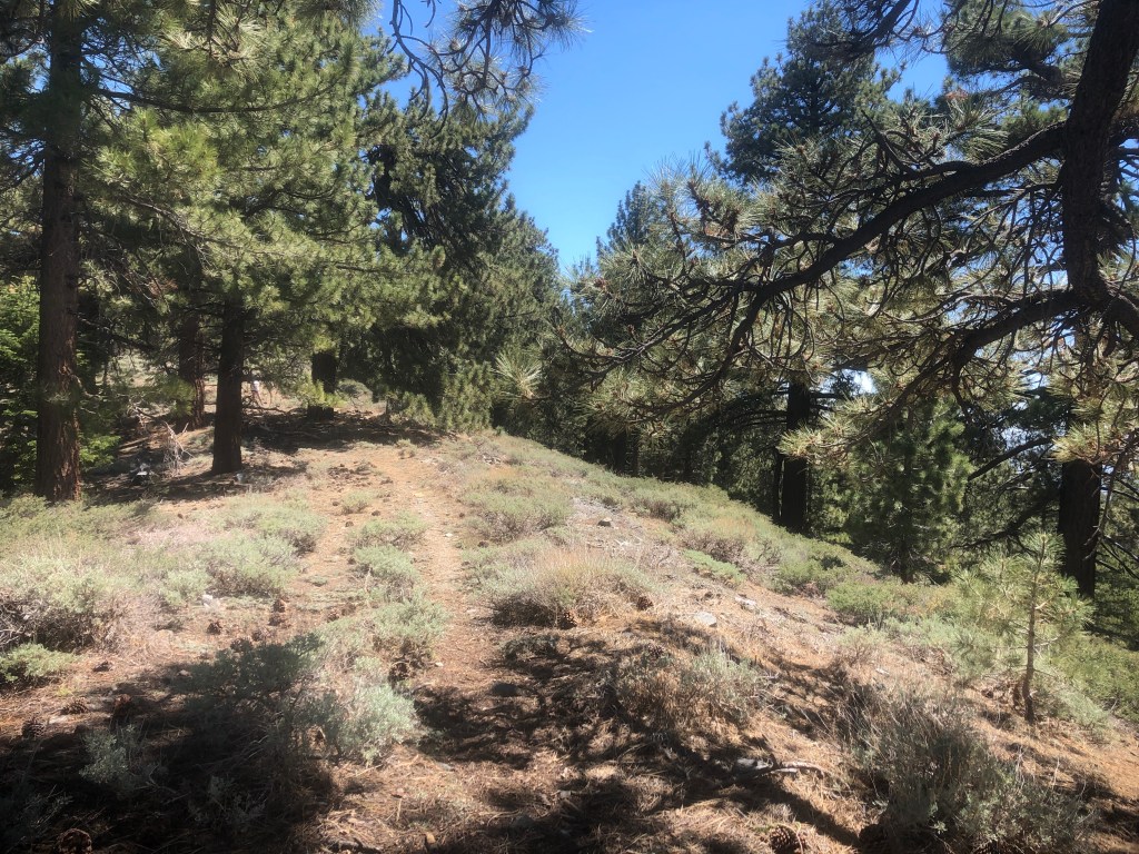
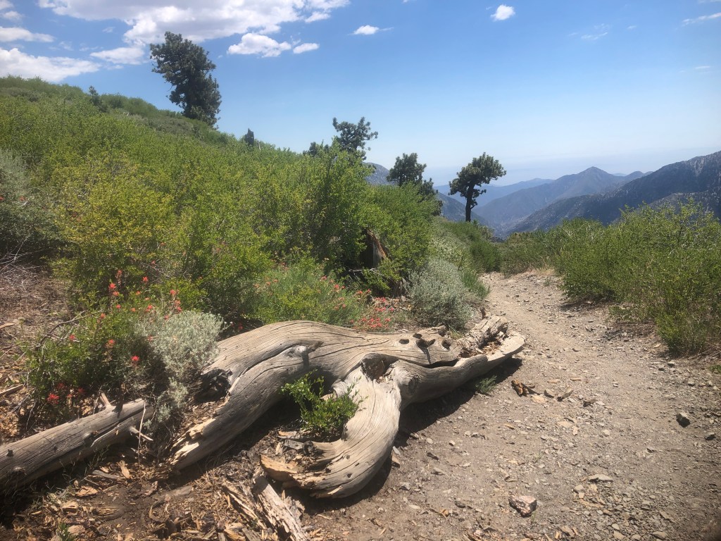
Al along the PCT you have beautiful scenic views of the surrounding peaks.
Camping in the WIlderness
You will pass by two campgrounds, both accessible via the unpaved road. The first is called Blue Jay, and second is Guffy. Both have firepits, and restrooms (pit toilets), though fires are strictly off limits during dry years like we are experiencing now in California.

This is one water source noted by a sign, just downhill from Guffy camp, but I am not sure if it was running, or not. My guess is it runs only when there has been rain, or from spring to early summer. I would assume it’s not running, and plan accordingly.
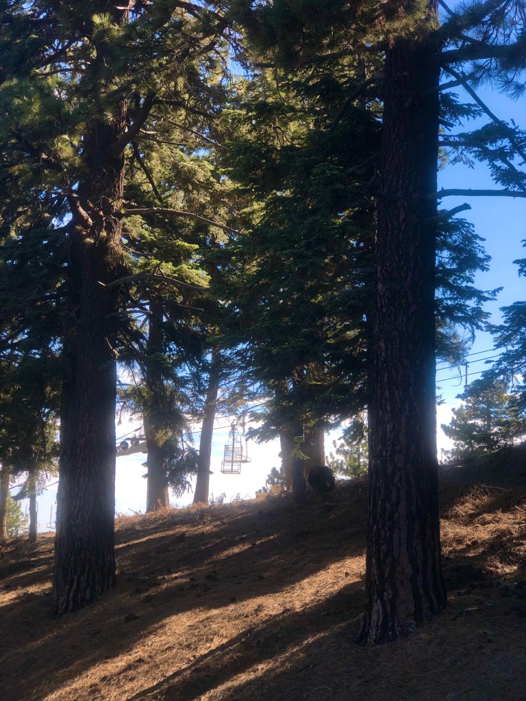
Eventually we passed by the ski lifts of Mountain High. I have not been skiing there yet. The road to this area is apparently gated, and closed during winter snow, just past the ski resort in Wrightwood. This is something to note, and plan for, were you to venture this way from November to March.
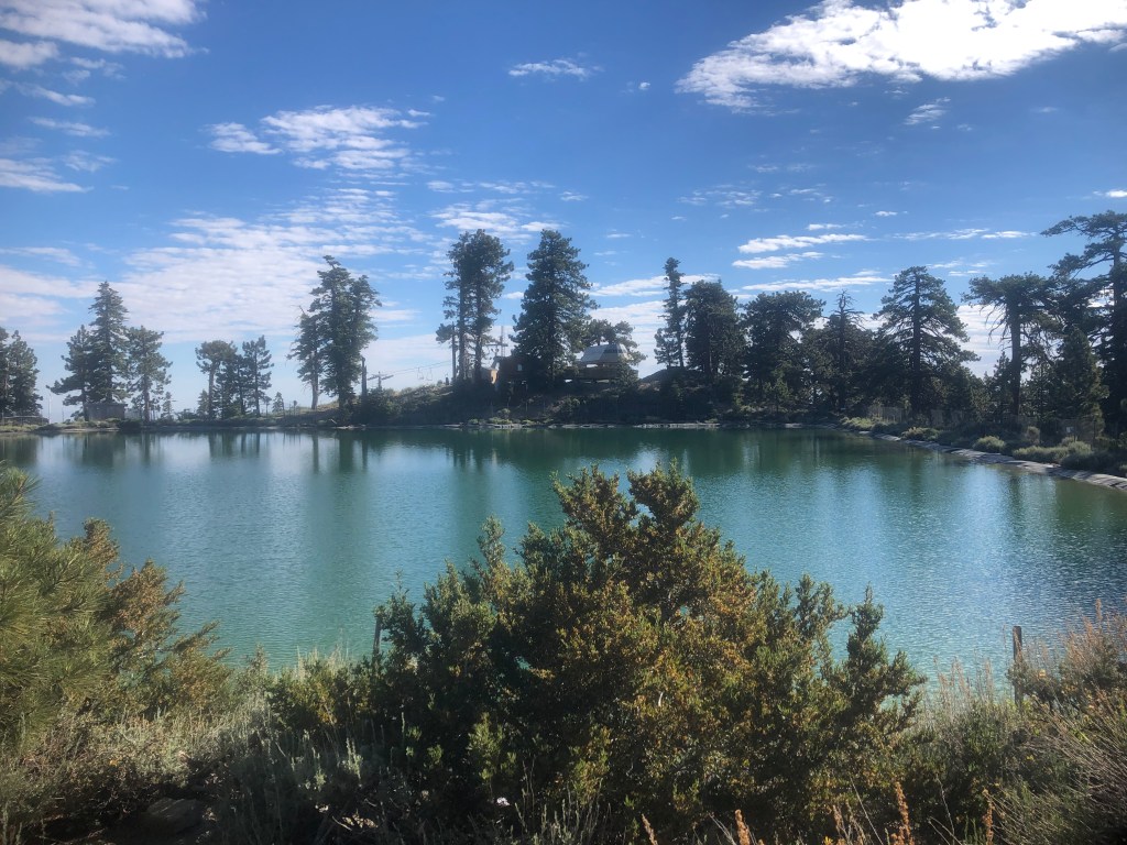
We then came across a glistening tranquil blue reservoir. This is off limits to swimming in, as you might assume, and was surrounded by a fence. Even if you were to find a way in, I have no information on the quality of this water.
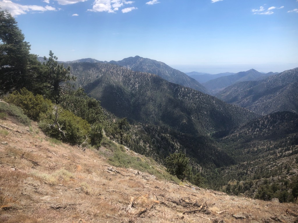
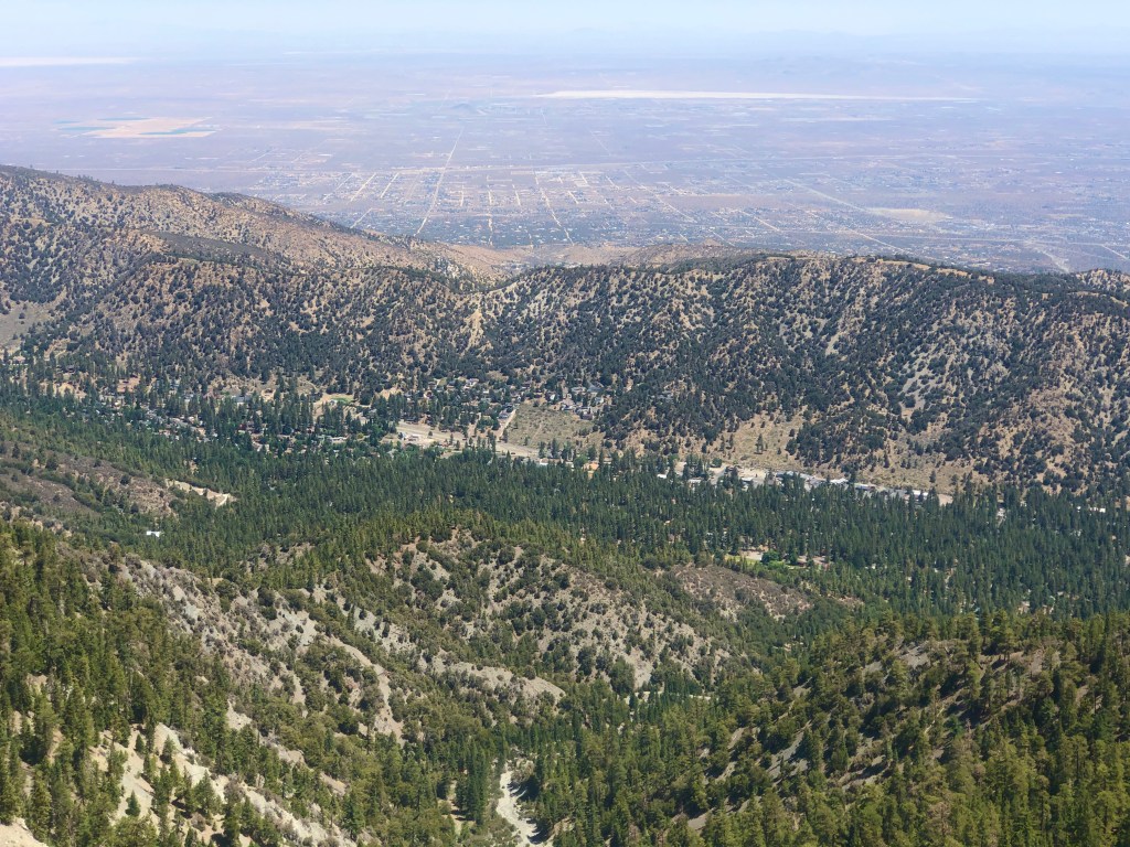
There were more and more awesome views of the desert valley below to the north.
As we continued on the PCT, there would be no evidence of thru hikers this time of the year. Most thru hikers pass through here in May and early June enroute to Canada on their 2600 mile journey.
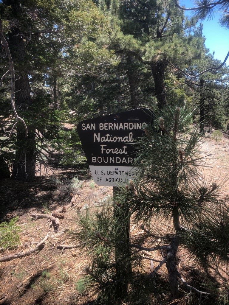
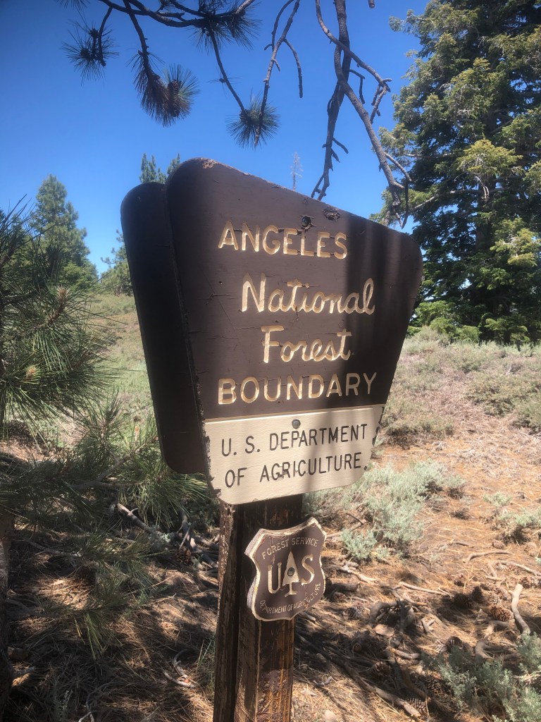
On your way to Wright Mountain you eventually cross over from one forest to the other, leaving the San Bernardino National Forest, and enter into the Angeles National Forest, which is kind of interesting.
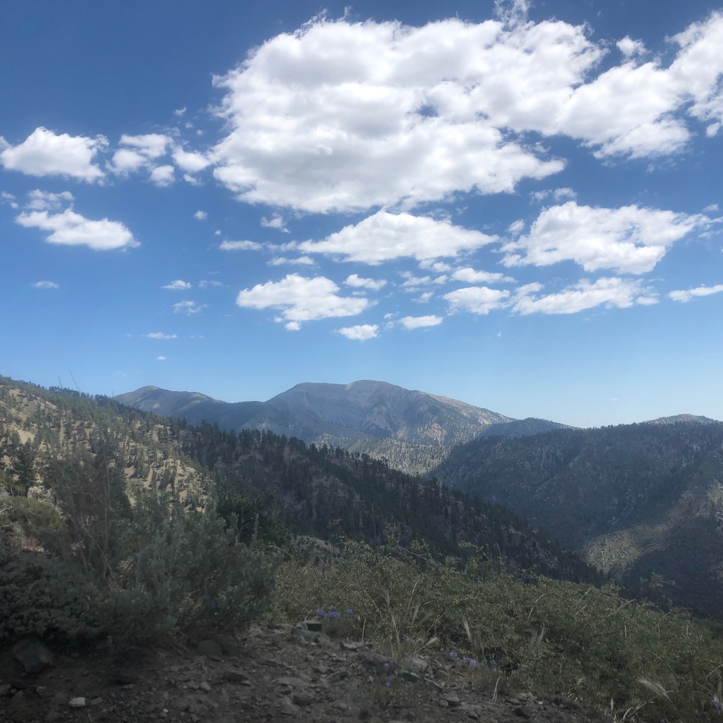
I spotted the glistening Pine Mountain off to the right, and could now see Wright Mountain to the left. Pine Mountain was something we discussed adding to the itinterary, and had we done so, we would have possibly gotten into trouble. It’s a very steep mountain, and you need trekking poles, which I did not carry on this particular day. The other factor was we might likely run out of water. We opted to keep this days hike to just Wright Mountain and save Pine Mountain for another day. It almost shimmers, possibly due to the type of rocks on its face. Until next time Pine.
We eventually passed by the sign for the Acorn Trail, which leads you an additional 2.7 miles down to Wrightwood, from the PCT. We knew we were close at this point.
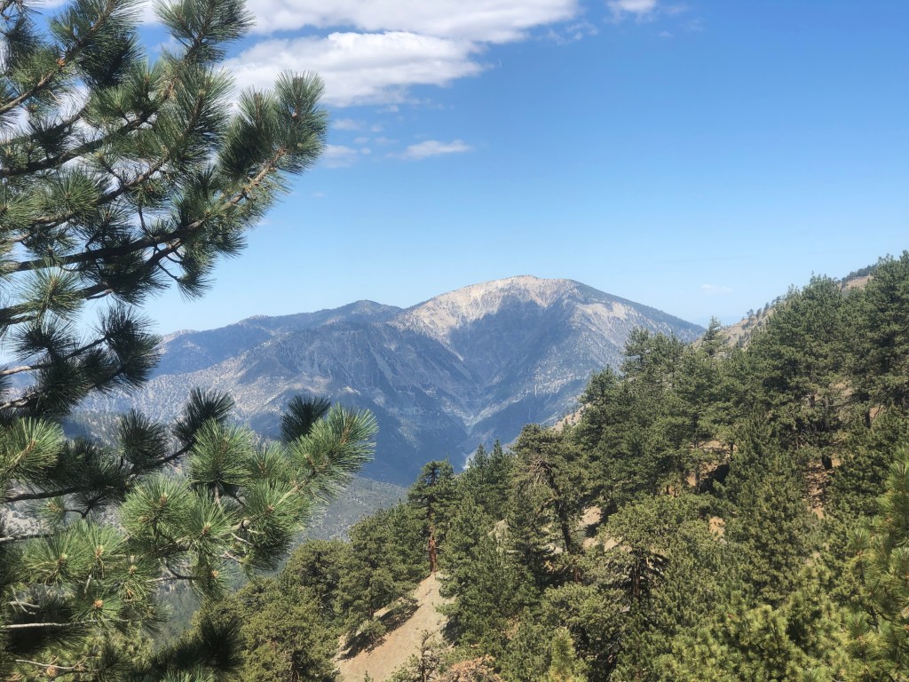
Pine Mountain trail, leads you up to Mount Baldy, but it’s barely visible behind it from this angle. That would be a heck of a climb.
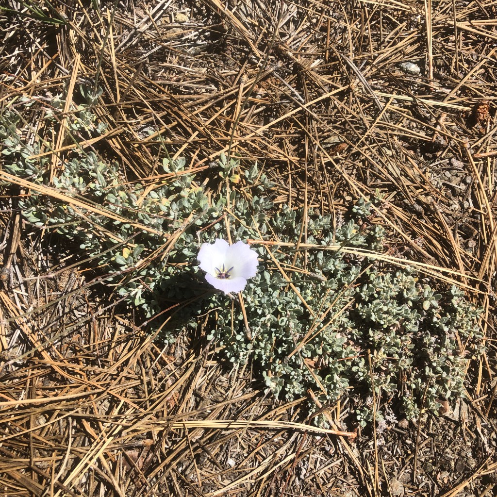
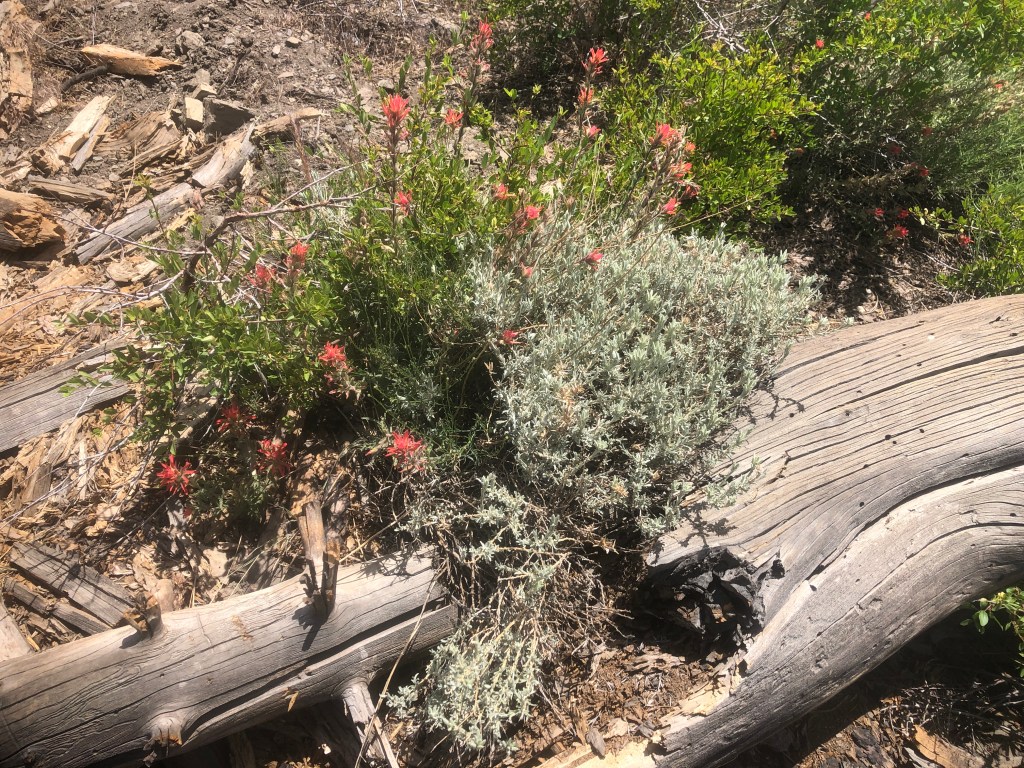
I found some interesting wildflowers along the way, such as this lavender colored Wild Mariposa Lily.
The steep trail to Wright Mountain quickly became indistinguishable, and we consulted our navigation to find the summit. Alison was using Gaia, and I had alltrails. Between the two of us, we found a way there. Without them, I’m pretty sure we would have gotten lost.
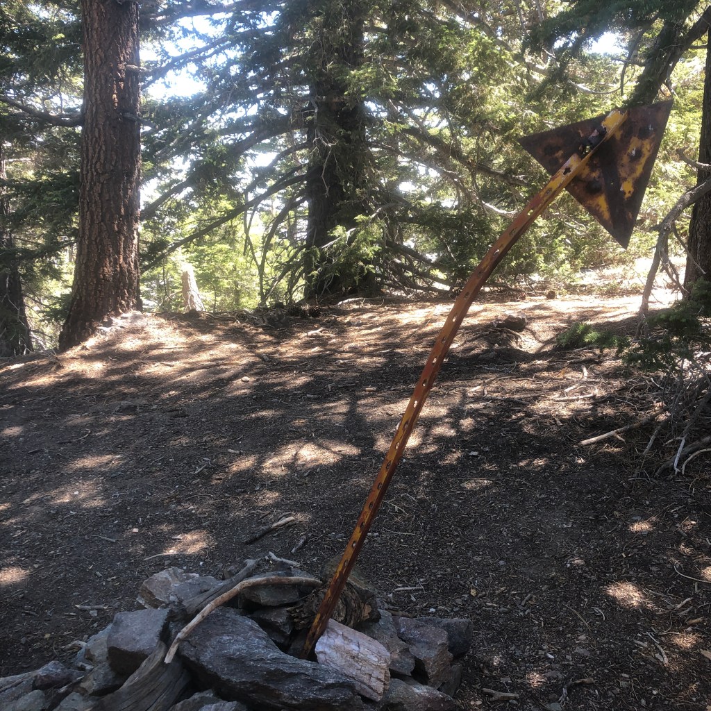
Eventually we came to an iron marker stuck haphazardly into a pile of rocks. This would have to do. It’s a rather uneventful summit, with no view to speak of, surrounded by pine trees. We recalled seeing a flag waving on the ridge, so we set off to find it. There was not trail…so this would be interesting.
We found our way out of the trees, and onto the exposed ridgeline, where Wrightwood was visible from above. There was a steep cliff and dropoff.
There were lots of thorny bushes around, and we would end up wading through them, in search of the flag. It did not take us too long, and we found it. Alison’s Gaia app, showed another older trail, not on alltrails, which aided us in not only finding the flag, but finding our way back to the PCT.
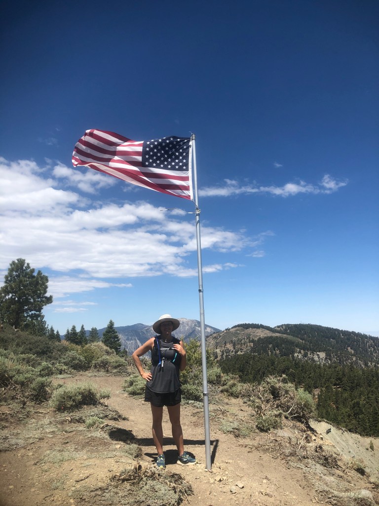
It was a cool moment here with the flag, which felt more like an official summit, or end goal than the marker in the pile of rocks.
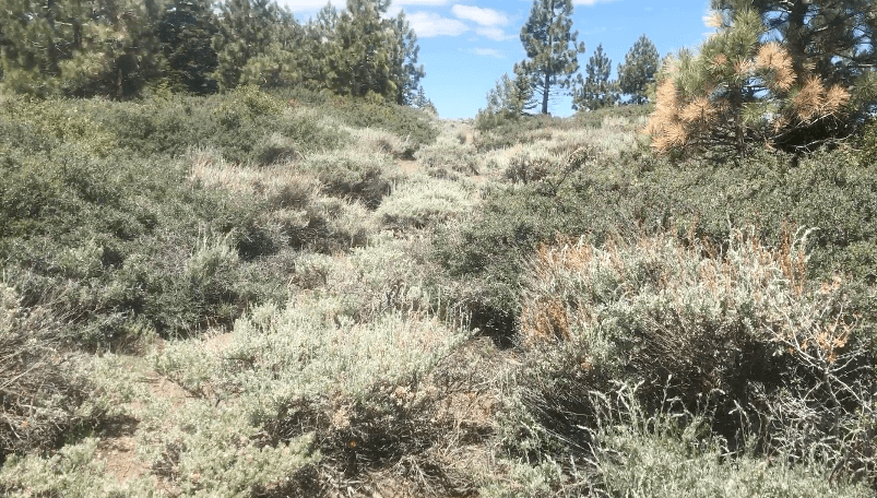
Then we started bushwacking our way through thorny bushes, slowly making our way down a steep ridge. We were definitely off trail. I don’t recommend you do any of this.
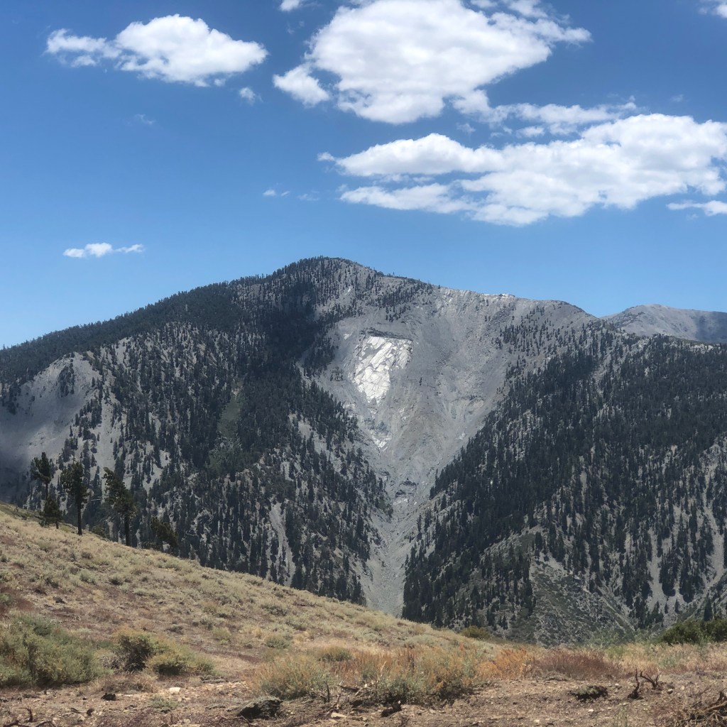
But we made it back down to the PCT, and glanced back towards Pine Mountain which had a shimmering silver patch on its face. I could now glimpse Mt Baldy behind it. Pine is supposed to be comparable to Iron Mountain, I would later find.

Along the way I found a few interesting wildflowers, like this snowplant, which only grows at high altitude. Even during a dry summer there were still so many colorful blooms, dotting the landscape.
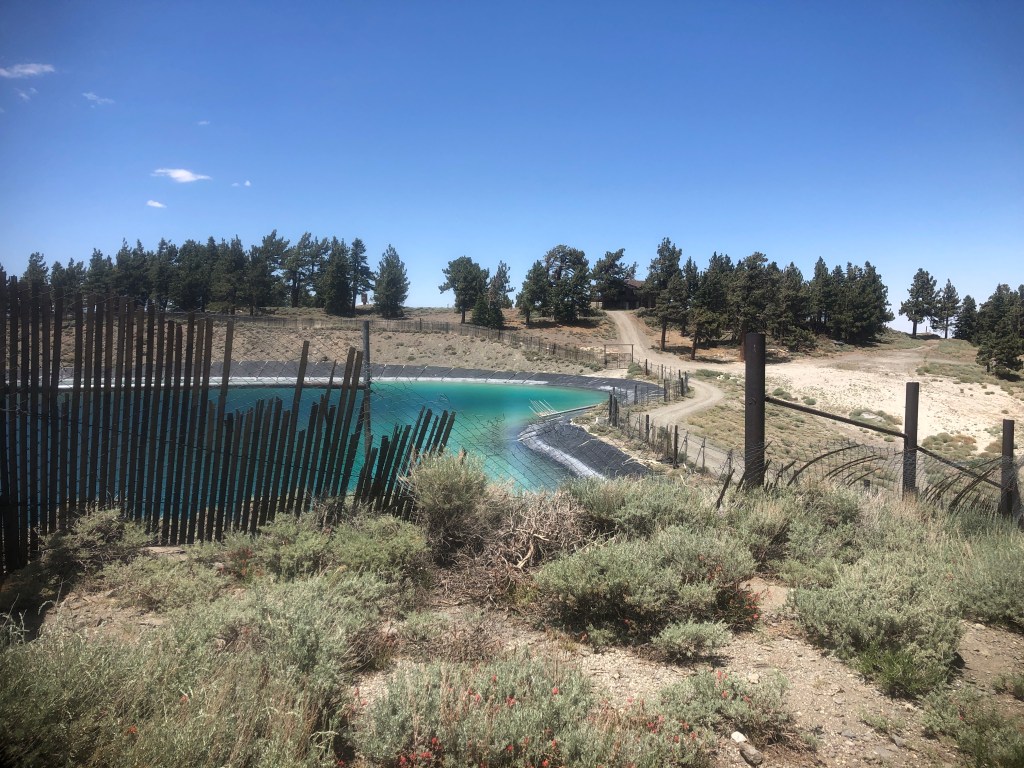
As clean it looks, I expect these waters are high in bacteria, so I don’t advise hopping any fences for a dip.
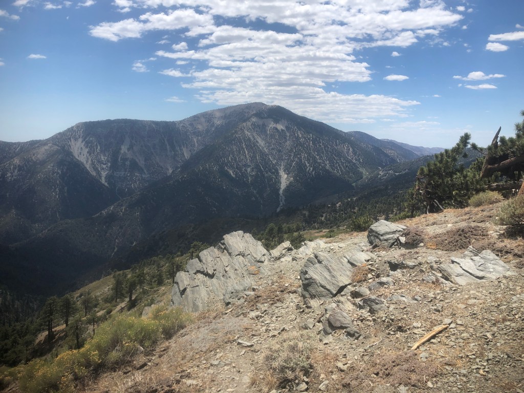
You can see awesome views of surrounding peaks, such as Mt Baden Powell.
We has logged 15 miles roundtrip on our recording. The hike to Guffy camp was sort of a breeze, and I would recommend this section of the PCT to just about anyone looking for an empty partially shaded wilderness trail, with a hint of adventure.
A Delicious Ending
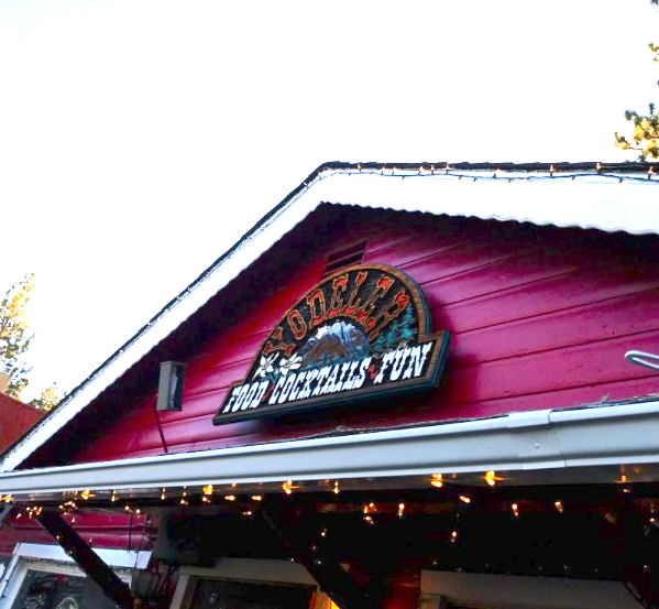
It was a beautiful hike, and it was time for lunch, so we headed into Wrightwood to The Grizzley Cafe, but it was closed. So we instead headed to my friends favorite hangout “The Yodeler,” where I enjoyed a Black Bean burger, with waffle fries, and a pink lemonade. It was vegan, and was not terrible, though I’m not a huge black bean burger fan. Sometimes its more about the company than the food.
It was 90 degrees on the patio in Wrightwood, and after quickly downing ice an ice cold pink lemonade we headed home to Orange County. I love adventures, and today I was celebrating a new milestone in my life with a friend, and simultaneously her birthday. Hiking with friends, on a sunny afternoon in June, is the best way to enjoy a heatwave.
Until next time Angeles National Forest!
About Me
I’m Serafina! I’m a writer and California girl who loves to go exploring. Hope you will get outside today, breathe some fresh air, and be happy!
Follow my Journey…
Be sure to Like and Subscribe to My Youtube Channel where I post videos!
Disclaimer: The work on this blog is my opinion and my opinion alone and I am not responsible for the outcome if someone were to apply these thoughts to their own life. All text and photography copyright 2021-2023 by Serafina, all rights reserved. Information and opinions provided are kept current to the best of the author’s ability. All readers’ usage of the ideas and opinions presented in the blog, are at their own risk. Be aware of the possible dangers of hiking, surfing, walking, cooking, and other activities, which may take place indoors or outdoors. By reading this, you agree not to hold the author or publisher of the content on this web site responsible for any injuries or inconveniences that may result from reading the blog, or partaking in any activity mentioned in the blog. Read the blog, and use its ideas, if you so desire, at your own risk.
