Who does not love an adventure, with a little history, and some suspense?
The trails in Santiago Oaks are all dirt, with some loose rock. They are mostly at least 4 foot wide, and hard packed. Wearing trail runners or hiking boots, is recommended. Expect to be dusty too.
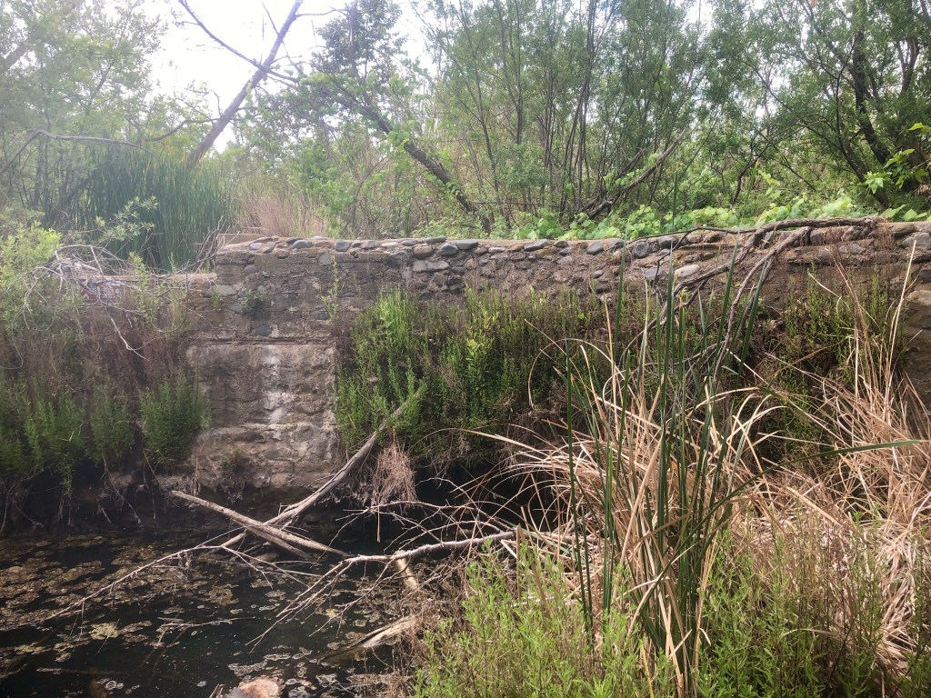
In Santiago Oaks Regional Park the most famous landmark is Robbers Peak, which sit’s high above the park. There is also an old historic dam, along Santiago Creek trail below, near the nature center.
The park has many scenic hiking and mountain biking trails, with names such as Mountain Goat, and Bumblebee. You may guess which one is the the tamer of the two, just from the names.
Weir Canyon even links up to Santiago Oaks via Anaheim Hills trail. The trails of Irvine Regional are also not far off, were you to head down Chutes, connecting to Roadrunner, or take the much less eventful Corral trail, over to Willow trail, on to Irvine Regional Park. There are endless possibilities here, with too many named trails to count.
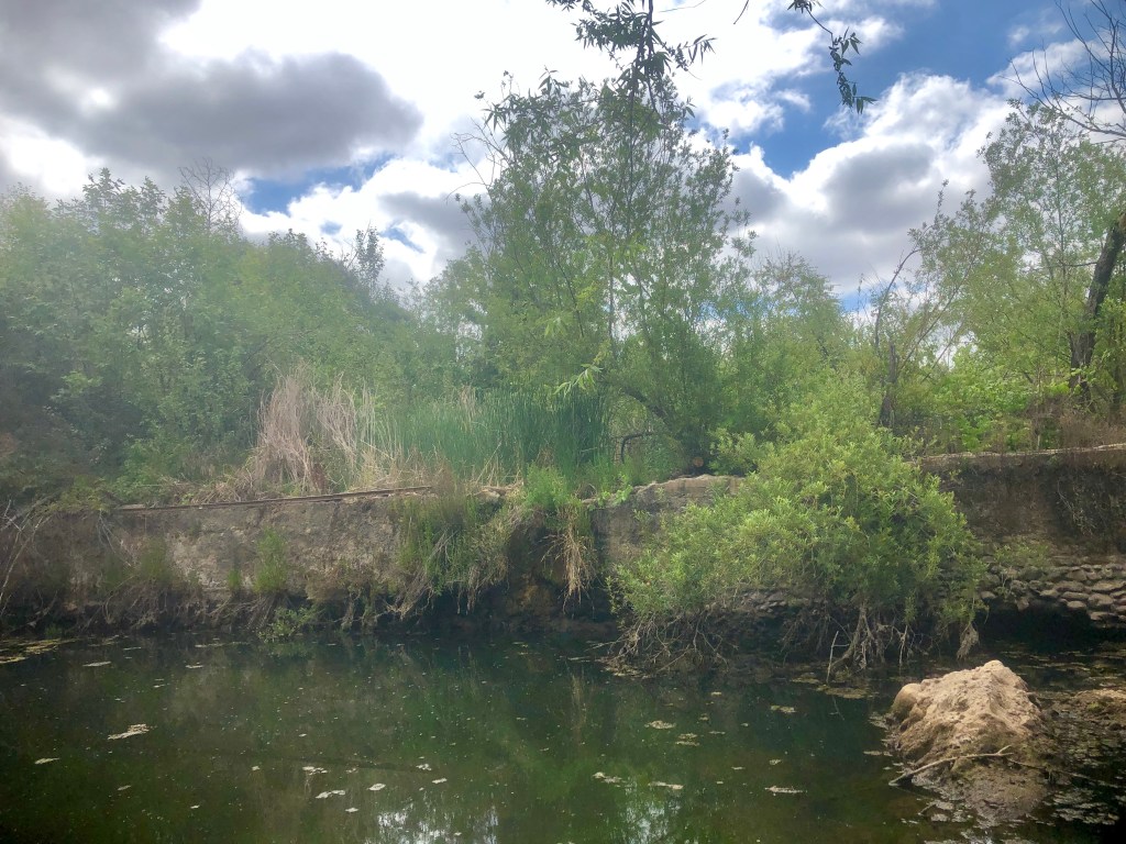
I began my hike today in the riparian area, along Santiago Creek trail, passing by the old historic dam. It is interesting to check out. After a big rain, this area will flood, and a cascading waterfall can be seen here.
My first time at Santiago Oaks was on a naturalist led hike, when my daughter was much younger. We had wandered close to the stream, in search of plants, learning all about what mugwort was, picking peppercorns off the native pepper tree. A lifetime of exploration, often begins when your young.
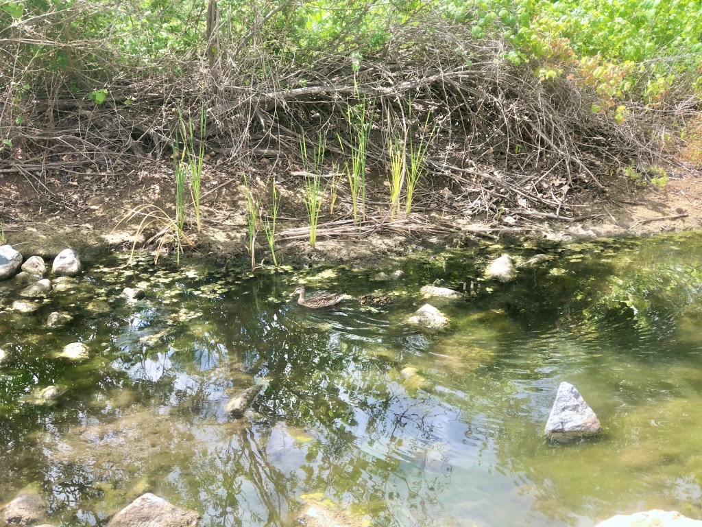
I happened to spot a mother duck and her baby ducks, bathing in the algae laden stream.
Hiking up Oak Trail, from Santiago Creek trail, takes you straight up to Robbers Peak. This was where robbers would hide out by a large boulder, for the the stagecoach to roll through. They would come out guns a blazing. The wild west was very wild. It makes you appreciate even more being able to take a leisurely stroll in a park like this, without a looming fear of bandits, as Anaheim Hills is generally a safe place to be.
Another interesting fact about the park, is that this was once a shooting range, where troops trained for battle, here in the park, according to a local historian I spoke to.
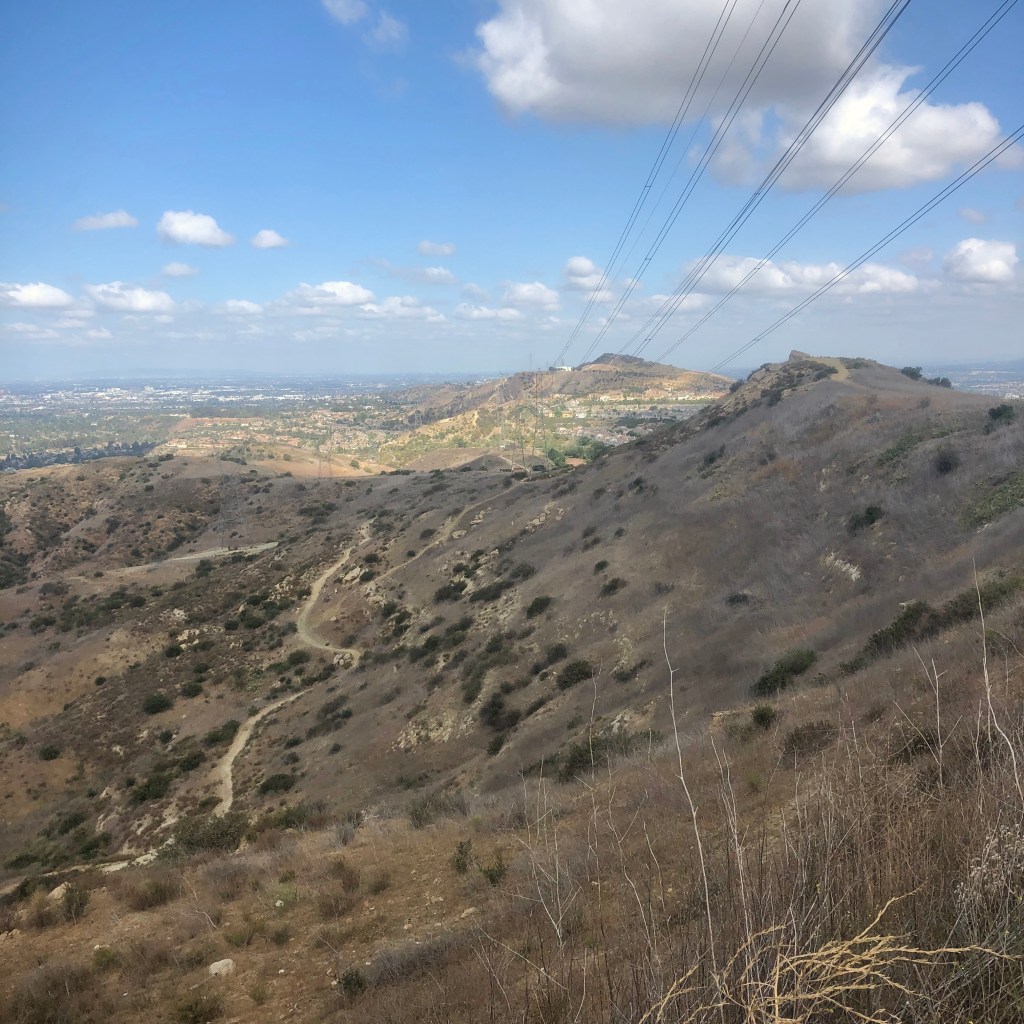
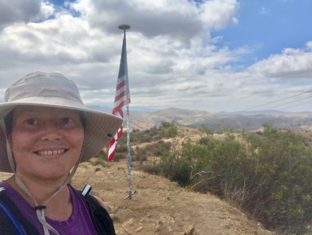
I hiked up beyond Robbers Peak, up to the flagpole, atop Barham Ridge. Afterward I descended down into the canyon that leads toward Weir Canyon on Deer trail, for a total 7.5 miles roundtrip.
So if your planning to hike here you can expect a few things:
Amazing views
Majestic Oak Trees
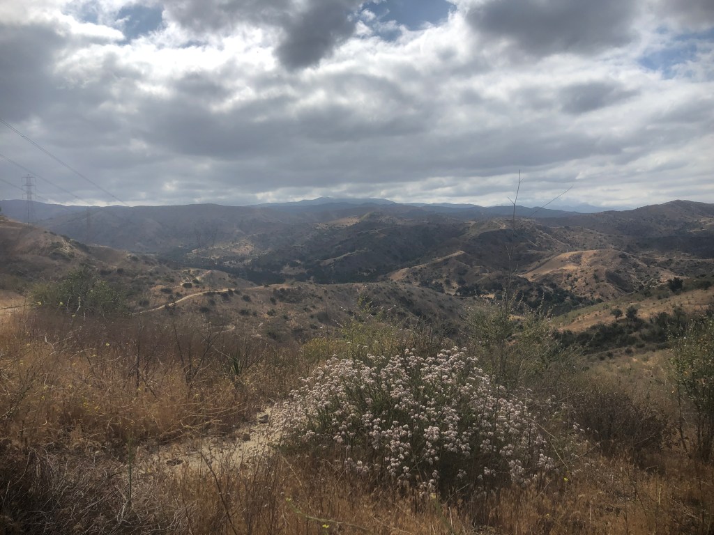
Wildflowers
The remnants of an historic dam
A stream with algae
Maybe a few ducks?
Steep trails
More leisurely ones
A great workout
Possible rattlesnakes or other wildlife
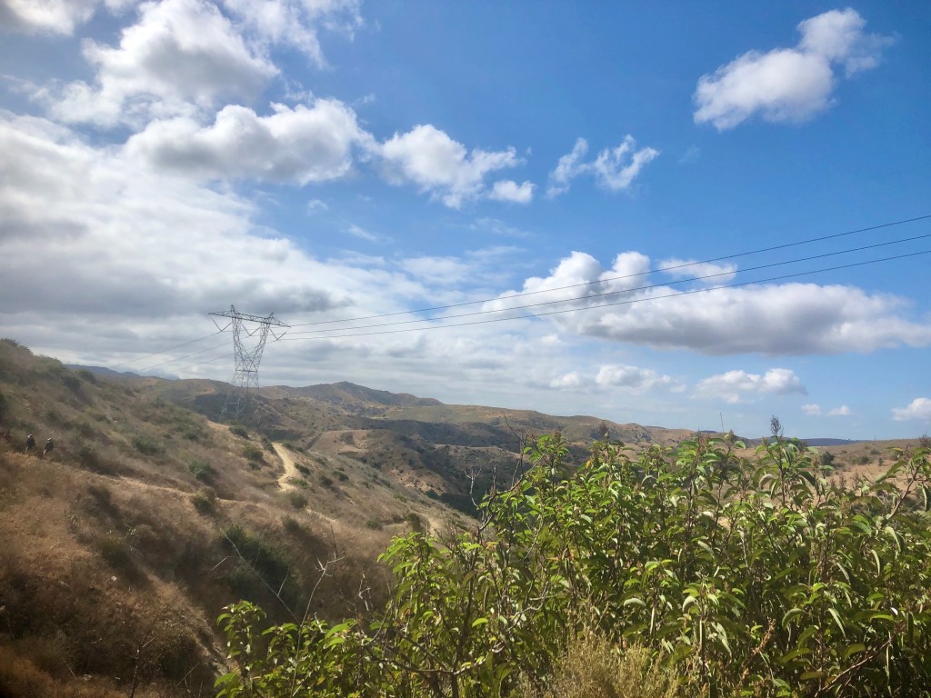
A few large powerlines
No shade
History and some mystery

The trails of Santiago Oaks can be confusing, winding, and hard to follow. Bring this free printable map, or download one of the trails on the alltrails app, so you hike without fear of getting lost. But it is a beautiful place to be lost, if you had to be. Just keep in mind the park closes at dusk.
Check out the trail I hiked today up to Barnham Ridge.

One of my favorite hikes here, is to head up Santiago Creek, to Barham Ridge, heading to the flag, and back down Oak trail. It’s a great 4.5 mile cardio hike.
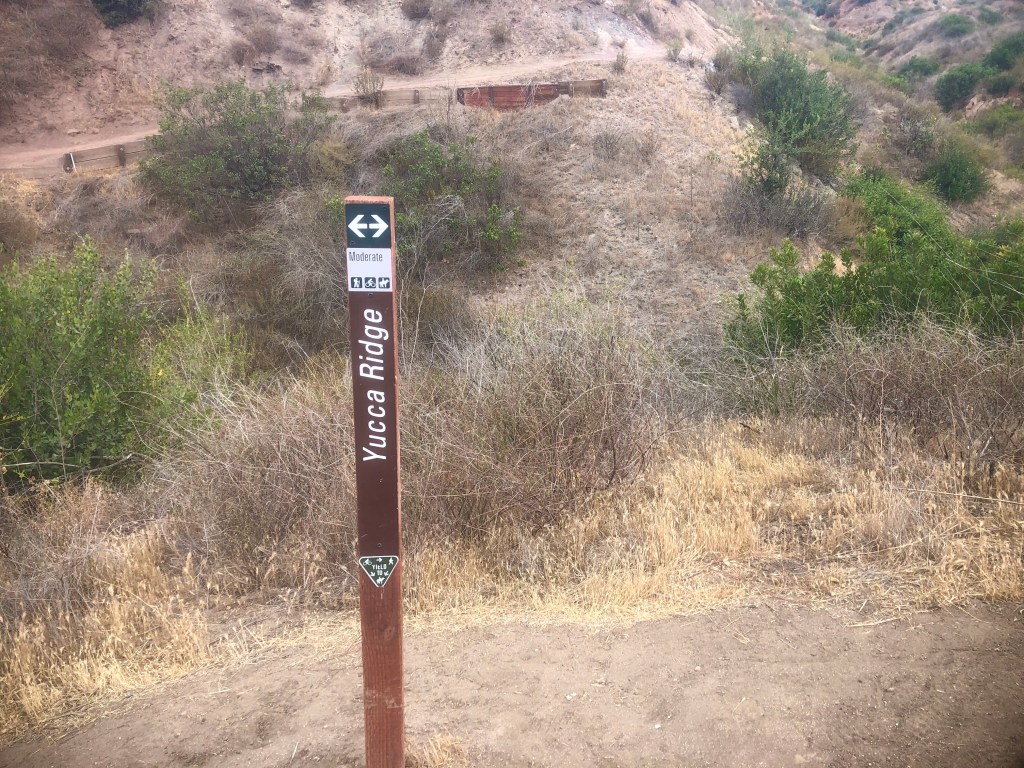
Yucca is one of the steepest trails, frequented by mountain bikers, looking for a fast fun ride.
It’s hard to not feel blessed, seeing so much beauty.
You share this park with mountain bikers, so be aware since some, but not all use bells.

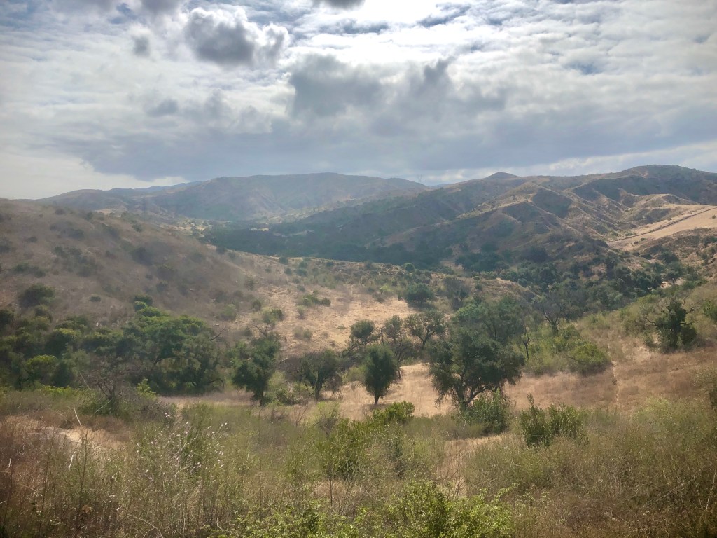
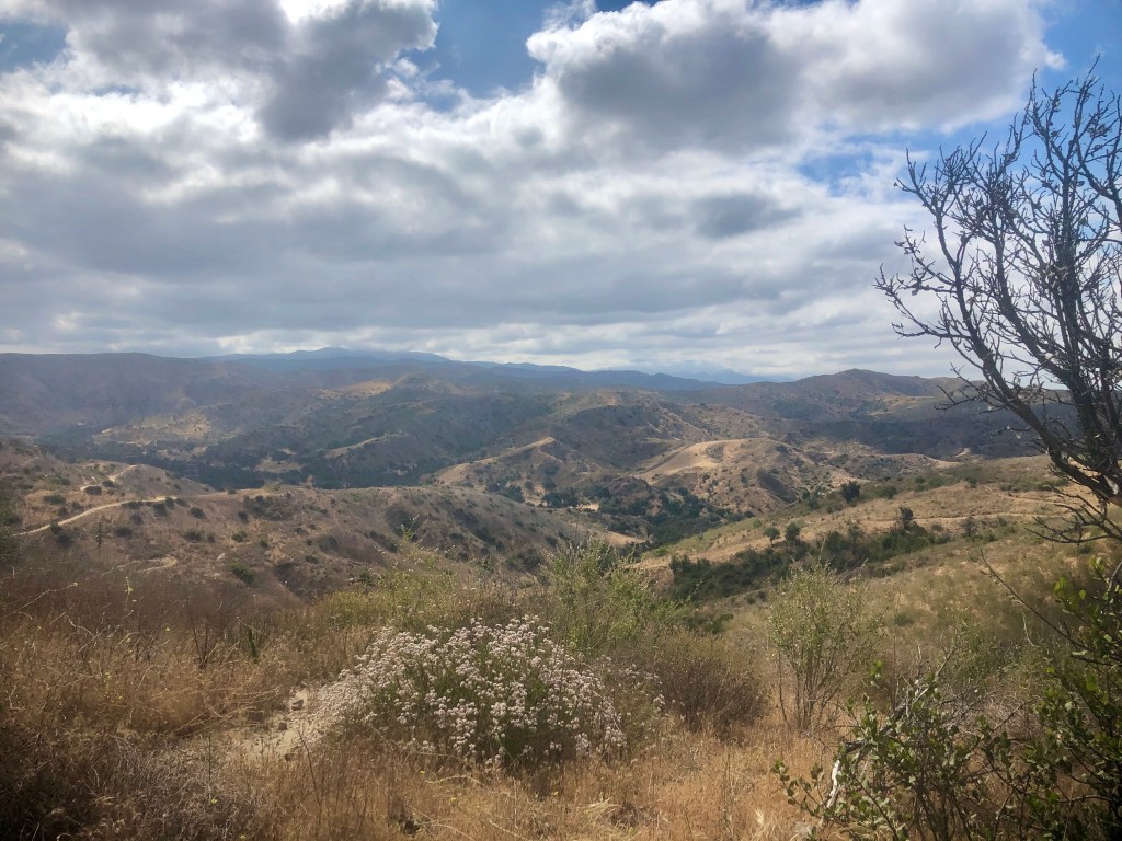
There are a range of microclimates here, from the riparian area down below to the windier, drier hills above.
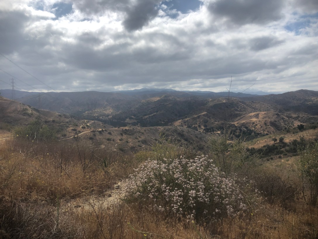
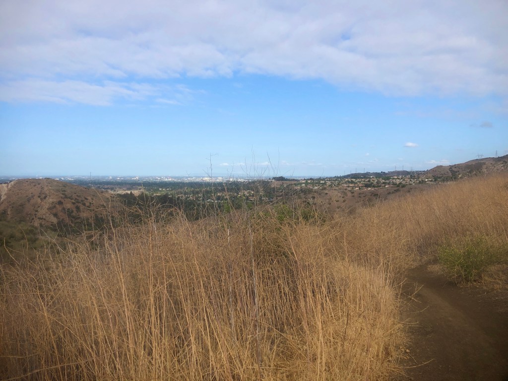
You can expect the best 360 degree view of Orange County, I have found.

You can see far into the distance, to the high peaks of the Angeles and San Bernardino forests on a clear day, along with downtown LA, and Palos Verdes.
The Essentials
Hat
Sunglasses
At least a liter of water (per 2 hours of hiking)
Map
PMA (Positive Mental Attitude)
Parking
There is no cost to park on Marbury Ave to enter, but there is a $5 charge to park in the park on weekends. If you purchase the OC Parks pass you can as much as you want here.
The OC Parks pass is also good for the trails along Laguna Canyon, Aliso and Wood Canyons, and Caspers Wilderness Park, so I recommend picking one up.
Here I am at the flagpole, on the peak.
About me
I’m Serafina! I’m a writer and California girl who loves to go exploring. Hope you will get outside today, breathe some fresh air, and be happy!
Follow my Journey…
Be sure to Like and Subscribe to My Youtube Channel where I post videos!
Disclaimer: The work on this blog is my opinion and my opinion alone and I am not responsible for the outcome if someone were to apply these thoughts to their own life. All text and photography copyright 2021 by Serafina, all rights reserved. Information and opinions provided are kept current to the best of the author’s ability. All readers’ usage of the ideas and opinions presented in the blog, are at their own risk. Be aware of the possible dangers of hiking, surfing, walking, cooking, and other activities, which may take place indoors or outdoors. By reading this, you agree not to hold the author or publisher of the content on this web site responsible for any injuries or inconveniences that may result from reading the blog, or partaking in any activity mentioned in the blog. Read the blog, and use its ideas, if you so desire, at your own risk.
