
Lots of hiking diaries resemble tour guides. There are “highlights,” of a trip, and many of the mishaps, are left out. I’m just leaving it all in my trail diary, intact, because I hope it will maybe help someone planning a similar adventure. It’s my unique experience, and why leave out the juicy details, since that’s what makes life interesting, versus predictable.
No two backpacking trips are the same. You can never predict exactly how it’s going to go. When I am planning a backpacking trip, I want to know not just about all the beauty I will encounter, but about potential hazards along the way. Will it be buggy requiring a bug net and deet, or will there be scrambles over boulders? Let me go into the wilderness, at least somewhat prepared.
Planning a Trip in the Wilderness
When you go into the wilderness, especially solo, as I was attempting to do, you will want to know what you’re getting yourself into. So I hope you enjoy following along on my adventure, and though it’s not glamourous, it was successful, in that I finished what I started.
I took my time planning this trip, and I will be sharing all this information with you here, so you can also plan your hike on the TCT.
Many fail to plan, but nobody plans to fail. Backpacking trips don’t usually come together overnight. It’s expensive to walk into REI, and just buy everything for a trip all at once. I at least like to set it up, and test it out, before relying on it for a backpacking trip.
Even with all the careful planning, studying of maps, reading of others experiences, and preparedness, stuff happens. Whether it’s freak storms, animal encounters, or things that go bump in the night, backpackers all have a story.
So here is my story of my first solo “thru hike,” backpacking the Trans Catalina Trail in 3 days, in April of 2021.
Day 1
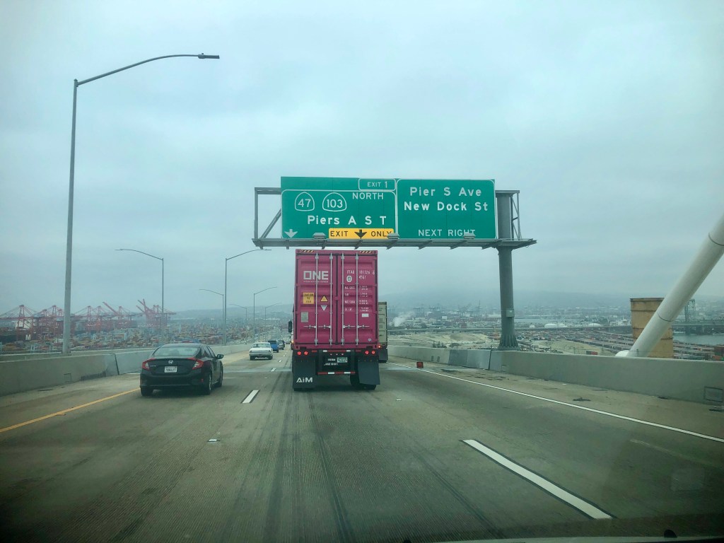
It’s 5:30 am on April 2021, and I am making my way out of my house, with a hot coffee in hand. I am about to drive to the ferry dock in San Pedro, to leave for my trip to Catalina Island. I plan to leave my car there at the ferry terminal, which will cost about $20 per day.
I was up late the night before making sure my bags were packed, and everything was in the car, ready to go. I knew that my morning brain, would not manage to do anything more than just get dressed, and pour my coffee in a cup. It’s good to know yourself, when planning a big day like this.
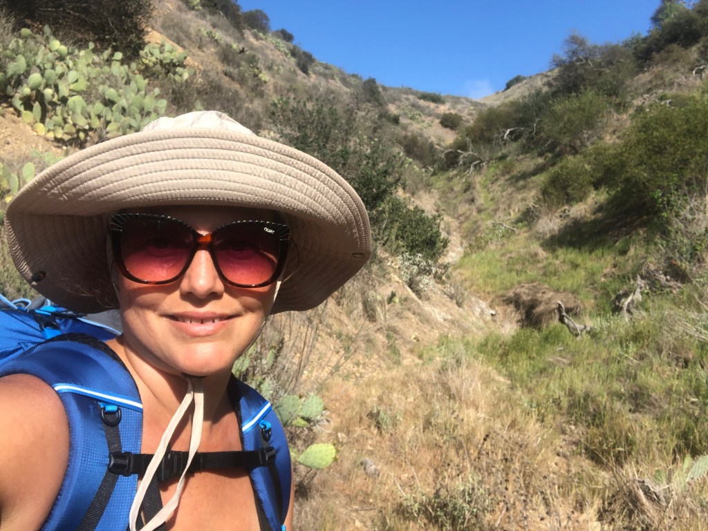
It had taken so much planning to get to this point, where I was ready to embark on a 3 day solo backpacking trip. I had not yet done a shakedown hike with my new backpack, a G4-20 from Gossamer Gear. I wanted to make this an ultralight backpacking journey. I had just purchased it on their site, on sale, for just $125.
In my mind, a 3 day backpacking trip, was a great way to test out my new gear. I had dreamed of hiking the John Muir Trail, so 3 days did not seem like a lot of time. Catalina Island’s TCT is like a mini-thru hike.
I had been religiously following countless thru hikers travel vlogs, of their journeys on the PCT, AZT, CDT, and AT on youtube for what felt like years. I had done enough watching, and started believing I could do it too.
I had many changes happening in my life, and it seemed like a good time to try new things, go further, and to places I never thought I could go before. I wanted to some day hike these long trails. But first, I would have to begin by successfully backpacking shorter distances.
A 3 day solo backpacking trip seemed reasonable. Then I maybe my next trail could be the Tahoe Rim Trail, the High Sierra Trail, or even the JMT? I already had a permit for the JMT from Cottonwood Pass, going nobo in early September, in addition to a permit for Mt Whitney in August.
I was all in on this adventure, having been an absolute hiking fanatic the last few years. I had been hiking around 30 miles a week, for many months, so over a hundred miles per month. I felt like I had actually trained for this trip. But you never know until you go, how ready you actually are.
So here I was, 45 minutes early at the terminal. I parked my car, and proceeded over to the ticket area, to check in. I had already booked my ride to Avalon in advance. The ferry can book up fast, so it’s good to plan this as far in advance as possible, especially for weekend trips.
I would ride the ferry ride to Avalon, from San Pedro, and return via Two Harbors. Since this is the only ferry that does both, I chose to leave from San Pedro, not from another ferry terminal. There are ferry’s from Newport Beach, and Dana Point to Catalina as well. It took some time to figure this all out. So San Pedro was the ferry to leave from, for a thru hike. For a day hike, you could leave from the other locations.
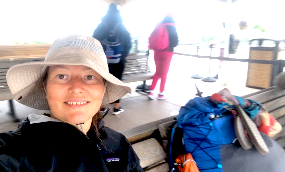
I waited for my boat on the benches near where you board. There were those social distancing circles on the ground. This would be my first time boarding a type of public transport, since before the pandemic. Since it’s been a full year later, I wondered how long this health emergency and panic would have to go on.
Pre Hike Checklist
The night before I had laid out all my gear, I would put in my Gossamer Gear G4-20. I took this photo of everything I was bringing. It was a proud moment in future thru-hiker-hood. I had brought 4 liters of water. I had checked, and double checked my gear many times. I had even written a to do list. I added a backup lighter for my stove.I did not want to take any chances. I was after all going solo into the wilderness

TCT Packing List
In no particular order, here is the list of what I thought I needed and the order it came to mind.
- Big Agnes Tent Copper Spur UL2 tent (3.2 lbs)
- Gossamer Gear G4-20 Backpack
- Enlightened Equipment quilt (20 Degree 850 Down Filled)
- Thermarest Neoair Sleep Pad
- MSR Pocket Rocket Stove
- Toaks 750ml Pot
- 2 Bic Lighters
- Emergency poncho
- Space blanket
- Knife
- Small Caribiners for hanging stuff
- Folded up Duck tape
- Mini sewing kit
- Piece of dental floss wound up
- Ditty bag (toilet paper, small trash ziploc, trowel, all in a bag)
- Toiletries (soap flakes pack, wilderness wipes, toothpaste, toothbrush, small hair brush, hairbands, deodorant in small spray bottle, flossers, sanitizer, antibacterial wipes, packed in a ziploc)
- Emergency Kit (bandaids, neosporin, butterfly closures, waterproof bandage, gauze, tape, peroxide in small bottle, moleskin for blisters, stitch kit/torniquet)
- Safety gear – headlamp, whistle, and pepper spray
- Leki Trekking poles
- Umbrella, sunhat, and sunglasses
- Extra Ortlieb daypack (3 oz)
- Clothing (Arcterx shorts, cotton tank top to sleep in, quick dry t-shirt, fleece, mid calf Wright Socks, long Zella leggings, Zella capri leggings, another lightweight Tank Top, a hooded sun shirt, an Rei zip front base layer, 2 pairs of extra underwear, gaiters, Darn Tough sleep socks, Extra Wright Socks, sleepwear, fleece hat, liner gloves). Yeah it was too much, lol.
- Raingear – Frog Toggs rain pants, and a Patagonia Torrentshell
- Camp shoes (Sanuk flip flops)
- Phone charging cable, wall charger, and solar panel charger/battery combo
- Small Canon pocket size camera
- Food bag (2 lunches, 3 dinners, 7 energy bars, miso soup packet, tea, cough drops, 2 small bags of popcorn, 3 packs of olives)
- Downloaded book on tape
You can check out my TCT Gear list on lighterpack here.
The meals I was bringing were from Backpackers Pantry (Pad Thai) and Good to Go, along with some instant mashed potatoes from Sprouts to mix with some Thai Kitchen Rice noodles, and miso soup, plus some condiment packs (hoisin, soy sauce, sriracha, hot sauce).
Calorie Burn
I also had plenty of dried fruit bars, Pro Bars, and Cliff Bars to keep me going throughout the day. You burn a lot of calories hiking all day, so you need more calories to burn, so plan accordingly.
When looking for the best backpacker meals, an important thing to note, is they vary widely in terms of how much protein, carbs, and calories they have.
Food Prep for Day 1
Food to Go in Morning: Smoothie (premade night before)
Food for boat: Lunch would be 3 Gluten Free Veggie Wrap Sandwiches with Hummus, Follow Your Heart Cheese, and Spicy Spread. I also had some Chips, and a Nalgene bottle with Lemon Water in it.
Vons in Avalon: Once in Avalon, I planned to check in for my hike at the hotel, and grab a cold beverage for the trail at the grocery. They have a Vons store these with some essentials, and the prices were not off the charts, but fairly reasonable, in line with other groceries on the mainland.
The Adventure Begins
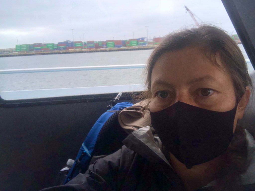
It was time to board, and upon boarding, masks were required. I don’t like masks at all. I know they don’t prevent illnesses, rather they encourage wearing germs on your face, as airborne particles stick to it. When you touch objects, and then your mask, it becomes like wearing a germ sponge.
I also prefer to breathe air, which is a God given right. In the Bible it is written that “Breathe is life.” and not to cover our faces.
They required the mask on the ship, so I chose to continue with my journey. I wore my neoprene Costco one, which is very breathable opposed to ones with cotton fibers that can go in your lungs. Outside I took it off to breathe. I was too excited about the trip to be bummed out by all this.
It was very chilly and windy outside, so I ended up going back in, for most of the trip.
There were just a handful of backpackers on board, surprisingly. I now realized the TCT might be much more empty than I anticipated.

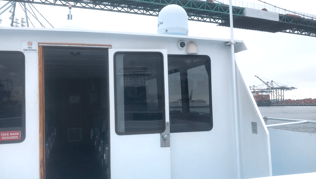
Part of the fun of a trip like this is the boat ride through the port, getting up close and personal with the huge cargo ships.

We passed the Angels Gate Lighthouse, which was erected in 1913. It sits out on the end of the breakwater, at the mouth of the harbor. As we left the port for the open ocean, I felt a sense of freedom, as if nothing was stopping me.
Sometimes taking the first step into unfamiliar territory takes a lot of courage. Having the courage to change one’s life is sometimes difficult, even when the outcome is beneficial. Think of all the bad habits people have, and struggle to change. I was undergoing many changes in my personal life at this time, and getting divorced. This trip felt like just the right medicine, at a time, when I was literally craving change, as if life depended on it.
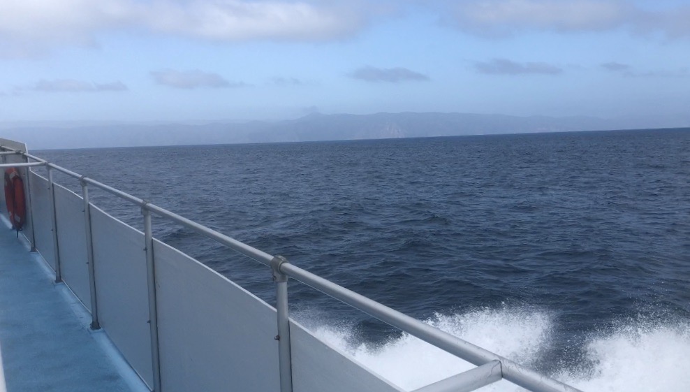
I could smell the salty air wafting through the cabin, from the sea spray coming off the back of the ferry. Huge waves started to roll by, as we traveled further out to sea. We were now speeding steadily toward Catalina Island, bouncing along over the breakers. The trip takes about 2.5 hours total, and if you enjoy speedboats, you might just find the ride there quite thrilling.
I thought some more about the isolated feeling I was going to likely have, and the challenge of hiking a 37.5 mile trail. I was ready for a challenge, to gain more confidence, by setting an attainable goal, and accomplishing it.
They say your story is not yet written. This trip to Catalina, was more than my first solo backpacking trip, it was literally the start of a new chapter in my life, where I blaze my own trail. It was going to be a process, but every journey begins with a single step, and it was go time.

My bible verse of the day was right on time, as the Lord always is. I knew I needed to not let fear hold me back anymore in my life, but just needed to keep moving forward. I knew I would not be walking alone, at any moment on this trip, since there would be another set of footprints, right alongside mine in the dirt.
I finally spot a speck of land in the distance. Catalina Island is in my sights.
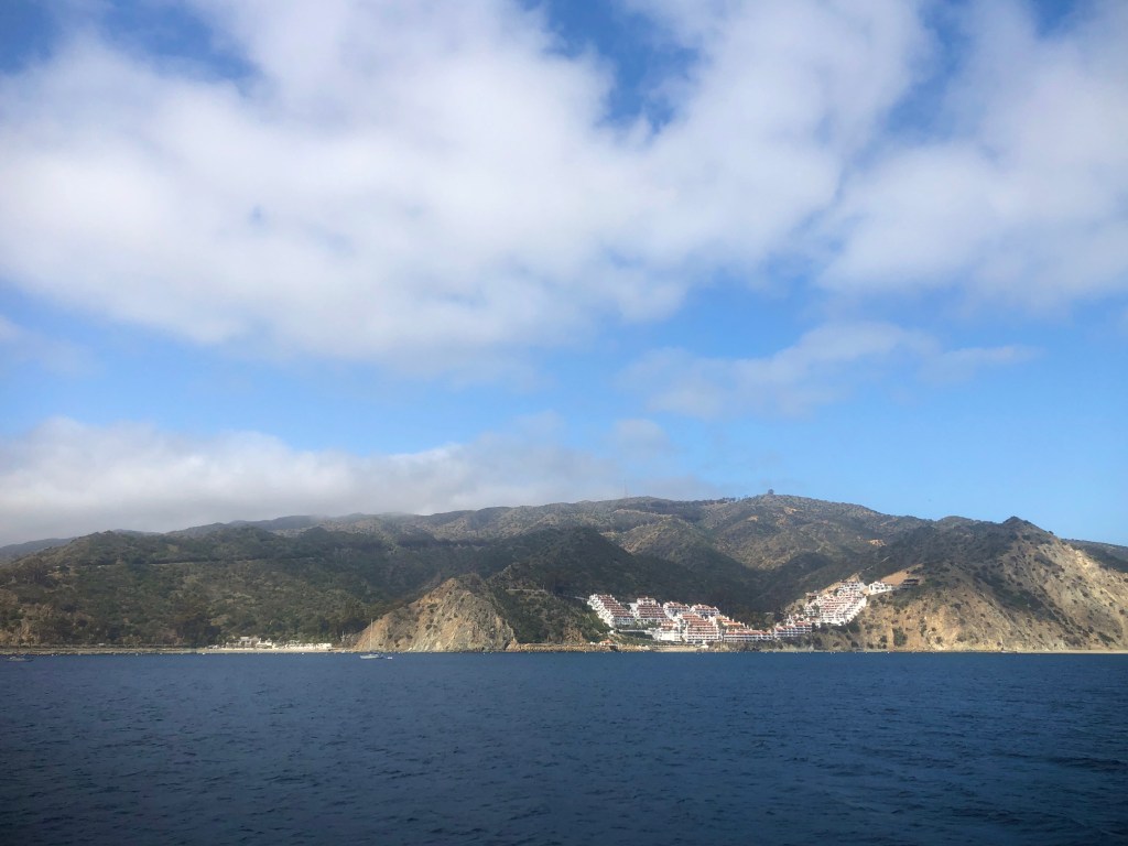
Soon I can make out the town of Avalon, set amidst soaring sea cliffs.
On arrival in Avalon, as I disembarked from the ferry, gazing down into the crystal clear waters of the harbor, remembering snorkeling here years ago, on a warm, sunny, late summer day. The water was warm, and around 70 degrees then. The waters had so many fish that it felt like I was swimming in an aquarium. Today the sun was shining brightly, and the clouds were making way for sunshine.
I heard that it can get very cloudy on the island this time of year. A slight chance of rain was in the forecast. I was hopeful, I would not get soaked. Today it was in the low 60’s, and seemed like ideal hiking weather.
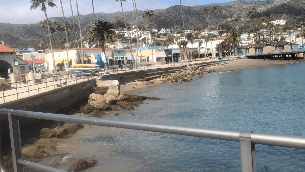
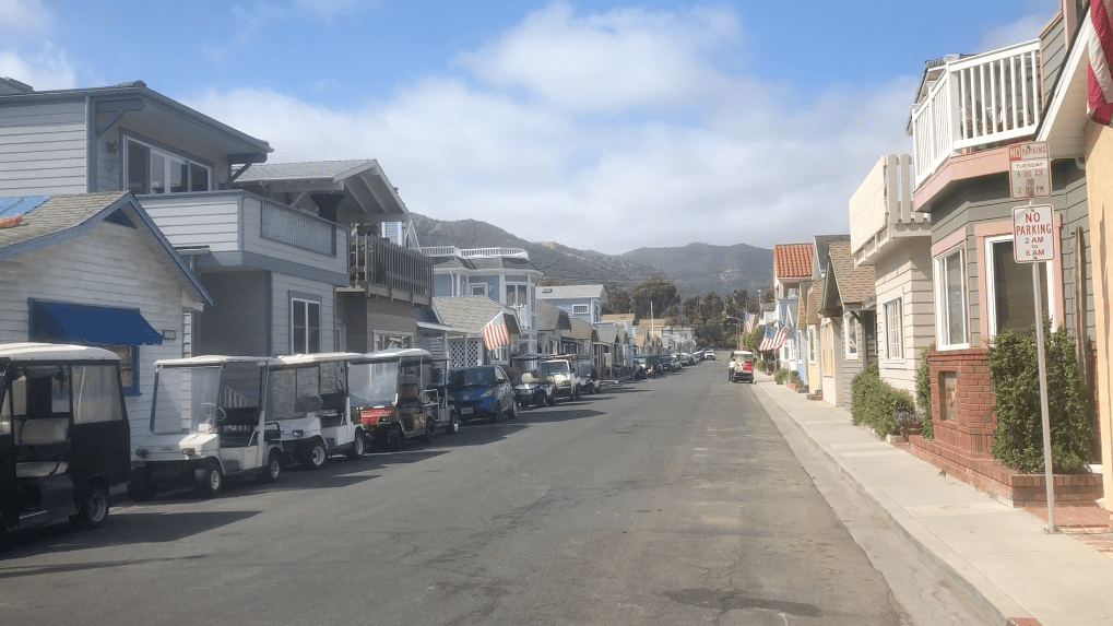
I marched up the boat ramp, and turned left toward the restrooms. There were some lockers there too if you needed them. I proceeded on my way into town towards Vons. This is a town catering to tourists, so you will notice many types of rental businesses lined up along the road, with everything from dive equipment, to kayak and bicycle rentals, to golf carts.
As I strolled through town, past quaint beach cottages, toward Vons, I notice it’s far quieter and empty here now, than it was when I was here before, during summertime. There was plenty of spring cleaning going on around me. It looked as if people were readying their cottages for the summer rush.
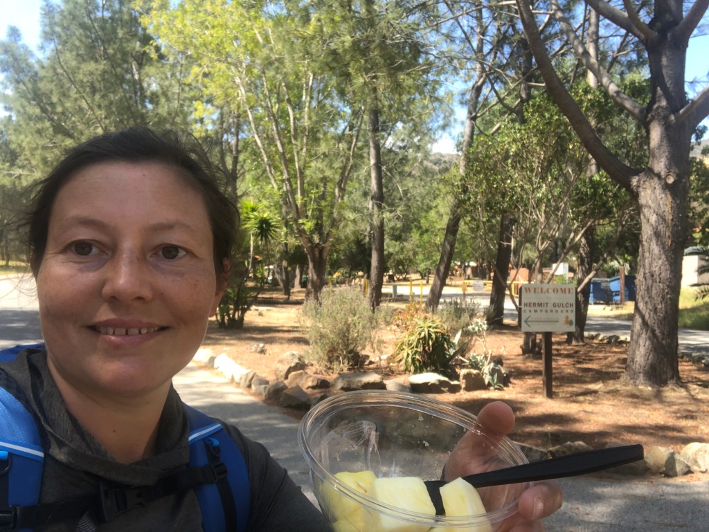
I made it to Vons and grabbed some Vitamin Water, along with a bowl of fresh pineapple, something I would not enjoy again for several days. Vitamin Water bottles are sturdy, with a wide mouth, so they are great for putting coffee, or electrolytes in. This bottle would be my extra 1/2 liter of hydration on my journey.
I had no second thoughts, but knew I could always bail on the trip, if it got too difficult for some reason. There was the Airport by the Sea near to Blackjack Campground, which is the first campsite along the trail, about 11.5 miles away. The Catalina Island taxi service offers a $200 taxi ride of shame back to port too. So if it was too much for me to handle backpacking alone, or if I was not feeling well, there was a way out.
I had not backpacked since I was 12.5 years old. So it was nice to backpack somewhere, I could get help if need be, other than just call SAR. I had a Garmin In-Reach device in case that happened too. It was my first time using it. It would be my only communication to my daughter during most of the trip, to check in and let her know all was well.
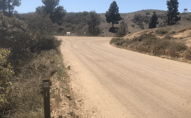
I headed up the road to Hermit Gulch Campground, the terminus of the TCT. The original terminus was further to the south side of the island, by the beach. It’s a mile from the ferry, which is not counted in the 37.5 miles.
The mile to the trailhead was uphill the entire way. My pack for this trip weighed in around 20 lbs plus water weight. Since I was carrying (4.5 liters), that added 9 lbs.
At the campground, I found an empty picnic table, to enjoy my lunch in the shade. I decided to charge my phone with the solar charger while I ate. It was around 11:30 am. It seemed rather deserted there. My guess is people were either out enjoying activities, or it was between the time people check out or check in.

I double checked everything was in order, before realizing the most obvious thing, and most important that, I had somehow forgotten to do. I had neglected to download my alltrails map. I had two bars of cellular service there, so I started the download. I also had paper maps, I had printed screen captures of alltrails of each section. I had hand written directions since I did not want to take any chances on this hike.
After getting charged up, and thinking I had downloaded my map, even though I actually hadn’t, I headed to the west side of the campground, to the terminus of the TCT.

It was now close to 12 noon, and the sun was starting to beat down. The plan was to hike to Blackjack Campground, about 10 miles. My recording would later show my actual mileage, which was a bit more than that.
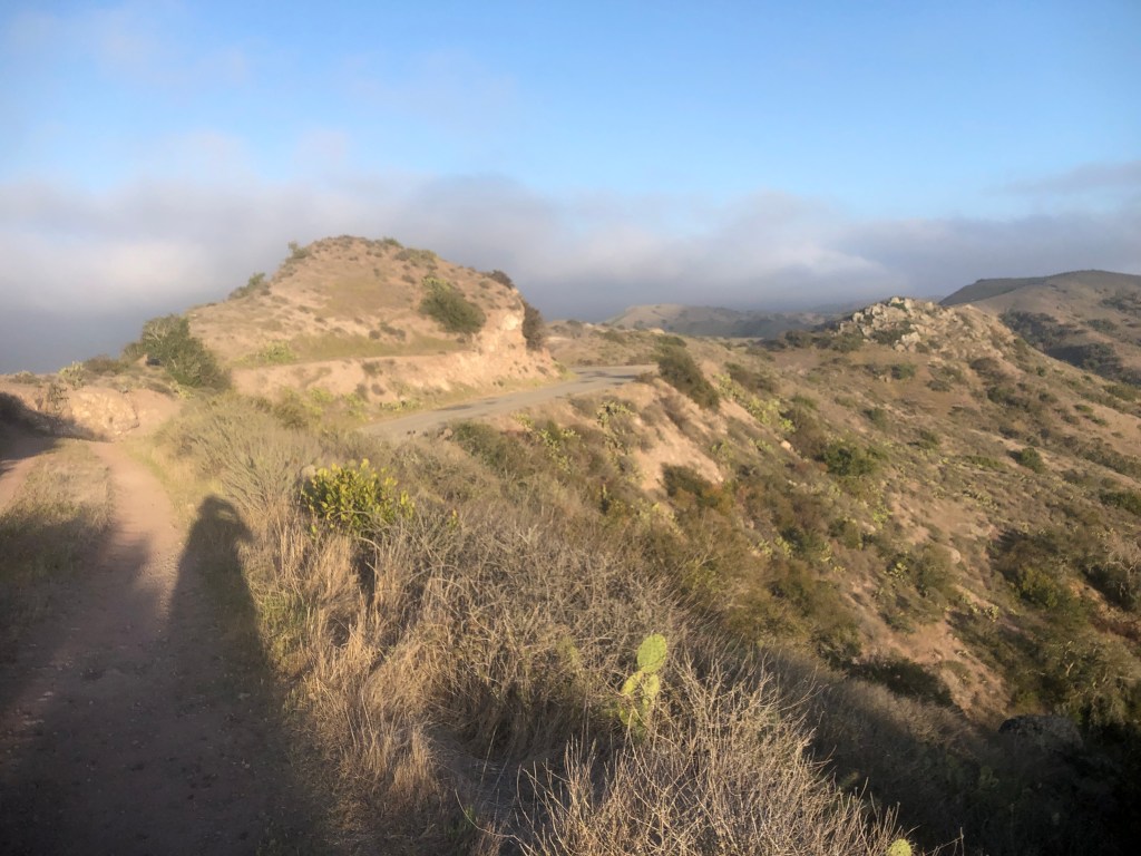
The beginning of this hike climbs about 1700 feet. I ended up taking 1.5 hours to climb the first 3 miles to the ridge in the beating hot sun. Once there, chatted a moment with two day hikers, who had passed me earlier. I enjoyed the shade, and rested for about 15 minutes, while enjoying the view.
Three trail runners ran up the south ridge trail, which intersects this one from Hermit Gulch. They likely met up with the ridge via the original, and much longer Catalina Trail terminus, beginning on the beach, on the south side of the island.
I headed off down the ridgeline, noting the restrooms there. It was around 1pm, as the sun was starting to bake me alive. I opened my umbrella, and felt much cooler for the rest of the afternoon, as I walked.
My mantra today was slow and steady wins the race. I never consider myself a fast hiker, and I don’t think you have to be, to enjoy it. Lots of groups, make it a competition, calling a hike a “training hike,” and saying “only fast hikers.” I tend to stay away from these types of groups, because I am only there to challenge myself, at my own pace.
Sure, it’s fine for people to race, and compete, but that’s not why I hike. I love hiking for the journey, the stops along the way, smelling the flowers, watching the butterflies, listening to the birds sing, feeling the breeze blowing, and soaking in the beautiful scenery. Most of all I enjoy the the peace and quiet, and of course breathing in fresh air.
If I want to stop and take photos, I will, and if I want to take a break in the shade, I don’t want to feel like I need permission from people, or am holding anyone up like on group hikes. If I need to bail, I don’t want inconvenience anyone. I was hiking my own hike, on my terms, at my own pace, and all this was very exciting.
Being Prepared for Anything
When you hike your own hike it’s on your terms. It’s your set of challenges, and your potential failings, which for me was to have to turn back. The first taller local peak I ever climbed in the Orange County area was Sitton Peak, and I actually turned back the first time I tried it, since I realized I was unprepared. I went back the next day, and I made it.
That’s why I like to just go hiking on my own, more often than in groups. You just feel more free. If you don’t like to take responsibility for yourself, a group hike is maybe a better idea. I won’t put the burden of my safety on others if I can help it.
I enjoy the challenge of planning, and being prepared. I enjoy reading maps, and researching where I am going. Not everyone enjoys this, and that’s where tours come in.
I have been on a handful of group hikes. I often hear other women say, they never look at a map, that’s it’s too difficult, so they prefer to just follow along.
I’m the opposite, I want to know everything about where I’m going, how long it will take, the elevation gain, the water sources, down to the flowers, the plants, and everything in between.
I know my phone will die, and even on day hikes, so bring a solar charger. I was bringing a Garmin In-Reach too, because I wanted to at least have the option to get help, if I was all alone, and injured.
Nobo
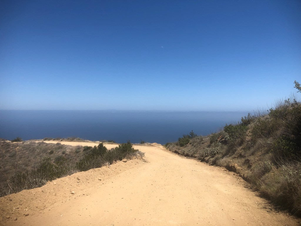
So I headed north, along the ridgeline, passing some restrooms on my left. I would see a few vehicles in spots where the trail intersects the dirt road. None of the roads are paved in the backcountry of Catalina. I would cross from Avalon to Two Harbors during the next two days.
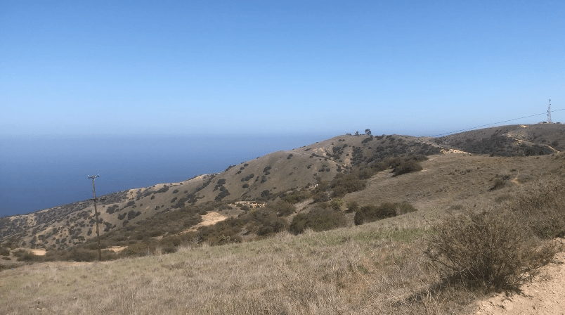
As I’m walking to the first rest area, a shaded picnic table overlooking the ocean, it feels like I am walking into the deepest blue ocean.
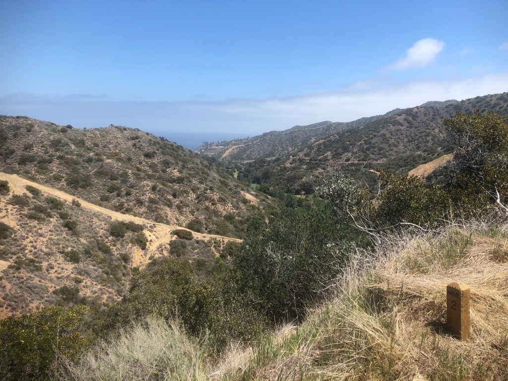
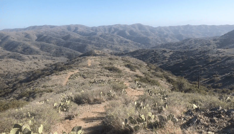
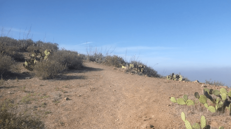
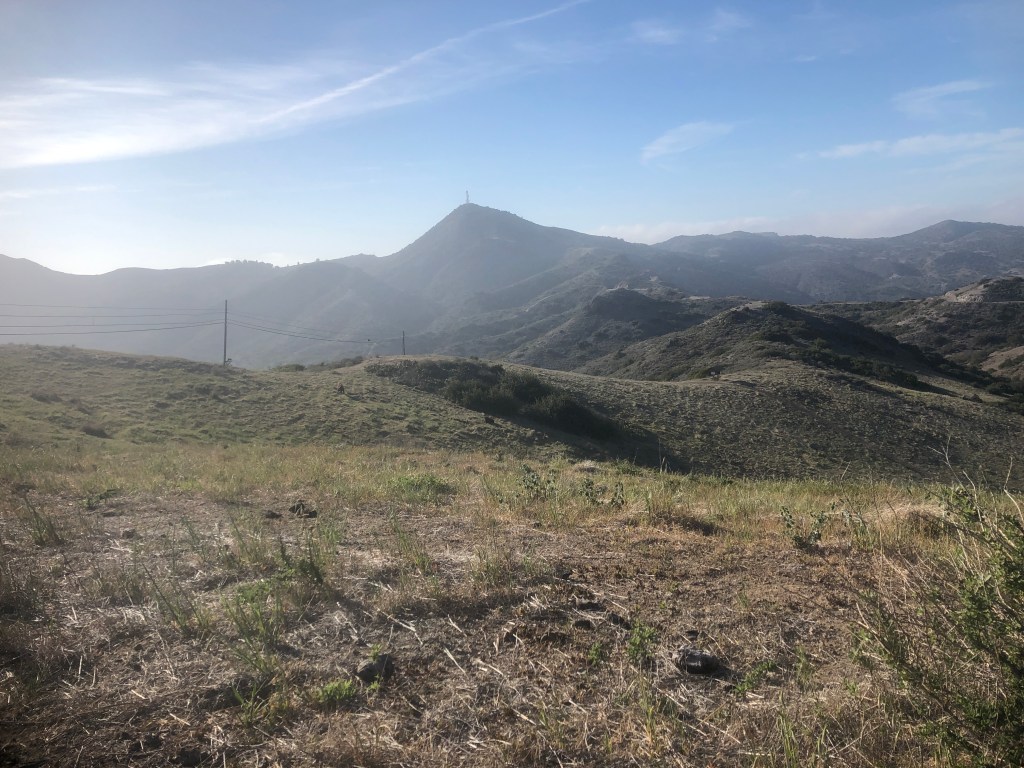
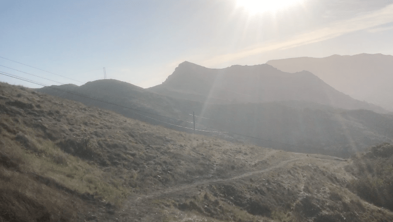
I had been alone on the trail all day so far, which was not what I expected. I had it all to myself. The views kept getting better, and better, as I climbed higher up the ridge, before descending, then ascending, over and over again.
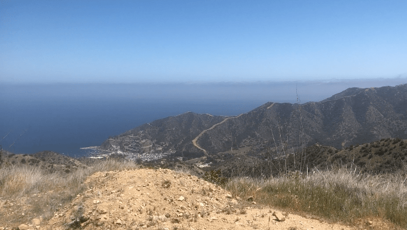
In total, my first day on trail would include over 3000 feet of gain The highest elevation I would reach would be 1653 feet.

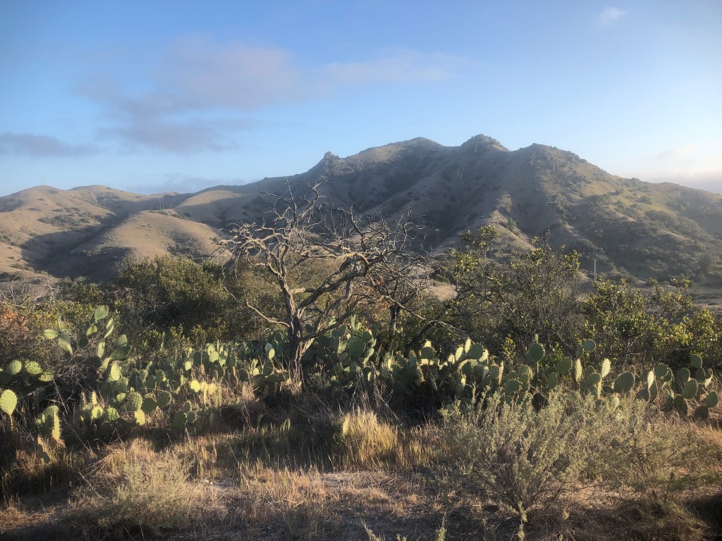
The views here were just spectacular. I could see a few trees up ahead, and possibly Blackjack Mountain in the distance.
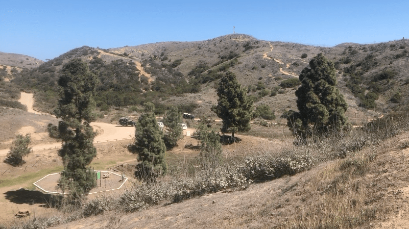
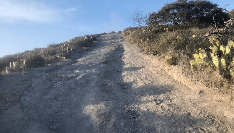
An open air safari vehicle full of passengers suddenly plowed by me, kicking up a ton of dust. I am walking on a fire road section of the trail, which hikers like to call a road walk. With its loudspeakers blaring info on Bison, it seemed like a miserable experience to be stuck in that safari vehicle tourist trap, Maybe it’s fun for some, but it would not be much fun for me.
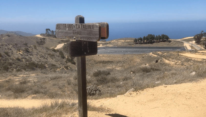
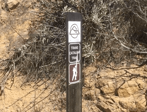
I follow alltrails, and eventually spot another sign for the TCT. The signs are fairly easy, and the trail is well marked, at least until this point.
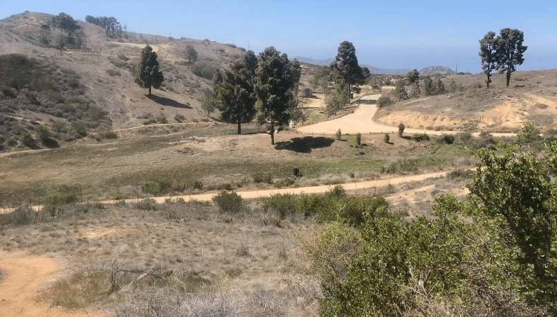
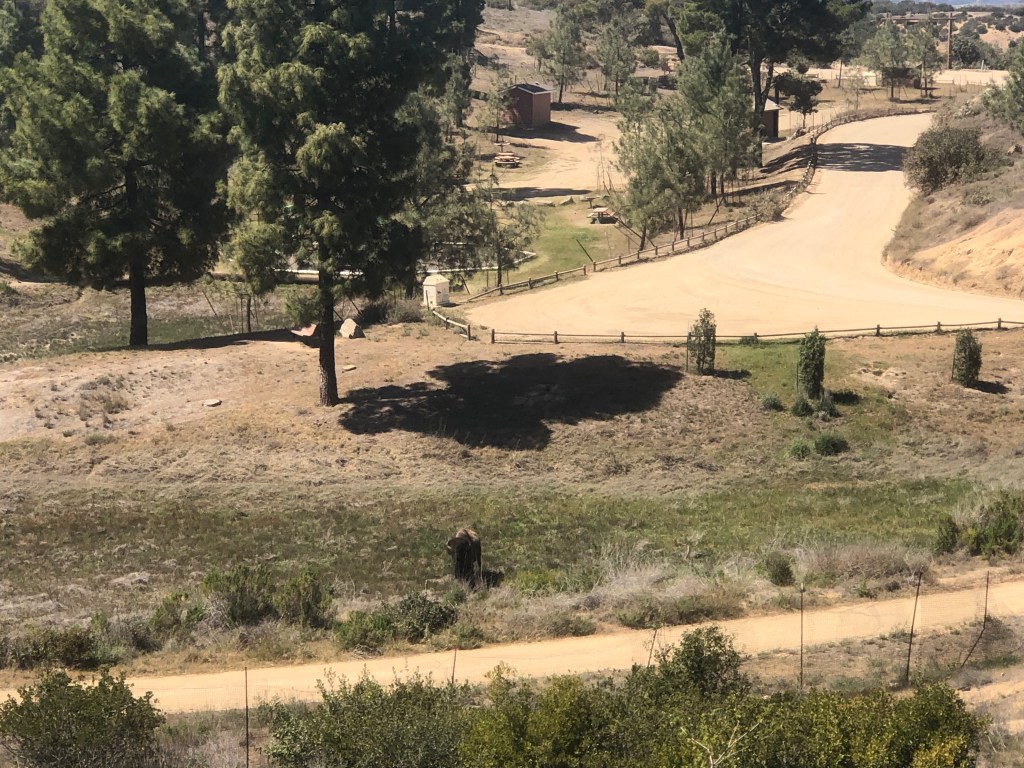
I was now approaching the Haypress Reservoir, along with the Wrigley Reservoir to the right. There would be a picnic area, and restrooms beside it. I am planning on taking a break here, from the beating sun. But my plans would soon change.
After another mile or so, I am just about there.
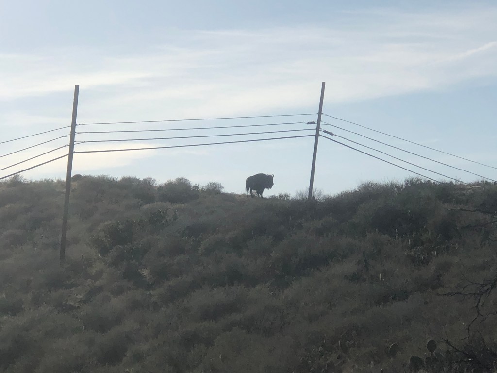
I begin my descent to the rest area. I stop for moment, to assess the situation. I believe I have finally spotted my first Bison of the trip. I can make out a lone Bison standing in a field in the distance, very close to where the trail intersects the road. It’s unfortunately very close to where I need to go.
This would be my first test of the TCT. I decide to continue on slowly, gradually, and taking my time, heading in his direction. I’m sure the umbrella made it extremely hard to notice me.

But he sees me, so I freeze. I am still on the other side of a Bison gate at this point, and safe. I am officially about to enter Bison country, and it all starts to sink in. I am not just on a hike, I am on a safari of sorts. I look the part right, with the umbrella and all?
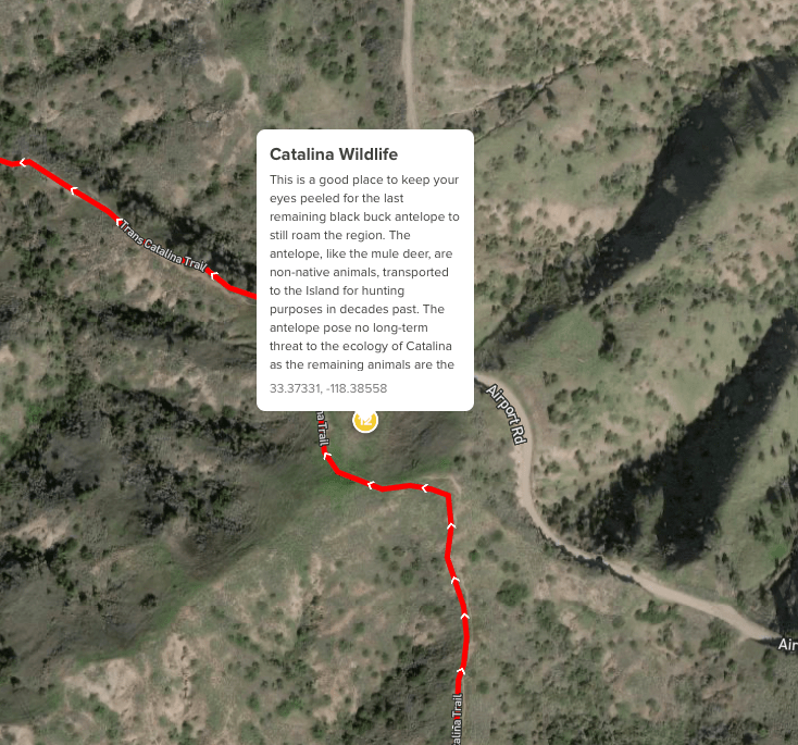
You can find a map of where Bison have been seen on Catalina Island here.
The most nerve wracking thing about it was probably the opening and shutting the Bison gate ever so softly, so he does not hear it. For all I know, that would have been his signal to investigate, hearing the gate slam. I decide my best course of action is to move very slowly past him, so he does not notice me.
There were a few thick bushes between myself walking down the road (trail) and him. I played the try to imagine I am invisible game, from childhood, so maybe he won’t notice me. But I decide to still pull out my phone to film me passing him. Yes, he apparently did. He turned around to face me, as I walked away, my back to him.
The bushes were my buffer zone. I was definitely not stopping by the picnic area now. I wanted to get as far away from this Bison as possible.
You’re not supposed to mess with the Bison, because they can kill you. They attack someone almost every year somewhere in the US.
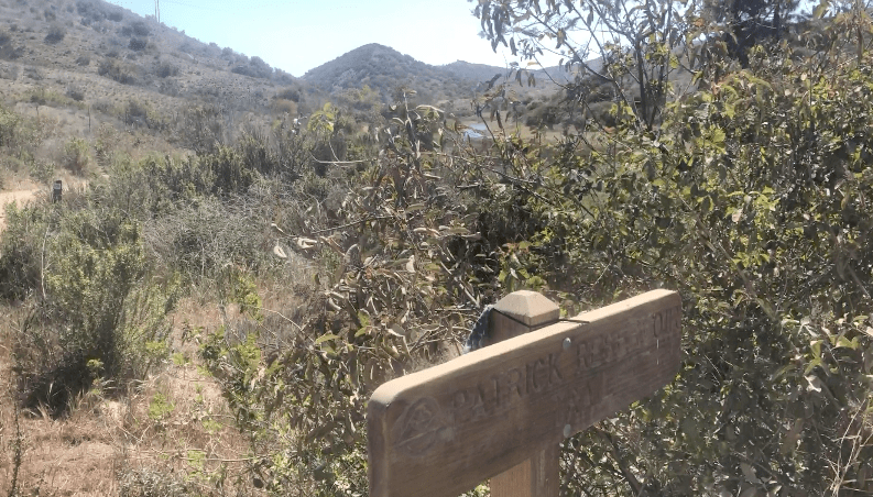
There was yet another reservoir I noted, behind Haypress, called Patrick Reservoir. If you end up there, you went the wrong way.
So this was my first milestone, the Haypress Reservoir, complete with Bison. I was about 5 miles from Hermit Gulch now. I had climbed about 2000 feet in gain at this point.
I spot the restrooms and a dusty picnic area by the road. I decide to use the restroom, but not hang around longer. Another safari vehicle roars past. I take off my pack a moment. I planned to take lots of rest breaks.
One of my main concerns backpacking, was not injuring myself, by carrying too much weight, which I was not used to. I have this spot in the center of my back that sort of bothers me, for a long time, and the last thing I wanted was to aggravate it, so I would be in pain. So taking off the pack every stop, definitely helped alleviate this.
As I hiked on, the trail does not seem as apparent. I kept walking on the road, but there was no trailhead signs. I noticed my alltrails map did not finish downloading. I would use my paper map, but it was still unclear. So I just started hiking up the road, looking a sign, any sign.
After about 5 minutes of walking, I am suddenly feeling a little unsure of myself. Am I on the right track? But I just kept walking down the road, having faith I would spot a TCT sign soon.
Yet another safari vehicle passes me, causing a cloud of dust to rise in the air, blaring its recording about Bison. This time, the guide gets on the loudspeaker, points me out to the tourists, talking about hikers on the trail. Can I die now? I am a tourist attraction. I might as well stand next to the Bison as company.
Two giant dump trucks of gravel whiz by, a bit too close to me. I am not enjoying the road walk at all. I am definitely feeling tested by all this. I have now been walking almost 10 minutes. I keep thinking how much I would hate to backtrack at this point.
A red truck pulls up, with two scruffy gentlemen inside. They ask me, if I need a ride to the Airport in the Sky? I politely decline. They then go on to ask if I’m sure. That’s the price of being a thru hiker. At one time or another, people will just want to stop and help you, and they probably feel sorry for you, carrying all your stuff on your back like a turtle, long after cars were invented.
But I was all in. I was tired, I was scared (of the Bison), and I was a little lost. I was definitely not quitting. I would keep on walking.
I would only accept a ride if I actually needed help. I would end up reconnecting with the trail shortly after that off to my left. I still don’t know if I was on the trail, or if there was a trail section I missed at the reservoir. In all the chaos of avoiding the Bison, I likely missed a turn somehow.
The sections where the TCT crosses the road could be confusing. The trail is narrow, and the road is wide, so you can easily know if you’re on the “trail.” Some sections of the TCT definitely a road. I was alway relieved to be back on trail. I was now about halfway to Blackjack Campground.
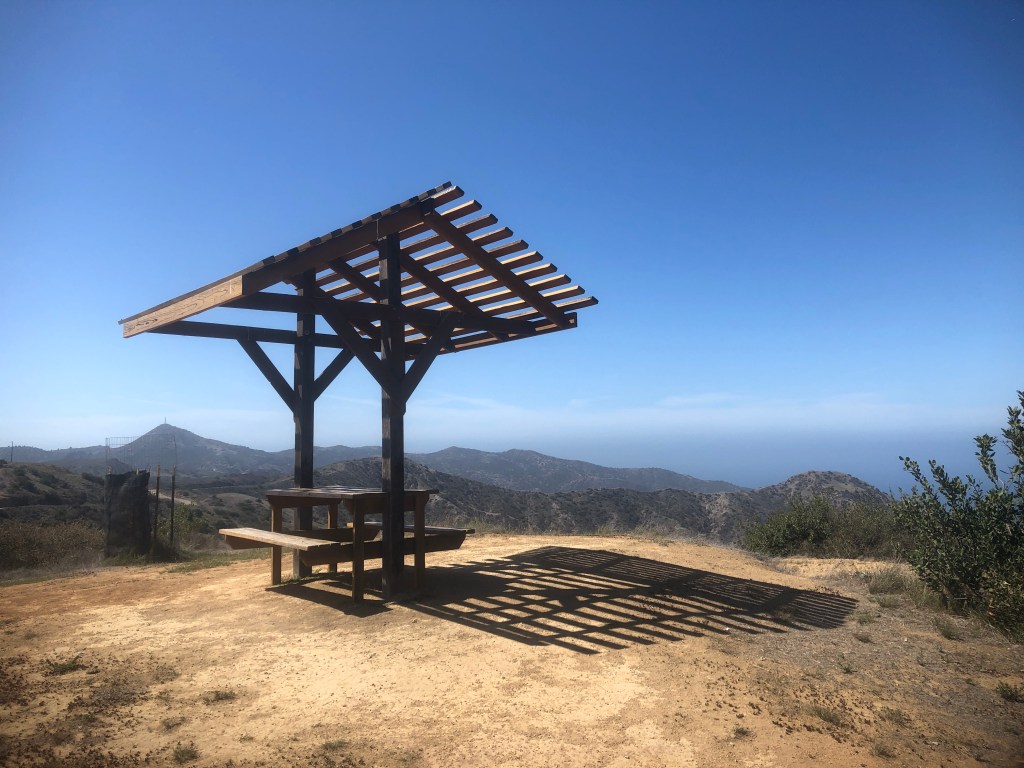
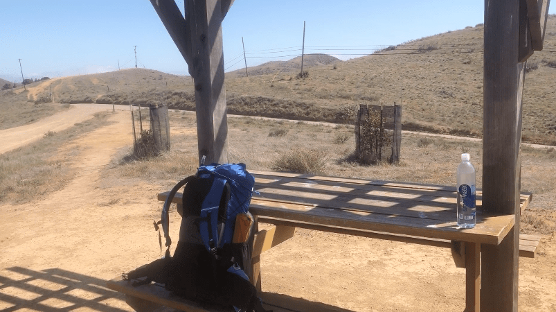
I stopped for a snack, at this covered picnic table. I would find these all along the TCT. I enjoyed an energy bar, some olives, a piece of fruit, and some popcorn.
I laid out on the flat bench stretching, and ready to take a nap. It was late afternoon around 2pm, and I had been hiking for almost 3 hours.
It was so peaceful and serene there. I felt like I could just sit there all day. I was ready for a complete reset on my life, and hiking the TCT was part of that.
I thought about my past, where I’m going today, tomorrow, and beyond that. I could have stayed at this picnic table much longer. After about 30 minutes I continued on down the trail.

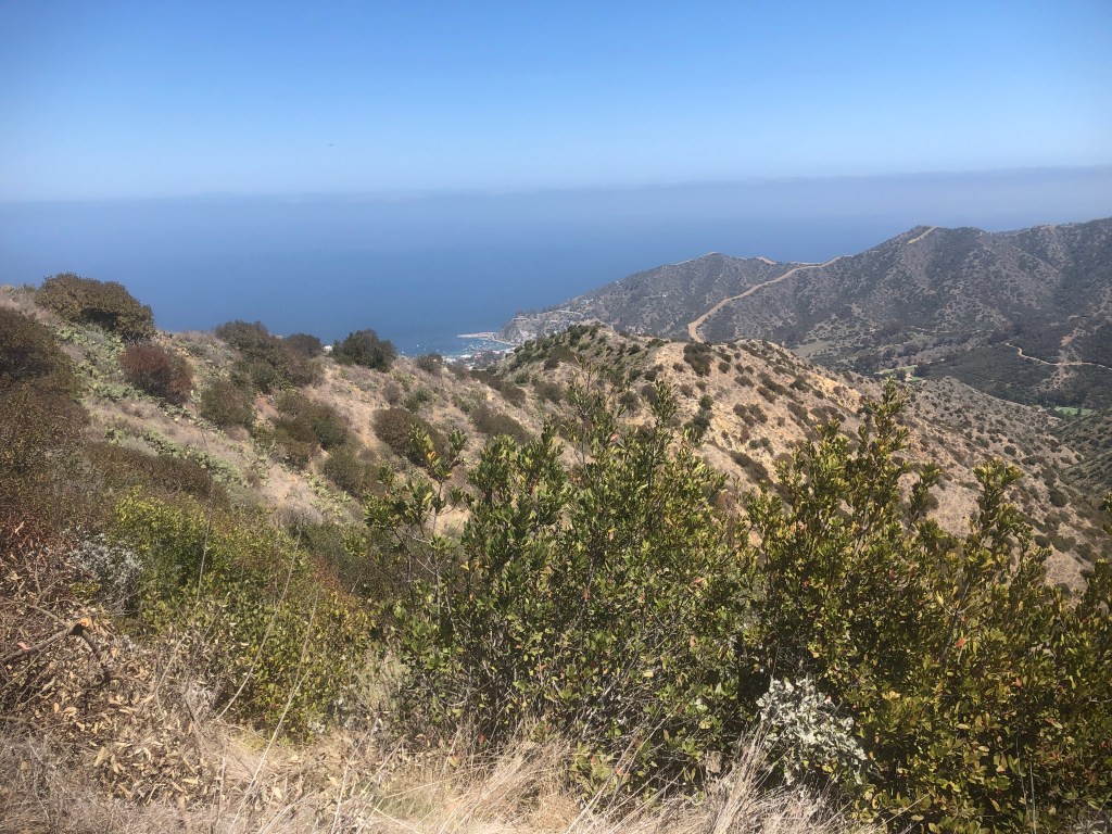
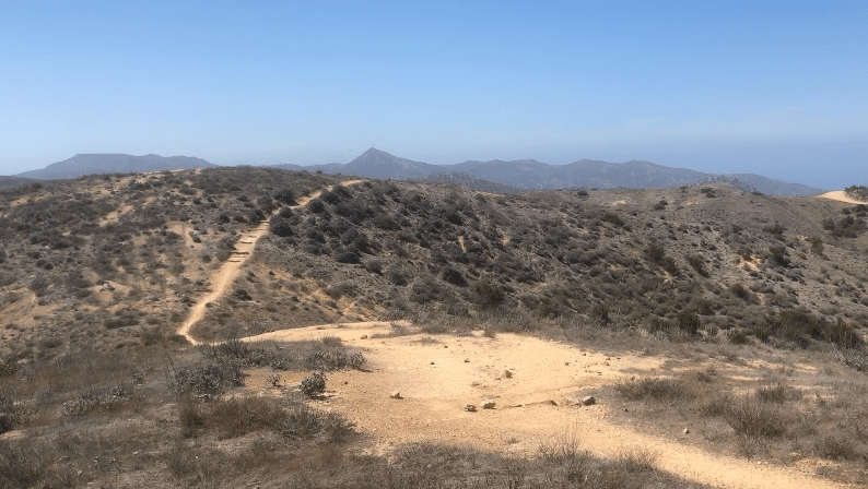
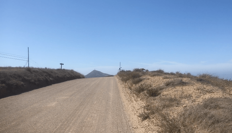
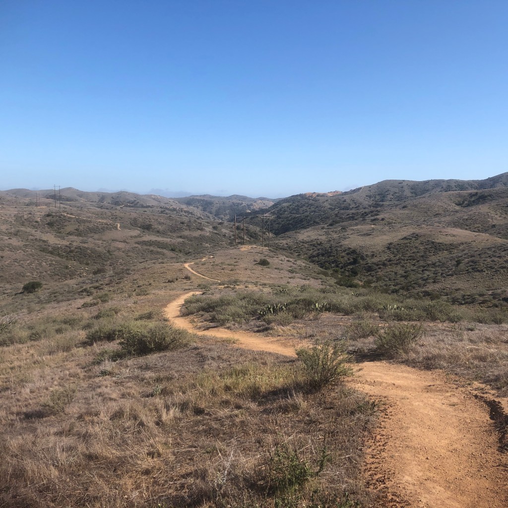
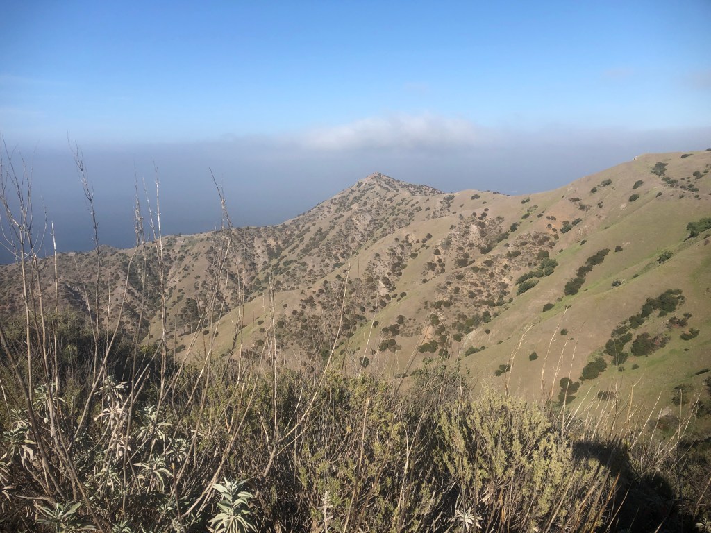
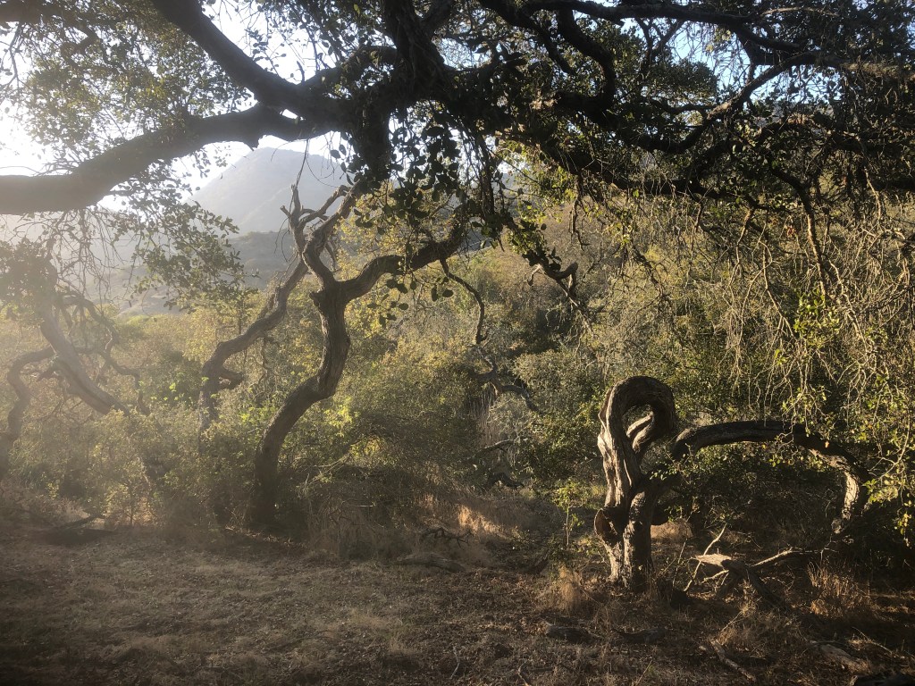
The waters of the pacific were such a dark blue in the afternoon sun as I headed off down the trail again to Blackjack. As I descended again and again, over on another ridge, feeling like I was walking on top of the ocean. The trail then would continue inland through warm, dry canyons, for what remained of the journey to the campground. They were filled with coastal scrub vegetation. I would say goodbye to the blue Pacific for awhile.
There was little shade, but I had my umbrella to stay cool. From Hermit Gulch to Blackjack, I had hiked over many peaks, and valley’s.

This became my view from the canyon, on the second half of day.
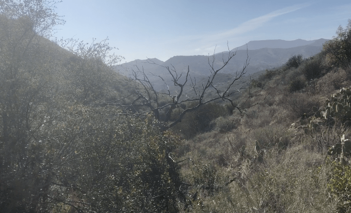
It felt exhausting in the baking hot sun, in these canyons. I was ready for some shade.
This is what the canyons of chaparral look like. Did I mention it was very hot and dry? I also heard a few rattlesnakes, but none entered my path. That was my main worry going into the hike.
It was early spring, just about to be snake season, when all the baby snakes emerge. They are more deadly than their parents, since they can’t yet control the flow of venom they inject.
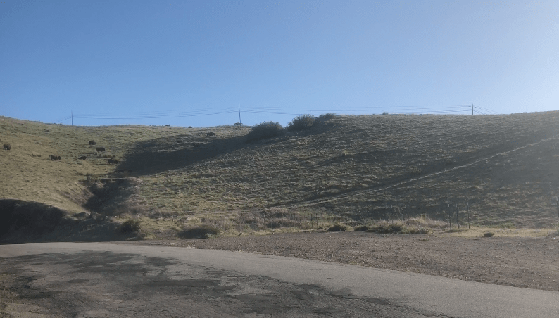
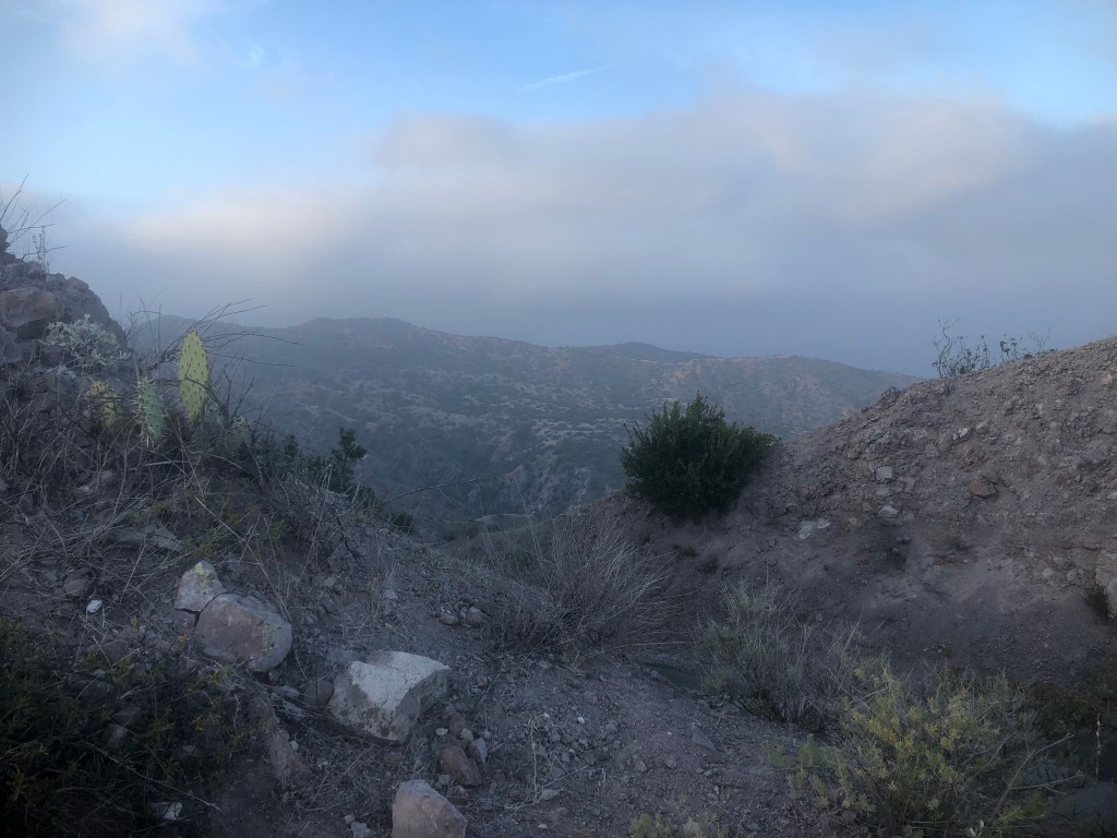
Suddenly I freeze. I have spotted two more Bison on the ridge ahead of me, which I need to travel past to get to Blackjack. One of them walks away, disappearing over the ridge. I decide to wait for the other to move, not wanting to get too close to his territory. So I ever so slowly walk up the ridge, to get a closer look, and see if I can maybe pass him.
I can see the ocean again, which is a welcome sight.
Catalina has its enchanting moments, but this was not one of them. Bison were on the horizon.
I inch closer to the Bison, I see he has company. I had to get moving, Bison or no Bison. After 20 minutes of watching and waiting I feel impatient. The sun is setting soon, and I need to get to camp.
I can now see there are at least 10 or more bison, and a huge herd, directly on the trail ahead of me.
I sit on a rock, waiting for these Bison to go away, but they don’t.
Safety Not Guaranteed
Off to my right is the road, and a steep cliff. The road is a good 200 feet below where I am standing. The hill slopes down sharply. Nervously I decide to head down the steep hill, unsure how it will all turn out. None of the options I had to choose from were safe. Backtracking would have left me hiking in the dark. I had to move forward.
I remembered reading trail logs of the TCT, and hiker’s had told stories of bushwhacking around the Bison. I realize, that is my only option. As I walk off slowly to the right, I am thinking only about snakes as I crunch through thick clumps of grass down the steep hillside. The brush is not that tall, but still thick, and spongy.
The grass is laden with bison poop and is well trampled. It is a very very steep cliff, with a 45% grade. I’m wearing a backpack, which is heavy. It could send me off balance, and tumbling down. It’s no longer a hike, it’s mountaineering.
My focus is on getting good, hand, and foot holds. It’s three points of contact all the way. I’m grabbing onto a woody brush, or anything that seems firmly attached to the ground.
I ever so slowly make my way down this steep slope. I keep thinking to myself…how did I get here? I now thank my lucky stars I chose rock climbing for PE in community college. I was still a beginner, and only did a handful of small climbs. I knew the basics though. I knew how to get those small holds with the side of your foot, or your toe.
I knew how even the smallest holds can matter. I also know how to use momentum to fling myself around to get to the next hold. Was I great at it? Here was my test. My biggest aid would be my trekking pole. I used it to dig in, and prevent sliding down. Without it, I would not have made it, while balancing my pack on my back.
At the bottom of the cliff I sighed, since it was a complete drop off of maybe 15-20 feet, where the road was cut into the hillside, straight down. My only option was to crawl through a bush, along a one foot animal trail, holding on to the bush for dear life. I somehow got through that part, and found a way to create my own switchback down to the road.
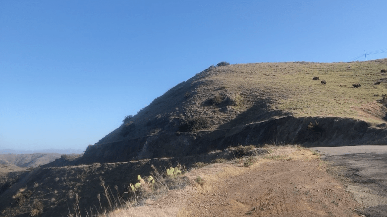
Here is the steep slope I climbed down. The bush at the top is where I started, and the one on the lower right, along the sheer cliff edge, is where I crawled through. Did I make a good choice? Death was a possibility here, no matter which choice I made. I am still here, so I suppose I made the best choice I could. For all I know backtracking could have landed me with even more Bison.
There is Bison “evidence” all along the TCT. You can encounter them anywhere, at any time. They were by far the biggest threat I faced on the TCT, in addition to my own fears, either real or imagined. Everywhere I walked, they had walked too.
One false step, and I would have plummeted down onto the road. It was horrible to think and rethink this scenario. The ordeal was not over yet. I would still have to pass within 25 feet of them, to get around them, and back on trail. These were my most fearful moments of the entire trail. I would not want to relive this scenario ever again. But there was no guarantee on that, because I still had a ways to go.
At this point, I realized I had happened to have wifi, and I called my daughter to check in. I was feeling like some kind of irresponsible parent, endangering myself like that. I had just survived the Bison, and I felt like I needed counseling now.
I had reached 8.3 miles in on alltrails, and oddly there is a “wildlife viewing,” waypoint where I was standing on the map, go figure. I will take those waypoints seriously in the future. But it cheerfully mentions antelope, and deer not Bison.
I was officially a Bison survivor now. I would climb another 50 feet or so from the road, onto the trail, passing a mere 25 feet from the Bison.
The Bison were majestic, and it was interesting to see them all up close. But I don’t need to do it again. Two Bison encounters in one day were plenty for me.
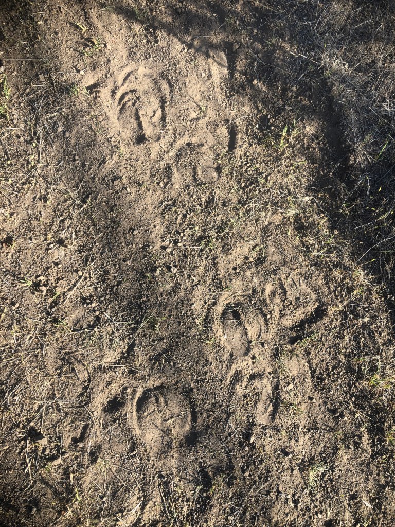
The Bison had left their mark.
I was more exhausted by the mental challenge of this hike than the physical aspects at this point.
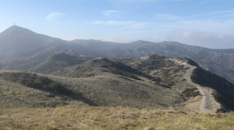
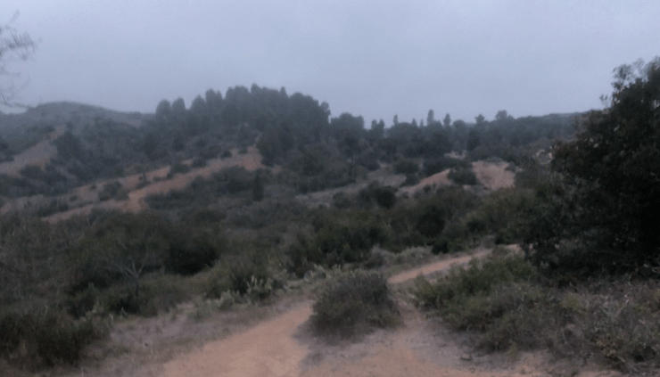
The last section of the day felt like the home stretch. There would be more climbing, and more descending, as I edged closer to Blackjack. As the sun started to fade, it was finally a bit cooler.
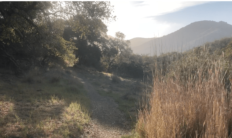
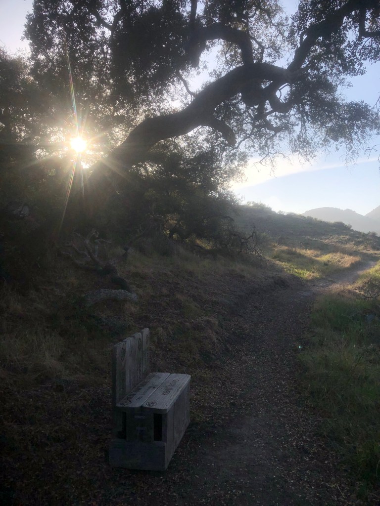
I made my way through a beautiful oak woodland, and passed a small bench, made from old Trans Catalina signs. I had maybe a mile or so to go now.
It was very green in this last valley.
The sun was setting and I felt confident I would get there by 7:00 pm, right at sunset. I was almost home free.
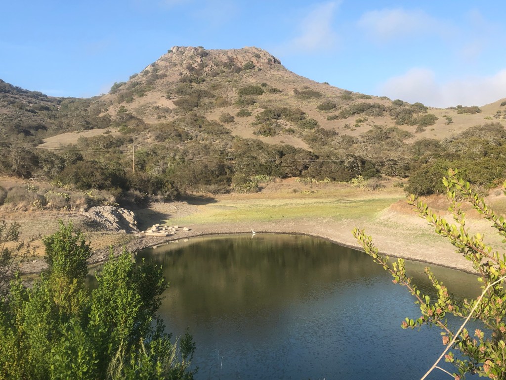
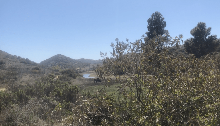
I was 9.5 miles in, when I reached the Cape Canyon Reservoir. A single heron was standing there stoically, and it gave me a feeling of peace. But that peace would be short lived, as I made a navigation error. The trail to branches off three ways. I missed the sharp left at the sign, continuing straight up a very steep hill. This is not the trail, I repeat.
I was feeling exhausted, mentally, and physically. I was dazed, and confused. I figured it all out at the top of the hill, since something did not seem quite right. This was after an extra 300 feet of climbing, just as it was starting to get dark. I was on Airport Rd, not at Blackjack.
My phone had finally picked up enough signal to fully download my maps from alltrails, so I knew where I needed to go. I was running out of light to get there. So off I went back down the hill, with my aching feet, only to have to ascend once again, to reach Blackjack.
I even tried jogging to make up time. I found the sign I passed, due to the evening sun shining in my face, obscuring my view. I made a sharp right, continuing up one of the steepest climbs of the day, which added another 500 feet or so. The light was going dim, but not my spirit. I was still determined, and hopeful. Despite all the obstacles, I had not lost faith!
It was now too dark to enjoy the scenery. I got out my headlamp, and just went onward, hopeful no more Bison were in my future.
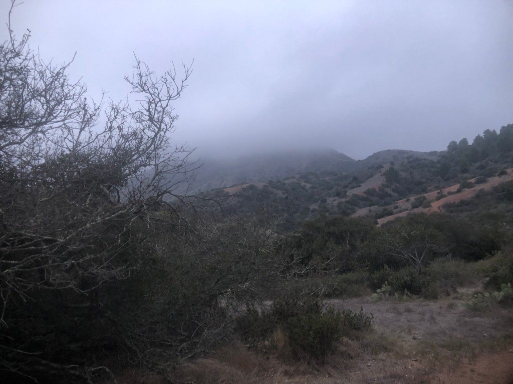
It was dusk as I hobbled into the campground. Blackjack mountain was covered in mist. The light was fading fast. The last ½ mile was maybe the longest 1/2 mile section of trail I had ever experienced. It was uphill all the way. I was glad I had enough in the tank to get me there, just barely.
I was greeted by several hikers when I arrived. One guy was helpful in simply helping me figure out where the site markers were. The numbers were on the picnic tables. It was now officially dark, and with my headlamp, I found site number 6. The campground is not that big, so finding it did not take long. There are just a few sites, mostly clustered around the bathrooms. I chose the site furthest from all the others, to have space.
My site seemed to be sloped. There was a dwarf willow tree, so I set up the tent next to it, as a windbreak. A towering cypress stood behind my site. I started to hear island foxes howling. I was in the wilderness now.
There was little time to enjoy the night sounds. I had work to do, in setting up my tent. I could barely see anything. I did it wrong the first time, since the tabs on a Big Agnes Tiger Wall are color coded to line up the poles, with the tent and the groundsheet tabs. I could not really see what I was doing. I was also tired, and a little light headed. I also was ready to eat.
After my tent was together, I threw in my Thermarest Neoair Pad, and Enlightened Equipment 20 degree quilt, along with the rest of my gear. I kept out my food, and cookware, consisting of a Toaks 750 pot, MSR Pocket Rocket stove, and a can of Isobutane, along with a lighter. I also had a Toaks long handled spoon.
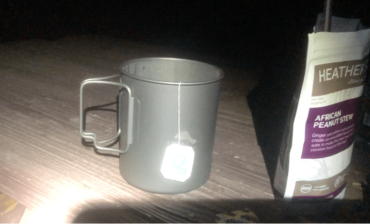
I decided tonight’s dinner in the wilderness would be Heather’s African Peanut Stew, which I had not tried before. I left some extra water in the pot for a cup of tea. I added a bag of Ginger Turmeric Tea in the pot, which doubles as a cup. I let the water boil for about 2 minutes, and poured it in the pouch. I put the food pouch into a dry sack to stay warm, since I had not brought a pot cozy. I blew up my sleeping pad in the meantime, and laid out my quilt, and liner. After about 15 minutes, and a good soak, I would enjoy the Peanut Stew.
One of the best parts of the day would prove to be sitting in the dark at my picnic table, enjoying my meal, sipping my tea, and listening to the foxes howling. There had to have been a whole bunch of baby foxes right there, and it was all pretty neat. That’s why you escape to the wilderness, right? No cars, not added noise pollution, and the only lights are the stars in the sky, along with your headlamp.
I was done for the day, just enjoying my dinner in the dark by the light of the moon, listening to the night sounds. The near death experience today with the Bison and the hillside, was nerve wracking. I wanted to challenge myself on the TCT, and challenge myself I had.
There are bear boxes for your food, but there are no actual bears on Catalina Island. There are however, Island Foxes who on occasion may unzip your tent, and crawl inside with you. It is recommended you zip your tent to the top, to prevent this from happening, which I did.
I had no idea while camping there that Bison may even enter the campground unannounced. Not even the camping area is off limits to them
I crawled in my tent, and spent my last hour organizing my stuff for the morning. I opened my ebook, called “Thirst,” which is not just about hiking, but ultrarunning. I needed encouragement. Hiking can be hard and strenuous, but ultras are far beyond that. I tried to simply think of what’s possible. When I feel tired, it’s the time to just push harder. That’s what the book was about. I read Heather’s story of running through a desert with no water. My Bison problems suddenly seemed quite small.
I finally was able to escape my dirty hiker clothes, before using a wet wipe to clean off my face, hands, and ankles. A confession is that I love the outdoors, but I also like to be clean. Will I ever qualify as hiker trash? That remains to be seen. That was going to be my shower for the next few days. I put on clean leggings, and a clean tank top, along with another long sleeve shirt. Sleeping in dirty clothing is really only something I will do if I have no other choice. It was worth the weight to carry sleepwear, at least for me.
I settled into bed for the night. I tucked myself into my sea to summit the sleeping bag liner, pulled my quilt over me, and fell asleep, not long after, sometime around 9:30. It’s early bedtime, and early to rise, when you’re backpacking. Today I re-defined my definition of being exhausted.

This ebook called “Thirst,” is the story of an ultrarunner, who runs an FKT (Fastest Known Time) on the PCT. This is a good one, if you want to read about a woman transforming herself, focusing on her assets, rather than her liabilities. It’s an intense book, full of far more stressful scenarios, than I was experiencing at the moment. Her determination was inspiring to me.
I was feeling grateful. Facing my fears is part of what this hike was for me j. It was not just mindless exploring, to see the beautiful scenery, it was more deliberate exploring, for a purpose, to re-define myself, and move forward with my life.
I did not know it at the time, but I had faced my last Bison of the journey. There would be other challenges I had to face, most of which had to do with simply facing myself.
There was some rain in the forecast, and it had rained overnight. I had stayed warm and dry in my tent. In the morning everything outside was drenched, and I would have to dry it off before heading off in the morning.
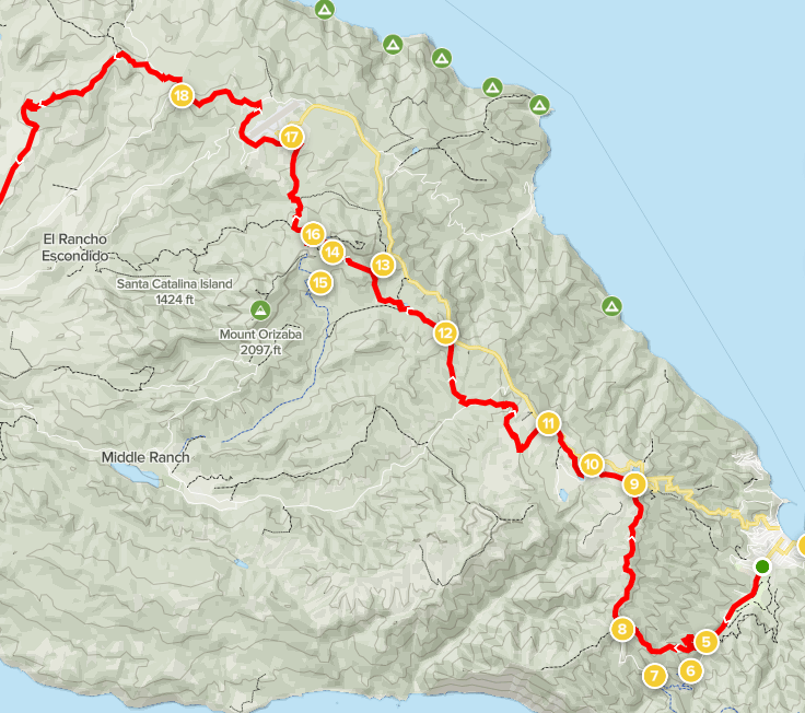
Here is the first section of my hike on alltrails
You can read about Day 2, and Day 3 of my hike on the TCT.
Also be sure to check out my Planning Guide to the TCT.
About me
I’m Serafina! I’m a writer and California girl who loves to go exploring. Hope you will get outside today, breathe some fresh air, and be happy!
Follow my Journey…
Be sure to Like and Subscribe to My Youtube Channel where I post videos!
Disclaimer: The work on this blog is my opinion and my opinion alone and I am not responsible for the outcome if someone were to apply these thoughts to their own life. All text and photography copyright 2021 by Serafina, all rights reserved. Information and opinions provided are kept current to the best of the author’s ability. All readers’ usage of the ideas and opinions presented in the blog, are at their own risk. Be aware of the possible dangers of hiking, surfing, walking, cooking, and other activities, which may take place indoors or outdoors. By reading this, you agree not to hold the author or publisher of the content on this web site responsible for any injuries or inconveniences that may result from reading the blog, or partaking in any activity mentioned in the blog. Read the blog, and use its ideas, if you so desire, at your own risk.
